 03-17-2023, 10:32 PM
|
#616
|
|
Member
|
|
Join Date: Sep 2015
Location: Montreal, Canada
Posts: 915
Real Name: Jean
|
|
|
Member
Join Date: Sep 2015
Location: Montreal, Canada
Posts: 915
Real Name: Jean
|
Day 34:
Start point: Kanab UT
End point: Kanab UT
Distance driven: 175 km
Distance hiked: 3.9 km
We had a very nice day, going through some off-road tracks around Kanab to reach some points of interest not accessible otherwise. We had some apprehensions about the state of these in the region, because a thin layer of snow had fallen during the night. However, as the ground is mostly sand, driving there was relatively easy as it was humid.
Our first destination of the day was Moccasin Mountain Dinosaur Tracksite, reached by a sandy track of just under 4 km. Although the state of the track at the very beginning left some doubt, we reached the start of the hike without incident.
This hike, apart from an information panel, is not marked at all. The number of dinosaur tracks being relatively low there, we are not sure to have seen any. On the other hand, the area was really beautiful.
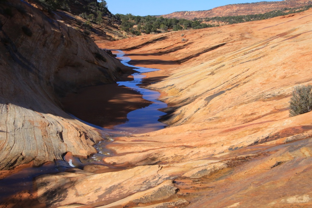

After our unsuccessful search for dinosaur tracks, we still enjoyed the beauty of the place by walking along the stream. A thin trickle of water flowed there but the bed of the creek was composed of sand compacted enough to be able to walk without getting dirty.
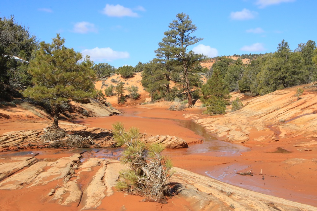
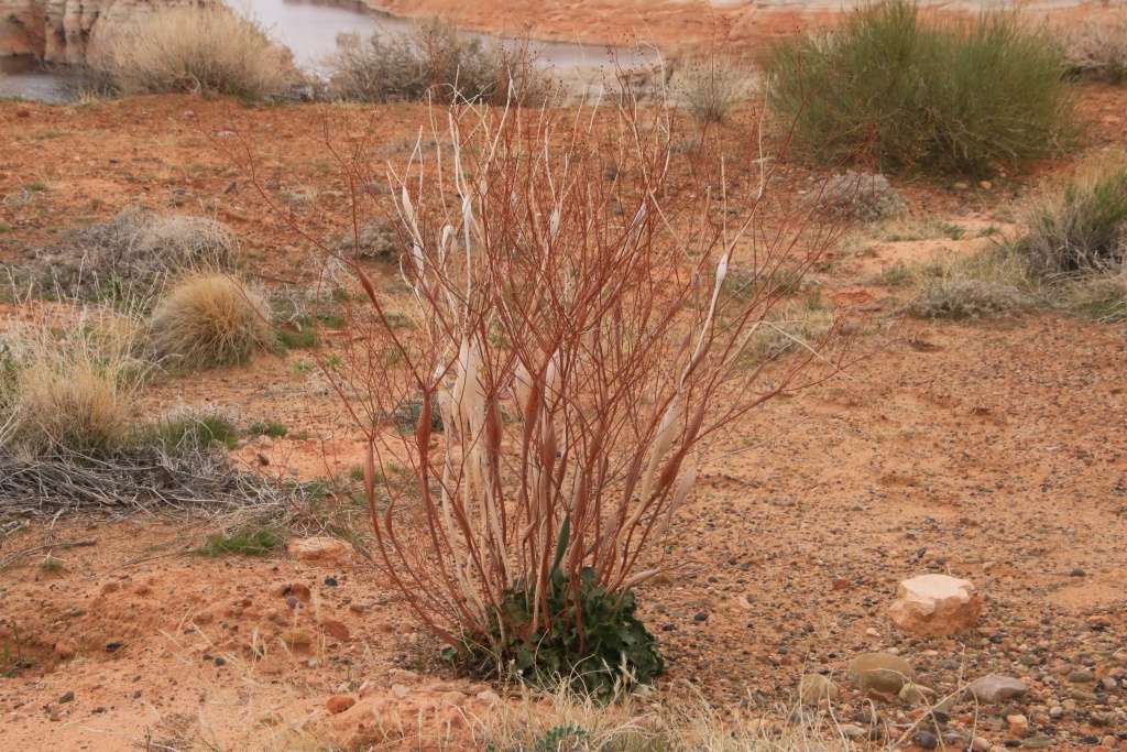
On the way back down the trail we noticed a nice area of colored sandstone. We took a short walk there.

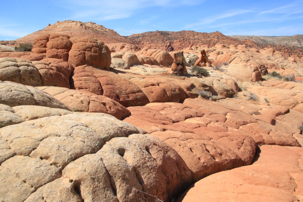
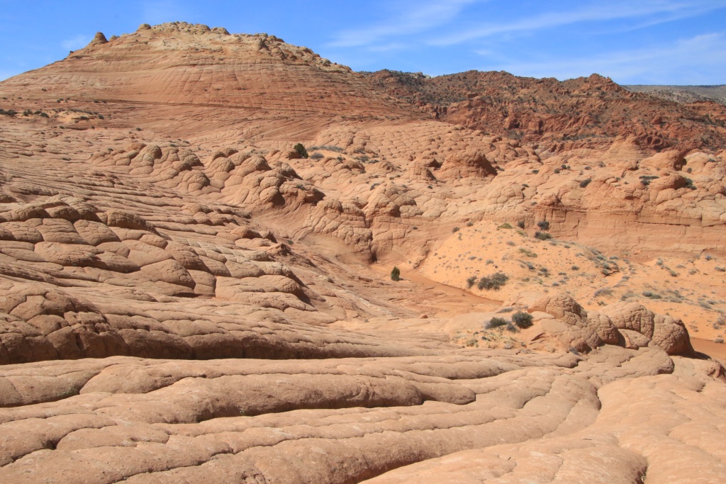
Confident by the condition of this first track, we then headed to Nephi Pasture Road, a long track in Grand Staircase-Escalante National Monument. A secondary track allowed us to reach Inchworm Arch.


As we still had a lot of time left, we explored other secondary tracks, somewhat at random.

On one of them, we reached a fairly low sector and encountered an intimidating obstacle, especially since it seemed to have caused a victim. I approached on foot to see if there was anyone on board to assist him. The vehicle was empty and appeared to have gotten stuck a long time ago as the mud and sand were dry under the fenders. Since he was carrying a bale of hay, we believe he is a rancher.

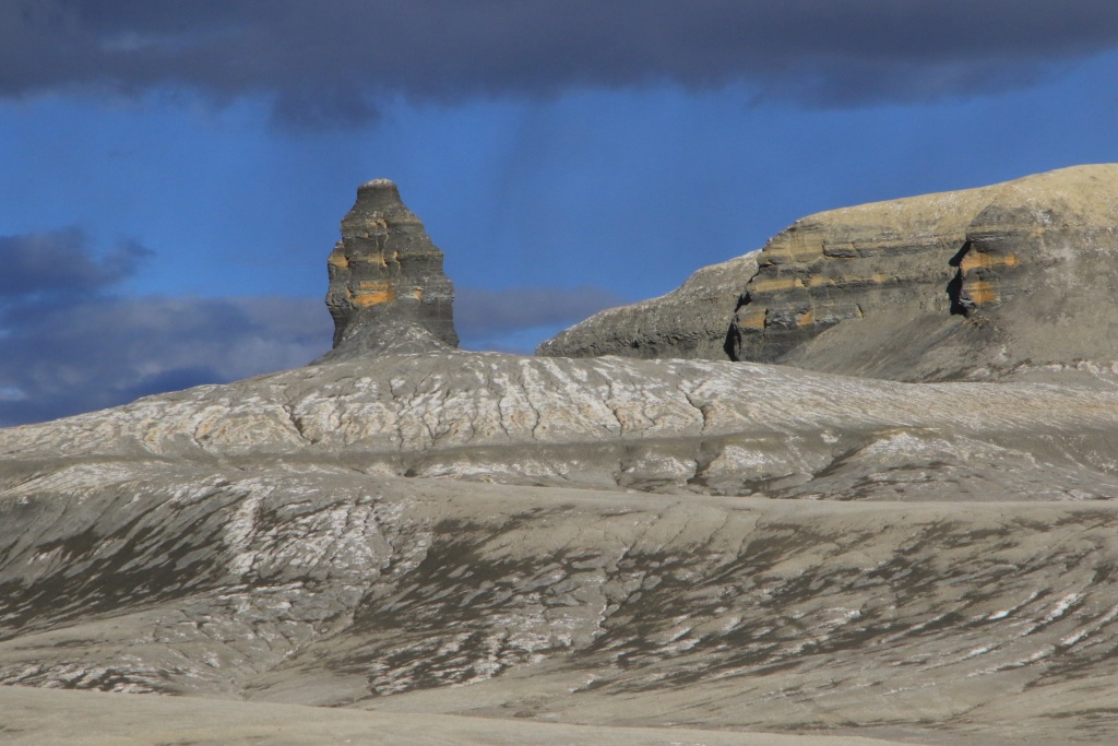
We then turned around, not daring to risk getting stuck in our turn. Another secondary track caught our attention as it approached a highly colored cliff, Pink Cove.


We walked to reach the base of the cliff, on a promontory offering a beautiful view. Unfortunately, a large cloud mass appeared above the cliff and blocked the sun. We waited long enough, but no clearing came. The photos would have been much better, but anyway, here's what we got.


Tomorrow again we should have another mostly sunny day. We will advise tomorrow morning for our activities of the day, but the impassable state of several roads limit our choice of activities.
__________________
 2016 Trail Edition Classic Silver Metallic with KDSS, sunroof
ToyTec BOSS lift, SPC Light Racing UCA, RCI sliders, RCI aluminum full skids, RCI Cat Guard, Eezi-Awn K9 2.2m, BFG KO2 275/70R17E, FN Wheels f(X) Pro, ARB Breather kit, Husky WeatherBeater Mat and Cargo, XPEL window tint, 3M wrapped hood
Build thread
Adventures thread
|

|
 Reply With Quote Reply With Quote
|
|
03-18-2023, 11:09 PM
|
#617
|
|
Member
|
|
Join Date: Sep 2015
Location: Montreal, Canada
Posts: 915
Real Name: Jean
|
|
|
Member
Join Date: Sep 2015
Location: Montreal, Canada
Posts: 915
Real Name: Jean
|
Day 35:
Start point: Kanab UT
End point: Kanab UT
Distance driven: 165 km
Distance hiked: 11.1 km
We had a great day as we like them; sunny and slightly cool. We took a long hike through Paria Canyon-Vermilion Cliffs Wilderness to an area called Edmaier's Secret. We had explored the southern part of this place on a previous trip in November 2016. Due to lack of time, we then skipped a few more northern attractions. Today's objective was to explore them. Get ready for a photo festival!
To reach the starting point of the hike, we had to take the House Rock Road, a superb road but how tricky due to the precipitation. The road crosses Buckskin Gulch and the place is often impassable. Precisely, a pickup truck was stuck there and someone was busy getting out two somewhat reckless tourists. A second passage made crossing easier.
Our hike started with the trail along Buckskin Gulch. The heavy rains of a few days ago swelled this creek significantly. At the beginning, a thin trickle of water was still flowing there and the bottom was a little muddy but nothing more.


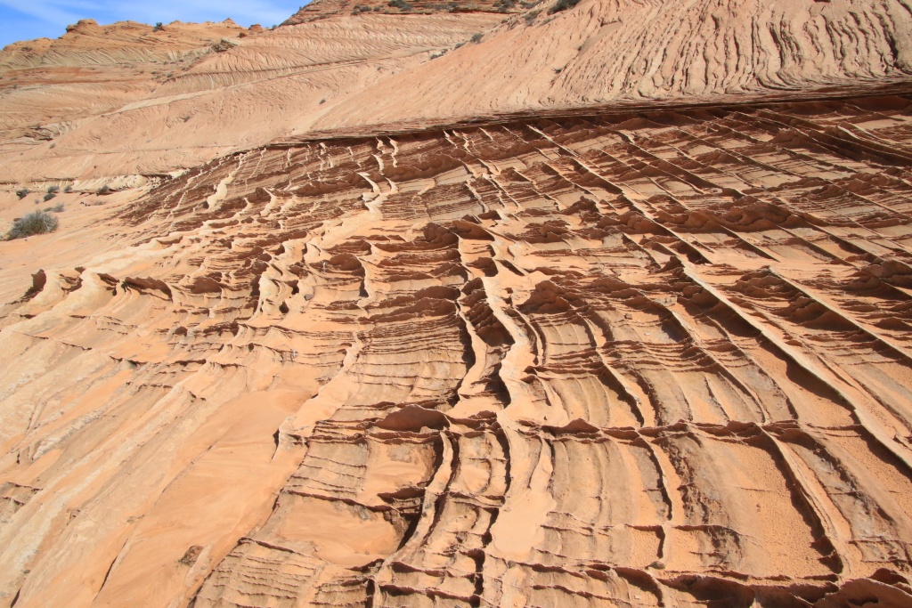
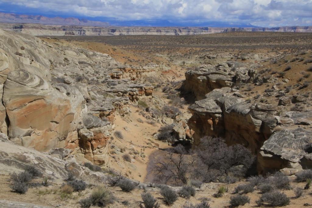
After about 3.5 km, we left the Buckskin Gulch trail, branching off to a large secondary wash on a dry sand bottom. We reached the bottom of the hills leading to Edmaier's Secret. Soon we started to see some interesting formations created by the wind erosion of layers of sandstone with different compositions.

Our first point of interest was a colorful area made up of brain cell rocks. This type of formation is very common in this region and you will be able to see it in the distance on the photos to come.


All the rocks in this area were originally sand dunes now petrified. Erosion has created all sorts of forms, each more surprising than the next.
One type of formation that we saw in huge numbers on our hike was thin slivers between the hardened layers of sand. These slats are extremely fragile and we have taken great care to minimize the impact of our steps. Curiously, on several occasions we have seen slats intersecting at right angles.


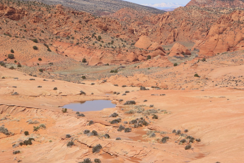
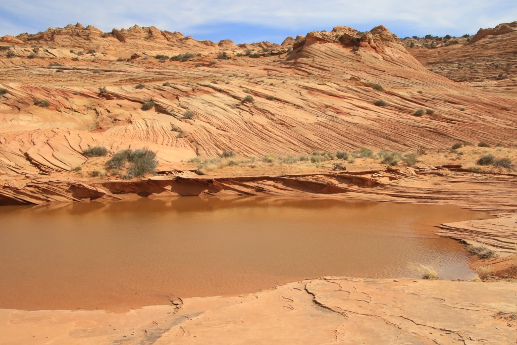
Continuing our exploration, we reached a high ridge offering a superb view of the region covered by our hike.

We could even see that several small lakes had formed during the last rainfall. Also, the green plains in the distance near Buckskin Gulch seemed to show us the way back.
Back in our vehicle, we drove again House Rock Road, always so spectacular.

Tomorrow promises to be much cloudier than today. Let's hope that the rain expected at the end of the day does not degrade the roads in the region too much, which are just beginning to recover.
__________________
2016 Trail Edition Classic Silver Metallic with KDSS, sunroof
ToyTec BOSS lift, SPC Light Racing UCA, RCI sliders, RCI aluminum full skids, RCI Cat Guard, Eezi-Awn K9 2.2m, BFG KO2 275/70R17E, FN Wheels f(X) Pro, ARB Breather kit, Husky WeatherBeater Mat and Cargo, XPEL window tint, 3M wrapped hood
Build thread
Adventures thread
|
|
|
Reply With Quote
|
|
03-19-2023, 01:54 AM
|
#618
|
 |
Senior Member
|
|
Join Date: Jan 2019
Location: AZ
Posts: 1,385
|
|
|
Senior Member
Join Date: Jan 2019
Location: AZ
Posts: 1,385
|
Thanks for the latest series of great pics!
Sure that guy could not make it, he bought a Ford truck 
Cheers!
__________________
2018 TRD OP non-kdss, well armored, well used
(6112s/650lb at 2.25" lift, 8100 rear with Bilstein B12 1.5" springs, Mickey Thompson ATZ P3 LTE 265 70 17, RCI set of front 3/16 skids, Shrockworks step sliders and 3/16 steel gas tank skid, C4Fab rear diff skid, Rockmen rear LCAs, Total Chaos rear LCA bracket skids, Diode Dynamics SS3 white fog lights).
|
|
|
Reply With Quote
|
|
03-19-2023, 08:51 PM
|
#619
|
|
Member
|
|
Join Date: Sep 2015
Location: Montreal, Canada
Posts: 915
Real Name: Jean
|
|
|
Member
Join Date: Sep 2015
Location: Montreal, Canada
Posts: 915
Real Name: Jean
|
Quote:
Originally Posted by MAST4R

Thanks for the latest series of great pics!
Sure that guy could not make it, he bought a Ford truck
Cheers! |
Thanks!
In fact, the stuck truck wasn't a Ford, it was a GMC Silverado. Different vehicle, same result!!!
__________________
2016 Trail Edition Classic Silver Metallic with KDSS, sunroof
ToyTec BOSS lift, SPC Light Racing UCA, RCI sliders, RCI aluminum full skids, RCI Cat Guard, Eezi-Awn K9 2.2m, BFG KO2 275/70R17E, FN Wheels f(X) Pro, ARB Breather kit, Husky WeatherBeater Mat and Cargo, XPEL window tint, 3M wrapped hood
Build thread
Adventures thread
|
|
|
Reply With Quote
|
|
03-19-2023, 10:14 PM
|
#620
|
|
Member
|
|
Join Date: Sep 2015
Location: Montreal, Canada
Posts: 915
Real Name: Jean
|
|
|
Member
Join Date: Sep 2015
Location: Montreal, Canada
Posts: 915
Real Name: Jean
|
Day 36:
Start point: Kanab UT
End point: Kanab UT
Distance driven: 183 km
Distance hiked: 2.9 km
As the weather forecast mentioned precipitation from the middle of the afternoon, we took the opportunity to travel an off-road track northwest of Kanab and leading to some attractions that we had spotted. Fortunately, the sun was present at the beginning, despite a slight veil.
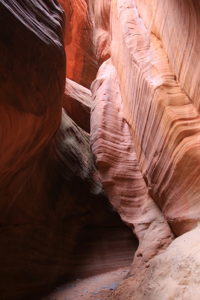
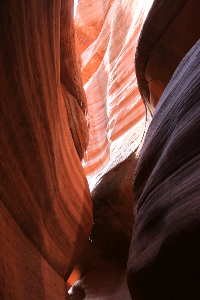
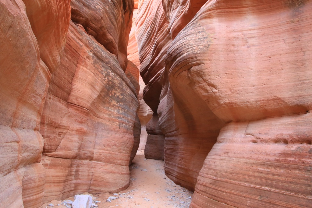
The first attraction was Peekaboo Slot Canyon (also called Red Canyon Slot). It is possible to reach this one by walking from the US89, but having the appropriate vehicle, we traveled the very sandy track to reach directly from the beginning of the canyon.

Peekaboo Slot Canyon is very pretty and luckily for me, wide enough to explore easily. In addition, the ground, composed of sand and rock, was completely dry. We were able to explore it for a little less than 1 km before encountering an impassable obstacle.

Back in the vehicle, we continued further north and took a secondary track climbing towards the colored cliffs that openings between the trees and bushes gave a glimpse of.

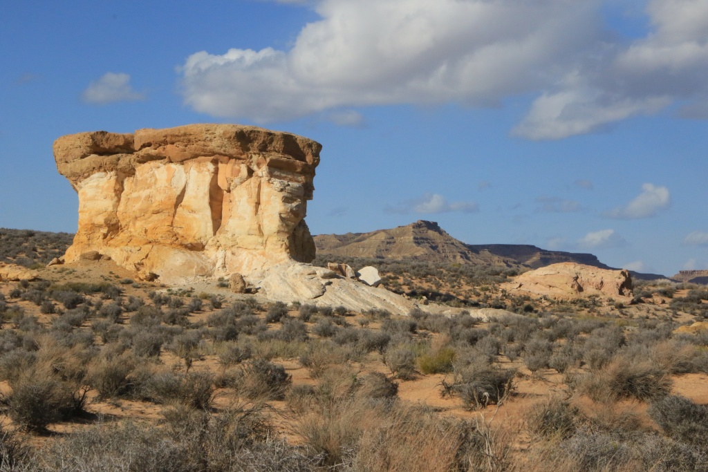
At the end of the track, we reached our second attraction, White Wave, a formation in waves, formed in the whitish rock, as opposed to the famous The Waves which is located in the reddish rock. We covered a loop of about 1 km climbing on a ridge offering a view down to the wave.


Continuing on the main track, we approached our third attraction, White Tower. We had planned to hike around it, but as the terrain was much too rugged we decided to give up.
By this time the clouds had arrived and the sky was beginning to darken to become ominous. We continued to reach an intersection with a track to leave the area quickly. To do so, it was necessary to cross Kanab Creek whose waters laden with sediments did not make it possible to assess the depth. We crossed it with caution and without incident, apart from a short section which was a little deeper.

It was already past noon, so since we would have run out of time anyway to see the other attractions we had planned, we decided to take the shortcut back to the paved roads.
After a quick dinner, and as the precipitation did not seem to be imminent, we decided to explore an area still unknown to us. We had identified a few off-road tracks that we had to cover tomorrow when we left Kanab, but with the forecast rainfall, we couldn't have covered them.
The main trail we traveled is located in Arizona and runs along Kaibab National Forest to reach Gunsight Point. This long trail is well maintained at the start, but as we progressed the conditions got a little tougher. We encountered several pools of muddy water practically blocking the road. In addition, it is heading mainly towards the southwest, bringing us closer to the showers at the same time. A few more threatening clouds were beginning to be visible in the distance. We were still able to reach Gunsight Point, not without having decorated the 4Runner a little!

We quickly admired the landscape, at the confluence of Kanab Creek and Snake Gulch, surprised by the beauty of this unknown area. Under the sunlight, the place must be even more admirable. We will definitely return to this area to see other viewpoints.

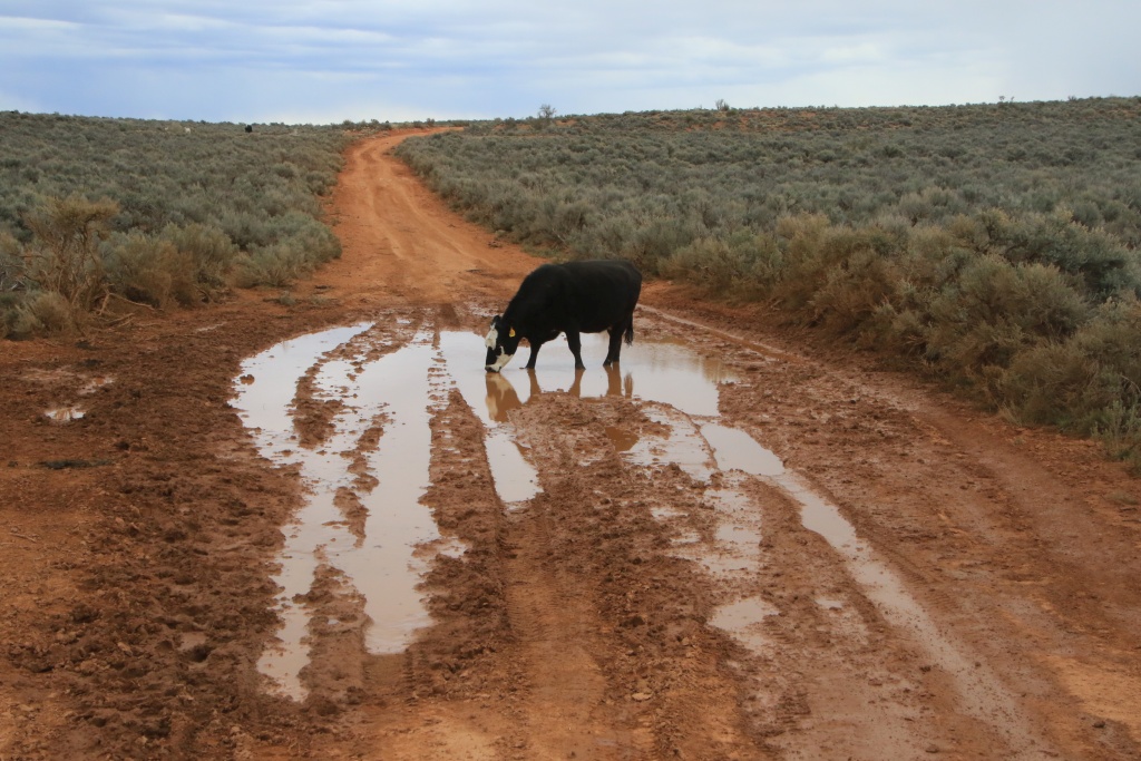
On the way back, the shower clouds had closed in and we felt a little rushed to get back on the paved roads. This was without counting a stubborn cow drinking quietly in one of the many ponds that we had to cross. Sweet words, engine roar, cries, horn, nothing helped. After ten minutes, probably sated to capacity, she decided to leave very slowly. Finally!
After rejoining the safety of the paved roads and reaching Kanab, a continuous rain started, a little too late to clean the truck. We will have this rain mixed with snow during the night and the day tomorrow. This may affect our planned activities around Page AZ, where we are staying for the next week.
__________________
2016 Trail Edition Classic Silver Metallic with KDSS, sunroof
ToyTec BOSS lift, SPC Light Racing UCA, RCI sliders, RCI aluminum full skids, RCI Cat Guard, Eezi-Awn K9 2.2m, BFG KO2 275/70R17E, FN Wheels f(X) Pro, ARB Breather kit, Husky WeatherBeater Mat and Cargo, XPEL window tint, 3M wrapped hood
Build thread
Adventures thread
|
|
|
Reply With Quote
|
|
03-21-2023, 12:35 AM
|
#621
|
|
Member
|
|
Join Date: Sep 2015
Location: Montreal, Canada
Posts: 915
Real Name: Jean
|
|
|
Member
Join Date: Sep 2015
Location: Montreal, Canada
Posts: 915
Real Name: Jean
|
Day 37:
Start point: Kanab UT
End point: Page AZ
Distance driven: 161 km
Our beautiful sun seemed far away today, while clouds and rain showers were there with a frankly quite chilly temperature. So we had a day with very slow flow. We did a short historic visit to Kanab before hitting the road to Page, with a detour to Glen Canyon National Recreation Area on the way.
Before leaving Kanab, we went to Heritage House Museum, a Victorian house built in 1892 and now a museum. This tells the story of the city, seen through the lives of the families who occupied this house before it was given to the city of Kanab to preserve it.

The original owner was a Mormon teacher and merchant and lived there with his first wife. His other wives lived elsewhere (polygamy was common among Mormons in those days, though persecuted by the federal government). His business had to be very profitable to be able to build such a house.
The interior was very modern for its time, decorated tastefully but without excess.


The many children of this first marriage lived on the second floor, the roof and the walls being not insulated, apart from some newspapers attached to the walls and dating from the 1930s. This was perhaps an incentive for them to leave and build their own home!


We then took the road to Page, about an hour and a half from Kanab, in relentless rain and a temperature dropping as we gained a little elevation.
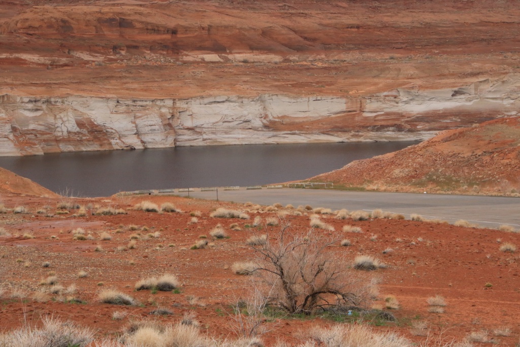
As we approached Page the rain stopped and we even had a few sunny spells. We took a short detour into Glen Canyon National Recreation Area to see Lone Rock in Wahweap Bay, a much more photogenic sight a few years ago when it was surrounded by water. Since our first trip in the region, in April 2010, Lake Powell water level dropped more than 35m.

Further on, we reached Wahweap Overlook overlooking Wahweap Bay and Wahweap Marina, one of the few still open, given the very low water level of Lake Powell.

Further, we traveled the Lakeshore Drive along Wahweap Bay. A few houseboats circulated in the narrow, still navigable channel to reach the vast Lake Powell.

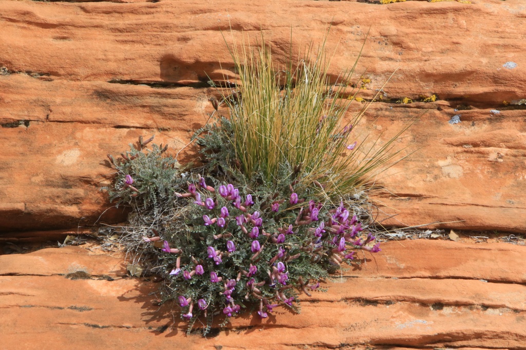
A sign that spring is coming, we started to see several types of roadside flowers. The very rainy winter will certainly favor the growth of these plants, hoping that we will not be gone already.

Continuing towards Page, we made a short stop at the Glen Canyon Dam, blocking the Colorado River flow and forming the Lake Powell reservoir.

More precipitations are expected tomorrow for most of the day. We will therefore have another quiet day, before a beautiful sequence of several sunny days.
__________________
2016 Trail Edition Classic Silver Metallic with KDSS, sunroof
ToyTec BOSS lift, SPC Light Racing UCA, RCI sliders, RCI aluminum full skids, RCI Cat Guard, Eezi-Awn K9 2.2m, BFG KO2 275/70R17E, FN Wheels f(X) Pro, ARB Breather kit, Husky WeatherBeater Mat and Cargo, XPEL window tint, 3M wrapped hood
Build thread
Adventures thread
Last edited by JohnTheLuck; 03-21-2023 at 09:14 PM.
|
|
|
Reply With Quote
|
|
03-21-2023, 09:36 PM
|
#622
|
|
Member
|
|
Join Date: Sep 2015
Location: Montreal, Canada
Posts: 915
Real Name: Jean
|
|
|
Member
Join Date: Sep 2015
Location: Montreal, Canada
Posts: 915
Real Name: Jean
|
Day 38:
Start point: Page AZ
End point: Page AZ
Distance driven: 110 km
As expected, the rain was present all day, with rare and short sunny spells in the afternoon. Perfect scenario for a laundry chore. Then, we tried to visit a few attractions inside, but those that interested us were either closed for renovations or simply closed on certain days because of the off-season.
We still took advantage of a slight lull to go see the state of the Smoky Mountain Road leading to several trails that we had planned to do in the next few days in Glen Canyon National Recreation Area. It will be necessary that the conditions improve a little because currently, that is not very promising with the level of Wahweap Creek having to be crossed at the very beginning. The landscape is representative of our day, gray, foggy, and colorless.

Then we went to see Antelope Point, also in Glen Canyon NRA. The marina is one of many closed due to lack of water. The end of the ramp is about 15 to 20 meters above the current water level.

The weather forecast is much better for the next few days. We will try to reach the start of a long off-trail hike which should be spectacular.
__________________
2016 Trail Edition Classic Silver Metallic with KDSS, sunroof
ToyTec BOSS lift, SPC Light Racing UCA, RCI sliders, RCI aluminum full skids, RCI Cat Guard, Eezi-Awn K9 2.2m, BFG KO2 275/70R17E, FN Wheels f(X) Pro, ARB Breather kit, Husky WeatherBeater Mat and Cargo, XPEL window tint, 3M wrapped hood
Build thread
Adventures thread
|
|
|
Reply With Quote
|
|
03-23-2023, 12:08 AM
|
#623
|
|
Member
|
|
Join Date: Sep 2015
Location: Montreal, Canada
Posts: 915
Real Name: Jean
|
|
|
Member
Join Date: Sep 2015
Location: Montreal, Canada
Posts: 915
Real Name: Jean
|
Day 39:
Start point: Page AZ
End point: Page AZ
Distance driven: 54 km
Distance hiked: 8.1 km
We had a superb and mostly sunny day, the first of a long streak of days without precipitation. How good that is! We chose to explore a sandy, clay-free area in Vermilion Cliffs National Monument, until the ground dried out after all the rain.
Our first destination was a loop hike, adjacent to the one we hiked in March 2020 while exploring Thousand Pockets. By this time, we had abandoned the westernmost sector because our journey for the day had already been long enough.
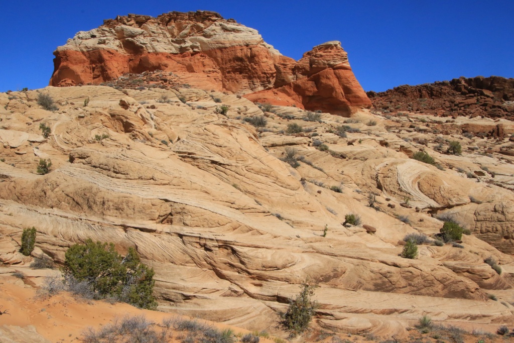
Today's loop joined the Big Red Rock area, a series of reddish sandstone promontories topped by a layer of black boulders.

We explored somewhat haphazardly, sometimes descending to the base of the promontories, other times reaching viewpoints at the top. Our progress was facilitated by the absence of major washes in this sector.

At some point we came across a very large field of Moki Marbles, concretions forming in specific layers of sandstone. They were everywhere!

We finally reached the westernmost point of our route and the highest point of the hike. From this place, the view was magnificent and allowed to see the many red buttes that we had passed, and Navajo Mountain in the distance under the snow and the clouds.

On the other side of a major wash that caused us some detours in March 2020, we could see the Thousand Pockets mounds, a set of cavities and mounds capturing water from precipitation.

For the return to our vehicle, we chose to reach the big wash, being careful not to go down there before having circumvented a dry fall of several meters. Exploring this wash alone is worth a hike.

Back in the vehicle, we continued further down the road to Ferry Swale Canyon Road leading to some high viewpoints of the Colorado River and the Lee's Ferry area in Glen Canyon National Recreation Area. We had already explored this area below during multiple trips, including the one in December 2013.

We had a prime view of the confluence of the Paria River, its sediment-laden waters flowing into the clear waters of the Colorado River.

Our first vantage point was located near the communications towers. The wind there was extremely strong to the point of being unpleasant.

The return was made by the same route. Although this road has been worked to allow the installation of communication towers, the fact remains that the elements have degraded it in some places. With an adapted vehicle and a little precaution, it is still passable even if certain passages are more delicate.

After descending the steepest sections, we continued on Ferry Swale Canyon Road toward US89 near Page. We circulated in washes whose sand was still a little wet, causing a slight concern without more. Further on, the signs of nearby civilization became more and more present.

We wanted to check the condition of Ferry Swale Canyon Road as we plan to return there tomorrow for an even longer hike that promises to be spectacular, well we hope so.
__________________
2016 Trail Edition Classic Silver Metallic with KDSS, sunroof
ToyTec BOSS lift, SPC Light Racing UCA, RCI sliders, RCI aluminum full skids, RCI Cat Guard, Eezi-Awn K9 2.2m, BFG KO2 275/70R17E, FN Wheels f(X) Pro, ARB Breather kit, Husky WeatherBeater Mat and Cargo, XPEL window tint, 3M wrapped hood
Build thread
Adventures thread
|
|
|
Reply With Quote
|
|
03-23-2023, 02:44 PM
|
#624
|
|
Member
|
|
Join Date: Jan 2023
Location: San Diego
Posts: 44
|
|
|
Member
Join Date: Jan 2023
Location: San Diego
Posts: 44
|
Great thread. Looks like a ton of great adventures.
|
|
|
Reply With Quote
|
|
03-23-2023, 10:57 PM
|
#625
|
|
Member
|
|
Join Date: Sep 2015
Location: Montreal, Canada
Posts: 915
Real Name: Jean
|
|
|
Member
Join Date: Sep 2015
Location: Montreal, Canada
Posts: 915
Real Name: Jean
|
Quote:
Originally Posted by HuskyMike
Great thread. Looks like a ton of great adventures.
|
Thanks for following our adventures! Regardless of the weather, this trip is great so far. And about 25 more days to go!
__________________
2016 Trail Edition Classic Silver Metallic with KDSS, sunroof
ToyTec BOSS lift, SPC Light Racing UCA, RCI sliders, RCI aluminum full skids, RCI Cat Guard, Eezi-Awn K9 2.2m, BFG KO2 275/70R17E, FN Wheels f(X) Pro, ARB Breather kit, Husky WeatherBeater Mat and Cargo, XPEL window tint, 3M wrapped hood
Build thread
Adventures thread
|
|
|
Reply With Quote
|
|
03-24-2023, 12:06 AM
|
#626
|
|
Member
|
|
Join Date: Sep 2015
Location: Montreal, Canada
Posts: 915
Real Name: Jean
|
|
|
Member
Join Date: Sep 2015
Location: Montreal, Canada
Posts: 915
Real Name: Jean
|
Day 40:
Start point: Page UT
End point: Page UT
Distance driven: 127 km
Distance hiked: 10.2 km
We returned to Paria Canyon-Vermilion Cliffs Wilderness to do another off-trail hike, Nancy's creation. While the weather forecast was encouraging, the sun was quickly eclipsed by multiple cloudy periods that refreshed us with a few drops and even a fine hail in the form of Styrofoam.
We took the Ferry Swale Canyon Road back to the starting point of the hike. At some point, we saw in the distance the objective of the day, a huge sand dune nestled in a valley, separated from Paria Canyon by a high cliff.

Our hike started by crossing a sandy expanse populated by low bushes, before reaching a wash that we followed for a good part of the hike. As we had guessed, several rocky passages formed dry falls with residual pools of water, impossible to cross. However, we always easily found workarounds.

The big clouds appeared above the high hills as we reached an area with a fairly large rise in elevation in a narrow pass. We watched the clouds and especially the precipitations. The danger of flash floods was very low because the surroundings of the wash offered a multitude of slopes that could be climbed quickly if necessary.

At one point we stopped under a cedar tree as hail was falling. When it stopped, we resumed our walk under a still gray sky. Another large cloud arrived and dumped a mixture similar to the first. Doubt began to animate us. What's the point of hiking in these conditions, especially since the sandstone rock gets somewhat slippery when wet.
But having decided to continue, our efforts were rewarded, when we had just crossed the last obstacle and joined the small valley at the foot of the sand dune, the sun showed its nose above the cliff.

At the foot of the dune, another cloud appeared. The silence was broken by the faint sound of hailstones hitting nearby cliffs. The cloud brushed past us without affecting us too much. After it passed, a clearing illuminated the wet rocks.

We did not climb the dune given its height and its inclination. On the other hand, I couldn't resist climbing a long sandstone ridge offering a beautiful view.

On the return trip, by the same path, we were gifted by the presence of the sun between small cloudy passages. Fortunately, the heat of the sun had quickly dried the rocks.


After crossing the most difficult passages again, new clouds appeared again behind us above the hills.


Back at the 4Runner, we headed back to Page for a combined dinner-supper. Then, wanting to take advantage of the few remaining hours, we went to check out the was of Smoky Mountain Road in Glen Canyon National Recreation Area. We have several points of interest accessible by this road. However, it crosses clayey and impassable areas after heavy rainfall. Some sections were in a state requiring a little more vigilance. Luckily, the sun of the last two days has greatly helped to dry it out.
 [

We reached the intersection with Crosby Canyon Road, an area that we will explore again tomorrow, weather permitting. We had visited this place in March 2013.
__________________
2016 Trail Edition Classic Silver Metallic with KDSS, sunroof
ToyTec BOSS lift, SPC Light Racing UCA, RCI sliders, RCI aluminum full skids, RCI Cat Guard, Eezi-Awn K9 2.2m, BFG KO2 275/70R17E, FN Wheels f(X) Pro, ARB Breather kit, Husky WeatherBeater Mat and Cargo, XPEL window tint, 3M wrapped hood
Build thread
Adventures thread
|
|
|
Reply With Quote
|
|
03-24-2023, 10:25 PM
|
#627
|
|
Member
|
|
Join Date: Sep 2015
Location: Montreal, Canada
Posts: 915
Real Name: Jean
|
|
|
Member
Join Date: Sep 2015
Location: Montreal, Canada
Posts: 915
Real Name: Jean
|
Day 41:
Start point: Page AZ
End point: Page UT
Distance driven: 248 km
When we left the hotel this morning, the pavement was wet. Several showers surrounded Page and very few sunny openings between them. This caused us a lot of hesitation.
We still tried to reach Crosby Canyon in Glen Canyon National Recreation Area. We passed a van whose driver informed us that the road was impassable further. Although we had covered this segment late yesterday afternoon, the overnight showers had turned the clay into as slippery a substance as possible. Like the driver we had met, we wisely turned around, especially since other precipitation was heading towards the area.
Then, we hesitated between a few possible destinations, including Cockscomb Wilderness Study Area, a little further west towards Kanab. We had slightly explored this place during our January 2020 trip. On the other hand, when we reached this place, clouds and rain were present. We will have better opportunities to explore it under the sun.
We came back to Page as the sun broke more and more. We then decided to explore the sandy roads north of US89, not far from those we had taken in the last two days. This sector has beautiful cliffs of gray-greenish rocks, conducive to the formation of hoodoos, these pillars supporting a harder rock.


We reached a promontory offering a view of an area of colored rocks, a candidate place for another Nancy vintage hike.

We continued by reaching the sector of Stud Horse Point, composed of the same type of rocks.

We then joined a sector even further west. We were drawn to a road that climbed uphill and offered a view of the sandy valley we were exploring. Continuing, it led us to Paria Canyon Overlook Road, a road we traveled in October 2016. We turned around at this point.


Back on the road in the valley, we continued, getting closer to the gray-greenish hills.


The weather is so inaccurate these days that it is difficult to plan what we will do tomorrow. One thing is certain, the number of days remaining in the Page area is rapidly diminishing, and we have done very little of the things included in our itinerary. On the other hand, we made some great discoveries. But quickly, full sunny days!!!
__________________
2016 Trail Edition Classic Silver Metallic with KDSS, sunroof
ToyTec BOSS lift, SPC Light Racing UCA, RCI sliders, RCI aluminum full skids, RCI Cat Guard, Eezi-Awn K9 2.2m, BFG KO2 275/70R17E, FN Wheels f(X) Pro, ARB Breather kit, Husky WeatherBeater Mat and Cargo, XPEL window tint, 3M wrapped hood
Build thread
Adventures thread
|
|
|
Reply With Quote
|
|
03-25-2023, 11:36 PM
|
#628
|
|
Member
|
|
Join Date: Sep 2015
Location: Montreal, Canada
Posts: 915
Real Name: Jean
|
|
|
Member
Join Date: Sep 2015
Location: Montreal, Canada
Posts: 915
Real Name: Jean
|
Day 42:
Start point: Page AZ
End point: Page AZ
Distance driven: 156 km
Distance hiked: 6.4 km
We finally had a full day without any precipitation. This will greatly help to improve the conditions of the tracks and trails. We took the opportunity to hike in a wilderness, and return to some viewpoints on a high plateau overlooking Paria Canyon.
Our first destination of the day was the promontory overlooking the Lee's Ferry area in Glen Canyon National Recreation Area, a place we had explored a few days ago, but since the sunshine conditions weren't great, we wanted to go back a sunny morning. Unfortunately, yesterday's high winds had deposited an additional layer of dry sand on the roads and as we were the very first vehicle to drive there, progress was very difficult. We gave up on the idea.
Instead, we headed to The Cockscomb Wilderness Study Area to take an off-trail hike through an area of bentonite cliffs, easily eroded and sculpted by rainfall. We followed a long wash, slightly damp at first. On the west side rose the colored cliffs sloping from a fold of the earth's crust.

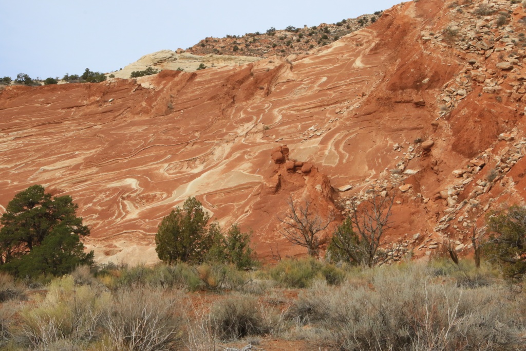
The erosion of different layers has sculpted random shapes of astonishing beauty. The wash was getting narrower and narrower and a thin trickle of water was constantly flowing. The mud stuck to our shoes but didn't slip too much.


We reached a place where our progress was no longer possible and we returned by the same route. The sun was becoming more and more present, bringing out the colors even more.


Back in the vehicle, we decided to head back to Paria Canyon Overlook Road, taking the section of Cottonwood Road through the Flat Top area. Paria Canyon Overlook Road offers a series of viewpoints over the canyon carved out by the Paria River. Together with Buckskin Gulch, which we explored a few days ago, this canyon separates the Paria high plateau. We had traveled this route in November 2016, but very early in the morning. The dazzling sun and the shadow of the cliffs prevented us from appreciating the beauty of the place.


From these headlands we were able to see some familiar spots, such as the viewpoints overlooking Lee's Ferry in the distance, the Lee's Ferry area in Glen Canyon NRA, and the Paria River. In March 2020 we had hiked along the cliff to the left on the series of sloping plateaus. At this time, the colors of the bentonite hills were vivid when viewed up close.

The cliffs of Paria Canyon are very sculpted and steep.

Tomorrow we will make another attempt to explore Glen Canyon NRA via Smoky Mountain Road. Today's beautiful temperature may have been enough to make it passable again.
__________________
2016 Trail Edition Classic Silver Metallic with KDSS, sunroof
ToyTec BOSS lift, SPC Light Racing UCA, RCI sliders, RCI aluminum full skids, RCI Cat Guard, Eezi-Awn K9 2.2m, BFG KO2 275/70R17E, FN Wheels f(X) Pro, ARB Breather kit, Husky WeatherBeater Mat and Cargo, XPEL window tint, 3M wrapped hood
Build thread
Adventures thread
|
|
|
Reply With Quote
|
|
03-26-2023, 01:49 AM
|
#629
|
|
Senior Member
|
|
Join Date: Jan 2019
Location: AZ
Posts: 1,385
|
|
|
Senior Member
Join Date: Jan 2019
Location: AZ
Posts: 1,385
|
Looking at the horrible reality presented by your Lake Powell pictures, you should NOT want to go down Crosby Canyon.
Just don't. It will be dreadful, aesthetically. A place that has never had the water is different but one where it used to and now does not....
As for Smoky Mountain Rd, the smooth dirt road that goes right where Smokey continues north and that ends at the intersection where Croton heads north and Grand Bench going to the lake is a very nice drive through gorgeous "lunar" terrain. I really like that one, and it is fast.
Croton elicits mixed views, it really depends on suspension and what exactly you do. The five miles north from the intersection are similar to the WHite Rim Road in Canyonlands and I rank them very, very high for scenery. Mild rocks. The majority of the trail, once you gain elevation is not very interesting and anything but a top suspension will make you feel the rocks.
Smokey Mountain itself is great up to the point on the top of the climb and is a fun drive for several more miles. After that it is pretty awful, with nothing really to see and lots and lots of embedded rock.
Knowing your suspension and usual speeds, I would suggest not driving any of the main sections of either Croton or Smokey. The southern climb/descents of each are glorious but the rest is forgettable. You can loop Smokey Mtn with Smokey Hollow going up the latter and down the former. That makes for a very nice loop.
As for Grand Bench...it is about as remote as anything in the lower 48 so gotta be careful. I had a suspension hit, very hard near the far end and my face froze for a few seconds till I made sure I had not broken anything. Of course you could drive slower and stay at the end of that trail overnight. But going out and back in one day in daylight is not easy.
Good luck and stay safe, almost nobody goes to Grand Bench/Croton.
__________________
2018 TRD OP non-kdss, well armored, well used
(6112s/650lb at 2.25" lift, 8100 rear with Bilstein B12 1.5" springs, Mickey Thompson ATZ P3 LTE 265 70 17, RCI set of front 3/16 skids, Shrockworks step sliders and 3/16 steel gas tank skid, C4Fab rear diff skid, Rockmen rear LCAs, Total Chaos rear LCA bracket skids, Diode Dynamics SS3 white fog lights).
|
|
|
Reply With Quote
|
|
03-26-2023, 09:51 PM
|
#630
|
|
Member
|
|
Join Date: Sep 2015
Location: Montreal, Canada
Posts: 915
Real Name: Jean
|
|
|
Member
Join Date: Sep 2015
Location: Montreal, Canada
Posts: 915
Real Name: Jean
|

Quote:
Originally Posted by MAST4R
Looking at the horrible reality presented by your Lake Powell pictures, you should NOT want to go down Crosby Canyon.
Just don't. It will be dreadful, aesthetically. A place that has never had the water is different but one where it used to and now does not....
As for Smoky Mountain Rd, the smooth dirt road that goes right where Smokey continues north and that ends at the intersection where Croton heads north and Grand Bench going to the lake is a very nice drive through gorgeous "lunar" terrain. I really like that one, and it is fast.
Croton elicits mixed views, it really depends on suspension and what exactly you do. The five miles north from the intersection are similar to the WHite Rim Road in Canyonlands and I rank them very, very high for scenery. Mild rocks. The majority of the trail, once you gain elevation is not very interesting and anything but a top suspension will make you feel the rocks.
Smokey Mountain itself is great up to the point on the top of the climb and is a fun drive for several more miles. After that it is pretty awful, with nothing really to see and lots and lots of embedded rock.
Knowing your suspension and usual speeds, I would suggest not driving any of the main sections of either Croton or Smokey. The southern climb/descents of each are glorious but the rest is forgettable. You can loop Smokey Mtn with Smokey Hollow going up the latter and down the former. That makes for a very nice loop.
As for Grand Bench...it is about as remote as anything in the lower 48 so gotta be careful. I had a suspension hit, very hard near the far end and my face froze for a few seconds till I made sure I had not broken anything. Of course you could drive slower and stay at the end of that trail overnight. But going out and back in one day in daylight is not easy.
Good luck and stay safe, almost nobody goes to Grand Bench/Croton.
|
The lowering of Lake Powell water level is, sadly, a reality we have to live with it meanwhile we address climate change and reverse its effects. Crosby Canyon is a really nice canyon with a wide variety of colors and textures. We visited this canyon in March 2013 with a rented vehicle. See my French Blog for great pictures (I didn't own the 4Runner at that time).
We also drove Smoky Mountain Road and Sitdown Bench Road up to the intersection with Croton Road in October 2016. See my T4R post here.
Now, for embedded rocks and suspension; it is mostly a mater of the speed of the vehicle. You know I am nos a speed demon as, humm... you! ;)
My plan is to explore near the Croton and Grand Bench intersection, not too far since we have to come back during daylight. Weather will decide for tomorrow. Looks promising, hoping everything is not ruined during the night with slight chance of rain.
Thanks for the comments and advices.
__________________
2016 Trail Edition Classic Silver Metallic with KDSS, sunroof
ToyTec BOSS lift, SPC Light Racing UCA, RCI sliders, RCI aluminum full skids, RCI Cat Guard, Eezi-Awn K9 2.2m, BFG KO2 275/70R17E, FN Wheels f(X) Pro, ARB Breather kit, Husky WeatherBeater Mat and Cargo, XPEL window tint, 3M wrapped hood
Build thread
Adventures thread
Last edited by JohnTheLuck; 03-26-2023 at 11:38 PM.
Reason: Typo
|
|
|
Reply With Quote
|
 Posting Rules
|
You may not post new threads
You may not post replies
You may not post attachments
You may not edit your posts
HTML code is On
|
|
|
|


 Linear Mode


