 03-18-2024, 10:18 PM
|
#766
|
|
Member
|
|
Join Date: Sep 2015
Location: Montreal, Canada
Posts: 915
Real Name: Jean
|
|
|
Member
Join Date: Sep 2015
Location: Montreal, Canada
Posts: 915
Real Name: Jean
|
Quote:
Originally Posted by ShermanOlsen

LOL, I'm not sure why 10,000 meters did not trigger second thoughts--I saw 6000 feet and did my a mileage conversion in reverse! Sigh.
|
Yep, altitudes likes the Himalayas!!! Mt. Everest is at 8850 meters!
__________________
 2016 Trail Edition Classic Silver Metallic with KDSS, sunroof
ToyTec BOSS lift, SPC Light Racing UCA, RCI sliders, RCI aluminum full skids, RCI Cat Guard, Eezi-Awn K9 2.2m, BFG KO2 275/70R17E, FN Wheels f(X) Pro, ARB Breather kit, Husky WeatherBeater Mat and Cargo, XPEL window tint, 3M wrapped hood
Build thread
Adventures thread
|

|
 Reply With Quote Reply With Quote
|
|
03-18-2024, 11:56 PM
|
#767
|
|
Member
|
|
Join Date: Sep 2015
Location: Montreal, Canada
Posts: 915
Real Name: Jean
|
|
|
Member
Join Date: Sep 2015
Location: Montreal, Canada
Posts: 915
Real Name: Jean
|
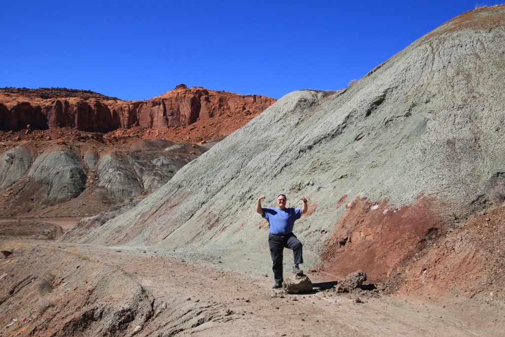
Day 27:
Starting point: Hanksville UT
Ending point: Torrey UT
Distance driven: 277 km
Distance hiked: 3.6 km
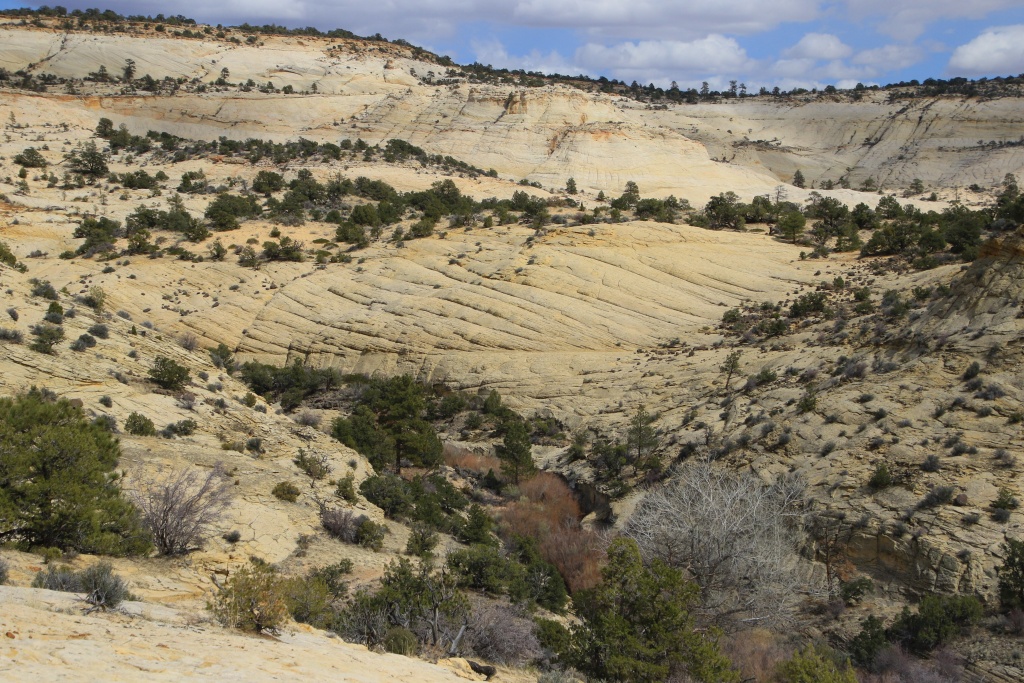
Finally, we had a superb sunny day, with only a few inconsequential clouds, and a temperature of 14C. As we were on our last day officially around Hanksville (more on this below...) we took the opportunity to do some activities along UT 95 southeast of Hanksville.
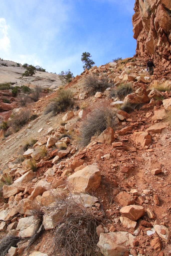
Our first activity of the day was a hike in Leprechaun Canyon. This can be partially explored by hiking, but is especially popular with climbing enthusiasts. Nevertheless, we were pleasantly surprised by the beauty of the place, which is earned with slight challenges.
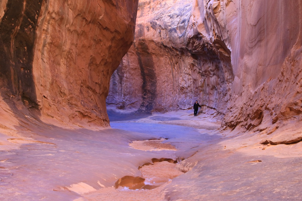
The wide canyon gives way to a narrow slot just wide enough to pass at ground level, but a few tens of centimeters higher. During floods, the water level must rise very high.


We then returned to Trachyte Point Road, a road that we had partially traveled two days ago when the ground was still too wet. Today the conditions were ideal and we were able to explore it thoroughly. This road overlooks UT 95 which we have taken many times. However, we were only able to partially glimpse it in only a few places because lower benches masked it. One of the first viewpoints allowed you to see Hog Spring Rest Area.

Further on, we had some slight challenges, with rocky areas to cross, but nothing insurmountable.

Further on, we reached another viewpoint towards the Hite region, with Lake Powell visible in the distance.

Even further, we followed the cliff and a final plateau revealed itself to us. The descent to this proved a bit intimidating as the road leaned a bit to the side, but safe nonetheless.


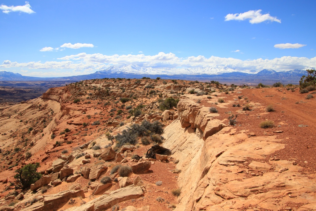
After reaching a point further than we had planned, we began our return. The Henry Mountains stood proudly before us with their recent blanket of snow.

Having rejoined the UT 276 road, we drove quite slowly because our tires were aired down. We then reached the start of another road, South Turkey Knob Road leading to Cedar Point.
We reached a viewpoint overlooking Stair Canyon.
Then, further on, we reached the superb viewpoint of Cedar Point. From this spot we could see now familiar places, like Poison Springs Canyon that we hiked last winter, Dirty Devil River winding all the way down below.


Also visible in the distance are Sunset Pass and Gunsight Butte, the place where we experienced a hailstorm while exploring Flint Trail Road and the east end of Poison Springs Canyon Road.

Further down the road we reached Poison Springs Canyon Overlook. The road visible toward the center of the next photo and around the tip of Bert Mesa is certainly a destination for a future trip as it connects to Happy Canyon, a fairly popular destination for long-distance hikers.

We continued on a much less traveled segment, as we crossed stretches of small sand dunes. We finally joined UT 276, re-inflated the tires and took the road towards Torrey.
As we passed through Capitol Reef National Park, we checked to see if the Scenic Drive was finally open and it was. With the colors resplendent with the setting sun, we couldn't miss this chance and trekked it. In several places, meltwater laden with reddish sediment crossed the road.


The presence of snow will certainly limit our choice of activities that we had planned in Capitol Reef NP. Arriving at our hotel in Torrey, we tried unsuccessfully to shorten our stay here, hoping to return to Hanksville where conditions are much better. So we are going to stay in Torrey for the next three nights. We might drive back to Hanksville area every day.
__________________
2016 Trail Edition Classic Silver Metallic with KDSS, sunroof
ToyTec BOSS lift, SPC Light Racing UCA, RCI sliders, RCI aluminum full skids, RCI Cat Guard, Eezi-Awn K9 2.2m, BFG KO2 275/70R17E, FN Wheels f(X) Pro, ARB Breather kit, Husky WeatherBeater Mat and Cargo, XPEL window tint, 3M wrapped hood
Build thread
Adventures thread
|
|
|
Reply With Quote
|
|
03-19-2024, 11:21 PM
|
#768
|
|
Member
|
|
Join Date: Sep 2015
Location: Montreal, Canada
Posts: 915
Real Name: Jean
|
|
|
Member
Join Date: Sep 2015
Location: Montreal, Canada
Posts: 915
Real Name: Jean
|
Day 28:
Starting point: Torrey UT
Ending point: Torrey UT
Distance driven: 297 km
Distance hiked: 5.2 km
We hit the road without much of a well-established objective, the presence of melting snow compromising our activities that we had planned around Torrey. So we headed to Hanksville, giving ourselves about an hour to think about it better. Along the way, we decided on our first activity of the day, a hike to the base of San Rafael Swell.
As we traveled a short dirt road to the trailhead, we noticed a road traveling through a canyon crossing the rock barrier. After some consultation of the Trails Offroad application, we decided to partially travel it.


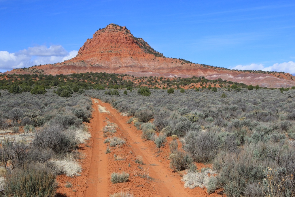
It was such a good choice that we pursued it much further. At the exit of the canyon stood Temple Mountain in all its splendor. We imagine that its name was given in reference to the Temple located in Salt Lake City.

Then, again thanks to our friends from Trails Offroad, we continued with another road joining mining remains. Based on the nature of the rock layer exploited, we believe that these were uranium mines dating from the 1940s-1950s.


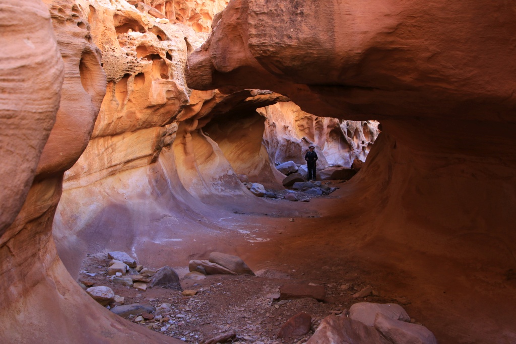
After a few more critical passages since the road had suffered some damage following recent precipitation, we joined the main road Temple Mountain Road. We then moved on with Behind the Reef Road, which, as the name suggests, runs behind San Rafael Reef in a very spectacular setting. After some distance, our second activity of the day came into view, Crack Canyon in Muddy Creek Wilderness, also crossing San Rafael Reef.

It is a very spectacular canyon, with many places that erosion by wind and water have carved countless holes, called tafoni.


At one point, as the canyon passes through a somewhat harder layer of rock, the water has hollowed out the underlying rock and formed a long tunnel of sorts, with a narrow slit in its ceiling. Awesome!
Further on, we reached an interesting obstacle, a depression bordered by rocks with a tree trunk installed on an inclined plane to allow passage. A little challenge of the day!


Further on, the canyon becomes very narrow and numerous water-filled depressions encouraged us to turn around. The return was made with the same wonder.


After the hike, we took a chance on Cow Dunk Road, a road that winds through the bentonite clay hills. You now know my apprehension for this type of soil that is slippery when wet. We wanted to check if three days without precipitation was enough to explore certain areas that we had not yet reached. Although some places were still wet (this ground is so impermeable that water remains on the surface), the passage of other vehicles had dried most of it.
We saw NASA Mars Research Station once again.

Further on, we took a cross track leading west toward North Blue Valley Road, and continued on it north. At the foot of the Factory Butte plateau and Moon Overlook lies a wide expanse of grayish hills, with San Rafael Swell in the distance. A landscape from another world.

We drove a short distance on North Blue Valley Road before turning back out of caution as the road descended a long, still wet slope. On the way back, the sinking late afternoon sun lit up this special landscape, with the Henrys Mountains in the background.

We are still deciding on our activities for tomorrow because the snow is still too present to be able to enjoy it around Torrey.
__________________
2016 Trail Edition Classic Silver Metallic with KDSS, sunroof
ToyTec BOSS lift, SPC Light Racing UCA, RCI sliders, RCI aluminum full skids, RCI Cat Guard, Eezi-Awn K9 2.2m, BFG KO2 275/70R17E, FN Wheels f(X) Pro, ARB Breather kit, Husky WeatherBeater Mat and Cargo, XPEL window tint, 3M wrapped hood
Build thread
Adventures thread
|
|
|
Reply With Quote
|
|
03-21-2024, 01:28 AM
|
#769
|
|
Member
|
|
Join Date: Sep 2015
Location: Montreal, Canada
Posts: 915
Real Name: Jean
|
|
|
Member
Join Date: Sep 2015
Location: Montreal, Canada
Posts: 915
Real Name: Jean
|
Day 29:
Starting point: Torrey UT
Ending point: Torrey UT
Distance driven: 289 km
Distance hiked: 12.7 km
We had another beautiful sunny day, with barely a few clouds in the afternoon. The temperature even rose to 18C, a bit warm in the blazing sun.
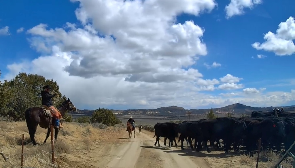
To start the day, hoping to get some useful information, we made a stop at the Capitol Reef National Park visitor center to get the status of the roads we wanted to travel. The Ranger who greeted us said that they had no recent information on the state of these roads, but that given the recent precipitation, it must be very muddy, even impassable, and that she would not even dare to go there with your personal vehicle. I have to say they are more concerned with covering their behinds than providing useful information. All the roads we wanted to travel on were in exemplary condition. We even saw a Dodge Charger at the Wolverine Canyon trailhead! Waste of time... Okay, enough venting, let's move on to the interesting stuff!
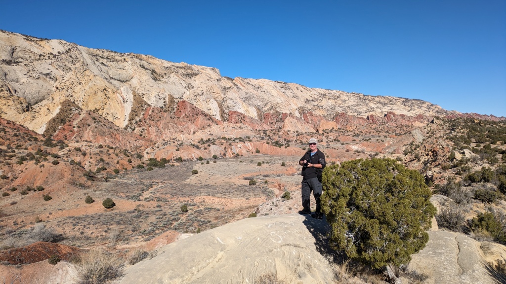
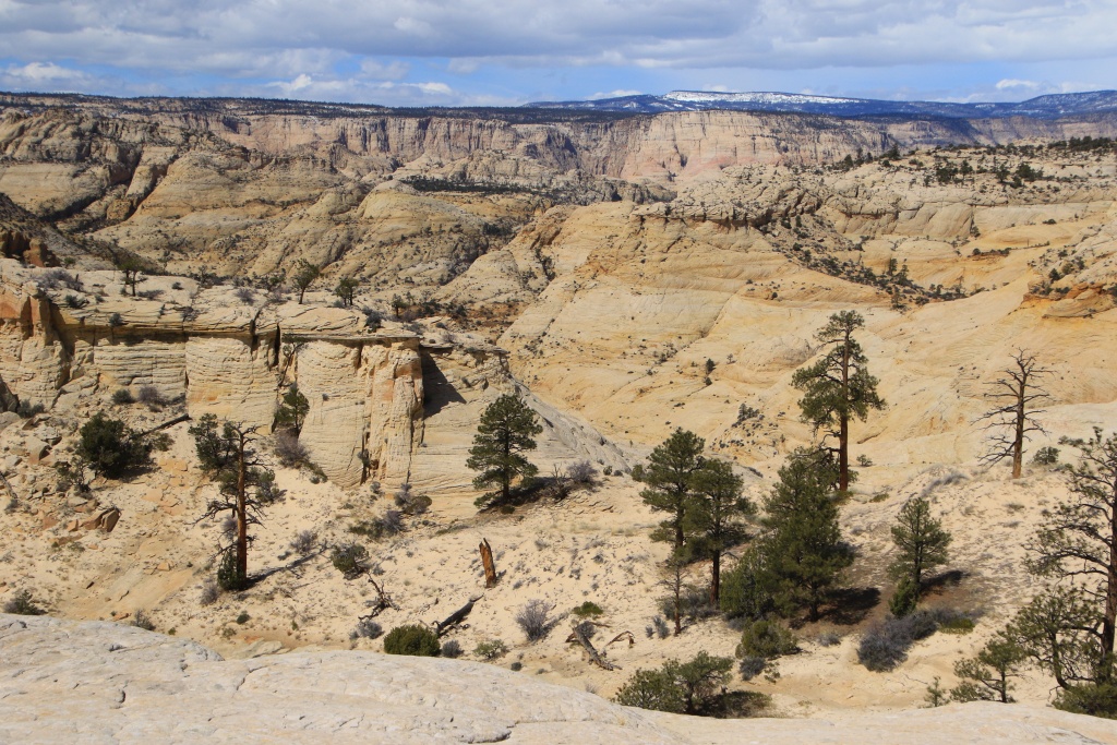
So we started our day by traveling through Notom-Bullfrog Scenic Byway. This road runs along the Waterpocket Fold for some distance. Among other things, we wanted to check the accessibility of certain potential activities. We stopped and climbed a hill for a spectacular view of this fold in the earth's crust.

At the top of the Waterpocket Fold, Peek-a-boo Arch stood proudly in this splendid setting.

We recognized other points that we saw up close when we hiked one of the most beautiful hikes in Capitol Reef NP, the Upper Muley Twist Canyon Loop (see message from March 29, 2013). From this high point, the view is simply extraordinary.

Further on, we joined Burr Trail Road and its long switchbacks climbing to the top of Waterpocket Fold.

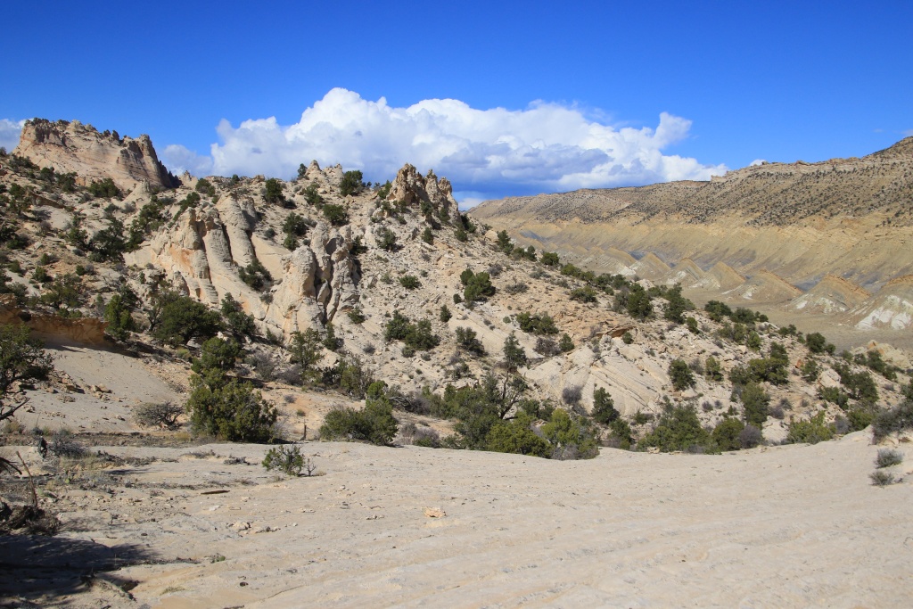
Next, we joined the east end of Wolverine Loop Road, then continued onto Wolverine Cutoff Road, then joined the southern section of Wolverine Loop Road. This area is very spectacular with its high colorful cliffs.


We then reached the start of Horse Canyon Road, running through a narrow canyon and the end of which must be hiked because it is included in the North Escalante Canyons Instant Study Area. Unfortunately, we ran into a long section that was still flooded and muddy, so we turned back.

So we decided to go do another hike in a nearby canyon, backtracking a bit on Wolverine Loop Road then taking Moody Creek Road then Silver Falls Road.

We sometimes encounter small pitfalls without too much seriousness. It feels good to get out of the vehicle to stretch your legs and arms!
A little further, the road ends at the border with Glen Canyon National Recreation Area. We prepared for a moderately long hike up Silver Falls Creek, but it turned out to be much longer than expected, despite it already being late.
At first, Silver Falls Creek is lined with bentonite clay hills, but as you progress, the canyon closes in and tall cliffs line it.


We came across some large pieces of petrified wood, probably from the nearby Wolverine Petrified Forest.

Our turnaround point was some petroglyphs in the canyon. However, since we hadn't planned to hike this hike, we only had rough coordinates and no description. So we didn't find them and turned back. The return took place while the sun was beating down in the canyon without any wind. Additionally, we were heading back toward the headwaters of Silver Falls Creek, adding to the effort.


The hike originally estimated between 6 to 8 km therefore turned out to be 11.2 km. When I got to the vehicle, I felt unwell, probably due to the heat and too little meal this afternoon. After eating and drinking a lot, my form returned and we took the road in the opposite direction. It was then already 6:15 p.m.
After reaching the Burr Trail Road, which was paved at this point, we decided to stay on paved roads because we knew the sun would set long before we were back in Torrey. We therefore joined the UT 12 road heading north. We thought we had made a good choice, but the presence of a large number of deer along the road slowed us down on many occasions.
We finally arrived in Torrey and quickly reached the Subway restaurant, only 20 minutes before closing at 9:00 p.m. A day way too long...
__________________
2016 Trail Edition Classic Silver Metallic with KDSS, sunroof
ToyTec BOSS lift, SPC Light Racing UCA, RCI sliders, RCI aluminum full skids, RCI Cat Guard, Eezi-Awn K9 2.2m, BFG KO2 275/70R17E, FN Wheels f(X) Pro, ARB Breather kit, Husky WeatherBeater Mat and Cargo, XPEL window tint, 3M wrapped hood
Build thread
Adventures thread
|
|
|
Reply With Quote
|
|
03-21-2024, 10:22 PM
|
#770
|
|
Member
|
|
Join Date: Sep 2015
Location: Montreal, Canada
Posts: 915
Real Name: Jean
|
|
|
Member
Join Date: Sep 2015
Location: Montreal, Canada
Posts: 915
Real Name: Jean
|
Day 30 :
Starting point: Torrey UT
End point: Escalante UT
Distance driven: 287 km
Still feeling a little tired from our long day yesterday, we decided to take a drive on Cathedral Valley Road in Capitol Reef National Park. This is another route that the Rangers at the Visitor Center did not recommend yesterday morning...
At first the route runs alongside Caineville Wash which was still slightly wet in places. It then circulates in an area of bentonite clay, which is completely dry today.


Queen of the Wash, a high mound of bentonite is visible from a very distance, with in the background the high reddish cliffs bordering Middle Desert to the north.

As we only had a few hours before having to hit the road back to where we will be staying for the next few nights, we only explored the area of Temple of the Sun, visible in the center of the next photo, and Temple of the Moon a little to the left and partially hidden.


Temple of the Moon is a little less imposing. These two monoliths are remains of the eroded cliff.

Nearby, a natural curiosity, the astonishing Glass Mountain, a mound formed of gypsum crystals.


Unusually, as we were looking at Glass Mountain, two other vehicles arrived in quick succession, two more 4Runners, so the only vehicles in this place were 4Runners! We talked a bit with these people, exchanging tips and recommendations. The shopping list is growing!
We then took Cathedral Valley Road in the opposite direction to head towards Escalante. We again drove along the cliffs at the foot of which runs West Factory Road, which we took a few days ago.

Back on UT 24, we opted to take Old Notom Road then Notom-Bullfrog Road which we had traveled yesterday.
We then made a small detour onto Spring Canyon Road, a rather pretty unused track leading toward the top of a plateau overlooking Strike Valley.


Although the road was in good condition at the beginning, its condition deteriorated when we reached a large area of bentonite clay, with deep cracks and some muddy passages. The tires sank about 10 centimeters into the soft ground.
Further on, we reached the edge of a stream that should be dry, but with the moisture in the ground and the melting of the recently fallen snow, the bentonite was too muddy to continue. There were only old and not very obvious tracks to follow. This is what I was able to see on Google Earth during our planning. We turned around, having to go through the same obstacles again.

We joined Notom-Bullfrog Road again heading south towards Burr Trail Road. Clouds were appearing but we were blessed with a rare clearing as we crossed one of the most spectacular point of this route.

Rejoining Burr Trail Road, we once again ascended the many switchbacks, reaching the paved section just as a light downpour hit us. Further on, the section of Red Canyon that we hiked yesterday with the sun setting in our faces, too tight in time to be able to enjoy it.


We then completed Burr Trail Road in Boulder UT, then took the beautiful UT 12 route, but under the clouds. As we will certainly return to this route during the next four days, we did not stop.
__________________
2016 Trail Edition Classic Silver Metallic with KDSS, sunroof
ToyTec BOSS lift, SPC Light Racing UCA, RCI sliders, RCI aluminum full skids, RCI Cat Guard, Eezi-Awn K9 2.2m, BFG KO2 275/70R17E, FN Wheels f(X) Pro, ARB Breather kit, Husky WeatherBeater Mat and Cargo, XPEL window tint, 3M wrapped hood
Build thread
Adventures thread
|
|
|
Reply With Quote
|
|
03-22-2024, 10:06 PM
|
#771
|
|
Member
|
|
Join Date: Sep 2015
Location: Montreal, Canada
Posts: 915
Real Name: Jean
|
|
|
Member
Join Date: Sep 2015
Location: Montreal, Canada
Posts: 915
Real Name: Jean
|
Day 31:
Starting point: Escalante UT
Ending point: Escalante UT
Distance driven: 89 km
Distance hiked: 15.3 km
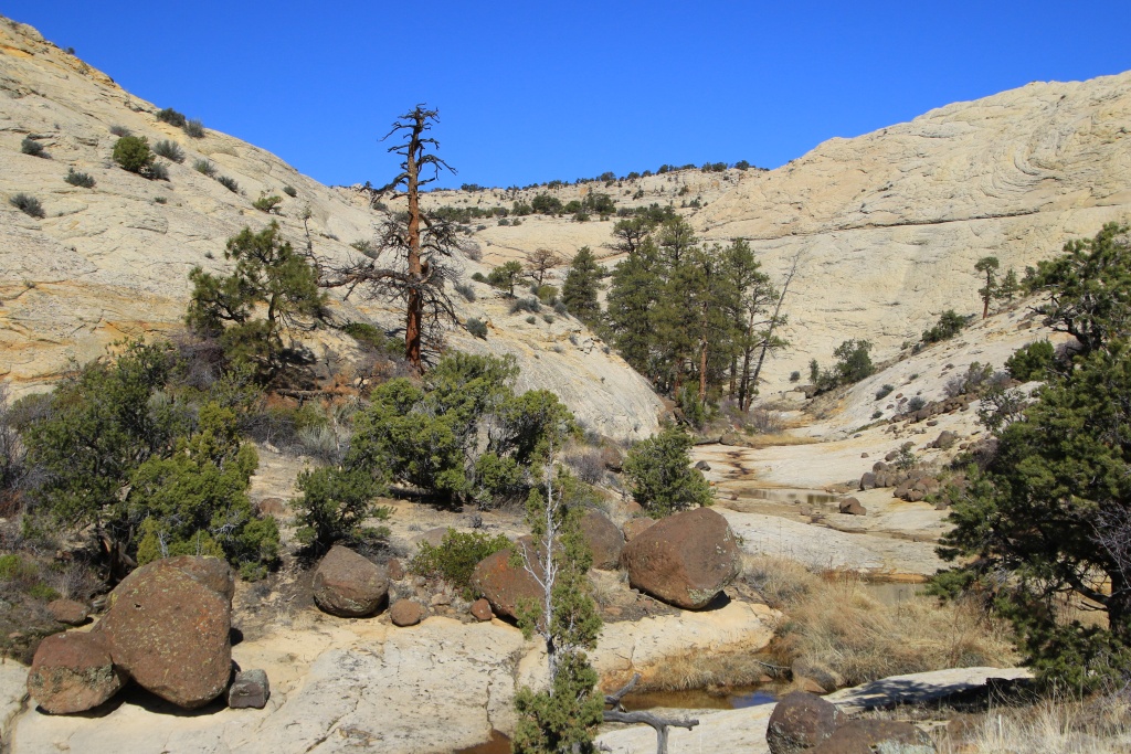
We once again had a wonderful day, with the main attraction being hiking a portion of the famous Boulder Mail Trail. This 24 kilometer long trail was established in 1902 to transport mail and other goods by mule between the isolated towns of Escalante and Boulder. In 1911, the Forest Service installed a telegraph line between trees and poles as needed. The line was used until 1955 when a microwave link replaced it. In 1940, when UT 12 was built, the Boulder Mail Trail was abandoned.
This magnificent hike is normally completed in a few days. We simply started near its northern end in Grand Staircase-Escalante NM and reached a point overlooking Death Hollow Creek in Phipps-Death Hollow Outstanding Natural Area.
We saved a few miles by starting on McGath Point Road. After a little over half a kilometer, we joined the Boulder Mail Trail and a little further, began the descent on the petrified dunes of white, yellow and a little orange.
The very popular path is very well marked with cairns. This is very useful because at certain times, without these landmarks, it would have been difficult to get your bearings.


We continued our descent towards Sand Creek. At this location, rocks of volcanic origin have become very present, accumulated in the low points.
A sign of spring which has finally arrived, a few shy flowers were growing in crevices to collect a little water during precipitation. There were also many conifers, including large pines, and numerous clusters of cacti.

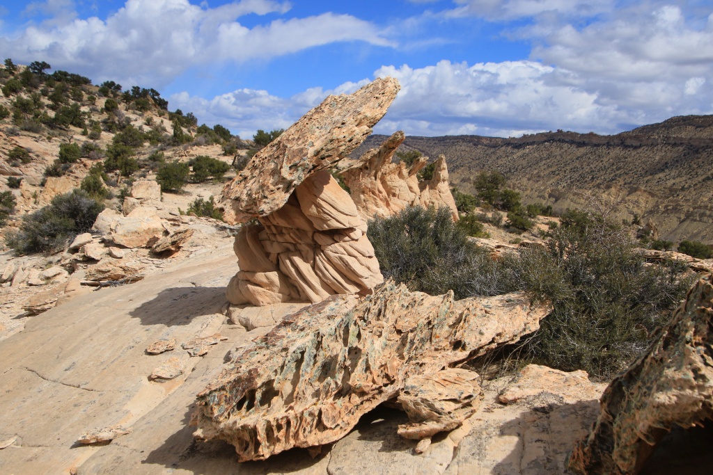
The landscapes are grandiose, with numerous mounds, patterns similar to brain cells, waves, etc.


At some point we joined the route of the telegraph line, with the single wire attached to the trees with insulators.

After crossing Sand Creek which was flowing with a good flow of very clear water, we regained altitude to reach Slickrock Saddle.
We deviated a bit from the official trail to reach a point overlooking Death Hollow. We then had more than 7.5 kilometers covered. We took advantage of the place, in the shade of a large pine tree, to have a good snack and to rest. At that moment, we heard screams coming from below Death Hollow. A group had likely just crossed Death Hollow Creek and was heading up the other side.


Then, given the distance and the significant difference in altitude to go down and up, we began our return following the same route. As is often the case, clouds began to form near the surrounding mountains, providing us with some welcome shade on several occasions.

Further on, we saw Sand Creek and the long line of vegetation taking advantage of the presence of water.
As we departed Sand Creek and began our ascension, one of its tributaries carved out the rock with a certain elegance.


We continued the long climb, with more insistent clouds in the distance.

We finally reached the 4Runner, after a superb hike of almost 7 hours. We had dreamed to do this trail since several years.
As we were quite tired and it was getting quite late, we headed back towards Escalante, stopping a few times on the side of the UT 12 Scenic Byway, between the clouds becoming very insistent.

Tomorrow, we should cover more distance by vehicle because we are going to rest our legs and knees a little.
__________________
2016 Trail Edition Classic Silver Metallic with KDSS, sunroof
ToyTec BOSS lift, SPC Light Racing UCA, RCI sliders, RCI aluminum full skids, RCI Cat Guard, Eezi-Awn K9 2.2m, BFG KO2 275/70R17E, FN Wheels f(X) Pro, ARB Breather kit, Husky WeatherBeater Mat and Cargo, XPEL window tint, 3M wrapped hood
Build thread
Adventures thread
|
|
|
Reply With Quote
|
|
03-23-2024, 10:51 PM
|
#772
|
|
Member
|
|
Join Date: Sep 2015
Location: Montreal, Canada
Posts: 915
Real Name: Jean
|
|
|
Member
Join Date: Sep 2015
Location: Montreal, Canada
Posts: 915
Real Name: Jean
|
Day 32:
Starting point: Escalante UT
Ending point: Escalante UT
Distance driven: 174 km
Distance hiked: 5.5 km
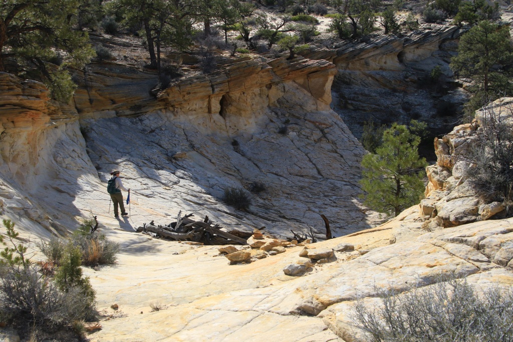
Our first goal of the day was to reach some viewpoints overlooking Death Hollow, the point at the end of our long hike yesterday. As we were still feeling a little tired from yesterday, we did one hike of a few kilometers in addition to many shorter ones.
The first viewpoint is accessible by hiking an old abandoned road that runs along the cliff, offering spectacular views all along its route.


The Escalante River is visible in the next photo, along with a series of cascading, water-filled pools just a little higher than the river. Also visible are some hikers' trails down in the canyon. We knew that it was possible to descend towards the river at this point, passing through a series of ledges and plateaus. We think we know the route and perhaps this will be a hike for a future trip.


The second viewpoint allowed us to see the confluence between Escalante River and Sand Creek which we crossed during our hike yesterday, but a few kilometers further up towards its source. Sand Creek is the stream that carved the canyon into the reddish rocks.


Very close on the same trail, we went to see this series of hoodoos. We wanted to go to the other side to get better lighting from the sun, but we quickly changed our mind because they are located right on the edge of the cliff!


After a real meal in Escalante, we headed to Alvey Wash Road and Smoky Mountain Road. We wanted to check its status in preparation for our next trip to Page AZ in two days. This 124 kilometer long road between Escalante and Big Water UT is quite isolated. Although at first it was in immaculate condition, we went through some snow and mud as we gained altitude. We turned around because the clouds were too present to highlight the landscapes. We should be able to cover part of it starting from Big Water in few days.


Back in Escalante, we continued on Cedar Wash Road, then onto Hole in the Rock Road. We checked the water level in Harris Wash for a possible hike into Bighorn Canyon, but it seems to be still too high. We continued onto Hole in the Rock Road which crosses very beautiful and varied landscapes.

Further on, we turned off Harris Wash then Buckaroo Flat Road, wanting to explore a little randomly. This road runs between reddish hills and large flats.


We took a short track leading to a promontory overlooking Aetschi Baetschi Tower, a rock formation marked on maps in our navigation software, GaiaGPS. This rocky spur is surrounded by very colorful hills sculpted by erosion.


As some precipitation is expected tonight, we don't know exactly what we will do yet. We'll see tomorrow morning.
__________________
2016 Trail Edition Classic Silver Metallic with KDSS, sunroof
ToyTec BOSS lift, SPC Light Racing UCA, RCI sliders, RCI aluminum full skids, RCI Cat Guard, Eezi-Awn K9 2.2m, BFG KO2 275/70R17E, FN Wheels f(X) Pro, ARB Breather kit, Husky WeatherBeater Mat and Cargo, XPEL window tint, 3M wrapped hood
Build thread
Adventures thread
|
|
|
Reply With Quote
|
|
03-24-2024, 10:32 PM
|
#773
|
|
Member
|
|
Join Date: Sep 2015
Location: Montreal, Canada
Posts: 915
Real Name: Jean
|
|
|
Member
Join Date: Sep 2015
Location: Montreal, Canada
Posts: 915
Real Name: Jean
|
Day 33:
Starting point: Escalante UT
Ending point: Escalante UT
Distance driven: 308 km
Distance hiked: 4.1 km
In search of blue, and white... We got up under the clouds, with a strong wind and a low 1C. We had planned to do a hike a little to the east, but as it was a little rainy, combined with the discomfort of the temperature we felt, we hesitated. Then we noticed a clearing heading west, that of Bryce Canyon National Park, so the decision was quickly made to head towards that place.
So we headed out on the UT 12 Scenic Byway, stopping at various viewpoints, including this one towards Powell Point, a future off-road destination, but definitely not this trip!

Arriving at Bryce Canyon NP, we hiked a short section of the Rim Trail near Sunrise Point. The fresh snow from the night was beginning to melt and had turned the trail into a field of very slippery mud and puddles. But all this had little importance in view of the grandiose panoramas of the place.

Looking towards Sunset Point, we noticed a few hikers risking the descent. From experience during our trip in April 2010, I would not dare to hike in these conditions. We then completed a loop, starting early before the sun melted the snow. At some point during the climb back up, one of my feet had slipped and I almost fell towards the descending slope. Not fun at all, this memorable memory.


After, we went to Sunset Point.


As we were so close, we continued on UT 12 towards the Red Canyon area in Dixie National Forest. Among other things, we wanted to check if it would be possible to hike tomorrow morning as we head towards Page AZ. Although some areas appeared dry, others were still covered in snow.


We then turned around and decided to check if Cottonwood Canyon Road, located in Grand Staircase-Escalante National Monument, would be a possible option for our trip tomorrow to avoid a long detour of more than 200 kilometers on paved roads.

At one point, we encountered massive congestion!
Further on, we stopped to see the spectacular Grosvernor Arch again.

Further south, the road enters Cottonwood Canyon proper, one of the most spectacular sections.


We covered almost half of it, about 35 kilometers without any problems, then turned around to return to Escalante. Unfortunately, as we did not encounter any vehicles coming in the opposite direction, we cannot be certain that a section further south and which is often problematic is passable. We'll find out tomorrow morning!


Back on UT 12, the sun sinking towards the horizon illuminated the cliffs.

Tomorrow we will leave Escalante towards Page AZ. Our plan is to drive the entire Cottonwood Canyon Road, making several stops to see certain points of interest. If we have to turn around because of the problematic section, we have several options. In this case, it is likely that tomorrow's message will be delayed a bit!
__________________
2016 Trail Edition Classic Silver Metallic with KDSS, sunroof
ToyTec BOSS lift, SPC Light Racing UCA, RCI sliders, RCI aluminum full skids, RCI Cat Guard, Eezi-Awn K9 2.2m, BFG KO2 275/70R17E, FN Wheels f(X) Pro, ARB Breather kit, Husky WeatherBeater Mat and Cargo, XPEL window tint, 3M wrapped hood
Build thread
Adventures thread
|
|
|
Reply With Quote
|
|
03-25-2024, 09:42 PM
|
#774
|
|
Member
|
|
Join Date: Sep 2015
Location: Montreal, Canada
Posts: 915
Real Name: Jean
|
|
|
Member
Join Date: Sep 2015
Location: Montreal, Canada
Posts: 915
Real Name: Jean
|
Day 34:
Starting point: Escalante UT
Ending point: Page AZ
Distance driven: 253 km
Distance hiked: 2.4 km
We left Escalante UT with a few clouds clinging to the distant mountains to the north, while the sky was mostly cloudless to the south, the direction we were heading in Grand Staircase-Escalante NM. As hoped, we were able to drive the entire Cottonwood Canyon Road as its condition was very dry and minimally damaged.
As always, it is unthinkable to travel this route without marveling at the festival of colors and shapes.


We took a break to go hike to Purple and White Hogback, a photogenic hill. We were careful not walk over it to prevent further erosion because it is made of very friable rock.


A little further south, we took Brigham Plains Road climbing steeply up the mountainside to reach the Brigham Plains plateau. The climb offers a spectacular view of The Cockscomb, an other fold in the earth's crust, similar to the Waterpocket Fold that we saw in Capitol Reef NP.


Although the panorama is unrivaled, the undisputed star of the place is the view towards the splendid Yellow Rock, located on the other side of The Cockscomb. We hiked to this one during our March 2013 trip.


Not knowing the conditions at the other end of Brigham Plains Road, and since the climb we had just climbed was somewhat eroded, we decided to return to Cottonwood Canyon Road. We then crossed the area which could be problematic, this large expanse of gray bentonite clay giving a somewhat unreal appearance to the landscape, with The Cockcomb in the background.

Finally wanting to know the condition of the descent from the Brigham Plains plateau, we reached the east end of Brigham Plains Road and entered the canyon carved by Coyote Creek in which the trail runs. We quickly noticed that it is not maintained and we encountered some more delicate passages.


We went over a few, but realized that if it wasn't maintained there, the descent wouldn't be either and certainly in much worse shape. Although a few old trails seemed to continue, we decided to turn back.
We then completed Cottonwood Canyon Road and joined US 89 and headed towards Page AZ. We were curious to see the effect of the increased water level in Lake Powell. So we took a detour into Glen Canyon National Recreation Area to see Lone Rock up close. Last winter, a thin stream of water flowed at its foot. Today, Lone Rock had become an island again.

Finally, we made one last classic stop at Wahweap Overlook, overlooking Wahweap Marina in Glen Canyon NRA.

Despite the late afternoon clouds, the weather for the next few days is good and we will take the opportunity to go on long hikes, as well as some fairly remote roads.
__________________
2016 Trail Edition Classic Silver Metallic with KDSS, sunroof
ToyTec BOSS lift, SPC Light Racing UCA, RCI sliders, RCI aluminum full skids, RCI Cat Guard, Eezi-Awn K9 2.2m, BFG KO2 275/70R17E, FN Wheels f(X) Pro, ARB Breather kit, Husky WeatherBeater Mat and Cargo, XPEL window tint, 3M wrapped hood
Build thread
Adventures thread
|
|
|
Reply With Quote
|
|
03-27-2024, 08:45 AM
|
#775
|
|
Member
|
|
Join Date: Sep 2015
Location: Montreal, Canada
Posts: 915
Real Name: Jean
|
|
|
Member
Join Date: Sep 2015
Location: Montreal, Canada
Posts: 915
Real Name: Jean
|
Day 35:
Starting point: Page AZ
Ending point: Page AZ
Distance driven: 135 km
Distance hiked: 10.9 km
A dream come true! Today we finally completed a long hike in the Paria-Hackberry Wilderness that Nancy had planned back in 2019. During our Winter 2020 trip, we planned to hike it on March 15, 2020, which is when we decided to end to our trip due to the COVID-19 pandemic. A little over four years later, we made it!
The hike begins on Cottonwood Canyon Road and quickly reaches a steep and grueling ascent of the oblique layers of The Cockscomb (as the slope was in shadow, I preferred to take photos on the descent at the end of the day). Once at the top of the slope, the view was magnificent.

Then, we continued the ascent and reached an area of very beautiful rocks sculpted by the wind.

Nearby, we reached a promontory overlooking the yellowish layer similar to that of nearby Yellow Rock. Here too, the rock had beautiful colored patterns. At the very top of this slope sat the Cottonwood Hoodoos.


Towards the north, the yellowish layer continues in the hills.


Continuing with a much more moderate climb, we followed a long ridge offering very beautiful views of the hills and Castle Rock.


Further on, we reached another promontory in front of Castle Rock. We had a good snack in front of this great landscape.

A little further on we reached another viewpoint, this one towards Hackberry Canyon.


We planned to continue further towards another promontory overlooking Hackberry Canyon. However, the terrain had become quite uneven and it would have taken us a long time to reach the point. As the place where we were already offered a beautiful view, we took advantage of it and then began our return.
Visible in the distance is Yellow Rock and the Paria River Valley area, an area we should visit in a few days.

Further on, we crossed Cottonwood Hoodoos rock again. We were a little hesitant to take a little detour, but as it was already getting a little late, we postponed it for another time, perhaps.

As we approached the final descent, with a little apprehension I must say, we took one last look at an area just to the north, with other beautiful wind-sculpted formations.
Then we reached the top of the steep slope. The descent seemed to us to be more intimidating than the ascent. On the other hand, I was surprised by the grip offered by the ground. Slowly but surely we made our way down the slope without any problems.

Tomorrow, we hope to be able to cover a long road that we have already covered, and push even further to discover other sumptuous landscapes.
__________________
2016 Trail Edition Classic Silver Metallic with KDSS, sunroof
ToyTec BOSS lift, SPC Light Racing UCA, RCI sliders, RCI aluminum full skids, RCI Cat Guard, Eezi-Awn K9 2.2m, BFG KO2 275/70R17E, FN Wheels f(X) Pro, ARB Breather kit, Husky WeatherBeater Mat and Cargo, XPEL window tint, 3M wrapped hood
Build thread
Adventures thread
|
|
|
Reply With Quote
|
|
03-28-2024, 07:40 AM
|
#776
|
|
Member
|
|
Join Date: Sep 2015
Location: Montreal, Canada
Posts: 915
Real Name: Jean
|
|
|
Member
Join Date: Sep 2015
Location: Montreal, Canada
Posts: 915
Real Name: Jean
|
Day 36:
Starting point: Page AZ
Ending point: Page AZ
Distance driven: 198 km
We got up quite early because we wanted to do a fairly long drive in Glen Canyon National Recreation Area and Grand Staircase-Escalante National Monument. We had previously traveled Warm Creek Road and Sitdown Bench Road on our fall 2016 trip, but turned around when we reached the intersection of Croton Road as well as Grand Bench Road. The objective of the day was to explore these two routes.
We made a few stops on Sitdown Bench Road, a very spectacular road running through areas of very colorful bentonite clay. During our trip in February 2023, we were forced to turn around on several attempts because the road became impassable. Today, although it sometimes showed deep traces of vehicles having had difficulty traveling, the road was completely dry and therefore passable.

We had planned a hike following the bed of Last Chance Creek but there was still a lot of water and mud. We postponed this until next time and continued further on Sitdown Bench Road.


After reaching our turnaround point on our fall 2016 trip, we continued on Croton Road. This rises in altitude to eventually join Smoky Mountain Road. Our goal was only to drive the climb to the top of the mountains and admire the different viewpoints.


Near the summit we began to see Lake Powell in the distance. At this point, a more delicate passage awaited us, but we passed it without too much difficulty. This is the only place requiring special attention, apart from a large rock on the road which left us very little space to pass by near the edge of the precipice!

Even in these remote and high altitude places, flowers are starting to become more and more present.

After returning to the intersection, we continued on Grand Bench Road.

We were surprised to see that the road joined a horse enclosure, with living quarters in containers and breeding equipment. We were uncomfortable crossing the enclosure at the risk of one or more of the five horses escaping, despite the fact that there was a sign indicating to keep the fences closed. As the most difficult portion, the descent and ascent of a canyon, was just after this enclosure, it would have been necessary to cross it and risk returning immediately if the road was impassable. And to add, I am extremely allergic to horses.

We reluctantly turned back, feeling frustrated that someone would set up like this on a public road in a park.
On the way back, we thought about doing other activities nearby, but the presence of clouds covering the beautiful blue sky that we had had since the morning discouraged us a little. Since we were greatly due for another laundry task, we returned to Page early to do it.
__________________
2016 Trail Edition Classic Silver Metallic with KDSS, sunroof
ToyTec BOSS lift, SPC Light Racing UCA, RCI sliders, RCI aluminum full skids, RCI Cat Guard, Eezi-Awn K9 2.2m, BFG KO2 275/70R17E, FN Wheels f(X) Pro, ARB Breather kit, Husky WeatherBeater Mat and Cargo, XPEL window tint, 3M wrapped hood
Build thread
Adventures thread
|
|
|
Reply With Quote
|
|
03-28-2024, 09:19 PM
|
#777
|
|
Member
|
|
Join Date: Sep 2015
Location: Montreal, Canada
Posts: 915
Real Name: Jean
|
|
|
Member
Join Date: Sep 2015
Location: Montreal, Canada
Posts: 915
Real Name: Jean
|
Day 37:
Starting point: Page A-Z
Ending point: Page AZ
Distance driven: 172 km
Distance hiked: 12.6 km
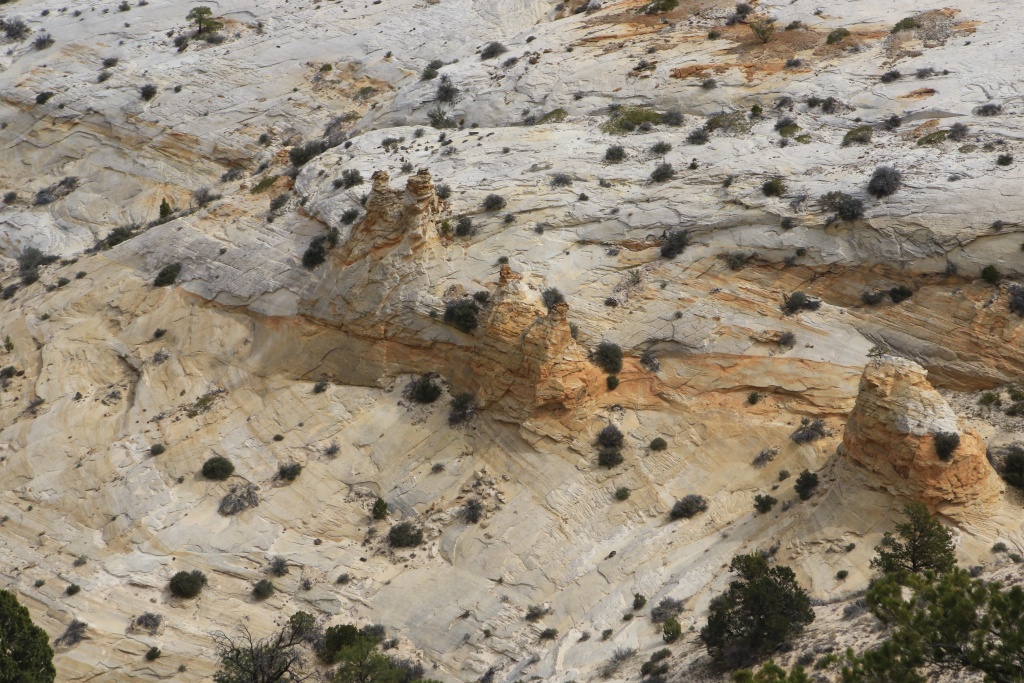
As our main activity for the day, we did a long hike in the area called White Rocks, very close to Church Wells UT. In the past, it was possible to reach this beautiful area by vehicle, but since its designation as a Wahweap Wilderness Study Area, access must be done on foot. We traveled a large loop going clockwise, starting with a large wash. We saw a local resident who, oddly enough, stayed quietly to pose.

As its name suggests, the White Rocks is mainly composed of a very friable immaculate white rock, with several layers of different colors. The main attraction is undoubtedly the high number of hoodoos.


Several of the formations or hoodoos have names, including this one aptly named Zebra.

We left the wash to reach the top of the plateau. The white rock then gave way to harder and colored rock.


After walking a short distance, we reached White Valley with an impressive number of hoodoos, very often with striped pod.


White Ghost Hoodoo and his little brother at his feet.


After crossing White Valley, we reached an intermediate area at the foot of the highest cliff.

We found the right place to climb onto the highest plateau, taking a relatively tricky passage, probably easier going up than going down. On the plateau, we found yellowish rocks streaked with pink patterns, similar to those of Yellow Rock.

We then took a track running along the cliff and allowing us to enjoy a beautiful view of the valleys and canyons below.

Back to the 4Runner, we still had some time to spare. We went to do a little scouting in Paria Valley for our activities tomorrow which will mainly be in this sector.

Tomorrow, we will get back to Paria Valley for short hikes and a few offroad trails.
__________________
2016 Trail Edition Classic Silver Metallic with KDSS, sunroof
ToyTec BOSS lift, SPC Light Racing UCA, RCI sliders, RCI aluminum full skids, RCI Cat Guard, Eezi-Awn K9 2.2m, BFG KO2 275/70R17E, FN Wheels f(X) Pro, ARB Breather kit, Husky WeatherBeater Mat and Cargo, XPEL window tint, 3M wrapped hood
Build thread
Adventures thread
|
|
|
Reply With Quote
|
|
03-30-2024, 12:04 AM
|
#778
|
|
Member
|
|
Join Date: Sep 2015
Location: Montreal, Canada
Posts: 915
Real Name: Jean
|
|
|
Member
Join Date: Sep 2015
Location: Montreal, Canada
Posts: 915
Real Name: Jean
|
Day 38:
Starting point: Page A-Z
Ending point: Page AZ
Distance driven: 275 km
Distance hiked: 1.0 km
As planned, we returned to Paria River Valley to start the day.

We planned to do two short hikes in two canyons surrounded by colorful hills formed of bentonite clay. Once there, the colors were duller than those of the main canyon and did not please the co-pilot and we continued our route by taking Paria Breaks Road, a road that we had partially traveled during our winter 2020 trip.


Further on, we took a short detour on Eightmile Pass Road to get closer to pretty hills well lit by the morning sun.

Next, we completed Paria Breaks Road and continued on Kitchen Corral Road, then Starlight Arch Road, transitioning from the reddish rock layer to the more yellowish one. This road is more of a narrow track running between numerous cedars on excessively sandy soil. The 4Runner will keep good memories in the form of multiple scratches, adding to the many it already has.
As we gained altitude, the view improved over our goal, a hill named Mollie's Nipple (who is Mollie?). This very recognizable hillock is visible from a long distance and serves as a landmark for long-distance hikers.

We were able to reach the base of Mollie's Nipple and did a short hike on a small part of its contour, the terrain turning out to be much more rugged than we had estimated.


On the way back on Starlight Arch Road, we could see the area we were heading towards.

We continued further, crossed Nipple Ranch, and took Oil Well Road leading to a promontory. The presence of many trees and too many clouds discouraged us from taking beautiful photos.
Returning to Kitchen Corral Road, we were lured to take another detour onto Park Wash Road. This road runs along a small ridge which has several hoodoos.

In the distance, Mollie's Nipple was visible.


As the road crossed Park Wash at one point, we noticed numerous vehicle tracks in the wash. On the way back, we entered the wash, curious to see how far we could go. What a good decision as the wash turned out to look great with many hoodoos.


The slopes on the sides of the wash show a long history of deposition and erosion, with multiple layers of varying pastel colors.

Unusually, we reached the confluence of Park Wash and Lick Wash. Since we had hiked Lick Wash before, we were curious if we could reach our turnaround point on the hike. And yes!
Then we continued as far as we could on Park Wash. This became narrower and narrower, and we inevitably reached a point that was impossible to pass, thus forcing a U-turn.

Tomorrow we should do another long hike in Paria-Hackberry Wilderness Study Area, which promises to be spectacular.
__________________
2016 Trail Edition Classic Silver Metallic with KDSS, sunroof
ToyTec BOSS lift, SPC Light Racing UCA, RCI sliders, RCI aluminum full skids, RCI Cat Guard, Eezi-Awn K9 2.2m, BFG KO2 275/70R17E, FN Wheels f(X) Pro, ARB Breather kit, Husky WeatherBeater Mat and Cargo, XPEL window tint, 3M wrapped hood
Build thread
Adventures thread
|
|
|
Reply With Quote
|
|
03-30-2024, 10:14 PM
|
#779
|
|
Member
|
|
Join Date: Sep 2015
Location: Montreal, Canada
Posts: 915
Real Name: Jean
|
|
|
Member
Join Date: Sep 2015
Location: Montreal, Canada
Posts: 915
Real Name: Jean
|
Day 39:
Starting point: Page AZ
Endin point: Page AZ
Distance driven: 318 km
Distance hiked: 5.4 km
Change of plan, complete U-turn! We had planned to do a long hike in Paria-Hackberry WSA, but as we were en route we quickly realized that we would spend the day under the clouds and that our photos would be rather lousy color-wise. Since the skies were much clearer south of Page, we turned around and headed in that direction.
On US 89 south of Page, we made a short stop at a viewpoint towards the area we were heading to, the Lee's Ferry area in Glen Canyon National Recreation Area. We know this area well, having explored it on many occasions, either from Page by vehicle and by hike, or by the usual access via Lee's Ferry.

Once there, we walked the interpretive trail of the various remains related to the old ferry having been established in 1899 in one of the rare places possible to cross the Colorado River.


Next, we continued south into Vermillion Cliffs National Monument, skirting the colorful cliffs of the Paria Plateau. Our objective, in a more or less distant future, is to drive to some points of view located high on the plateau.

We then reached some viewpoints overlooking the Colorado River. This area is designated as a Marble Canyon Area of Critical Environmental Concern, protecting a variety of small cacti. The first trail we took was Badger Creek Road, then Ten Mile Rock Road. Here and there, a few flowers began to bloom, bent under the force of the strong winds.


Further on, we reached the edge of the canyon. From Marble Canyon near Lee's Ferry, the Colorado River, its banks and cliffs are included in Grand Canyon National Park.

At another viewpoint on Ten Mile Rock, the view of Colorado stretched into the distance. We even saw several rafting groups on an expedition on the turbulent river, including one grouping up before a series of rapids.


We then drove one last trail, the one called Marble Canyon Overlook Road, the southernmost of the three we went. This offers an effect of surprise because it goes from left to right, somewhat for no apparent reason, and then the canyon opens before us at the last moment.


As rain is expected in the area overnight, we do not know how our activities planned for tomorrow will be affected.
__________________
2016 Trail Edition Classic Silver Metallic with KDSS, sunroof
ToyTec BOSS lift, SPC Light Racing UCA, RCI sliders, RCI aluminum full skids, RCI Cat Guard, Eezi-Awn K9 2.2m, BFG KO2 275/70R17E, FN Wheels f(X) Pro, ARB Breather kit, Husky WeatherBeater Mat and Cargo, XPEL window tint, 3M wrapped hood
Build thread
Adventures thread
|
|
|
Reply With Quote
|
|
03-31-2024, 10:24 PM
|
#780
|
|
Member
|
|
Join Date: Sep 2015
Location: Montreal, Canada
Posts: 915
Real Name: Jean
|
|
|
Member
Join Date: Sep 2015
Location: Montreal, Canada
Posts: 915
Real Name: Jean
|
Day 40:
Starting point: Page AZ
Ending point: Page AZ
Distance driven: 149 km
Distance hiked: 1.5 km
This morning, we had a somewhat slow start, facing conflicting weather forecasts, and unable to use the Internet properly to decide which destinations we were going to head to. We did some shopping since our supplies were dwindling quickly.
We then headed to Antelope Point in Glen Canyon National Recreation Area, very close to Page. We wanted to walk a bit, but frequent downpours kept us in the vehicle.


After a lunch in Page, we continued towards Lakeshore Drive still in Glen Canyon NRA.


Later we returned to Lone Rock to reach the west end of the large beach on Lake Powell, as the wind blew at a good speed and kicked up the sand. We reached the mouth of a secondary canyon.


On a previous trip, we started hiking in this canyon, but at its southern end near the US 89, but we gave up due to the presence of water and mud. Today we started at its north end and moved up the canyon a bit.


Since we still had a little time left, we drove a short segment of Nipple Creek Road, a road we had traveled very early one morning during our fall 2016 trip. The southern section of this road is much more beautiful with the late afternoon lighting.

We were intrigued by a side track heading towards the cliff to the north. This enters a small valley of gray bentonite clay bordered by beautiful cliffs, then continues climbing the hills to reach a beautiful viewpoint overlooking Wahweap Fish Hatchery.


As it was getting late, we turned around and took one last look at this beautiful place.

Tomorrow, as the weather forecast seems to be favorable, we should do our last long hike in the Page area for this trip.
__________________
2016 Trail Edition Classic Silver Metallic with KDSS, sunroof
ToyTec BOSS lift, SPC Light Racing UCA, RCI sliders, RCI aluminum full skids, RCI Cat Guard, Eezi-Awn K9 2.2m, BFG KO2 275/70R17E, FN Wheels f(X) Pro, ARB Breather kit, Husky WeatherBeater Mat and Cargo, XPEL window tint, 3M wrapped hood
Build thread
Adventures thread
|
|
|
Reply With Quote
|
 Posting Rules
|
You may not post new threads
You may not post replies
You may not post attachments
You may not edit your posts
HTML code is On
|
|
|
|


 Linear Mode


