 03-26-2019, 03:15 PM
|
#1
|
 |
Senior Member
|
|
Join Date: Aug 2016
Location: CA
Posts: 3,528
|
|
|
Senior Member
Join Date: Aug 2016
Location: CA
Posts: 3,528
|
Getting serious about off-road navigation
Been needing some serious off-road nav for a while, and wanted a Lowrance setup but it was almost impossible to justify the cost of a dedicated unit
Lowrance
HDS-7 Live Multifunction Off Road GPS Baja Bundle By Lowrance
I kicked around the iPad idea and after running with some friends who use iPad mini in their sports UTVs. Pretty impressed they could hold their own in that environment. I decided on the iPad Pro 11" with cellular to get a true GPS receiver.
My friends are currently using Motion X, but does anyone have any experience with the application options? I found these two that also look popular.
LeadNav
Best 4x4 App - Offline Offroad and Overlanding Trail Maps | Gaia GPS
MotionX GPS HD on the App Store
|

|
 Reply With Quote Reply With Quote
|
|
03-27-2019, 03:55 PM
|
#2
|
|
Member
|
|
Join Date: Jul 2016
Location: MD
Posts: 291
Real Name: Mike
|
|
|
Member
Join Date: Jul 2016
Location: MD
Posts: 291
Real Name: Mike
|
I have been looking into this as well. Which is why I am looking at the android head unit swap. This way I can run Gaia or other software app directly on the head unit without needing another device to clutter up the dash. plus I have torque pro so I could blue tooth all that data in a heads up live feed.
I am waiting to see others reviews before I jump on that.
__________________
Humankind cannot gain anything without first giving something in return. To obtain, something of equal value must be lost.
|
|
|
Reply With Quote
|
|
03-27-2019, 04:24 PM
|
#3
|
|
Senior Member
|
|
Join Date: Aug 2016
Location: CA
Posts: 3,528
|
|
|
Senior Member
Join Date: Aug 2016
Location: CA
Posts: 3,528
|
I like the idea of having something in dash. Not sure if Apple CarPlay has any support for what I am trying to do here, ill have to look into it.
Being able to use the iPad Pro which appears to be a pretty capable device for other tasks. Lots of value for the other tasks portion like adding the ability for video editing, which I wanted to start doing for 4Runner and project videos to share, seems like a good use of cash. Especially when you consider I would have just about spent the same on the Lowrance and still had to deal with the same challenges with mounting/install.
Either way, been hearing a bunch of good stuff about Gaia, but the LeadNav has peaked my curiosity. I think thats what the KOH 4Runner was running as well. I like that I can connect it to the Iridium sat network for real time positioning. Considering I wanted the Sat communicator anyways, might be another check box for LeadNav.
|
|
|
Reply With Quote
|
|
03-27-2019, 04:34 PM
|
#4
|
|
Member
|
|
Join Date: Jul 2016
Location: MD
Posts: 291
Real Name: Mike
|
|
|
Member
Join Date: Jul 2016
Location: MD
Posts: 291
Real Name: Mike
|
yeah GPS live tracking is a huge plus. That's kinda why I was looking at the Samsung e tablet. But it doesn't transmit. Right now im not that in depth into it. right now just at the collections of info and options stage.
__________________
Humankind cannot gain anything without first giving something in return. To obtain, something of equal value must be lost.
|
|
|
Reply With Quote
|
|
03-29-2019, 09:42 AM
|
#5
|
 |
Senior Member
|
|
Join Date: Sep 2014
Location: Cherokee Co., GA
Posts: 2,754
Real Name: Russell (OB #9908)
|
|
|
Senior Member
Join Date: Sep 2014
Location: Cherokee Co., GA
Posts: 2,754
Real Name: Russell (OB #9908)
|
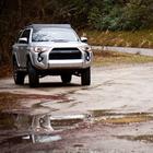
Heres my setup in case anything there is helpful in making your choice.
|
|
|
Reply With Quote
|
|
03-29-2019, 10:00 AM
|
#6
|
 |
Senior Member
|
|
Join Date: Jul 2015
Location: Northern California
Age: 37
Posts: 1,471
|
|
|
Senior Member
Join Date: Jul 2015
Location: Northern California
Age: 37
Posts: 1,471
|
Still pretty new to the whole scene, so grain of salt with any of my input:
The Gaia app is pretty badass to use on my cell phone at least. Only crummy part is that to retain the maps for "off the grid" use (which I believe means no cell towers) you need to not only buy a yearly subscription (only like $20 but still a thing to know) but also actually draw out a map and save it to your device to use it off the grid. This means you need to be on the grid, and potentially save a huge ass map to use for a large trip.
This isn't a big deal if you're just gonna run one well known trail in one day. Done and done. But what happens if you have a multi day adventure planned, and some roads are closed? So you need to detour but your detours aren't on the "saved" map you did the week before? Maybe someone else can chime in on that part.
Sent from my iPhone using Tapatalk
__________________
The 4Reak Show: 1995 4Runner, 3.4 swapped, manual conversion, supercharged & 7th injected, Eaton TrueTrac in rear, poly bushings F&R, lots of other outrageous add ons...
Wife's: 2016 Trail Premium, bone stock until she joins T4R.org one day...
|
|
|
Reply With Quote
|
|
03-29-2019, 12:09 PM
|
#7
|
|
Senior Member
|
|
Join Date: Aug 2016
Location: CA
Posts: 3,528
|
|
|
Senior Member
Join Date: Aug 2016
Location: CA
Posts: 3,528
|
I got my iPad pro last night, what an amazing device
got Gaia, Motion X GPS, and even LumaFusion video editing software which is amazing
Handles 4k video editing smoothly. I am impressed.
I have not bought it yet, but reading I learned LeadNav is pretty expensive, nice but expensive because you have to dump money into the app annually to really get benefit of satellite imagery and other features.
A friend who uses Motion X showed me how to get google sat images into the thing, downloaded for off-line use, along with other map types which could be useful.
With 512 GB, more than adequate to download large areas of places I generally visit. I will most likely run this until I find a deficiency, but I think it a good setup. It does car to car positioning with cellular, but I can always use ham radio / APRS to accomplish something similar. Not as convenient, but it works if I need it.
Gaia looks good too, but I like the "one and done" aspect of Motion X. Maps on in the device, dont have to worry about subscriptions.
Now to figure out my ram mounting situation.
|
|
|
Reply With Quote
|
|
03-29-2019, 01:05 PM
|
#8
|
|
Senior Member
|
|
Join Date: Dec 2015
Location: Colorado
Posts: 1,181
Real Name: Ron
|
|
|
Senior Member
Join Date: Dec 2015
Location: Colorado
Posts: 1,181
Real Name: Ron
|
I have a Samsung android tablet, with cellular data and GPS capability. I mounted it with a pro-clip mount that fits securely to my dash just left of the glove compartment. It stayed put with no issues on the entire White Rim trail.
I use Earthmate from Garmin, which is part of my Garmin Inreach subscription. It's not the best nav program, but gets the job done, and it's "free" since I already have the Inreach subscription for backcountry communication and emergency purposes. I stuck a 32Gbyte memory card in the Samsung, and that's more than big enough to hold all of the maps I could ever need for any imaginable trip.
__________________
2006 Sport Edition, V8, 206K miles, 2.5/1.5" OME lift, SPC adjustable UCA's, 255/75/17 BFG KO2's load range C @ 40psi. Regeared diffs to 4.30, with TrueTrac in rear.
1994 SR5, V6, 5-spd, Aussie locker front, Aisin manual hubs, Truetrac rear, 33/10.50/15 BFG KO's, stock suspension, OBA (Viair 400C), Front Range Offroad twin stick, 225K miles. Dual 2.28 transfer cases, for a 90:1 crawl ratio.
|
|
|
Reply With Quote
|
|
05-30-2019, 02:20 AM
|
#9
|
 |
Member
|
|
Join Date: Sep 2017
Location: BATON ROUGE, LA
Posts: 413
|
|
|
Member
Join Date: Sep 2017
Location: BATON ROUGE, LA
Posts: 413
|
Just a bit of info in case anyone is using a wifi only ipad... like me. I use gaia and added in the garmin glo bluetooth gps receiver. This gives the wifi only ipad its gps position. It is battery powered, although mine stays plugged in, so if you go on a hike it can be portable. Its pretty small and easy to find a placement for it.
I have been impressed with gaia. Yes you need to be online to save a map section, but I save LARGE sections to the ipad for a given trip. Currently all of North Georgia and Southern Tennessee plus the Georgia Traverse track, Th entire pigeon forge/gatlinberg/ smokey national park, and the whopper carlsbad NM to Wyoming enchanted rockies trail. This ipad...ipad mini...is dedicated to the t4r with apps like gaia, ioverlander, etc. i dont really use it unless I am exploring. I also have saved all of the Kisatchie and Homochitta national forest lands. If Im on the highway/blacktop, I typically use the in dash gps or more likely Waze on my iphone.
|
|
|
Reply With Quote
|
|
05-31-2019, 10:15 AM
|
#10
|
 |
Member
|
|
Join Date: Mar 2017
Location: Richmond, VA
Posts: 294
|
|
|
Member
Join Date: Mar 2017
Location: Richmond, VA
Posts: 294
|
Quote:
Originally Posted by Louisiana Overland

Just a bit of info in case anyone is using a wifi only ipad... like me. I use gaia and added in the garmin glo bluetooth gps receiver. This gives the wifi only ipad its gps position. It is battery powered, although mine stays plugged in, so if you go on a hike it can be portable. Its pretty small and easy to find a placement for it.
I have been impressed with gaia. Yes you need to be online to save a map section, but I save LARGE sections to the ipad for a given trip. Currently all of North Georgia and Southern Tennessee plus the Georgia Traverse track, Th entire pigeon forge/gatlinberg/ smokey national park, and the whopper carlsbad NM to Wyoming enchanted rockies trail. This ipad...ipad mini...is dedicated to the t4r with apps like gaia, ioverlander, etc. i dont really use it unless I am exploring. I also have saved all of the Kisatchie and Homochitta national forest lands. If Im on the highway/blacktop, I typically use the in dash gps or more likely Waze on my iphone.
|
Lots of great information here. Thanks for providing it.
|
|
|
Reply With Quote
|
|
05-31-2019, 01:15 PM
|
#11
|
 |
Member
|
|
Join Date: Mar 2017
Location: SoCal
Posts: 270
|
|
|
Member
Join Date: Mar 2017
Location: SoCal
Posts: 270
|
I'm participating in the Baja XL 2021 and most of the previous event drivers used a Samsung Tab A with a 10.5 screen. The navigation software is called Oruxmaps and only runs on android. Many also used the Gaia software.
__________________
Mark
04 V8 SE, RST Twin stick conversion. 4x4 Labs rear bumper, SW Sliders & Bullbar, ARB Locked F&R, 5.39s, Smittybilt 10,000lb winch, 1.5 4Crawler BL, Flowmaster, CB and 2m/70cm Ham, Sat. Radio, CO2 system, Lightforce, African Outback Rack, Budbuilt, Front Runner RTT. Rock Solid Toys Solid axles, Atlas Crawl Case, 40" Cooper STT Pro's on Fuel Anza D116 beadlocks, 5:38 gear set, ADS Coilovers.
|
|
|
Reply With Quote
|
|
05-31-2019, 01:57 PM
|
#12
|
|
Banned
|
|
Join Date: Nov 2017
Location: Bay Area, CA
Posts: 2,247
Real Name: Mark
|
|
|
Banned
Join Date: Nov 2017
Location: Bay Area, CA
Posts: 2,247
Real Name: Mark
|
With any GPS app you have to play around with it and experiment to get to know all the features and shortcomings. I use several often simultaneously to compare while driving or hiking. In the truck thats not a problem but while hiking I take a portable battery pack to recharge the iPhone due to higher battery usage. Im not totally proficient with all features of all apps, but for my uses here are my opinions:
MotionX:
Pro - Very good maps, tracking, statistics. Ive used this a lot for many years. Easy to use. Sometimes shows hiking trails that do not show up on other apps. One time purchase, $2.99.
Con - In order to use off-network you have to download maps to device memory. If you want very fine details (which I do) I set a high zoom level, which results in a large file of many tiles. This takes a long time to download, like 8 to 10 hours. I start my downloads days ahead of time at night. Any network outage can result in resuming or restarting the process. And downloads are paused when the app is backgrounded so you should avoid using your phone until the download is done.
Avenza Maps:
Pro - PDF map reader with tracking capabilities. Easy to use. Download maps from their Map Store. Lots of free maps of off-road areas, BLM land, parks. App is inexpensive. Fast downloads.
Con - Some park maps are not very detailed. The USGS maps are pretty useless since they are old and trails/roads are often not named or identified. You have to poke around the store and search for free maps of the area you want. Sometimes downloading then deleting the map because the preview feature is lousy. There are really nice National Geographic Trails maps and other park maps for sale in the store, but at around $15 per map that gets pretty expensive.
Gaia:
Pro - Excellent maps, tracking features, fast downloads, very impressive. Many layers can be enabled or disabled to get the detail and clarity you want. The free version can be used with a cell connection. You need a subscription to download maps for tracking. Then all maps are free. I was so impressed that I purchased a 5 year premium membership when I found it on sale.
Con - More expensive of course. More complex to get proficient. You have to set up your area of interest with the layers you want enabled before downloading the maps.
Maplets:
Pro - A simpler, inexpensive GPS locator and offline map viewer of all sorts of city, park, campuses, bike trails, etc. Quick easy downloads. Easy to search for maps in store.
Con - No tracking capabilities (yet); you drop pins if you want to track your progress.
I use a combination of all of these. Remember that map downloads can use up a lot of your devices memory. Use airplane mode to conserve battery power. Take a spare battery pack when hiking. And paper maps and a compass.
|
|
|
Reply With Quote
|
|
05-31-2019, 02:15 PM
|
#13
|
 |
Member
|
|
Join Date: Apr 2019
Location: Los Angeles, CA
Posts: 975
|
|
|
Member
Join Date: Apr 2019
Location: Los Angeles, CA
Posts: 975
|
I use my phone alot of backpacking and have been pleased with BackCountry navigator. Tried Gaia last weekend (with the premium sub to use my own custom maps thru mobac) and wasn't too pleased with it. It seems to have a difficult time tracking while google maps (on the same phone) doesn't. BackCountry navigator worked flawlessly with my Caltopo USGS/USFS and MapBuilder Topo maps.
__________________
2019 ORP - KDSS, Dobinsons C59-302/GS59-700 front and C59-725/IMS59-50701 rear, Dobinsons UCA, DuroBump/Daystar bumpstops, Sonoran Steel High Articulation tracbar, Marlin Crawler LCA frame brace, OGS Lo-Key Bumper w/ Warn VR EVO 10-S, RCI Sliders, fully armored with RCI/C4/Outgear Solutions skids, Falken Wildpeak M/T 285/70/17, LFD SS-Crossbars, ARB breather kit (Rear Diff and Locker), ScanGaugeII, Anytime Front/Backup Camera, onboard ARB Twin compressor MORRFlate kit, and DD SS3 Sport fogs
|
|
|
Reply With Quote
|
|
05-31-2019, 06:38 PM
|
#14
|
|
Member
|
|
Join Date: Mar 2019
Location: Calgary
Posts: 82
|
|
|
Member
Join Date: Mar 2019
Location: Calgary
Posts: 82
|
Quote:
Originally Posted by Bumbo
I got my iPad pro last night, what an amazing device
got Gaia, Motion X GPS, and even LumaFusion video editing software which is amazing
Handles 4k video editing smoothly. I am impressed.
|
That's my ideal setup... an iPad pro for both navigation and photo/video editing on the go. Too bad they are so darn expensive here in Canada.
|
|
|
Reply With Quote
|
|
05-31-2019, 06:49 PM
|
#15
|
|
Senior Member
|
|
Join Date: Aug 2016
Location: CA
Posts: 3,528
|
|
|
Senior Member
Join Date: Aug 2016
Location: CA
Posts: 3,528
|
Quote:
Originally Posted by ac1617
That's my ideal setup... an iPad pro for both navigation and photo/video editing on the go. Too bad they are so darn expensive here in Canada.
|
Considering I was literally ready to blow $1000+ on a Lowrance unit which would only get used a few times a year... this turned out being a bargain in my mind.
That said, it is an expensive device, but there is a lot of value if you use it for a lot of things.
|
|
|
Reply With Quote
|
 Posting Rules
|
You may not post new threads
You may not post replies
You may not post attachments
You may not edit your posts
HTML code is On
|
|
|
|


 Linear Mode


