Trail Maps for Factory Nav?

NCtrailX

New member
Anybody try to load trail maps into the factory nav unit? Seems like detailed maps that include trails could be loaded in place of the factory maps. Have used BackCountry Navigator in the past and like it, but saving and loading the maps is a mild pain. Would be great to load something like that into the factory nav unit and have it on hand so that you don't have to save select areas before a trip.

 
Register to hide this ad
I havent seen anyone do it. Heck no one has even shared the updated factory maps so you could update your system without paying an arm and a leg!
 
Maps

I use Google maps on a tablet with GPS. I load the areas I want before a trip and save them for off line access when out on a trail. So far that has worked well for me. I mark points with the save feature and that lets me know how far or if I passed a point.
 
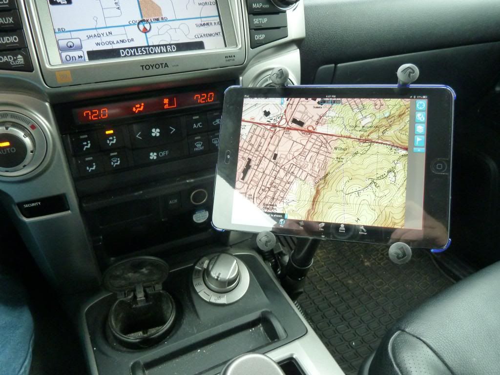
Android tablets are dirt cheap with lots of great apps available. We use an iPad mini mounted but if going the iPad route make sure you get one with a GPS chip. More details in my build thread.
 
I did pull the SD card out of the dash and read it. The chip is formatted with FAT32 and the file structure is nothing new. But I did not recognize any of the files in any of the folders as a common format used by Garmin or Magellan.

So I am at a loss on how to load trail maps into the factory Navigation system.

I would love to be able to load topo maps or something like "Roads and Recreation" and use it on off road trips! If anyone can figure this out, I'll bite and try it.
 
Man I think that stuff (ie software/map updates) should be covered under the base 3/36 warranty. Seriously most software products you buy give you a minimum of one year software upgrades/updates.

OT who has one of the "X" type clamps for a large iPad or similar. I figured some of you may have them? quick opinions?
 
Perfect.

RamMountMap_zps6251a070.jpg~original
 
On a recent off-road trip through the Joshua Tree area of So Cal, I noticed that many of the 4X4 dirt roads we were using showed up on my stock nav unit. There was no other detail, elevations or land features, but the roads I was on were right there.
 

Members online

Forum statistics

Threads
278,308
Messages
3,554,057
Members
248,016
Latest member
Advally Service

Trending content

Back
Top