Warthog Build and Adventure Thread

How much would you charge me to build this same set up for my TRD PRO 4RUNNER?

(Sorry, I only just noticed this post)

As i was building it i did think about the feasability of making building this kind of thing as my retirement job :)

But I would have to figure put how to limit the time it took a lot.

But for now with full time job and all i just couldn't set up to do ot at a reasonable price :(

Basically the only reason it was cheap was because i did it for myself. Otherwise, paying for my labor into it would make it as expensive as the commercial offerings :/
 
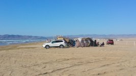
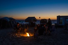
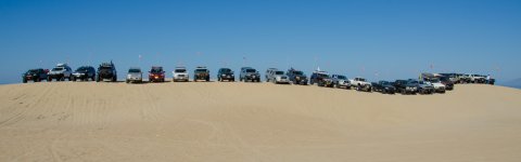
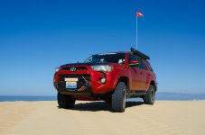
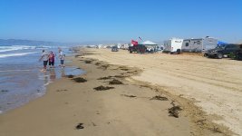
Last weekend I want to the Toyota (4r) Pismo Jamboree for some camping and dunes riding and some nice serious relaxing on the beach in between :)

A few pictures below. Nothing too much to show, wasn't on a real picture kick, just trying to take it easy and not roll the runner!

Friday.jpg

Campfire.jpg

Lineup.jpg

Profile1.jpg

Saturday.jpg

Oh, one funny thing, on the Friday night run. I was in front for some reason and we went way out too the south and then east. Then on the way back we got "trapped" in the wildy wandering fence line. And man, all dunes look the same at night :D we were actually a bit lost for a while. Having my food and bed with me all the time I was just ready to camp out on a dune till daylight if necessary :D
 

Attachments

  • Friday.jpg
    Friday.jpg
    66.6 KB · Views: 1,167
  • Campfire.jpg
    Campfire.jpg
    64.5 KB · Views: 1,189
  • Lineup.jpg
    Lineup.jpg
    118.5 KB · Views: 1,200
  • Profile1.jpg
    Profile1.jpg
    60.3 KB · Views: 1,276
  • Saturday.jpg
    Saturday.jpg
    90 KB · Views: 1,192
Omgsuperbloodmoon!

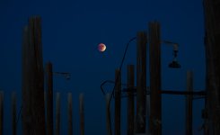
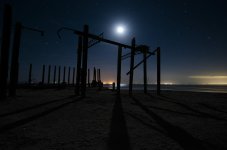
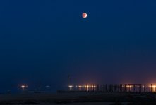
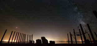
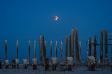
So it was the eclipse last Sunday, and I really wanted to get out somewhere to take pictures. The first place that came to mind was the PBY dock at the old Salton Sea Test Station. Only problem was that it was hotter than hell out there :(

Oh well, only going out for a few hours I can handle it! The weather app said 102 in Borrego Springs. Course I was going out a lot futher than that and though when going by Borrego Springs the temp did read 92, the further I went east and the lower I went, the hotter it got. Hot 108 at one point!

When I finally got out to the edge of the sea it had dropped to 100 because of the cooling effect of the water. Unfortunately, 100 degree air temperature evaporates a lot moisture as well, it was a hot sauna! A dead fish smelly hot sauna :(

I set up a couple of cameras about 300 feet apart and was trekking between them and the Warthog every 10 minutes to take pictures and drink another bottle of water. Carried a towel around to wipe my forehead just like a real sauna too :D

So with that and a camera that was acting up, I was lucky to get much in the way of decent photos, but here they are:

DarkMoonOverPilings.jpg

FullMoonShadows.jpg

MoonHighOverPilings.jpg

MoonMilkywayPano.jpg

MoonOverPilings.jpg

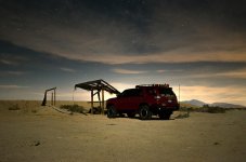
WarthogAtNight.jpg

Was eerie and fun, never been out there at night before. Was a tiny bit worried about getting lost and unexpectedly stick in a silty sand hole trying to get out. The "road" into the base is hard to follow in the day time in places and always seem to change as the sand dunes drift across that area.

So I used Orux Maps to track my trek in so I could (and did) follow my tire tracks exactly on the way out again at night.
 

Attachments

  • DarkMoonOverPilings.jpg
    DarkMoonOverPilings.jpg
    100.3 KB · Views: 1,173
  • FullMoonShadows.jpg
    FullMoonShadows.jpg
    57.5 KB · Views: 1,170
  • MoonHighOverPilings.jpg
    MoonHighOverPilings.jpg
    114.5 KB · Views: 1,225
  • MoonMilkywayPano.jpg
    MoonMilkywayPano.jpg
    83 KB · Views: 1,183
  • MoonOverPilings.jpg
    MoonOverPilings.jpg
    77 KB · Views: 1,154
  • WarthogAtNight.jpg
    WarthogAtNight.jpg
    75 KB · Views: 1,176
Took quite a while for me to get through this thread front to back.

I haven't seen many modded 5th gens. I must say, yours is quite nice. Props to you, sir.
 
MOAB Oct 2015

Just back from a solo trip to Moab for about a week including travel time. Super awesome time. Though when I say "solo" I mean almost completely alone! No group, no wheeling partner, not even a passenger for moral support. Only spoke a few sentences the entire trip when ordering food.

Heck there was hardly anyone at all otherwise. In 5 days of off-roading I saw one (ONE!) other off-roader in a Jeep. All campgrounds were just drive up and find a spot, Fee or Free. There were a few intrepid camper haulers out there but off-road season was apparently utterly over.

Weather for the most part was really good, though winter weather plowed in towards the end. I was sunned on a lot which was great, but also, rained, hailed, sleeted and snowed on. Temps stated out at an utterly perfect 40 nights, 60 days, but then dropped to 25 nights and 40 days.

I got tons of hiking and picture taking in. Lots of easier trails and back country roads. I tried to not to put myself into too many possibly disabling positions while I was alone and no one else was around. So did some more touristy things than normal.

Pictures to follow but here is a teaser of the warthog at Hurrah Pass...

HarrahPass.jpg
 

Attachments

  • HarrahPass.jpg
    HarrahPass.jpg
    144.3 KB · Views: 1,145
12 hours from San Diego to.. well not Moab yet. Drove to the edge of Horseshoe Canyon. Was going to hike it the next day. But after a small test hike, I realized that going from sea level to 5500 feet and being terribly out of shape, I wasn't going to be able to make the hike as I was :( 750 foot vertical and 5 miles round trip in the sandy bottom. Disappointing, but my fault for bad planning. Maybe later in the week?

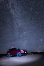
Got this picture of the Warthog under the Milky Way that night. Though some thin clouds and Moab light pollution kind of washed it out a bit, you can still see Andromeda in the upper right and another galaxy a bit lower and further right. And the Pleiades in the lower right. This was just before my rig got sucked up by a passing aliens tractor beam too :(

Sat-WarthogAtNight.jpg

I got it back though thankfully...

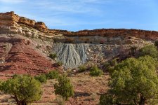
So from Horseshoe I drove to Temple Mtn Road which is on the way to Goblin Valley. You are allowed to off-road in that area around the old Uranium mines. Lots of trails off into the wild back desert from there too.

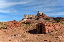
These are old Prospectors shacks, underneath Temple Mtn which is way WAY larger than it looks in this wide angle shot.

Sun-MinersShacksAtTempleMtn.jpg

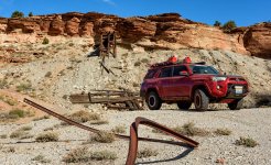
Hiked some, drove some. Uranium mines and tailings.

Sun-UraniumMine.jpg

Another Uranium mine around the corner.

Sun-UraniumMine2.jpg

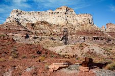
And more on top! Lots of drill cores laying around and one platform left. Tons of other junk. There are some Petroglyphs in this area but I was unable to find them :/

Sun-UraniumMine3.jpg

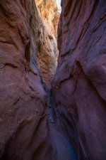
Then went into Wild Horse canyon, paved road, also on the way to GV. Hiked the slot canyon there a bit. Very colorful rocks and trees in this area. I did not do the entire canyon, was already a bit hiked out and had more to do!

Sun-SlotCanyon.jpg

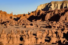
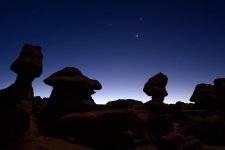
Sunset over the Goblins.

Sun-GoblinValleySunset.jpg

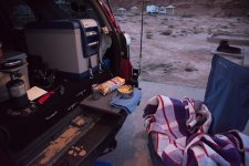
Quick dinner at my camp spot in Goblin Valley, making use of my little dining table. Turns out that there is free camping along the road to GV and along Temple Mtn road. Though if you want a shower, they have it here.

Sun-Dinner.jpg

Went to bed when it got dark and set the alarm for 4am...

(I wish I knew what the deal with the random image sizes was. The horizontal ones are all the same width IRL. But all different sizes in this post)
 

Attachments

  • Sat-WarthogAtNight.jpg
    Sat-WarthogAtNight.jpg
    130.9 KB · Views: 1,094
  • Sun-MinersShacksAtTempleMtn.jpg
    Sun-MinersShacksAtTempleMtn.jpg
    141.3 KB · Views: 1,123
  • Sun-UraniumMine.jpg
    Sun-UraniumMine.jpg
    141.8 KB · Views: 1,104
  • Sun-UraniumMine2.jpg
    Sun-UraniumMine2.jpg
    143.1 KB · Views: 1,104
  • Sun-SlotCanyon.jpg
    Sun-SlotCanyon.jpg
    117.3 KB · Views: 1,090
  • Sun-GoblinValleySunset.jpg
    Sun-GoblinValleySunset.jpg
    146.1 KB · Views: 1,087
  • Sun-Dinner.jpg
    Sun-Dinner.jpg
    111.4 KB · Views: 1,106
  • Sun-UraniumMine3.jpg
    Sun-UraniumMine3.jpg
    142.5 KB · Views: 1,110
Last edited:
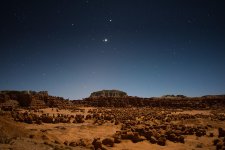
So I set the alarm for 4am because the 66% moon was going to be up and the planets Mars, Venus and Jupiter are in close proximity. Luckily the moon was not partying with the planets to it did nicely as a source of light without blocking the planets or stars from the images :)

Mon-GoblinPlanets2.jpg

Mon-GoblinPlanets.jpg

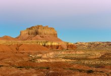
Wild Horse Butte in early dawn light under the earth shadow gradient in the sky.

Mon-DawnButte.jpg

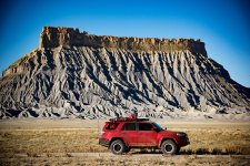
From Goblin Valley I headed south, then east on the 24 till I got to Factory Butte Road. I only went about half way up the road, but there was some more interesting stuff in a canyon at the end that I missed. Factory Butte itself is amazing though.

Mon-FactoryButteNWarthog.jpg

From there I continued east and got off at Cathedral Valley Road. A well maintained dirt road that leads into the back country of the Capital Reef State Park. From the 24 to the 24 it is a 60 mile loop that takes 3-4 hours depending on how often you stop for views or pictures.

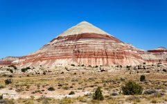
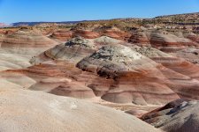
You start going through some Bentonite hills.

Mon-BentoniteMound.jpg

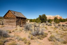
Then a long set of High cliffs and sandstone mounts. Amazing scenery the entire way. At the very end of the canyon there is a well preserved line shack.

Mon-LineshackOutside.jpg

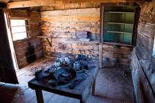
Inside...

Mon-LineshackInside.jpg
 

Attachments

  • Mon-GoblinPlanets2.jpg
    Mon-GoblinPlanets2.jpg
    109.2 KB · Views: 1,088
  • Mon-GoblinPlanets.jpg
    Mon-GoblinPlanets.jpg
    105.2 KB · Views: 1,074
  • Mon-DawnButte.jpg
    Mon-DawnButte.jpg
    125.9 KB · Views: 1,086
  • Mon-FactoryButteNWarthog.jpg
    Mon-FactoryButteNWarthog.jpg
    146.8 KB · Views: 1,037
  • Mon-BentoniteMound.jpg
    Mon-BentoniteMound.jpg
    140.5 KB · Views: 1,053
  • Mon-LineshackOutside.jpg
    Mon-LineshackOutside.jpg
    138.6 KB · Views: 1,053
  • Mon-LineshackInside.jpg
    Mon-LineshackInside.jpg
    142.2 KB · Views: 1,057
Last edited:
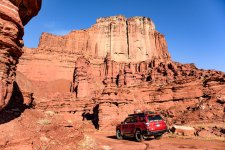
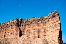
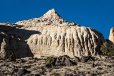
Part of the Cathedral Valley Wall

Mon-SandstoneCliffFace.jpg

At the end of the valley you go up into the mountains a little and then back along the top of the ridge for a while. Rougher road here. Not a lot to see at first but nice high desert country. The primitive camp is at the top of the ridge and I was going to stay there for the night but a ranger said it was expected to rain that night and tomorrow and said the roads may be difficult if it did (Plus the 20 or so drainage creeks I crossed getting there) So I continued on back to the highway.

More and most awesome bentonite hill area

Mon-Bentonite2.jpg

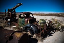
Old abandoned truck

Mon-AbandonedTruck.jpg

And it looks like the Warthog may suffer from the same state!!!

Story: So after 60 miles of travel through the back country, I am about 1/2 mile from the 24 highway. All that stands between me and being back in civilization is a river crossing that I've never seen before.

I wade into it, about knee deep. Hmm.. And it's not just a crossing, I have to go in, go up stream a ways then out the other side. I was a little uneasy about it, There are SO few people out here (like no one) I don't want to get stuck in a muddy river. Even at 1/2 mile from the road, the nearest people are 20 miles in either direction.

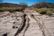
I font another crossing further up stream, it looks shallower and slower moving and the map shows a route up there so I back track a little and find this wash/road over to the other spot. There were even tracks leading over it. Only.. It was a trap! Sandy on top, quick sandy, mud underneath, never saw it coming.

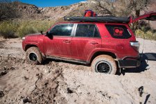
Stuck in the mud was exactly the thing I didn't want to happen -.-

Mon-Stuck1.jpg

I'd already dug the tires out in the previous pic... Aired down more to 16 pounds, 4 low, ATRAK on and locker engaged. Put it in reverse and gunned it, came out pretty quickly. Didn't have to get out the maxx traks or anything. Whew!

Mon-Stuck2.jpg

So after getting out, I'd pressed my luck enough and decided to go back from where I came. Another 3-4 hours out, though not like the scenery wasn't worth seeing... But a couple miles back up the trail I run into a rancher with a large but not lifted truck pulling a 4 horse trailer (with 4 horses in it). I waved him down and asked if he was going to cross the river and he said yes. So I followed him back down (very slowly) and watched as they got the horses out and he plowed across then up the stream and out. Turns out the river was a bit shallower on the far side and no mud.

So I followed across and got to the 24 and headed for the civilized side of Capitol Reef to camp that night!

Hiked around and looked at old buildings, petroglyphs, arches and canyons till sunset.

Mon-MudLump.jpg

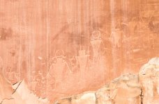
Ancient space travelers?!? :D

Mon-AncientSpacemen.jpg

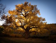
Mon-OakTreeSunset.jpg
 

Attachments

  • Mon-SandstoneCliffFace.jpg
    Mon-SandstoneCliffFace.jpg
    139.8 KB · Views: 1,055
  • Mon-AbandonedTruck.jpg
    Mon-AbandonedTruck.jpg
    138.1 KB · Views: 1,074
  • Mon-Bentonite2.jpg
    Mon-Bentonite2.jpg
    137.5 KB · Views: 1,078
  • Mon-Stuck1.jpg
    Mon-Stuck1.jpg
    141.5 KB · Views: 1,088
  • Mon-Stuck2.jpg
    Mon-Stuck2.jpg
    140.6 KB · Views: 1,050
  • Mon-AncientSpacemen.jpg
    Mon-AncientSpacemen.jpg
    120.3 KB · Views: 1,065
  • Mon-OakTreeSunset.jpg
    Mon-OakTreeSunset.jpg
    139.1 KB · Views: 1,050
  • Mon-MudLump.jpg
    Mon-MudLump.jpg
    141.5 KB · Views: 1,076
Last edited:
Next morning at Capital Reef I took the Civilized scenic drive. Turns out it did NOT rain last night or that morning so I could have camped at the primitive camp but oh well :)

Did some hiking too, but then packed up and headed for Sego Canyon on my way to Moab finally.

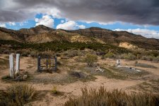
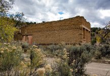
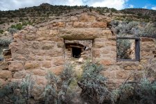
There are the remains of an old town there. I didn't find a name for it, just Sego Canyon Ghost Town. One huge building (General store?) and several stone and a couple wood houses in the area. Also a small cemetery.

Tues-SegoGhostTownCemetary.jpg

Tues-SegoGhostTownGeneralStore.jpg

Tues-SegoGhostTownHouse.jpg

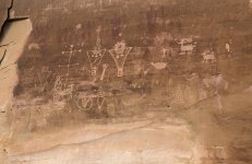
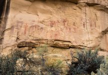
There were also some nice petroglyphs. Some older and some newer ones. The older ones are like the ones I wanted to hike Horseshoe Canyon for.

Tues-SegoPetroglyphsNewer.jpg

Tues-SegoPetroglyphsOlder.jpg

Was a long drive to Moab. And the rain was finally showing up. I camped at a mostly empty Sand Flat and though I was planning on a spin on Fins and Things, I'd had a long day already. Ate dinner in the back of the warthog to avoid the rain.

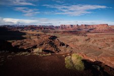
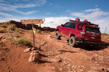
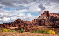
Rained all night long but wok to clear with some clouds the next day. I ran the Harrah Pass trail and Chicken Corners, again, taking it easy going solo. Chicken is listed as a med trail but it was even easier than the easy Harrah Pass. Wet trails were nice, no dust. Clouds made for great pictures of the Colorado and Anticlline areas.

Wed-AnticlineAreaMorning.jpg

Wed-ChickenCornersSign.jpg

Wed-Color.jpg
 

Attachments

  • Tues-SegoGhostTownCemetary.jpg
    Tues-SegoGhostTownCemetary.jpg
    140 KB · Views: 1,086
  • Tues-SegoGhostTownGeneralStore.jpg
    Tues-SegoGhostTownGeneralStore.jpg
    141 KB · Views: 1,121
  • Tues-SegoGhostTownHouse.jpg
    Tues-SegoGhostTownHouse.jpg
    141.7 KB · Views: 1,031
  • Tues-SegoPetroglyphsNewer.jpg
    Tues-SegoPetroglyphsNewer.jpg
    121.7 KB · Views: 1,037
  • Tues-SegoPetroglyphsOlder.jpg
    Tues-SegoPetroglyphsOlder.jpg
    140.6 KB · Views: 1,045
  • Wed-AnticlineAreaMorning.jpg
    Wed-AnticlineAreaMorning.jpg
    139.4 KB · Views: 1,053
  • Wed-ChickenCornersSign.jpg
    Wed-ChickenCornersSign.jpg
    140.5 KB · Views: 1,042
  • Wed-Color.jpg
    Wed-Color.jpg
    138.9 KB · Views: 1,043
Last edited:
The Colorado at the end of Chicken Corners...
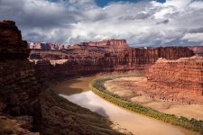
Wed-Colorado.jpg

After the trails I went north a bit to see if I could get an awesome picture of the Monitor in a ray of sunlight. First I drove around on Hells Roaring Ravine trail, but the look out trail was closed :( Then through Hidden valley for some sandy fun. The river had a pretty big washout at one point, that was fun to go through.

Then I went around and checked out the dinosaur tracks and fossils. They were really neat, very touristy but I was the only one there...
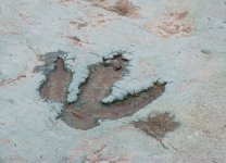
Wed-DinoTrack.jpg

The sun was going down so I headed to a sandy trail to view the Monitor Butte and waited for a ray of sunshine before sunset for a picture that never came. As I was waiting I got rained on and hailed on intermittently.
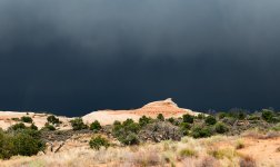
Wed-TheRainFalls.jpg

I went to the nearest campground for the which was Horse Thief at 5700 feet. This is what I woke up to the next day!
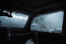
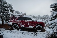
Thur-Morning1.jpg

Thur-Morning2.jpg

The sun came out quickly and a Tupper ware lid was used to move most of the snow off. (Note, I need to keep an ice scraper in the back). I headed out Gemini Bridges road to the main highway. Had lunch and decided to try out Top of the World, a Difficult trail because of a single obstacle.

I'd never been up Castle Valley wither so it was a nice drive through a new area for me. I got to the trail head and slowly crawled through 2.9 miles of mild to med ledges will I hit the 2.9 mile obstacle. The first ledge was too high for me, but there was a side way up onto it which I got up on easy enough. But the second ledge was so ragged and narrow... I just couldn't "go for it" without someone else around to strap onto if necessary :( Also remembering about the three people that broke axels on this trail at Rock Therapy earlier this year...

Sadly I backed down off the obstacle and made my way back down the trail. The views were nice and now I know what I'm up against next time I do it :)

It was 2pm when IO got back to Moab for lunch and I decided to head part way home taking the slightly longer southern route back to San Diego. Passed through Mexican Hat...
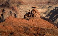
Thur-MexicanHat.jpg

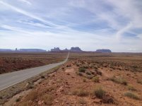
Then into Monument valley. While I was stopped taking a picture of the back side of the valley monuments, I turned around and three wild horses were crossing the road just behind me!
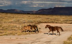
Thur-WildHorses.jpg

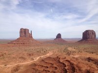
As I got up to the official Monument Valley entrance and visitor center road, the sun was PERFECT for getting pictures of the Mittens so...
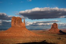
Thur-Mittens.jpg

After that it was dark and those one lane roads to Flagstaff are treacherous! Was snowed on and light snow everywhere all the way down to and in Flagstaff. Ate dinner there and headed to Barstow expecting to conk out at some point and sleep at a rest stop. But I was doing great and powered all the way home. Arrived at 2am, 13 hours after leaving Moab and continuous driving since 9am (17 hours total) except when stopping to eat, Whew!

I got so many more nice pictures, but had to cull them :D I did NOT get much video, my dash cam said it was recording but it didn't record anything on 4 of the 5 memory cards :( So I don' have pictures of the river I crossed and other things I was just planning on just frame grabbing of the video :/

But overall it was an insanely great trip weather and all!

 

Attachments

  • Wed-Colorado.jpg
    Wed-Colorado.jpg
    139.8 KB · Views: 1,026
  • Wed-TheRainFalls.jpg
    Wed-TheRainFalls.jpg
    94.8 KB · Views: 1,029
  • Wed-DinoTrack.jpg
    Wed-DinoTrack.jpg
    139.1 KB · Views: 1,023
  • Thur-Morning1.jpg
    Thur-Morning1.jpg
    62.3 KB · Views: 1,042
  • Thur-Morning2.jpg
    Thur-Morning2.jpg
    138.9 KB · Views: 1,035
  • Thur-MexicanHat.jpg
    Thur-MexicanHat.jpg
    139.8 KB · Views: 1,046
  • Thur-Mittens.jpg
    Thur-Mittens.jpg
    120.9 KB · Views: 1,024
  • Thur-WildHorses.jpg
    Thur-WildHorses.jpg
    137.3 KB · Views: 1,058
Last edited:
That's awesome. Solo trips can be really rejuvenating.

Or they can be really lonely. Sounds like you had a good one.
 
Sounds like a nice trip. I was just out there two weeks ago. Passed by the same places on my way home too. I traveled south from Moab to Blanding, then southwest to Bluff, Mexican Hat and through Monument Valley before turning back east at Kayenta to Farmington and eventually home through New Mexico and West Texas. No snow for me just two weeks ago, though!
Sorry to hear you got turned back from the end of Top of The World. It is an awesome place. I bet you would have been fine though. Last time I did that trail I don't remember anything other than those two ledges you mentioned that would cause serious trouble.
 

Attachments

  • IMG_4401.jpg
    IMG_4401.jpg
    135.3 KB · Views: 979
  • IMG_4408.jpg
    IMG_4408.jpg
    133.6 KB · Views: 979
Last edited:

Members online

Forum statistics

Threads
278,312
Messages
3,554,089
Members
248,016
Latest member
Advally Service

Trending content

Back
Top