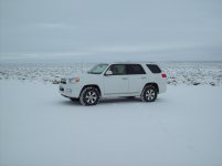
2013 SR5 4x4 Update

Ron4RNevada

New member
Well I just got my Toyo Open Country LT (E) MT's balanced and rotated Front to rear and crossed. They now have a bit more than 40,000 miles on them - Still more than 60% of original tread left on them and all four took less than an ounce to balance them. Best damned tire made for this country - Don't get the C rated - the sidewalls puncture too easily.

I bought the car in December 2014 with 28,000 miles on it - Now it's at 70,700 miles. about 10,000 of those miles are off-road (I get out a lot!).
The truck gets oil, filters, etc maintained by Dolan Toyota in Reno every 5000 miles. I'm an old fart with stiff joints so I don't do my own maintenance as much any more. Dolan treats me very well, does everything correctly and doesn't charge very much.

During the time I've had her I have never had any OBD2 faults, no funny noises, no leaks, no leaning, no funny smells, no troubles shifting, no steering complaints (except for flat spots in the stiff tires on cold morning for a couple of miles), nada.

I give most of the credit to Toyota for building a fine machine, to me for keeping it well maintained, to me for exersizing it properly, also to me for leaving it stock. If it aint broke, don't fix it!

I bought the 100,000 mile - seven year unlimited warranty the day I bought it (good until 132,019 mi and 12/10/2021). I'll probably never have to use it - That's just fine!


30738-up%20and%20down%20a%20lot_zpsztikirmx.jpg~original


If Toyota ever does build a sixth gen; make it exactly like a 2013 SR5 but put a real steel, chromed bumper on both ends.
 
Last edited:
Register to hide this ad
BTW: Even with the E rated M/Ts - On flat highway I get typically get between 20 and 21 mpg at 60 to 65 mph (unless there is a strong head wind or side wind - it's very windy around here). Around town I usually get around 17 mpg (small town - few traffic lights - light traffic). Amazingly the truck is actually getting the mileage that Toyota and EPA advertise. Off-road it's a different story = running around in lo range -> sand, rocks, steep climbs, stooping and starting a lot and generally at less than 5 mph with a lot of shifting between 1st and 3rd (in 4LO) i get between 10 and 13 mpg.

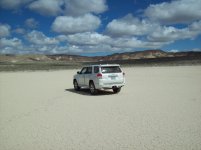
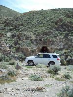
Since the truck is stock I have lots of little paint chips along the bottom of the front bumper (the black air dam is mostly gone - someday I'll probably remove the rest of the black air dam, trim a couple of inches of the white painted bumper (similar to what Antman did).

The rear bumper is still in good shape as I usually have the rear hitch upside down (without a ball plugged in). It slides down ravine cut-banks and protects the rear painted fascia.

The front edges of the engine skid plate are a bit scraped and dinged - not bad as I tend to go quite slow when crossing areas of tall rocks - and stop when I hear scraping. The gas tank skid has very little abuse showing.

The deep hanging SR5 type "under the door" panels have very little wear. Sometime in the future I may trim them a bit (up to the chrome strip) and back them with some 2x4x1/4 aluminum rectangular tube (home-built rock slider) Did this on my '04 LR Discovery and it worked super.

30814_zpsao3mnaec.jpg~original
 
Last edited:
About that bumper saving hitch

I just plug in the hitch without a ball to save the bumper. Also where I hook my d-ring for recovery

31009-Hitch%20saves%20bumper_zpsqoha5p87.jpg~original

31031-A%20bit%20dusty_zpssjzis7jc.jpg~original

31010-3rd%20Challenge_zpshgbpkwuv.jpg~original


Oh; a little bit about me:
I probably get better mileage than most on here because I'm a conservative driver. Even though we have areas where the speed limit is 70 and 75 miles per hour. I tend to travel at 65.
Brake pads and rotors last me forever as I tend to "plan ahead" taking my foot off the accelerator rather than a last second squashing of the brake pedal. Thus I rarely experience the dive that people complain about. Actually that dive is built into off-road capable machines that have decent amounts of articulation.

Offroad I use the S+/- mode most off the time rather than the brakes.
A lot of gravel and dirt roads around here. So even when I don't need it I shift into 4H just to exercise it - plus it gives better control.

Very rarely do I air down tires - I do when conditions really get extreme but not often. The Toyo M/Ts have pretty good tread for about three inches up the sidewalls so it really doesn't add much.

The last truck that I owned with a locker was my '89 GMC. These new rigs with A-TRac and my '04 LR with 4ETC (same as A-TRac) pretty much do a better job than lockers.

- - -
 
Refreshing thread. :cowboy:

Though I'm surprised you haven't killed yourself out there in the desert without a roof rack, LED light bars, and rock sliders.
 
ActuallyI have a homebuilt roof rack that I saved from my Land Rover. It's in the back yard propped against the fence getting rusty.

I used it only once - when I lead an expedition from the north east corner of California to the north west corner of Utah - pretty much running all across the northern edge of Nevada - in 2006 - all off-road except for about 200 feet of pavement crossing NV140, US 95, NV 226, NV 225 and US 93. We were four Land Rovers; each carrying an extra 10 gallons of fuel, 10 gallons of water, tools, a second spare tire, a few critical parts, clothes, tents, food, cooking gear, recovery gear, all the usual emergency gear.

The off-road part going east was about 600 miles, returning west on I-80 was about 450 miles. We stopped twice: Mountain City and Jackpot to replenish gasoline and water. The trip was six days. Casualties 1 ripped tire side wall and on 8" piece of 3/8 vacuum line. We were driving two Discovery's and two Freelander's so we had less spare parts to carry.

I have never ever wanted to reinvent the wheel by blacking out chrome, changing light bulbs, install massive front bumpers or install shelves, etc.

Maybe some nice hood louvres or racing stripes though?

Would anyone care to read that Trans Nevada Trip Report from 2006? It's all about Land Rovers but an interesting read. I cannot locate the Photobucket photos anymore but I've still got the report. Five pages of "WORD" If you have a DeLorme Nevada Atlas you can follow most of it.
 
Last edited:
Trans Nevada Trail Trip Report

Trip Report
Trans Nevada Trek
15 September to 19 September 2006

Day minus 1 – Friday
The four of us headed up to Alturas, CA from home. In my case from Rocklin; a 290 mile run up I-80 to Reno and then US395 north to Alturas. It was cold and rainy north of Susanville and I started catching a bit of snow as I passed Madeline.

We had all checked into the motel by about 6:00. About 6:30 we decided to try a place called the Brass Rail for some Basque style food. About 2 hours later we were all stuffed. Pretty good food, good service, nice atmosphere.

Day 2 – Saturday
Saturday morning at 6:00 we met for the motels continental breakfast and were underway before 7:00. After a 22 mile highway run we stopped at Cedarville for a last chance fuel top-off and then another 8 miles across the Middle Alkali Lake causeway to the to the end of the pavement at the Nevada state line. A few photos of the trucks clean and the adventure began.

A well maintained graded road took us over Fortynine Creek Pass, past the site of Vya, past the Massacre Lakes and on into the Sheldon National Wildlife Refuge. This part of the run is along the old Applegate Immigrant Trail. The road was fairly dry with perhaps 2 inches of snow in the brush alongside and a temperature of about 36 degrees. Along with a few cattle, we spotted a couple of coyotes, some buzzards, hawks and eagles. Everything else must have been still asleep.

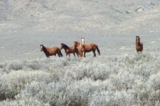
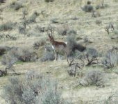
Near Fish Creek Mountain we turned off the main road and headed southeast towards Summit Lake following Badger Creek. Near Mahogany Mountain the going got rougher and we stopped to air down the tires. They would stay this way for the next four days. After passing Tenmile Spring, Fivemile Flat, Onemile Spring and the Summit Lake Indian Reservation (pop. 7) we started up Mahogany Creek. We made a brief stop at an old abandoned camp called Stanley. From there at about 5800 feet we started a steep climb up to the top of the un-named pass over the Black Rock Range at about 7000 feet. During the climb we began seeing wild horses and antelope. Somewhere along here we stopped for a lunch break in an aspen grove, after having cut our way through some fallen trees blocking the trail.

A bit south of Bartlett Peak we turned off of our planned route and took an excursion down Pearl Creek passing the abandoned mining town sites of Bartlett Mine, Juanita Mine and Columbia Mine. At the mouth of the canyon we entered the northern end of the Black Rock Desert. Now we began to make some good time out on the flats. We passed through the very nice looking Leonard Creek Ranch, around Windy Point, across the Quinn River, past the Quinn River Crossing Ranch (where we crossed highway 141 to Denio), and headed towards the Bilk Creek Mountains. We’ve been spotting a lot of wildlife now, especially near water. The Quinn isn’t much of a River, at this time of year it’s a bit more than what runs down your gutter when you’re washing your car; but for Nevada in summer, that’s enough.

Coming off of the Bilk Range we dropped down into and crossed the Kings River Valley (less water than the Quinn) and then on over Thacker Pass between the Montana Mountains and Double Mountains. For about 2 miles the trail is part of paved NV283 (bummer) until we reach a turnoff near Sentinal Rock. We had a bit of adventurous trail hunting here as one option was to drive over a forty foot lava bluff a second was to try to navigate a 40 degree washout and finally the third which actually got us past Sentinal Rock and out into a huge sand flat along the west bank of the Quinn (yes, same river that has doubled back on itself a couple of times). After 12 miles and more than two hours we finally make it through the sand and reach highway 95. We do a quick 12 mile run up the highway to McDermitt, gas up and return back down the highway to where we originally left the trail.

At this point, because it’s getting very late, I decide to temporarily turn over the Trail Boss responsibility to Brian H. as he was in this area last year and knows the route to the campsite he used last year. It’s a spectacular run up the west face of the Santa Rosa Range. From the valley at 4400 feet we steadily climb past many switchbacks to the pass at Windy Gap at 7344 feet. Then it’s a lot of winding through spectacular scenery and finally arriving at Lie Creek Campground a bit above 8000 feet. It’s 8:00 pm, dark and very cold. We’ve done about 210 miles today. The tables are covered with ice and snow. All of us do a quick job of setting up camp and Brian M. sets about making dinner. Great job; barbecued ribs, beans and salad! We all get to bed very soon as it’s already below freezing.

Day 3 – Sunday
At about O-dark-thirty Brian M. starts his engine and we all get up. It’s about 26 degrees. We do two pots of coffee, down a bunch of muffins and frantically pack up, just to stay warm! Around 7:00, I think, we head out towards Hinkley Summit. A gorgeous, sunny, very cold morning! The scenery coming down from the summit (7838 feet) is spectacular. About an hour later we turn east at Paradise Valley (4528 feet). It’s a quaint little town with a very photogenic, but boarded up, saloon. A short picture stop, and then across the valley towards the Hot Springs range. The wildlife abounds; I spot deer, quail, pheasant, grouse, a coyote, eagles, hawks, and dozens of buzzards sitting on fence posts alongside the road.

A bit later we arrive at Chimney Dam Reservoir for a break and a chance for me to clean up a bit and change clothes. It was just too cold to undress this morning! Then we head north east along the South Fork of The Little Humboldt River towards the Little Humboldt Ranch. After a bit of searching near the ranch I eventually find the ratty little bridge that crosses the river. After I cross it, the rest of the gang decides it needs a bit of repair before they want to cross, so I wait for them on the bluff on the far side.

After passing Four Mile Butte (don’t you just love these creative names?) we enter the Owyhee Desert. For the next 75 miles we’ll be crossing this desert; it’s nothing but sagebrush and sand: deep sand! Also the BLM and other agencies have widened the trail,
 
TNT trip report

actually making the trail worse, to use it as a fire break to stop the Tuscarora Fire that burned this area a month ago. As I recall, the fire consumed about 400,000 acres. We will be passing through burned land for the next 100 miles. We are spread out with almost a mile between each other as that is what it takes for the dust and fire ash to settle after each truck has passed. After about 35 miles we stop for lunch at the burned out Winters Ranch.

There is nothing left of the ranch except for the blackened stone walls of the buildings. The spring is still flowing nicely and a few cattle are grazing the creek bottom vegetation that didn’t burn. After lunch we head towards the Bull Run Mountains; passing the IL and VN Ranches. The cattlemen are in the midst of a roundup, probably to move the cattle that survived the fires to better grazing lands. We eventually arrive at Deep Creek; then over Chicken Creek Summit and start looking for the night’s campsite at Jack Creek.

The bridge near Jack Creek is burned so we cross the creek at a ford. All the way up the creek and on across the Independence Mountains all of the campsites are burned out so we decide to head on up paved NV225 for Wild Horse Reservoir. We find a nice BLM campsite and set up at about 4:30. We’ve still got more than an hour of sunlight; it’s relatively warm and plenty of time for a leisurely dinner. Brian H. treats us to some great barbecued pork loin, rice, salad and wine. Brian M. breaks out the cigars and another bottle of wine. Life is good!

Day 4 – Monday
Next morning we’re up just before dawn. It’s a bit warmer; maybe 33 and we’re doing much better packing up. Coffee and muffins again and we’re on our way. We head up to Mountain City to gas up then turn around and head back to where we left the dirt trail.

It’s past Goicoechea Ranch, Riff Ranch, and Heguy Ranch and on to the Bruneau Meadows. Passing the headwaters of the Bruneau we cross the southern end of the Jarbidge Mountains and head towards the Marys River. The whole mountain range in this area is burned. Navigation gets to be a bit tricky as fire roads keep intersecting the trail that I’m trying to follow. Eventually we wind up on top of a cliff at about 7200 feet looking down at the valley 2500 vertical feet below. We back track about a mile and turn onto a steep rutted, rocky trail down a narrow canyon heading for the bottom.

Reaching gentler slopes at about 6000 feet, Gary finds that he’s got a blown tire on the trailer. We jack it up and pull off the wheel. It appears that maybe we’ve just unseated the bead. With a strap around the tire, two of us pushing on the bulges and Gary’s high pressure tank we get the tire to reseat. Whoops! The side wall on the inside of the tire is slashed. We experiment with some tire repair stuff to no avail. We put the Disco spare on the trailer and head out.

Upon reaching the valley we find that the Marys River Ranch has posted the entire length of the valley with NO TRESPASSING signs on their barbed wire fence. We traverse the fence in both directions for several miles and come to the conclusion that we’ll not be crossing here. We find a trail on the maps that looks as if we can go north-north west about 16 miles crossing the Hanks Creek and then the headwaters of the Marys River and then east again for about 19 miles and come back onto our original course.

The trail isn’t very difficult. The Hanks Creek crossing is down a four foot cut bank through about 8 inches of water on gravel and back up the other bank. We find a shortcut trail that should cross the Marys River. It looks as if the trail hasn’t been used for at least 10 years. We get to the river and find a 45 degree rocky descent for about forty feet then a 4 foot vertical drop to the water and the water is about 4 feet deep. If that wasn’t enough; we can see no sign of the trail on the other side of the river. We turn back and head toward another crossing about 5 more miles north west. At last we come to a bridge. Hoorah!

Now it’s north up the Hot Creek Valley, east around the north end of the Snake Mountains, past Horse Creek and Antelope Creek, across Sun Well Creek and then across a pass south of Cold Springs Mountain. Eventually we arrive at north-south running highway 93. We stop to do an inventory of gas supplies, remaining daylight and remaining run miles. We will definitely need to make a run up to Jackpot for gas. It’s already pretty late in the day so that by the time we got to the Utah border where we had planned on camping it will be dark. We take a consensus: It’s 4 to zero that we go get a motel in Jackpot, get a good shower and have a restaurant dinner!

The rooms are cheap and pretty decent at the 93 Casino at $47. The shower is great; I use it for 20 minutes at least. We go across the street to the Cactus Pete Casino for the buffet. It’s about $8 a piece and excellent. I eat about $30 worth of their food.

Day 5 – Tuesday
We meet for breakfast in the coffee shop at 6:00. We’re on the trail by about 6:45 with Brian M. as temporary Trail Boss. Its easy going for the whole sixty some miles to the border. At times we’re within a few hundred yards of the Idaho border but never actually cross it. At about 2 miles before the Utah line, Brian asks me to lead us across. Thanks Brian. Running up the bottom of Goose Creek I come to a gated fence at 41 degrees 57.834 minutes North by 114 degrees 02.427 minutes West. We’ve made it!

We shake hands all around, have a sip of brandy and take some photos of the rigs and us. We have come 624 miles from the California state line. Then it’s a 1 mile drive south in Utah, cross the border back into Nevada and begin following the California immigrant trail back to the highway at Wilkins, NV about 60 miles away.

The trail is mostly graded gravel with a couple of easy creek crossings, a couple of Trail Monuments to stop at, and half dozen very lonely ranches. We pretty much follow the courses of Goose Creek, Rock Springs Creek and Thousand Springs Creek much as the emigrants did some 110 years ago. We stop at Wilkins (nothing there except the highway) and pump our tires back up. It has been almost 700 miles since we aired them down.

Now it’s all highway back to California. By the time I reach Rocklin again it has been 1494 miles since I left.

“Rocky” Ron Cunningham
Trail Boss
 
A couple pics of the '04 LR Discovery just for reference

24511_zps89b39525.jpg~original

24516_zps13765b02.jpg~original

24503-gravellysand_zps8f3802f7.jpg~original


By the way it had the same Toyo M/Ts as I have on the 4Runner except in size LT 265/75-R16
 
Great trip report Ron! It's refreshing to read a trip report like that instead of watching a youtube video. If it's well written (like yours) then the reader can let their imagination determine the scenery.

It's why I still read books instead of only watching movies.
 
[MENTION=118209]Ron4RNevada[/MENTION]. Thanks for sharing this. I look forward to your posts. Lots of wisdom and no nonsense. This is good stuff- like a Louis L'Amour novel.


2016 SR5P 4WD Super White
Bilstein 5100 @ .85
Nokian Rotiiva AT 265 70 17
Sent from my iPhone using Tapatalk
 
Thanks guys.

I would have attached pictures but PhotoBucket has gotten very hard to use these past couple years. I've got about 400 pictures of the Trans Nevada Trek buried in there somewhere. Guess I'll have to find some other way to get my stuff hosted.

That week of the trek was fantastic..An awesome adventure.

BTW: Since getting my tires properly balanced and cross-rotated this past 400 miles I've gotten 20.2 mpg (about 1/3 highway, 1/3 town, 1/3 off-road). Now if we ever stop getting this almost daily mix of rain and snow - - -
 
Last edited:
I'll try again
 

Attachments

  • 1006 Walter.jpg
    1006 Walter.jpg
    57.6 KB · Views: 2,851
  • 1019 D T L.jpg
    1019 D T L.jpg
    55.8 KB · Views: 2,869
  • 1027 At the shovel.jpg
    1027 At the shovel.jpg
    49.9 KB · Views: 2,860
  • Brian2.jpg
    Brian2.jpg
    52.1 KB · Views: 2,856
Last edited:
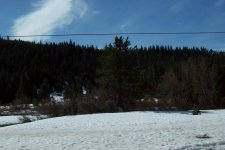
Well the snow has melted. Getting back out and about again.
 

Attachments

  • nh17.jpg
    nh17.jpg
    105.5 KB · Views: 706
  • ab13-Ft Churchill Ranch.jpg
    ab13-Ft Churchill Ranch.jpg
    138.5 KB · Views: 719
  • pr03.jpg
    pr03.jpg
    135.6 KB · Views: 701
  • pr06.jpg
    pr06.jpg
    120 KB · Views: 707
  • 330-07.jpg
    330-07.jpg
    132.5 KB · Views: 712
By the way: Even here in the big empty section of N. Nevada; when off-road I only get out of range of cell coverage about 75% of the time and there is a Walmart within 100 miles about 25% of the time. - REFERENCING THE DEBATE ABOUT "EXPEDITION OVERLANDING"
 

Attachments

  • 30003-Four Mile Flat and Sand Mountain.jpg
    30003-Four Mile Flat and Sand Mountain.jpg
    136.3 KB · Views: 693
  • 30016-In front of adit.jpg
    30016-In front of adit.jpg
    140.8 KB · Views: 678
  • 30036-NV Scheelite-Rawhide.jpg
    30036-NV Scheelite-Rawhide.jpg
    137.9 KB · Views: 713
  • 32009.jpg
    32009.jpg
    139 KB · Views: 699
  • 32019-goblins.jpg
    32019-goblins.jpg
    138.6 KB · Views: 685
  • 32020-the elephant.jpg
    32020-the elephant.jpg
    142.1 KB · Views: 700
March 31 - April 1

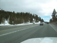
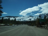
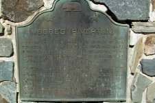
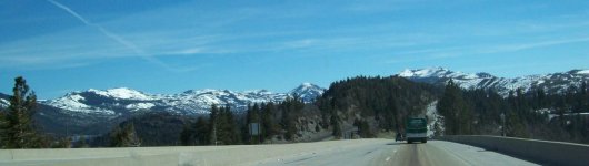
Seems as if first weekend since New Years that US-50 and I-80 haven't been closed due to snow storms. Decided to take a ride over Echo Summit and Donner Summit to Visit Daughter and grand kids.

Fernley 4117
Carson City 4600
Spooner Summit 7100
S.Lake Tahoe 6500
Echo Summit 7300
El Dorado Hills 1500
Donner Summit 7300
Fernley 4117
Total round trip = 345 miles
Fuel Economy = 20.5 mpg
 

Attachments

  • SP01-Spooner Summit.jpg
    SP01-Spooner Summit.jpg
    129 KB · Views: 657
  • SP03-S-Lake Tahoe.jpg
    SP03-S-Lake Tahoe.jpg
    131.6 KB · Views: 638
  • SP05-Moores Station.jpg
    SP05-Moores Station.jpg
    140.2 KB · Views: 652
  • SP09-I-80.jpg
    SP09-I-80.jpg
    74.7 KB · Views: 642
  • SP10-Emigrant Gap.jpg
    SP10-Emigrant Gap.jpg
    125.5 KB · Views: 639
Well I just got my Toyo Open Country LT (E) MT's balanced and rotated Front to rear and crossed. They now have a bit more than 40,000 miles on them - Still more than 60% of original tread left on them and all four took less than an ounce to balance them. Best damned tire made for this country - Don't get the C rated - the sidewalls puncture too easily.

I bought the car in December 2014 with 28,000 miles on it - Now it's at 70,700 miles. about 10,000 of those miles are off-road (I get out a lot!).
The truck gets oil, filters, etc maintained by Dolan Toyota in Reno every 5000 miles. I'm an old fart with stiff joints so I don't do my own maintenance as much any more. Dolan treats me very well, does everything correctly and doesn't charge very much.

During the time I've had her I have never had any OBD2 faults, no funny noises, no leaks, no leaning, no funny smells, no troubles shifting, no steering complaints (except for flat spots in the stiff tires on cold morning for a couple of miles), nada.

I give most of the credit to Toyota for building a fine machine, to me for keeping it well maintained, to me for exersizing it properly, also to me for leaving it stock. If it aint broke, don't fix it!

I bought the 100,000 mile - seven year unlimited warranty the day I bought it (good until 132,019 mi and 12/10/2021). I'll probably never have to use it - That's just fine!


30738-up%20and%20down%20a%20lot_zpsztikirmx.jpg~original


If Toyota ever does build a sixth gen; make it exactly like a 2013 SR5 but put a real steel, chromed bumper on both ends.

What warranty did you go with? A Toyota one or third party?
 
84 Months, 100,000 miles, no deductables, comprehensive (covers everything except regular maintenance items) . Sold to me by Toyota, Administered by First Extended Service Corporation. Cost $2200. Probably could have gotten something else cheaper; who knows?

Coverage to 4/17/2020 or 132,000
 

Members online

Forum statistics

Threads
278,308
Messages
3,554,058
Members
248,016
Latest member
Advally Service

Trending content

Back
Top