4Runners in scenic places

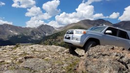
Exploring Tricouni near Whistler, BC. (Pelion Mountain in the background)

36584661291_a99a85bd3c_o.jpg
 
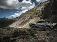
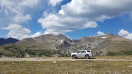
Imogene Pass

Here's one of many. Just uploaded a new album from our recent trip from CA- Telluride - Durango - Monument Valley - Grand Canyon - CA.
 

Attachments

  • IMG_4158.jpg
    IMG_4158.jpg
    139.3 KB · Views: 935
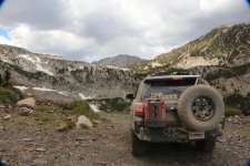
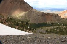
Laurel Lakes, Mammoth Lakes, CA
 

Attachments

  • Laurel Lakes Mammoth.jpg
    Laurel Lakes Mammoth.jpg
    143.1 KB · Views: 926
  • Laurel Lakes with snow.jpg
    Laurel Lakes with snow.jpg
    141.3 KB · Views: 904
Last edited:
[MENTION=115782]RedStripeRanger[/MENTION] and I drove through Long Valley on our way to camp for the night. The scenery was epic...

36352081550_786d8fa401_b.jpg
 
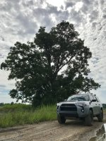
One of the off-road entrances to Yosemite National Park. I normally take this during the busiest time of the day during the heart of the busy season to help get around the good 5 mile backups.

It's a fun little route and looks like it should be filled with wildlife, though I have never seen any. Can get real muddy after rain or when the snow melt happens.

36558217182_3ec022d103_b.jpg
 
20170822_201148.jpg

20170822_201346.jpg

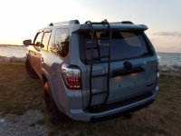
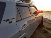
A little Great Lakes Sunset with my day old truck.
 

Attachments

  • 20170822_201148.jpg
    20170822_201148.jpg
    133.6 KB · Views: 1,133
  • 20170822_201346.jpg
    20170822_201346.jpg
    129.5 KB · Views: 1,122
.

Btw I must add this very important side note regarding my first run with the 5th gen in DEEP sand and high up on the dunes...in 4 low with the Cooper STT Pros aired down to 16 psi, and the multi terrain dial set at ' Mud Snow Sand'... this thing was nearly unstoppable. It surpassed EVERY expectation that I could ever have for a rig of this size and weight. I can honestly say that it impressed the hell out of me !!!

It's amazing. I had to go up a small hill, but a little steep in the very beginning with a good 3" or so deep soft sand. 4Lo and I just had A-Trac on being it was my first time in sand. Went down to 18 and it climbed up and over like nothing.
 
One of the off-road entrances to Yosemite National Park. I normally take this during the busiest time of the day during the heart of the busy season to help get around the good 5 mile backups.

It's a fun little route and looks like it should be filled with wildlife, though I have never seen any. Can get real muddy after rain or when the snow melt happens.

36558217182_3ec022d103_b.jpg

Exactly where is this at? Or is it a secret!?
 
Exactly where is this at? Or is it a secret!?

It's off Highway 41 just before you get into Fish Camp. It ends up coming out across from the Wawona Hotel. There's another one as well that starts on Old Coulterville Road and ends up in Foresta along the Big Oak Flat Road.
 
It's off Highway 41 just before you get into Fish Camp. It ends up coming out across from the Wawona Hotel. There's another one as well that starts on Old Coulterville Road and ends up in Foresta along the Big Oak Flat Road.

Road label? Turn off location? Would love to take the family in that way!
 
Road label? Turn off location? Would love to take the family in that way!

Take Highway 41 towards Yosemite like you normally would, and turn onto Summit Camp Road (left) immediately after passing Tenaya Lodge. It's probably 50ft away from the entrance to the Lodge.

From there you take Summit Camp Road all the way until it comes to a T (a few miles), that will be Chowchilla Mountain Road. You want to go right at that T. You'll go down that for about a quarter mile or so and it'll fork, stay to your right (still Chowchilla Mountain Road, left goes to a horse thing or something).

After that just stay on the road and it'll take you all the way into the Park. Approximately another quarter mile or so after that fork you'll come to the gate and there will be a wooden sign saying Yosemite National Park. You will eventually reconnect with Highway 41 across from the Wawona Hotel.

The road becomes dirt and single lane about half a mile after you turn off of Highway 41.

There are a couple ruts, but nothing you won't be able to handle. Just note that if it's rained recently, or that day, that road can be very slippery. I did it in my CR-V when it was muddy, but some of the downhill areas I was going down sideways.

It will get smokey the closer you get to Wawona right now because of the fire, but it gets you away from all the speed demons and RV's. It's probably about 30 minutes longer than taking the 41, but it's worth it IMO.

Of course if you are trying to get around fee's you won't pay them there either.

From what I've searched, it was originally a Native American trail, which eventually became a horse carriage route, and eventually car route. I believe it was done by whoever owned the Wawona area at the time as they didn't want their guests paying the park fees to stay there.

Back when GPS first came out it would actually take people this way and they'd get stuck and or scared and call 911 for help.

Road isn't maintained and there's no way to know when it's open. You just either find the gate open or closed. Typically I would say in non-snow years May-Oct it's open.
[MENTION=147060]BlueRunner15[/MENTION]

 
Take Highway 41 towards Yosemite like you normally would, and turn onto Summit Camp Road (left) immediately after passing Tenaya Lodge. It's probably 50ft away from the entrance to the Lodge.

From there you take Summit Camp Road all the way until it comes to a T (a few miles), that will be Chowchilla Mountain Road. You want to go right at that T. You'll go down that for about a quarter mile or so and it'll fork, stay to your right (still Chowchilla Mountain Road, left goes to a horse thing or something).

After that just stay on the road and it'll take you all the way into the Park. Approximately another quarter mile or so after that fork you'll come to the gate and there will be a wooden sign saying Yosemite National Park. You will eventually reconnect with Highway 41 across from the Wawona Hotel.

The road becomes dirt and single lane about half a mile after you turn off of Highway 41.

There are a couple ruts, but nothing you won't be able to handle. Just note that if it's rained recently, or that day, that road can be very slippery. I did it in my CR-V when it was muddy, but some of the downhill areas I was going down sideways.

It will get smokey the closer you get to Wawona right now because of the fire, but it gets you away from all the speed demons and RV's. It's probably about 30 minutes longer than taking the 41, but it's worth it IMO.

Of course if you are trying to get around fee's you won't pay them there either.

From what I've searched, it was originally a Native American trail, which eventually became a horse carriage route, and eventually car route. I believe it was done by whoever owned the Wawona area at the time as they didn't want their guests paying the park fees to stay there.

Back when GPS first came out it would actually take people this way and they'd get stuck and or scared and call 911 for help.

Road isn't maintained and there's no way to know when it's open. You just either find the gate open or closed. Typically I would say in non-snow years May-Oct it's open.
[MENTION=147060]BlueRunner15[/MENTION]

Thank you! This is awesome as we frequent Yosemite a lot, and it will be fun to have a new route to take the family on!
 
Did some crawling around the Brohm Ridge area in Squamish, BC yesterday morning, had the place all to myself.

35973001584_683dc1b363_o.jpg
 

Members online

Forum statistics

Threads
278,316
Messages
3,554,120
Members
248,016
Latest member
Advally Service

Trending content

Back
Top