chottinger's Summer Adventure

chottinger

New member
I'm not a person who spends a lot of effort blogging and photographing every event that I partake in but here's my go at it:

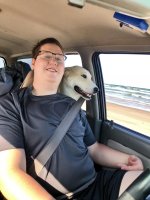
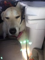
My name is Cullen (bet you can't guess my last name) and I'm a 21 year old senior accounting student at Texas Tech University. My family is in Buda, Texas but I live, work and go to school in Lubbock, Texas. This is my dog Lada. She's a year+ old lab/husky that I rescued this time last summer.


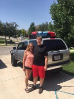
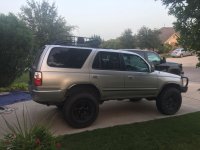
This is my truck. She's a '01 SR5 4x4 auto (no locker) silver beauty with 193k on the clock that I've had for roughly 6k miles. My build, roughly is:
Stripped plastics
285/75r16 Antares Deep Digger tires on stock rims
1" body lift
3" Rough Country lift
ARB offroad bumper
40" led light bar
Unknown winch
Curt roof rack
and not much more. I've spent a while going over various boring maintenance items that I won't go into depth on. Let's call her tuned up and ready to ride. She's bare bones but runs strong and has enough to get me down non-maintained dirt roads. I keep fuel logs every single tank so I'll be sure to keep those numbers posted.

This summer my dog, mother and I are going on an "overlanding adventure" across New Mexico and Colorado to see some places I haven't seen or see some places I like that I haven't been to in a while. I am going to be working off of several different routes, piecing them together to see places I want to while not burning expensive New Mexico gas on boring highways. The four big routes that I'll be referencing for this trip are the New Mexico Backcountry Discovery Route (NMBDR), the Colorado Backcountry Discovery Route (COBDR), the Continental Divide Trail (CDT), and the Enchanted Rockies Trail (ERT). I will also be exploring some routes I've found online around southwest Colorado. This trip will last roughly one full month, so it's going to be a big one. I'll be meeting my girlfriend in Denver for a week in mid-August but otherwise I have no strong daily goals. I am hoping I don't go over one gas station visit a day, otherwise the trip just becomes a painful routine of watching my bank account dwindle. This will mean under 200 and hopefully under 180.

This is a budget trip, no fancy overlanding equipment, just my wits. My recovery gear is a hatchet, a shovel and 100 feet of rope, plus my winch and factory bottle jack. I'll have three days of food, 5.5 gallons of water and 5.5 gallons of gas on me at all times just in case. I've got a few handy camping gizmos but for the most part I will be operating out of a Coleman stove/burner combo, a knockoff yeti 50L cooler, some totes and a fancy tire table. My sleeping arrangements will be a Marmot Tungsten 2P tent, no sleeping platform (though I will eventually build one) or RTT. Just backpacking gear. My mom is stepping it up with a tent cot which takes up most of my cargo space but makes her feel comfortable so it's excusable. I have no intention on hunting for campgrounds or ever sleeping in a hotel/motel, but best laid plans and all that.

My goals for this thread are simple. I want to keep daily tabs on what I've done, where I've been and what I'm planning on doing the next day. I will be adding pictures and .gpx files and/or Gaia links (still deciding) to demonstrate where I've been exactly. With any luck I won't have reliable service so I will continue to write and document and more than likely add a few days’ worth of posts at once. This trip starts Monday, July 23 tentatively.
 

Attachments

  • IMG_3877.jpg
    IMG_3877.jpg
    129 KB · Views: 306
  • IMG_2523.jpg
    IMG_2523.jpg
    130.3 KB · Views: 263
Register to hide this ad
7-23-18. Day 1

Thank you everyone for your support. Aside from just journalizing this for family and myself in the future I really like to see other users reading this. I get so much joy from reading about other member’s adventures that I’m thrilled to add to the collection.

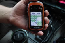
Today was uneventful. We left the house around noon after a frantic last-minute packing episode for those little convenience items. Today was 491.0 miles of Texas highway, light traffic going through San Antonio but otherwise uneventful. I averaged around 14mpg without adjusting for my tires, which is pretty good considering the wind and roof rack. I didn’t use my GPS today so I have no tracks to share, but I assure you it was nothing anyone need repeat exactly. We quickly discovered how important it is to reconsider internal organization as it quickly became inconvenient to bring new stuff into the front seats when everything we wanted was all the way in the back.

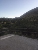
We rolled into Pine Springs campground around 8:30 and were immediately knocked off our feet by the amazing scenery of these beautiful Texas mountains. Pine Springs campground is at the southern edge of the Guadalupe Mountains National Park, but unlike most national parks in Texas it is moderately spread out in its camping. This will more than likely be our last campground of the week, so we are enjoying the vault toilets and running water while we can.

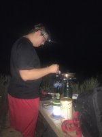
While setting up the small Coleman grill/burner combo we brought, we quickly discovered that I had forgotten to bring the adaptor for the propane canister. Fortunately we have a 9” nonstick pan, 3qt pot and a small burner that attaches to the top of a propane canister. Despite the missing part, we were able to cook store-seasoned pork tenderloins and mixed vegetables under the bright Texas sky. I’m hoping that I can find the adaptor in Weed, New Mexico but otherwise I think we will be fine.

Tomorrow we are going to ride pavement until we get to Dell City, Texas. After that we will follow the NMBDR through Weed, New Mexico where I know there is (very expensive) gas and a convenience store. From there we will see what the clock looks like and then attempt to find ourselves a patch of grass in the Lincoln forest to sleep. Our goal is to start hunting for a campsite around 4:30 and park no later than 7:30. We have 21 days to make it to Denver and see no reason to rush it and not enjoy this amazing opportunity.

That’s all for today, fortunately I have cell service so I can upload before bed. I don’t know when my next will come so stay tuned!
 

Attachments

  • IMG_1873.jpg
    IMG_1873.jpg
    136.2 KB · Views: 198
  • IMG_1881.jpg
    IMG_1881.jpg
    124.4 KB · Views: 209
  • IMG_1882.jpg
    IMG_1882.jpg
    131 KB · Views: 195
  • IMG_1900.jpg
    IMG_1900.jpg
    138.3 KB · Views: 199
  • IMG_1907.jpg
    IMG_1907.jpg
    137.3 KB · Views: 187
7-23-18, Day 2

Today was the first day of our offroad trip, having made it through Texas. In short, we traveled 229.8 miles averaging 14mpg still on the trails. We started our day somewhere around 11:00 and after multiple stops we finished around 6:30, so it was a long and productive.

We began our day folding up our camping gear for the first time. We didn’t find a much better solution for organizing the inside of the cabin but it was better than when we left the house. Despite the large amount of space it takes up (though she disagrees) the tent cot is pretty handy. It folds up and fits back into its bag with the sleeping pad and sleeping bag still in it, effectively shrinking her setup/tear down time to nothing at all. My tent, my sleeping bag, sleeping bag liner, sleeping pad and collapsible pillow however require much more time, effort and patience to fit into their bags and go into the duffel bag on my roof. It’s a system that I’ve used before though, so I am more than used to it and by now have it down to twenty relaxed minutes of getting it packed tightly.

Roughly 30 miles past the campground we made it to Dell City where we gassed up for the day. Despite being a little town, the gas prices were fair. From Dell City it was another 40 or so miles of dusty roads in between cattle ranches. This was a good shake down for how well everything was packed and tied down and aside from a few small objects we passed with flying colors. It eventually led to a small stretch of tarmac and then into the Lincoln forest for our final stretch of dirt for the day. For the most part it was the same as the first half but eventually the terrain turned into what you expect of the Lincoln Forest. Once we made it out onto a deserted farm road – watching the growing storm in the sky – we turned towards Weed. After being blown away at their gas prices and realizing we still had half a tank, we eventually decided to just drive to Cloudcroft. This would have been much faster if we wouldn’t have turned down every forest road looking for a campsite. I really liked Bear Canyon, but my mom refused to camp anywhere named after bears.

Once we made it all the way into Cloudcroft, gassing up and restocking the cooler with ice, we made our way down the NMBDR by a hair more. Roughly three miles back on trail we came to an area that seemed perfect for camping. It was still daylight for two more hours so we celebrated by taking nearly everything we brought out of the truck for the first time. Despite it sprinkling on us while setting up camp, the rain quickly dispersed and we had a nice dry and uneventful night. The lows are around the high 60s so we are getting a little chilly. We were also at roughly 8500 feet.

So far so good. The only major issue that we have found is that the bolts for my roof rack seem to be wearing through my plastic jerry cans, leaving a small bit of plastic rubbed off of my water jug. We are considering better solutions but for now we have cotton towels between the jugs and the cans. This is the best I can do without rubber caps or cutting it off.
 

Attachments

  • DSC02408.jpg
    DSC02408.jpg
    103.3 KB · Views: 142
7-25-18 Day 3

We are currently calling today the best day of the trip. It admittedly doesn’t help that day one was highway and day two was ranch roads. Again in summary, we traveled 91.5 miles of mostly dirt today. We didn’t go to any gas station because we topped off before camping last night but I estimate that this tank will be closer to 13mpg just because we spent more time in 4Hi locked than yesterday. We started at 1:00 PM and quit around 7:30 PM, making it a short but eventful day.

We decided that because we had some privacy we were going to allow the dog to run off some energy and set up the popup shower. We didn’t actually wind up using the solar showers but we did get to have sponge baths out of a bucket, so we don’t smell terribly. After deciding what we were going to do with our day for about 3 hours, we finally decided around 1:00 to just head on down the road. We searched Cloudcroft for about 15 minutes for beer and then decided to just get on with it. My mom did all of the driving for the first two and a half hours of the day while I tried to catch up on logs and play with the cameras. I have her old Sony Nex-5 and she has a brand new Canon Rebel (don’t know the model) and we are attempting to learn photography. On a side note, if anybody has any good tips anything would be appreciated. We are learning as much as we can about focal length and shutter speed.

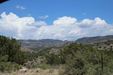
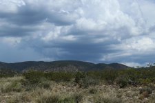
After we got through some light dirt roads with great views of the canyons, we got to amazing paved switchbacks down a mountain side. It may not compare road-wise with some stuff in Colorado or Tail of the Dragon, but the views more than made up for it. Once we got to the fun stuff, I took over. I know it was selfish but I knew what was coming and I couldn’t resist the urge to drive my new 4Runner through it all. For the most part it was tight, rocky and rutted out so I was I was happy with the trail. We stopped for some more pictures, to clear some brush and to take this great video that I’ll hopefully share. It is of my mom getting splashed (accidentally, I’m not that mean) with a lot of mud. The entire time that we were driving through this we were watching a storm grow on the other side of the mountains. This made me want to rush through the tail end because it was mostly the runoff creeks from the mountain the storm was over so I had no intention of getting caught in that. Past that it was mostly windy pavement all the way into Ruidoso. We stopped, got a couple six packs and lunch meat and found our way back into the mountains.

Once we got out of town, we referenced some maps we found at the ranger station and found a campground called Upper Bonita Campground about fifteen miles outside of Ruidoso. It’s got a graded gravel road and some clearings but it’s in no way a legitimate campground. It’s hard being around other people because that means that Lada can’t run wild and explore. This really only makes my nights harder but it’s better than pulling her out of some stranger’s camp or being kicked out entirely (not that there seems to be anyone in charge here). I started cooking as soon as I could because a filling breakfast simply isn’t enough to keep us energized for sitting in the car all day. There is no service here but based on what we saw earlier we could see rain tomorrow or even tonight. We have the truck set up to be loaded quickly in rain so we won’t suffer too much before we find a dry spot to make breakfast on our lone propane burner.

No big issues tonight, just a lot of fun. Tomorrow’s plans are heading to Lincoln and hitting the ERT until Vaughn. From there we will probably just spend Friday on the highway to Truth or Consequences because this entire side of New Mexico will more than likely be under rain then. From there the Gilas but who knows what we will decide then. Hopefully I’ll have these last two days posted before typing day 4 but if not there will be a lot for you to read at once.
 

Attachments

  • IMG_0135.jpg
    IMG_0135.jpg
    138.3 KB · Views: 154
  • IMG_0235.jpg
    IMG_0235.jpg
    136 KB · Views: 153
7-26-18 Day 4

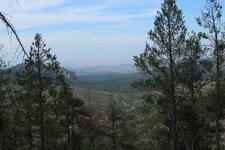
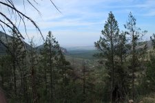
Today’s trip was from Bonita Lakes to Capitan Gap. I cannot describe how beautiful this place is, so I’m hoping the attached pictures do it justice. We started today around noon or so after yet again completely reorganizing the truck and got off the trail around 7:00. We traveled roughly 83.1 miles today, getting no doubt single digit mpgs due to the fact I was in 4Hi locked for about three hours of trails. Today’s fillup before the trails was about 13.5, so not bad. This was mostly 2Hi through windy uphill roads.

As mentioned, we spent the morning reorganizing the truck. Today’s experiment is putting as much on the roof as possible and having only bags and containers – solid things we can quickly remove – in the cabin. This seemed to work out surprisingly well and we are even able to not take everything down from the roof tonight, or at least not yet. We are still in the early stages of waking up every morning in the mountains and are still in complete awe at every leg of the trip. This morning we washed our hair and I showered with one of the solar showers. It never quite warmed up and the spigot was located too high so in the future we will be using it for its 20L dry bag function and using the other solar shower since it warms up faster and has the valve lower.

Before leaving the Smokey Bear district of the Lincoln Forest we decided we were going to do some light hiking at Crest Trail. We only went a mile round trip but it was more than exhausting enough for us. Even Lada was tired, which is always nice to see. After working our way through some more of the NMBDR to get onto NM 380, we pointed our nose towards Capitan. In the city we stocked up on more food, ice (the cooler got left open a little too long in the heat yesterday) and more water. We neglected to fill up on gas thinking there would be some in Lincoln. This proved a mistake so we waster about 45 minutes driving to Hondo to top off.

Once we got onto section 2 of the ERT things got exciting. It took us roughly 2 hours to cover about ten miles in 4Hi locked. It started out washboard gravel for about a mile and then quickly turned into incredibly rocky and degraded trails. Eventually we caught a forest road to the Capitan Gap and decided to turn right onto an interesting looking trail. This was probably the best decision we made all day because this trail took us towards the top of a mountain side facing the gap. It was a 4Hi locked crawl to get there, and I even got to hit 4Lo locked on the way down. My mom decided that she was going to walk the 50 yards down the steep mountain side instead of ride with me going down her, despite the descent being kinder to the inside of the truck than the climb. We only got to about 7600, lower than we have been this week, but it seemed higher due to the overwhelming vastness of the gap.

We set up camp where we made the right turn. It looks as if it’s been camped on often and even has a fire pit, but no dead brush around to burn so we will likely go without a fire tonight. We are yet again skirting heavy thunderstorms through my mom’s careful watching of the radars and sheer guesswork on my part. I can’t wait to travel another 85 miles through this terrain to make it to Vaughn. It’s a good thing we are starting right on the trail tomorrow. If it rains it’s going to be a sort of hell getting through but I’m sure we will.

That’s it for today, finally I’m going to upload three days of logs so prepare for a lot of reading.
 

Attachments

  • IMG_0271.jpg
    IMG_0271.jpg
    140.9 KB · Views: 155
  • IMG_0275.jpg
    IMG_0275.jpg
    139.2 KB · Views: 151
  • IMG_0276.jpg
    IMG_0276.jpg
    122 KB · Views: 153

Members online

Forum statistics

Threads
278,312
Messages
3,554,089
Members
248,016
Latest member
Advally Service

Trending content

Back
Top