
You are using an out of date browser. It may not display this or other websites correctly.
You should upgrade or use an alternative browser.
You should upgrade or use an alternative browser.
Is October 2004, 4ROTM gone?
- Thread starter JB.
- Start date
Register to hide this ad


ToyotaDoodz
New member
It's not the original but here are a couple with the 4Runner related images reposted.
http://www.toyota-4runner.org/showthread.php?s=&threadid=8222
http://www.toyota-4runner.org/showthread.php?s=&threadid=8297
http://www.toyota-4runner.org/showthread.php?s=&threadid=8222
http://www.toyota-4runner.org/showthread.php?s=&threadid=8297

JB.
New member
Thanks for the replies.
I actually have page one as an .mht file. I was more interested in the discussion as I may be headin' out to do some Colorado trails soon. Not as soon as I expected, however, as the book I got, "4WD Adventures: Colorado", states that most of them don't open up until mid-June.
Toyotadoodz, you mentioned a little nervousness on the Schofield Pass/Devil's Punchbowl trail due to 4th gen width. Was that a body damage moment or a life 'n limb moment.
I actually have page one as an .mht file. I was more interested in the discussion as I may be headin' out to do some Colorado trails soon. Not as soon as I expected, however, as the book I got, "4WD Adventures: Colorado", states that most of them don't open up until mid-June.
Toyotadoodz, you mentioned a little nervousness on the Schofield Pass/Devil's Punchbowl trail due to 4th gen width. Was that a body damage moment or a life 'n limb moment.
ToyotaDoodz
New member
I've done trails in Ouray/Silverton area as early as late May but even on years that there was little snow, the passes will not be open that early. They've had a lot of snow this winter. There are a few web sites that post trail conditions and when the passes are open. You can check http://www.bushducks.com/tripreps/passopen.htm and http://www.4x4trails.net/index.php for evidence that trails are starting to open.
I've had spring snow block passes overnight in June. Generally, late June on is OK if you're trying to plan in advance. Many of the lower parts of the trail will be open and you can go up and back but that makes planning a day of runs harder.
I'm glad to help with any info or advice on trails if you're interested. I just love the area.
The best books I've ever found with specific trail info are by Charles A Wells. The "Guide to Colorado Backroads & 4-Wheel Drive Trails" is a book even a first timer can use to plan an entire trip having never seen the area. His trail descriptions are that good. The first book, Volume 1, covers the Ouray/Silverton area.
OK, as to the Schofield Pass/Devil's Punchbowl trail, it has a few places that are VERY tight. That is as in solid rock with in 2 - 3 inches of sheet metal on both sides at the same time. It's a section where you have to squeeze between two immovable jagged boulders. I've run it in my 3rd GEN with no problem. The 4th GEN definitely has a wider body up around the doors and this is a killer on that trail. It took a good 5 minutes to inch past this section with a spotter. The other thing is the entire canyon is long with only a couple of places to pass. If it's a crowded day you may have to back up a LONG way to pass. Backing up on terrain that is difficult to go forward on is not fun.
If your 4th GEN is "not" lifted you will tear the heck out of it on this trail. Even with a 3" lift you're going to hit solid rock on the bottom in a few place no matter how good your tire placement is. There's just no where else to go due to lack of room and no rocks to pile under the tires. The canyon section has been blasted out of solid rock to make a shelf road. It's not gravel based at all in the canyon.
Coming from the top headed toward Marble, there is a short but very deep water crossing. I'd not do it in the spring run off. The water is deep and fast even in August. The trail itself is like a little shelf road that's never very high above the river itself. It's not an altitude thing at all. I was surprised when I first saw it after all the things I'd heard. From the stories, I assumed it was 1,000 ft above the river or something.
I know there are a lot of signs on this trail to scare away inexperienced drivers because of the van full of people that slid off an off-camber section and died on this trail. In a 4th GEN you will need more skill to do it undamaged because of the extra vehicle width and lack of stock 4th GEN clearance. Darren on the other site has a very good trip report that makes it sound easy. He forgets that his 3rd GEN has a lot of clearance, is not stock, and is not as wide. He has a great rig, I've seen it zooming past me on the trail.
My stock 3rd GEN had no trouble. I don't recommend any "stock" 4th GEN do this trail. Even with a lift, you may come out with body sheet metal damage. Sliders are in the wrong place to help on this trail.
I hope this helps.
I've had spring snow block passes overnight in June. Generally, late June on is OK if you're trying to plan in advance. Many of the lower parts of the trail will be open and you can go up and back but that makes planning a day of runs harder.
I'm glad to help with any info or advice on trails if you're interested. I just love the area.
The best books I've ever found with specific trail info are by Charles A Wells. The "Guide to Colorado Backroads & 4-Wheel Drive Trails" is a book even a first timer can use to plan an entire trip having never seen the area. His trail descriptions are that good. The first book, Volume 1, covers the Ouray/Silverton area.
OK, as to the Schofield Pass/Devil's Punchbowl trail, it has a few places that are VERY tight. That is as in solid rock with in 2 - 3 inches of sheet metal on both sides at the same time. It's a section where you have to squeeze between two immovable jagged boulders. I've run it in my 3rd GEN with no problem. The 4th GEN definitely has a wider body up around the doors and this is a killer on that trail. It took a good 5 minutes to inch past this section with a spotter. The other thing is the entire canyon is long with only a couple of places to pass. If it's a crowded day you may have to back up a LONG way to pass. Backing up on terrain that is difficult to go forward on is not fun.
If your 4th GEN is "not" lifted you will tear the heck out of it on this trail. Even with a 3" lift you're going to hit solid rock on the bottom in a few place no matter how good your tire placement is. There's just no where else to go due to lack of room and no rocks to pile under the tires. The canyon section has been blasted out of solid rock to make a shelf road. It's not gravel based at all in the canyon.
Coming from the top headed toward Marble, there is a short but very deep water crossing. I'd not do it in the spring run off. The water is deep and fast even in August. The trail itself is like a little shelf road that's never very high above the river itself. It's not an altitude thing at all. I was surprised when I first saw it after all the things I'd heard. From the stories, I assumed it was 1,000 ft above the river or something.
I know there are a lot of signs on this trail to scare away inexperienced drivers because of the van full of people that slid off an off-camber section and died on this trail. In a 4th GEN you will need more skill to do it undamaged because of the extra vehicle width and lack of stock 4th GEN clearance. Darren on the other site has a very good trip report that makes it sound easy. He forgets that his 3rd GEN has a lot of clearance, is not stock, and is not as wide. He has a great rig, I've seen it zooming past me on the trail.
My stock 3rd GEN had no trouble. I don't recommend any "stock" 4th GEN do this trail. Even with a lift, you may come out with body sheet metal damage. Sliders are in the wrong place to help on this trail.
I hope this helps.
JB.
New member
ToyotaDoodz said:...I hope this helps.
Thanks for the detailed reply. I'll definitely check out the links.
I'll also pick up the Wells book. Can't have too much info and it'll be interesting to compare books.
Since reading your post, I've been trying to reconcile your description with what's written in my book. Then it occurred to me that this book (and probably all of them) was written a few years ago (1999). A stock vehicle then, say, a 4runner, had 11" clearance and was a little shorter and narrower. The stock and mid-size referred to in the book are not the stock and mid-size of today. That seems to answer the apparent discrepency. Note: The authors claim to have taken a suburban over that trail. No mention of what it looked like afterwards, however.
Around here, any trail book that was written less than about a month ago would be mostly obsolete due to the heavy rain year and unprecedented washouts of many dirt roads. That trail being bedrock, however, seems to rule out the trail deterioration explanation.The way I'm going it wouldn't surprise me at all if I end up with a lift. However, I'm enjoying the incrementalism of slow upgrading. It was a kick to go over the same trail with beefier/bigger tires that I had gone over with the stock H/Ts. When and if I get a lift, I'll really enjoy it.
Did you see the Crystal Mill? That was my main reason for wanting to do the trail. I wonder if the mill is visible by any other vehicle route.
I'll cut my teeth on easier trails. I'll do Imogene and Engineer and let you know how they went "stock". I don't mind going really slow with constant attention to tire placement. I've gotten quite accustomed to using my skid plates. (Is that a good thing?) And if you're wondering, the running boards are already off, though the protection they offered during their noble sacrifice makes me seriously consider sliders. Alas, I was too late for the Hanna slider group buy.
The book refers to peak season but I don't know what that means. When would you recommend going that's the least crowded?
Thanks again for all the info.
Last edited:
ToyotaDoodz
New member
JB, you sound like my kind of off roader! Mine's a daily driver so it needs to get me there and back and I don't get in a hurry. I'm no Baja racer like some I've seen on trail. Besides we like to enjoy the scenery while we're there.
I like the Well's books because you can read his detailed description and pretty well know exactly what parts of a trail might give you trouble while you're still at home. Example here. His time estimates are very good. Makes it easy to plan a trip before you go. I have both Volumes of Colorado but Vol 1 has my favorite areas and I have the Arizona book. He also has Moab and California books.
You're right on the nose about the trail descriptions and vehicle sizes. A suburban is what slid off into the Punch Bowl and killed 7 people around 1970. Your basic stock 3rd GEN or older 4Runner has enough clearance to do this trail without damage. The lowered and wider 4th GEN will have some trouble. You wouldn't think a couple of inches in width would make a lot of difference and it usually doesn't except for that one spot on this trail. It's possible that this one rock was not previously there and fell later. I ran the trail for the first time in 2000 in my 3rd GEN. From July on the vegetation at the top of the trail will get higher than your vehicle and you almost have to push through it so you will get trail rash. There's no where to turn around and in that section you can't see anyone coming until they're 10ft away.
The Crystal Mill is accessible by car (part of the problem) from the town of Marble. I'll dig my pics out. I'd posted them here but took them down with the new forum rule about not being 4 Runner related. There is SERIOUS signage to keep people from driving farther up.
Being used to a stock 2001 4Runner, I took my stock 03 to run some Arizona trails. Very capable but dang the front end was LOW compared to the 01. I quickly learned that I needed a lift to continue to run the kind of trails I was accustom to or I was going to leave parts behind. Don't get me wrong, stock is very capable but it made me too nervous to enjoy it as much. The 3" Revtek gave "slightly" more clearance of the stock 01. I've been extremely pleased with it.
The skid plates on the 3rd GEN will give you some protection but they're very thin and will crush at some point. I work real hard to not use them. My Running boards quickly came off so I wouldn't drag them off.
Peak season in CO is 4th of July through August. I've run the trails from late May to early October. Each month's weather is different. Cold and snow with limited access in May, June, October. July will have cold mornings, warm up quickly, and afternoon thunderstorms and rain. This is not bad because it keeps the dust down and washes all the dirt off daily. August is warmer and dryer and dustier. Fall colors come on in September as to high pass snows. They may or may not melt overnight. The colors are awesome!!
Crowds? More so every year but they're never that bad. There was a national Jeep jamboree in Ouray last year which made lodging tight but the trails were not bad. If a large group is caravaning they "might" let you pass or you can wait them out for a while.
All other factors aside, I personally like July. The wildflowers in the passes are in full bloom and will knock your socks off, but it WILL rain. If that bothers you, pick August. I can run with the windows down in July and not get dusted much but if you do that in August you'll bring 30lbs of Colorado dust back on your seats. I've had to run with the A/C on in August because it was so hot and dusty. I like the windows down to smell the pines and hear noisy Jeeps coming.
I've learned to do breakfast at 6am and be "on" the trial at 7am. You'll virtually be by yourself for the first 2 - 3 hours until the on coming traffic reaches you. It works. I highly recommend that technique when going up Engineer from the Ouray side. The lower section is doable at stock but it's EXTREMELY rocky and you will need to GO SLOW so you don't want to have to mess with others passing you. That's the only "bad" section of Engineer so if you want to by pass it you can always do the Alpine Loop from Silverton via Animas Forks which meets Engineer at the half way point then on to Lake City and return via Cinnamon Pass. There are several routes from there back to 550 with out taking the rough section of Engineer back to 550.
Imogene is fun and very popular. It and the bottom of Engineer are slightly more technical than some of the other trails.
I can go on for hours if you like. Can you tell I like the Ouray area?
Mine's a daily driver so it needs to get me there and back and I don't get in a hurry. I'm no Baja racer like some I've seen on trail. Besides we like to enjoy the scenery while we're there.I like the Well's books because you can read his detailed description and pretty well know exactly what parts of a trail might give you trouble while you're still at home. Example here. His time estimates are very good. Makes it easy to plan a trip before you go. I have both Volumes of Colorado but Vol 1 has my favorite areas and I have the Arizona book. He also has Moab and California books.
You're right on the nose about the trail descriptions and vehicle sizes. A suburban is what slid off into the Punch Bowl and killed 7 people around 1970. Your basic stock 3rd GEN or older 4Runner has enough clearance to do this trail without damage. The lowered and wider 4th GEN will have some trouble. You wouldn't think a couple of inches in width would make a lot of difference and it usually doesn't except for that one spot on this trail. It's possible that this one rock was not previously there and fell later. I ran the trail for the first time in 2000 in my 3rd GEN. From July on the vegetation at the top of the trail will get higher than your vehicle and you almost have to push through it so you will get trail rash. There's no where to turn around and in that section you can't see anyone coming until they're 10ft away.
The Crystal Mill is accessible by car (part of the problem) from the town of Marble. I'll dig my pics out. I'd posted them here but took them down with the new forum rule about not being 4 Runner related. There is SERIOUS signage to keep people from driving farther up.
Being used to a stock 2001 4Runner, I took my stock 03 to run some Arizona trails. Very capable but dang the front end was LOW compared to the 01. I quickly learned that I needed a lift to continue to run the kind of trails I was accustom to or I was going to leave parts behind. Don't get me wrong, stock is very capable but it made me too nervous to enjoy it as much. The 3" Revtek gave "slightly" more clearance of the stock 01. I've been extremely pleased with it.
The skid plates on the 3rd GEN will give you some protection but they're very thin and will crush at some point. I work real hard to not use them. My Running boards quickly came off so I wouldn't drag them off.
Peak season in CO is 4th of July through August. I've run the trails from late May to early October. Each month's weather is different. Cold and snow with limited access in May, June, October. July will have cold mornings, warm up quickly, and afternoon thunderstorms and rain. This is not bad because it keeps the dust down and washes all the dirt off daily.
August is warmer and dryer and dustier. Fall colors come on in September as to high pass snows. They may or may not melt overnight. The colors are awesome!!Crowds? More so every year but they're never that bad. There was a national Jeep jamboree in Ouray last year which made lodging tight but the trails were not bad. If a large group is caravaning they "might" let you pass or you can wait them out for a while.
All other factors aside, I personally like July. The wildflowers in the passes are in full bloom and will knock your socks off, but it WILL rain. If that bothers you, pick August. I can run with the windows down in July and not get dusted much but if you do that in August you'll bring 30lbs of Colorado dust back on your seats.
I've had to run with the A/C on in August because it was so hot and dusty. I like the windows down to smell the pines and hear noisy Jeeps coming. I've learned to do breakfast at 6am and be "on" the trial at 7am. You'll virtually be by yourself for the first 2 - 3 hours until the on coming traffic reaches you. It works. I highly recommend that technique when going up Engineer from the Ouray side. The lower section is doable at stock but it's EXTREMELY rocky and you will need to GO SLOW so you don't want to have to mess with others passing you. That's the only "bad" section of Engineer so if you want to by pass it you can always do the Alpine Loop from Silverton via Animas Forks which meets Engineer at the half way point then on to Lake City and return via Cinnamon Pass. There are several routes from there back to 550 with out taking the rough section of Engineer back to 550.
Imogene is fun and very popular. It and the bottom of Engineer are slightly more technical than some of the other trails.
I can go on for hours if you like. Can you tell I like the Ouray area?
JB.
New member
Well, your record is intact of providing at least one interesting link per message. I appreciate the detailed info. Since my normal hours are just about the opposite of getting up at 6am, I'd better start training soon. July sounds pretty good. I love rain and I suppose the washed areas in those trails are very old and well established. Off roading around here in rainy conditions is asking for trouble. I don't like mud much but that may change a bit now that the mud catchers...I mean, running boards are gone.
At this point, I think I'm going to have to do Engineer from the Ouray side. I get to see all that scenery and stuff, but I gotta let the new tires have some fun too.
At this point, I think I'm going to have to do Engineer from the Ouray side. I get to see all that scenery and stuff, but I gotta let the new tires have some fun too.
ToyotaDoodz
New member
The majority of the trails in that area of Colorado are very rocky. There is some soil but very little unless you're in an area of recent mining or mine reclamation. The Corkscrew trail between Animas Forks and 550 can get a bit soggy just above 550 but it's not bad. Many years of snow melt and rain have washed them down to rock and when the county clears them each spring, the bulldozer stirs it up again.
I always stay in Ouray because it's very central and easy to base camp from. I'd do the lower portion of Engineer on the second or third day just to get acclimated to the terrain. It can be a little unnerving if you haven't done that kind of rocky trail before. Slow is the key.
I always stay in Ouray because it's very central and easy to base camp from. I'd do the lower portion of Engineer on the second or third day just to get acclimated to the terrain. It can be a little unnerving if you haven't done that kind of rocky trail before. Slow is the key.
Last edited:
JB.
New member
ToyotaDoodz said:If you're interested, I can give you a suggested iteneray based out of Ouray that will fill each day with new trails and no repeats for as many days as you want. That's what I love about that area.
Yeah, that'd be great.
ToyotaDoodz
New member
Engineer is part of the famous Alpine loop. The lower section we've been talking about is only about 1/10 of the trail. It goes all the way to Lake City. If you do it, it's an all day round trip and well worth it. The rest of the loop is easy and gorgeous. Well, it's all gorgeous.
You drive south of Ouray on 550 only a mile or so. On that sheer shelf road if feels much farther. You can always tell the drivers that have not driven it before because they drive right down the middle of the road.:bugeye:
If you're interested, I can give you a suggested itinerary based out of Ouray that will fill each day with new trails and no repeats for as many days as you want. That's what I love about that area. I like to start out easy and increase to harder or more technical trails as we go. Depends on the weather to.
Also, if you plan to lodge in Ouray or Silverton, you need to make a reservation 3 - 4 weeks in advance (farther out if you can). If you're a AAA member, the travel guides have great motel info. If not, I can look it up for you.
I like Ouray because there are more places to eat and stay. For much cheaper gasoline, make the 10 mile drive north to Ridgeway where there are three gas stations. Ouray only has one.
You drive south of Ouray on 550 only a mile or so. On that sheer shelf road if feels much farther.
You can always tell the drivers that have not driven it before because they drive right down the middle of the road.:bugeye: If you're interested, I can give you a suggested itinerary based out of Ouray that will fill each day with new trails and no repeats for as many days as you want. That's what I love about that area. I like to start out easy and increase to harder or more technical trails as we go. Depends on the weather to.
Also, if you plan to lodge in Ouray or Silverton, you need to make a reservation 3 - 4 weeks in advance (farther out if you can). If you're a AAA member, the travel guides have great motel info. If not, I can look it up for you.
I like Ouray because there are more places to eat and stay. For much cheaper gasoline, make the 10 mile drive north to Ridgeway where there are three gas stations. Ouray only has one.
Last edited:
ToyotaDoodz
New member
JB. said:Yeah, that'd be great.
Sorry, I edited that into one long post.
OK, I'll get my book out so I have the trail names spelled correct
and post here.You're going to have a blast!!!
Do you have an idea where you're staying and how long you're going to be there?
JB.
New member
ToyotaDoodz said:Do you have an idea where you're staying and how long you're going to be there?
Nah, my time is my own for a while so I can go when I want. I don't like to plan lodging very much, but if I have to I'll bite the bullet.
ToyotaDoodz
New member
Your headed to an area that you can't get a room on short notice. While there a lot of trails to dilute the vehicles, the towns are very small and rooms fill up fast. Last year's trip was spur of the moment and I tried to make a reservation 10 days ahead. I lucked out after the 7th place and we had to change rooms 2 times in 6 days. It just so happened that there was a national Jeep jamboree that weekend, but you can never tell who is going to be there and when. Weekends are busiest. If you're not camping, I'd strongly recommend reserving ahead. The crowds are in the towns. The trails aren't that bad.
ToyotaDoodz
New member
Ok, I'll get my book out this weekend and give you some options that you can mix and match. You're going to have a blast.
ToyotaDoodz
New member
JB, I'm going to start a new thread with the trail descriptions to make it easier for others to find. I'll post the link here.
See http://www.toyota-4runner.org/showthread.php?s=&threadid=10115
See http://www.toyota-4runner.org/showthread.php?s=&threadid=10115
Last edited:
JB.
New member
ToyotaDoodz said:JB, I'm going to start a new thread with the trail descriptions to make it easier for others to find. I'll post the link here.
See http://www.toyota-4runner.org/showthread.php?s=&threadid=10115
Thanks a ton. It took a little work putting that together, but hopefully the re-living was worth it.
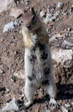
This is how I feel lookin' at the pics.
(Incredible monk shot)
Attachments
ToyotaDoodz
New member
Thanks! I know the trails by heart but some of the name spellings I wanted to verify from the book.
We stopped for a moment and I just looked down and there she was.
We stopped for a moment and I just looked down and there she was.

