No not sure. Let me spend a little more time looking into our posted options.
Sent from my SAMSUNG-SM-G890A using Tapatalk
i'm looking forward this one... it will be the first weekend i have free in June. might even convince wifey to come out with me... if it's on the Saturday
I knew that I planned it around your schedule, just for you coach!!
That's the kinda guy I am...are ya sensing the sarcasm,hahaha.
Yeah and bringing the wifey not a good idea, your gonna hold back and skip the ones you really wanna do and just keep it simple.
But I understand the other side of it wanting to involve her and show her how it all goes down when we do these meet up's so she understands, we all do it. But now we ask if they wanna go in hopes they say no and go ahead and have fun and be careful. Looking like a good husband or boyfriend for asking and then saying are you sure you don't wanna go? It's gonna be good times and a nice day with cool views? Well ok then, see ya later!!
J/k
No not really. Lol
Oh yeah so what I'm gonna have to do is either send it to you or bring it with me to give to you at the next meet, I downloaded all the video footage from our pre run onto a usb memory stick for you to view and keep for yourself. So let me know. Pm me your address and I will mail it if you want.
Actually that would help a lot since I'm newer to SoCal and newer still to the back roads.If you need photos of each different area let me know or some attachments with good references and descriptions of a certain area let me know.
I love Anza Borrego but it's probably too late IMHO:
https://www.wunderground.com/us/ca/borrego-springs/zmw:92004.1.99999
I'm up for Big Bear..


What are the min vehicle requirements for these runs?
I'm still stock TE with sliders and 285/70/17 rubber.
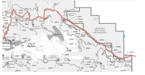
Throwing out a route for a big bear run if everyone leans in that direction.
May be a bit far for a starting point for most of us but I think it would be worth it.
Starting out at rimrock/pioneer town north of Joshua Tree,
get onto Burns Canyon rd and head up the mountain( rated as a green circle).
The trails splits off into Smarts Ranch rd.
Take that to its end and onto hwy18 for a mile or so.
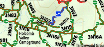
Get onto 3N61 (Jacoby canyon rd) rated as a blue square and take it to its end as it intersects 3N16 (green circle).
Head east on 3N16 and turn onto 3N32 (green circle) due north.
Just before it hits John Bull head south west onto 3N07A( blue square).
Take that onto 3N43( green circle) heading west.
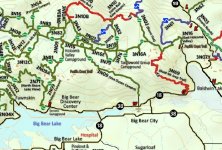
Hop onto 3N10 heading south( this portion is a green circle).
Get back onto 3N16 heading east.
Then onto 2N09 due south to its end at Hwy 38 .
Let me know what you guys think
What's your estimated trail time? From start to finish?
I dig on the route from start to finish you got a huge amount of that area covered and perfect starting point. This will also have everyone headed back in the direction of home and good camping options. Also good camping options along this route to come back too as well.