Oklahoma 4Runners

Got some springs, and thinking of selling the roof rack I just had powder coated....for right now.

I have been kicking around the idea of a roof rack
What kind how much and where are you located.....and all that kind of information
 
I have been kicking around the idea of a roof rack
What kind how much and where are you located.....and all that kind of information

I’m in Lawton area, it was made by eimkeith here on the forum. Depending on work, I am going to try to get it picked up today or tomorrow.
 
Possible trail options

Hey y'all, I've been doing a little research because I'm getting an interest in overlanding and have come across some possible options for off-road expeditions through our great state.

Talimena Byway
Talimena National Scenic Byway Home - Talimena National Scenic Byway

Trans America Trail
Runs from Tennessee to Oregon, with a portion of the trial coming from Arkansas into Oklahoma, and out to the pan handle into Colorado. It is meant to be traveled from East to West however I'm sure it doesn't matter that much. It is ranked by the Adventure Journal as one of the top 5 North American overlanding trails.
TransAmTrail.com is the exclusive source for Maps Roll-Charts, and GPS Tracks for navigating the Trans-America Trail - an exciting, off-road, dual-sport motorcycle adventure across the United States
 
Camping suggestions?

Does anyone have any decent camping spots they know of throughout Oklahoma? I would prefer to not pay for a campsite when I can just drive my truck in the woods and claim a spot. I was thinking Broken Bow would be a good place to start, but I am open to any suggestions.

Thanks!
 
Christmas Party Tulsa 4Wheel Parts

DEC 9 Tulsa OK 4 Wheel Parts Overlander's Christmas Party & Toys for Tots drive.
 
Last edited:
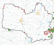
Without digging through all 45 pages on that forum Is this map correct?
 

Attachments

  • 821E5264-2A6C-4CB9-ACC7-591EC0F2F810.jpg
    821E5264-2A6C-4CB9-ACC7-591EC0F2F810.jpg
    79.4 KB · Views: 121
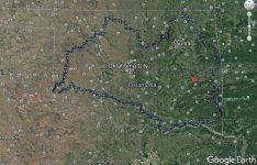
On the first page of the forum you can save the file and open it using whatever GPS mapping program you use. I opened it with Google Earth Pro as a KMZ and played with the layers a little bit until I got this trail. Whoever made it did a great job labeling a ton of points.
 

Attachments

  • OAT Route Snip.jpg
    OAT Route Snip.jpg
    140.9 KB · Views: 112

Members online

Forum statistics

Threads
278,310
Messages
3,554,078
Members
248,016
Latest member
Advally Service

Trending content

Back
Top