Warthog Build and Adventure Thread

Sounds like a nice trip. I was just out there two weeks ago. Passed by the same places on my way home too. I traveled south from Moab to Blanding, then southwest to Bluff, Mexican Hat and through Monument Valley before turning back east at Kayenta to Farmington and eventually home through New Mexico and West Texas. No snow for me just two weeks ago, though!

Sorry to hear you got turned back from the end of Top of The World. It is an awesome place. I bet you would have been fine though. Last time I did that trail I don't remember anything other than those two ledges you mentioned that would cause serious trouble.

Heh yeah, same route :D

Yeah, just having a spotter to let me know about my left tire position and that rock on the right would have helped a ton! I'll get it next time :)
 
Awesome pictures.

If you are interested in an early spring Utah trip lets talk. I don't need a big group either but my truck is to old to go it alone in the wilderness. I'd like to go out there when first snow melt hits. Mid-March?
 
Dude I'm way overdue for commenting on your trip, but thanks for the advice about Moab, you definitely didn't need to hit me up from the road! The pics are making me drool, the wife was getting excited for the trip until she saw the snow, then her Florida genes kicked in and she's like "Ew, there won't be snow when we go, right?". And like a good husband I lied through my teeth and assured her that no, it will not snow in Utah in the end of November! I'll cross that bridge when I get to it!

What kind of camera set-up were you shooting? Great trip report and awesome pics!!
 
Last edited:
Dude I'm way overdue for commenting on your trip, but thanks for the advice about Moab, you definitely didn't need to hit me up from the road! The pics are making me drool, the wife was getting excited for the trip until she saw the snow, then her Florida genes kicked in and she's like "Ew, there won't be snow when we go, right?". And like a good husband I lied through my teeth and assured her that no, it will not snow in Utah in the end of November! I'll cross that bridge when I get to it!

What kind of camera set-up were you shooting? Great trip report and awesome pics!!

And you're a good 5 hours closer!!!

I was at one of the higher spots in the area when I got snowed on (5700ft) Moab itself is about 4000 so camping around there, sand flats or south near the sand dunes would be less chance for snow. BUT you never know :D

If you are camping, you might as well stay at Sand Flats, it's right near town, can go in for a good meal at any time. It'll be empty. $10 a night. OR when I'm out with my wife, we usually stay in a hotel room and make daytrips adventures but then have a warm place and a soft bed to come back to at night.

I just bought a new camera a month ago. Nikon D810 with the 24-120 kit lens. Super nice lens, extremely sharp and allows you to use every pixel. The full size images are awesome :) Part of the trip was to field test the camera. Very happy over all. Only issue I had was with some vinetting on wide shots which takes some care to get rid of in some photos (Not the ones where I purposely enhanced it for effect :D)
 
Last edited:
Awesome pictures.

If you are interested in an early spring Utah trip lets talk. I don't need a big group either but my truck is to old to go it alone in the wilderness. I'd like to go out there when first snow melt hits. Mid-March?

ATM I have my spring Moab trip ear marked for taking the Wife out to see the sights trip. Very light offroading, seeing arches etc. She's never been at all. That'll be in May.

But if I haven't blown my vacation and have the itch an earlier trip might be possible :)
 
Story: So after 60 miles of travel through the back country, I am about 1/2 mile from the 24 highway. All that stands between me and being back in civilization is a river crossing that I've never seen before.

I wade into it, about knee deep. Hmm.. And it's not just a crossing, I have to go in, go up stream a ways then out the other side. I was a little uneasy about it, There are SO few people out here (like no one) I don't want to get stuck in a muddy river. Even at 1/2 mile from the road, the nearest people are 20 miles in either direction.
Great report and nice pictures.
I crossed the river ford with a rental Tahoe stock 4x2 with street tires! The trick is stay on the south side as long as possible (for you, reach the far side immediately after entering the water). The bottom is hard rock with only a few inches deep. At first, I was a lot worried since it was a rental truck, but everybody I asked about were telling me this is no problem, and now I confirm this.
 
Last edited:
New Guy here, just joined after picking up a 4 runner. Your build and adventures alone have made this forum awesome, I am inspired to get back out there and hit the trails. Nothing could be more therapeutic, (cept maybe fly fishing). A million thanks for all your efforts!!
 
New Guy here, just joined after picking up a 4 runner. Your build and adventures alone have made this forum awesome, I am inspired to get back out there and hit the trails. Nothing could be more therapeutic, (cept maybe fly fishing). A million thanks for all your efforts!!

Wow thanks! :D

Welcome to the forum, I too got a lot of my inspiration from here and also meeting up with people for trips. I just got back from 3 days in Death Valley with [MENTION=46138]chmura[/MENTION] and a couple others. Never would have met them or had their experience to piggy back on without T4R :)

Will have pics tomorrow maybe!
 
Wow thanks! :D

Welcome to the forum, I too got a lot of my inspiration from here and also meeting up with people for trips. I just got back from 3 days in Death Valley with [MENTION=46138]chmura[/MENTION] and a couple others. Never would have met them or had their experience to piggy back on without T4R :)

Will have pics tomorrow maybe!

Was indeed an awesome trip! Thanks for coming.

Now post some pics!
 
And you're a good 5 hours closer!!!

I was at one of the higher spots in the area when I got snowed on (5700ft) Moab itself is about 4000 so camping around there, sand flats or south near the sand dunes would be less chance for snow. BUT you never know :D

If you are camping, you might as well stay at Sand Flats, it's right near town, can go in for a good meal at any time. It'll be empty. $10 a night. OR when I'm out with my wife, we usually stay in a hotel room and make daytrips adventures but then have a warm place and a soft bed to come back to at night.

I just bought a new camera a month ago. Nikon D810 with the 24-120 kit lens. Super nice lens, extremely sharp and allows you to use every pixel. The full size images are awesome :) Part of the trip was to field test the camera. Very happy over all. Only issue I had was with some vinetting on wide shots which takes some care to get rid of in some photos (Not the ones where I purposely enhanced it for effect :D)

Based on the temps, I think we're going to bed down in a hotel for the night, she was OK with camping until I mentioned lows in the 20s! She shoots a Canon 7d mark II, and I just got her a 24-105mm lens so I'm stoked on the shots she'll get!! Too bad it's a full moon for the next few nights, we may have to get up wicked early to get some decent night shots. Should be a fun trip, just runnin' and gunnin', but hopefully it puts a bug in her to go back more frequently!
 
Based on the temps, I think we're going to bed down in a hotel for the night, she was OK with camping until I mentioned lows in the 20s! She shoots a Canon 7d mark II, and I just got her a 24-105mm lens so I'm stoked on the shots she'll get!! Too bad it's a full moon for the next few nights, we may have to get up wicked early to get some decent night shots. Should be a fun trip, just runnin' and gunnin', but hopefully it puts a bug in her to go back more frequently!

Take landscape shots under the moon! Moon, no moon, doesn't matter. Different types of shots for both. In fact you kind of want at least 1/4 moon behind you for fill lighting when doing milky way shots anyway or everything else is just utter blackness :D

When I have the wife we frequently use a hotel for base of operations and do day trips to sights so I know how that goes :D Have a great trip!
 
My build will be similar, have toytec lift, bfg's installed. Shrockworks front bumper, demello sliders, ramsey winch, and cbi rear bumper on order. Your tutorial on the cbi rear bumper is gonna help a bunch im sure.

Probably gonna try to make my own roof rack, the boss cut me off so no gobi for me.

Holler if you make it out New Mexico way.
W8
 
My build will be similar, have toytec lift, bfg's installed. Shrockworks front bumper, demello sliders, ramsey winch, and cbi rear bumper on order. Your tutorial on the cbi rear bumper is gonna help a bunch im sure.

Probably gonna try to make my own roof rack, the boss cut me off so no gobi for me.

Holler if you make it out New Mexico way.
W8

I'm a bit ashamed that I didn't try to make more parts myself. I have all the equipment but impatience gets to me!

Hopefully the weather will be nice for the bumper install, it's a long day :)
 
Death Valley 2015

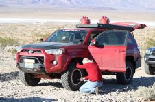
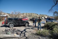
Last weekend I went to Death Valley for three days of offroading with [MENTION=46138]chmura[/MENTION] and a couple of friends of his and a Jeeper named Mike from Expedition Portal. 4 vehicles total.

Weather was perfect, trails were rough, nothing broke. basically a 99% perfect trip!

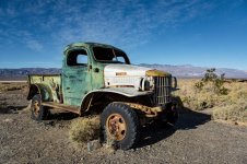
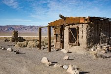
We met in Ridgecrest at 7am, gassed up and got coffee and headed through stinky Trona to the little Ballerat ghost town.

01-BalleratTruck.jpg

02-BalleratAdobe.jpg

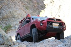
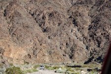
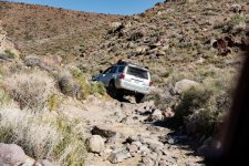
THen it was time to air down and get serious. We headed south for Coyote Canyon / Goler Wash.
03-WarthogBallerat-Thomas.jpg

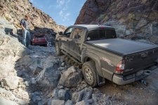
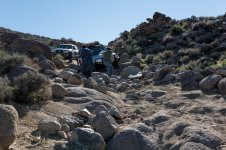
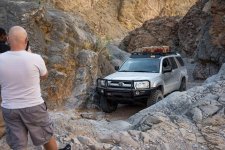
According to Mike, the most experienced DV traveler, this was the worst condition he'd seen it. The water washed away all the sand and pre-stacked rocks. Though it was plenty doable in the end. Everyone scraped their tank skids, I had to stack a couple rocks in a hole on this ledge due to my 32 in tires :)

04-MarkGoler.jpg

06-WarthogGoler-Thomas.jpg

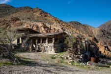
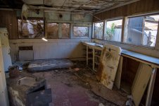
It then opens into an easy wash for a while with a mine site to explore.

08-ThomasGoler2.jpg

10-GolerMineHouse.jpg

11-GolerMineOHouseInside.jpg
 

Attachments

  • 01-BalleratTruck.jpg
    01-BalleratTruck.jpg
    131 KB · Views: 907
  • 02-BalleratAdobe.jpg
    02-BalleratAdobe.jpg
    133.9 KB · Views: 842
  • 03-WarthogBallerat-Thomas.jpg
    03-WarthogBallerat-Thomas.jpg
    136.1 KB · Views: 890
  • 04-MarkGoler.jpg
    04-MarkGoler.jpg
    136.3 KB · Views: 881
  • 06-WarthogGoler-Thomas.jpg
    06-WarthogGoler-Thomas.jpg
    118.2 KB · Views: 893
  • 08-ThomasGoler2.jpg
    08-ThomasGoler2.jpg
    142.5 KB · Views: 882
  • 10-GolerMineHouse.jpg
    10-GolerMineHouse.jpg
    141.2 KB · Views: 930
  • 11-GolerMineOHouseInside.jpg
    11-GolerMineOHouseInside.jpg
    100.9 KB · Views: 876
Stopped for lunch ad the infamous Barker Ranch (Charles Manson "Family" hideout)

12-BarkerRanch.jpg

Then up Mengle pass! ALL ROCKS :D

13-ThomasGoler3.jpg

And down the other side. This picture perfectly illustrates the reason that sliders are the MOST important piece of armor to have.

14-ThomasMengle.jpg

We checked out the "Cabins". They were pretty... iffy to stay in, other than Geologist Cabin, that one was in good shape. Tons of rat droppings everywhere and many rooms had no ceiling. Was just imagining them running in the rafters and pooping out you as you slept!

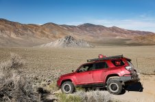
Striped butte.

17a-WarthogStripedButte.jpg

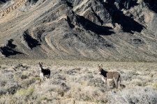
Burros! The above picture shows Butte Valley which is home to a rather large herd of leftover burros. They were all over, though usually too far away to take pictures. I did get these two though! And later on a couple others were right next to the road and came up to the group asking for handouts! (I missed them so no pics from me)
17-Burros.jpg

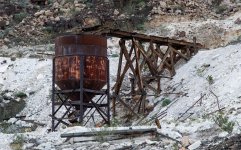
Stopped at Warm Springs Talc mine (I didn't know you mined Talc) The area was built up nice at one time. Sturdy painted houses, a warm spring fed pool, the works. Miners were spoiled here :D

22-TalcMine.jpg

23-TalkMine2.jpg

We almost spent the night at Warm Springs (Would have been a good place for it). But we wanted to be in the north end of the valley tomorrow and it was a LONG drive. So we decided to push on, and we knew we may have to contend with some closed roads and take a long way around too...

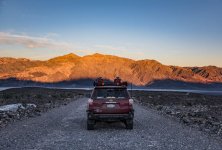
Entering Death Valley proper at sunset. This nice graded road here completely disappears a bit further down as it crosses a huge flood plane. The recent rains have completely reclaimed it.

25a-SunsetOverBadwater.jpg
 

Attachments

  • 12-BarkerRanch.jpg
    12-BarkerRanch.jpg
    137.7 KB · Views: 1,262
  • 13-ThomasGoler3.jpg
    13-ThomasGoler3.jpg
    142.3 KB · Views: 1,209
  • 14-ThomasMengle.jpg
    14-ThomasMengle.jpg
    134.5 KB · Views: 1,253
  • 17a-WarthogStripedButte.jpg
    17a-WarthogStripedButte.jpg
    120.7 KB · Views: 1,137
  • 17-Burros.jpg
    17-Burros.jpg
    142.3 KB · Views: 1,160
  • 22-TalcMine.jpg
    22-TalcMine.jpg
    136.2 KB · Views: 1,154
  • 23-TalkMine2.jpg
    23-TalkMine2.jpg
    141.9 KB · Views: 1,140
  • 25a-SunsetOverBadwater.jpg
    25a-SunsetOverBadwater.jpg
    100.9 KB · Views: 1,138
When we reached the intersection of Warm Springs canyon road and West Side Road... well you couldn't tell there was a rod there at all except for a gate and a couple of signs sticking up through the sand.

From there we made it to the Badwater road which we knew was closed going north. We were planning on going south out of the park and around to the east and back in to Furnace Creek. Only as we headed south, the Pass and the wash out the south end were also closed! TRAPPED!

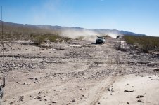
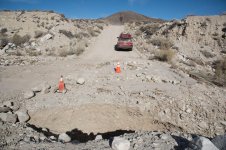
Reluctantly we decided to go up Jubilee Pass road. It was night, we had 4x4s... The west side of that road is utterly destroyed. Tons of washouts, areas with missing asphalt or 1-2 feet of sand and rocks covering the road. Overall was easy going for a high clearance vehicle.

26-WashedOut1.jpg

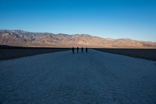
We made it to Furnace Creek late, there was tons of camping space. Had an expensive and not very good dinner at the Cafe, then hit the sack. Next morning went south to see the Badwater flood if it was still there...

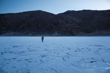
27-Badwater.jpg

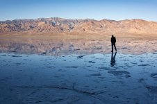
Had to hike out a good mile or so but we found some water left!

28-FloodedBadwater1.jpg

Looking back.

29-FloodedBadwater2.jpg

From there we checked the road conditions at the visitor center and headed north.

Aaaand, another closed road on our planned route. Even though we were JUST at the visitor center and it was not marked closed on their map :(

Sigh... I'm not normally one to just go around closed road signs but... the entire days activities were planned around this one. So we went around the sign.. This is heading to Crankshaft Junction. Road was washed out in 30+ places like this but not bad. After Crankshaft, it was completely regraded! I think they might have had the road closed temporarily due to the graders working but it was the weekend and they were just parked off the side of the road. Whew!

31-WashedOut2.jpg

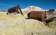
Sulphur mine in the Last Chance mountains.

32-SulphurMine.jpg

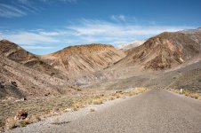
Stripes of varying colors and tilts on a paved section through the Last Chance mountains.

33-StripedCanyon.jpg

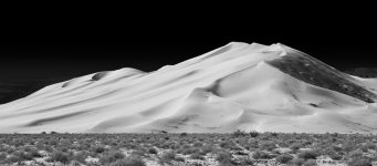
Finally made it to out Saturday ;lunch stop. The Eureka Dunes! You can see some people on the right who are climbing up. A couple of us wet up a little ways but uh... climbing sand dues is WAY too much work for me :D

34-EurekaDunes.jpg
 

Attachments

  • 26-WashedOut1.jpg
    26-WashedOut1.jpg
    88.9 KB · Views: 1,129
  • 27-Badwater.jpg
    27-Badwater.jpg
    119.5 KB · Views: 1,120
  • 28-FloodedBadwater1.jpg
    28-FloodedBadwater1.jpg
    93.7 KB · Views: 1,114
  • 29-FloodedBadwater2.jpg
    29-FloodedBadwater2.jpg
    119.8 KB · Views: 1,116
  • 31-WashedOut2.jpg
    31-WashedOut2.jpg
    117.6 KB · Views: 1,129
  • 32-SulphurMine.jpg
    32-SulphurMine.jpg
    135.6 KB · Views: 1,158
  • 33-StripedCanyon.jpg
    33-StripedCanyon.jpg
    132.4 KB · Views: 1,172
  • 34-EurekaDunes.jpg
    34-EurekaDunes.jpg
    80.7 KB · Views: 1,102
After lunch we went through Dedeckra Canyon. Some nice ledges and tight spots. About the same difficulty as Coyote Canyon.

35-ThomasDeDecktraCyn.jpg

Then 2.5 hours through steel pass and down into saline valley. Slow going. Driving on a beg of decently sized rocks with plenty of boulders to drive around/over thrown in. Was nice scenery and all but once was probably enough for that trail :D

36-SalineSPringsUpper.jpg

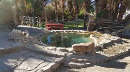
The Saline Hot Spings. A bit of an old hippie era relic. People were showing up for Thanksgiving already. Apparently it's like a 2-300 person mass potluck thing out here :)

I have to say that I sort of avoided doing the naked hot tubbing myself, ah well...

37-MikeSalineValley.jpg

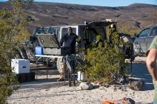
Pic of Mike and his Jeep and his camping setup. He packs a LOT of stuff in that Jeep!

38-SalineSpringsLower.jpg

Sun morning picture of one of the lower hot tubs with no one in it. (Pictures with people in them is of course not looked on too well :D)

41-WashedOut3.jpg

We headed for north pass, Knew it might be closed but there was no sign from the bottom. Though we did run into this! And it was a surprise at the bottom of a small hump in the road. But there was a bypass to the right.

The rest of the road out to the highway was rough but fine for high clearance, no 4x4 needed. At the top there were signs once outside the park that said closed coming the other way but there were a lot of people through anyway.


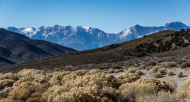
42-Sierras.jpg

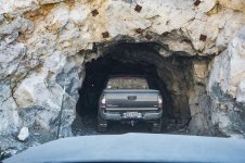
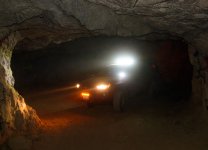
We headed down to Big Pine and picked up 395 south. One more attraction along the way is a Mine that is big enough to drive in!

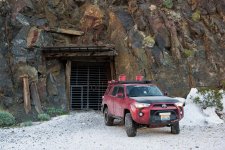
43-MarkMine.jpg

You can go about 1/4 mile or so down into the mountain before it ends in a space large enough to turn around (thankfully) It was fun/scary :D Hard to get good pictures too, not because of the darkness but the dust was SO thick it was like fog almost.

44-WarthogInMine.jpg

Another 4.5 hours and I was home. Warthog has two thick layers of dust inside and out now. Will need a really thorough cleaning this thanksgiving weekend!

Thanks to [MENTION=46138]chmura[/MENTION] and Mike for inviting me and guiding the trails. It was a super fun trip! :)
 

Attachments

  • 35-ThomasDeDecktraCyn.jpg
    35-ThomasDeDecktraCyn.jpg
    137.1 KB · Views: 1,138
  • 36-SalineSPringsUpper.jpg
    36-SalineSPringsUpper.jpg
    132.6 KB · Views: 1,160
  • 37-MikeSalineValley.jpg
    37-MikeSalineValley.jpg
    140.7 KB · Views: 1,205
  • 38-SalineSpringsLower.jpg
    38-SalineSpringsLower.jpg
    118 KB · Views: 1,138
  • 41-WashedOut3.jpg
    41-WashedOut3.jpg
    128.1 KB · Views: 1,195
  • 42-Sierras.jpg
    42-Sierras.jpg
    113.7 KB · Views: 1,099
  • 43-MarkMine.jpg
    43-MarkMine.jpg
    117.1 KB · Views: 1,233
  • 44-WarthogInMine.jpg
    44-WarthogInMine.jpg
    101.5 KB · Views: 1,141
Awesome photos Warthog! Looks like a real good tour of some of the nice spots one can drive to in DV. Never seen, or heard of, that mine before. Crazy how you can drive in there! Haven't been up Goler yet this year, but been hearing its pretty rough right now, as your pics sure seem to show!
 

Members online

Forum statistics

Threads
278,312
Messages
3,554,089
Members
248,016
Latest member
Advally Service

Trending content

Back
Top