What's a good portable GPS?

I'm a little late to the party and it seems a lot of the confusion about phone GPS has been cleared up. A little tip about extending battery life for Android users though. Put your plane in airplane mode. Then turn on GPS to device only. That'll keep the radio off and save you tons of juice. I'm sure the iPhone has a similar feature.

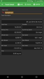
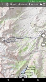
My go to app is Backcountry Navigation Pro and has been for a few years. I still carry a paper map as a backup but never end up pulling it out. Here's a few screenies from the app. This was a climb up Mt Humhprey's I did last year.
 

Attachments

  • 2016-08-30 23.35.00.jpg
    2016-08-30 23.35.00.jpg
    139.2 KB · Views: 325
  • 2016-08-30 23.35.57.jpg
    2016-08-30 23.35.57.jpg
    106.1 KB · Views: 325
I'll second Backcountry Navigator. I use it on my phone when backpacking and use it in my car as well.

In my 4runner I use a Ram mounted Galaxy 7" Tab.

bfNohGhl.jpg


GNvtHFzl.jpg


Cool part is that the Galaxy Tab A does have stand alone GPS. Backcountry has several map choices including forest service topo maps that I really like. Cool part about using this setup is that I also use AutoGuard which is a dashcam program that runs in the background. Also in camp you just drop it out of the mount and you have a full fuction tablet for reading, music, photos etc.
 
Last edited:
You want a dedicated GPS. I don't trust my phones very broad GPS chip, sketchy hardware, software and poor battery life. I have a Garmin rino 655t and a 60CSX. They are both awesome units, the rino has the ability to communicate with other rinos and they will work when you need them to. I use my rino snowmobiling in wyoming, it's outside for up to 10 hrs in the cold and my battery never drops below 60%. Should last for days in the summer.
 
I'll throw in another vote for a standalone GPS. I like the idea of the GPS phone apps but my issue is battery life. I have an older model Garmin Etrex that I've used for years and it has worked great. Runs off of AA batteries which makes it easy and relatively inexpensive to carry spares in my pocket or backpack if I'm out hiking.
 
GARMIN MONTANA 600 for sale.

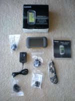
I did a lot of research on portable GPS units before I bought a Garmin Montana 600 GPS. I had just moved out to Utah and bought a Honda dual sport motorcycle. The trails out there go off into wilderness and I didn't want to get lost. I couldn't get any cell phone coverage in the mountains. I used the GPS maybe a dozen times and it worked great for me. I've since moved back to the East Coast and don't really have a need for it here. The unit is in new condition and includes all accessories. I paid $429 for it and am selling it for $325. Message me if interested.

Garmin Montana 600.jpg
 

Attachments

  • Garmin Montana 600.jpg
    Garmin Montana 600.jpg
    129.4 KB · Views: 500
Last edited:
I have been using a Samsung tablet with Back Country Navigator loaded on it for a few trips now. I really like the ability to build a route on my laptop in Google Earth and then export it to a kml file for my tablet. The screen is large enough I can easily see it while driving or my wife can look over and see it easy. Plus it has all the major map sources on it so I can switch map sources based on where I am at without losing my route.

I still carry paper maps when I can but the tablet has made maps and routes so much easier. I do not have to worry about missing a turn and then what is going to happen. Sometimes I can appreciate the adventure but sometimes I just want to enjoy the specific route we have planned and get to camp for a cold beer with a good view.
 
I have a garmin gps 64, I like it a lot. I compared it to backcountry navigator and gaia on a recent trip and it won out over both. It can be a pain to work with but not too bad when you get used to it (I assume most or all handheld units are the same in that respect).
 
I have been using a Samsung tablet with Back Country Navigator loaded on it for a few trips now. I really like the ability to build a route on my laptop in Google Earth and then export it to a kml file for my tablet. The screen is large enough I can easily see it while driving or my wife can look over and see it easy. Plus it has all the major map sources on it so I can switch map sources based on where I am at without losing my route.

I still carry paper maps when I can but the tablet has made maps and routes so much easier. I do not have to worry about missing a turn and then what is going to happen. Sometimes I can appreciate the adventure but sometimes I just want to enjoy the specific route we have planned and get to camp for a cold beer with a good view.

+1 on this.
Describes my setup pretty much exactly. Its been a good setup.
 
I like the backcountry navigator as a program, although it is an extreme pain in my opinion to download the maps for even a reasonable sized area. Also compared to a gazetteer map and the garmin handheld it was missing a lot of trails and was sending me in weird places.
 
+1 on this.
Describes my setup pretty much exactly. Its been a good setup.

I was at Big Bend Ranch State Park the last week of December. My kml files that I built on my laptop were a great tool on my tablet once we were out there where the trail and the map do not match. Over all I am going to start building a good kml library of all the parks I go to.
 
I use Avenza Maps. It's free, and has a ton of free and paid maps to choose from. The Forest Service puts out Motor Vehicle Use Maps every year and you can download them on this app. You can drop pins and keep tracks and all that garbage. Always worked well in the middle of nowhere.

Sent from my SM-G955U using Tapatalk
 
Gaia GPS hands down, the Premium subscription includes USFS Motor Vehicle Use Maps as well as NatGeo Trails Illustrated and a whole bunch of other layers.
 

I have this and a couple previous models of this garmin and I will say they work great in every way it’s needed for ...except that size of screen sucks for driving, zooming and panning around sucks and it’s not simple just on the go. Better off with a tablet and a premium paid app for that kind of dough. Those are good for hiking and geo caching ..not driving.
 
Memory-map is a simple app, iOS, not sure on Android, which did a good job for me last time I was without service for a while. Buy specific regional USGS and other providers as well.

Works offline, as close of a solution for me to carrying tons of detailed topos.
 

Members online

Forum statistics

Threads
278,316
Messages
3,554,111
Members
248,016
Latest member
Advally Service

Trending content

Back
Top