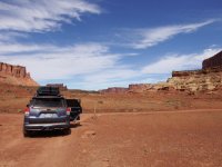
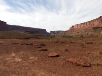
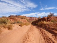
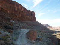
White Rim Road in a 5th gen Limited

Orbital Debris

New member
This will be my placeholder as I add details of my White Rim trip.

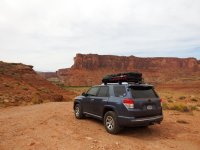
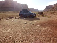
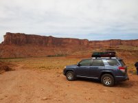
The Truck: 2013 Limited, stock suspension (XREAS), with 2014 Trail wheels with 265/70/17 Cooper AT3's, Yakima Loadwarrior with extension on top. Ham APRS set up with a Kenwood D710 outputting through a Comet SBB-5 antenna.


Participants: Orbital Debris (OD-me), my brother-in-law (BIL) and my nephew (BFD -those are really his initials). I put it out there for other participants, but it did not work out.

The plan: Travel from Northern Colorado, camp the first night in Arches, Start the trail from Mineral Bottom side, Camp at Taylor the first night, Candlestick the second night, Gooseberry the third night, and exit the canyons via Shafer on the fourth day.
 

Attachments
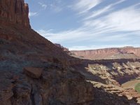
  • DSCF2915.jpg
    DSCF2915.jpg
    136.5 KB · Views: 2,419
Last edited:
Register to hide this ad
APRS track

As part of this trip, I wanted to see if I could maintain communications with my Ham radios and APRS. For those unfamiliar with APRS, it allows position reporting by sending out the GPS position via packets on Ham radio. If there is a receiving station or repeater within range (this is a simplification), it will be output to the internet and can be viewed on certain websites, such as aprs.fi

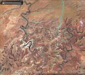
Below is a plot of the packets received by APRS internet stations, and plotted in google earth, showing my position. As you can see, I was able to get a few packets out on the west side, but being down in the canyons, I had some difficulty hitting the APRS repeaters. I was actually surprised that I was able to get a few positions out from Taylor Canyon. On the east side, I was able to reach enough repeaters to plot my path.
 

Attachments

  • Canyonlands APRS track.jpg
    Canyonlands APRS track.jpg
    140.1 KB · Views: 2,316
Last edited:
Arches - Sunday night

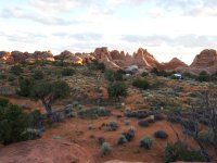
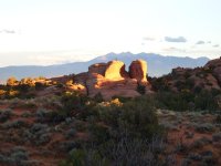
Sunday we drove down from NoCo to Arches - a trip of about 6.5 hours. We had reservations at Devil's Garden campground. Everything was good, we got the tent set up, set up the campsite, and had time to climb around on the rocks nearby. The campsite seemed sheltered, which was good because the weather reports indicated a front coming through some time Monday. I expected some wind Monday, but only 10-15 mph. We staked the tent down ate some dinner and turned in. In the picture below, the 4runner is to the right of the tent hidden by some bushes, we were not able to pull it in from the road. The scenery in Arches is phenomenal, and I wished I had scheduled more time there.
 

Attachments

  • DSCF2880.jpg
    DSCF2880.jpg
    134.5 KB · Views: 2,246
  • DSCF2867.jpg
    DSCF2867.jpg
    129.8 KB · Views: 2,197
Last edited:
The WIND

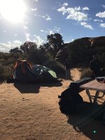
I woke up again about 11:30 to flashes of light. Stepping out, there was lightning all around the perimeter, but still stars overhead, and the wind was coming up. Checking the tent, I added a couple of stakes since we had only staked out the corners. This was all for naught, since the soil was pretty sandy. The wind buffeted the tent all night, and around 5 am, the rear gave way. By that time the wind had pulled up all the stakes. Repairs were futile in the wind, so we retreated to the 4runner. We had planned on a stop in Moab for breakfast and gas, so we decided to go into town and get breakfast and gas while daylight came up, and to see if the wind would break. Checking the weather app from the diner, there was a wind advisory (no kidding!). Winds 20-25 sustained with gusts to 50 mph! We returned to find the tent in poor conditions. We broke camp as best we could while getting sandblasted, threw everything in the 4runner and moved on toward Canyonlands, hoping the storm did not deteriorate the trail conditions.
 

Attachments

  • Arches tent.jpg
    Arches tent.jpg
    136.7 KB · Views: 2,202
So we checked in at the visitor center, and backtracked to Mineral Bottom road. This road is pretty much just a dirty road, but the washboard reminded me that it was time to air down prior to the trail. We stopped and I dropped the Cooper AT3's to 26 psi all around. Interestingly, the TPMS light did not activate until the next morning when the tires were 24 psi from the overnight cool down.
We went down the Mineral Bottom switchbacks and then got out for photos.

Moving a little further down the road with the Green River close to the right, I encountered a little road damage. The road conditions on the NPS website had listed 'minor flood damage' for White Rim Road. There were a few areas of these washouts.
 

Attachments

  • DSCF2913.jpg
    DSCF2913.jpg
    136.9 KB · Views: 2,077
  • DSCF2926.jpg
    DSCF2926.jpg
    136.2 KB · Views: 2,073
Along the Green River.

We soon crossed from BLM land into the Canyonlands NP proper. The road along this point was very narrow and most of the stress was worrying about encountering oncoming traffic, but this part of the road was pretty sparse.
 

Attachments

  • DSCF2950.jpg
    DSCF2950.jpg
    119.3 KB · Views: 2,035
That looks like an awesome experience. Are you out there now?

I see you're an Aggie. I'd crack a joke but I'm sure you heard them all. :naughty: Hookem' \m/. :boink:
 
That looks like an awesome experience. Are you out there now?

I see you're an Aggie. I'd crack a joke but I'm sure you heard them all. :naughty: Hookem' \m/. :boink:

I already know all the best ones. :biggrin2:
But I won't hold it against you, my niece attends t.u. studying the art of being liberal.

I was there last week. 10/3-10/6
 
Last edited:
Is a permit required to camp along the White Rim trail?

Yes. Canyonlands has a limited number of specific camp sites along the road which you can reserve on their website. There is no dispersed camping.

You actually need a permit to drive the entire road, even if you do it in a day. (which would be a long day, btw.) I think you can drive as far as Lathrop Canyon or Musselman Arch or thereabouts from the Schafer trail w/o a permit, but not further. Check the Canyonlands website - it's all there.
 
Last edited:
Taylor Campground

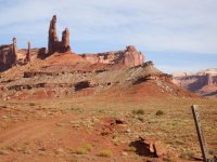
Our first night was at Taylor, which is up a 5 mile spur road into Taylor canyon. The road in weaves in and out of a dry wash. It was sandy, and we put it into H4L just in case (prob overkill). The first pic is looking east to the Moses and Zeus formations, the second is looking back down the canyon that we just came up. Taylor campground is a little exposed, I suspect they made it up the side a little in case the wash floods.
 

Attachments

  • DSCF2965.jpg
    DSCF2965.jpg
    137.4 KB · Views: 1,966
  • DSCF2961.jpg
    DSCF2961.jpg
    135.5 KB · Views: 2,239
Moses and Zeus

The scale of this place is lost in most pictures unless the truck or people are in the foreground. BIL and BFD took the trail up to Moses and Zeus while I hung at the campground to try to assess the tent damage from Sunday night. In the first pic, they are lost in the rocks, so they are highlighted in the red circle. The second pic is with the zoom on the camera.
 

Attachments

  • DSCF2959.jpg
    DSCF2959.jpg
    137.7 KB · Views: 1,950
  • DSCF2958.jpg
    DSCF2958.jpg
    141.3 KB · Views: 1,891
Last edited:
Great photography

Wonderful photos. I'll never get there at my advanced age, but you have made the adventure come alive with your camera. Many thanks - Ted
 
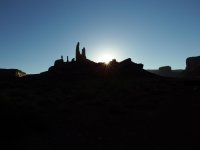
Sunrise the next morning came up over Moses and Zeus. We added a little duct tape to the tent poles and it held up.(I brought a chest full of tools in case of emergency and thankfully that was the only one used) The wind finally died down during the night.
 

Attachments

  • DSCF2983.jpg
    DSCF2983.jpg
    145.1 KB · Views: 866
Last edited:
Labyrinth Campground

We took the road out of Taylor canyon and stopped at Labyrinth campground for pics. Labyrinth is at the intersection where the Taylor road branches off.
First pic: Looking north from Lab CG
2nd: Looking south from Lab CG
 

Attachments

  • DSCF3008.jpg
    DSCF3008.jpg
    135.2 KB · Views: 859
  • DSCF3009.jpg
    DSCF3009.jpg
    137.6 KB · Views: 897
Last edited:
Really cool pictures and thanks for sharing! Sometimes I wish we had some more time and more of a group then just my wife and I to explore Canyonlands more. Place was great and these pictures remind me I need to get out there again.
 
Bottom land

South of Labyrinth the road runs through some bottom land which was soft sand at the time. It also runs across several dry washes. Easy conditions in this weather.
 

Attachments

  • DSCF3014.jpg
    DSCF3014.jpg
    137.3 KB · Views: 886
Hardscrabble

Hardscrabble campground is down near the river. After passing it, the road climbs and is perched on a shelf between the straight cliffs above, and the steep talus down to the river. Another section where I was happy to not meet opposing traffic. BFD was driving, I was taking pictures and we were all taking note of any spots on the road that were possible for 2 vehicles to squeeze past. We took the opportunity to try out the 4WD LO. The road is there in the 2nd pic, but you have to look hard to pic it out among the rocks.

I heard a few scrapes on the skids, but nothing major. No wheelspin or other drama.
 

Attachments

  • DSCF3033.jpg
    DSCF3033.jpg
    131.8 KB · Views: 897
  • DSCF3035.jpg
    DSCF3035.jpg
    134.6 KB · Views: 954

Members online

Forum statistics

Threads
278,316
Messages
3,554,120
Members
248,016
Latest member
Advally Service

Trending content

Back
Top