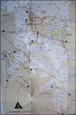
Like Brian said all that area sandstone, fish creek, oyster shell reef, mud cave area, wind caves, Fossil reef etc is all easy. Just a few side trails in that area can be difficult.
Activity Type: Off-Highway Drives
Nearby City: Ocotillo Wells
Length: 30 total miles
Elevation Gain: Minimal
Trail Type: Out-and-back
Skill Level: Easy
Duration: 3 to 4 hours plus sidetrips
Season: Best late fall thru early spring
Local Contacts: Anza-Borrego Desert State Park
Local Maps: DeLorme Atlas & Gazetteer; Anza - Borrego Desert Region Recreation map; USGS El Cajon
Lengthy drive through massive Fish Creek Canyon ends at dramatic Sandstone Canyon. See geologic wonders including Split Mountain, the Wind Caves and Fossil Reef. Explore more difficult side canyons. Sandy wash bottom suitable for most stock 4x4 SUVs. Conditions can worsen after storms. Dangerous flash floods possible.
Fish Creek–Sandstone Canyon Trail
PointToPoint • 174.3 mi • 0 ft
The combination of Fish Creek and Sandstone Canyon offers a varied and very beautiful drive within Anza-Borrego Desert State Park. The trail commences on Split Mountain Road, 8 miles south of Ocotillo Wells. The intersection is marked for the Fish Creek Area and travels up the sandy Fish Creek Wash right from the start. After 1.4 miles, the primitive Fish Creek Camp area is reached. Set above the wash, the area has plenty of cleared spaces for campsites, but no facilities other than a pit toilet. There is no fee. Campers are advised to select a site here; once in the canyon there are no places to camp out of the wash. After the campsite, the trail enters Fish Creek Canyon, traveling through the gap in Split Mountain along the fault zone. Keep a careful eye out for the many fossilized mollusk shells to be found embedded in the wall of the canyon and fallen boulders. Remember that collecting within the park is prohibited by law, so look, enjoy, and then leave them for others to appreciate. Special Attractions: Fossilized marine reefs in the Split Mountain Fault Zone; Beautiful narrow Sandstone Canyon and Fish Creek Canyon; Wind Caves Hiking Trail. High-clearance 4WDs are preferred, but any high-clearance vehicle is acceptable. Expect a rough road surface; mud and sand are possible but will be easily passable. You may encounter rocks up to 6 inches in diameter, a loose road surface, and shelf roads, though these will be wide enough for passing or will have adequate pull-offs.« show less