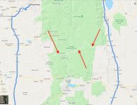
I'm planning a trip where I want to cross from Sequoia & Kings Canyon NP over to the northern end of Death Valley... but the southern end of the Sierra is in the way! If you stay on paved roads, it's a really long trip. I note this interesting line on Google Maps (see photo). Anyone know anything about it??
Even if it was slow & took the same number of hours as going all the way around on highways, it might be more interesting... Is it real? Is it passable??
Even if it was slow & took the same number of hours as going all the way around on highways, it might be more interesting... Is it real? Is it passable??