EPIC Trip 2016 - CO, UT, ID, WY, MT, SD - Looking for advice, suggestions, etc

Goose is sick, one of the best trails I have ever done. Lots of trail in that area, but Goose is really the only technical one. The last obstacle is difficult, but nothing that should scare you away, sounds like your truck is pretty capable.

I would plan to spend 3 full days from the base of Morrison in the Clarke Fork Canyon, up to Goose and running around Lulu Pass and surrounding areas.

DSC01673_zpsc156e492.jpg~original


618_zpse28571af.jpg~original


797_zpse2f766d9.jpg~original
 
do the trip in reverse. this is an awesome event and it hits some great trails.

I have a gobi rack to pick up on first day out to Colorado, it sucks that it would such a waste of time and gas... Otherwise I would absolutely do so. I'm planning on meeting the 100s in the hills event where a few friends will be.


Goose is sick, one of the best trails I have ever done. Lots of trail in that area, but Goose is really the only technical one. The last obstacle is difficult, but nothing that should scare you away, sounds like your truck is pretty capable.

I would plan to spend 3 full days from the base of Morrison in the Clarke Fork Canyon, up to Goose and running around Lulu Pass and surrounding areas.

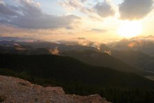
Wow, now that's beautiful. Nice pics! I need a nicer camera. I might never come home back to Chicago...

Do you have any directions, or an idea of where to find a map of Goose Lake and Lulu Pass? I'm having a very hard time finding anything. I bought a map of the Northern Shoshone forest just so I could find the Morrison. Thanks.

EDIT: After weeks of looking I finally found a map. I'm so stoked I can't even explain.
 
Last edited:
Dang, I'm gone the 23-31st driving through Colorado to Moab and back.

Got a picture of your 4th gen so I know who to look for, in case we see eachother? Sounds similarly modded to mine minus the bumpers and locker.
 
Last edited:
Dang, I'm gone the 23-31st driving through Colorado to Moab and back.

Got a picture of your 4th gen so I know who to look for, in case we see eachother? Sounds similarly modded to mine minus the bumpers and locker.

I don't have any pictures off hand. But it's silver with all the before mentioned mods. I recently put a snorkel on and a matte gray hood wrap. Gobi rack, etc. I will be impossible to miss lol. I'll be in Aurora the 30th at 8AM ish and heading towards Ouray around 1PM.

this book is probably the best thing you can buy for trails. step by step directions on how to get to the trail head, and tons of info for the trail.

https://www.amazon.com/Guide-Colorado-Backroads-4-Wheel-Drive-Trails/dp/1934838047


I have a copy of this. Thanks!
 
I have a gobi rack to pick up on first day out to Colorado, it sucks that it would such a waste of time and gas... Otherwise I would absolutely do so. I'm planning on meeting the 100s in the hills event where a few friends will be.


Wow, now that's beautiful. Nice pics! I need a nicer camera. I might never come home back to Chicago...

Do you have any directions, or an idea of where to find a map of Goose Lake and Lulu Pass? I'm having a very hard time finding anything. I bought a map of the Northern Shoshone forest just so I could find the Morrison. Thanks.

EDIT: After weeks of looking I finally found a map. I'm so stoked I can't even explain.

What map did you find?

Look on Google maps and you can see all of the trails pretty easily, there are a few by Sawtooth Lake that you pass coming up from Morrison, then the Lulu and Goose area. I didn't have a mao when I was there, just saw turns off the road an took them LOL, then went back and took other turns if there was a fork. Pretty easy area to navigate, have fun!
 
What map did you find?

Look on Google maps and you can see all of the trails pretty easily, there are a few by Sawtooth Lake that you pass coming up from Morrison, then the Lulu and Goose area. I didn't have a mao when I was there, just saw turns off the road an took them LOL, then went back and took other turns if there was a fork. Pretty easy area to navigate, have fun!

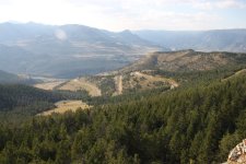
I have topo maps of the the Cooke City area, in Montana, and the Northern Shoshone forest topo map. It's essentially the top left portion of Wyoming and outlines several trails that are worth a look. I think from now on, I may just grab a topo map of the area and start exploring.
 
So it looks like we're gonna be in Moab the first week of August, and Wyoming/Montana the second. Please let me know if you're free, I'd love to meet/wheel with local members.
 
[MENTION=118909]MTgirl[/MENTION] gave me some great advice on my trip up that way last summer. Definitely get in touch with her for some good stuff on the north end.

My trip was in a rented Explorer, so off-road was not really an option. But there were some great things to be enjoyed:

Tetons:
Eat at Trapper's Grill / Peak's Restaurant near the Signal Mountain Lodge
Great view from the dining room or patio, the Wild Game ChiliBurger is AMAZING, best meal I had the whole trip.

Yellowstone Area:
Cody Nite Rodeo
Eat at the Roosevelt Lodge, gets busy, so go early, but worth it
Alternatively go to the Corral and take one of the dinner trail rides on horseback, book early (like right now).
Do the hike to Fairy Falls, before you get to the trail split turn left and climb the steep hill for a great overlook of the Grand Prismatic Spring. It's much better than seeing it from a boardwalk around the spring.
Be prepared for busloads of asian tourists armed with selfie-sticks, they tend to chase away the wildlife and clog traffic everywhere you go in the park. If you need an escape from them go find a hiking trail that isn't paved or has a boardwalk.
Make the trip to see the original North Entrance. Hopefully you can drive through it, it was a detoured around last year for road construction.
One evening exit the park on the NE corner out US-212, watch for Chief Joseph Hwy on right and take that. Some spectacular views and fun driving.
Alternatively if you continue on US-212 (Sawtooth Hwy), you'll have a similar experience. Pics from Chief Joseph Hwy
11885356_10153570005834603_2852717696278413505_n.jpg
11880677_10153570005589603_3403705495095610064_n.jpg
11894429_10153570005744603_5345008730339869667_o.jpg
11947775_10153570005819603_7102026466448041104_o.jpg

Glacier NP:
Absolutely go into the Many Glacier area, the prettiest area of the park, but be prepared for cooler wet weather, not as temperate and pleasant as the western side.
Get some fresh cherries from one of the farms near Flathead Lake
If you need a place to eat near Polson MT hit up the patio at Fiesta En Jalisco, right on the lake and some decent Mexican food

Absolutely stop at Kootenai Falls on US 2 in the west end of the state. A short hike from the highway, but very scenic. Take off your shoes or swap into trunks and go wading or for a swim in the pools. Climb out on the rocks for the best views
SR-37 is a gorgeous drive from Eureka-Libby


In Idaho
If in Bonners Ferry, hit up Kootenai River Brewing Company for lunch, great beer and burgers.
Coeur d'Alene was nice, but expensive, and seemingly overrated, but Dragon House had some of the best Chinese food I've ever had.
In Boise, Edge Brewing company had some mighty tasty Salmon Tacos I'd absolutely go again for, beer was decent.
 

Attachments

  • 11885356_10153570005834603_2852717696278413505_n.jpg
    11885356_10153570005834603_2852717696278413505_n.jpg
    119.6 KB · Views: 143
  • 11880677_10153570005589603_3403705495095610064_n.jpg
    11880677_10153570005589603_3403705495095610064_n.jpg
    49.8 KB · Views: 146
  • 11894429_10153570005744603_5345008730339869667_o.jpg
    11894429_10153570005744603_5345008730339869667_o.jpg
    163.7 KB · Views: 280
  • 11947775_10153570005819603_7102026466448041104_o.jpg
    11947775_10153570005819603_7102026466448041104_o.jpg
    144 KB · Views: 142
Here's my suggestions.

Moab - It'll be hot as noted. Carry an extra 2-3 gallons of water and offer to refill bottles of any hikers or bikers you see out on the trail. Makes for good relationships and keeps our trails open. I think you have a pretty good plan on what to do/see while you're there, so I won't repeat all that has been said. My last trip and the only one I've done in my 5th gen I ran Poison Spider, Hell's Revenge, and Fins and Things. I would not plan on anything more difficult than Poison Spider on whatever scale you're using. It was near the limits of my 4runner without having to use any other stuff - like a winch or jack. I was able to drive the entire trail cleanly, but much more and I think I'd be needing the "other" offroad toys. If you're just out for fun, why waste a bunch of time winching up obstacles?

As for Yellowstone/teton -

I would travel north monument valley. Good camping in primitive areas. Then north and west to the wind river range. Camping is great just about everywhere to the east of Big Piney area. Lots of lakes and rivers and tons of primitive camping and forest service campgrounds to suite your liking. Then you can head north and be about 3 hours to Jackson Wyoming. Grand Teton is about a 2hr park visit if all you want to do is window shop. If you want to see more, you could spend a lifetime hiking there. From Jackson there's good camping north in the wind river range or just around the east side near Debois. It's not a terrible drive from there up into Yellowstone park. Yellowstone park is great. Tons of fantastic hikes, even the short ones. IMO the must see stuff there are the geysers, the old faithful lodge, and the Gardiner area. You can tent camp near Gardiner. Most of the rest of the park is hardside only - bears. Same with some camping areas outside the park. Check with the camp hosts. Last time I was in pine creek (about 40? miles from Gardiner outside the park) there was a bear in camp, so they had some temporary restrictions on tent camping. Bring bear spray for hiking. I bow hunt and sleep in a bivy on the ground near YNP and have never had a bear problem doing so, but take precautions like food in a tree, etc. If I were at my car, I'd be sleeping inside.

I grew up near Yellowstone so I've done basically all the marked hiking trails. Hard to suggest the best of them. If you like geology, specimen ridge is super cool. Wolves in Lamar valley are likely, but not guaranteed. They're stealthy and hard to find if you don't have a lot of time to wait for them. Uncle tom's trail is a popular hike.

Oh - don't walk off the boardwalk around the geysers. You can fall in. And there won't be much left of your body to recover.
 
Last edited:
Here's my suggestions.

Moab - It'll be hot as noted. Carry an extra 2-3 gallons of water and offer to refill bottles of any hikers or bikers you see out on the trail. Makes for good relationships and keeps our trails open. I think you have a pretty good plan on what to do/see while you're there, so I won't repeat all that has been said. My last trip and the only one I've done in my 5th gen I ran Poison Spider, Hell's Revenge, and Fins and Things. I would not plan on anything more difficult than Poison Spider on whatever scale you're using. It was near the limits of my 4runner without having to use any other stuff - like a winch or jack. I was able to drive the entire trail cleanly, but much more and I think I'd be needing the "other" offroad toys. If you're just out for fun, why waste a bunch of time winching up obstacles?

As for Yellowstone/teton -

I would travel north monument valley. Good camping in primitive areas. Then north and west to the wind river range. Camping is great just about everywhere to the east of Big Piney area. Lots of lakes and rivers and tons of primitive camping and forest service campgrounds to suite your liking. Then you can head north and be about 3 hours to Jackson Wyoming. Grand Teton is about a 2hr park visit if all you want to do is window shop. If you want to see more, you could spend a lifetime hiking there. From Jackson there's good camping north in the wind river range or just around the east side near Debois. It's not a terrible drive from there up into Yellowstone park. Yellowstone park is great. Tons of fantastic hikes, even the short ones. IMO the must see stuff there are the geysers, the old faithful lodge, and the Gardiner area. You can tent camp near Gardiner. Most of the rest of the park is hardside only - bears. Same with some camping areas outside the park. Check with the camp hosts. Last time I was in pine creek (about 40? miles from Gardiner outside the park) there was a bear in camp, so they had some temporary restrictions on tent camping. Bring bear spray for hiking. I bow hunt and sleep in a bivy on the ground near YNP and have never had a bear problem doing so, but take precautions like food in a tree, etc. If I were at my car, I'd be sleeping inside.

I grew up near Yellowstone so I've done basically all the marked hiking trails. Hard to suggest the best of them. If you like geology, specimen ridge is super cool. Wolves in Lamar valley are likely, but not guaranteed. They're stealthy and hard to find if you don't have a lot of time to wait for them. Uncle tom's trail is a popular hike.

Oh - don't walk off the boardwalk around the geysers. You can fall in. And there won't be much left of your body to recover.
The areas around lake, just outside of cooke city, and between the east entrance and cody are the only hard side only areas - all other campgrounds take tenters. If in doubt yellowstone's campground page lists all of the restrictions/conveniences/etc. in one location.https://www.nps.gov/yell/planyourvisit/campgrounds.htm

lots of options for FS camping outside of the park as well (beartooth, gardiner, hebgen districts)
Custer Gallatin National Forest - Camping & Cabins:Campground Camping
 
So far, thats the extent of serious planning I have done. After leaving Moab I would like to explore Yellowstone and Grand Teton before heading to Montana to run the Morrison Jeep Trail, Goose Lake Trail and the Shoshone Lake Trail. I am super excited to run the morrison trail as I have not seen many people run this trail, despite its fame. There is another trail called Goose Lake, but reports say that it can get a little sketchy towards the end and its good to be with a group. These are the only trail plans I have made since it is very difficult to find trails anywhere except Colorado/Moab. I have heard there are some trails in South Dakota as well, specifically in the Black Hills, but again its very difficult to get an idea, let alone a map of any trails in that area.

Any suggestions for trails near Yellowstone/Grand Teton and the Black Hills in South Dakota would be much appreciated. I would also love any suggestions for things to do and any cool attractions that are a must see.

Thanks in advance, and I hope I can coordinate with a few members to make this trip even MOAR EPIC!

Cheers!
-Konrad

:wave: what you wanna know?

morrison


goose


yellowstone teton stuff
https://www.tacomaworld.com/threads/mtgirls-yellowstone-and-grand-teton-travel-thread.302102/

anything yellowstone/teton/MT related....I'm your girl. Ask away....
 
WARNING: do not click if you have slow internet or are about to max out your data limit on your phone...
https://www.tacomaworld.com/threads/the-epic-wy-co-meet-picture-thread.289451/

A group from TW and myself did the morrison and goose trails a few years back, mine is the white first gen. They continued on to other trails in WY and CO. Everything is documented in that link.

Morrison wasn't terribly bad when we were there but the trail had just gotten some much needed TLC so I'm sure its worse that I remember. If you do the switchbacks be prepared to take your time, no room for error there. The rest of the trail isn't bad, sliders help in a few areas. Great views and great camping anywhere. Bear country so keep EVERYTHING locked up in the rig at night.
Goose was so-so. The first half wasn't bad, the second half got worse. There are a couple of shortcuts to avoid some of the bad stuff. The worst spot that I can recall was near the end. There are two large boulders on the east side and a rock wall on the west side with a deep ravine in between. You have to drive over the rocks on the east side to avoid the ravine. If you slip you will be high centered possibly with your vehicle laying against the rock wall and stranded as there aren't any close trees to winch from. This pic is the spot, doesn't really do it justice as you can't see the ravine. This was on the way back down, east in the foreground of the pic.


oh, and there are no signs to mark goose lake, and it doesn't really show up on gps...
 
[MENTION=118909]MTgirl[/MENTION] gave me some great advice on my trip up that way last summer. Definitely get in touch with her for some good stuff on the north end.

My trip was in a rented Explorer, so off-road was not really an option. But there were some great things to be enjoyed:

Tetons:
Eat at Trapper's Grill / Peak's Restaurant near the Signal Mountain Lodge
Great view from the dining room or patio, the Wild Game ChiliBurger is AMAZING, best meal I had the whole trip.

Yellowstone Area:
Cody Nite Rodeo
Eat at the Roosevelt Lodge, gets busy, so go early, but worth it
Alternatively go to the Corral and take one of the dinner trail rides on horseback, book early (like right now).
Do the hike to Fairy Falls, before you get to the trail split turn left and climb the steep hill for a great overlook of the Grand Prismatic Spring. It's much better than seeing it from a boardwalk around the spring.
Be prepared for busloads of asian tourists armed with selfie-sticks, they tend to chase away the wildlife and clog traffic everywhere you go in the park. If you need an escape from them go find a hiking trail that isn't paved or has a boardwalk.
Make the trip to see the original North Entrance. Hopefully you can drive through it, it was a detoured around last year for road construction.
One evening exit the park on the NE corner out US-212, watch for Chief Joseph Hwy on right and take that. Some spectacular views and fun driving.
Alternatively if you continue on US-212 (Sawtooth Hwy), you'll have a similar experience. Pics from Chief Joseph Hwy

Glacier NP:
Absolutely go into the Many Glacier area, the prettiest area of the park, but be prepared for cooler wet weather, not as temperate and pleasant as the western side.
Get some fresh cherries from one of the farms near Flathead Lake
If you need a place to eat near Polson MT hit up the patio at Fiesta En Jalisco, right on the lake and some decent Mexican food

Absolutely stop at Kootenai Falls on US 2 in the west end of the state. A short hike from the highway, but very scenic. Take off your shoes or swap into trunks and go wading or for a swim in the pools. Climb out on the rocks for the best views
SR-37 is a gorgeous drive from Eureka-Libby


In Idaho
If in Bonners Ferry, hit up Kootenai River Brewing Company for lunch, great beer and burgers.
Coeur d'Alene was nice, but expensive, and seemingly overrated, but Dragon House had some of the best Chinese food I've ever had.
In Boise, Edge Brewing company had some mighty tasty Salmon Tacos I'd absolutely go again for, beer was decent.

Thanks a bunch! This is awesome! I will take everything into consideration.
 
WARNING: do not click if you have slow internet or are about to max out your data limit on your phone...
https://www.tacomaworld.com/threads/the-epic-wy-co-meet-picture-thread.289451/

A group from TW and myself did the morrison and goose trails a few years back, mine is the white first gen. They continued on to other trails in WY and CO. Everything is documented in that link.

Morrison wasn't terribly bad when we were there but the trail had just gotten some much needed TLC so I'm sure its worse that I remember. If you do the switchbacks be prepared to take your time, no room for error there. The rest of the trail isn't bad, sliders help in a few areas. Great views and great camping anywhere. Bear country so keep EVERYTHING locked up in the rig at night.
Goose was so-so. The first half wasn't bad, the second half got worse. There are a couple of shortcuts to avoid some of the bad stuff. The worst spot that I can recall was near the end. There are two large boulders on the east side and a rock wall on the west side with a deep ravine in between. You have to drive over the rocks on the east side to avoid the ravine. If you slip you will be high centered possibly with your vehicle laying against the rock wall and stranded as there aren't any close trees to winch from. This pic is the spot, doesn't really do it justice as you can't see the ravine. This was on the way back down, east in the foreground of the pic.


oh, and there are no signs to mark goose lake, and it doesn't really show up on gps...

Wow, all this info and pictures are awesome, thank you so much. It will come in handy. I will probably have more questions for you later, I'm doing last minute prep before we leave tmrw. Any interest in running any trails together? I may have another guy off expedition portal willing to tag along as well.
 
Wow, all this info and pictures are awesome, thank you so much. It will come in handy. I will probably have more questions for you later, I'm doing last minute prep before we leave tmrw. Any interest in running any trails together? I may have another guy off expedition portal willing to tag along as well.
Runner is still stock, no trails for him. If you want to see some awesome places and are good with just boring dirt roads let me know. I'm in Bozeman but know pretty much every forest service road in a 200 mile radius. Let me know when you make it to my 'hood
 
Look up Colorado and Utah Backcountry Discovery Routes, see link below. They are done by the adventure motorcycle crowd but all the trails are stock 4Runner friendly and 4wd legal. I just completed the Utah route last week and am on the Colorado route as we speak on my off-road bike.

You can download all of the gps tracks for these routes for free from the website.

Cheers, James

http://www.backcountrydiscoveryroutes.com/


Sent from my iPad using Tapatalk
 
Last edited:

Members online

Forum statistics

Threads
278,317
Messages
3,554,128
Members
248,016
Latest member
Advally Service

Trending content

Back
Top