
You are using an out of date browser. It may not display this or other websites correctly.
You should upgrade or use an alternative browser.
You should upgrade or use an alternative browser.
JohnTheLuck's Adventures Thread
- Thread starter JohnTheLuck
- Start date
JohnTheLuck
Member
John,
Thank you very much for all the fantastic photos and write ups. I think that if I show this to my wife, she may be way more inclined to do a little wheelin'!
Thanks! Don't forget to tell her that my 4Runner is mostly stock and easy trails still have incredible scenery.
.
JohnTheLuck
Member
Day 33:
Start point: Page, AZ
End point: Page, AZ
Johnny in Wonderland...
That's how I feel as this exiting day comes to an end.
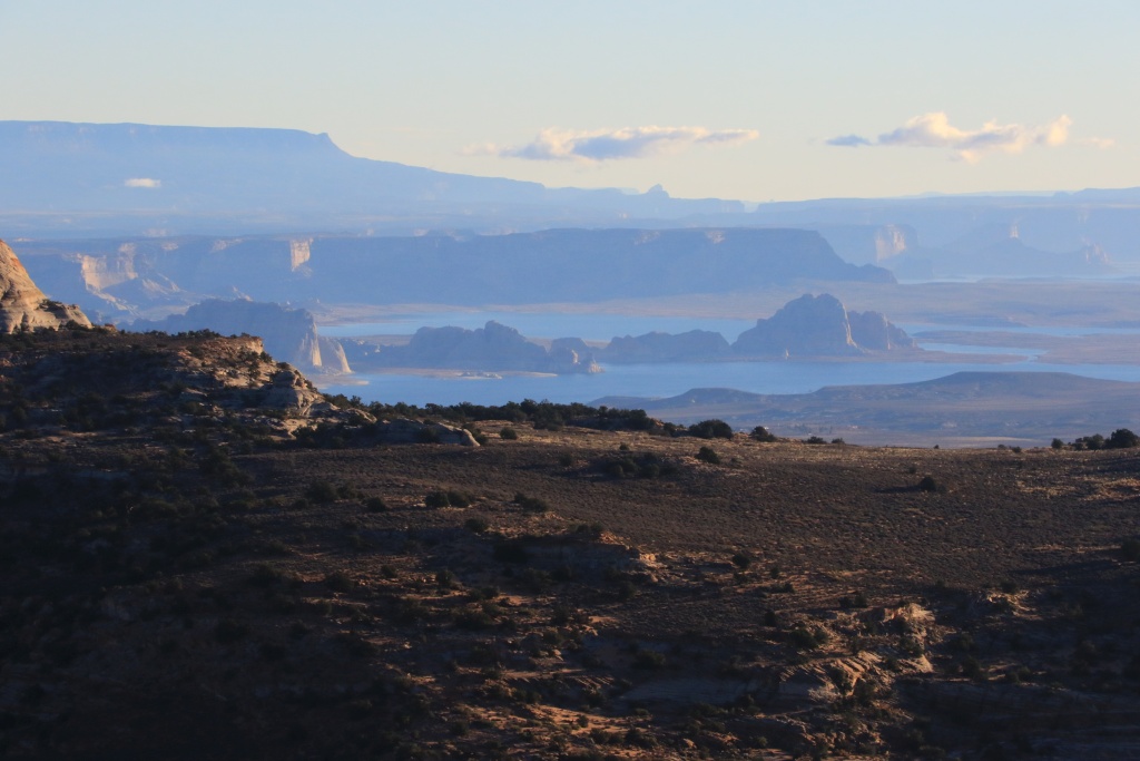
Today first wheeling destination was the Paria Overlook Road, climbing high above the Paria Canyon. This is probably a class 3 trail, with some little steps but deep sands portion. On our way while climbing, we had a nice view of Lake Powell and vicinity.
We then arrived at the overlooks. Unfortunately, the sun was still very low and the glare remove all colors. This would be better at noon or early afternoon.

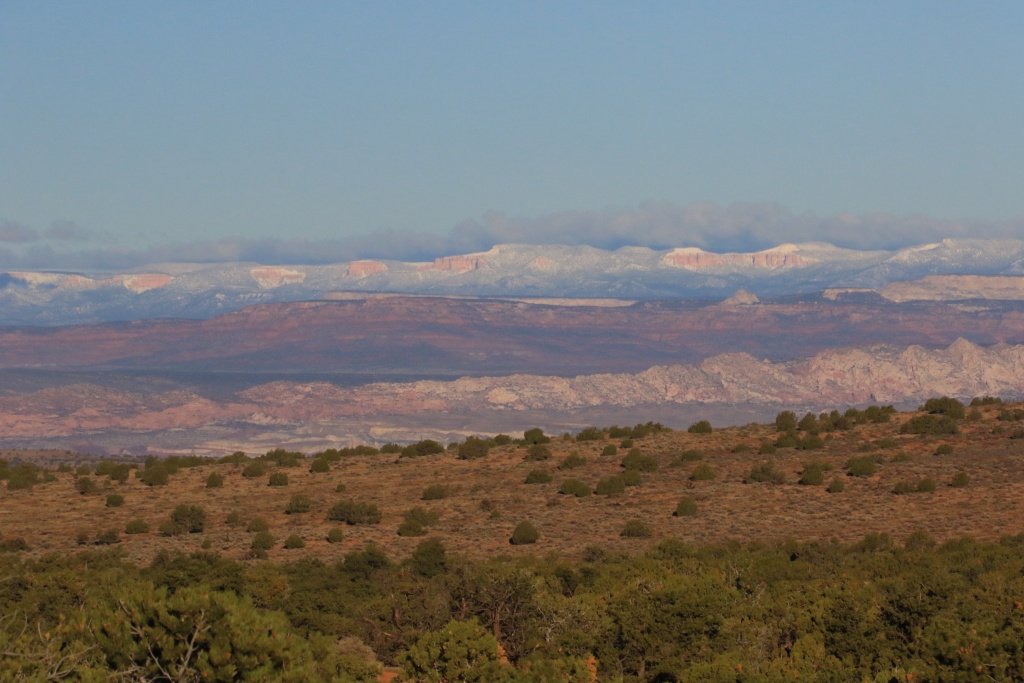
While completing the loop, we saw in the distance a familiar view, Bryce Canyon at more that 9800 feet, and under snow, probably from yesterday.
We then went to the Long Valley Road, the first backcountry road that we visited during our very first Southwest trip back in 2010. This really encouraged me to get a proper vehicle. Here I am now with a 4Runner!
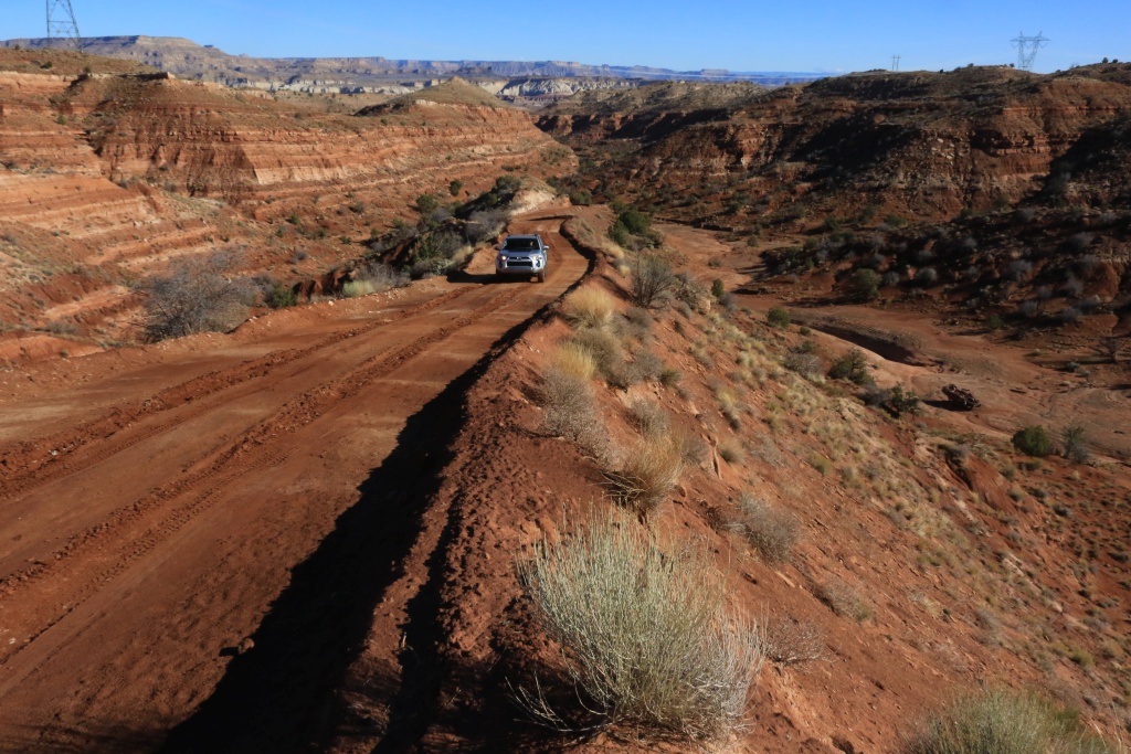
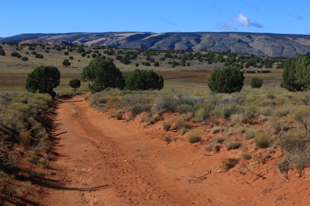
After climbing the canyon the road continues onto West Clark Bench, a sandy plateau.
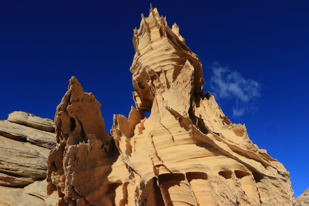
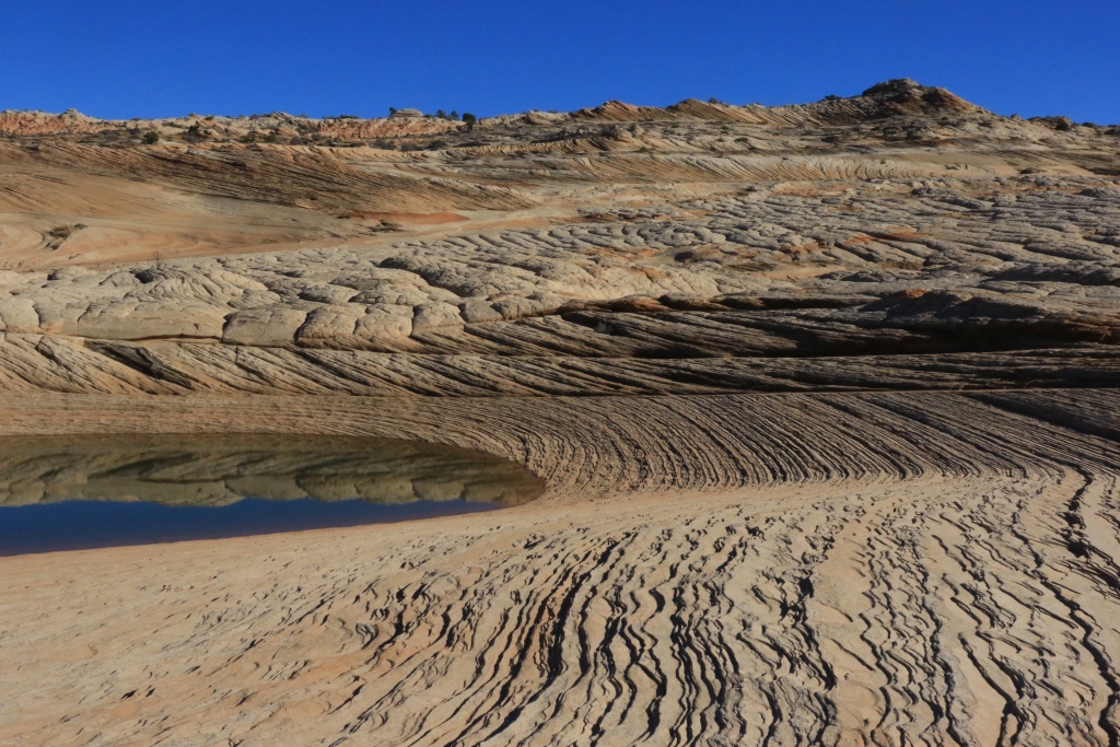
My goal was originally only to verify that our destinations for the next two days were reachable without severe damage from yesterday precipitations. We then decided to go to what was supposed to be tomorrow destination, Edmaier's Secret. We are so glad we decided to do this since there was many small ponds everywhere. Let the pictures speaks for themselves.
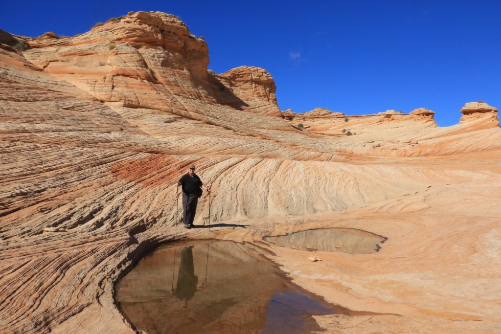
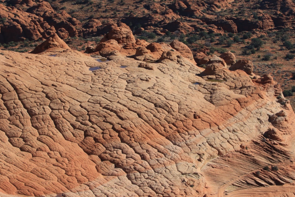
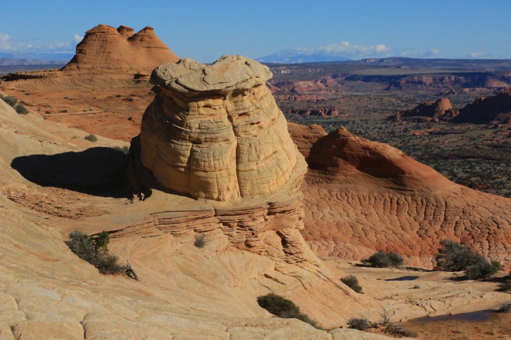
My wife was so excited to see these kind of formations. They are so fragile so we were very careful not to step onto or touch them.
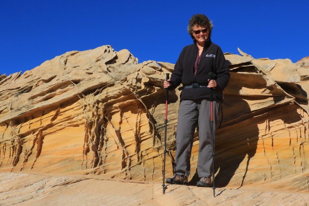
Once we got back onto US89, we made a short stop at Paria Outpost & Outfitters to say hello to Steve and Susan, which were our guide during a tour to White Pocket in Paria Canyon - Vermillion Cliff back in 2013.
Steve indicated me a good destination for tomorrow. Some more wheeling to come!
.
Start point: Page, AZ
End point: Page, AZ
Johnny in Wonderland...
That's how I feel as this exiting day comes to an end.
Today first wheeling destination was the Paria Overlook Road, climbing high above the Paria Canyon. This is probably a class 3 trail, with some little steps but deep sands portion. On our way while climbing, we had a nice view of Lake Powell and vicinity.
We then arrived at the overlooks. Unfortunately, the sun was still very low and the glare remove all colors. This would be better at noon or early afternoon.
While completing the loop, we saw in the distance a familiar view, Bryce Canyon at more that 9800 feet, and under snow, probably from yesterday.
We then went to the Long Valley Road, the first backcountry road that we visited during our very first Southwest trip back in 2010. This really encouraged me to get a proper vehicle. Here I am now with a 4Runner!
After climbing the canyon the road continues onto West Clark Bench, a sandy plateau.
My goal was originally only to verify that our destinations for the next two days were reachable without severe damage from yesterday precipitations. We then decided to go to what was supposed to be tomorrow destination, Edmaier's Secret. We are so glad we decided to do this since there was many small ponds everywhere. Let the pictures speaks for themselves.
My wife was so excited to see these kind of formations. They are so fragile so we were very careful not to step onto or touch them.
Once we got back onto US89, we made a short stop at Paria Outpost & Outfitters to say hello to Steve and Susan, which were our guide during a tour to White Pocket in Paria Canyon - Vermillion Cliff back in 2013.
Steve indicated me a good destination for tomorrow. Some more wheeling to come!
.
Last edited:

Ray Dunakin
Senior Member
Way awesome!! And those first two scenic overlook pics are soooo beautiful!
JohnTheLuck
Member
Are you or your wife a geologist? Loving the photos and the descriptions that accompany your photos.
No we are not, but I think I would have loved to be one. But my daughter is one and see is looking for a term or full time job. If anyone can help her.
.
JohnTheLuck
Member
Day 34:
Start point: Page, AZ
End point: Page, AZ
Today was another great wheeling day, with three trails.
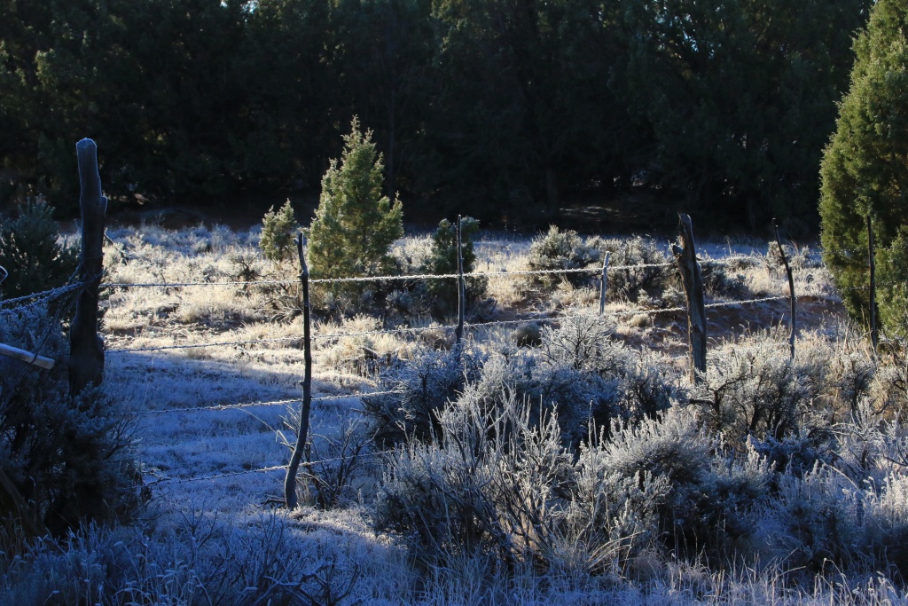
First, after some advice from Steve from the Paria Outpost & Outfitters, we headed up toward House Rock Road, the road leading to the Waves. This is a scenic drive by itself, but our destination was Pinnacle Valley on the southern region of the Paria Plateau. On our way, there was nice frost all over the place,
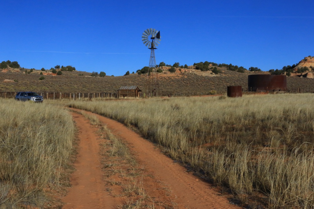
To reach this valley, the Pine Tree Road climbing to the plateau is nice and easy until we reached these installation.
After, we encountered some deep sand but with the recent precipitations, it wasn't too bad. The factory front skid acted as a shovel in a single occasion! Under dryer period, traveling on the Paria Plateau is always an adventure because of sand traps.
The Pinnacle Valley contains numerous, well, pinnacles, of white and orange sandstone, with interesting forms.
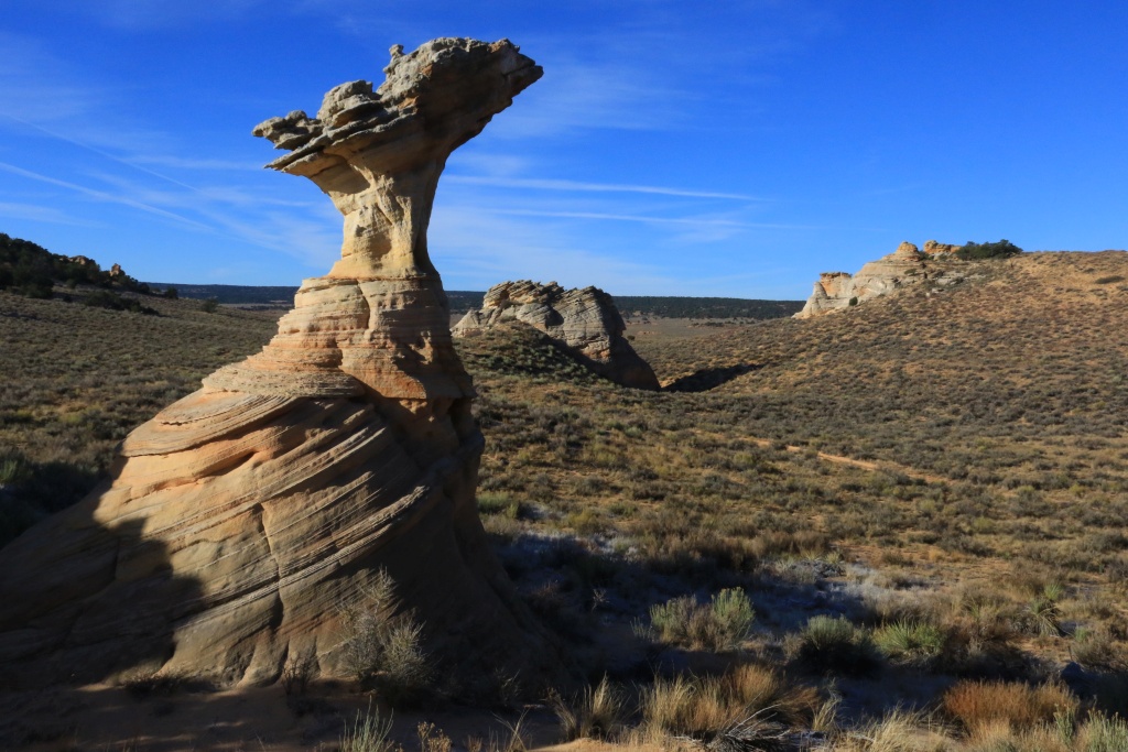
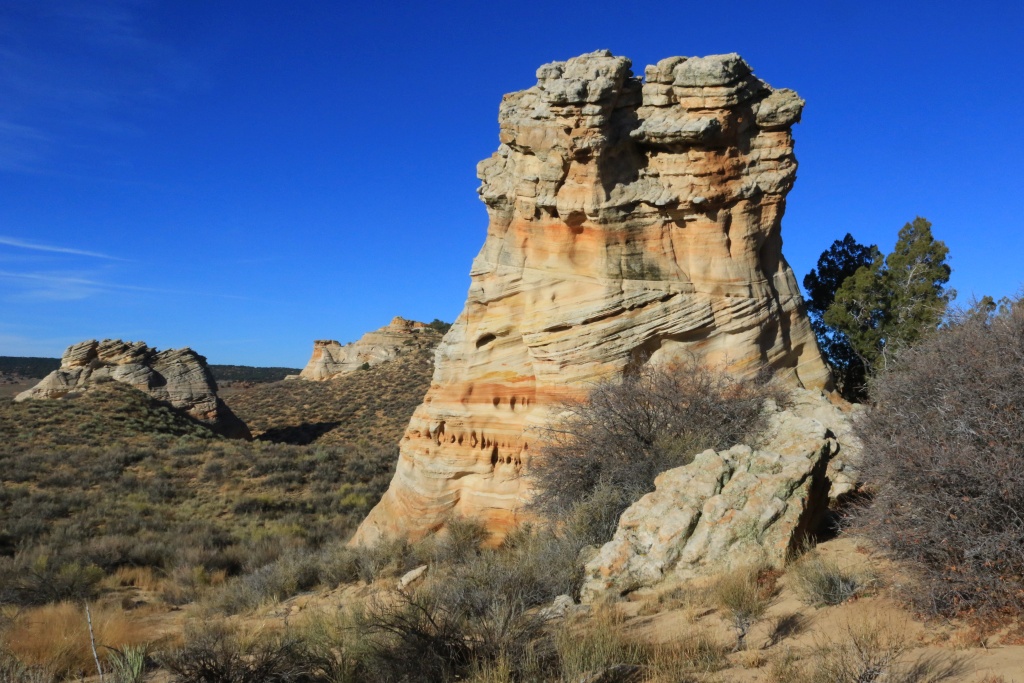
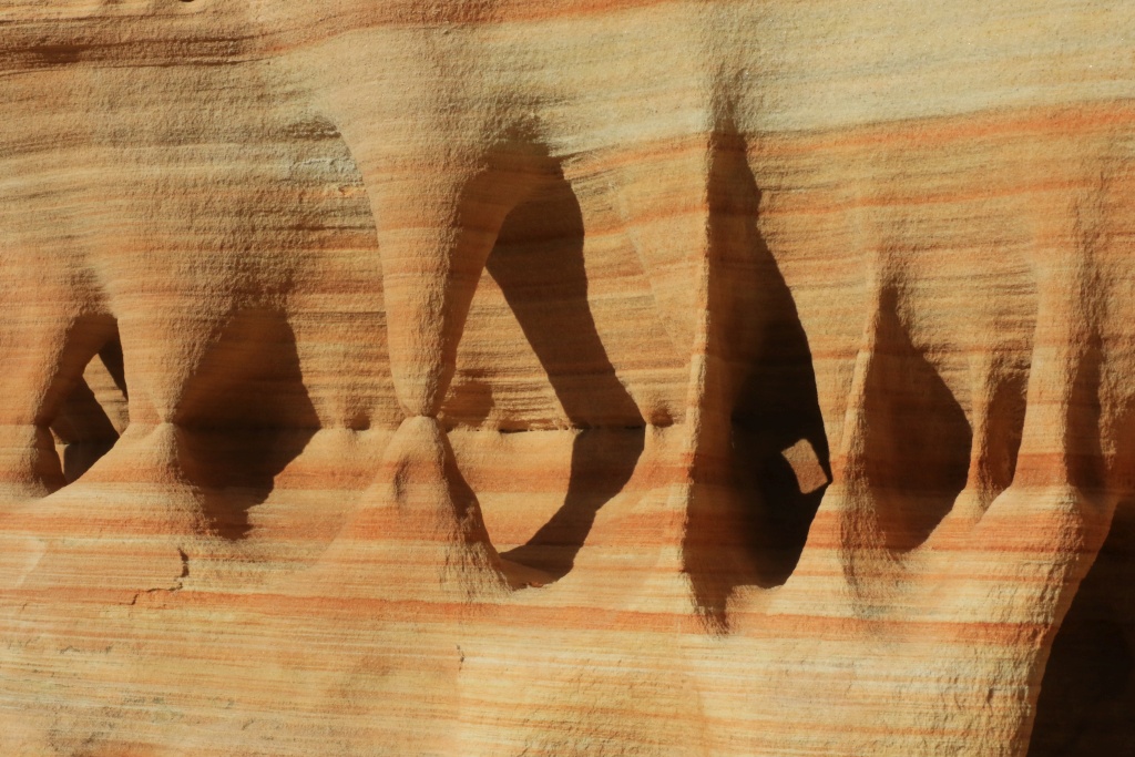
We explored a bit, using side roads which were sandy and narrow because of bushes. We will get back home with some pinstripes as souvenirs.
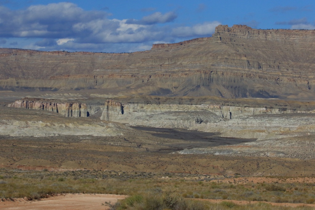
We then headed back toward Page, to go onto a trail leading to a possible hiking destination for a futur trip, Lower or Upper White Rocks. These sites were more accessible until a few years ago when BLM closed a road connecting to the Cottonwood Road. For today, this was purely a stop and go.
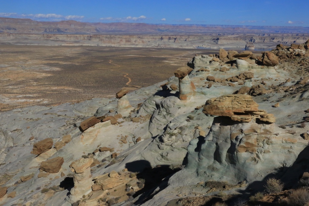
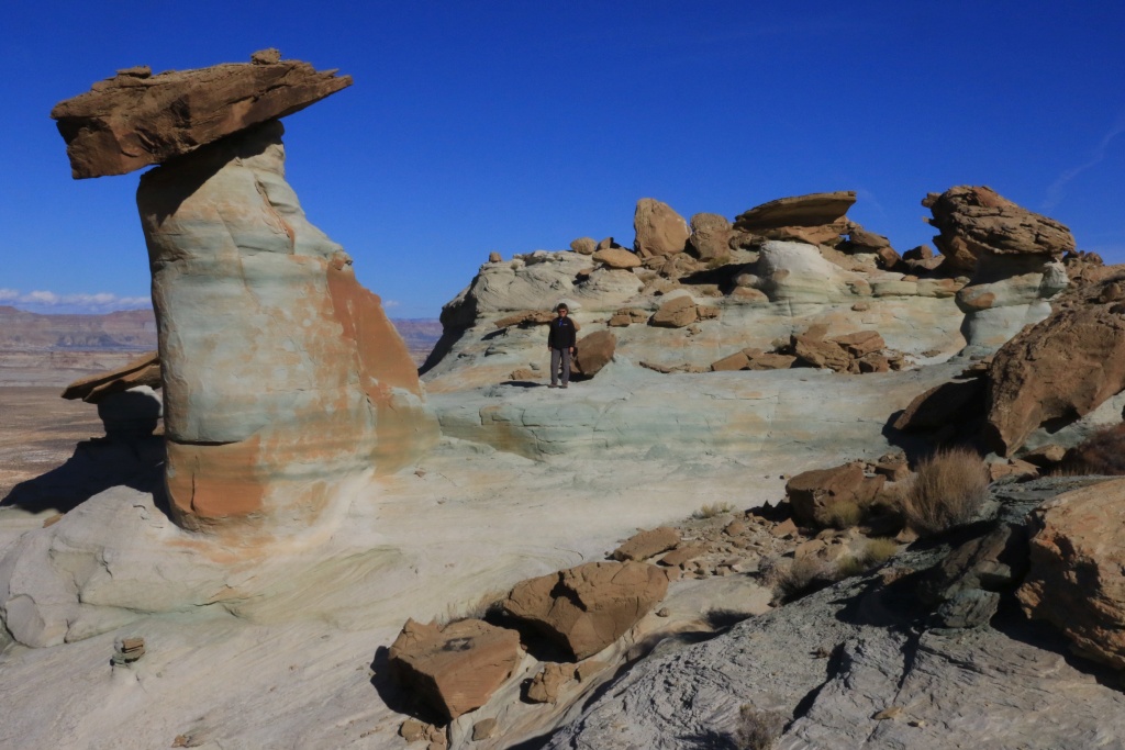
We finally headed toward our third destination, the Stud Horse Point Road. Along the road, we encountered nice hoodoos on greenish rock, which is pretty unusual.
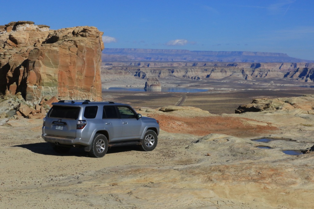
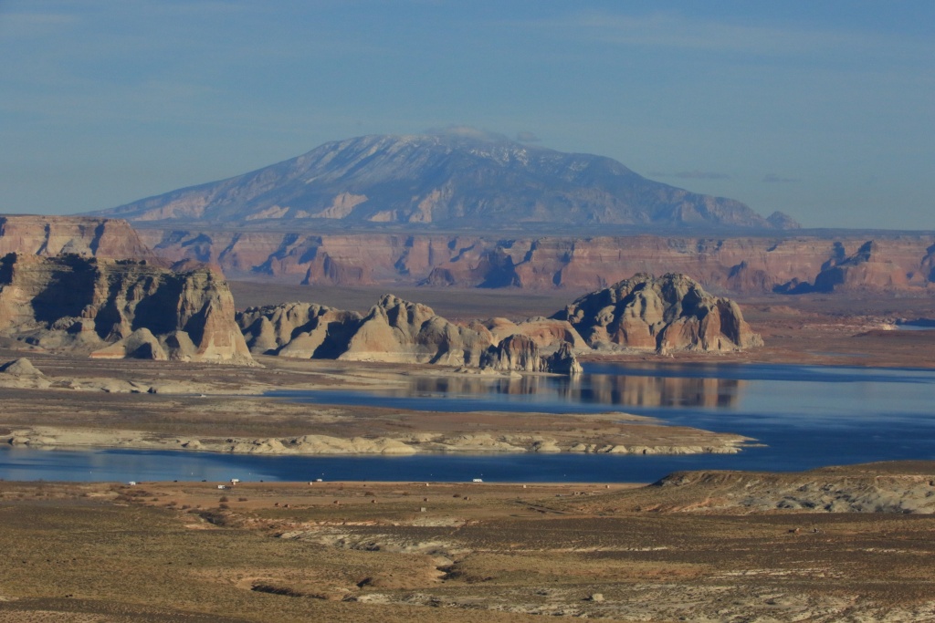
This road is easy and leads to a superb overlook over the US89 with Lake Powell in the background.
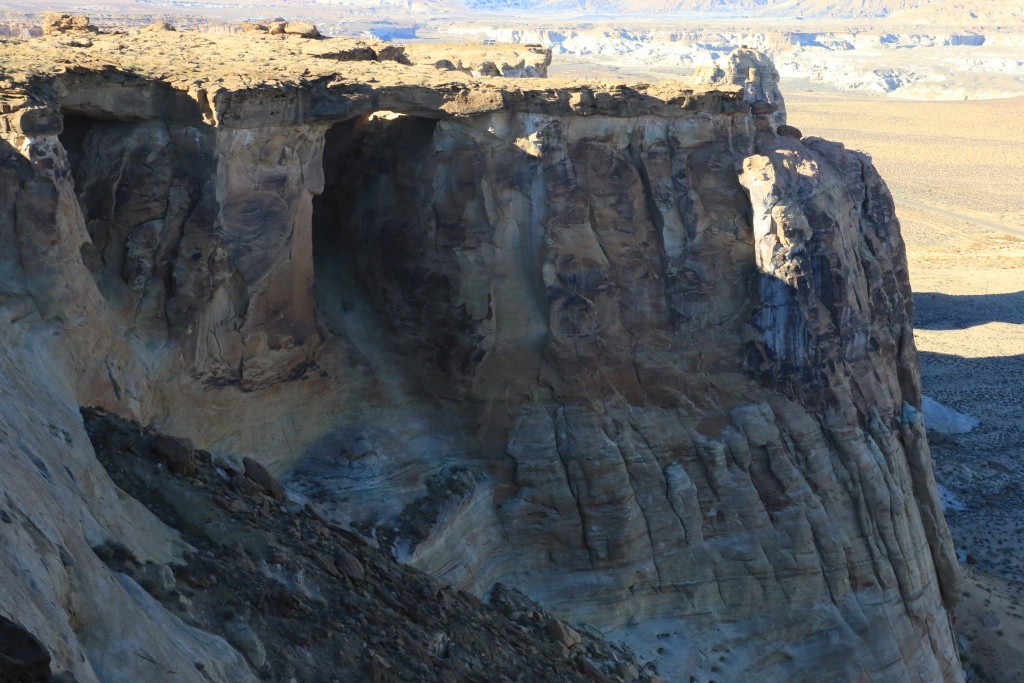
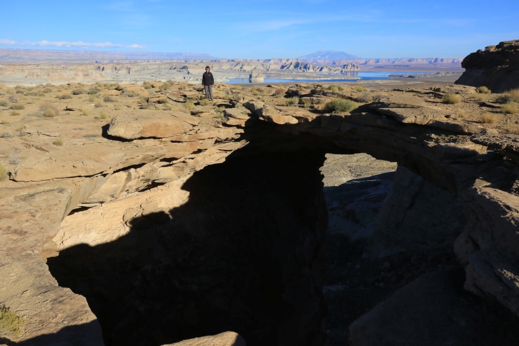
Along the cliff, also visible from US89, the Skyline Arch was an interesting feature, accessible by hiking about 1.5 km.
Today was our last day near Page. Tomorrow, we head toward Flagstaff for five days, a region which is a lot less familiar to us.
.
Start point: Page, AZ
End point: Page, AZ
Today was another great wheeling day, with three trails.
First, after some advice from Steve from the Paria Outpost & Outfitters, we headed up toward House Rock Road, the road leading to the Waves. This is a scenic drive by itself, but our destination was Pinnacle Valley on the southern region of the Paria Plateau. On our way, there was nice frost all over the place,
To reach this valley, the Pine Tree Road climbing to the plateau is nice and easy until we reached these installation.
After, we encountered some deep sand but with the recent precipitations, it wasn't too bad. The factory front skid acted as a shovel in a single occasion! Under dryer period, traveling on the Paria Plateau is always an adventure because of sand traps.
The Pinnacle Valley contains numerous, well, pinnacles, of white and orange sandstone, with interesting forms.
We explored a bit, using side roads which were sandy and narrow because of bushes. We will get back home with some pinstripes as souvenirs.
We then headed back toward Page, to go onto a trail leading to a possible hiking destination for a futur trip, Lower or Upper White Rocks. These sites were more accessible until a few years ago when BLM closed a road connecting to the Cottonwood Road. For today, this was purely a stop and go.
We finally headed toward our third destination, the Stud Horse Point Road. Along the road, we encountered nice hoodoos on greenish rock, which is pretty unusual.
This road is easy and leads to a superb overlook over the US89 with Lake Powell in the background.
Along the cliff, also visible from US89, the Skyline Arch was an interesting feature, accessible by hiking about 1.5 km.
Today was our last day near Page. Tomorrow, we head toward Flagstaff for five days, a region which is a lot less familiar to us.
.
Last edited:
JohnTheLuck
Member
Day 35:
Start point: Page, AZ
End point: Flagstaff, AZ
First, happy Thanksgiving to all my american friends!
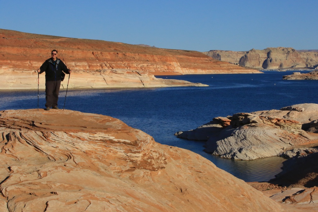
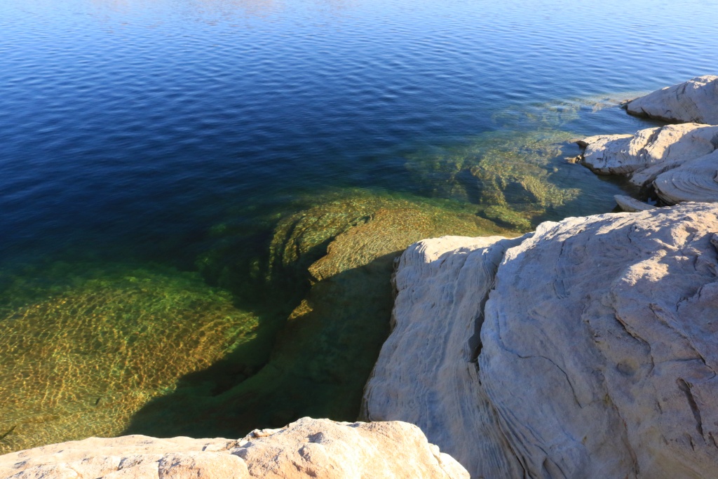
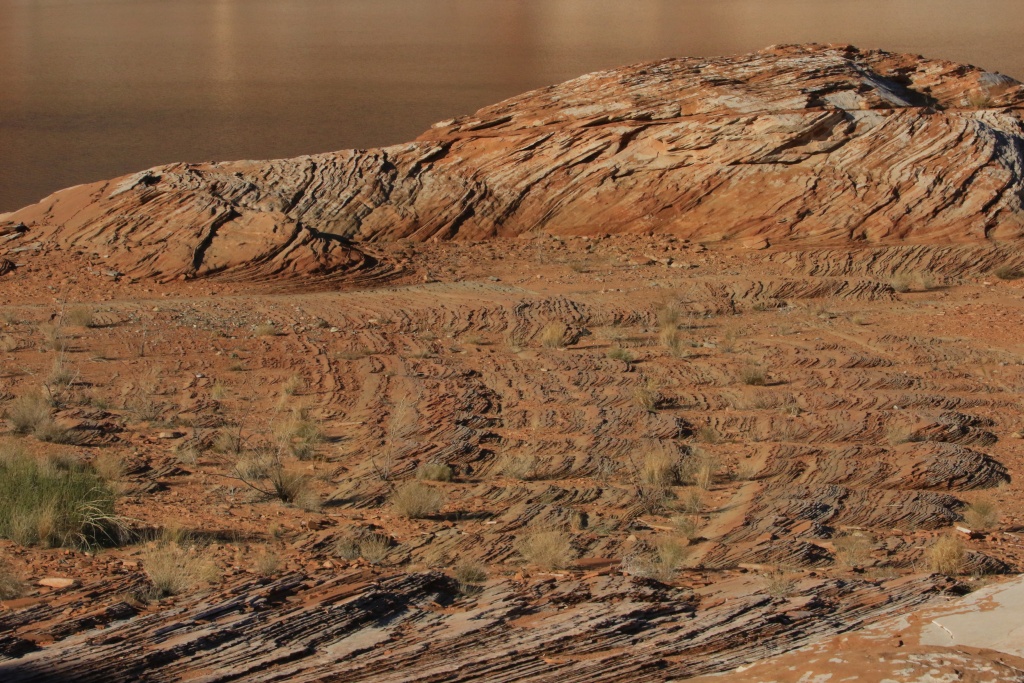
This morning, we wanted to make our last hours in Page to good use, so we went an area called The Chains, a rocky section near Lake Powell. The calm and cristal clear waters and rising sun mas a perfect match for nice pictures.
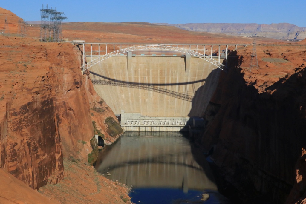
After, we headed to the Glen Canyon Dam Scenic View.
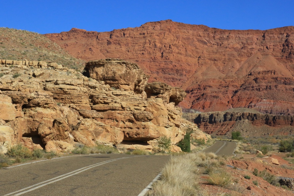
We then took the road toward the Lee's Ferry area of Glen Canyon NRA. This place is magical, with Vermillion Cliffs high above, and the Colorado River down in the canyon.
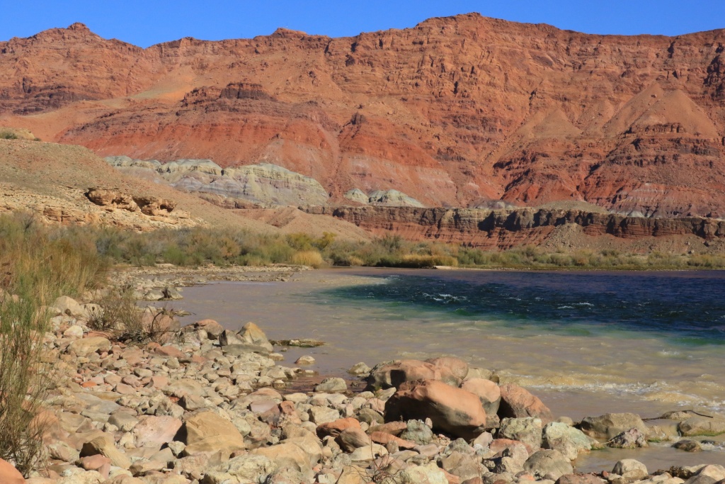
Next, we saw the confluence of the cristal clear Colorado River with the muddy Paria River coming from the longest slot canyon in the world, the Buckskin Gulch.
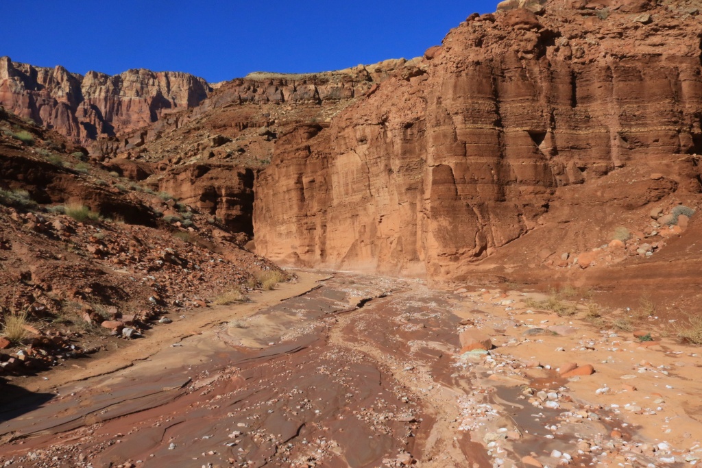
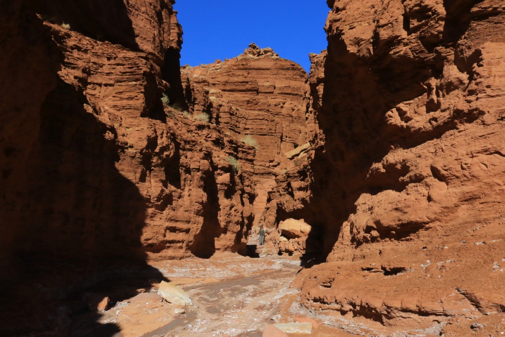
We then stop to hike the Upper Cathedral Wash Trail, one of the few trail we didn't hike during previous trips.
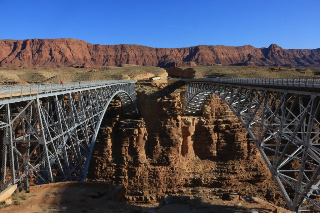
On our way out of Glen Canyon NRA, we stopped at Marble Canyon, with the old Rainbow Bridge aside the newer US89A bridge. The view from the Rainbow Bridge is fantastic, with a huge drop to the Colorado River.
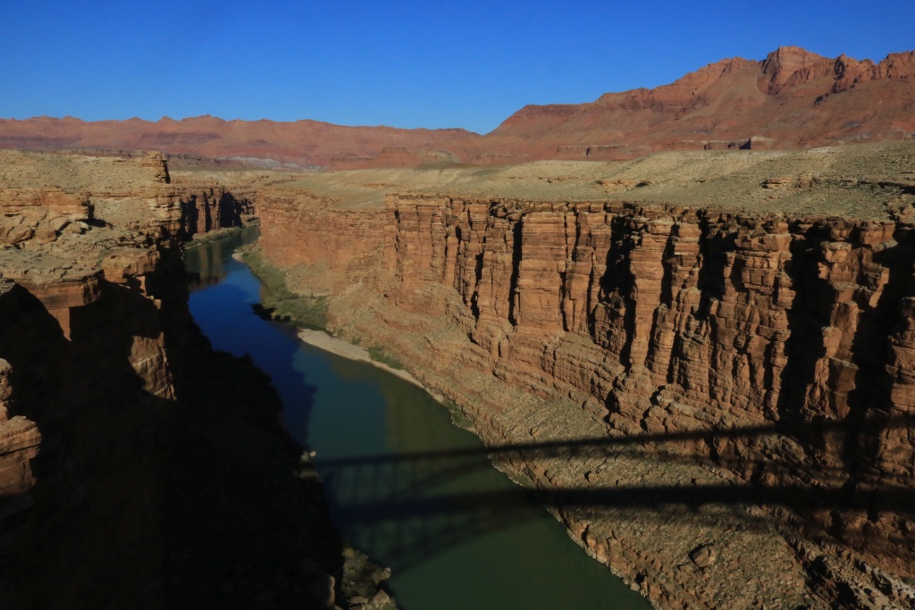
There was a few people down on the beach near the Colorado River, probably using the river to get there.
We finally arrived in Flagstaff. Our scheduled five night stay will probably be shortened a bit since snow is expected on Sunday. You would think as a Canadian, I like snow? Not really, I enjoy much more the weather you guys have around here.
.
Start point: Page, AZ
End point: Flagstaff, AZ
First, happy Thanksgiving to all my american friends!
This morning, we wanted to make our last hours in Page to good use, so we went an area called The Chains, a rocky section near Lake Powell. The calm and cristal clear waters and rising sun mas a perfect match for nice pictures.
After, we headed to the Glen Canyon Dam Scenic View.
We then took the road toward the Lee's Ferry area of Glen Canyon NRA. This place is magical, with Vermillion Cliffs high above, and the Colorado River down in the canyon.
Next, we saw the confluence of the cristal clear Colorado River with the muddy Paria River coming from the longest slot canyon in the world, the Buckskin Gulch.
We then stop to hike the Upper Cathedral Wash Trail, one of the few trail we didn't hike during previous trips.
On our way out of Glen Canyon NRA, we stopped at Marble Canyon, with the old Rainbow Bridge aside the newer US89A bridge. The view from the Rainbow Bridge is fantastic, with a huge drop to the Colorado River.
There was a few people down on the beach near the Colorado River, probably using the river to get there.
We finally arrived in Flagstaff. Our scheduled five night stay will probably be shortened a bit since snow is expected on Sunday. You would think as a Canadian, I like snow? Not really, I enjoy much more the weather you guys have around here.
.
Last edited:
JohnTheLuck
Member
John,
Where are you mainly staying: camping, 4Runner, Hotels?
We are staying in hotels. The 4Runner is too small for two persons with luggage and camping a bit too cold. I will get eventually an RTT and stay in camping or BLM land.
JohnTheLuck
Member
Day 36:
Start point: Flagstaff, AZ
End point: Flagstaff, AZ
Today was so much fun!!!
Our first destination of the day was Cinder Hills OHV Area, near Sunset Crater. Our goal was to do the loop NF776 and NF777, but also the loop around Double Crater.
When arriving, it was very cold with frost all around.
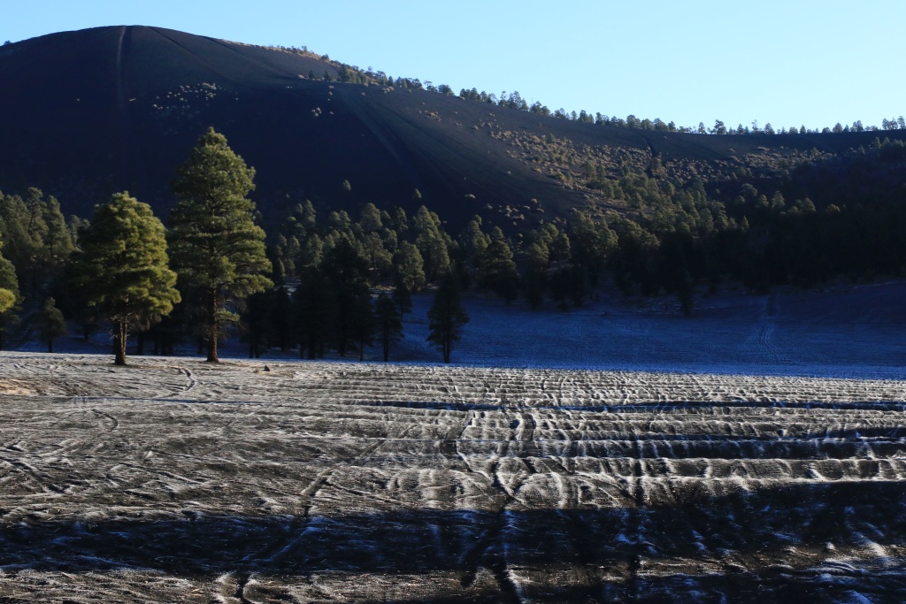
I was a bit worried about going uphill in this kind of terrain, afraid to slip or get stuck. We aired down at about 20psi, engage 4WD and go! On the steepest section, I used 4LO, and the 4Runner climbed like a champ.
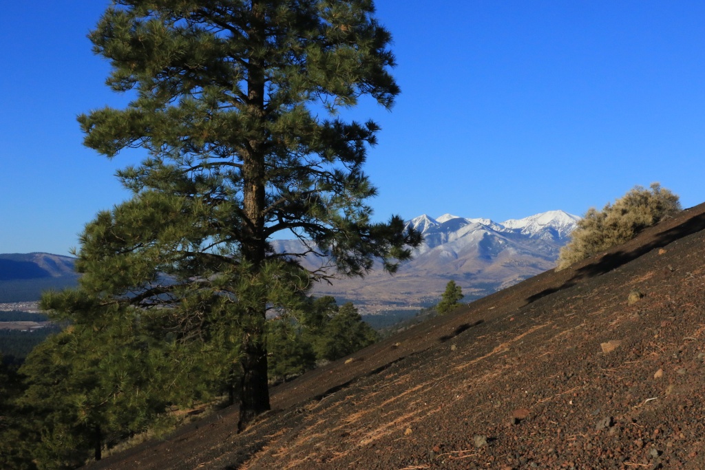
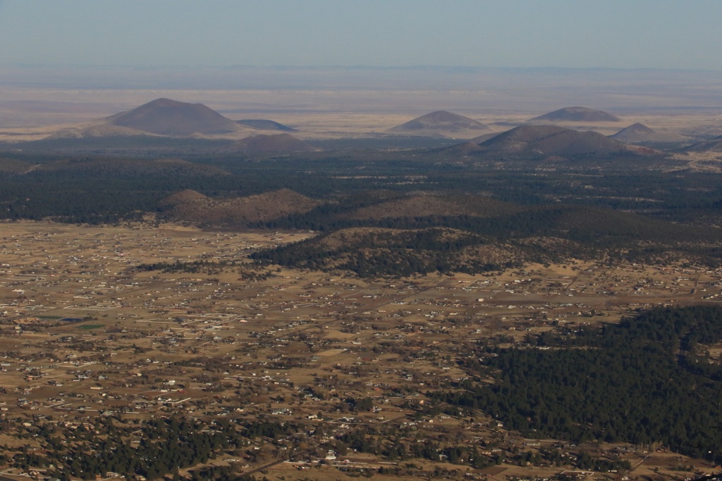
From the top, the view of the surrounding is amazing, with volcanoes everywhere. There are around 600 hundred in this region.
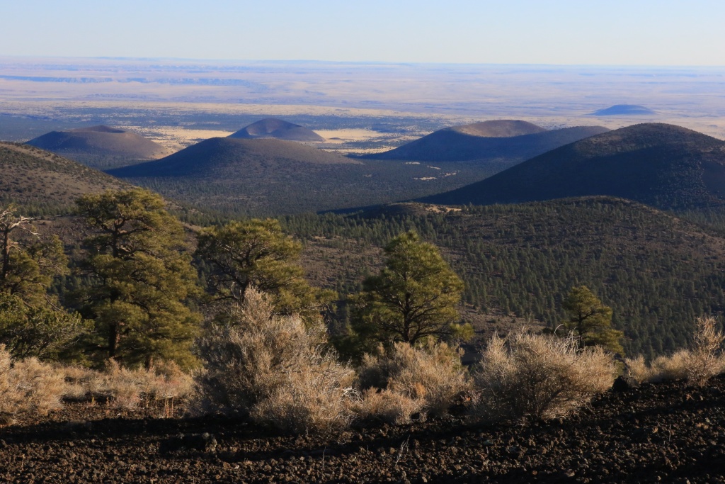
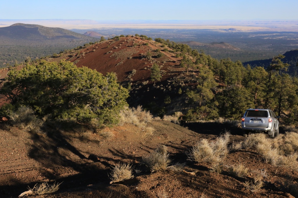
Continuing on the loop, we crossed the junction between the two craters.
Mt. San Francisco in the background already had some snow. Later in the day, we met a guy who just skied this morning.
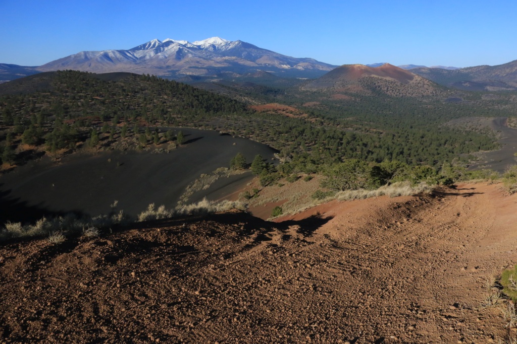
We then headed down. We made a small side trip outside the most used track to see something, and we had some worry when the wheels began to slip and the 4Runner moved sideways a bit downhill. We backed-off after turning from sideways to up-down direction, and we were able to get back on the track which is more compact. I just missed my first opportunity to use my Maxsa boards!
Later, we went to Sunset Crater Volcano NM. We had to go back to the US89 since the FR776 road is effectively closed between Cinder Hills OHV and the monument.
We hiked a few trails, in particular the Lava Flow Trail, going just at the base of Sunset Crater.
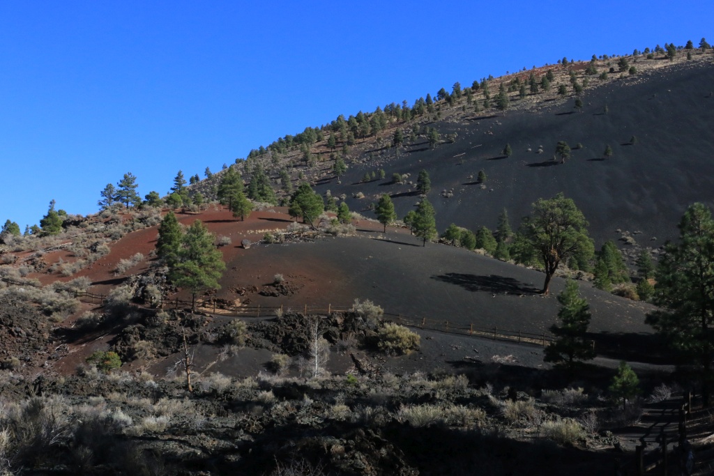
After, we continued onto the Scenic Loop Drive between Sunset Crater and Wutpatki NM. We stopped at Doney Rest Area to hike on top of the hills for a nice view.
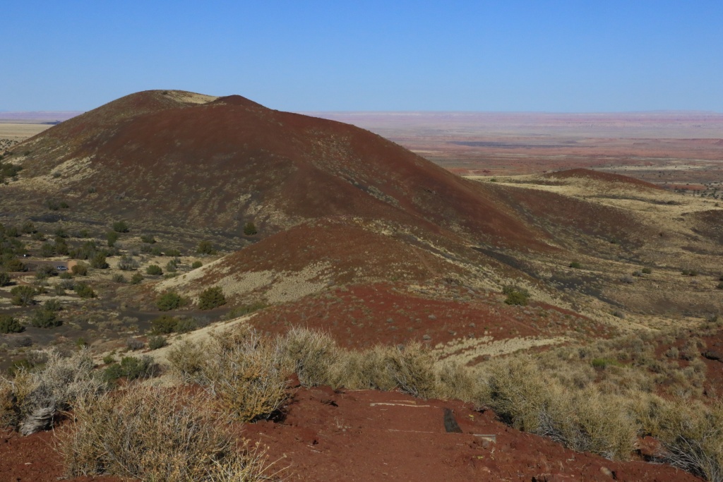
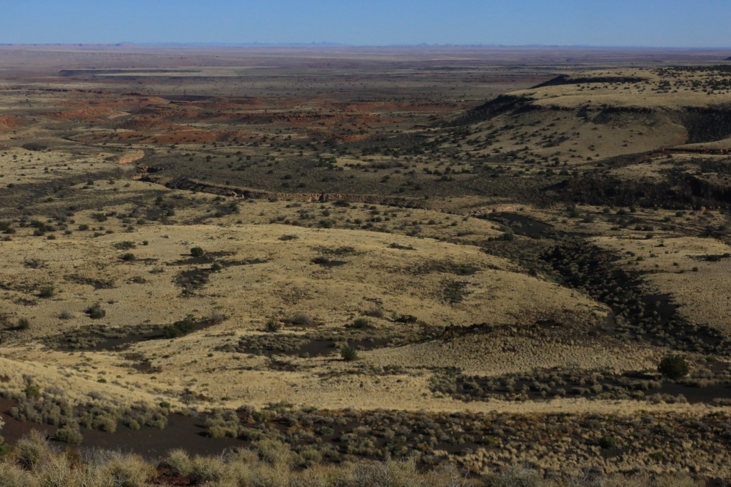
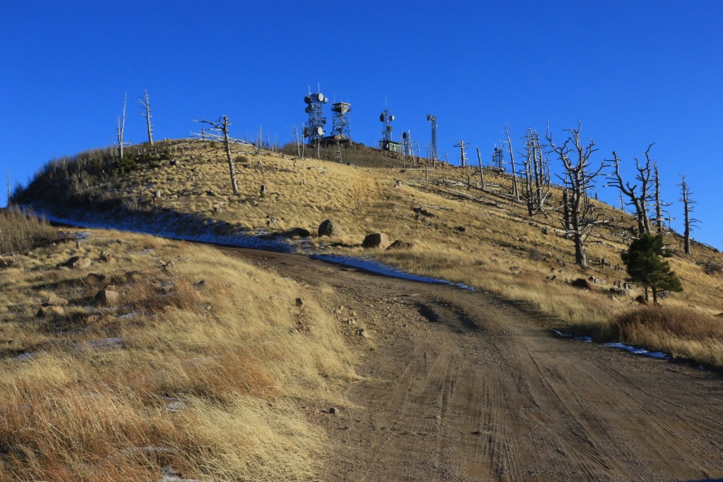
With about an hour of sunlight left, we headed toward Elden Mountain Lookout, offering a outstanding view of Flagstaff and vicinity, Sunset Crater, Cinder Hills OHV and more.
Tomorrow, we head toward Sedona, avoiding the snow fall over Flagstaff on Sunday.
.
Start point: Flagstaff, AZ
End point: Flagstaff, AZ
Today was so much fun!!!
Our first destination of the day was Cinder Hills OHV Area, near Sunset Crater. Our goal was to do the loop NF776 and NF777, but also the loop around Double Crater.
When arriving, it was very cold with frost all around.
I was a bit worried about going uphill in this kind of terrain, afraid to slip or get stuck. We aired down at about 20psi, engage 4WD and go! On the steepest section, I used 4LO, and the 4Runner climbed like a champ.
From the top, the view of the surrounding is amazing, with volcanoes everywhere. There are around 600 hundred in this region.
Continuing on the loop, we crossed the junction between the two craters.
Mt. San Francisco in the background already had some snow. Later in the day, we met a guy who just skied this morning.
We then headed down. We made a small side trip outside the most used track to see something, and we had some worry when the wheels began to slip and the 4Runner moved sideways a bit downhill. We backed-off after turning from sideways to up-down direction, and we were able to get back on the track which is more compact. I just missed my first opportunity to use my Maxsa boards!
Later, we went to Sunset Crater Volcano NM. We had to go back to the US89 since the FR776 road is effectively closed between Cinder Hills OHV and the monument.
We hiked a few trails, in particular the Lava Flow Trail, going just at the base of Sunset Crater.
After, we continued onto the Scenic Loop Drive between Sunset Crater and Wutpatki NM. We stopped at Doney Rest Area to hike on top of the hills for a nice view.
With about an hour of sunlight left, we headed toward Elden Mountain Lookout, offering a outstanding view of Flagstaff and vicinity, Sunset Crater, Cinder Hills OHV and more.
Tomorrow, we head toward Sedona, avoiding the snow fall over Flagstaff on Sunday.
.
Last edited:
JohnTheLuck
Member
Day 37:
Start point: Flagstaff, AZ
End point: Cottonwood, AZ
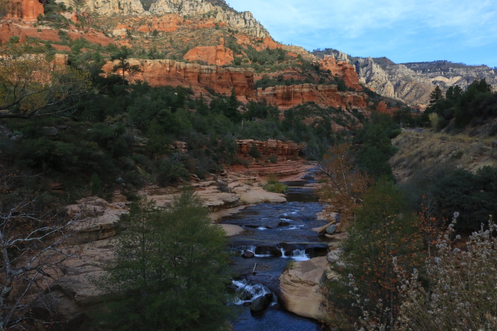
We left Flagstaff with its cold morning, remembering my home town mornings (...). We drove the Oak Creek Canyon Scenic Drive. I guess that with the sunlight, this road is spectacular, but the clouds we had, the colors are faded a bit. We made a few stops, at the Oak Creek Canyon Vista (which was closed before 9h00) and later at Slide Rock SP, also closed.
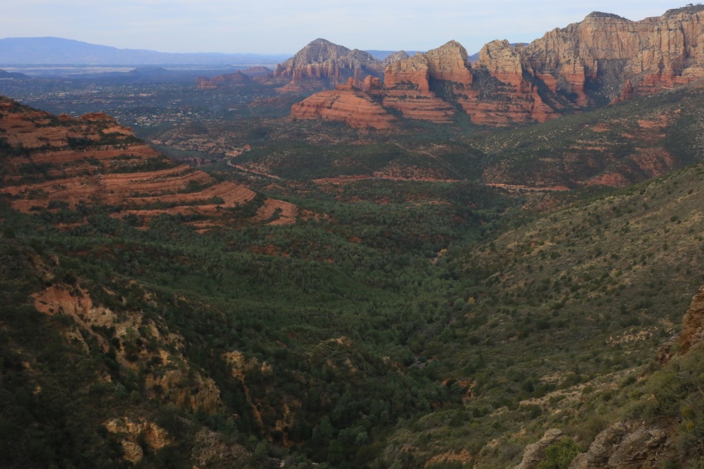
We then drove back on the I-17 to start wheeling the Schnebly Hills Road downward. This road was described as an easy road in the book I am using, but it seems that maintenance is really low to inexistant. It was rocky almost all the way, with big rocks and ledges, still manageable with my stock 4Runner, but definitively not an easy trail but moderate in my opinion. Anyway, the views over Sedona and red rocks was still great.
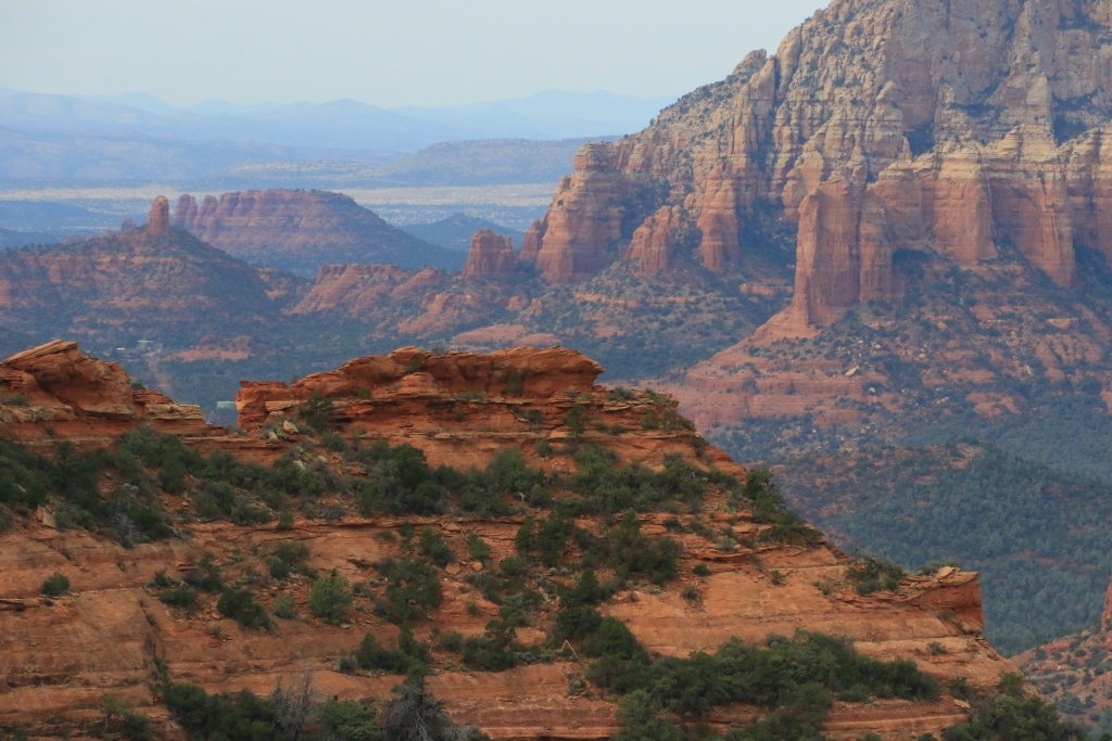
After getting down to Sedona, taking a small lunch, and getting stuck in the Saturday-afternoon-of-the-Thanksgiving-long-weekend, I had enough and went to wheel the Outlaw Trail, south of Sedona.
We were lucky enough to be able to visit both Indian Ruins sites. At the Palatki Ruins, volunteer guides told us about the site and their occupants in the past.
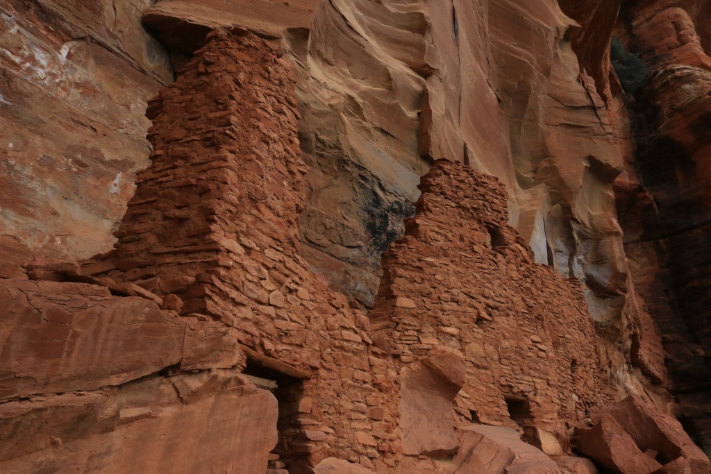
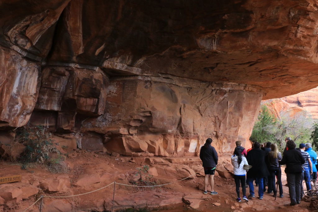
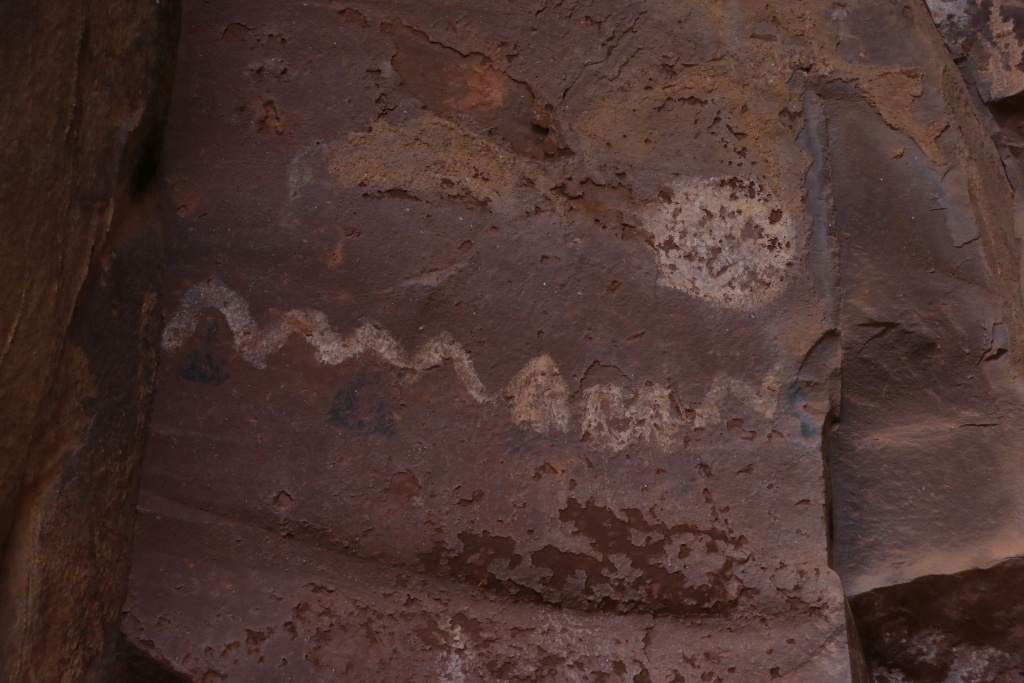
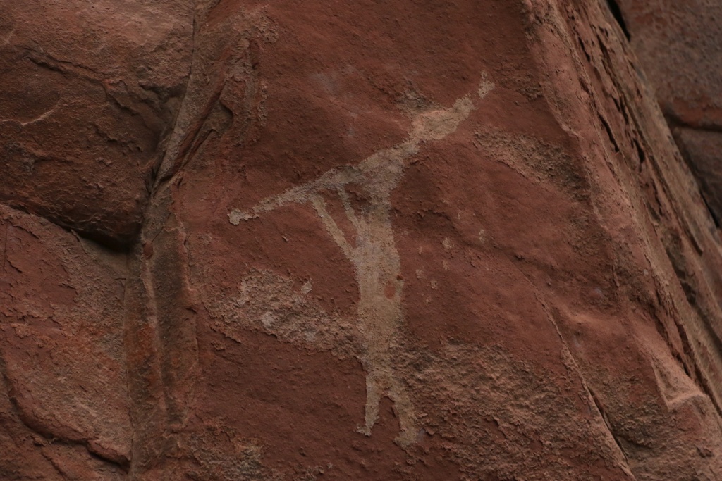
These guides were fantastic and very knowledgeable. Without them, we would have missed most of the meaning of the pictographs. These were dated from 5000 BC to about 1400 AC. Like this one, a solar calendar indicating the rising position of the sun against the cliffs in the east.
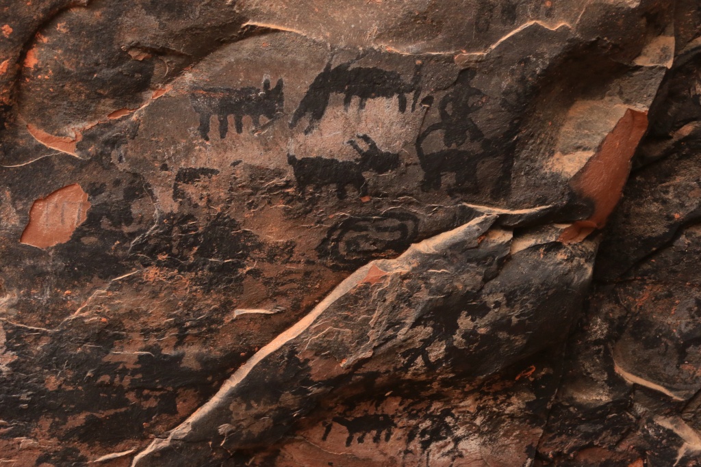
When we arrived at the second site, the Honanki Ruins, it was exactly 15h00, the closing time of the gate. A volunteer saw us arriving, and wave at us telling to get inside before she closes the gate. What a nice person!
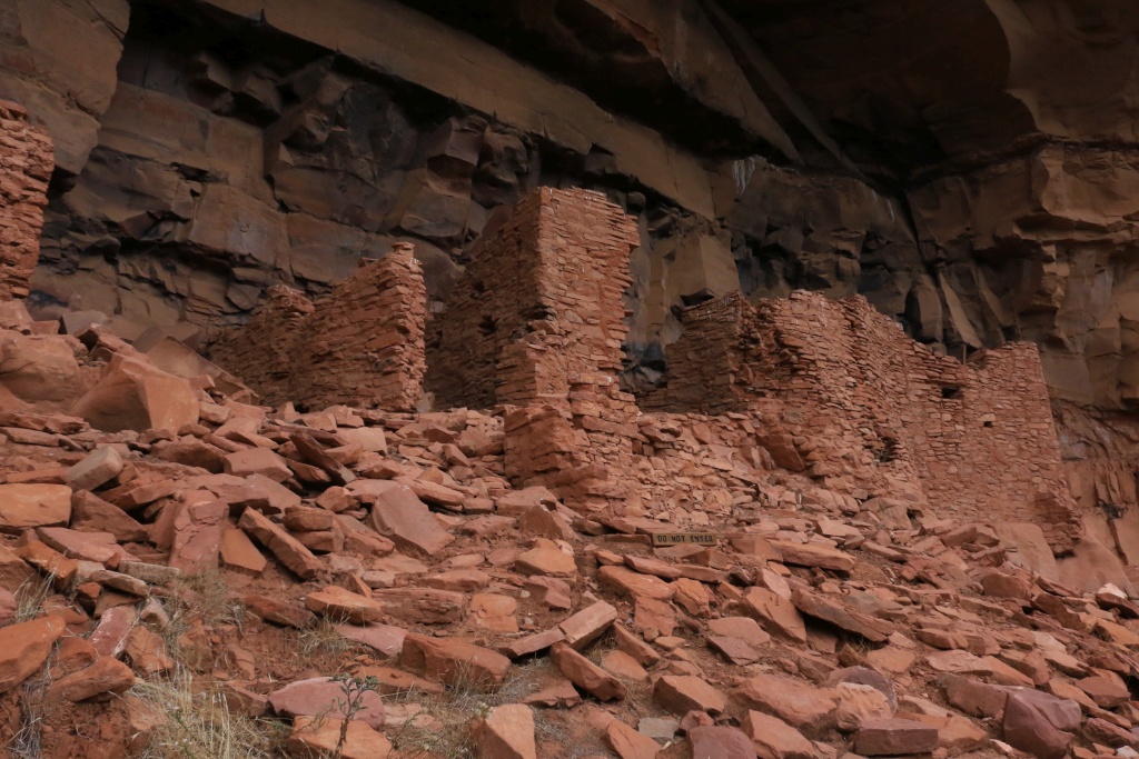
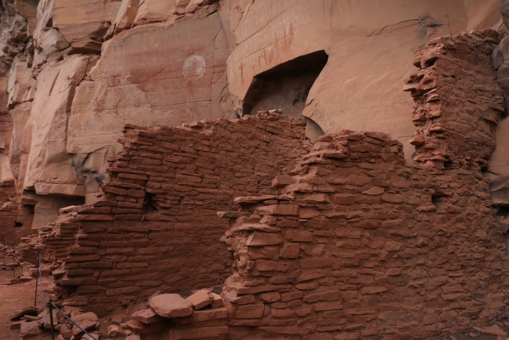
Before leaving, I asked the volunteer about the road condition further to complete the loop. She said that maintenance was so low the road is almost impassable, and only ATV could continue. We decided to turn around.
We then headed toward Dry Creek Trail to wheel up to the cabin, but a voluntary step right at the beginning discouraged me to continue, again. In the same book as mentioned before, this one is rated moderate, so I just imagined what would lie beyond.
Before leaving Sedona for the night, we went onto the Lower Red Rock Scenic Loop and catch this nice view of Cathedral Rock.
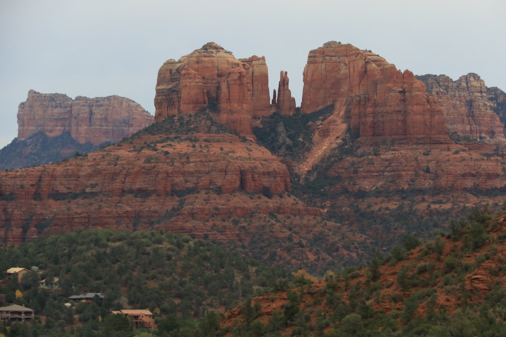
We might hike the trail going at the base of the needles in the middle in the next days if the weather cooperate a bit. Rain is expected in Cottonwood, but a bit of snow in Sedona, and a lot more in Flagstaff. We will probably stay on pavement, at least for tomorrow.
.
Start point: Flagstaff, AZ
End point: Cottonwood, AZ
We left Flagstaff with its cold morning, remembering my home town mornings (...). We drove the Oak Creek Canyon Scenic Drive. I guess that with the sunlight, this road is spectacular, but the clouds we had, the colors are faded a bit. We made a few stops, at the Oak Creek Canyon Vista (which was closed before 9h00) and later at Slide Rock SP, also closed.
We then drove back on the I-17 to start wheeling the Schnebly Hills Road downward. This road was described as an easy road in the book I am using, but it seems that maintenance is really low to inexistant. It was rocky almost all the way, with big rocks and ledges, still manageable with my stock 4Runner, but definitively not an easy trail but moderate in my opinion. Anyway, the views over Sedona and red rocks was still great.
After getting down to Sedona, taking a small lunch, and getting stuck in the Saturday-afternoon-of-the-Thanksgiving-long-weekend, I had enough and went to wheel the Outlaw Trail, south of Sedona.
We were lucky enough to be able to visit both Indian Ruins sites. At the Palatki Ruins, volunteer guides told us about the site and their occupants in the past.
These guides were fantastic and very knowledgeable. Without them, we would have missed most of the meaning of the pictographs. These were dated from 5000 BC to about 1400 AC. Like this one, a solar calendar indicating the rising position of the sun against the cliffs in the east.
When we arrived at the second site, the Honanki Ruins, it was exactly 15h00, the closing time of the gate. A volunteer saw us arriving, and wave at us telling to get inside before she closes the gate. What a nice person!
Before leaving, I asked the volunteer about the road condition further to complete the loop. She said that maintenance was so low the road is almost impassable, and only ATV could continue. We decided to turn around.
We then headed toward Dry Creek Trail to wheel up to the cabin, but a voluntary step right at the beginning discouraged me to continue, again. In the same book as mentioned before, this one is rated moderate, so I just imagined what would lie beyond.
Before leaving Sedona for the night, we went onto the Lower Red Rock Scenic Loop and catch this nice view of Cathedral Rock.
We might hike the trail going at the base of the needles in the middle in the next days if the weather cooperate a bit. Rain is expected in Cottonwood, but a bit of snow in Sedona, and a lot more in Flagstaff. We will probably stay on pavement, at least for tomorrow.
.
Last edited:

Ron4RNevada
New member
Just got caught up on your thread. I was last there in the '80s; took me about three years to do all of the places you have visited. Thanks for the memories.
I did it in a 1985 Ford Ranger 2wd. I did a lot of rock stacking and hiking.
Thanks again.
I did it in a 1985 Ford Ranger 2wd. I did a lot of rock stacking and hiking.
Thanks again.
JohnTheLuck
Member
Day 38:
Start point: Cottonwood, AZ
End point: Cottonwood, AZ
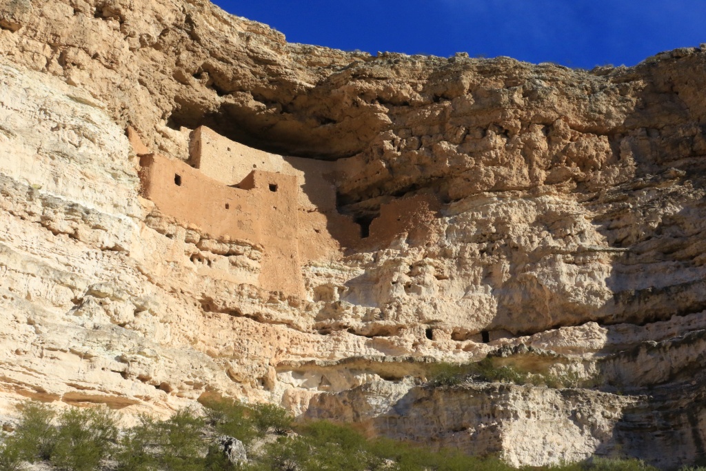
To our surprise, today started under the sun among scattered clouds. We took advantage of it by visiting again some Indians ruins. The first site, Montezuma Castle NM, is absolutely amazing. Inside an alcove in a limestone cliff, resides this incredible five story house built only in stone and mortar based on mud. Because of its location, protected against the elements, this is one of the best preserved ruins site.
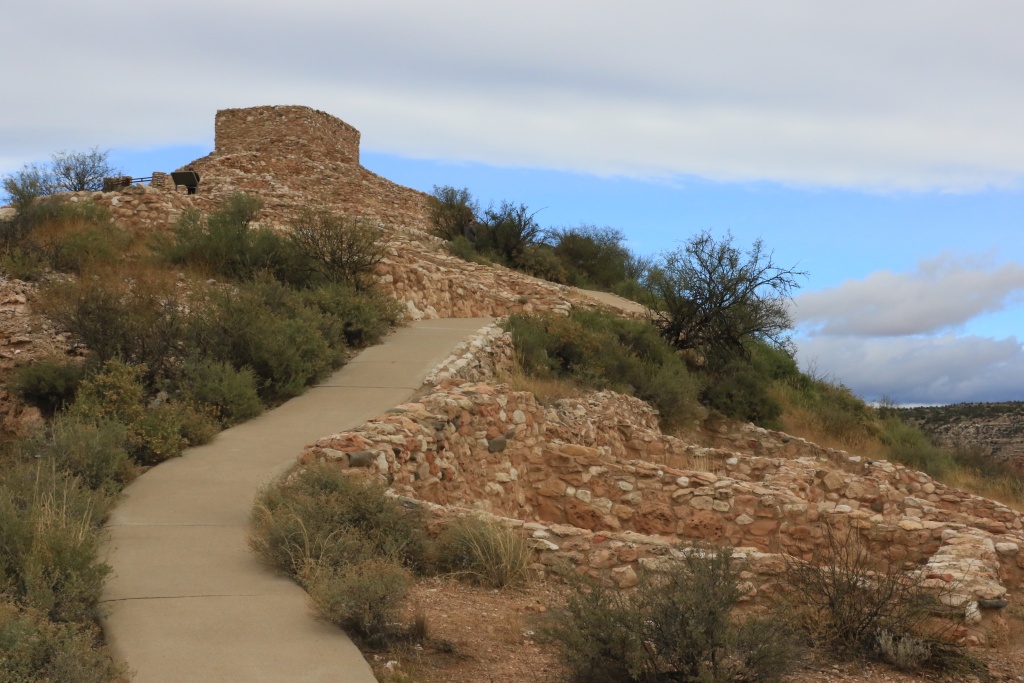
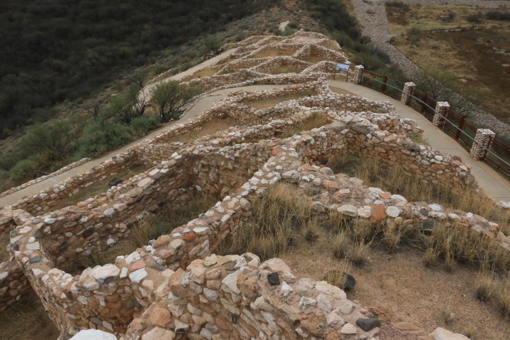
Nearby, another site worth visiting is Tuzigoot NM, preserving a pueblo with building originally 2 to 3 story high, with a total of 110 rooms.
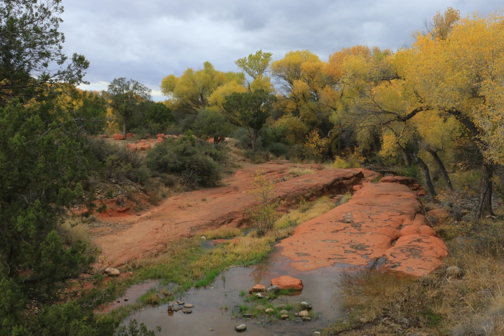
Since the weather was cooperating, even with the arrival of a full cloud cover, we decided to drive one of the proposed scenic drives on Coconino NF (which by the way has an excellent web site), the Desert View Loop. Part of it is on NF-618, a dirt road in excellent condition. On the way, some red rock patches are visible below the white limestone.
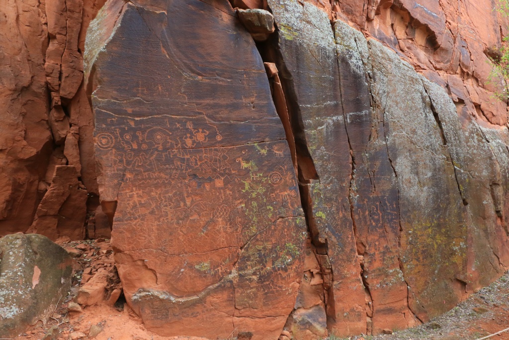
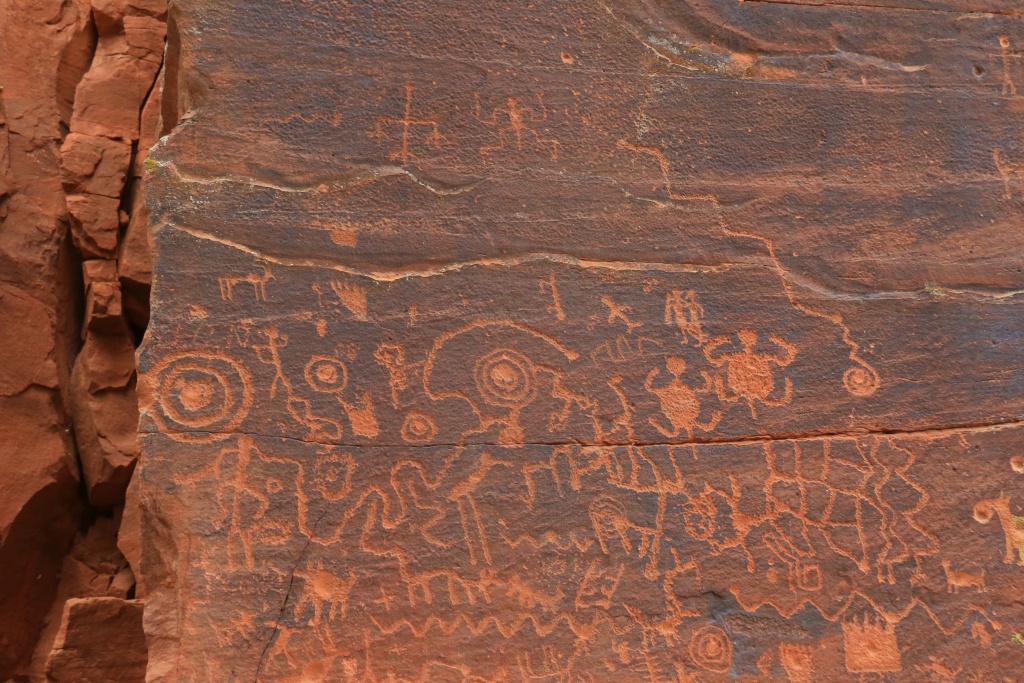
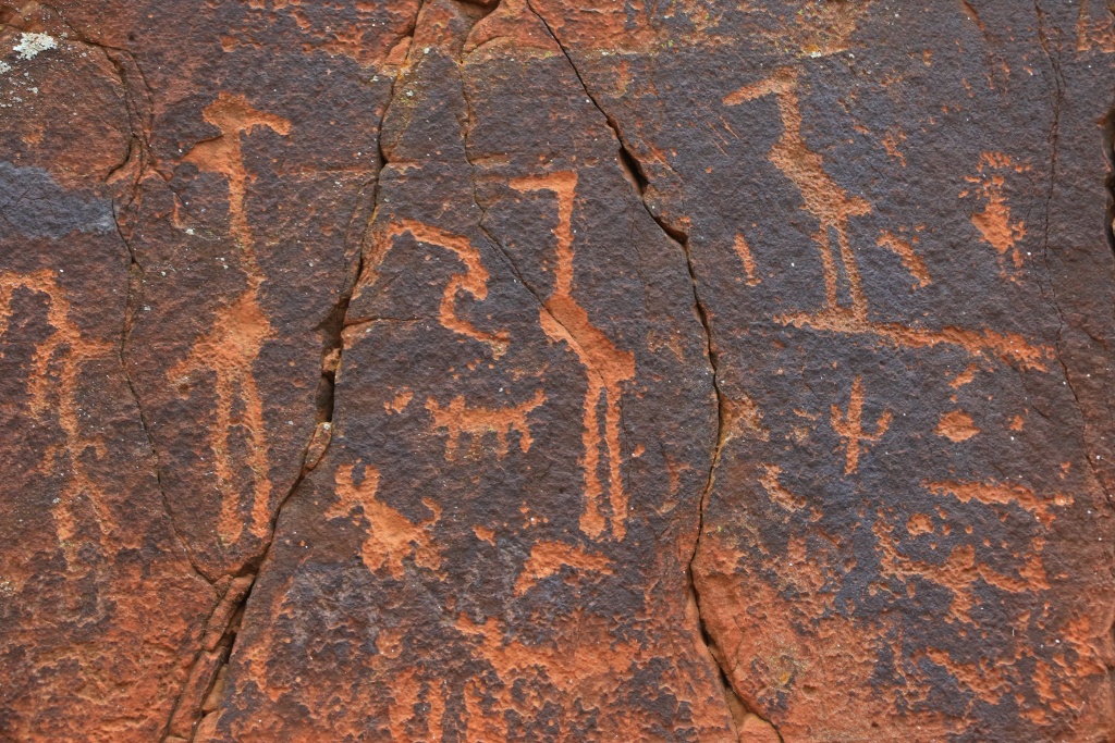
Near the end of the road, the V-Bar-V Ranch has an amazing petroglyph site. It contains some calendar, similar to the Honanki and Pulatki sites we visites yesterday.
Later, we returned back to Sedona, hoping to catch a few photographic opportunity. The inevitable occurred, the rain and some melting snow soon began to fall.
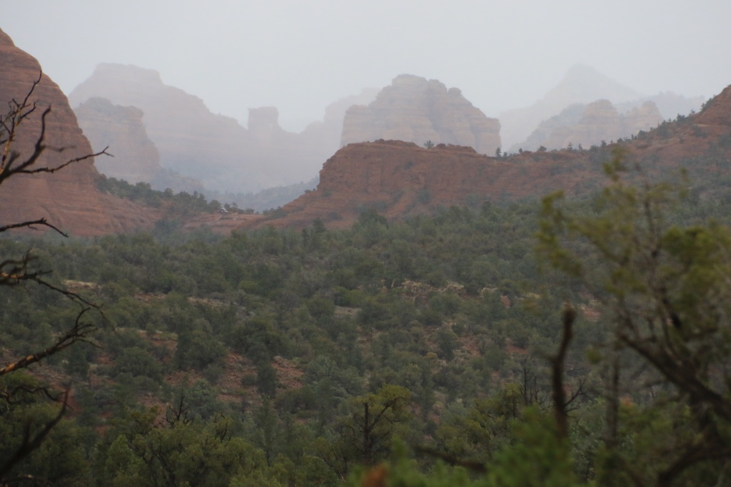
I am jealous. I hope you realize how lucky you are to have all these incredible preserved sites, and all this amazing scenery. Your national parks are the best creation of your nation. You should be extremely proud of them and support those who work hard to make them possible.
.
Start point: Cottonwood, AZ
End point: Cottonwood, AZ
To our surprise, today started under the sun among scattered clouds. We took advantage of it by visiting again some Indians ruins. The first site, Montezuma Castle NM, is absolutely amazing. Inside an alcove in a limestone cliff, resides this incredible five story house built only in stone and mortar based on mud. Because of its location, protected against the elements, this is one of the best preserved ruins site.
Nearby, another site worth visiting is Tuzigoot NM, preserving a pueblo with building originally 2 to 3 story high, with a total of 110 rooms.
Since the weather was cooperating, even with the arrival of a full cloud cover, we decided to drive one of the proposed scenic drives on Coconino NF (which by the way has an excellent web site), the Desert View Loop. Part of it is on NF-618, a dirt road in excellent condition. On the way, some red rock patches are visible below the white limestone.
Near the end of the road, the V-Bar-V Ranch has an amazing petroglyph site. It contains some calendar, similar to the Honanki and Pulatki sites we visites yesterday.
Later, we returned back to Sedona, hoping to catch a few photographic opportunity. The inevitable occurred, the rain and some melting snow soon began to fall.
I am jealous. I hope you realize how lucky you are to have all these incredible preserved sites, and all this amazing scenery. Your national parks are the best creation of your nation. You should be extremely proud of them and support those who work hard to make them possible.
.
Last edited:
HavanaTrader
New member
Amazing scenery! thanks for sharing.
I am jealous. I hope you realize how lucky you are to have all these incredible preserved sites, and all this amazing scenery. Your national parks are the best creation of your nation. You should be extremely proud of them and support those who work hard to make them possible.
Thank you! I wholeheartedly agree.

jdtaylor42
New member
We then drove back on the I-17 to start wheeling the Schnebly Hills Road downward. This road was described as an easy road in the book I am using, but it seems that maintenance is really low to inexistant. It was rocky almost all the way, with big rocks and ledges, still manageable with my stock 4Runner, but definitively not an easy trail but moderate in my opinion. Anyway, the views over Sedona and red rocks was still great.
The monsoon season always erodes that road some. Even in it's current condition though I would still consider it "easy" or low moderate compared to the other trails in Sedona. It it worth it though as it affords some spectacular views
Before leaving, I asked the volunteer about the road condition further to complete the loop. She said that maintenance was so low the road is almost impassable, and only ATV could continue. We decided to turn around.
This road definitely has parts that are much more difficult than Schnebly and it takes a long time to make that loop with not all that great views. Probably better you went back
We then headed toward Dry Creek Trail to wheel up to the cabin, but a voluntary step right at the beginning discouraged me to continue, again. In the same book as mentioned before, this one is rated moderate, so I just imagined what would lie beyond.
This trail is a true moderate trail. Much more difficult than Schnebly. Most vehicles that decide to start the trail park less than a 1/4mile in on the side of the trail and continue on foot. I can make it pretty easily in my rig but I am lifted 3". Would take some good spotting and wheel placement in a stock height rig.
The Devil's Bridge is worth the hike if you are going back through Sedona though. Strenuous hike but you can walk right out onto the arch and get some excellent photos
JohnTheLuck
Member
The monsoon season always erodes that road some. Even in it's current condition though I would still consider it "easy" or low moderate compared to the other trails in Sedona. It it worth it though as it affords some spectacular views
This road definitely has parts that are much more difficult than Schnebly and it takes a long time to make that loop with not all that great views. Probably better you went back
This trail is a true moderate trail. Much more difficult than Schnebly. Most vehicles that decide to start the trail park less than a 1/4mile in on the side of the trail and continue on foot. I can make it pretty easily in my rig but I am lifted 3". Would take some good spotting and wheel placement in a stock height rig.
The Devil's Bridge is worth the hike if you are going back through Sedona though. Strenuous hike but you can walk right out onto the arch and get some excellent photos
Thanks for your comments and advice. Being stock for now makes me very cautious about the trails I go.
JohnTheLuck
Member
Amazing scenery! thanks for sharing.
You are welcome! Its my pleasure to share.
JohnTheLuck
Member
Day 39:
Start point: Sedona, AZ
End point: Las Cruces, NM
The forecast changed during the night, and clouds were expected over Sedona with some showers and snow. We had enough, so we left toward the southeast, hoping to see some sunshine. My copilot has a certain talent to find roads avoiding the snow...
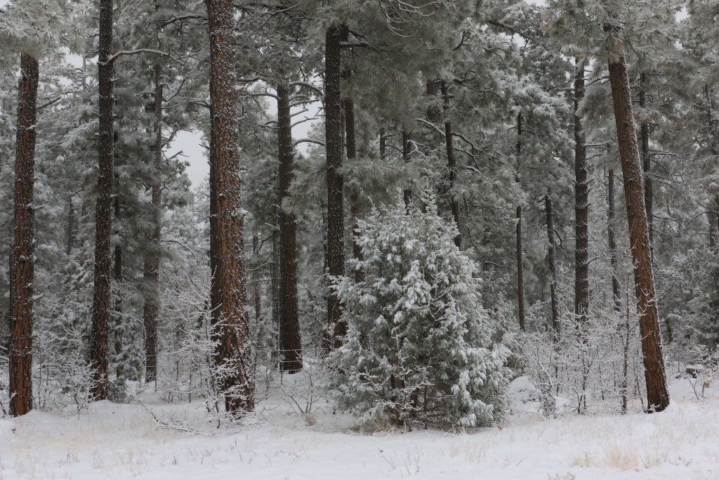
After driving in some mountains, we finally lost some altitude and got below the clouds, with the temperature warming a bit above freezing point.
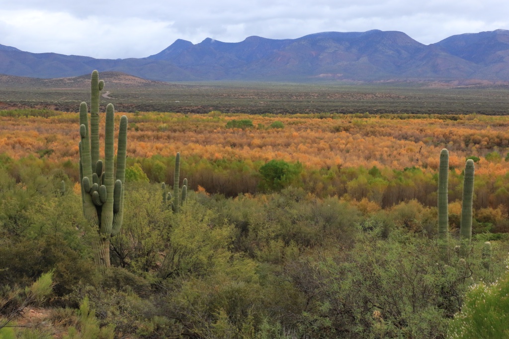
Later, in Tonto NF, we saw a first sight of normally higher temperature with saguaro, agave, and cholla filling the sight. Ahhhhhhh!!!!!!
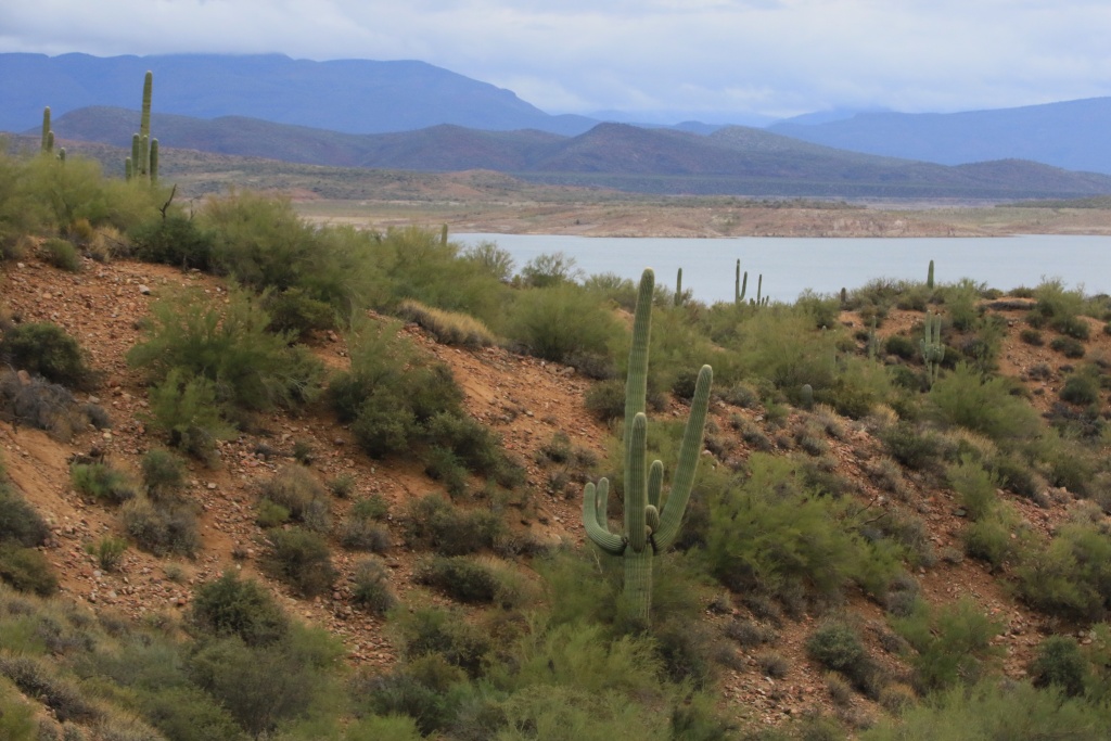
We drove along Thoedore Rosevelt Lake, which seems on the low side as I remember from a previous trip.
While driving on US70, we encountered escort police cars coming in our direction and forcing us off the highway so an excessive wide load truck would be able to pass. I missed to photograph it, but later we encountered another identical truck waiting at a weight station for the escort to come back.
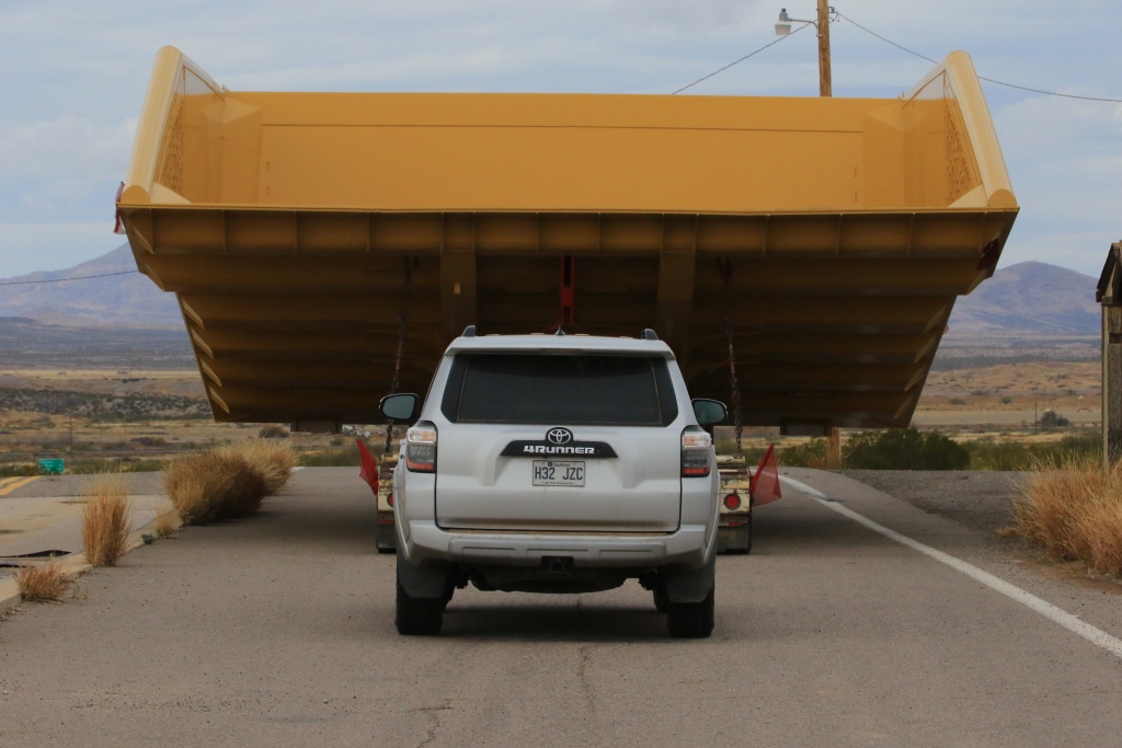
The rest of the road was not so scenic and we end up driving on I-10 after entering New Mexico. We stopped at Las Cruces for the night. The clouds are still hanging and we have to decide what to do next. For sure, the days are numbered until the end of the trip.
.
Start point: Sedona, AZ
End point: Las Cruces, NM
The forecast changed during the night, and clouds were expected over Sedona with some showers and snow. We had enough, so we left toward the southeast, hoping to see some sunshine. My copilot has a certain talent to find roads avoiding the snow...
After driving in some mountains, we finally lost some altitude and got below the clouds, with the temperature warming a bit above freezing point.
Later, in Tonto NF, we saw a first sight of normally higher temperature with saguaro, agave, and cholla filling the sight. Ahhhhhhh!!!!!!
We drove along Thoedore Rosevelt Lake, which seems on the low side as I remember from a previous trip.
While driving on US70, we encountered escort police cars coming in our direction and forcing us off the highway so an excessive wide load truck would be able to pass. I missed to photograph it, but later we encountered another identical truck waiting at a weight station for the escort to come back.
The rest of the road was not so scenic and we end up driving on I-10 after entering New Mexico. We stopped at Las Cruces for the night. The clouds are still hanging and we have to decide what to do next. For sure, the days are numbered until the end of the trip.
.
Last edited:
Similar threads
- Replies
- 0
- Views
- 2K
- Replies
- 1
- Views
- 2K
- Replies
- 34
- Views
- 10K


