JohnTheLuck's Adventures Thread

John,
very nice pics n documentation, loved that unimog. I was in Israel in 78 with my CJ5 and saw many unimogs used in their military, great go-anywhere vehicles. His sure looked set up for great traveling.
safe journies amigo,
willie
 
Day 7:

Start point: Hanksville, UT
End point: Torrey, UT

Today was a break from wheeling since my wife enjoy hiking much more. So we left Hanksville toward Capitol Reef NP to hike two trails. We started the day with a lot of sunshine, but scattered clouds moved in early in the morning.

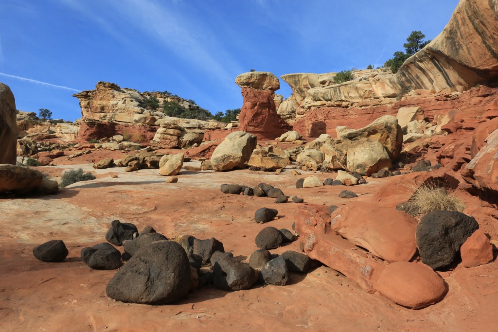
The first trail we hiked was Cohab Canyon to Fruita Overlooks. The scenery of this canyon and overlooks are amazing, with volcanic boulders in every corner.

37689450056_641feab941_o.jpg


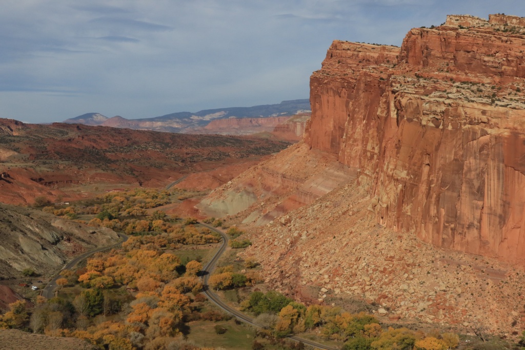
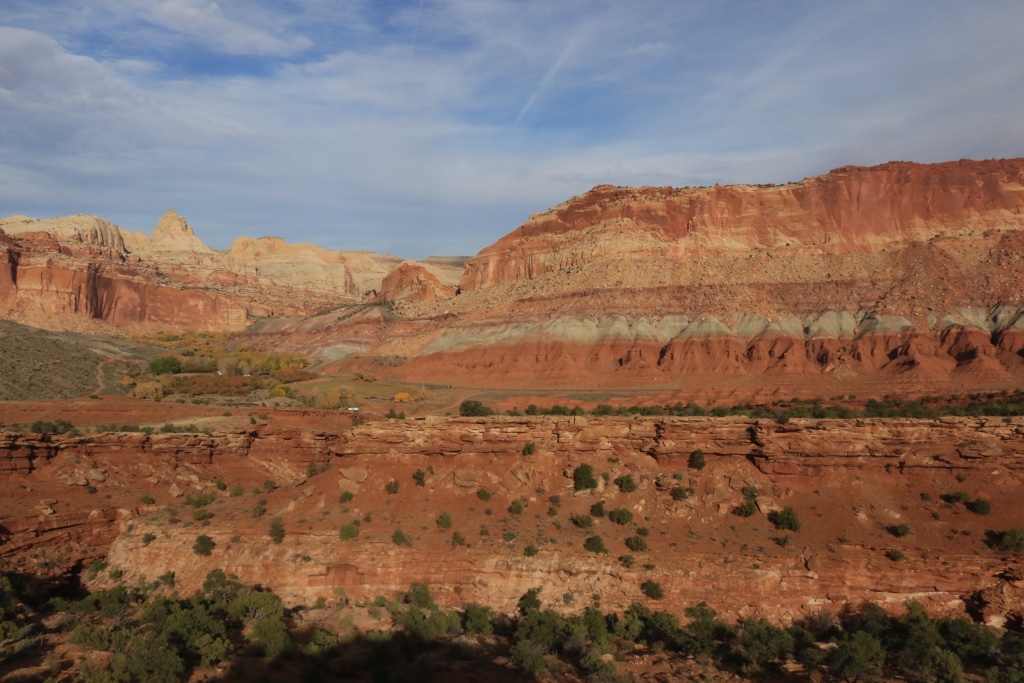
Arriving at the overlooks, the view was nothing else than spectacular. Down below was Fruita, an historic village founded by Mormons and where the conditions were exceptional for living, when compared with the surrounding. This is looking west.

37689448246_c1e7c6783f_o.jpg


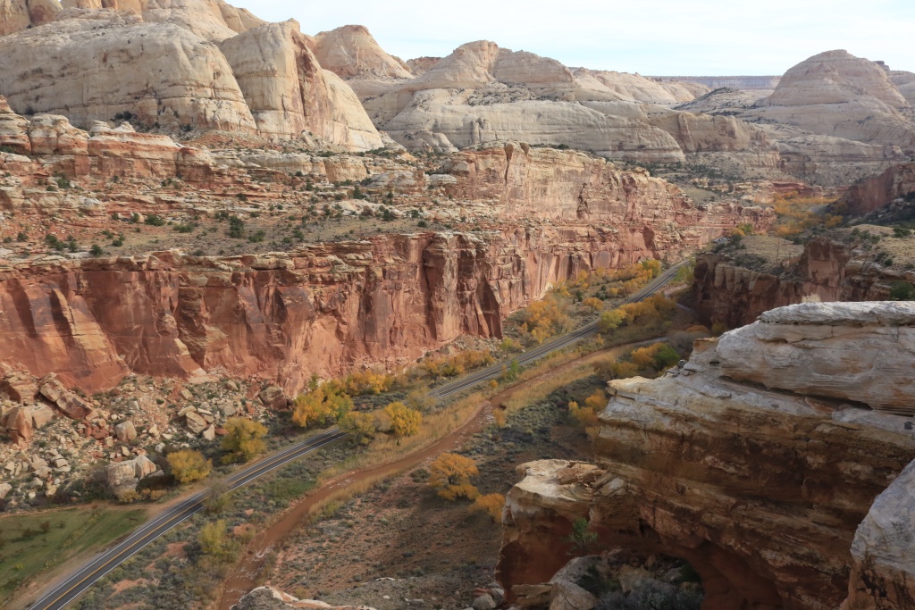
This is looking east.

37689447016_307c677115_o.jpg


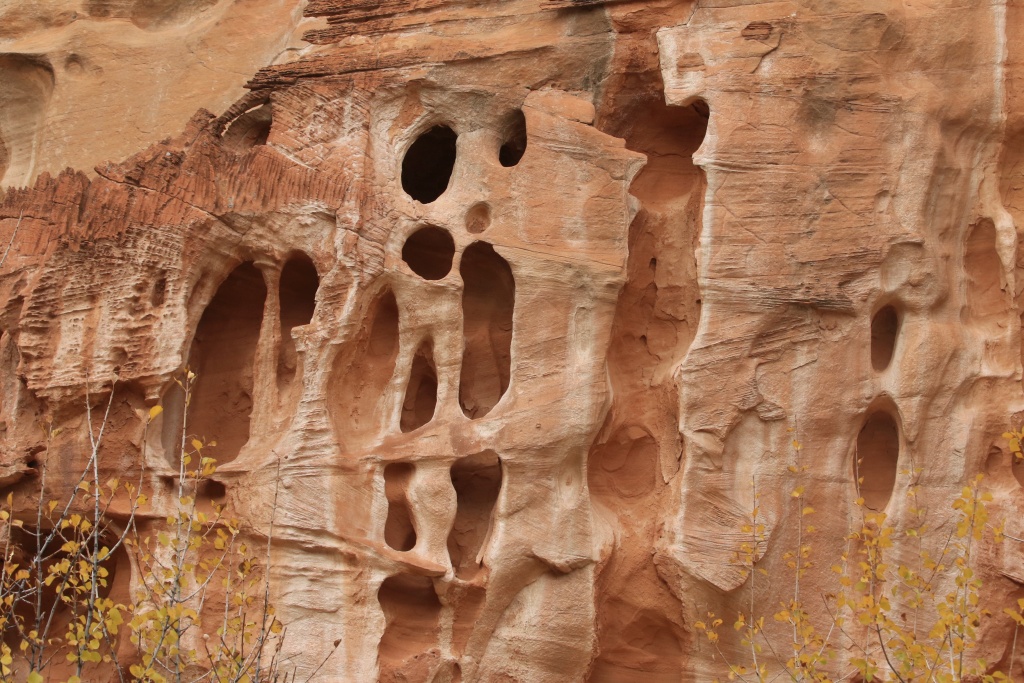
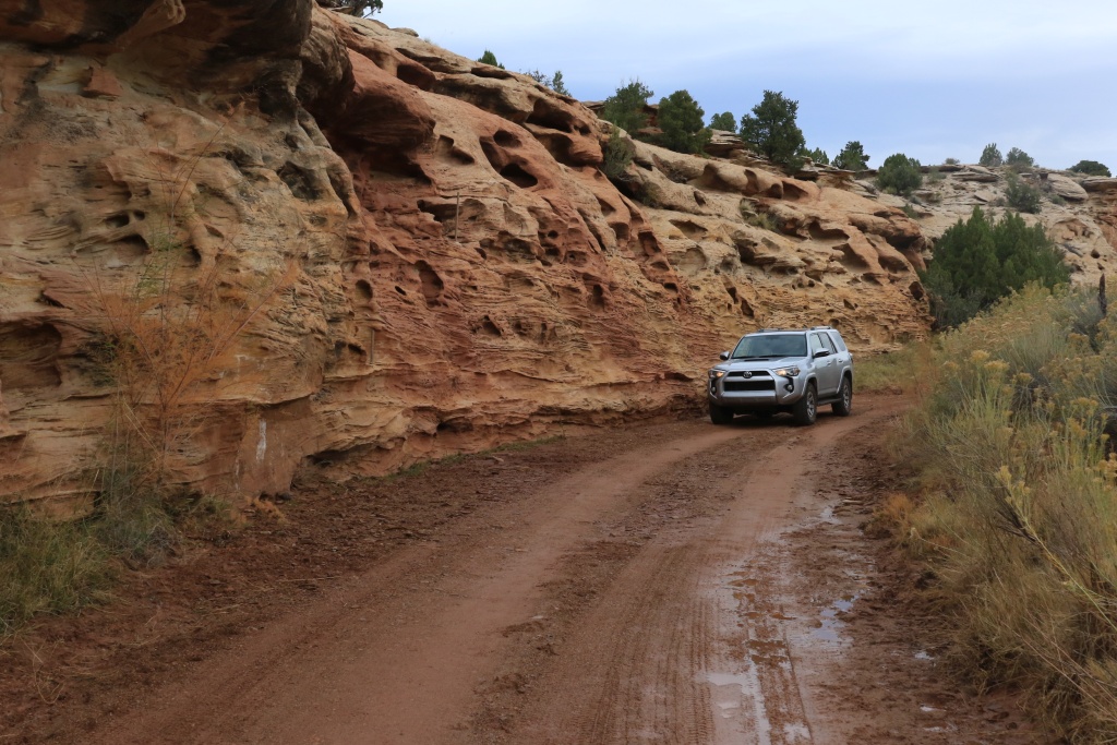
Going back to the trailhead, we encountered creative erosion work done by mother nature.

37689445156_b2a89a71e3_o.jpg


After completing the hike, we decided to take a short break and drove the Scenic Drive to the end and we continued onto Pleasant Creek Road. Sorry but no pictures of this road. The first portion is easy, but after reaching Pleasant Creek things got more interesting. We drove a bit, the turned around since time was passing fast and we wanted to hike again.

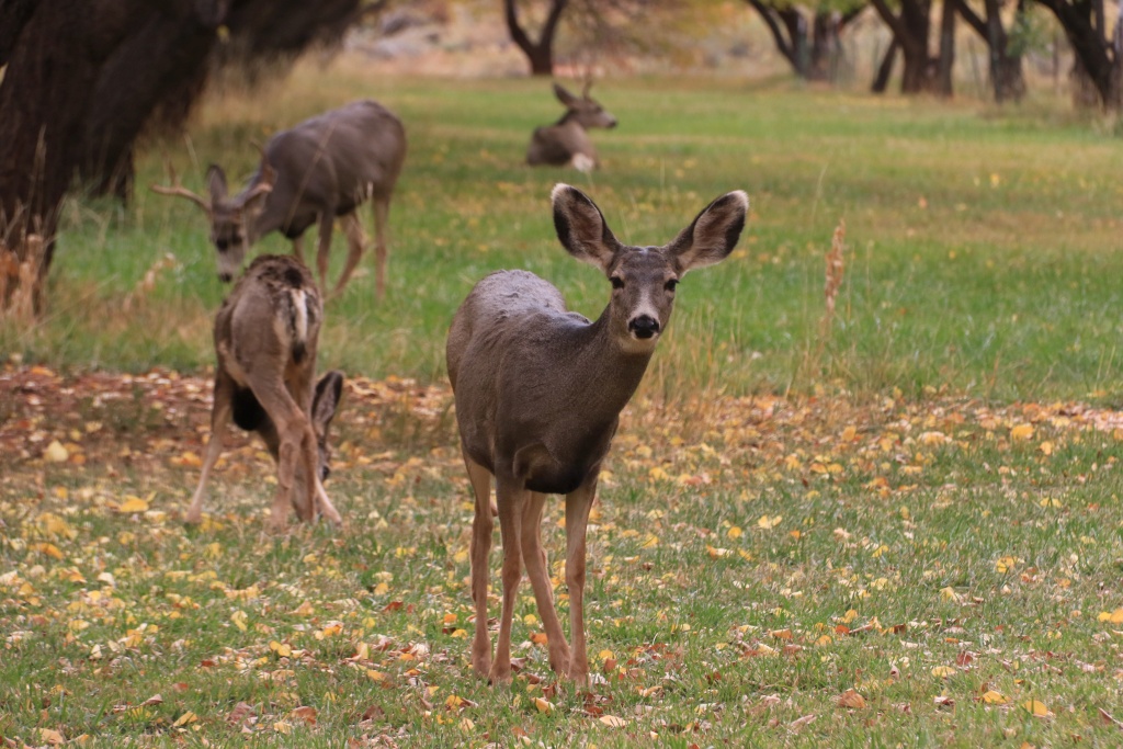
We parked at the Amphitheater where the Fremont River trailhead is located. We encountered some inhabitant of this area, not afraid of humans.

37689444156_89782ef68b_o.jpg


The trail follows the Fremont River bank, and then climbs along the river on the cliff.

37689443406_9e693a6a27_o.jpg


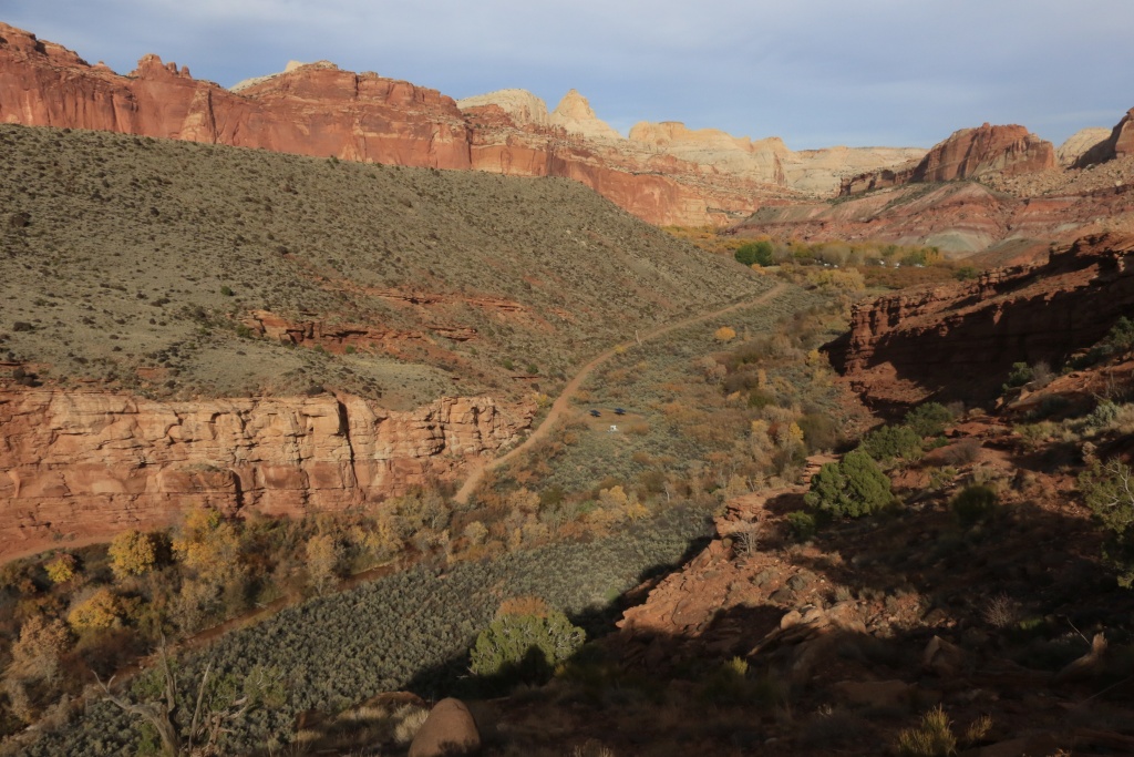
The trails reaches an overlook with a really nice view of Fruita, the Scenic Drive valley and cliffs high above.

37689442596_5f31515072_o.jpg


Tomorrow, we should do some wheeling again, with Wolverine Loop Road, Moody Canyon Road, and Silver Creek. My books rate this trail difficulty as 3 out of 10, but the ranger at the Capitol Reef Visitor Center said it is extremely rough. Does someone on this forum already did it with a stock 4Runner?
.
 
Last edited:
Man, I have got to make a trip out to Utah someday!

This is my 9th time in Utah, but the first with a descent vehicle for doing some off-road. There is so much to see arouns here.

I remember a sentence from Art Wolfe the photographer who did the show Travel to the Edge with Art Wolfe, an episode about southern Utah. He said: "You would need a life time to explore this region". He was about right!
 
Arriving at the overlooks, the view was nothing else than spectacular. Down below was Fruita, an historic village founded by Mormons and where the conditions were exceptional for living, when compared with the surrounding. This is looking west.

I hope you got to try some of their fresh "homemade" fruit pie :hungry::biggrin1:
 
Day 8:

Start point: Torrey, UT
End point: Torrey, UT

What a beautiful day wheeling on the trail. We were a bit concern about the weather since the forecast was mentionning a slight chance of rain or thunderstorm in the afternoon. We didn't received a drop but there was some clouds.

On the menu today was the Burr Trail from Boulder UT, up to the Wolverine Loop Trail west trailhead. The trail is a mix of nicely graded dirt with many wash crossing and even driving long part of them.

23889101418_231a3b4daa_o.jpg


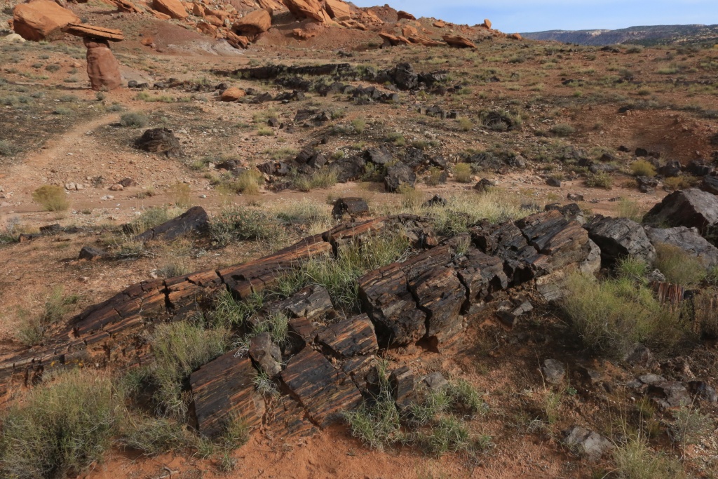
We made a stop at the Wolverine Petrified Forest to hike up to the petrified wood area. The quantity is simply amazing, with even large trees almost complete.

23889100458_b9300953a5_o.jpg


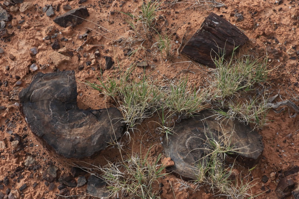
Contrary to Escalante Petrified Forest wood which has a lot of color, Wolverine Petrified Forest wood chunks are darker and almost entirely in hues of black.

37710105852_c29e28f748_o.jpg


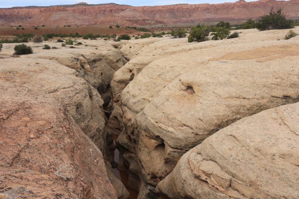
Continuying on the Wolverine Loop, we arrived in a region of white sandstone with deep cracks and even small slot canyons.

37710105112_84a69eab1a_o.jpg


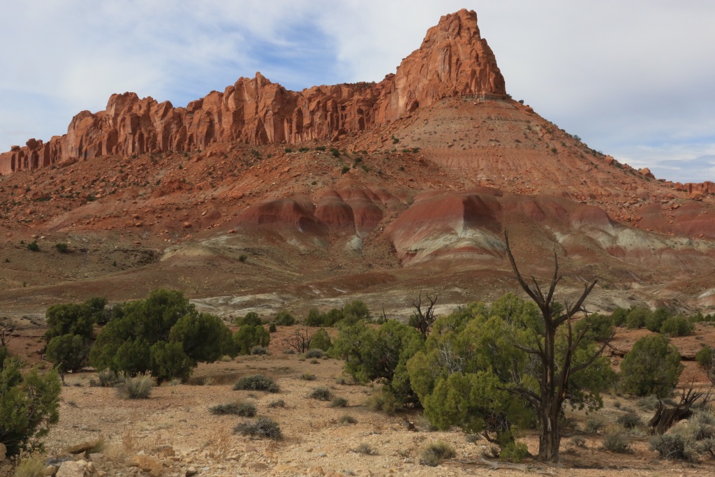
The scenery from this trail is superb with colorful bentonite hills and tall red sandstone cliffs, almost all around us.

23889099658_c8c854b9ea_o.jpg


We then arrived at the junction of Wolverine Loop and Moody Canyon Road and we headed south toward Moody Canyon.

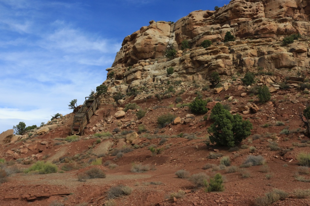
We stopped at an ancien mine, probably copper since there was a lot of green rocks left over.

37710104292_5abe0b466b_o.jpg


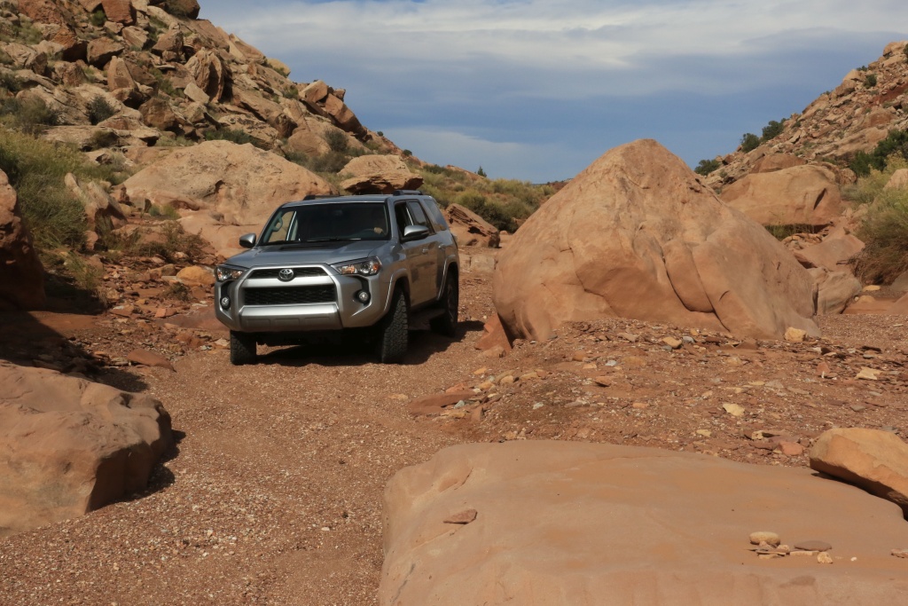
This trail is more challenging an runs lengthy portion inside the wash at the bottom of the canyon. We encountered area with water and soft loose gravel, and we also have to navigate narrow passages between big boulders. The photo does not represent well the challenges we encountered.

23889099018_9ef2a1cf34_o.jpg


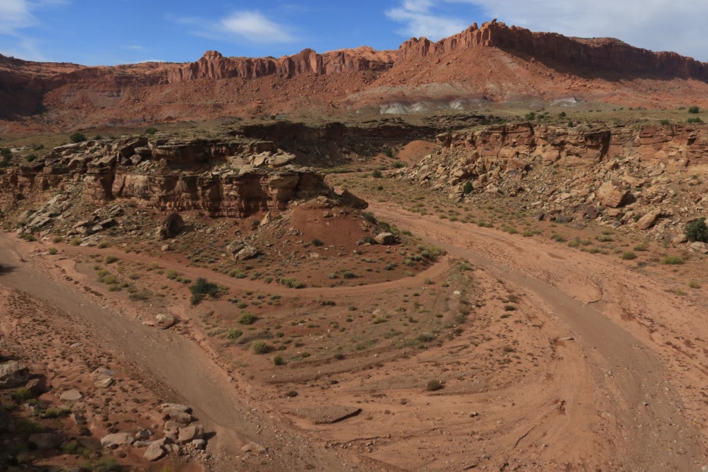
Later, we exit the canyon floor to turn sharply and rise along the side of the canyon giving great views of the trail below.

37710103232_8bc569a28d_o.jpg


We went all the way to the end which is the hiking trailhead for Moody Canyon branches. We turned back and completed the Wolverine Loop exiting on the Burr Trail on the East trailhead.

While heading back to Torrey, we made a small stop at the Long Canyon Slot, a short but nice slot canyon right on the Burr Trail.

Tomorrow, we should be doing some hiking again in Capitol Reef NP.
.
 
Last edited:
Wow!

Thank you for these awesome pics and your narrative. I was in some of this area last Oct, but as you said so much to see. You are giving me some great places to go to on my next trip. What book are you using?
 
Thank you for these awesome pics and your narrative. I was in some of this area last Oct, but as you said so much to see. You are giving me some great places to go to on my next trip. What book are you using?

Thanks!

I have so many books, but from the top of my head, for the 4x4 trails, I use Utah Trails series from APC Publishing. For hiking, I like the Falcon series, and Photographing the American Southwest series.

And of course the Web is in immense source. Sites like AllTrails, The American Southwest, gjhikes, Todd Desert Resource, and many more.

For this trip, I am starting to use Gaia GPS on a 4th gen iPad with Garmin GLO GPS receiver. This works so great.

Preparation is the key. For this 6 week trip, I have an Excel file with more than 1300 points listed!!! I am a planning addict...
 
Day 9:

Start point: Torrey, UT
End point: Torrey, UT

We did only 107km today and the 4Runner almost never touched the dirt, except for the short 2 miles Capitol Gorge in Capitol Reef NP. So no 4Runner pictures today.

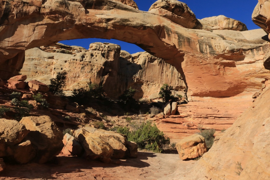
It was another great day of hiking in Capitol Reef NP. We started the day with the Hickman Bridge Trail, under a fantastic blue cloudless sky.

37484307840_31d0372433_o.jpg


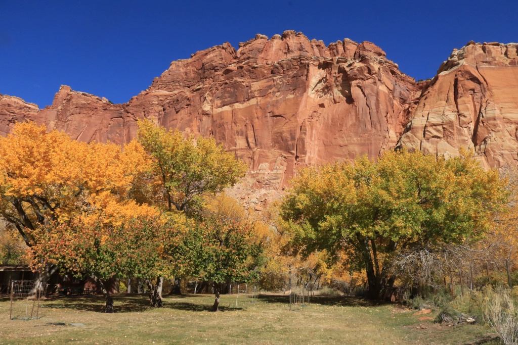
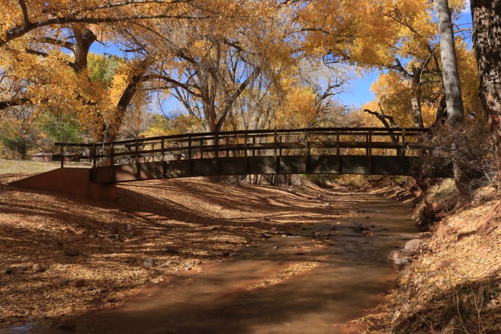
After the hike, we stopped in Fruita to walk in the cottonwood wooded area near the Fremont river. The trees were still having their bright yellow leaves. Very photogenic.

37694032936_8b52c860ff_o.jpg


23889530238_8d30478b96_o.jpg


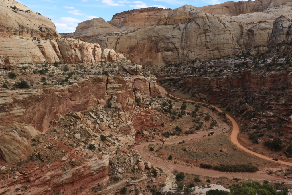
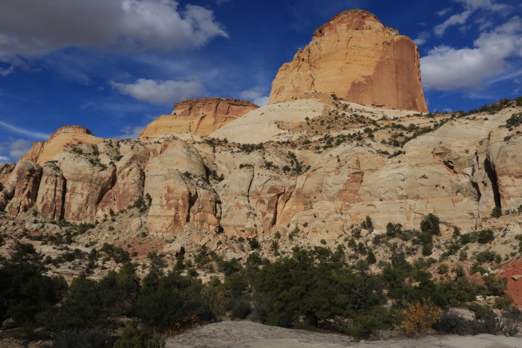
After lunch, we headed to Capitol Gorge to hike the Golden Throne Trail. Unfortunately for the pictures, there was a lot of clouds, but this hike is nothing less than sensational.

37484304790_407c6b882a_o.jpg


37484302740_b494e09f91_o.jpg


After supper, I met [MENTION=126269]QuinnImages[/MENTION] at Torrey gas station, with his nice white TRD Pro. Maybe we will wheel together later when I get around Sedona.
.
 
Last edited:
Day 7:

Start point: Hanksville, UT
End point: Torrey, UT


Tomorrow, we should do some wheeling again, with Wolverine Loop Road, Moody Canyon Road, and Silver Creek. My books rate this trail difficulty as 3 out of 10, but the ranger at the Capitol Reef Visitor Center said it is extremely rough. Does someone on this forum already did it with a stock 4Runner?
.

John, thanks for sharing all of your great adventures... I look forward each day to see where you are and what you found along your travels. I am in the pre-purchase stage now of researching the 4Runners- getting something bigger and 4WD from my current Subaru Forester (which I love and will keep). I have in the past owned a '83 CJ7 and did a lot of 4wheeling with that and a other 4WD vehicles after that so going with a 4Runner will be nice to have the ability to get back out in the backcountry. Reading through your posts you have written on a few occasions you chose not to go certain places b/c your TE is stock or "near" stock. Would you mind sharing what made you not feel safe going across some of the washes or down Moody Canyon/Silver Creek? Or what mods you think your TE needs to allow you to access these places? I read in one of your other posts "This will change in 2017 for sure," you wrote you will make mods... I also read you were traveling with some recovery gear if you would share what you brought but still wasn't safe for you to continue on the trails or conditions you were facing?

Looking forward to your next posts...
 
John, thanks for sharing all of your great adventures... I look forward each day to see where you are and what you found along your travels. I am in the pre-purchase stage now of researching the 4Runners- getting something bigger and 4WD from my current Subaru Forester (which I love and will keep). I have in the past owned a '83 CJ7 and did a lot of 4wheeling with that and a other 4WD vehicles after that so going with a 4Runner will be nice to have the ability to get back out in the backcountry. Reading through your posts you have written on a few occasions you chose not to go certain places b/c your TE is stock or "near" stock. Would you mind sharing what made you not feel safe going across some of the washes or down Moody Canyon/Silver Creek? Or what mods you think your TE needs to allow you to access these places? I read in one of your other posts "This will change in 2017 for sure," you wrote you will make mods... I also read you were traveling with some recovery gear if you would share what you brought but still wasn't safe for you to continue on the trails or conditions you were facing?

Looking forward to your next posts...

Hi, I am glad you find my posts interesting. This is the goal!!!

The trails I am doing are easy or moderate for now. I turned around at Salt Creek because of the water level and the soft banks but anyway, this road is a dead end. For Moody Canyon, I went all the way to the end. There was a few tougher spots, but not much. I didn't have time to go to Silver Falls. Maybe during another trip. Since I am not traveling with another vehicle, I keep myself on the safer side.

My plan for 2017, as mentioned in my build thread (see my signature), is to add a 2-3in lift, sliders, skid plates all around, rack, and RTT.

For the recovery gear list, see the first post of my build thread. There is a lot of information there.

The next post should be up in one hour or two. I am just back to my hotel from a really nice wheeling day. A lot of picture to choose from. I will get to work after a good shower...
 
Day 10:

Start point: Caineville Wash Road on UT24
End point: Temple Mountain Road on UT24

It was a long wheeling day, so be prepared for a long post!

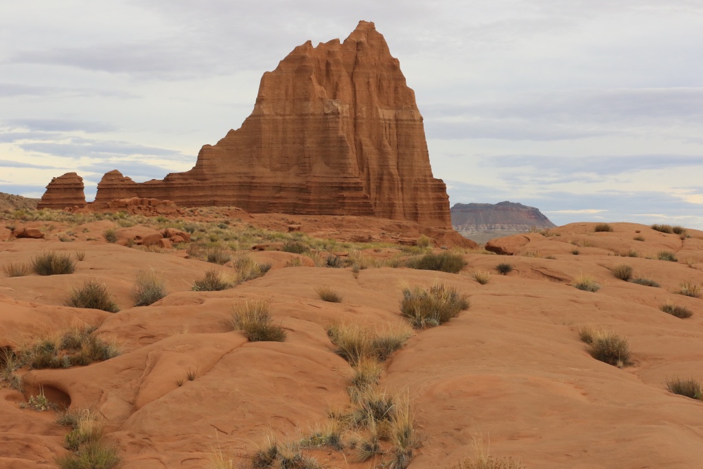
We headed on UT-24 to start our journey on Caineville Wash Road. This road is the East part of the Cathedral Valley Loop and is very well maintained. I wanted to photograph the sunrise over Temple of the Sun in Capitol Reef NP, but the clouds didn't give me a chance.

37745005751_3bd5837b46_o.jpg


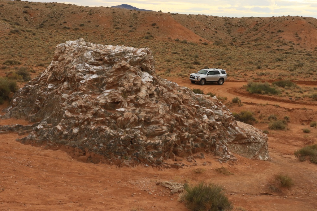
Nearby, Glass Mountain (a small hill in fact) is a strange feature made of gypsum crystals.

37033339204_d91dc9c6a6_o.jpg


Continuing on the road, we encountered the first dyke near the road. This feature originate from the magma filling cracks in the earth crust when under pressure.

37742650531_ec05417767_o.jpg


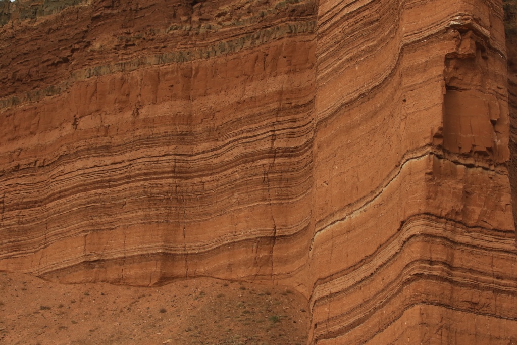
We then arrived at Layercake Wall.

37033338154_317c4cb632_o.jpg


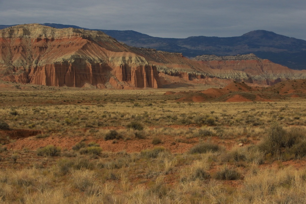
A small break in the clouds allowed me to photograph the natural beauty of Capitol Reef with its high eroded cliffs. This is one of my favorite park, not very known unfortunately (or fortunately...!).

37072207983_8104056d7f_o.jpg


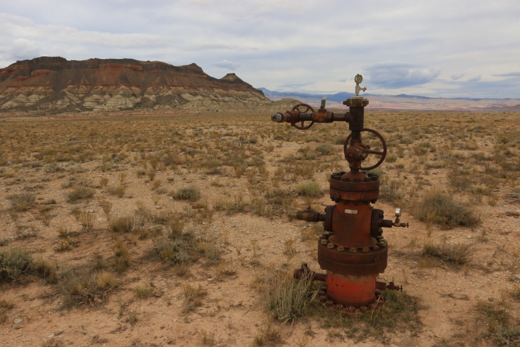
Leaving the Caineville Wash Road, we headed north on a connecting road toward Lower Last Chance Loop Road. We made a small side trip to Last Chance Gas Field and Last Chance Oil Well Bench where some old oil drilling installations can still be see, like this well head.

37033336994_9520041d79_o.jpg


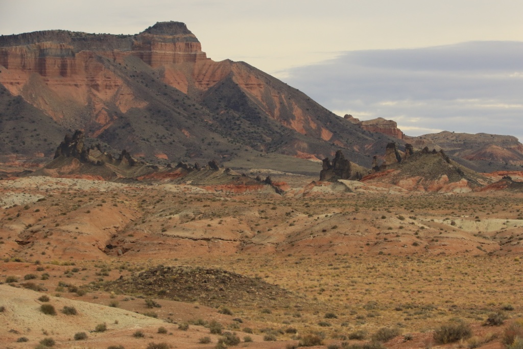
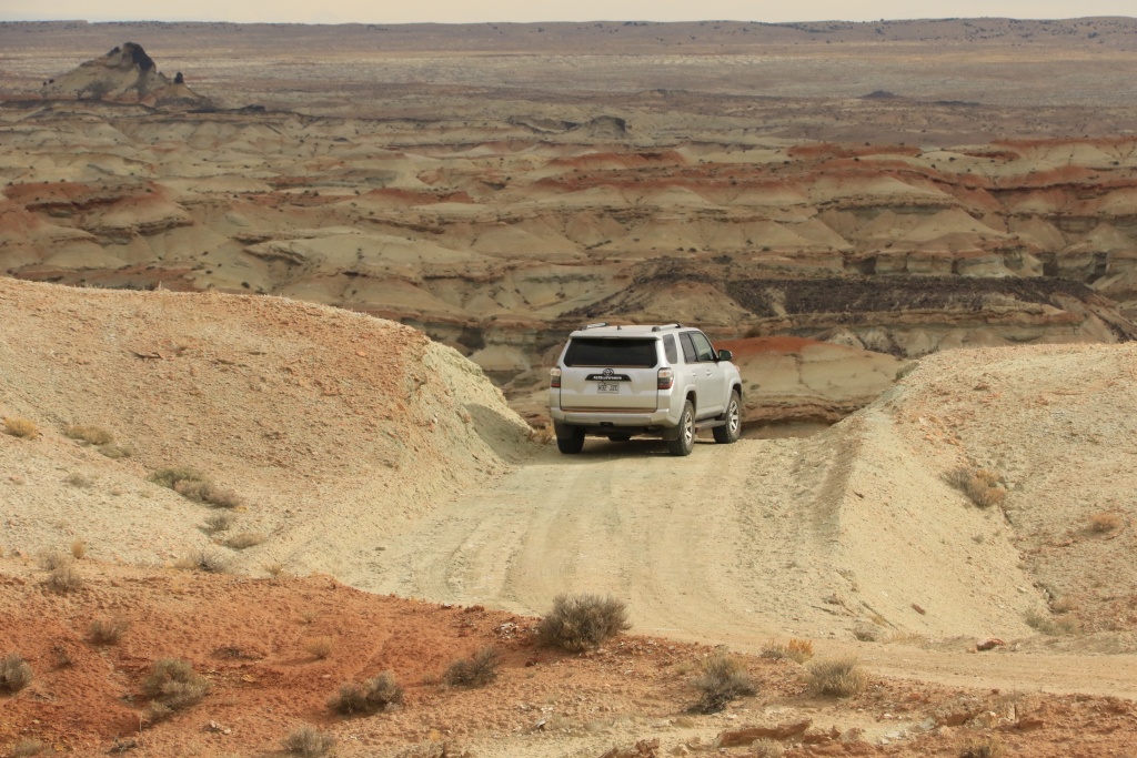
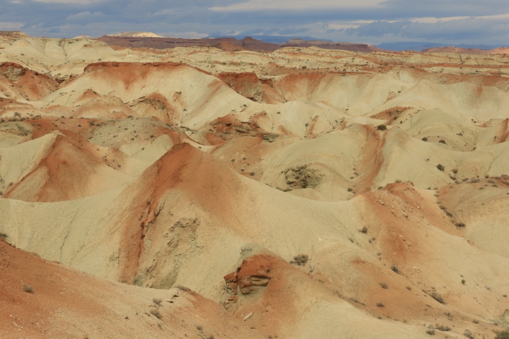
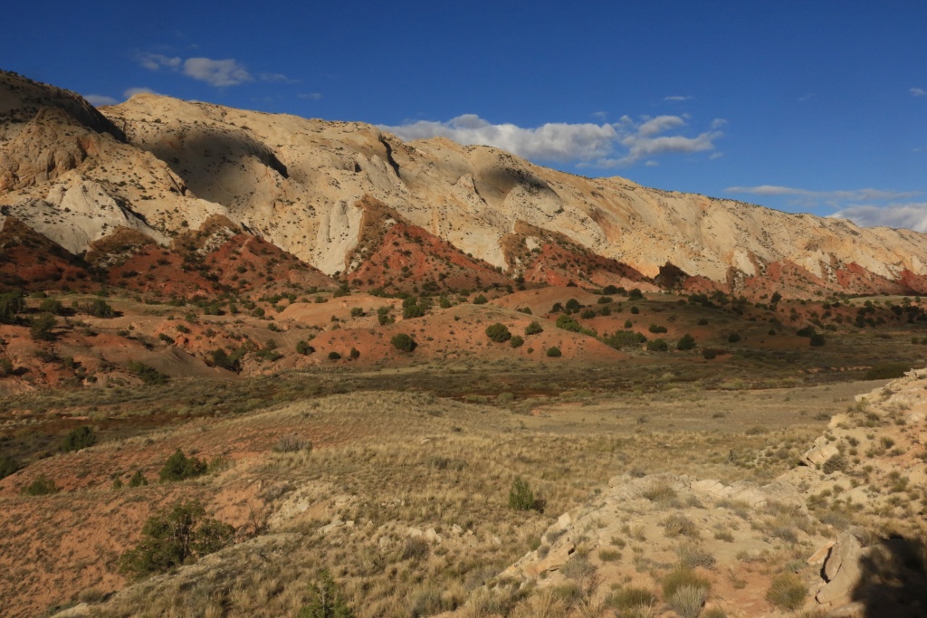
Continuing north, we arrived to a spectacular place, Middle Desert, with white and red hills.

37072207083_b361e5ec05_o.jpg


37072206453_05ff658d21_o.jpg


Later, we reached Last Chance Wash which was dry, except for a few muddy spots, just enough to be fun.

37033335664_ee7a38bb1c_o.jpg


We crossed another area with dykes. Amazing!

37072205823_686c5c44ce_o.jpg


Later, in Mussentuchit Valley, we encountered a few rocky or wet washes, but again nothing too serious.

37035805454_cace31c043_o.jpg


Later on, we finally reached the I-70. I remember the first I traveled onto I-70, stopping at all View Area. I was amazed with the beauty of this place, and its remoteness. You know, sometimes, you have the feeling you need to do something. I was asking myself then what would it take to go explore this area. Today, a dream came true, crossing between UT-24 and I-70, one of Utah most remote location. With the excellent roads, it is not a challenge anymore, but a milestone for me.

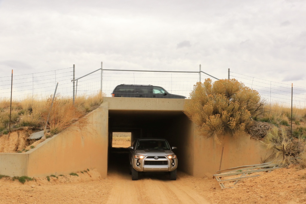
We then headed east onto I-70 up to the exit for Temple Mountain Road. We drove on it until we reached the Swasey's Cabin Road, and then the Head of Sinbad Road, passing under the I-70. That was cool!!!

37033333524_6796ba39b3_o.jpg


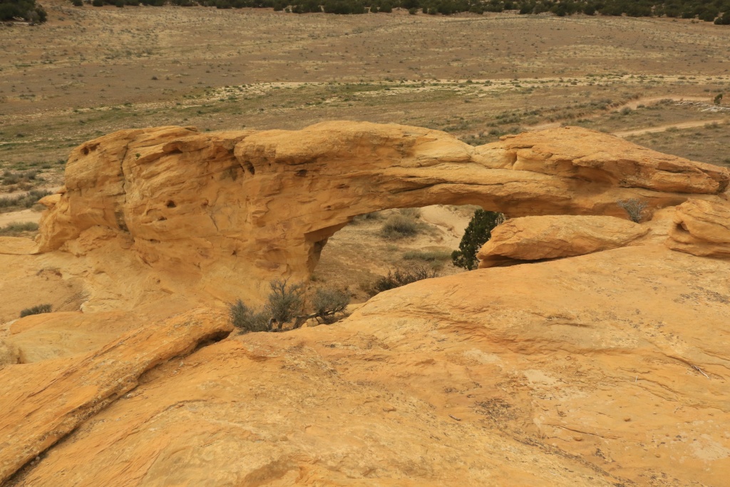
We first went to the Dutchman Arch.

37033334554_5768453e58_o.jpg


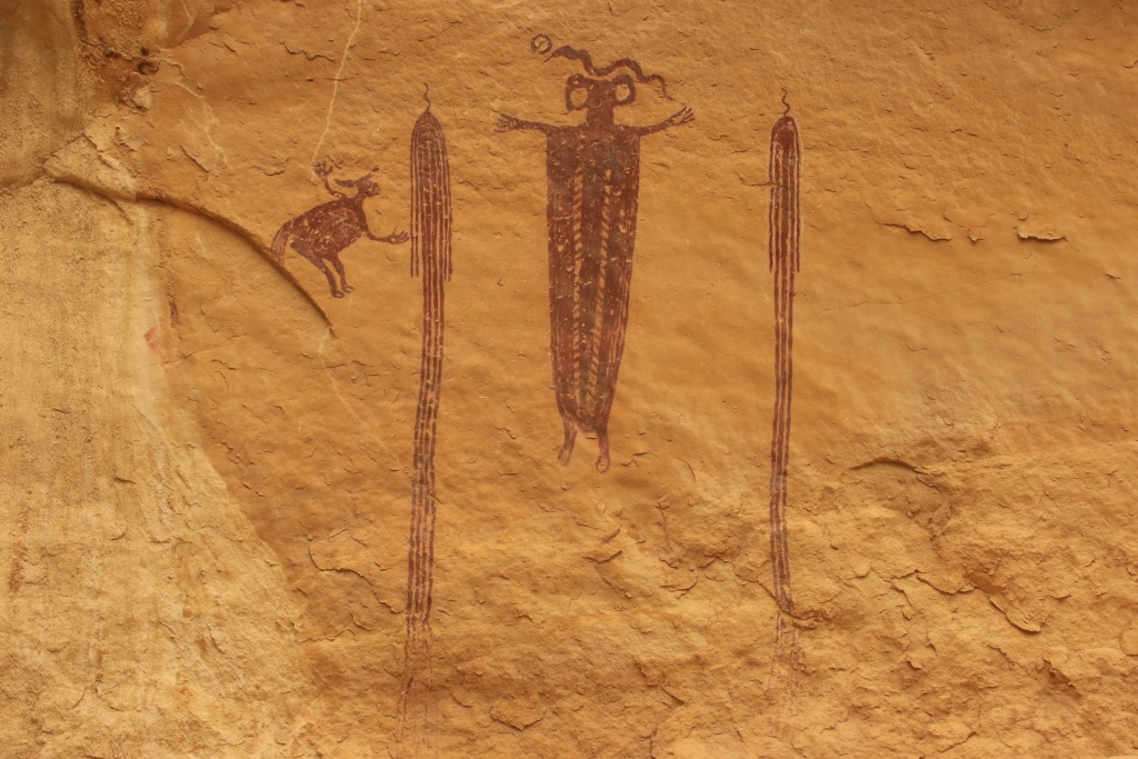
Then, we hiked a bit to see the Head of Sinbad Pictograph Panels. These are very well preserved.

37072204603_a734fa4eff_o.jpg


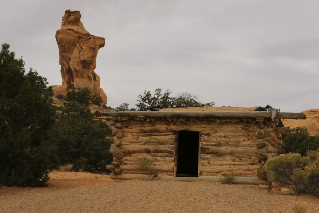
We came back under the I-70 (always fun!) and headed toward Swasey's Cabin.

37072203493_b6cfe09b95_o.jpg


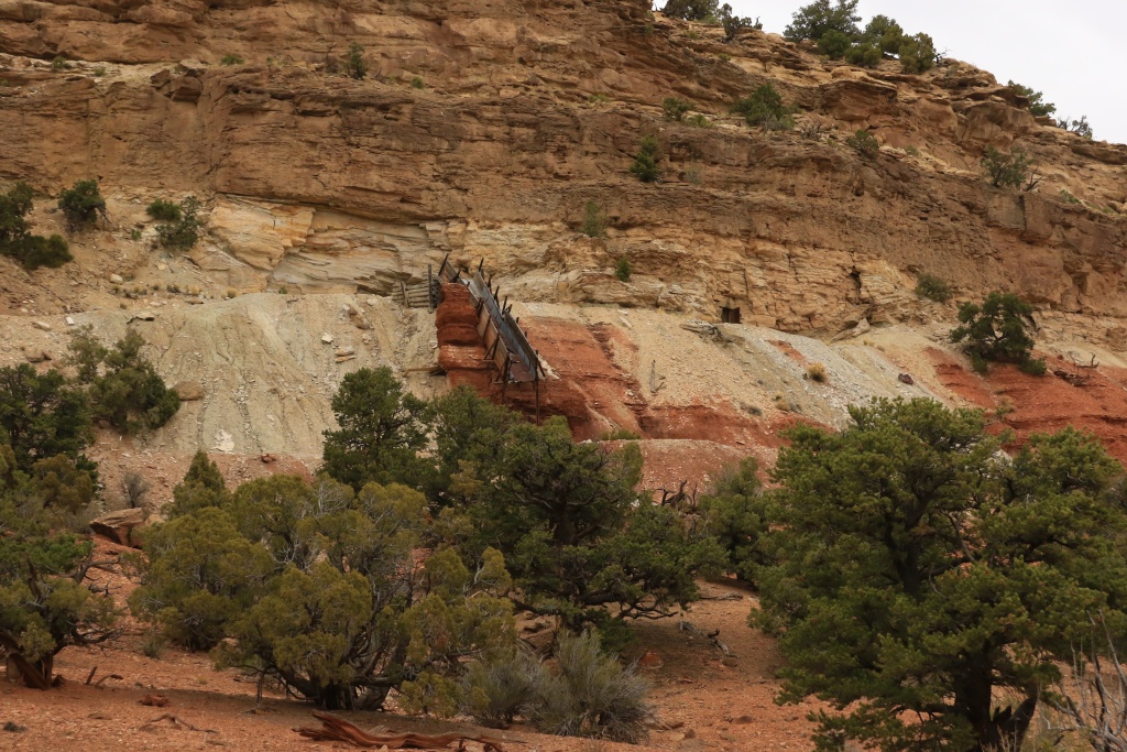
We then came back and took Rod's Valley Road to begin our journey south. On the way, we stopped at an old uranium mine were some installations were still visible.

37033332814_605ee34718_o.jpg


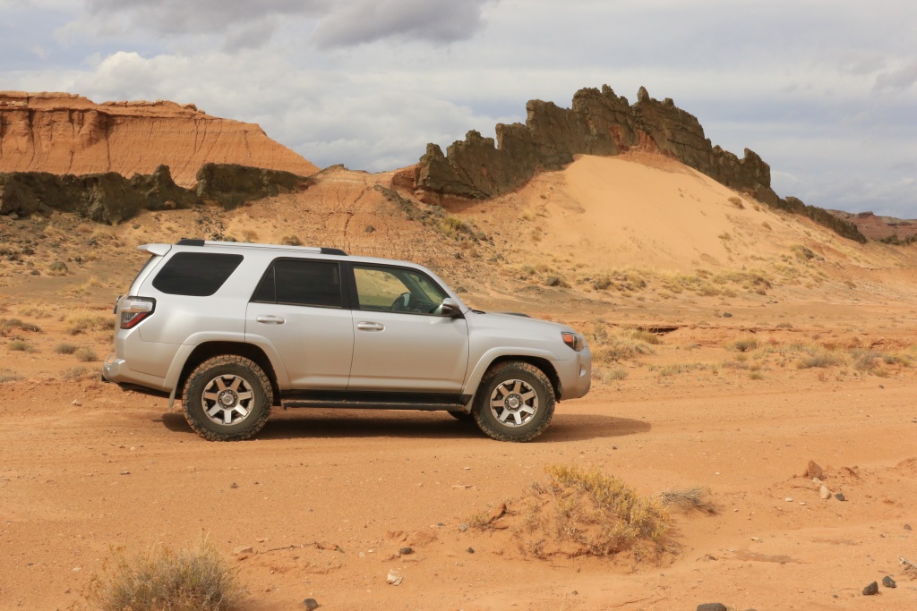
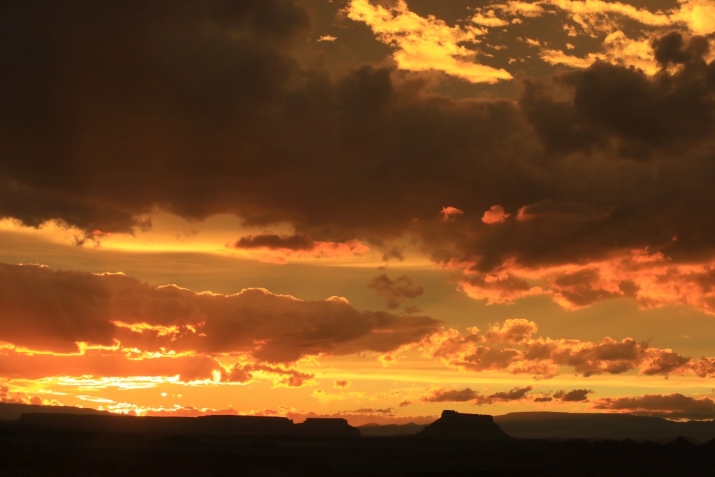
From the end of Rod's Valley Road, we headed east onto McKay Flat Road, the back again onto Temple Mountain Road. We reached UT-24 near Goblin Valley almost at sunset. We stop at a View Area near Hanksville to capture some nice sunset shots over Factory Butte. What a nice closure of this excellent day on the trails.

37072202803_de52f4b1f5_o.jpg


Tomorrow we will leave Torrey and move toward Escalante.
.
 
Last edited:
Day 11:

Start point: Torrey, UT
End point: Escalante, UT

Today was almost a complete hiking day. We left Torrey to go onto the Notom-Bullfrog Scenic Byway. We had a view our our playground for the day, the Water Pocket Fold in Capitol Reef.

23892681218_6335c88812_o.jpg


Our goal was to hike the Upper Muley Twist Loop, a strenuous 9 mile unofficial hike directly on top of the fold. We started hiking at the 4WD parking lot, after 2.7 miles of wheeling.

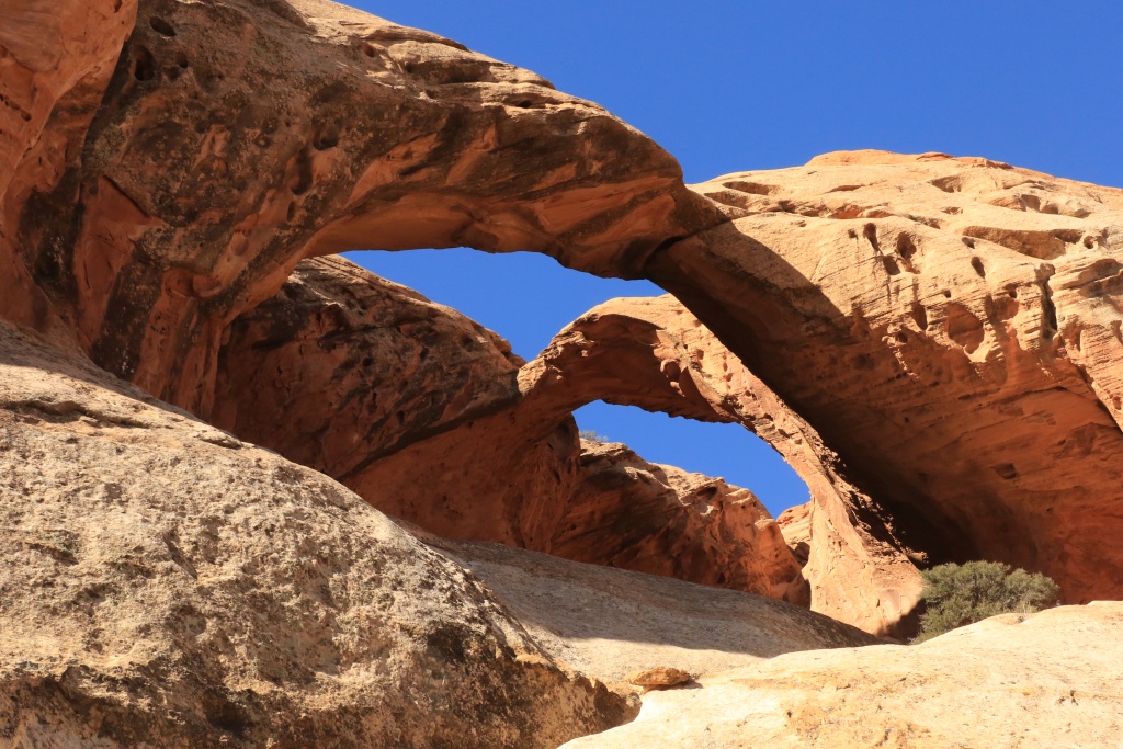
Starting hiking in the wash, we saw many arches, this one a double one.

37487408560_dcfac4e3c5_o.jpg


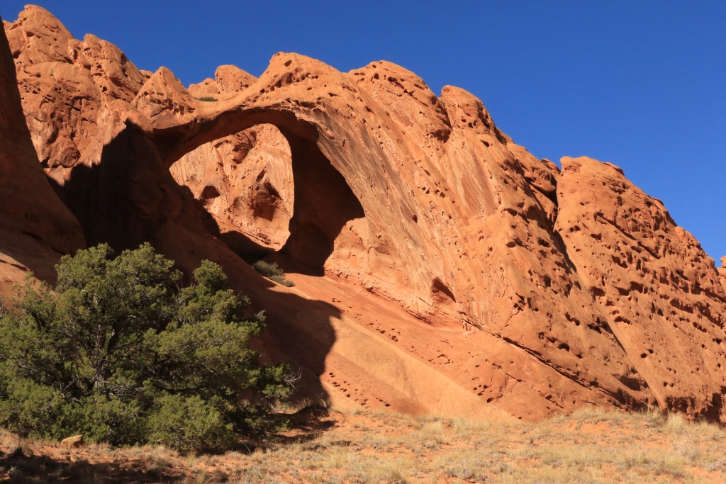
Then Saddle Arch.

23892680118_996d19c19c_o.jpg


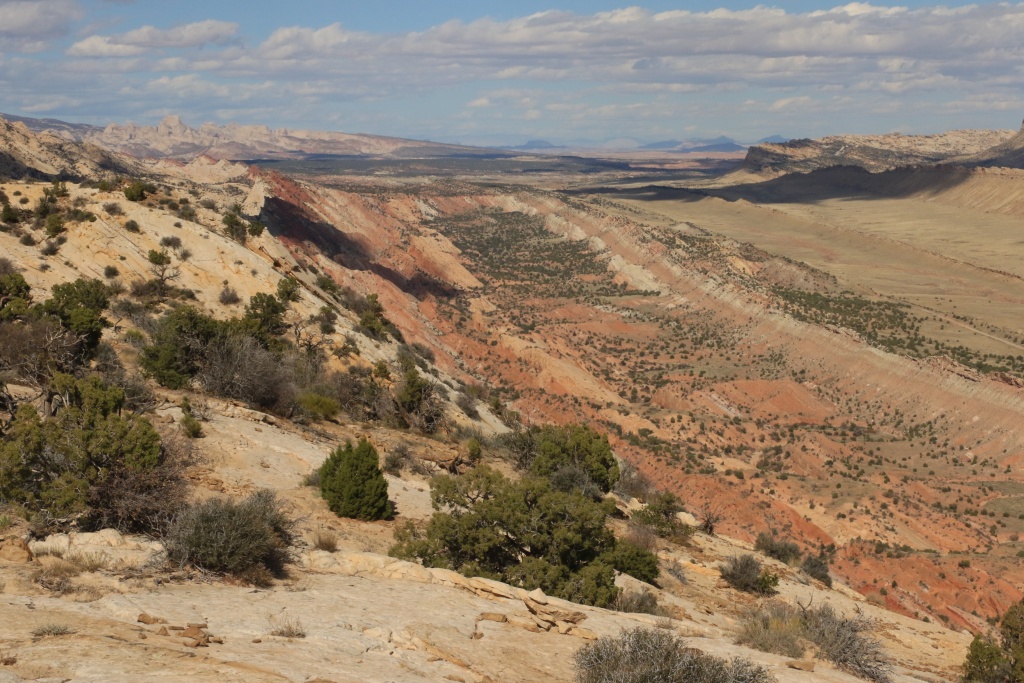
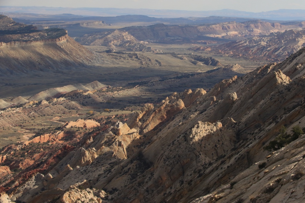
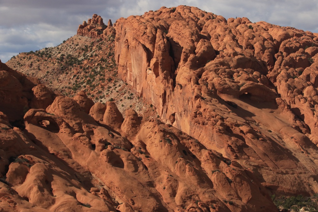
We then reached to beginning of the loop, hiking up to the rim route, a strenuous climb sometime a bit hazardous. The view from the top of the fold is nothing less than incredible, awesome, spectacular, etc...

23892679868_1ea1ac27b0_o.jpg


23892677638_f687852c54_o.jpg


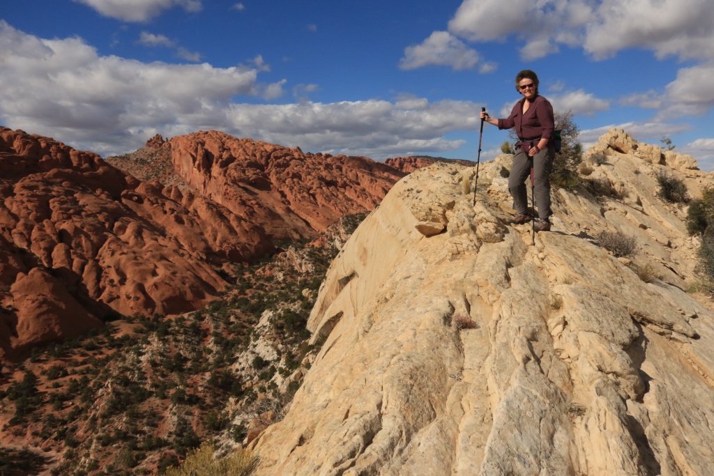
At some times, the width of the top was about 10 feet, with cliffs on either side. Here is wifey posing in the wind.

23892678938_6fbfd7e279_o.jpg


Continuing, we saw more arches in the distance.

23892678378_5c3b553742_o.jpg


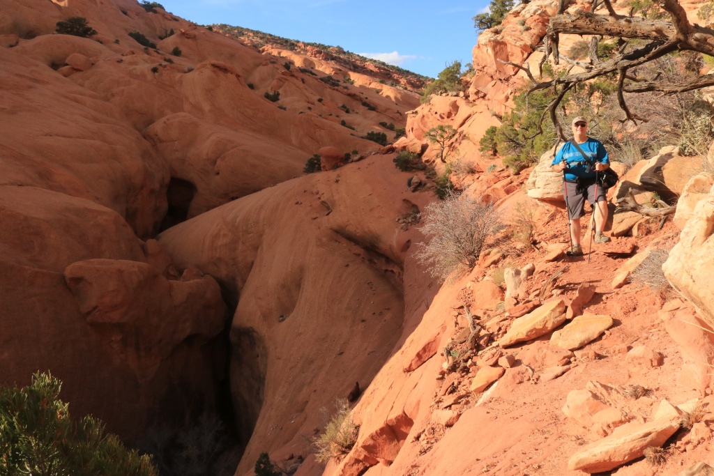
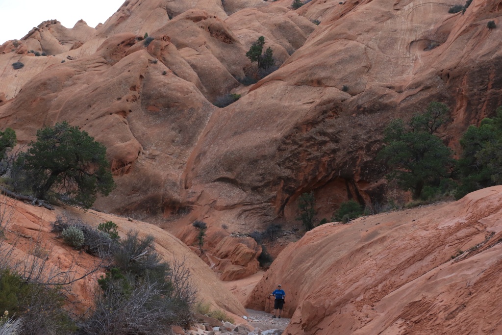
After reaching the upper end of the loop, we began hiking back to the canyon route, on the Narrow Bypass. The narrow below was spectacular. Again, a lot of exposure here, with ups and downs.

23892677088_073cc48560_o.jpg


23892676598_c84bced3d3_o.jpg


We badly calculated the total hiking time and came back to the 4Runner after sunset, when is was almost dark. Leaving the 4WD parking lot, we had to negotiate a few passages with care due to many large rocks and lack of visibility. This convinced me to add some lighting on my future rack.
.
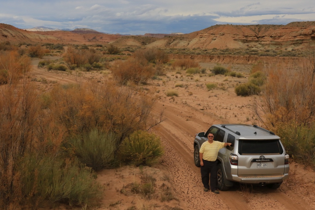
 
Last edited:
Fantastic adventure thread! Excellent ratio of pictures to explanations. Makes me nostalgic for home - I used to work in a park that looked similar to Utah in parks and like high elevation mountains in others. Utah is amazing, I would enjoy visiting someday! Keep up the excellent shots!! 4R looks good!
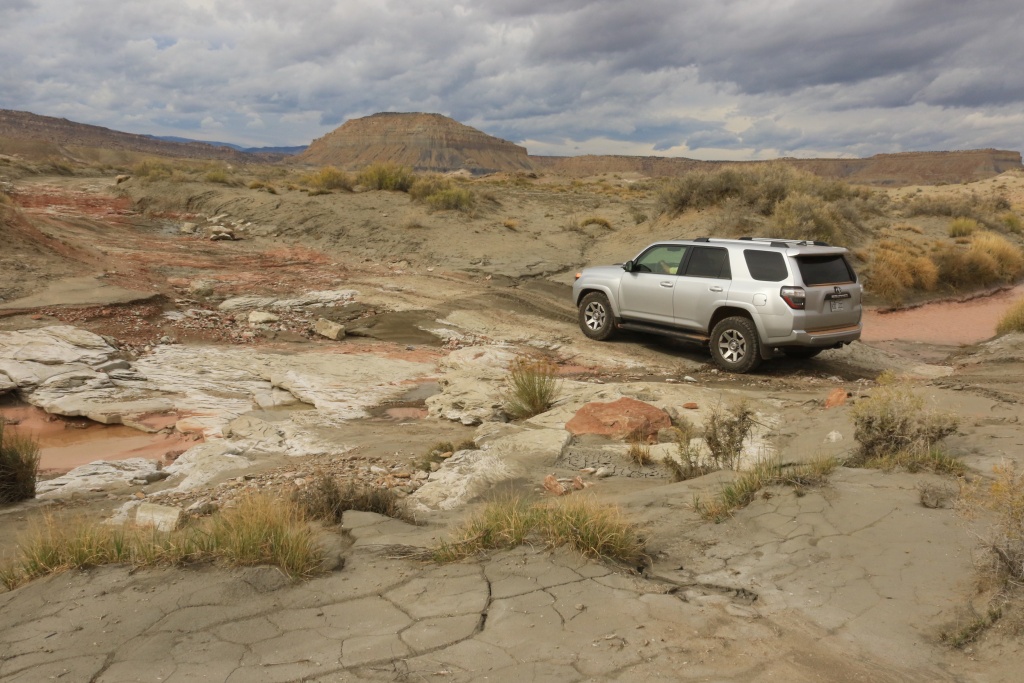
 
Fantastic adventure thread! Excellent ratio of pictures to explanations. Makes me nostalgic for home - I used to work in a park that looked similar to Utah in parks and like high elevation mountains in others. Utah is amazing, I would enjoy visiting someday! Keep up the excellent shots!! 4R looks good!

Thanks! There is a lot more to come in this 6 week trip!!!
 

Members online

Forum statistics

Threads
278,310
Messages
3,554,080
Members
248,016
Latest member
Advally Service

Trending content

Back
Top