
You are using an out of date browser. It may not display this or other websites correctly.
You should upgrade or use an alternative browser.
You should upgrade or use an alternative browser.
JohnTheLuck's Adventures Thread
- Thread starter JohnTheLuck
- Start date

JohnTheLuck
Member
John, I noticed in a couple of photos that you don't seem to have a winch. If that is so, then I must say that you are very brave, or very lucky indeed, in the trails that you have conquered. Keep up the good work - Ted
:canada::
No, I don't have a winch (yet...?). The trails that I am doing are mostly easy or easy-moderate. I am a very cautious man, so as soon as things get too difficult, I turn around. Don't forget my 4Runner is mostly stock. I do have on board Maxsa traction mat, compressor, and some other tools to help me if something goes wrong.
Thanks!
JohnTheLuck
Member
Alright!!!!! Looks like a very good trip report. I'm sub'd to see how it turns out and to get some good ideas for routes around Moab for my next trip there.
Thanks! I only eat lunch yesterday in Moab. I was there last spring, so we are doing other regions for this trip.
JohnTheLuck
Member
Day 19:
Start point: Blanding, UT
End point: Blanding, UT
After many hiking days, today was a wonderful wheeling day, mostly. We left Blanding early since we had a lot of road to do. We headed north onto UT95 to reach our trails near Hite, all withing Glen Canyon NRA.
On the way, we made a short stop at our exit point of the day since I was worried about the canyon crossing and the highway tunnel. We were lucky to see our friend of the day, the grader working on the last section of the Horse tank Road. The driver confirmed the trails was in excellent condition since he worked it completely.
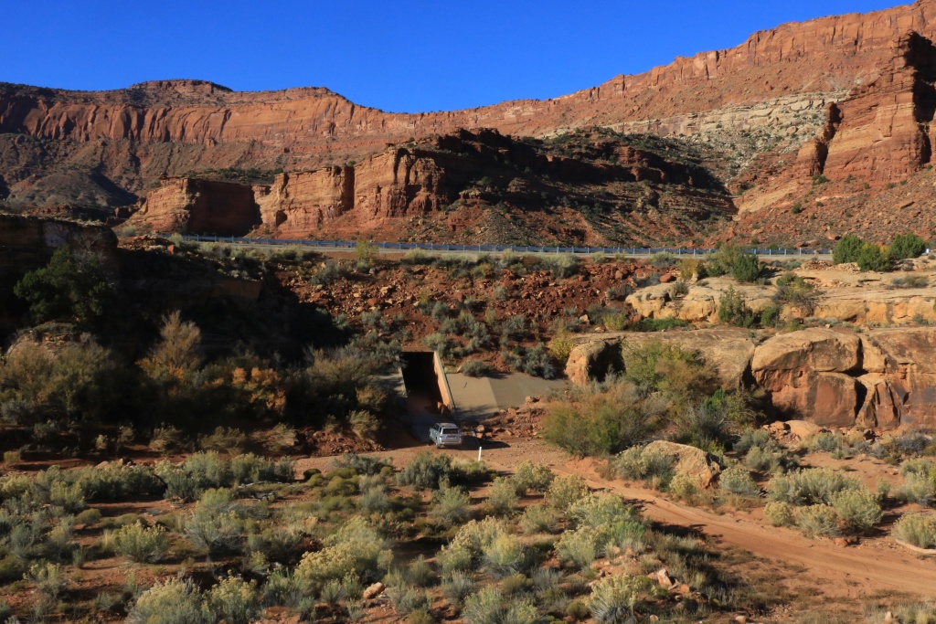
So we continued onto UT95 to reach our first trail near Hite, the Farley Canyon Road which ends at the Lake Powell. This is an very easy well maintained road, as all other we did today. The scenery is amazing, specially with the early daylight.
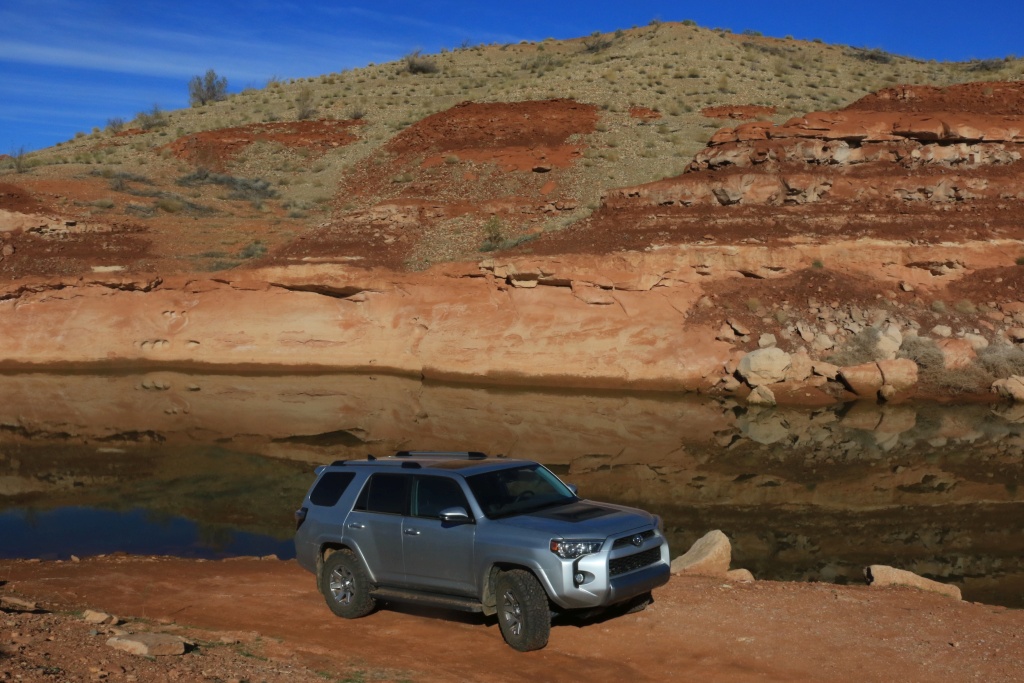
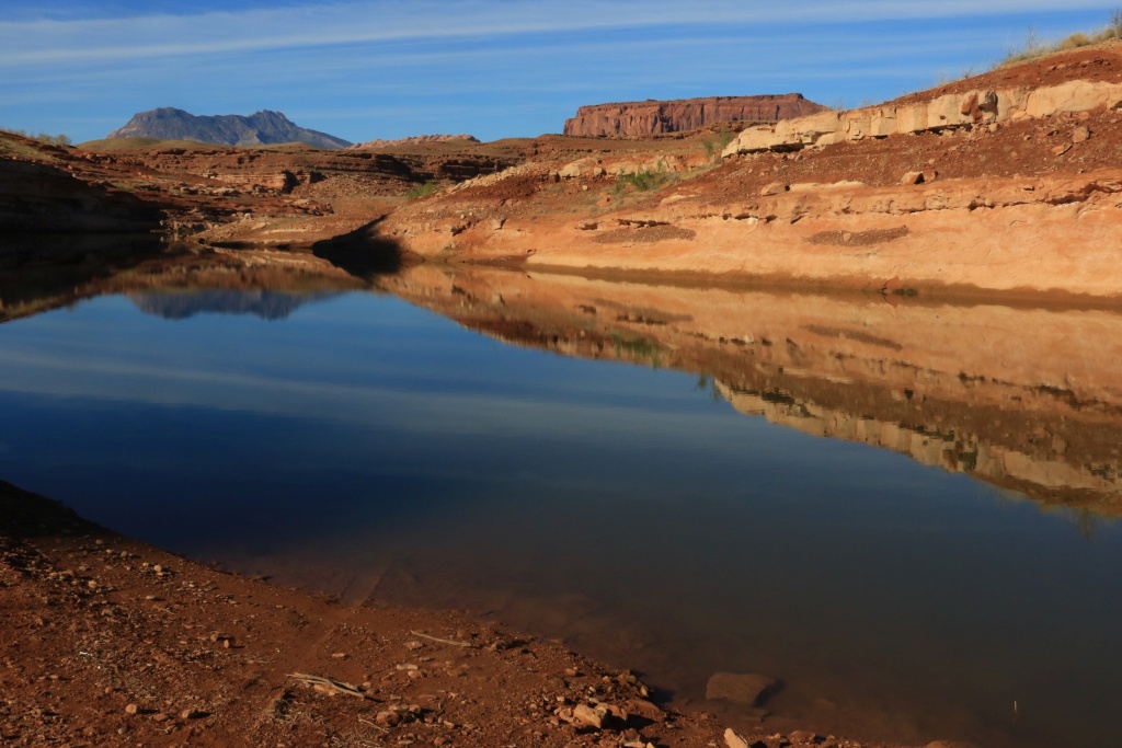
After getting back onto UT95, we then went onto White Canyon Road northern entrance. This road gives good views of canyon.
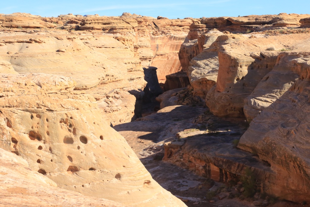
When planning, I was hoping to enter at the northern entrance, then continue and exit at the southern entrance. Unfortunately, it seems this is not possible anymore. We were stopped by bush and a deeper wash that expected. We turned around, of course.
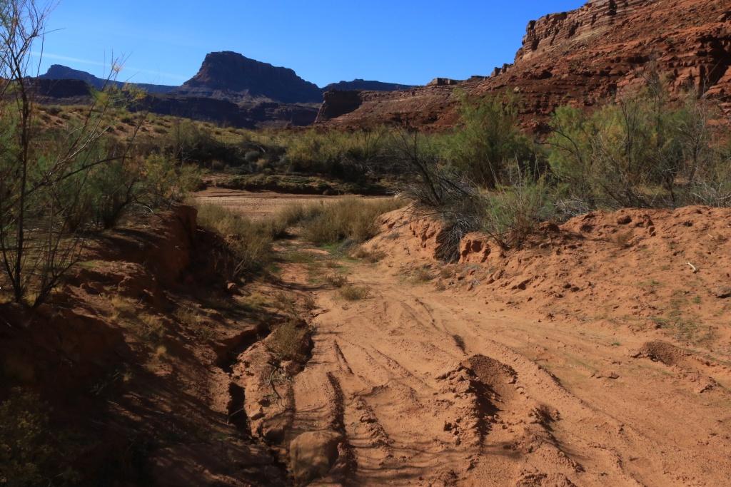
We drove the southern branch, but ended up on a large place near the toilet, but couldn't find a proper road to continue, only an old track with deep bushes. We turned back.
We then went to the Horse Tank Road, the good graded road from the morning, but we entered using the northern entrance near White Canyon Road.
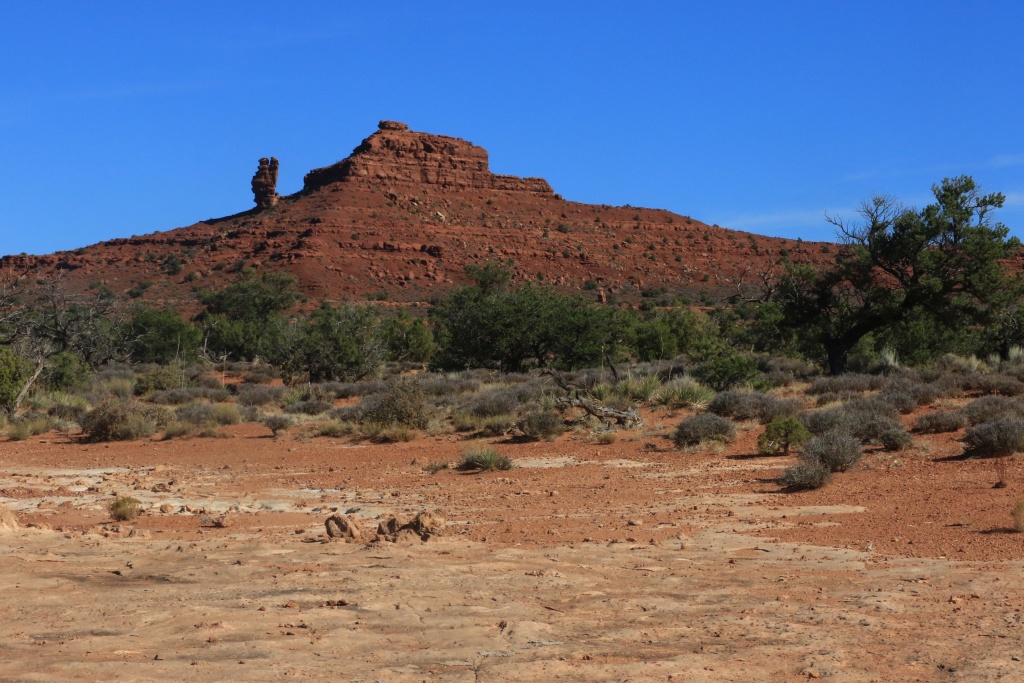
We made a small detour to go toward the Dark Canyon Overlook, passing by a rock formation called Squaw and Papoose Rock.
Then, the Dark Canyon Overlook, with an incredible view high above the canyon floor.
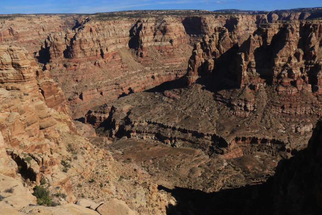
There was a few vehicles, some with climbing stickers so I guest that what this group was doing. I spotted another 4Runner, black limited, mostly stock except tires. Sorry, no photo.
We came back onto Horse Tank Road, with other incredible views.
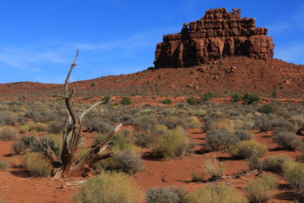
Further on the road, We made a stop near an access point to Fortknocker Canyon to hike a bit downstream. We encountered some narrows and a lot of dry falls to go around. This was a lot of fun!
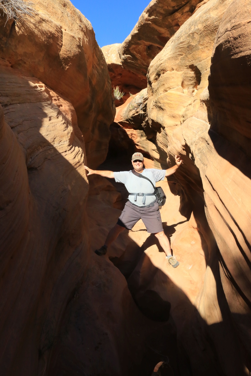
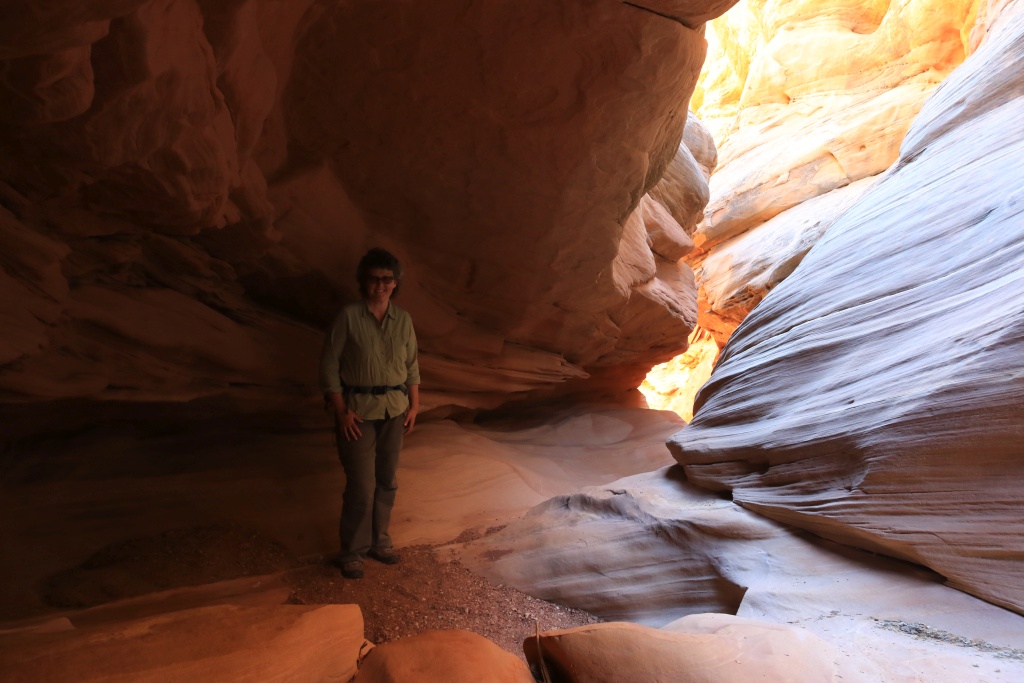
Unfortunately, the sun was beginning to go down and decided to cut short our planned hike. The daylight duration is shortening so fast at this time of the year.
Near our canyon exit point, time for a last goodbye to this very nice canyon. We will hike it again surely during another trip. On our way back, we saw Mr. and Mrs. Shadow (as seen many times by Jamal Green from AcrossUtah.com, a long distance hiker that inspire me a lot).

Back to the 4Runner, we completed the Horse Tank Road at the southern exit point we checked in the morning. With about an hour before sunset, we headed toward Hite near the bridge over the Colorado River.
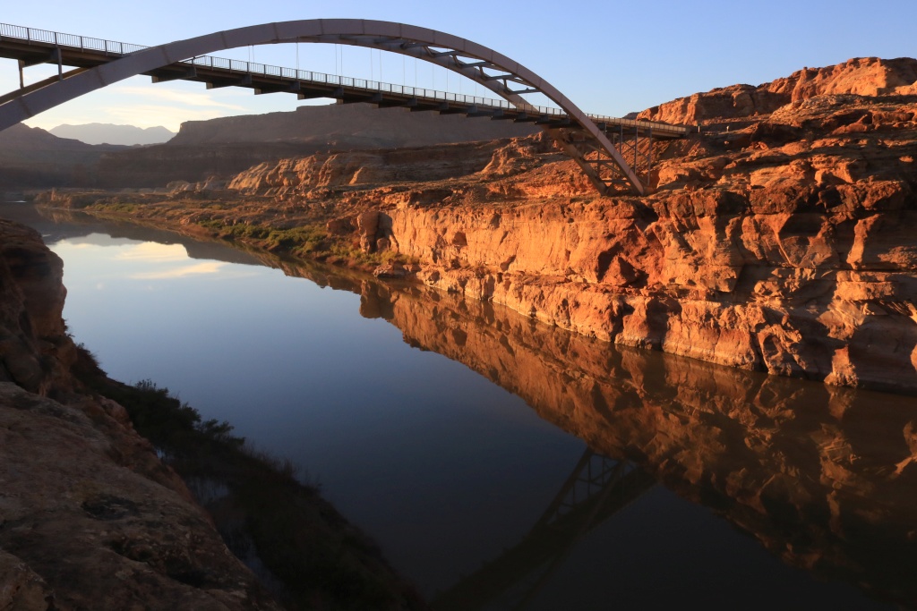
With that, we turned back toward Balnding. On the way, a stupid rabbit crossing just in front of the 4Runner made me experience the Panic Braking for the first time. Interesting... Then later, two groups of deers on the road made my heart pounding even more, without harm.
.
Start point: Blanding, UT
End point: Blanding, UT
After many hiking days, today was a wonderful wheeling day, mostly. We left Blanding early since we had a lot of road to do. We headed north onto UT95 to reach our trails near Hite, all withing Glen Canyon NRA.
On the way, we made a short stop at our exit point of the day since I was worried about the canyon crossing and the highway tunnel. We were lucky to see our friend of the day, the grader working on the last section of the Horse tank Road. The driver confirmed the trails was in excellent condition since he worked it completely.
So we continued onto UT95 to reach our first trail near Hite, the Farley Canyon Road which ends at the Lake Powell. This is an very easy well maintained road, as all other we did today. The scenery is amazing, specially with the early daylight.
After getting back onto UT95, we then went onto White Canyon Road northern entrance. This road gives good views of canyon.
When planning, I was hoping to enter at the northern entrance, then continue and exit at the southern entrance. Unfortunately, it seems this is not possible anymore. We were stopped by bush and a deeper wash that expected. We turned around, of course.
We drove the southern branch, but ended up on a large place near the toilet, but couldn't find a proper road to continue, only an old track with deep bushes. We turned back.
We then went to the Horse Tank Road, the good graded road from the morning, but we entered using the northern entrance near White Canyon Road.
We made a small detour to go toward the Dark Canyon Overlook, passing by a rock formation called Squaw and Papoose Rock.
Then, the Dark Canyon Overlook, with an incredible view high above the canyon floor.
There was a few vehicles, some with climbing stickers so I guest that what this group was doing. I spotted another 4Runner, black limited, mostly stock except tires. Sorry, no photo.
We came back onto Horse Tank Road, with other incredible views.
Further on the road, We made a stop near an access point to Fortknocker Canyon to hike a bit downstream. We encountered some narrows and a lot of dry falls to go around. This was a lot of fun!
Unfortunately, the sun was beginning to go down and decided to cut short our planned hike. The daylight duration is shortening so fast at this time of the year.
Near our canyon exit point, time for a last goodbye to this very nice canyon. We will hike it again surely during another trip. On our way back, we saw Mr. and Mrs. Shadow (as seen many times by Jamal Green from AcrossUtah.com, a long distance hiker that inspire me a lot).
Back to the 4Runner, we completed the Horse Tank Road at the southern exit point we checked in the morning. With about an hour before sunset, we headed toward Hite near the bridge over the Colorado River.
With that, we turned back toward Balnding. On the way, a stupid rabbit crossing just in front of the 4Runner made me experience the Panic Braking for the first time. Interesting... Then later, two groups of deers on the road made my heart pounding even more, without harm.
.
Last edited:
Off road gear
John: I don't have a winch either but I always carry some emergency gear. An air compressor of course, plus a rope come-along that can add considerable traction in a pinch, assorted tow straps, folding shovel, axe, traction mat, etc. Luckily, we have never needed them!
By the way, the recent photos are fantastic, as always. What camera do you use? The wife has a big Nikon with a selection of lenses but I have a compact Nikon with built-in tele/wide lens. We used to be semi-pro but now only take photos to send to the kids families. - Ted
John: I don't have a winch either but I always carry some emergency gear. An air compressor of course, plus a rope come-along that can add considerable traction in a pinch, assorted tow straps, folding shovel, axe, traction mat, etc. Luckily, we have never needed them!
By the way, the recent photos are fantastic, as always. What camera do you use? The wife has a big Nikon with a selection of lenses but I have a compact Nikon with built-in tele/wide lens. We used to be semi-pro but now only take photos to send to the kids families. - Ted
JohnTheLuck
Member
John: I don't have a winch either but I always carry some emergency gear. An air compressor of course, plus a rope come-along that can add considerable traction in a pinch, assorted tow straps, folding shovel, axe, traction mat, etc. Luckily, we have never needed them!
By the way, the recent photos are fantastic, as always. What camera do you use? The wife has a big Nikon with a selection of lenses but I have a compact Nikon with built-in tele/wide lens. We used to be semi-pro but now only take photos to send to the kids families. - Ted
I have most of the recovery gear you mentioned. I never used it yet, but again, these are easy or easy-moderate trails.
For photography, I use a Canon 7D Mk II with an consumer EF-S 18-200mm lens. I am still waiting a sealed L lens with focal similar to the one I am using. The old 18-300mm would be great, but it is heavyyyyyyyy.
JohnTheLuck
Member
Day 20:
Start point: Blanding, UT
End point: Blanding, UT
Today was again a hiking day. We went to Natural Bridges NM to hike a loop, going down on Sipapu Bridge, then inside the canyon to Katchina Bridge, then back-up on the trail across the Mesa to our starting point.
Sipapu Bridge.
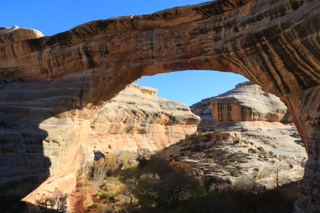
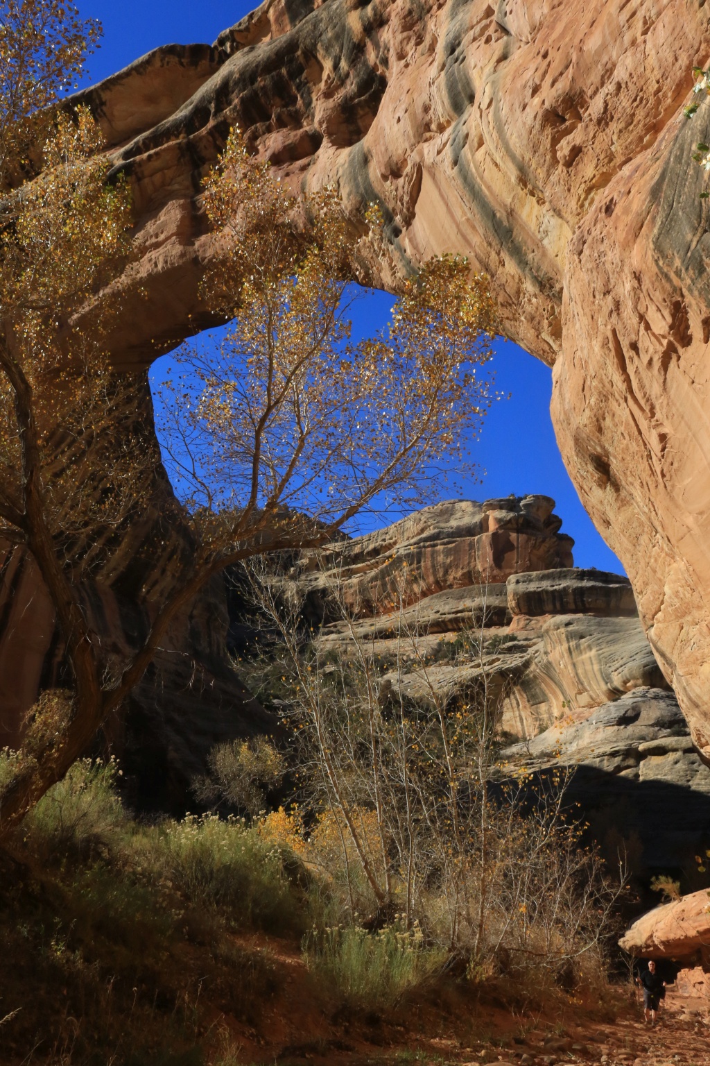
Along the way in the canyon, there are signs of heavy flash floods, with debris hung in the trees as high as 15 feet above the wash floor, now mostly dry.
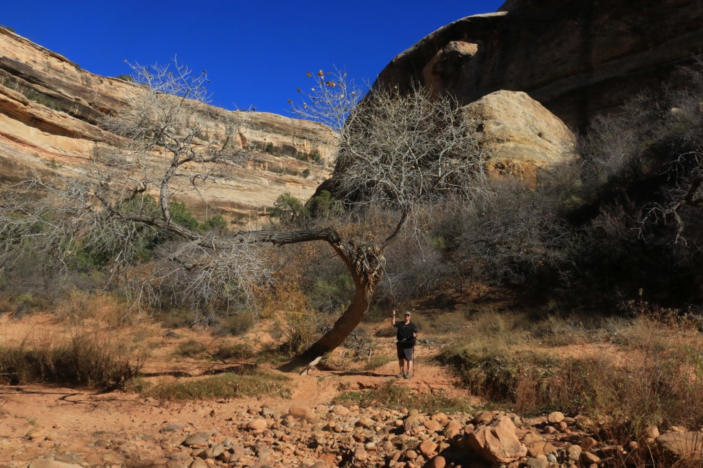
Then Katchina Bridge.

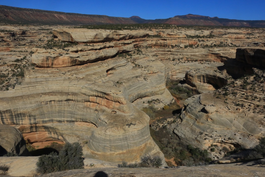
After we got back to the 4Runner, we completed the scenic drive, stopping at some points to admire the beautiful scenery. down below, the trail we just hiked was visible.
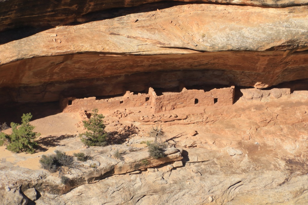
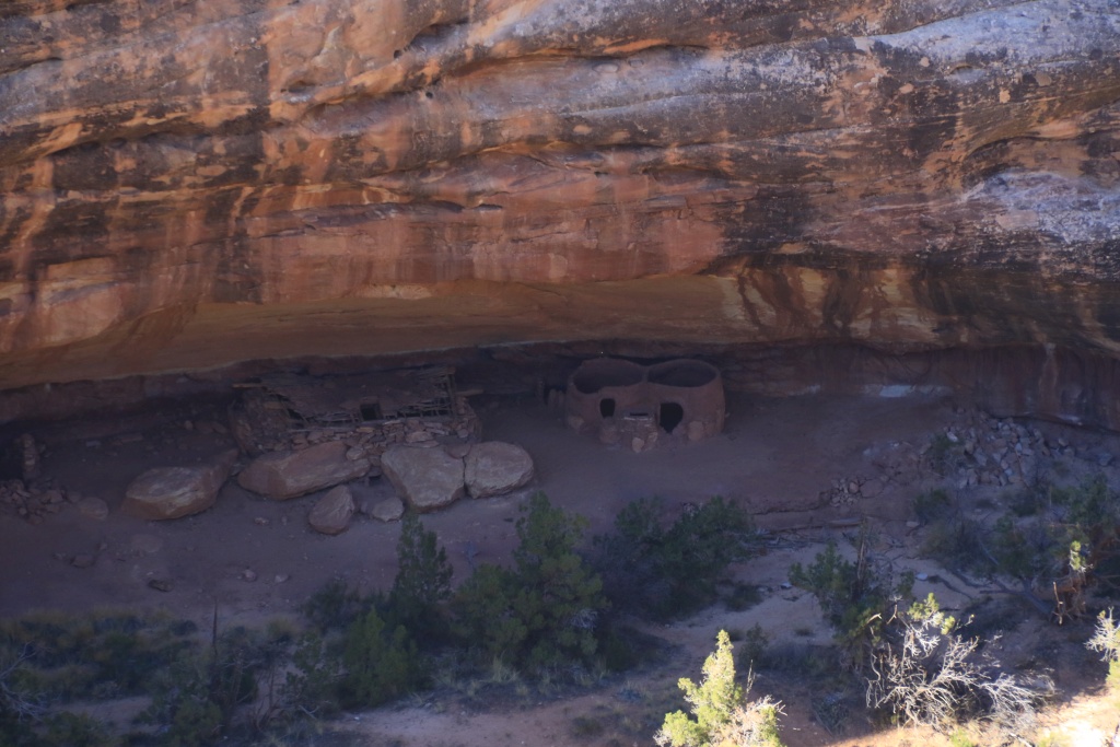
Well preserved ancestral puebloan cliff dwellings were visible from a viewpoint.
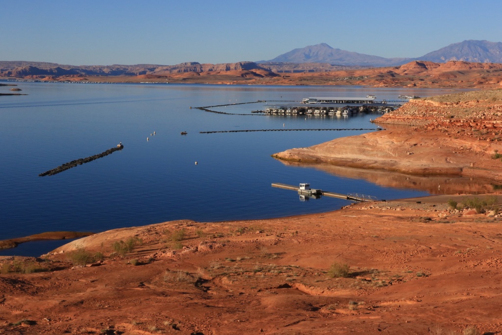
After the hike, even if it is only about 6 miles, we were a bit tired, so we decided to go see Hall's Crossing. Bullfrog, that we visited earlier in the trip, is visible in the distance.
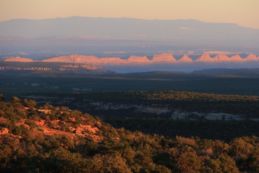
An our way back to Blanding, we were blessed with a really nice sunset over the west side of Comb Ridge.
Tomorrow should another great wheeling day.
.
Start point: Blanding, UT
End point: Blanding, UT
Today was again a hiking day. We went to Natural Bridges NM to hike a loop, going down on Sipapu Bridge, then inside the canyon to Katchina Bridge, then back-up on the trail across the Mesa to our starting point.
Sipapu Bridge.
Along the way in the canyon, there are signs of heavy flash floods, with debris hung in the trees as high as 15 feet above the wash floor, now mostly dry.
Then Katchina Bridge.
After we got back to the 4Runner, we completed the scenic drive, stopping at some points to admire the beautiful scenery. down below, the trail we just hiked was visible.
Well preserved ancestral puebloan cliff dwellings were visible from a viewpoint.
After the hike, even if it is only about 6 miles, we were a bit tired, so we decided to go see Hall's Crossing. Bullfrog, that we visited earlier in the trip, is visible in the distance.
An our way back to Blanding, we were blessed with a really nice sunset over the west side of Comb Ridge.
Tomorrow should another great wheeling day.
.
Last edited:

krelnydelnky
New member
read this whole thread. Love it!
JohnTheLuck
Member
read this whole thread. Love it!
Thanks. Glad you enjoyed it. More to come!!!
JohnTheLuck
Member
John - More fabulous photos as always. I sure wish that we could get down into that country, but your photos are almost as good as going there ourselves. - Ted
Thanks! I do my best, but the real thing is even better, believe me!
.
JohnTheLuck
Member
Day 21:
Start point: Blanding, UT
End point: Blanding, UT
Another wonderful wheeling day in Utah back country. This time, we headed toward Beef Basin, near the border of the Needles sector of Canyonlands NP. This road is mostly very easy, except for a few rocky or sandy sections, but nothing to be worried in a stock 4Runner.
Again, the scenery was fabulous and the cloudless sky with morning sky was making the cliffs glow. Awesome!
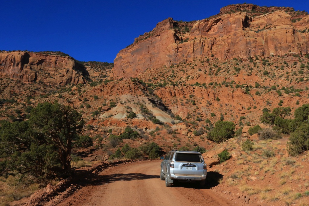
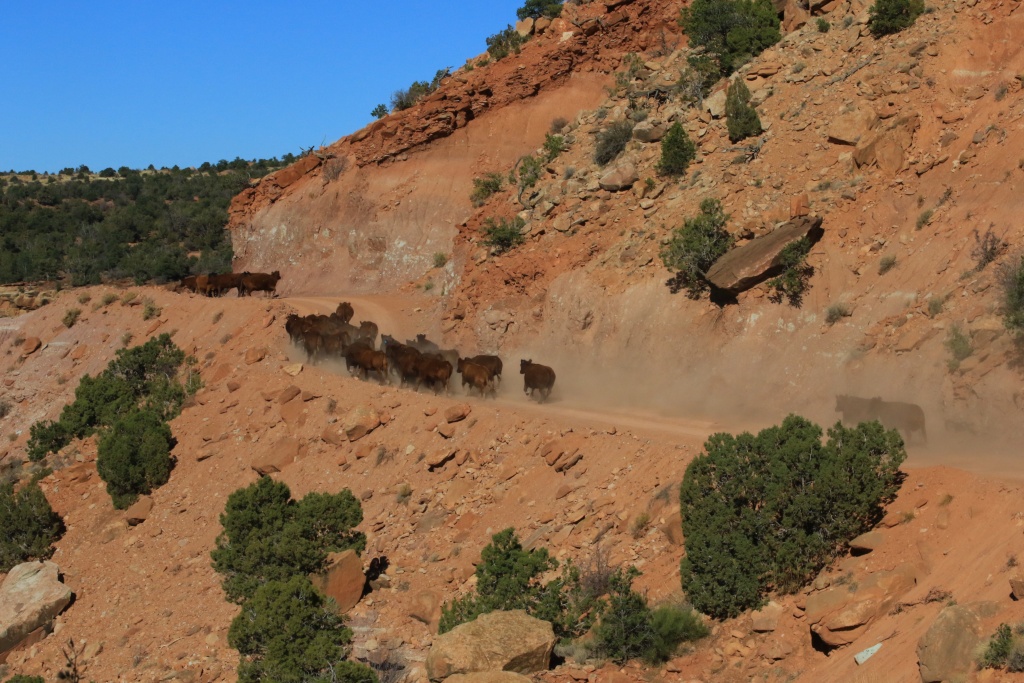
At the tightest section, a group of cows were holding their position on the narrow road. A man from Colorado following me made them move an we were able to continue. That was fun to watch!
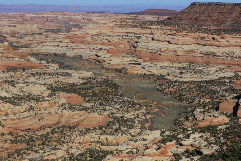
We then arrived at a high point above Salt creek. There is a two mile road going to an overlook, but it was in such bad conditions we decided to move forward. Luckily for us, the road passes at a narrow section where we were able to see the valley below.
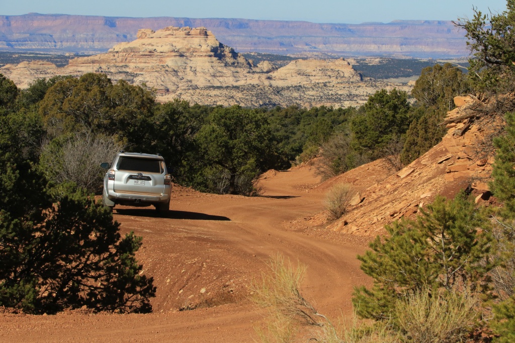
We finally arrived at Beef Basin, a large grassy section encircled by cliffs.

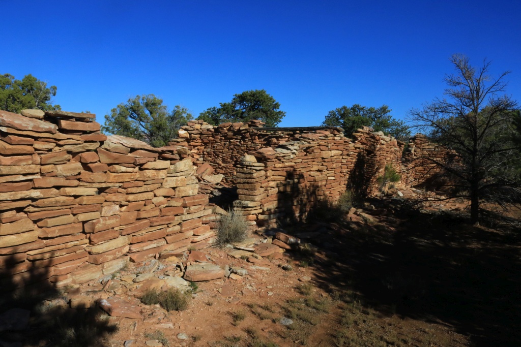
This area was populated by Ancestral Puebloans, and is rich in ruins. We visited a few of them, not marked at all, so it was trial and errors.
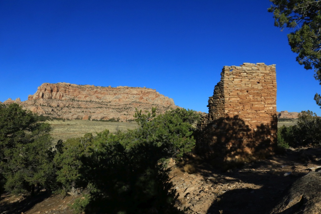
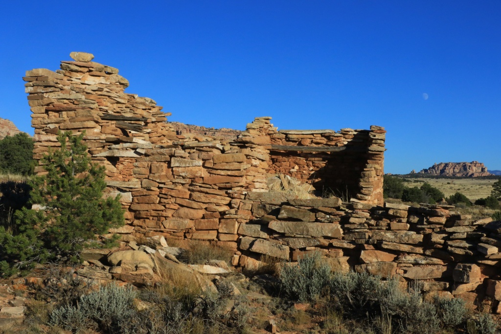
I was hoping that we would have the time to got take a look at Bobby's Hole, a difficult passage on the way to Elephant Hills in Canyonlands NP, but daylight was running out, indicated by the near full moon rising. Maybe that will be for another trip.
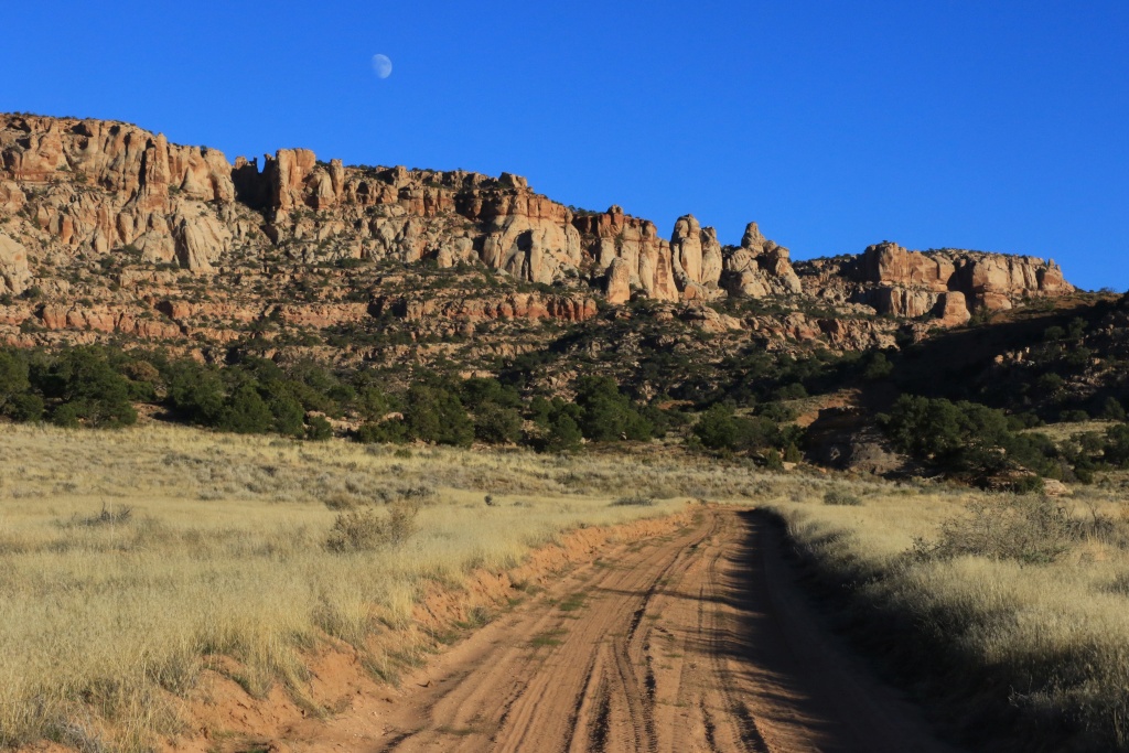
On our way back, the lasts sun rays of a really enjoyable day.
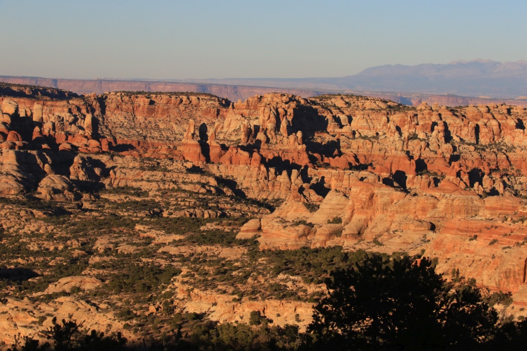
Tomorrow, we will return to the Needles section of Canyonlands.
.
Start point: Blanding, UT
End point: Blanding, UT
Another wonderful wheeling day in Utah back country. This time, we headed toward Beef Basin, near the border of the Needles sector of Canyonlands NP. This road is mostly very easy, except for a few rocky or sandy sections, but nothing to be worried in a stock 4Runner.
Again, the scenery was fabulous and the cloudless sky with morning sky was making the cliffs glow. Awesome!
At the tightest section, a group of cows were holding their position on the narrow road. A man from Colorado following me made them move an we were able to continue. That was fun to watch!
We then arrived at a high point above Salt creek. There is a two mile road going to an overlook, but it was in such bad conditions we decided to move forward. Luckily for us, the road passes at a narrow section where we were able to see the valley below.
We finally arrived at Beef Basin, a large grassy section encircled by cliffs.
This area was populated by Ancestral Puebloans, and is rich in ruins. We visited a few of them, not marked at all, so it was trial and errors.
I was hoping that we would have the time to got take a look at Bobby's Hole, a difficult passage on the way to Elephant Hills in Canyonlands NP, but daylight was running out, indicated by the near full moon rising. Maybe that will be for another trip.
On our way back, the lasts sun rays of a really enjoyable day.
Tomorrow, we will return to the Needles section of Canyonlands.
.
Last edited:

Ray Dunakin
Senior Member
Thanks for the latest update and pics!
JohnTheLuck
Member
These are great trip photos, thanks so much for sharing looks like a blast.
For sure it is!!! About half-way in the 6 weeks trip already...
JohnTheLuck
Member
Day 22:
Start point Blanding, UT
End point: Blanding, UT
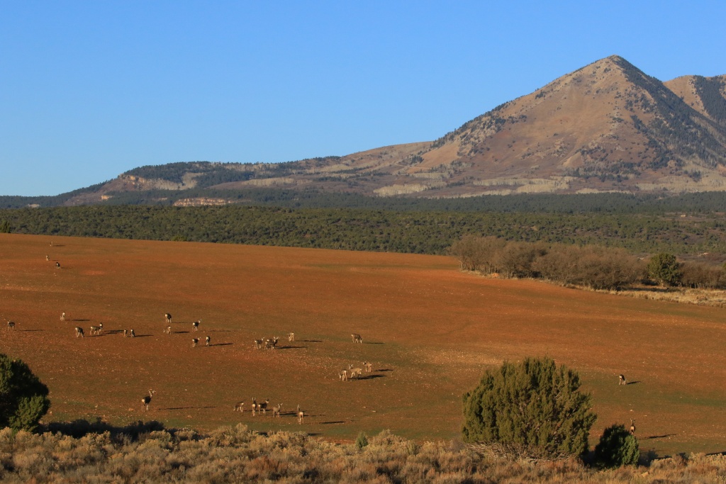
Today, we headed again toward Canyonlands NP. As yesterday, between Blanding and Monticello, we saw a great number of deers near the road. It is the migration season and we have to be vigilant in the morning and evening.
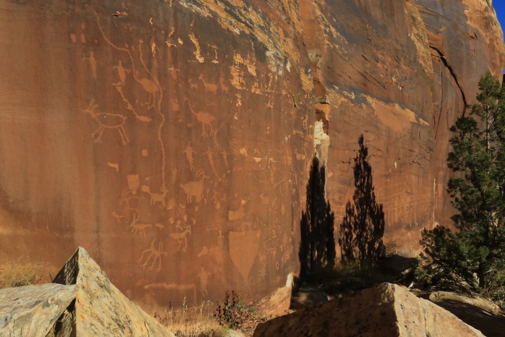
We started the day with a small hike near Newspaper Rock, nearby the Needles entrance to Canyonlands. We got information from a local about a nice petroglyph panel, near the road, but not well known. After searching for a few minutes, we found it. This is only a small portion of it.
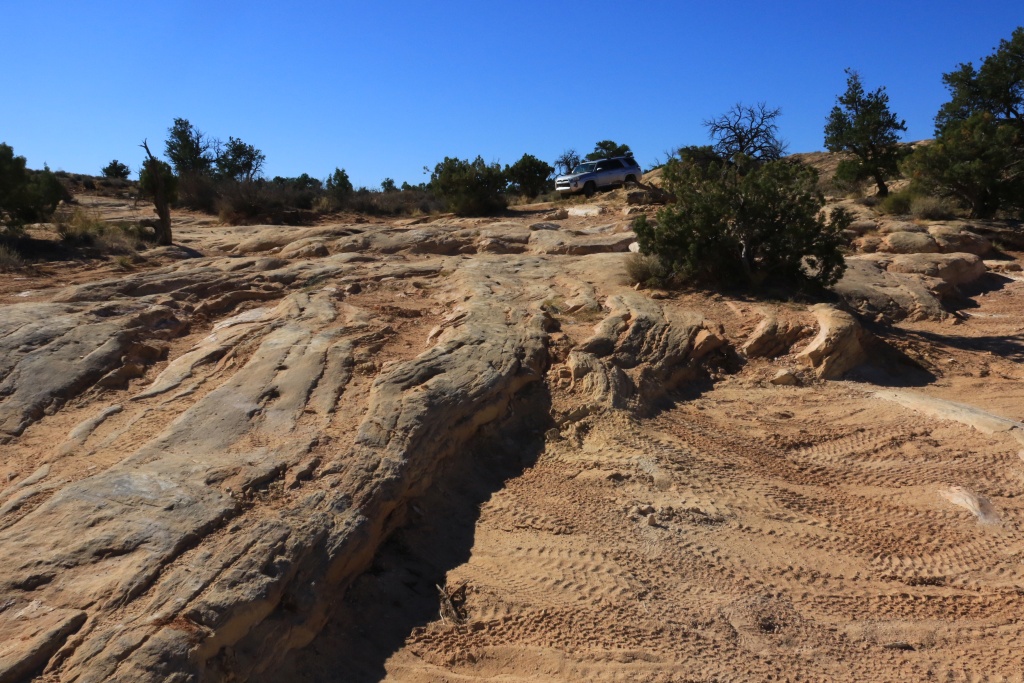
After entering the Needles sector of Canyonlands NP, we drove into the Colorado Overlook Trail, an easy road at the beginning but becoming a lot more challenging at the end. We stopped once we felt the obstacles were a bit too much for my stock 4Runner. The ledges began to be really tall at that point and we didn't loose time to pile rocks to move forward.
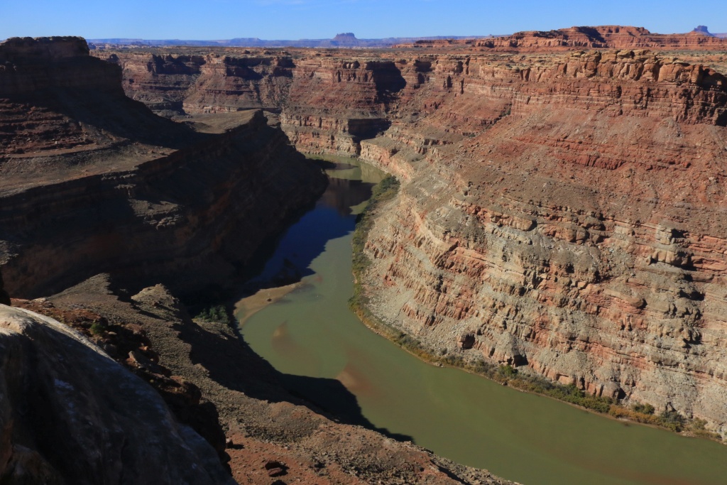
We hiked about the last 1.2 miles of the 7 miles trail. Not bad. At the overlook, the view was impressive.
When we got back, time was flying, as usual... We had only a few hours left of daylight. We then decided to do Elephant Hill...
.
.
.
.
.
... by foot of course. I am not crazy at the point to take an almost brand new 4Runner on a difficult trail as this !!!!! I even wonder what mods would make this trail possible for a 4Runner with KDSS. A 3 inches lift, with full armor, rear bumper with tire carrier and 285 I guess? Who did it?
As we began hiking, a stock Wrangler Rubicon was beginning its clims. We followed it to see what it looks like. It climbed easily, but on its way down on the other side, we heard some metal scraping and hits.

The scenery is simply incredible.
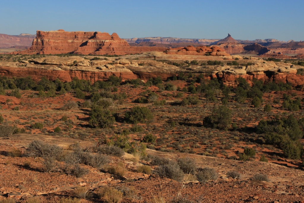
With a little less than an hour of daylight left, we headed onto the Lockhart Basin Road to go see a spot that was rated a moderate. Contrary of the Colorado Overlook Trail which is also rated moderate at the end and proved too much, this moderate portion was still easy. Maybe it was reworked since the book went to print.
Near the Hamburger Rocks Campground.
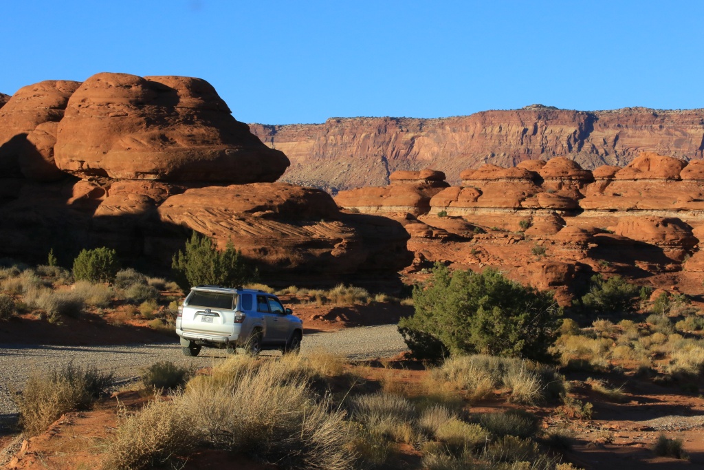
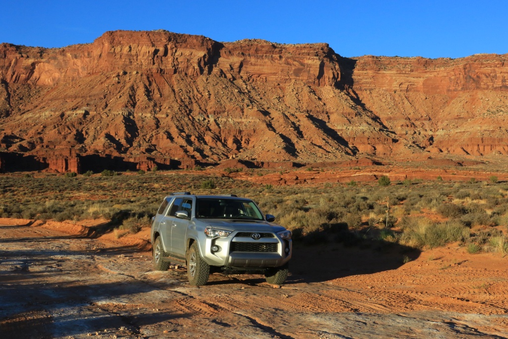
We will be back during a future trip to go to the end of Lockhart Basin Road. On our way back, the sun was very low and the colors vibrant.
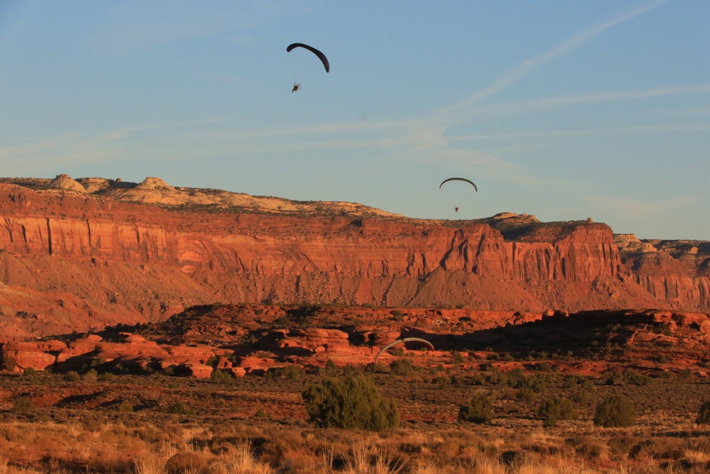
We were not the only persons contemplating this spectacle, but some had better seats than us...
Along UT-211 the moon was playing hide and seek with the cliffs. Magical!!!
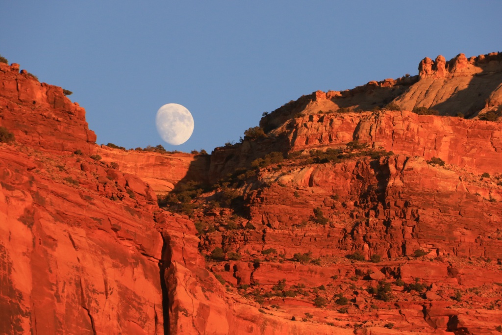
Tomorrow will be a long hiking day with maybe a trail at the end if time permits.
.
Start point Blanding, UT
End point: Blanding, UT
Today, we headed again toward Canyonlands NP. As yesterday, between Blanding and Monticello, we saw a great number of deers near the road. It is the migration season and we have to be vigilant in the morning and evening.
We started the day with a small hike near Newspaper Rock, nearby the Needles entrance to Canyonlands. We got information from a local about a nice petroglyph panel, near the road, but not well known. After searching for a few minutes, we found it. This is only a small portion of it.
After entering the Needles sector of Canyonlands NP, we drove into the Colorado Overlook Trail, an easy road at the beginning but becoming a lot more challenging at the end. We stopped once we felt the obstacles were a bit too much for my stock 4Runner. The ledges began to be really tall at that point and we didn't loose time to pile rocks to move forward.
We hiked about the last 1.2 miles of the 7 miles trail. Not bad. At the overlook, the view was impressive.
When we got back, time was flying, as usual... We had only a few hours left of daylight. We then decided to do Elephant Hill...
.
.
.
.
.
... by foot of course. I am not crazy at the point to take an almost brand new 4Runner on a difficult trail as this !!!!! I even wonder what mods would make this trail possible for a 4Runner with KDSS. A 3 inches lift, with full armor, rear bumper with tire carrier and 285 I guess? Who did it?
As we began hiking, a stock Wrangler Rubicon was beginning its clims. We followed it to see what it looks like. It climbed easily, but on its way down on the other side, we heard some metal scraping and hits.
The scenery is simply incredible.
With a little less than an hour of daylight left, we headed onto the Lockhart Basin Road to go see a spot that was rated a moderate. Contrary of the Colorado Overlook Trail which is also rated moderate at the end and proved too much, this moderate portion was still easy. Maybe it was reworked since the book went to print.
Near the Hamburger Rocks Campground.
We will be back during a future trip to go to the end of Lockhart Basin Road. On our way back, the sun was very low and the colors vibrant.
We were not the only persons contemplating this spectacle, but some had better seats than us...
Along UT-211 the moon was playing hide and seek with the cliffs. Magical!!!
Tomorrow will be a long hiking day with maybe a trail at the end if time permits.
.
Last edited:

Gofastpops
New member
I'm glad I found this thread because you're doing what I'm planning to do.
I just bought my 4Runner on Monday but every site I've been to since then implies that you have to buy a tremendous amount of "upgrades" to make the 4Runner usable.
Thanks for the awesome pictures, from the places I'd like to visit, in a stock 4Runner.
(I created an account basically just to say thank you)
Don B.
I just bought my 4Runner on Monday but every site I've been to since then implies that you have to buy a tremendous amount of "upgrades" to make the 4Runner usable.
Thanks for the awesome pictures, from the places I'd like to visit, in a stock 4Runner.
(I created an account basically just to say thank you)
Don B.
Inspiring trips John! We have been at L’Anse aux Meadows with our 34ft 5th wheel but it was 4C in the campground in Aug. Utah and Arizona are on the list for wheeling. We did rent Jeeps in Death Valley and Vegas (Logandale rock climbing). Kids are now out of the house and bought a new 4runner so we will be keeping your thread bookmarked for trip ideas.
Similar threads
- Replies
- 0
- Views
- 2K
- Replies
- 1
- Views
- 2K
- Replies
- 34
- Views
- 10K


