JohnTheLuck's Adventures Thread

The Pacific Northwest is a beautiful place. When you visit Mt. St. Helens, be sure to check out the Ape Caves for a cool hike/rock scramble in absolute darkness. Also near the Ape Caves is a neat little hike called the Lava Canyon trail. It's not too long and it has some awesome scenery.

While you are in the area, the Columbia River Gorge is close by. Take your pick of any of the waterfall hikes in the gorge and you won't be disappointed. A couple popular ones are the Eagle Creek trail (to Punchbowl Falls), Oneonta Gorge, Multnomah Falls, and Wahclella Falls.

Have fun!
 
I might then drive only the portion included in Golden Spike West scenic route. I was also planing to go down onto Promontory Point and Pokes Point, and maybe to Hogup Point. I also want to see Spiral Jetty.

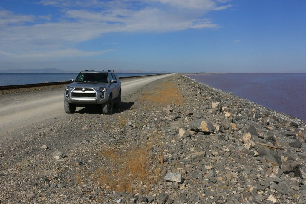
Do you know if it is possible to drive along the railway across the Salt Lake? This place is special since the color of the water on each side is different.

Were you using some mapping device? I plan to use my old iPad with my Garmin Glo and GaiaGPS. I will download the maps before going there. I also have Benchmark Maps of Utah, just in case.
 
US North West trip

Day 1:

Start point: Montreal QC
End point: Elkhart IN

3, 2, 1, it's a go for another trip (epic, I hope...)

We left Montreal QC this morning for a 6 weeks trip that will allow my wife and me to tour the US North West states, beginning with the solar eclipse, and then northern Utah, Wyoming, Montana, Washington, Oregon, Idaho, and finally Colorado.

We will be doing some wheeling, but the goal is to explore this region and identify possible destinations for future more in depth trips.


So today, we traveled in many states; Quebec, Ontario, New York, Pennsylvania, Ohio, and Indiana. Nothing special occurred today, so no pictures yet. Those who remember my previous trip to Utah know that there should be a lot of pictures in the next few days.

I wish to thank [MENTION=146827]TBBrewer[/MENTION], [MENTION=168275]MissouriBreaks[/MENTION], [MENTION=54404]jbstrd[/MENTION] for their help and suggestions when I was planning the itinerary.

Stay tuned !!!
 
Last edited:
Well, the planning is mostly done for this next adventure. Duration will be about six weeks and a half. Here is a summary of the major places my wife and me should visit:

- Somewhere in Idaho for August 21st solar eclipse;
- Salt Lake City UT
- Golden Spike NHS
- Cody WY
- Bighorn Canyon NRA
- Virginia City MT
- Bannack SP
- Butte MT
- Upper Missouri Breaks NM
- Glacier NP
- North Cascades NP
- Mount Baker-Snoqualmie NF
- Mount St. Helens NVM
- Gifford Pinchot NF
- Mount Rainier NP
- John Days Fossil Beds NM
- Hells Canyon NRA
- Twin Falls ID
- Craters of the Moon NM
- City of Rocks NR
- Rocky Mountains NP

The current total distance is somewhere 20000km for now... The 4Runner might need an oil change somewhere the end, before taking the road back to Montreal QC. Unless I extend a bit since I will travel a lot on interstates and highways. Well see!!!
.
Safe travels. I am sure you will be driving Going to Sun Road in GNP which is one of the best drives in NA. Yellowstone area favorites were also Beartooth and Cody where the museums and rodeo were a nice break from National Parks.

My wife and I are doing our first trip in our 4runner next month to Colorado (RMNP, Ouray and Colorado Springs) and Moab, inspired in part by your previous trip!
 
Safe travels. I am sure you will be driving Going to Sun Road in GNP which is one of the best drives in NA. Yellowstone area favorites were also Beartooth and Cody where the museums and rodeo were a nice break from National Parks.

My wife and I are doing our first trip in our 4runner next month to Colorado (RMNP, Ouray and Colorado Springs) and Moab, inspired in part by your previous trip!

Thanks.

I am pleased to see my trip inspired some! You will surely appreciate traveling with the 4Runner. Have fun!
.
 
Day 2:

Start point: Elkhart IN
End point: Grand Island NE

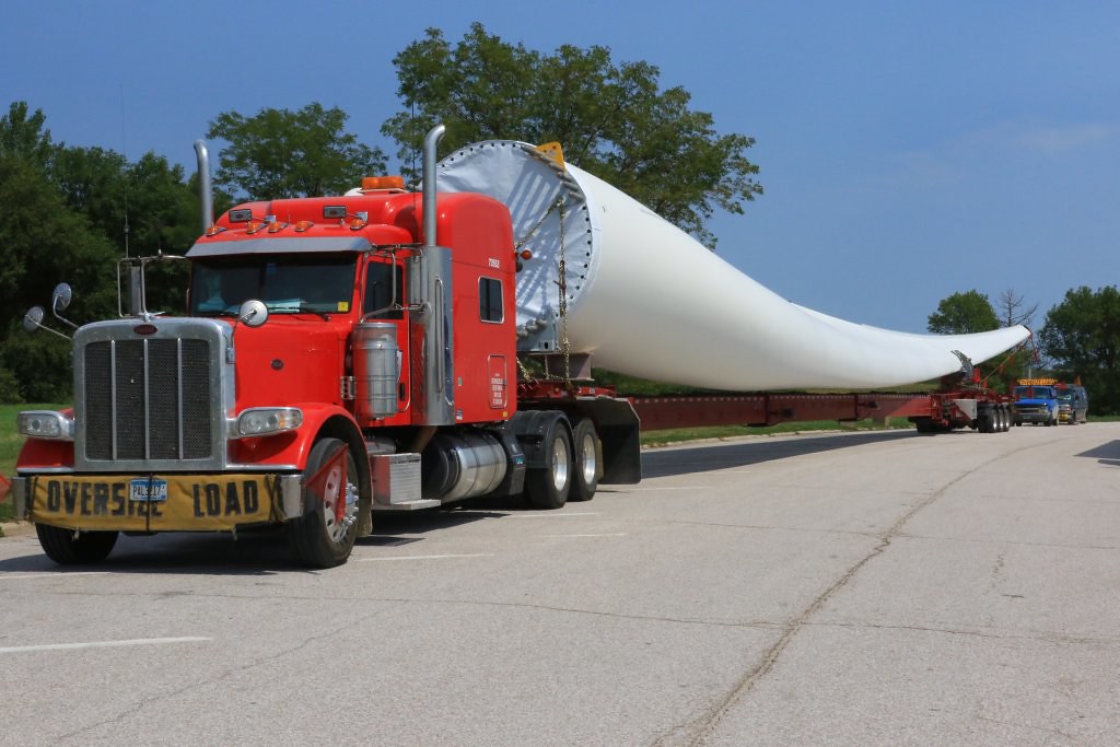
It was another day on the Interstate, under a beautiful sun. Nothing really to report, except some unusual excessive wide payload: a blade for a windmill turbine. We saw a few of them going in the opposite direction, and finally one at a rest stop.

36520360981_fdb2eec284_b.jpg


We stopped and talk a bit with the driver. The blade is 197 ft long and the truck is 215 ft long. This is probably a nightmare to drive around some thigh corners. I would not trade the 4Runner for this any time!!!

So today, we traveled in Indiana, Illinois, Iowa, and finally Nebraska, a first time for me.
.
 
Last edited:
Day 3:

Start point: Grand Island NE
End point: Wheatland WY

Today, we left the humid plains of the eastern half of the United States to climb on the western half. We climbed at over 8000 feet.

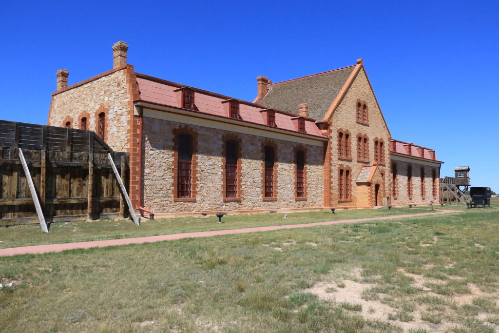
We stopped at Laramie WY to visit the Wyoming Territorial Prison State Historic Site, established in 1872.

36542366331_e775186118_b.jpg


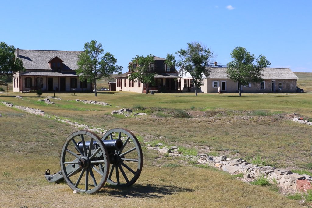
We then went north to visit another important place of the conquest of the west, Fort Laramie National Historic Site. This place is really interesting since we really felt the hard life of the people living at that time at the border of the unknown. The fort was established in 1834, initially as a fur trading post.

36542366251_322af1d408_b.jpg


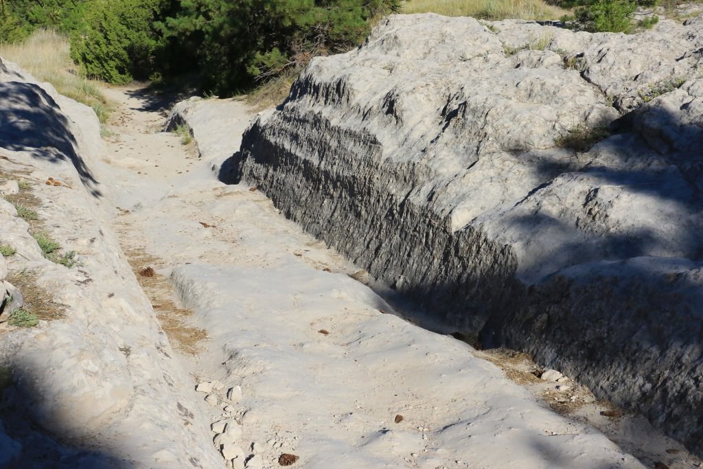
Finally, we stopped at two other places preserving traces of pioneers migrating on the Oregon Trail. The first is Oregon Trail Ruts State Historic Site where wagon wheels traces can still be seen on the rock.

36542366471_6b5a4bd749_b.jpg


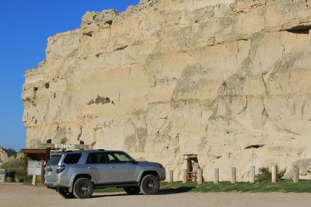
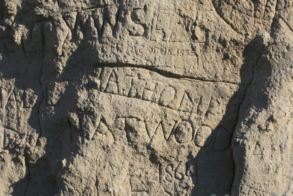
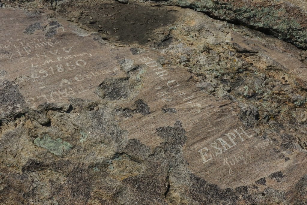
The second is Register Cliff State Historic Site where inscriptions from the early pioneers on the Oregon Trail can be seen, as well as other more recent.

36542366241_05d6dd42e6_b.jpg


36542366421_c75b4227f6_b.jpg


Tomorrow, we should reach Salt Lake City where the 4Runner should see more dust and gravel.
.
 
Last edited:
Day 4:

Start point: Wheatland WY
End point: Logan UT

The theme for today was the migration of pioneers toward the west during the years 1830 to 1870. For better understanding of the reasons, the trails, and the difficulties they encountered, we started the day by visiting the National Historic Trails Interpretive Center in Casper WY.

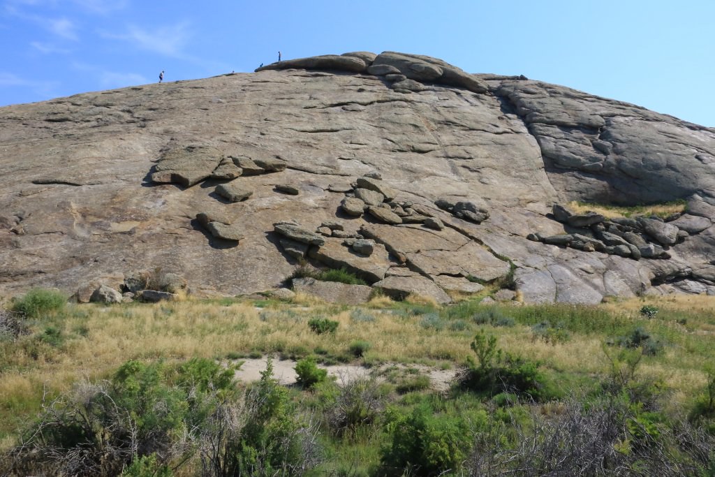
After, we traveled southwest onto the WY-220, following the path of the Oregon Trail. We stopped at Independance Rock, a landmark visible from the distance and used by the pioneers as a reference point, but also to establish camp for the night.

35868955234_2f0fa31f2b_b.jpg


35868955094_82b457e7c3_b.jpg


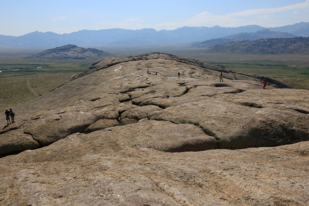
Many of them climbed the rock and left their mark.

35868954964_58ef9a7731_b.jpg


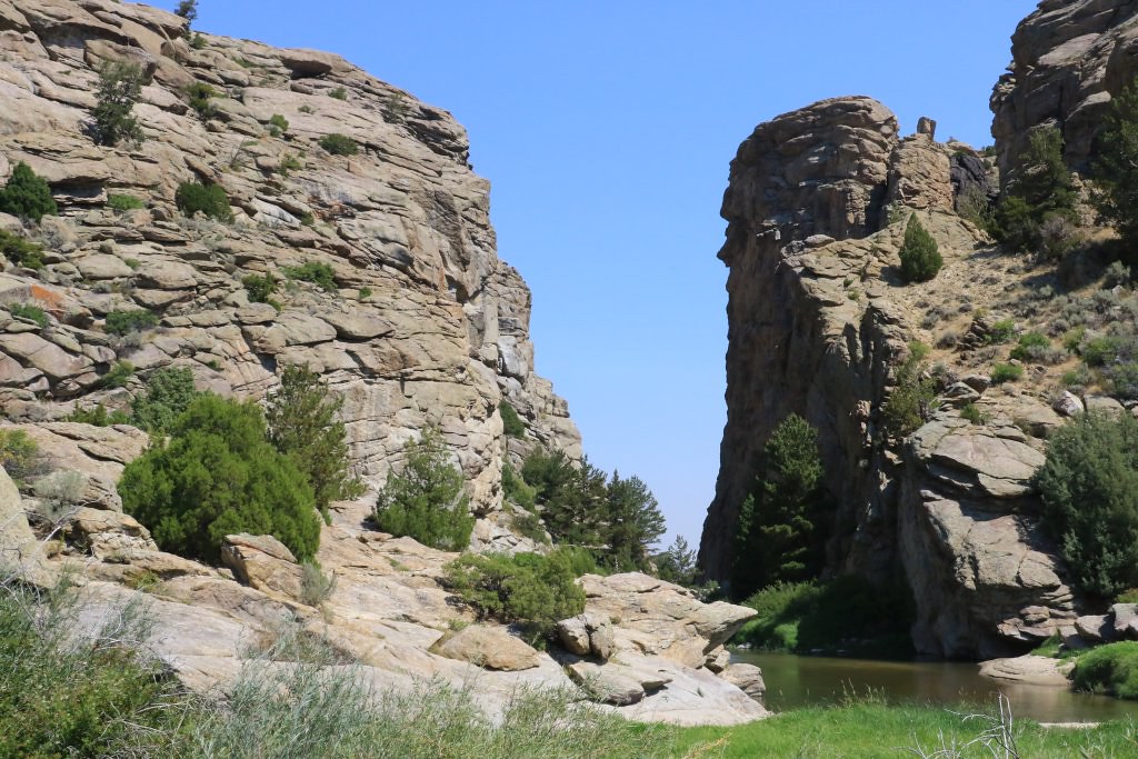
Continuing on the WY-220, we arrived at another landmark, Devil's Gate, a deep cut done by the into the rock by a small river.

35868954894_06c36eda97_b.jpg


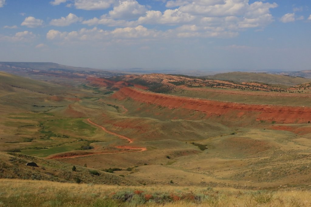
Time was run out, so we headed up toward the Rockies. While ascending, we stopped at a viewpoint over Red Canyon, a really scenic place.

35868954764_611dbb428d_b.jpg


It is bad that we were short on time because the road at the bottom was inviting for the 4Runner, but that will be for a next time.

Arriving at the top, we reached a large featureless and quite boring plateau. We spend almost two hours crossing it. We couldn't keep thinking about the pioneers traveling about 12 miles per day, so they would require about eleven days to cross this land, before descending toward Salt Lake City. They had to endure the wind, the heat, the lack of wood for fire, and probably very cold nights. These are many reasons why many of them perished during their trip. So inspiring...

Finally, we reached Bear Lake in Utah, a place very popular during weekends, as seen by the traffic on the road toward Logan UT.

img]https://farm5.staticflickr.com/4426/35868954704_c9c8c62b64_b.jpg[/img]

Tomorrow, it is the total solar eclipse day!!! We will drive north of Idaho Falls ID to try to find a good spot.
.
 
Day 5:

Start point: Logan UT
End point: Logan UT

What a great day; I experiences my first total solar eclipse at 52 year old... This was absolutely incredible. We drove from Logan UT to Rexburg ID located directly on the center path of the eclipse. We met with my cousin Pierre, an amateur astronomer who founded the Rendez-vous des Observateur du Ciel (ROC), one of the few star party in the eastern part of Canada.

35892790724_65f1397b98_b.jpg


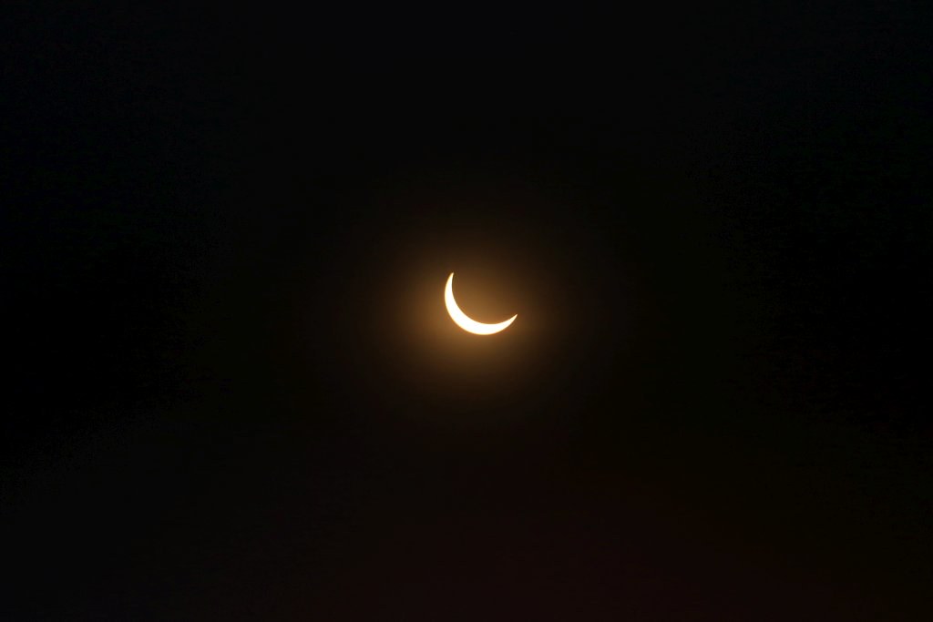
The partial phase started around 10h15. I was able to capture this through a solar filter in front of my lens.

35892790934_d885df950f_b.jpg


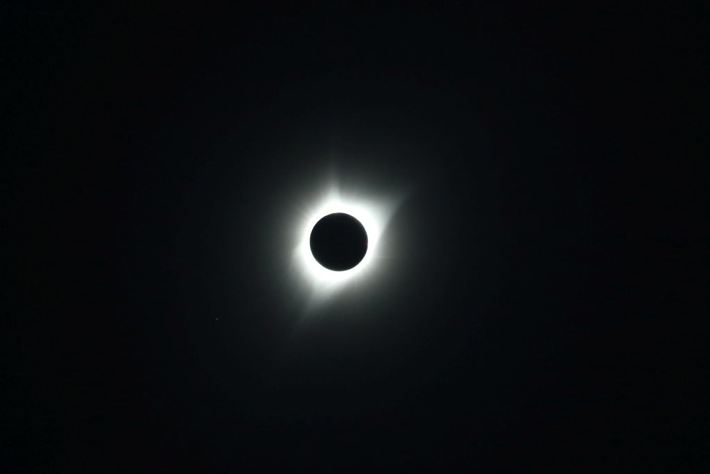
Then, at 11h32, the moon completely masked the sun and the total phase began. The solar was then visible with naked eyes.

35892790904_8c8ae4a57d_b.jpg


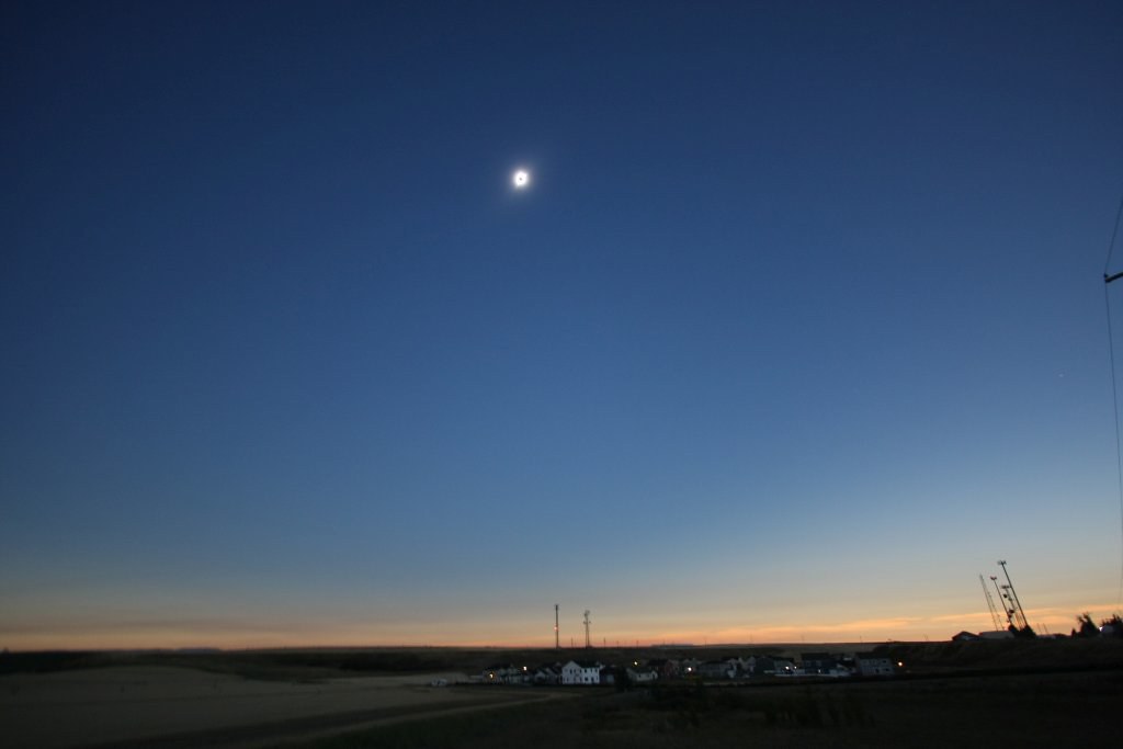
During this phase, there is a sunset all around us.

35892790644_73c5a64f6e_b.jpg


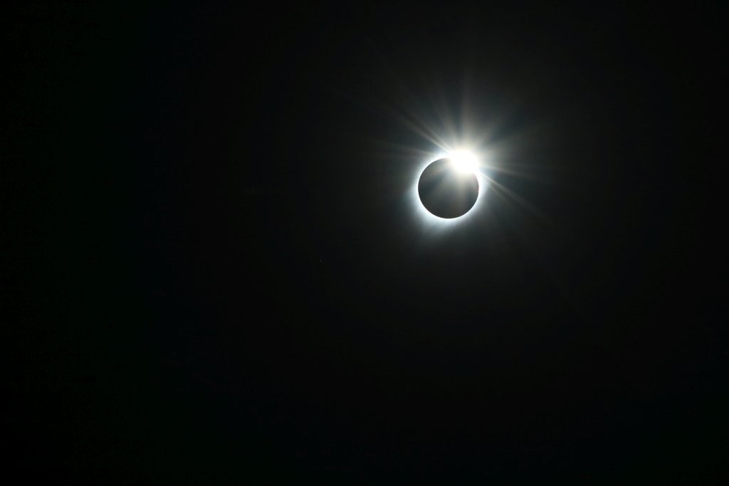
Unfortunately, as every good thing don't last forever, 2 minutes and 17 second after it began, the total phase ended. When the first sun ray begin to shine again, the effect created looks like a diamond ring.

35892790824_c071c612df_b.jpg


This was an incredible experience. The only negative thing of the day, the huge congestion everywhere after the eclipse, when everybody wanted to get back. The media were expecting more the half a million person in this region.
.
 
Day 6:

Start point: Logan UT
End point: Logan UT

Honey, lets go wheeling !!!

Today, our goal was to explore the region north of the Great Salt Lake.

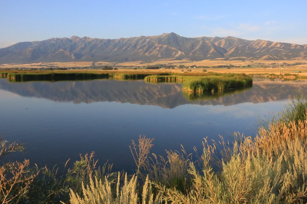
When we left Logan to reach the interstate, the sun was shining on a marsh and the wind inexistant, giving a pretty sight. I couldn't resist and stopped for a shot.

36609516471_dbf5b7457c_b.jpg


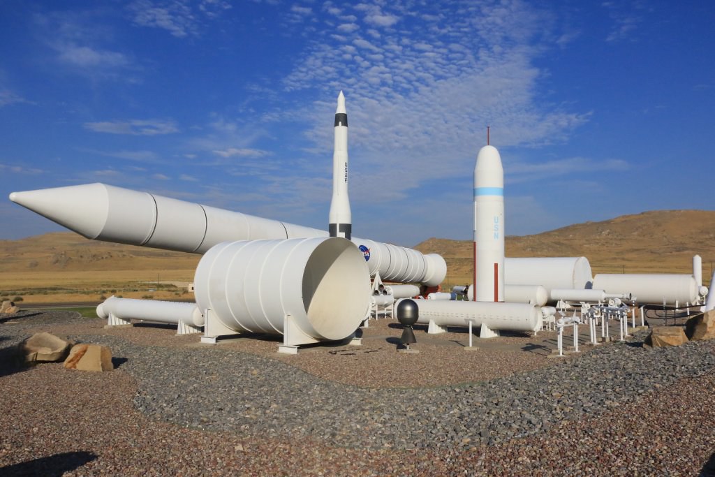
Continuing, we drove near Orbital ATK which present a few rocket exhibit near their test facility near the Promontory Summit.

36352586250_302cabbc6e_b.jpg


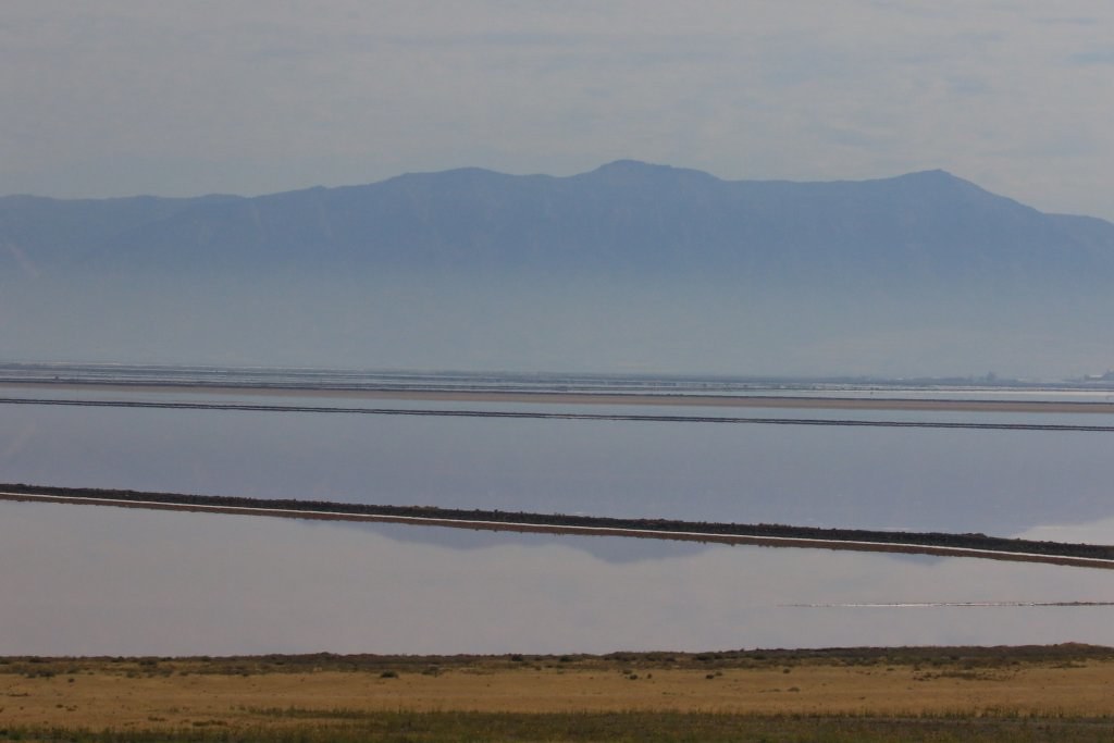
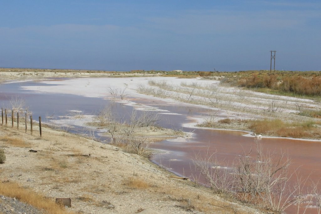
We then arrived near Promontory Point where we saw some salt marsh.

36352586630_5b362497d8_b.jpg


36609516431_cea0a4b02a_b.jpg


36352586050_e7214f28b5_b.jpg


36352586720_02a11b5504_b.jpg


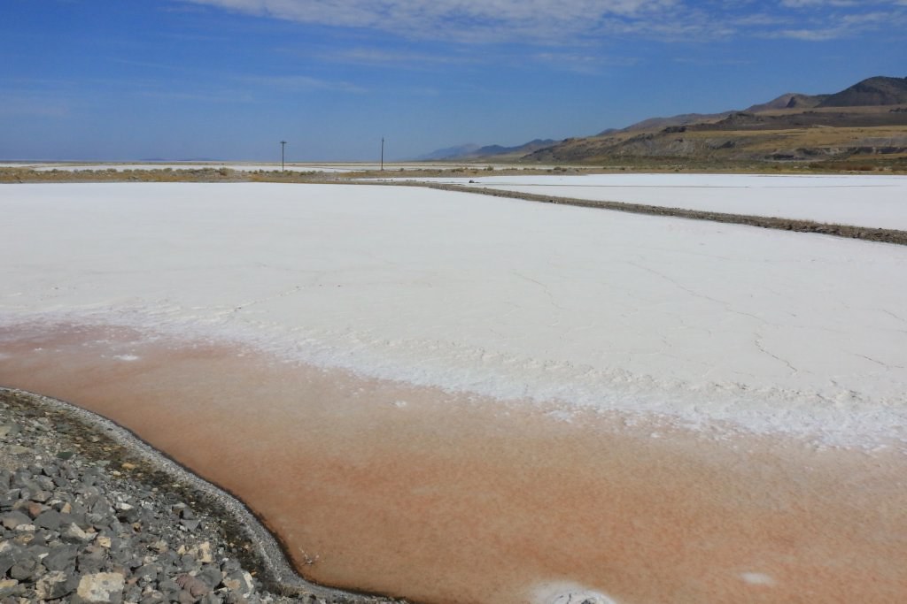
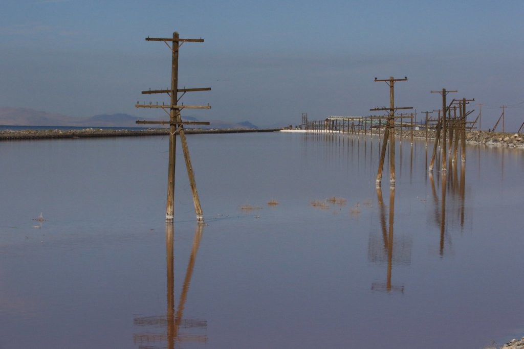
At Promontory Point, the Lucin Cutoff railway cuts the Great Salt Lake in two isolated sections. The north section (on the right) is twice as salty as the south section (on the left). This create a perfect condition for the proliferation of bacteria and algae which colors the water with a red tint.

36352586850_9757212768_b.jpg


When then turn back and reach Golden Spike National Monument which protects the exact point where the Union Pacific and Central Pacific railways were connected, creating the Transcontinental Railway.

The monument offers two auto tours circulating on the railway grade.

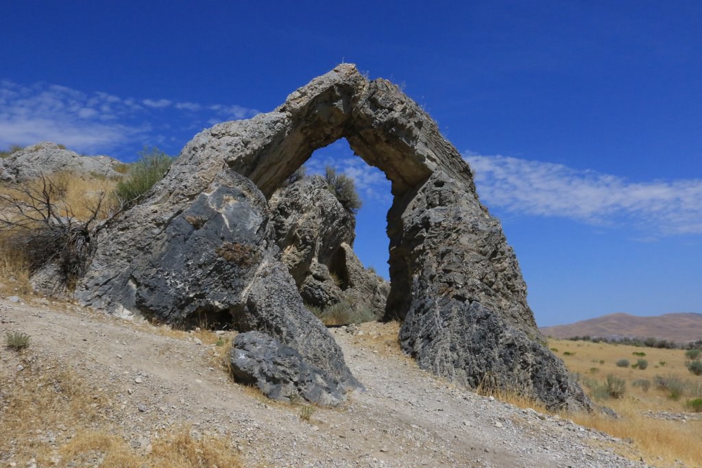
The East Auto Tour allows to view many cuts, several trestle abutments and fills. The Chinese Arch, a natural limestone arch, was named to honor the hard work of more than 10000 Chinese workers who contribute in a major way to the realization of the railway over 6 years.

35939767553_772a922fc8_b.jpg


36352586550_3d878f8b01_b.jpg


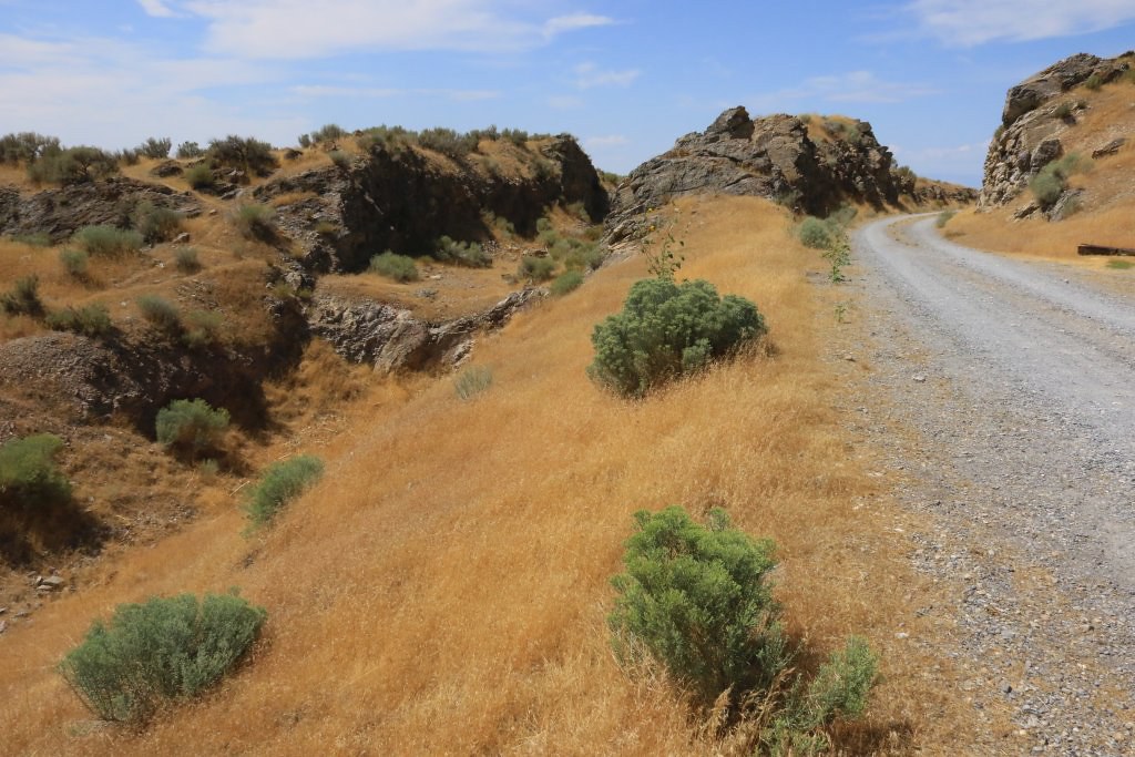
The West Auto Tour allows to see the unfinished Union Pacific grade and uncompleted stair-step cut.

36352586490_3df9b3ba78_b.jpg


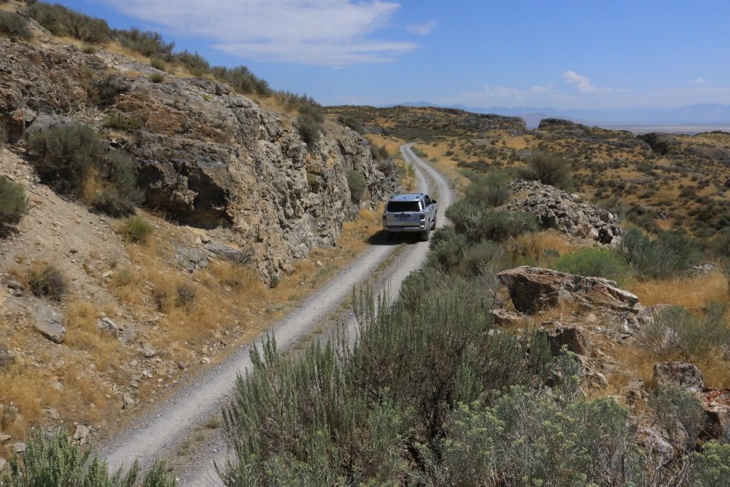
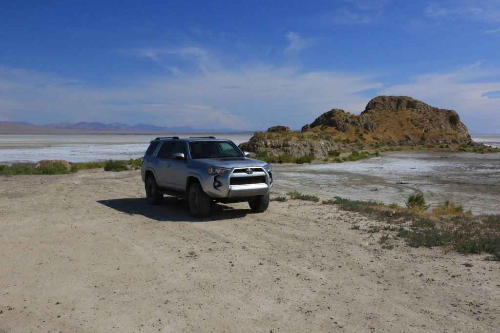
We then left Golden Spike NM to continue on the Transcontinental Railway Back Country Byway, driving mostly on railway grades. We stopped shortly at Monument Rock, on the shore of the Great Salt Lake.

36352586430_0c38fc1ce2_b.jpg


[MENTION=168275]MissouriBreaks[/MENTION] we followed your recommendation to use the parallel road instead of the grade to save some paint on the 4Runner!!!


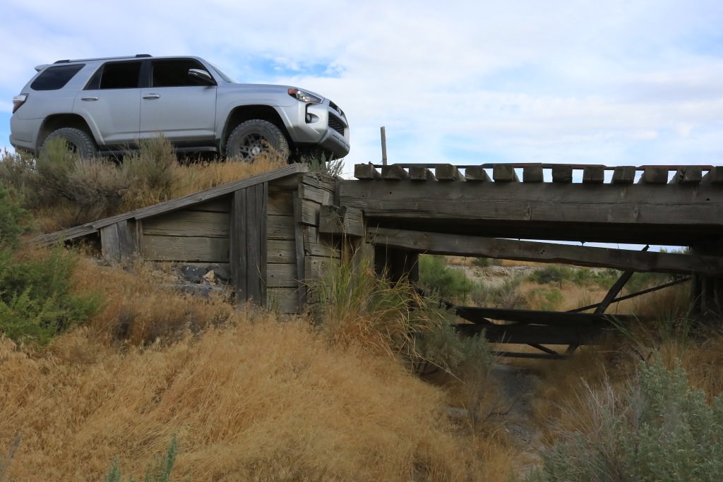
The road goes around many trestles but a few of them can actually be driver over, even if the structure is almost 150 years old.

36352585880_0ca3d67b8a_b.jpg


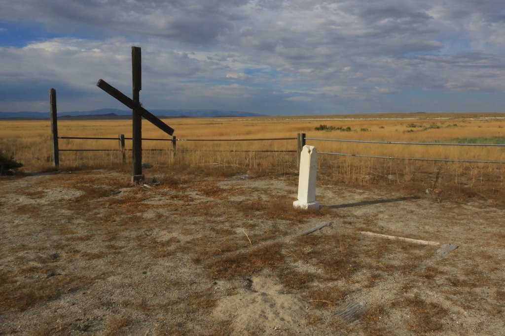
When the railway was in operation, many small town existed along the way to provide support for the train operation. When the Lucin Cutoff (seen earlier) was completed in 1904, these town died one after the other. Almost everything is now gone, but at a few places, some features can be seen, as the cemetery in Terrace.

36352586340_d9d80bc16d_b.jpg


Tomorrow will be our last day in this region. We will probably do more wheeling and a small hike.
.

 
Love following your adventure! Thank you so very much for taking the time to post your beautiful pictures and give us some history and story to go with them. Awesome!
 
Love following your adventure! Thank you so very much for taking the time to post your beautiful pictures and give us some history and story to go with them. Awesome!

You are welcome! I enjoy sharing these adventures, hoping they could inspire some, like many others who shared their stories inspired me.
 
Day 7:

Start point: Logan UT
End point: Logan UT

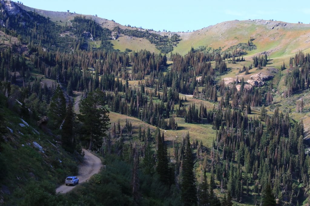
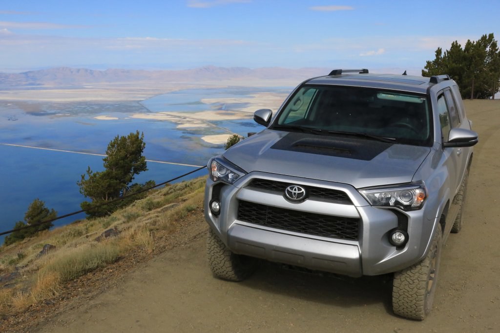
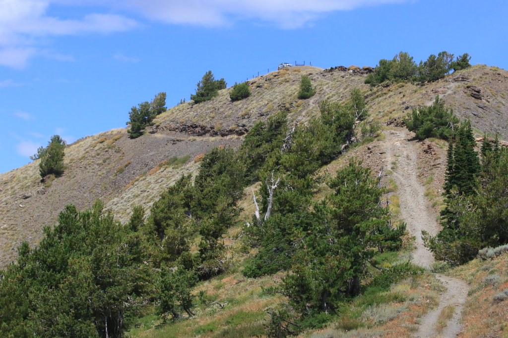
We started the day by driving up to Inspiration Point on Willard Peak, high above the Great Salt Lake. The road is mostly easy but with many drop-offs.

35960258153_a67158ea14_b.jpg


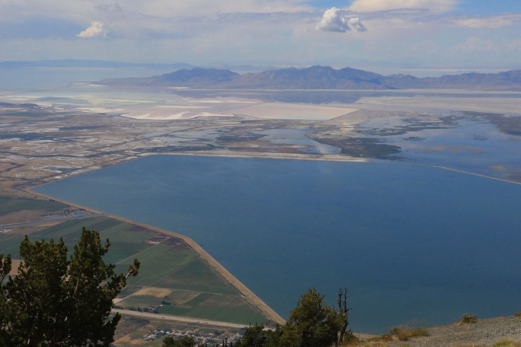
Inspiration Point really deserve its name. The view from there is incredible.

36630177001_1de75fafa0_b.jpg


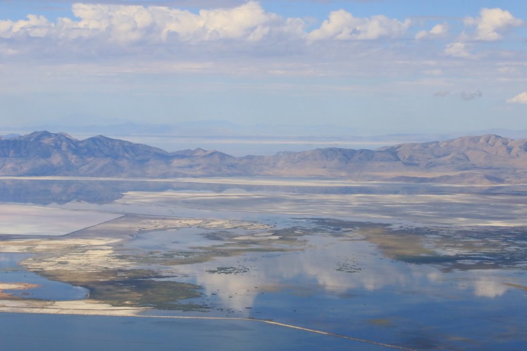
We could see many salt marsh, and also the large fresh water reservoir providing water to the greater Salt Lake City. The condition today allows us to see Promontory Point we went yesterday.

36372587180_6377709def_b.jpg


35960257953_aa1e834259_b.jpg


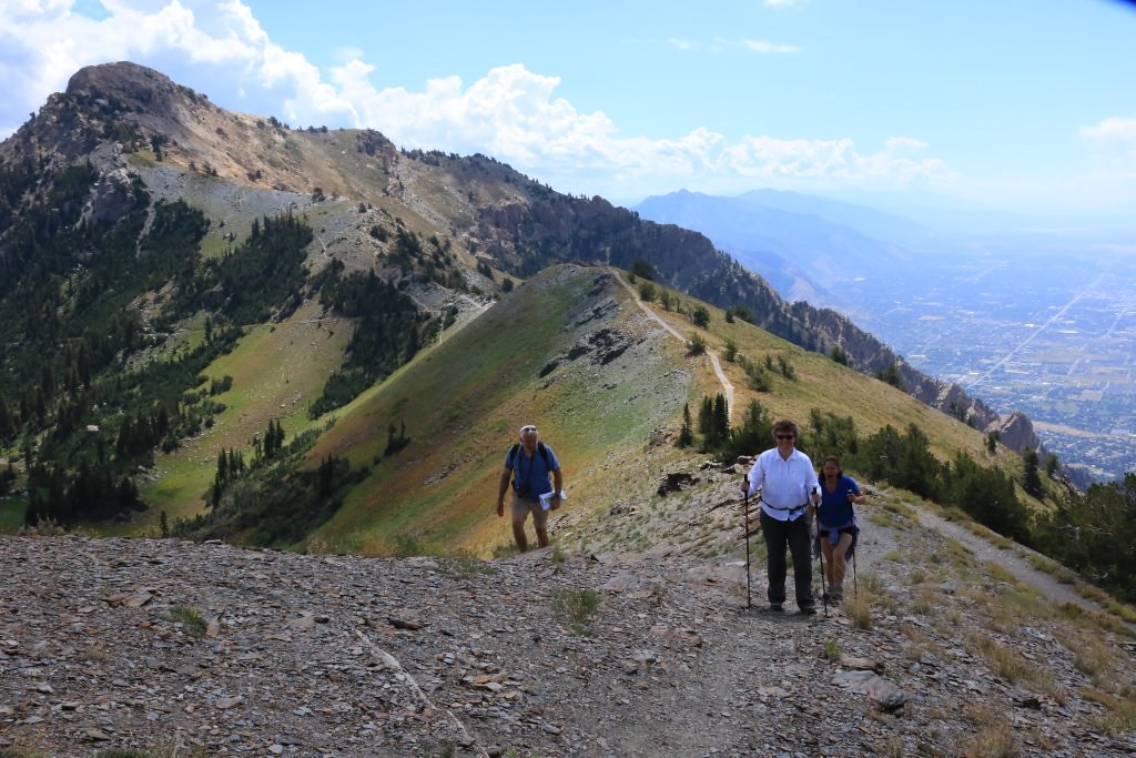
While we were contemplating the view, Peter and Chris, a couple from Utah, arrived and we exchange a bit. There were planning to hike to see the Eldorado mine, located not far away from an hiking trail. There were supposed to have many artefacts. The asked us if we wanted to join, and we gladly did.

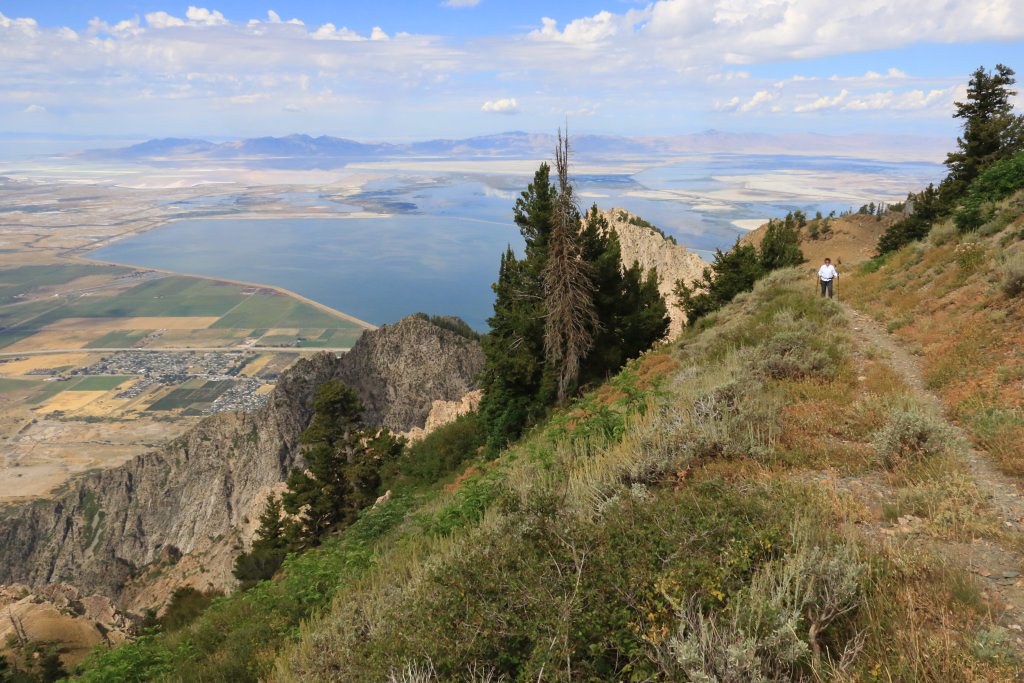
The view from the hiking trail following a ridge was spectacular.

36372587280_7811b643b3_b.jpg


Peter did some off trail exploration to find any traces and he did. But since the path to reach this point was really challenging, we decided to return to Inspiration Point. I have to say that even after one week at a higher altitude than where I am living (120ft), the climb proved challenging since we were at about 9000ft...

36630176931_40ce08ac6f_b.jpg


36372587210_aee268c802_b.jpg


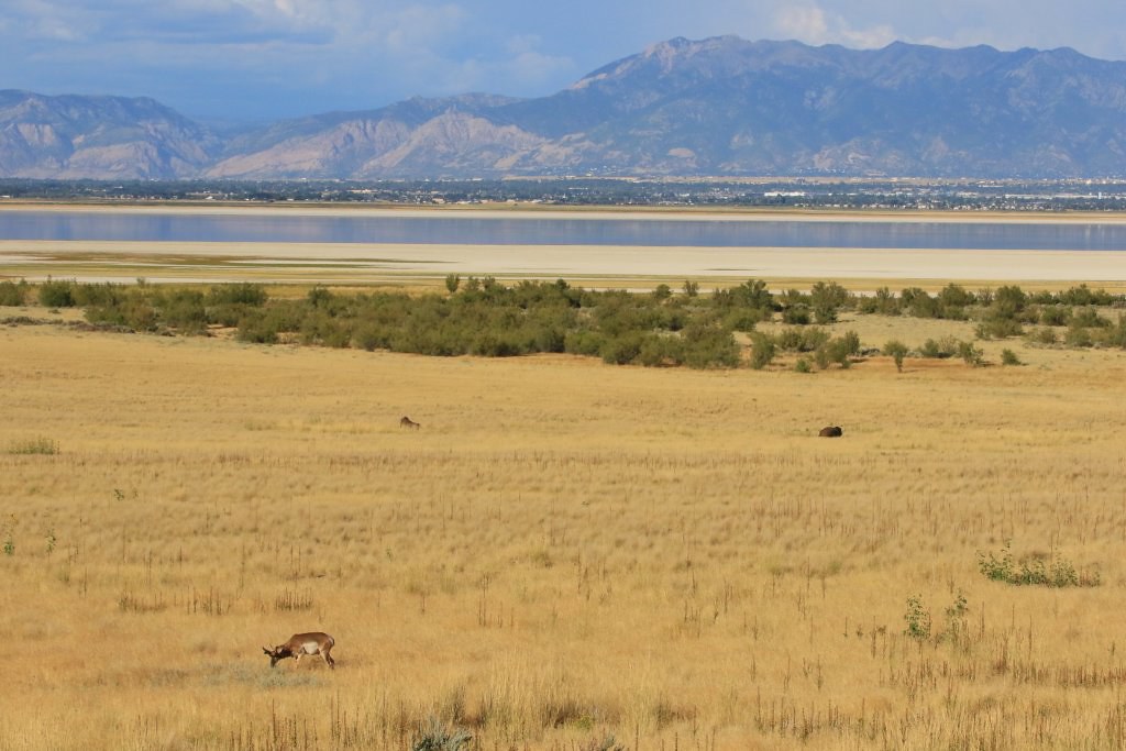
After leaving Peter and Chris, we went to Antelope Island in the Great Salt Lake. This parc preserve a group of bisons and antelopes (of course).

36372587100_829d017cea_b.jpg


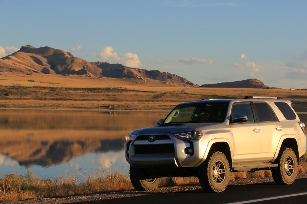
After a while, as the sun was slowly going down, we headed back toward Logan, not without stopping a last time before leaving the island.

36722083696_21dd389ec4_b.jpg


Tomorrow, we leave Logan and Utah, and we will cross the Wyoming completely to arrive in Montana for many days.
.
 
Great stuff!

As a railfan and history buff, I would love to get out that way and follow those old RR grades of the Transcontinental Railroad! BTW, for anyone at all interested in the history of the West in general and the railroad in particular, I highly recommend "The Empire Express" by David Haward Bain.
 
Great stuff!

As a railfan and history buff, I would love to get out that way and follow those old RR grades of the Transcontinental Railroad! BTW, for anyone at all interested in the history of the West in general and the railroad in particular, I highly recommend "The Empire Express" by David Haward Bain.

Thanks! It was really interesting to drive on the grade. All along, I couldn't stop thinking about the colossal effort to build this at that time. Their efforts made possible what the US is today.

I will look into the book when I will be back home. Thanks for mentioning it.
 

Members online

Forum statistics

Threads
278,311
Messages
3,554,082
Members
248,016
Latest member
Advally Service

Trending content

Back
Top