JohnTheLuck's Adventures Thread

keep these photos coming, they are inspiring me to get out and see the country....

now to just find the time....

Thanks! No worry, photos will still be coming everyday until we drive back home (which is too near now...). And if you like great scenery, wait for today's post, in about two hours!!!
.
 
Day 43:

Start point: Pahrump, NV
End point: Pahrump, NV

Distance driven: 329 km
Distance hiked: 10.3 km

After finally settling our credit card problems, we headed back to Death Valley NP to hike the Badlands Loop trail from Zabriskie Point. The view is absolutely grandiose given the variety of colors and shapes dominated by Manly Beacon, all covered with morning lighting. What a delight!

47324424821_eaba4402f8_o.jpg


46409432625_743922e6e6_o.jpg


47271840622_0eff908738_o.jpg


This very popular trail runs along a ridge offering a great panoramic view, before joining a succession of washes.

47324424661_e4989b7d98_o.jpg


47324424621_e6ebe6a8ef_o.jpg


Arrived at an intersection, we decided to make a detour to reach Manly Beacon then Red Cathedral, an area at the bottom of huge columns of reddish rocks carved by erosion. People had gone up to the promontory we wanted to reach.

46409432465_9237b0767c_o.jpg


47324424091_40ff48f6a3_o.jpg


33448674868_ddf49f739e_o.jpg


After finishing this superb hike, we went onto Badwater Road finally open again. We saw a few places where the debris flows had covered the road during heavy rainfall, but nothing extreme as we had been told. I guess it's the safety of people that's important.

This road runs along spectacular panoramas. Unfortunately, some points of interest were still closed, including the famous Artist Drive, and Devils Golf Course. Maybe we'll be lucky before we leave.

47271841252_9064d20a87_o.jpg


47271841172_840fde9813_o.jpg


46409433285_0a33fbfd84_o.jpg


46409432275_822e99f457_o.jpg


Then we travelled the Chloride Cliffs Road, climbing the mountains overlooking Keane Wonder Mine that we had visited yesterday.

47324425531_5ae312ea82_o.jpg


There are several points of view towards Death Valley at the top of the mountain. Keane Wonder Mine is however not visible from the places we went.

47324425451_cd339ea1df_o.jpg


Other allow to see Amargosa Valley.

46409433135_3697651649_o.jpg


47324424191_553950f5f0_o.jpg


This place has a number of tunnels and mine shafts. A small tunnel has already collapsed and allows to enter safely.

47271840982_7d87b1a767_o.jpg


We started our descent while the sun was already very low. We bifurcated to finish in Nevada rather than California, to save a long detour in Death Valley NP.

46409433025_97ab5f2508_o.jpg


While we had almost reached the paved road, a barricade was erected by four donkeys, the air determined not to let us pass. These animals do not fear man even if they live free in nature. As we moved slowly, they wisely moved to the side of the road. One of them was probably a youngster, with his puffy fur.

46409432755_f541a23422_o.jpg


As the last rays of sun illuminated the mountain tops, another great photographic opportunity came to us.

46409432665_e7a6a910c6_o.jpg


Tomorrow we should explore the southern end of Death Valley NP, an area still unknown to us. There will certainly be nice surprises, like every day since the beginning of the trip.
.
 
Yes, these are indeed great pictures! I, too, love that hike. I carried one of my kids on my back on it but it was still great.

On a different but related note, my 4R made one year yesterday. I had it detailed twice by a vary good shop over its first year but after the last 6 miles of tight brush I decided that it is time to take control. So, I washed it, clayed it using the modern version of a clay bar, the Mother 2.0, then used rubbing compound on the two sides, and then used "Meguiar’s Gold Class Carnauba Plus" wax. The result is stellar, with the headlight-to-taillight pinstripping hard to see even for me.

Hopefully, it will get dirty next weekend already but the point was to clean it thoroughly and seal the paint. I also read that some folks put wax and just leave it there going into brushy areas (without wiping it off). Apparently it helps the brush slide off the paint.
 
Last edited:
Day 44:

Start point: Pahrump, NV
End point: Pahrump, NV

Distance driven: 259 km
Distance hiked: 4.8 km

Once again we had a great sunny day, with temperatures approaching 20C. We took the opportunity to explore the southern region of Death Valley NP.

To begin, we drove the Alexander Hills Road, encircling these hills and being sometimes quite narrow and too close to the cliff.

47334285101_1935611f75_o.jpg


The road joins several mines in its highest part, but most have few vestiges and the tunnels are either too unstable to venture into or simply blocked. However, the panoramas it offers are superb. We saw in the distance the Dumont Dunes.

40369052783_c2fb856ae5_o.jpg


47281702652_e1a3b5c0e8_o.jpg


Further, the road enters a wash becoming narrower and crossing passages with colorful rocks.

40369052743_1454106d84_o.jpg


While we were almost at the end of this road, a little surprise was waiting for us, a step of almost 50 cm that we had to go down with an angle. Because of lack of nearby rocks, we had to shovel sand and gravel to make a ramp to allow us to progress.

47281702632_7e851173dc_o.jpg


After having negotiated the step and reached the end of the road, we came back a little on Sperry Wash Road to see the Western Talc Mine. The bright white contrasted with the other surrounding rocks. Nature likes contrasts.

47334285781_1c77b6b09d_o.jpg


Continuing westward on Sperry Wash Road, we entered a canyon lined with beautiful cliffs carved by water.

47281702592_672a98635d_o.jpg


Sperry Wash flows into the Amargosa River which travels a great distance into the earth, and flowing to the surface in a few places, including the one we were exploring. We had to cross it many times, but the challenge was not very hard.

40369052733_4ebb371dc1_o.jpg


47281702562_491d1a353b_o.jpg


Further on, we had to relax our legs a bit, we explored on foot a pretty canyon lined with red sedimentary rock and black volcanic.

40369052703_349c12c838_o.jpg


47334285601_df30858b4b_o.jpg


The end of Sperry Wash Road is located near Dumont Dunes State Recreation Area. We were surprised to see only a few groups since it was Saturday.

40369052693_771d3794a0_o.jpg


Having completed the route, we then proceeded to Ibex Dunes Road and Ibex Springs Road. Here again, we have seen several talc mines, including the Monarch Talc Mine with some structures.

47334284881_17c61a4463_o.jpg


Then we explored nearby Ibex Ghost Town and Ibex Springs.

47334285421_0a17602637_o.jpg


47281702752_6b3e7bc063_o.jpg


Continuing on Ibex Dunes Road, we reached the Ibex Dunes, very photogenic under the late afternoon sun.

47334285261_41c08788ca_o.jpg


47334285231_5a208f254e_o.jpg


Further on, we explored Saratoga Springs, one of the three largest in Death Valley NP. The ground was very soft because of the rain of the last days and we could not reach the edge of the water.

47334285201_38fed46dd1_o.jpg


As we finished the road, the setting sun lit up the mountains and brought out the colors. What a great way to end another beautiful day exploring this beautiful region in the 4Runner.

47281702532_608585a591_o.jpg


Tomorrow will be our last day in Death Valley NP. Although we still hope for a re-opening of some roads, we already have a plan B in mind.
.
 
Day 45:

Start point: Pahrump, NV
End point: Pahrump, NV

Distance driven: 521 km
Distance hiked: 2.8 km

For our last day in Death Valley NP, we hesitated for a long time between some hiking trails or making a long loop in the 4Runner in the remote areas of the park. Our hesitation came mainly from the gray weather forecasts for the day. At the decision point, the intersection of Badwater Road, we decided; the lack of sun would not have favored the hikes. We then proceeded north to join the volcanic cone Ubehebe Crater, created by a massive explosion of gas under pressure, and not by an eruption itself. In the following photo, we can appreciate the size of the crater with the people barely visible on the rim at the far left and the other going up the trail.

47345532701_46471fc9de_o.jpg


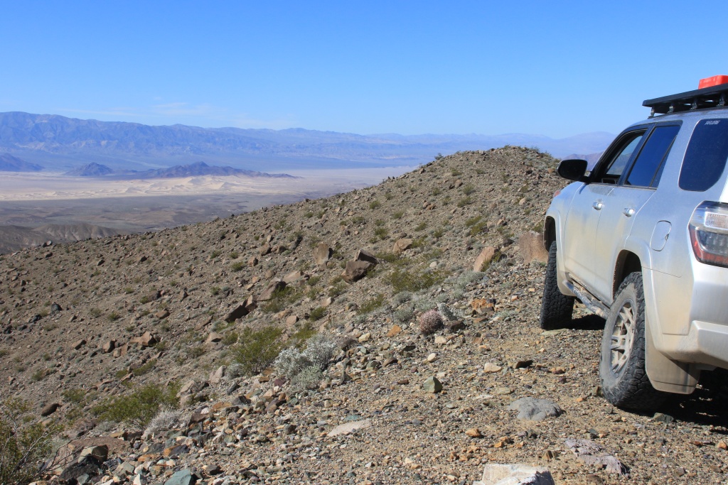
We then headed to Racetrack Playa, crossing Teakettle Junction invaded by too many tourists to stop there. Further, our goal appeared with its characteristic black hill. At that time, we were pampered by beautiful sunny days.

47345532661_d41116ea18_o.jpg


Obviously, Racetrack Playa is known worldwide for its rocks moving by themselves and leaving traces of their displacement.

47345532621_61cfb5e4cb_o.jpg


After a long time on Racetrack Playa, we continued driving south on Lippincott Mine Road. This mine has two levels, lower and upper, accessible by narrow shelf roads. We visited both of them. There are several tunnels, of course, and some interesting remains including rails.

33469478928_c44ac67f9b_o.jpg


47345532551_30a2779a7f_o.jpg


47345532531_8750ccbf47_o.jpg


47345532501_7db2d36ac0_o.jpg


Continuing on Lippincott Mine Road, we had a beautiful view of both levels of the mine and surrounding area.

33469478808_9119e08ebe_o.jpg


Further, the road joins Lippincott Pass and begins a long descent to Saline Valley. This road has a reputation for being very rough but it has probably been worked lately because we have only encountered a more difficult segment which required a slightly more delicate wheel placement.

47345532431_392ef84753_o.jpg


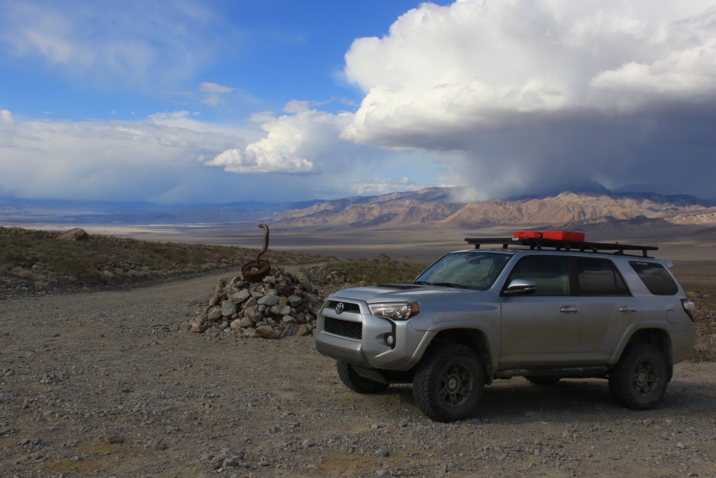
We finally reached Saline Valley Road and its strange monument at the intersection, then a last look at Lippincott Mine Road before leaving.

47345532391_9355462f9d_o.jpg


47345532331_f0ddf7070f_o.jpg


You may remember that Saline Valley Road is the closed road between North Pass and South Pass that had to be impassable? Well, as Lippincott Mine Road joins Saline Valley near the lake, you have to pass South Pass to get back, otherwise do everything in reverse. We took a chance and try to cross South Pass. A few kilometers before reaching South Pass, the threatening clouds did not look too well.

33469479318_f77af09c7d_o.jpg


A few minutes later, we met another 4Runner driver. He told us it was snowing at South Pass but that there was no noticeable buildup. This reassured us a little because with the advanced wear of the tires, we would have turned around in case of heavy accumulations, imposing a detour of several hours.

33469479248_e313f477f9_o.jpg


46430536825_af959c2cc6_o.jpg


Immediately after South Pass, the snow stopped before we lost altitude significantly. The Panamint Valley and its dunes appeared to be a relief, confirming that our bet had been profitable.

33469479048_72ea8b27bb_o.jpg


Farther down Saline Valley Road, after crossing the beautiful Joshua Tree Forest, the person responsible for the snowfall that we suddenly experienced appeared in all its grandeur.

46430536775_de18e1ebc2_o.jpg


There was still a lot of water in Panamint Lake and we were once again blessed by an unusual scene at Death Valley NP.

33469478908_5ea2a2316c_o.jpg


The setting sun indicated the end of the day but also the end of the California portion of this trip.

47345531951_fff6abba36_o.jpg


Tomorrow we will explore Valley of Fires in Nevada.
.

 
If you guys hike Pinnacle Loop in the Valley of Fire its not the easiest trail to follow and Prospect trail is slightly better. Have fun.

Great photos so far.
 
Those last two days must have been a blast, great roads, great scenery!

Thanks! Yes, we had a lot of fun in this region. Ubehebe Crater, Racetrack and Lippincott Mine Loop was on my bucket list since a long time. Done!

If you guys hike Pinnacle Loop in the Valley of Fire its not the easiest trail to follow and Prospect trail is slightly better. Have fun.

Great photos so far.

Thanks for the tip on trails. We will be there tomorrow instead.
 
Day 46:

Start point: Pahrump, NV
End point: Mesquite, NV

Distance driven: 429 km

We left Pahrump under a clear sky. As my wife loves all that is orange, and especially orange rock, the next two days should serve as an introduction and transition to our next trip that should be in Utah in the fall.

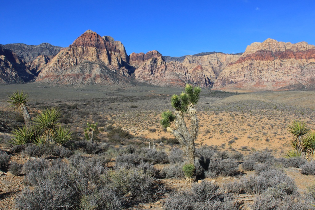
Our first destination was the Red Rock National Canyon Conservation Area, located just west of Las Vegas. As the name suggests, this site protects a very beautiful place made of red rocks and is very popular because of its proximity to the city. We only drove the scenic route as an exploration for our first visit, our time being now quite limited.

32413819587_0fa5558beb_o.jpg


32413819417_eb4810c49d_o.jpg


Continuing the route, we went around Las Vegas by the west then by the north, being not really attracted by big cities and preferring the wide natural spaces. We then passed close to Nellis Air Force Base as a KC 135 Stratotanker took off and two F16s landed. My son would have liked!

32413819197_5eda493794_o.jpg


Our second destination was the Northshore Drive in Lake Mead National Recreation Area, created by the construction of the famous Hoover Dam on the Colorado River. Our original plan was only to travel this route to make a reconnaissance for a future trip. We loved it so much that we postponed our scheduled activities in the afternoon in Valley of Fire SP for tomorrow.

32413819007_ce061f8ebb_o.jpg


32413819127_f35624c5ea_o.jpg


32413818867_33910336a8_o.jpg


At one point we could see Valley of Fire SP playing hide and seek with the hills along Northshore Drive.

32413818697_fd1f2801a6_o.jpg


Further down the road we reached Redrock, a group of red sandstone rock formations carved by water and wind.

32413818467_e90021d4e5_o.jpg


32413818587_5aab0c5b2b_o.jpg


Just a little further, as we approached a bridge spanning Echo Wash, we noticed traces of vehicles down below. Nothing like to pique our curiosity and here we are to explore this wash downstream. The water had dug a deep canyon up to 30 meters in some places.

32413818377_171f898c52_o.jpg


After a few kilometers driving in the wash, we reached the shore of Lake Mead whose level is currently extremely low. The 4Runner GPS and GaiaGPS both indicated that we had been driving in the lake for a long time!

47303062382_6cc6480c3c_o.jpg


We were then immediately next to the descent of boats from the old Echo Bay marina, closed because of the water level as you can imagine ...

46440849625_c0835f42da_o.jpg


We then reached the paved marina road to return to the main road. At several places we could see Echo Wash that we had just traveled.

47303061972_d37f008cf9_o.jpg


Once again reaching the Echo Wash access, we decided to go back down again to explore now the upstream portion.

47303061542_9aa772764e_o.jpg


46440849285_d27e6b9dfb_o.jpg


As time passed, we took a road out of the wash and headed for the main road. We came across beautiful, colorful hills and towards the end, Redrock, which we had seen previously. We finally realized that we had just traveled a short section of the Bitter Springs Trail Backcountry Byway.

46440848975_9ec5783b70_o.jpg


47303061212_c88b3562be_o.jpg


Tomorrow we should (again...) visit Valley of Fire State Park.
.
 
John, I've been away from the forum for a while, so just getting caught up again now. Your photos are beautiful and the reports of your progress are enjoyable! I'm sorry to hear your credit cards got hacked, but I'm glad that you apparently got everything worked out.

The National Park service at Death Valley is terrible about closing roads, often for no good reason. They also leave roads closed for years without doing repairs. It was a much better place to visit when it was a National Monument, prior to being put under control of the park service.
 
John, I've been away from the forum for a while, so just getting caught up again now. Your photos are beautiful and the reports of your progress are enjoyable! I'm sorry to hear your credit cards got hacked, but I'm glad that you apparently got everything worked out.

The National Park service at Death Valley is terrible about closing roads, often for no good reason. They also leave roads closed for years without doing repairs. It was a much better place to visit when it was a National Monument, prior to being put under control of the park service.

Thanks for your good comments!

Yes, I have kind lost confidence in the benefit at stopping at visitor centers to get road conditions of info about places to visit. Each time, I have the feeling they want me to turn around and go home, sadly. And the Web sites are always out of date, as well as Facebook road conditions. Now, I fell that I have to take a look and decide for myself. This works for roads closed with only post signed, but many others were closed by impassable fences.

I know they have the responsibility to keep everybody safe. Not everyone drive vehicles such as a 4Runner or Jeep Wrangler. I saw someone with a stock Nissan Rogue on the Racetrack Road yesterday. The tires on this is not really adapted to the ruggedness of that road. Most of the time it is ok, but he was driving so fast over washboard section it was dangerous. People are sometime not very aware of the danger they face.
.
 
Also I believe the National Park Service has a mindset that is generally opposed to "off-road" vehicular access, and only allows it very grudgingly if at all. Which is why many of the trails in Death Valley have been permanently closed since they took control.
 
Day 47:

Start point: Mesquite, NV
End point: Mesquite, NV

Distance driven: 254 km
Distance hiked: 9.6 km

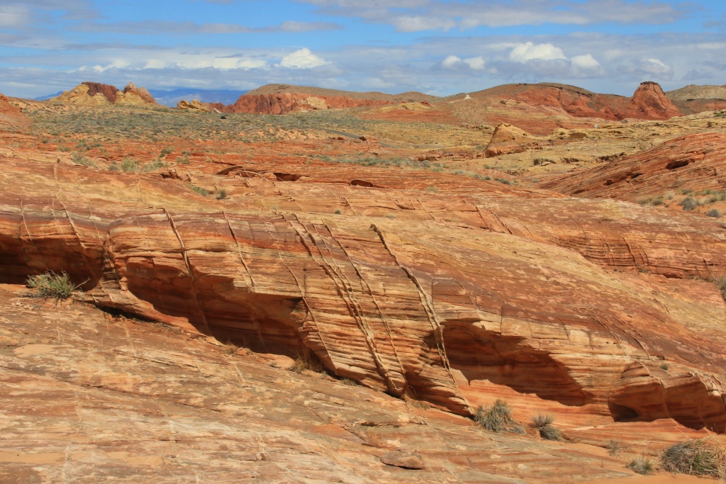
The day began with a gloomy weather with a completely overcast sky and frequent showers, but it got a lot better later and ended with an explosion of colors. We spent the whole day at Valley of Fire State Park, as promised yesterday ...

We started our visit by going to points of interest requiring only a short walk because of the rainfall. We drove the Scenic Loop circulating in the reddish rocks.

32423466847_fa93f3e548_o.jpg


Farther on the Scenic Loop, Atlatl rock is a rock with many petroglyphs, including a rare illustration of an atlatl, a weapon made up of a long spear thrown with a piece of wood increasing the launch force.

47365357841_d03945f7b0_o.jpg


Farther on the main road, we went to see Petrified Logs, large petrified coniferous trunks dating back more than 225 million years.

32423467077_34569c1b0e_o.jpg


Then, we made a short stop at cabins built in the 1930s by the CCC, a government agency hiring people for infrastructure work to get the country out of the Great Recession. Several CCC works still exist today across the country.

47365357401_4ac88f573f_o.jpg


Later, as the sky began to show signs of a much-needed release, we made a stop at P1 parking and randomly explored the area on the west side of the road. This area is made of very colorful sandstone rocks.

47365356991_30f4fffda3_o.jpg


32423466597_372e21c2cd_o.jpg


32423466457_e97b25d956_o.jpg


47365356501_9b13cf6b28_o.jpg


47365356171_18db3021db_o.jpg


32423466287_93f0a8a52d_o.jpg


Then we hiked the Seven Wonders Loop Trail, crossing varied backgrounds and seven notable attractions. On a few occasions, we had to deal with flooded passages in tight places, but that added to the pleasure.

32423466157_54307fc8c6_o.jpg


47365355861_fb4466c59c_o.jpg


32423465867_6f56337de7_o.jpg


47365355371_df1a30a15d_o.jpg


One of the major attractions of this trail is the Fire Wave, a zebra patterned and wind-sculpted rock, somewhat resembling the The Waves formation of Vermilion Cliffs NM in Arizona.

32423465597_81a4c94d22_o.jpg


We finished the day as the sun went down, making the rocks shine with bright colors.

32423465317_d51d545c9a_o.jpg


32423465067_fcffd56127_o.jpg


32423464787_76a9fe6565_o.jpg


Tomorrow is unfortunately already our last day of visit before starting our long trip back to Montreal. We will finish this in beauty, I promise!...
.
 
Day 48:

Start point: Mesquite, NV
End point: St George, UT

Distance driven: 277 km
Distance hiked: 3.5 km

For our last day touring for tis trip, we offered ourselves the all-new Gold Butte National Monument, designated by President Obama in 2016. To access it, we drove the Gold Butte Backcountry Byway, an easy road in excellent condition except for the part formerly paved at the beginning which is a field of potholes. This road runs in a rather remote area, and apart from a few campers at the beginning, we have the whole place to ourselves.

33497677028_a8ce610305_o.jpg


The first point on the road was Whitney Pocket, with its colorful hills, and a dam forming a reservoir and a shelter, both built by the CCC in the 1930s.

33497676458_c8a7b1b03b_o.jpg


47373955151_336320d9c7_o.jpg


32432259637_a2a594ae4a_o.jpg


33497676998_f6352a23bf_o.jpg


Further on, we reached the enchanting site of the former gold mining town of Gold Butte, located on a promontory and populated by rounded rocks.

47373956141_dc10e45ed0_o.jpg


Continuing on the other branch of the loop, we headed north. This part traveling in different rocky layers is much more colorful than the one we have taken to the south.

40408441363_dfbd556463_o.jpg


47373956021_29fdf7ef76_o.jpg


The northern portion of the loop circulates in a wash. As it had been raining last night, there was still a slightly muddy, slippery layer. Fortunately, another vehicle had circulated before and it was much less slippery in its tracks. My old KO2, already not that great in the mud when new, would have not be very helpful in this situation. The landscape was really beautiful with high colored cliffs.

47373955081_055a2e4a88_o.jpg


We made a slight detour into another wash to reach one of the main highlight of this route, Little Finland, an extraordinary region where orange sandstone was carved by water and wind in strange shapes.

33497676868_026ac757a0_o.jpg


47373955841_2e7bb80b0c_o.jpg


33497676368_95854b3e39_o.jpg


47373955811_bf303506aa_o.jpg


33497676748_4dc03b3466_o.jpg


47373955651_29323d7dc9_o.jpg


47373955581_1cb00d83b4_o.jpg


47373955441_ebeba9013e_o.jpg


47373955371_7c504bc4cf_o.jpg


47373955231_5d22a54fc8_o.jpg


Tomorrow, we will make a change of oil on the 4Runner and we will then start our return. We hope to be home late Sunday afternoon, if the weather does not play tricks.
.
 
Last edited:
Awesome pics! Reminds me that I really ought to make another trip to Valley of Fire one of these days.

Yes indeed this is a great place. The first two times, we only passed by without really taking the time to explore. Yesterday we did just that, with only a few points we did planned. Let room for some improvisation!
 
Day 49:

Start point: St George, UT
End point: Santa Rosa, NM

Distance driven: 1025 km
States traveled: UT, AZ, NM

After a very quick oil change at Stephen Wade Toyota in St. George, Utah, we began our travel back home. The high mountains to the north-west of St. George were under a thick cloud and from the city it was seen that it was snowing heavily there. Without knowing it, we observed a phenomenon that we would suffer many times during the day.

Approaching Kanab UT, I listened to the co-pilot's advice that it would be shorter to go south to join US 89 south of Vermilion Cliffs NM than to go through Page AZ as I suggested. Well, here's what we had while the road was 7912 feet ...

32440895077_10bb5ed2a6_o.jpg


For the rest of the day, each time we approached 6000 feet of altitude, clouds and snow appeared. The worst place was east of Albuquerque, New Mexico, while fairly heavy snow was falling but the hot pavement melted it to prevent accumulations.

A little further, we are still up around 6000 feet in the Cibola National Forest, but again without accumulation.

We are in Santa Rosa, New Mexico, on Route 66. Tomorrow, we will resume our journey by staying wisely on I-40 with hope for some heat and no snow.
.
 
Yeah, that's normal for the area! In dry weather it is faster, yes. Page slows you down for a while. This is also the more scenic route. The section around Vermillion Cliffs and then to the intersection with the road from Page is among the best paved roads there are even though it is best when driven the other way.
 

Members online

Forum statistics

Threads
278,312
Messages
3,554,085
Members
248,016
Latest member
Advally Service

Trending content

Back
Top