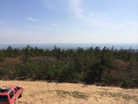
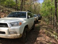
K-trail April 25-27

Here are my pics! Had a GREAT time fellas! Can't wait till next time! I'll have the GoPro footage uploaded sometime this week!

<iframe width="1280" height="720" src="http://s137.photobucket.com/user/madney08/embed/slideshow/K-Trail%20-%20April%2026th%202014"></iframe>
 
Last edited:
Here are my pics! Had a GREAT time fellas! Can't wait till next time! I'll have the GoPro footage uploaded sometime this week!

<iframe width="1280" height="720" src="http://s137.photobucket.com/user/madney08/embed/slideshow/K-Trail%20-%20April%2026th%202014"></iframe>

Great work Taylor!
 
Great pics, [MENTION=65827]MasonT4R[/MENTION], [MENTION=45399]thebwlife[/MENTION], [MENTION=89026]JMG73072[/MENTION]! Had a blast guys!
 
Sorry guys but my pictures are not very good and most were upside down.
 

Attachments

  • 027.jpg
    027.jpg
    133.4 KB · Views: 522
  • IMG_0789.jpg
    IMG_0789.jpg
    138.9 KB · Views: 497
<iframe width="853" height="480" src="https://www.youtube.com/embed/jLCTGaxKrUU" frameborder="0" allowfullscreen></iframe>


Here are my pics fullsize, with a bit of a storyline...

Clayton Lake State Park


Grabbing a quick breakfast in town...


On the trail!


First real obstacle...


Waiting in line for the first real obstacle...


Stopping for a scenic view...


On down the trail a little further, stopped to check out the next obstacle...


Another scenic view...


Pee break or something... who knows, we stopped 278 times... hahaha

 
Last edited:
The infamous "Last Resort" bus!


Another of my rig before heading on down the trail from the bus...


The whole group at the bus...


The bus...


Came up on a cabin that was under construction with an amazing view!


Everyone parked at the cabin...


Once we crossed the Indian Highway, it wasn't long before we came across the best views of the day... this is looking North...


To the South...


Back on the trail...


After we made it through "The Jungle" (the tightest, most overgrown portion of the trail) we came up on the fire tower...


Views from atop the Fire Tower...

Looking to the West...


...to the North


...to the East


...to the South


...down below


...in the fire tower


Homestead just after the fire tower...


...on the way home! If you look VERY closely, you can see the fire tower in the dead center of that ridge line.

 
Hey guys, some of you may not care but if you want to help avoid trail rash, put a fresh layer of wax on the sides of your rig. (Fenders and doors up to the roof line in back) It doesn't take much time and it makes a huge difference on tight OK trails. I was in the Honobia area last weekend and everything is growing. Lots of pine and hardwood branches on the sides and growing up the center of the trails.

There was also a group of about 35 Texas Jeeps heading up the K-trail so you probably will not be alone.

Have a great time.

Your were correct about the foliage and the need for protection. Our paint took a beating. Thankfully I'm one of the don't care much group.
 
Last edited:
Your were correct about the foliage and the need for protection. Our paint took a beating. Thankfully I'm one of the don't care much group.

When my 03 was new, I ran an old trail near Heavner that started out Ok, but towards the end it got very narrow and steep and going back was not an option. It had lots of tall sumac like stuff as well as post oak branches hanging down and onto the trail for about 300 yards. I learned about trail rash very quickly on that trip. Speed made no difference but most of it buffed out. After that, I always waxed the sides pre-trip if I was wheeling in the trees. After the first time, it's no big deal after that.

Arizona cactus will do it too!
 
Last edited:
Just curious [MENTION=45399]thebwlife[/MENTION], based on your experience in Colorado, what trail rating would you guess the K-trail is?
 
Last edited:
Just curious [MENTION=45399]thebwlife[/MENTION], based on your experience in Colorado, what trail rating would you guess the K-trail is?

This is the book I used while there.

Guide to Colorado Backroads & 4-Wheel-Drive Trails, 3rd Edition: Charles A. Wells, Matt Peterson, Shelley Mayer: 9781934838044: Amazon.com: Books

It uses green, blue, red ratings. That would have been on the red level. On the 1-10 scale I'd say a 7ish. Harder than Imogean Pass.

Also that book is awesome for up there. He has one for Moab, Arizona, and Northern CO also.
 

Members online

Forum statistics

Threads
278,316
Messages
3,554,111
Members
248,016
Latest member
Advally Service

Trending content

Back
Top