Labor Day weekend meetup Western NC

st8rocks

New member
Where: Richland Rd. Blowing Rock, NC
When: Sunday, August 31st


A few members( [MENTION=109693]kpd1999[/MENTION] [MENTION=102710]hokie76[/MENTION] ) and I have been talking about meeting up to run Richland Rd. Sunday August 31st. My plan is to do camping and exploring Friday-Sunday. I will go by Brown Mountain then explore forest roads out that way on Saturday; Old 105, Linville Falls, Mortimer, Globe Rd. etc etc...

If you are interested post up!
 
Register to hide this ad
We still shooting for 10a? The weather is showing afternoon storms, so I'm assuming we'll be good if this is a two hour run.
 
We still shooting for 10a? The weather is showing afternoon storms, so I'm assuming we'll be good if this is a two hour run.


I'll be there. First place I see on the map is a place called Supreme Restaurant... (4428 Blowing Rock Blvd. Lenoir 28645) Let's meet there at 10am. I'll PM you my cell number, I will be out in the woods all weekend with no internet.

Too bad a member who has been won't be there for a guide. Richland to Sampson does show up on my GPS so we won't get completely lost! :police::moon:
 
The bear general store (4565 blowing rock blvd, lenoir) is about 1/4 mile from Richland rd.

I know how to get to Richland rd but just didn't know where the entrance to the trail is. It's all posted no trespassing. According to Darklight, the trail entrance is across the creek at the end of the road.

I'm looking forward to getting up there and hoping the weather holds up.
 
I vote to meet at the bear general store (4565 blowing rock blvd, lenoir), which shows up on google map...4428 Blowing Rock Blvd. Lenoir 28645 looks like it is in the woods behind some house, LOL...at least on google map. According to what I am seeing I am a little over two hours away...can't wait.
 
I'll be there. First place I see on the map is a place called Supreme Restaurant... (4428 Blowing Rock Blvd. Lenoir 28645) Let's meet there at 10am. I'll PM you my cell number, I will be out in the woods all weekend with no internet.

Too bad a member who has been won't be there for a guide. Richland to Sampson does show up on my GPS so we won't get completely lost! :police::moon:

Not sure i'd trust the GPS too much out there. It shows up on mine also, but once you really get into the woods it tries to take you places the aren't the trail or even a trail peroid.
It's not too confusing once you get on the trail, just take the route that looks most traveled and you should be fine.

I'd like to make it out there but ill be heading up to harlan for the weekend!
Hope y'all have fun!
 
Not sure i'd trust the GPS too much out there. It shows up on mine also, but once you really get into the woods it tries to take you places the aren't the trail or even a trail peroid.
It's not too confusing once you get on the trail, just take the route that looks most traveled and you should be fine.

I'd like to make it out there but ill be heading up to harlan for the weekend!
Hope y'all have fun!

Too bad Graham..would have liked to check out your recent mods. I have had to wash a lot of mud off my 4Runner since we were at the Flats earlier this year, HaHa.
 
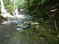
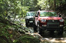
Just thought i would give you guys a heads up. The main bridge is out on Richland and you will have to go through the creek to continue on the trails pics from today.


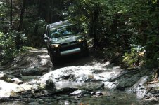
Creek with the rocks. Not bad if you stay to the left and avoid the one big rock in the middle


Had a lot of fun but there was a lot of trash and beer cans on the trail wish I had time to clean it up.

One of me on
the big rock

 
Last edited:
Just thought u would give you guys a heads up. The main bridge is out on Richland and you will have to go through the creek to continue on the trails pics from today.


Creek with the rocks. Not bad if you stay to the left and avoid the one big rock in the middle


Had a lot of fun but there was a lot of trash and beer cans on the trail wish I had time to clean it up.


One of me on

the big rock


Thanks for the info. Im looking forward to getting up there.

That looks like different bridge than I saw when we were looking for the entrance to the trail? The one I saw was concrete and marked private. Do you know which one I'm talking about? I don't want to get up there and we can't find the entrance. Been there and done that - no fun.
 
Just stay to the left. There will be several bridges and about 4 or 5 creek crossings. The last one you actually drive through the creek and over a large ledge. After that you are on the trail. Follow the main trail system all the way through it Deff is confusing if you have not been out before.
 
Just stay to the left. There will be several bridges and about 4 or 5 creek crossings. The last one you actually drive through the creek and over a large ledge. After that you are on the trail. Follow the main trail system all the way through it Deff is confusing if you have not been out before.

How far down Richland rd is the entrance? We went all the way to the end (at least 3 miles of paved road) before it seemed to end on a dirt/grass drive. We turned around at the last house we saw. It was past the paved portion and there was a creek on the right. The road seemed to end in a field. Did I go too far?
 
If you have doubts about how to find the trail then you may not be able to stay on the trail once you enter it. You travel down Richland rd until it crosses threw several creeks and then just stay to the left. You will see the old bridge is down. Once you pass that the gravel rd starts to turn into more of a trail. You will keep going and see it leads you right into a creek that you have to drive through and them up and over the large ledge. Then you are on the trail.
 
Last edited:
If you have doubts about how to find the trail then you may not be able to stay on the trail once you enter it. You travel down Richland rd until it crosses threw several creeks and then just stay to the left. You will see the old bridge is down. Once you pass that the gravel rd starts to turn into more of a trail. You will keep going and see it leads you right into a creek that you have to drive through and them up and over the large ledge. Then you are on the trail.

Not worried about not being able to stay on the trail, just don't want to miss it again. I found it in Gaia a little while ago, so all is good. Thanks
 
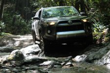
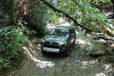
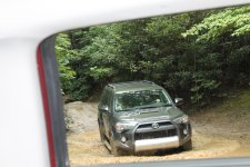
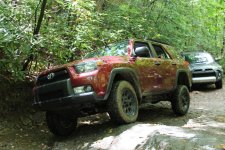
Looks like we had a little more water, and dampness on Sunday...but even my stock TE with OEM tires made it...thank God for lockers, lol
 

Attachments

  • DSCN3110.jpg
    DSCN3110.jpg
    141.9 KB · Views: 285
  • IMG_0955.jpg
    IMG_0955.jpg
    147.4 KB · Views: 297
  • IMG_0957.jpg
    IMG_0957.jpg
    146.5 KB · Views: 285
  • IMG_0959.jpg
    IMG_0959.jpg
    150.2 KB · Views: 301
  • IMG_0967.jpg
    IMG_0967.jpg
    149.3 KB · Views: 292
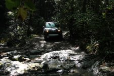
A few more pics. Looking forward to going back.
 

Attachments

  • IMG_1028.jpg
    IMG_1028.jpg
    138.5 KB · Views: 226
  • IMG_0983.jpg
    IMG_0983.jpg
    148.9 KB · Views: 241
  • IMG_0954.jpg
    IMG_0954.jpg
    144.3 KB · Views: 227
I've been through there with snow on the ground and ice everywhere. Its not a difficult trail at all. It's just really nice to look at it which I appreciate more.
 
I got a little.....not too bad. When are you planning on going?

Well I will be in NC visiting family the first weekend in October. I was doing some research just in case I can get away for a few hours. The more I learn about the events of the weekend the more I think it will be unlikely I get to venture out for some exploring.
 

Members online

Forum statistics

Threads
278,316
Messages
3,554,105
Members
248,016
Latest member
Advally Service

Trending content

Back
Top