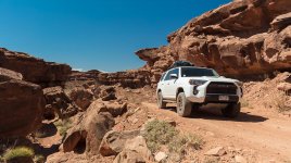
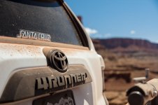
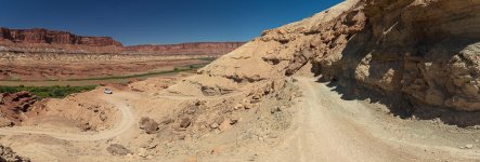
White Rim in a TRD Trip Report: 5/31 to 6/3/17 (pic heavy!)

b407driver

New member
First trip report here, thought I’d start with a classic, White Rim Road in the Island of the Sky district of Canyonlands National Park. As school just ended here in CO, I was looking for something to do with my now-high-school-sophomore, and originally intended on heading up into the San Rafael Swell north of I-70, but a week before lucked into three campsites on the White Rim (presumably from a late cancellation). Never having been, I spent some time here reading other trip reports and trying to decide exactly how much fuel I’d need to carry for the 5th Gen in a worst-case scenario situation (i.e. rockfall on the switchbacks at Mineral Bottom forcing us to backtrack 80+ miles). Additionally, Upheaval Wash has been below water for weeks due to the high flow rates of the Green River, and the Park Service was fairly non-committal (for obvious reasons) on what the conditions might be like when we got there. I’d decided that I’d be up for 24” deep, but no deeper (have ARB breather kit for rear diff and e-locker). I guess we’d find out when we got there.

Anyway I finally settled on the best solution being two Rotopax 2-gal fuel packs, and luckily they had a coupon for a free 2-gal water pack with each! Unfortunately one of the first two fuel packs shipped had a leak, so had to scramble to get them to re-send overnight after the Memorial Day weekend, which worked out (their customer support was great!). I did have to wing the mounting of the DLX mounts since it was completely un-obvious that you had to order an additional $25 mount plate for each pack, as they were out of the generic (and stupidly-designed, I might add) $10 backing plate. Murphy strikes again, but after a few tries I found something that worked with the Rola rack at the local hardware store for $3.50/each. Mounted the Rola Platypus bag on top of the Rotopax’s (yes, I’m a cheapskate when I can be), which kept the sun off the extra fuel and water. [EDIT: My cheapo hack-job turned out to be an I'm-permanent solution, as the brackets were moving very slightly over time. $100 later for two Universal Mounts from Rotopax, and I'm becoming less impressed with the consistency of their products and their customer service, but I'll save that for another thread once the issues are resolved.]

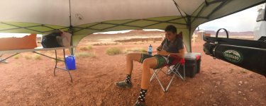
As an aside, some new-to-me gear acquired for this trip, in addition to the Rotopax: Ozark Trail 73-qt High Performance Cooler (3 gal of block ice, pre-cooled with a bit of bag ice); 10x10 Coleman Sun Canopy ('tent', borrowed from MTB team).

After waiting for FedEx to deliver the replacement fuel pack (which arrived at 10:23 AM for a 10:30 delivery window), we were off to the White Rim…

Day 1, Shafer to Airport Campground, 17.5 miles @ 79°, no bugs:

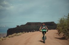
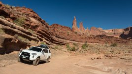
Backtracking a bit to my son, he’s a competitive swimmer and mountain biker, so we used this trip for training, and I provided ‘vehicle support and meals’ for the 3 night, 4 day trip. Perfect for me, as I was eager to get my recently-lifted TRD rig out for an extended test (as well as being a frustrated professional photographer who wishes he was an amateur who could go take landscape pictures all the time). After the first day it became clear to me that a vehicle may not be able to do the White Rim faster than a competitive mountain biker; I got smoked anytime it got bumpy. With an empty, light vehicle I may have come close, or driving an old beater I didn’t care about ripping the suspension out of. (Speaking of bumpy, after the descent down Shafer I took ten minutes to air down the Cooper AT3 C’s from 40 to 30; figured I’d start there and go further if I needed to, but 30 was plenty sticky and comfortable for the terrain.)

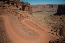
Since we’d driven from Denver, we didn’t have much time to get the 17 miles to Airport, so didn’t take the Lathrop trip down to the river. I hear it’s a must-do, but a dude in a Raptor told me I’d end up with desert pin-striping if I did it, and I’m not sure I’m quite ready for that, yet. Besides, we were eager to get to our first campsite, and we’d also planned not to cook, so we’d stopped at the Hot Tomato in Fruita to grab a pizza to-go. Being a pretty short day, not much to say; the Shafer switchbacks are visually compelling, but this leg is mostly easy road, with some nice views. Only got up to 79 degrees with clouds, compared to the 90 and clear forecast. Pizza was fantastic; half Supreme, half canadian bacon/black olives/mushrooms (my personal fave). Upslope Imperial IPA to top it all off.

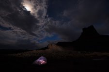
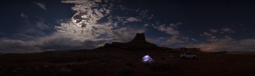
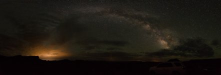
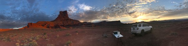
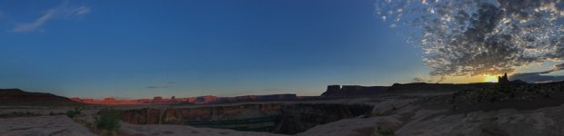
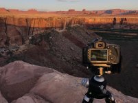
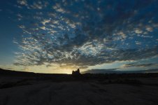
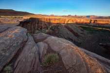
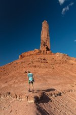
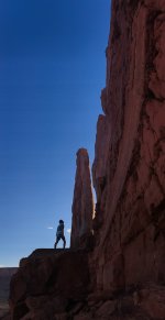
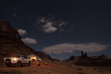
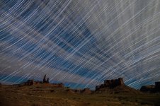
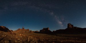
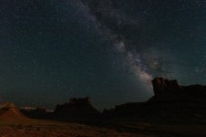
Airport Campground was pretty decent; four sites that aren’t near, nor in view of, each other, and a great view of Airport Tower. The weather wasn’t completely cooperating photographically-speaking, but I’ve learned to adapt with the conditions, and usually rally to find something compelling to shoot. I tend to capture lots of panoramas using a 50MP camera, as well as time-lapse sequences that I also compile into single photographs (read: cloud movement). I also do a lot of astrophotography when I can, and I like the nearly ubiquitous Milky Way photographs that are so common these days. An additional perk, being out in the desert in the middle of the night is a unique experience; it got freaky once out on Lake Powell. That being said, lots of clouds for sunset stymied both Golden Hour and Milky Way images, but during Blue Hour we had fun lighting things up with LED flashlights under the mostly-cloudy sky. I did wake up about 2AM and stumbled around for a couple of pano sequences to check the sky, but the lights of Moab were pretty obvious on a mid-level cloud layer above, even though the galactic center of the Milky Way had risen to a clear quadrant of sky. I do kinda like the image, though.

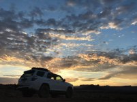
I stupidly forgot to set an alarm for dawn, and woke up to the best sunrise of the trip. The iPhone picture sticking out the tent door still turned out pretty cool, and the scattered cumulus clouds a bit later were perfect for a time-lapse beauty shot of the 4Runner with Airport Tower in the background prior to breaking camp and getting on our way.
 

Attachments

  • 01_5DS38579_-900x_WhiteRimTripReport.jpg
    01_5DS38579_-900x_WhiteRimTripReport.jpg
    61.2 KB · Views: 1,991
  • 02_5DS38611_-900x_WhiteRimTripReport.jpg
    02_5DS38611_-900x_WhiteRimTripReport.jpg
    124 KB · Views: 2,019
  • 03_5DS38672_-900x_WhiteRimTripReport.jpg
    03_5DS38672_-900x_WhiteRimTripReport.jpg
    98.1 KB · Views: 1,981
  • 04_5DS38729_-900x_WhiteRimTripReport.jpg
    04_5DS38729_-900x_WhiteRimTripReport.jpg
    96 KB · Views: 1,985
  • 05_5DS38733-Edit_-900x_WhiteRimTripReport.jpg
    05_5DS38733-Edit_-900x_WhiteRimTripReport.jpg
    81.7 KB · Views: 1,996
  • 06_5DS38784-Pano-Edit-Edit_-900x_WhiteRimTripReport.jpg
    06_5DS38784-Pano-Edit-Edit_-900x_WhiteRimTripReport.jpg
    82.9 KB · Views: 1,996
  • 07_IMG_1125_-900x_WhiteRimTripReport.jpg
    07_IMG_1125_-900x_WhiteRimTripReport.jpg
    86.9 KB · Views: 1,983
  • 08_IMG_1128_-900x_WhiteRimTripReport.jpg
    08_IMG_1128_-900x_WhiteRimTripReport.jpg
    105.7 KB · Views: 1,983
Last edited:
Register to hide this ad
Day 2, 37 miles to Candlestick @ 81°, mosquitoes:

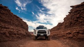
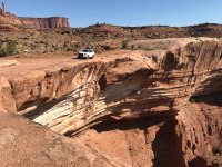
We got off a bit after 8, as it was by far the longest riding day of the four. Shortly after departing Airport is a cool little spot with a sharp left turn and Monster Tower in the background, with an easy rocky climb shortly after (not sure I’d call it Moderate, but FunTreks did). I honestly didn’t even notice passing Gooseberry; not sure where my head was at the time, but wish I would have seen it for future planning purposes. One great view spot early on where the road goes right up adjacent to a beautiful amphitheater (I think FunTreks had a shot here), and you can park as close as you dare to the edge of a several-hundred foot cliff.

We did take a break at a scenic spot down near the southern-most point of the White Rim, though I wasn’t really watching the map. While standing at an overlook, we realized we could hear voices… many voices. We happened to be just underneath Grand View Point, so of course we had to yell up that direction. Although I wanted to see White Crack, my son was motoring and I needed to keep up. Dang kids, still chasing them after all these years, lol. Stopped for lunch prior to getting to Murphy.

I passed a heavily-loaded black 4-door Jeep Wrangler Unlimited Sahara on the fast silty flats. Chatted briefly, nice guy from Kentucky out on a two-month trip, really heavily-loaded with all the gear you could imagine, much of it up on the roll cage-mounted roof rack. He said he was moving pretty slow because of all the weight on top throwing him around on the bumpy stuff. He ended up nearly catching up a few times as I was lagging taking pics.

The climb up Murphy Hogback was a fun, low-stress drive; it seems almost hidden until you finally round a corner and can see the grade (Murphy “A” is an amazing campsite at the top, will endeavor to get it or White Crack next time). I took the opportunity to test out some of the electronic 4WD wizardry in these vehicles of ours, and I must say, I was impressed, even though nothing required a locker nor robust offload experience. That being said, the part-time 4WD drive system in these vehicles really is well-designed, and performs as advertised. I’m sure that true rock-crawlers and purists poo-poo the electronic controls compared to lockers and skillz, but I found the Crawl Control to be a useful feature. Not so sure about Multi-Terrain Select (I didn’t find it at all useful on this trip), but the videos of Trails/TRD Pros digging themselves out of sand are impressive. Speaking of which, Jeep dude (Seth) passed us after we’d set up camp, on his way to Hardscrabble CG.

Since we didn’t really ‘plan’ our trip as far as being able to select our campgrounds, we didn’t know that Candlestick is one of the two ‘dogs’ of the available backcountry campsites on the White Rim. Maneuvering the truck for optimal campsite setup, I scraped the Kuat rack dropping down the ledge on a bit more aggressive line, just for the ‘fun’ of it (hitch would not have taken a hit). This lone campsite is immediately adjacent to the road and quite exposed, and really has few views to speak of, Candlestick Tower being the only prominence to look at several miles away. Its one redeeming feature, however, is the 100-meter walk to a significant amphitheater that spurs off the Green River, in the distance below. Spent about 15 minutes holding onto the 10x10’ Coleman sun canopy during a gust front that blew through (no big rocks around!), and then lowered it all the way down to a hobbi-tent, which worked well.

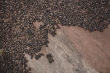
After literally prying him out of his camp chair, my son and I enjoyed walking along the edge of the canyon toward the Green, and once at the intersection of the river canyon and the amphitheater we had fun yelling to check the multiple echoes bouncing off the various canyon walls (9 seconds was the longest we could hear). Once again, the clouds weren’t cooperating for sunset. There was one big section of ‘Moqui Marbles’ sitting on top of the White Rim sandstone; these iron concretions persist from the erosion of the Navajo sandstone above, and end up—via stormwater runoff transport—being flushed into low spots, with the smaller ones being pushed further downslope. Some of them were almost perfect spheres (sorry, my former-geologist self is coming out). About the time we were done with our mini-hike the mosquitoes came out to feast, and we had to slather on the bug juice and huddle in our hobbi-tent.
 

Attachments

  • 01_5DS38940_-900x_WhiteRimTripReport.jpg
    01_5DS38940_-900x_WhiteRimTripReport.jpg
    111.8 KB · Views: 1,951
  • 02_IMG_1145_-900x_WhiteRimTripReport.jpg
    02_IMG_1145_-900x_WhiteRimTripReport.jpg
    140.3 KB · Views: 1,920
  • 03_5DS39045_-900x_WhiteRimTripReport.jpg
    03_5DS39045_-900x_WhiteRimTripReport.jpg
    81.4 KB · Views: 1,919
  • 04_5DS39079_-900x_WhiteRimTripReport.jpg
    04_5DS39079_-900x_WhiteRimTripReport.jpg
    66.7 KB · Views: 1,924
  • 05_IMG_1167 1_-900x_WhiteRimTripReport.jpg
    05_IMG_1167 1_-900x_WhiteRimTripReport.jpg
    137.1 KB · Views: 1,910
  • 06_IMG_1199 1_-900x_WhiteRimTripReport.jpg
    06_IMG_1199 1_-900x_WhiteRimTripReport.jpg
    61.7 KB · Views: 1,901
Last edited:
Day 2 pics (cont.)

More pics...
 

Attachments

  • 07_5DS39140_-900x_WhiteRimTripReport.jpg
    07_5DS39140_-900x_WhiteRimTripReport.jpg
    137.5 KB · Views: 1,900
  • 08_5DS39110_-900x_WhiteRimTripReport.jpg
    08_5DS39110_-900x_WhiteRimTripReport.jpg
    133.7 KB · Views: 1,920
  • 09_IMG_1222_-900x_WhiteRimTripReport.jpg
    09_IMG_1222_-900x_WhiteRimTripReport.jpg
    79.4 KB · Views: 1,919
  • 10_IMG_1227 1_-900x_WhiteRimTripReport.jpg
    10_IMG_1227 1_-900x_WhiteRimTripReport.jpg
    109.3 KB · Views: 1,905
  • 11_5DS39501_-900x_WhiteRimTripReport.jpg
    11_5DS39501_-900x_WhiteRimTripReport.jpg
    71.7 KB · Views: 1,904
  • 12_5DS39528_-900x_WhiteRimTripReport.jpg
    12_5DS39528_-900x_WhiteRimTripReport.jpg
    116.5 KB · Views: 1,911
Last edited:
Day 3, 2 miles of Jeep-towing, then to Taylor @ 84°, gnats and mice:

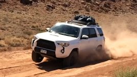
After waking at 5:30 to try and catch some sunrise pics over the amphitheater (clouds didn’t cooperate for my initial setup and went ‘poof’ right before the sun crested the horizon), I whipped up some breakfast burritos and packed up camp. The driving was pretty uneventful through Soda Springs Basin, and just prior to getting to Potato Bottom we ran across a 1/4-mile stretch of deep silt with one large compression in the middle. I decided to take another run(s!) at it at higher speed, and we ended up getting some cool slo-mo iPhone video of the TRD with a tire in the air and a cloud of dust behind. Fun stuff.

Hardscrabble is a weird hill from this direction, as it winds around and takes a 180-degree left turn down low in a loose wash, with a really steep climb out toward the bulk of Hardscrabble. I could see the area where a previous party I’d chatted with dropped a tire into the wash, and had to be yanked out by another truck in their party. Very narrow in there, and clearly someone wasn’t careful with tire placement. That being said, I think Hardscrabble from this direction is by far the most fun part of the White Rim, as it is very dynamic and changes quickly, both in direction and road surface conditions. Can’t say I’d want to drive it in a driving rainstorm!

Descending the long, narrow shelf of the strike-slope road off Hardscrabble, as I neared the campground I could see our Jeep friend… frantically pumping his hi-lift jack, which was attached to the rear of his vehicle. In the campground. WTF? Parked and went to see what was up. Or down, in this case. As it turns out, on the other side of Hardscrabble his clutch had started to go, and he nursed it down Hardscrabble in 1st gear, never stopping or depressing the clutch, knowing he had a limited number of shifts left before it crapped out completely. Seth told me he had considered driving the rest of the way out yesterday, assuming he could never shift, but was tired and instead parked in the campground and hoped for the best. Unfortunately he didn’t think through his parking logistics, and realized his mistake only after shutting the key off after parking in a way that would require reverse to get out. He was right about nursing the thing down Hardscrabble, as when he went to leave, the thing took a dump shifting into reverse, and at that point he had no drive gear, forward or backward. He thus was making about a foot a minute with the hi-lift, trying to get the jeep in a position where he could reverse course and at least get it pointed the correct direction, out of the campground toward the road. He’d made a sat phone call and found that he would need to get the rig to the top of the Mineral Bottom switchbacks before it could be put on a flatbed back to Moab. $175/hour for a jeep to come down and haul him up the switchbacks.

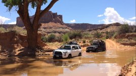
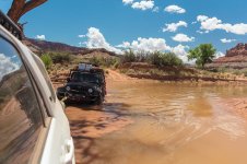
Enter the unsuspecting Toyota crowd. I had my son make us all some turkey/mayo/cheese/basil sandwiches while we got set up (“What’d you put on these sandwiches, they’re good!”), and 10 minutes later we had him out on the road. I agreed to pull him toward Labyrinth CG and see how it went, though I wasn’t keen of pulling him the next 8 miles from Labyrinth to the top (especially since we only had a 30k# recovery strap, which needed to be doubled to shorten for corners; let’s just say it was rather inflexible, and I was wishing I’d bought that ARB snatch strap prior to leaving for this trip). Murphy’s Law being what it is, in the two miles between Hardscrabble and Labyrinth lies the one ‘unknown’ factor of this entire trip, the Upheaval Bottom flood conditions. Seth walked it, and nowhere was it deeper than 18+ inches, most of it being about a foot (you could see the wet waterline where it had recently been 2+ feet higher). Anyway, we crossed fingers and went for it, and the TRD pulled through with no issues whatsoever. Immediately on the other side was, of course, the deepest section of silt of the whole trip (at least 12” and dry), and I almost bogged down and lost it, but I was able to pull him through… barely (pretty sure I'd put it in A-TRAC mode for this section). Now backtracking to my Build Thread, this vehicle is still pretty new to me, so towing a 5500# vehicle for miles wasn’t too high on my list of To-Do’s for this trip, and every time we let too much slack in the line, the yank on my drivetrain was rather unsettling.

Anyway, we got him to Labyrinth, and I apologized profusely for not being able to pull him the rest of the way out without a snatch strap as a buffer between my drivetrain and his dead weight. Made sure he didn’t need anything supplies-wise, and left him with one of my favorite IPAs, Dales Deviant from Oskar Blues. Wasn’t sure he’d like it, but he was thrilled to have it in that broiling sun.

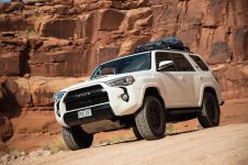
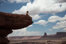
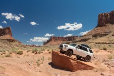
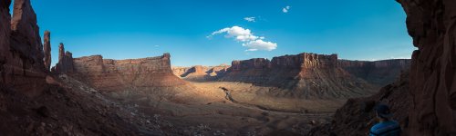
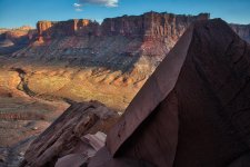
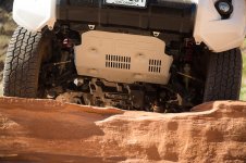
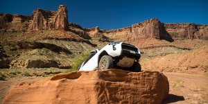
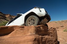
Here is where I have to stop to thank the party who cancelled out of these campsites that we lucked into, because the location at Taylor Canyon is phenomenal, and completely made up for the relative mundaneness of Candlestick. Nearly five miles up a ‘road’ that follows the wash is the most stunning multi-valley panorama that I can recall ever seeing. During one not-so-quick stop to shoot the TRD on top of a huge sloping slab of red sandstone float, my son rode up after backtracking to see what happened to me. He said he could see my front end way up in the air but couldn’t see why/how it got there, so came back. After I explained my photographic 'predicament', he rode off muttering “Such a child…” LOL He doesn’t yet know that after 50 (40?), us boys start regressing in age back toward the teenage years. I feel sorry for my wife.

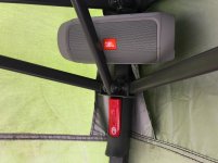
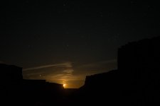
This must have been quite a day as it’s getting wordy, so I’ll try to finish up and let the pictures speak for themselves. Made dinner, hiked up Zeus and Moses (such a great trail!), hung in the moonlight listening to Led Zeppelin on the JBL Charge 2 speaker with mice that we couldn't see occasionally skittering over our feet, and I woke up once at 2:30 AM to catch moonset for some Milky Way pics, as well as waking for sunrise.

Taylor Canyon is a great, great campsite, highly recommended unless it’s raining, in which case I don’t know what people do.
 

Attachments

  • 01_5DS39662_-900x_WhiteRimTripReport.jpg
    01_5DS39662_-900x_WhiteRimTripReport.jpg
    120.7 KB · Views: 1,878
  • 02_5DS39679_-900x_WhiteRimTripReport.jpg
    02_5DS39679_-900x_WhiteRimTripReport.jpg
    69.1 KB · Views: 1,871
  • 03_5DS39688-Pano_-900x_WhiteRimTripReport.jpg
    03_5DS39688-Pano_-900x_WhiteRimTripReport.jpg
    73.7 KB · Views: 1,872
  • 04_IMG_1256_-900x_WhiteRimTripReport.jpg
    04_IMG_1256_-900x_WhiteRimTripReport.jpg
    69.4 KB · Views: 1,860
  • 05_IMG_1297 1_-900x_WhiteRimTripReport.jpg
    05_IMG_1297 1_-900x_WhiteRimTripReport.jpg
    98.1 KB · Views: 1,899
  • 06_5DS39704_-900x_WhiteRimTripReport.jpg
    06_5DS39704_-900x_WhiteRimTripReport.jpg
    107.5 KB · Views: 1,870
  • 07_IMG_1242 1_-900x_WhiteRimTripReport.jpg
    07_IMG_1242 1_-900x_WhiteRimTripReport.jpg
    122.7 KB · Views: 1,879
  • 08_5DS39722_-900x_WhiteRimTripReport.jpg
    08_5DS39722_-900x_WhiteRimTripReport.jpg
    117.4 KB · Views: 1,885
Last edited:
Pics Day 3 (cont.)

More pics...
 

Attachments

  • 09_5DS39739_-900x_WhiteRimTripReport.jpg
    09_5DS39739_-900x_WhiteRimTripReport.jpg
    116.1 KB · Views: 1,841
  • 10_IMG_1228 1_-900x_WhiteRimTripReport.jpg
    10_IMG_1228 1_-900x_WhiteRimTripReport.jpg
    93.4 KB · Views: 1,860
  • 11_5DS39790_-900x_WhiteRimTripReport.jpg
    11_5DS39790_-900x_WhiteRimTripReport.jpg
    118.5 KB · Views: 1,881
  • 12_5DS39823-Pano_-900x_WhiteRimTripReport.jpg
    12_5DS39823-Pano_-900x_WhiteRimTripReport.jpg
    119.8 KB · Views: 1,857
  • 13_IMG_1277 1_-900x_WhiteRimTripReport.jpg
    13_IMG_1277 1_-900x_WhiteRimTripReport.jpg
    115.6 KB · Views: 1,882
  • 13a_5DS39829_-900x_WhiteRimTripReport.jpg
    13a_5DS39829_-900x_WhiteRimTripReport.jpg
    107.8 KB · Views: 1,889
  • 14_5DS39856_-900x_WhiteRimTripReport.jpg
    14_5DS39856_-900x_WhiteRimTripReport.jpg
    109.7 KB · Views: 1,847
Last edited:
Pics Day 3 (cont. 2)

Even more...
 

Attachments

  • 15_5DS39923_-900x_WhiteRimTripReport.jpg
    15_5DS39923_-900x_WhiteRimTripReport.jpg
    53.8 KB · Views: 1,851
  • 16_DX_32937-3289_1h28m00s_-900x_WhiteRimTripReport.jpg
    16_DX_32937-3289_1h28m00s_-900x_WhiteRimTripReport.jpg
    136.9 KB · Views: 1,877
  • 17_5DS39939-Pano_-900x_WhiteRimTripReport.jpg
    17_5DS39939-Pano_-900x_WhiteRimTripReport.jpg
    50.3 KB · Views: 1,881
  • 18_DX_33511_-900x_WhiteRimTripReport.jpg
    18_DX_33511_-900x_WhiteRimTripReport.jpg
    59.2 KB · Views: 1,845
  • 19_5DS39962+40004_comp_-900x_WhiteRimTripReport.jpg
    19_5DS39962+40004_comp_-900x_WhiteRimTripReport.jpg
    71.6 KB · Views: 1,856
Last edited:
Day 4, to Mineral switchbacks and out! (90°):

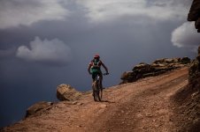
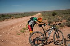
I’m glad I didn’t try to pull Seth’s Jeep the remaining 6+ miles, as the road surface while down low along the Green was severely rutted and bumpy; it would have been murder getting yanked all over the place. Pretty easy drive to the base of the switchbacks, which Strava reported to be 1.5 miles at 11%. My son had to work for that one, as it had been getting hotter each day (was 82 at 9AM). After the wicked climb he ground out about 6 miles of the continual false-flat uphills across the plateau, and then starting spouting expletives, at which point I loaded the bike and let him back in the truck. He rode all 90+ miles and didn’t spend one minute in the truck, I drove all 90+ miles and didn’t spend one minute on the bike. Consider Dad impressed.

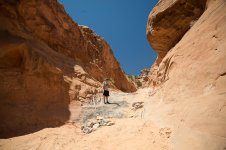
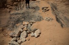
We tried to descend Long Canyon, but Pucker Pass looked nothing like it had looked in March, and even with the rock-stacking there was no way I was going to risk an off-camber slide into what was now a 4’ high rock wall on the left side (fresh gouge, and all). It was even worse than the pic I’d seen posted here by [MENTION=159847]Cuse Runner[/MENTION] from only a week before.

Backtrack and a quick burger and pasta at the Moab Brewery, and we set off for home.

Great trip.
 

Attachments

  • 01_DX_33548-Edit_-900x_WhiteRimTripReport.jpg
    01_DX_33548-Edit_-900x_WhiteRimTripReport.jpg
    123.1 KB · Views: 1,840
  • 02_DX_33556_-900x_WhiteRimTripReport.jpg
    02_DX_33556_-900x_WhiteRimTripReport.jpg
    94.9 KB · Views: 1,873
  • 03_DX_33570_-900x_WhiteRimTripReport.jpg
    03_DX_33570_-900x_WhiteRimTripReport.jpg
    120.1 KB · Views: 1,864
  • 04_DX_33606_-900x_WhiteRimTripReport.jpg
    04_DX_33606_-900x_WhiteRimTripReport.jpg
    120.1 KB · Views: 1,860
  • 05_DX_33624_-900x_WhiteRimTripReport.jpg
    05_DX_33624_-900x_WhiteRimTripReport.jpg
    128.7 KB · Views: 1,840
  • 06_DX_33631_-900x_WhiteRimTripReport.jpg
    06_DX_33631_-900x_WhiteRimTripReport.jpg
    104 KB · Views: 1,854
  • 07_DX_33632_-900x_WhiteRimTripReport.jpg
    07_DX_33632_-900x_WhiteRimTripReport.jpg
    132.3 KB · Views: 1,847
Last edited:
Sorry if you mentioned, I'm at work and don't have a ton of time. What is that low sun shelter?

It's just one of those burly 10x10 Coleman tents, dropped as low as it will go. Worked well on several levels, but it's flippin' huge folded up, and heavy.
 
I'm glad you were able to see my post about that area, prior to going down it. Pictures and video don't do it justice for how gnarly it is.
 
I like the White Rim, try to do it once a year. We usually go early in the season to try and avoid issues with Upheaval Wash.
 
Great pics and commentary! Can't wait to get out there this fall!

Are those last two pictures of Long Canyon/Pucker Pass? I went through there (going up) in 2012 and don't remember anything like that. It was just an easy 4wd road.
 
F**kin awesome trip photos/report, B407......
I'm sitting here wrapping up my workday and drooling over the awesomeness.

Props to your boy too for grinding out the miles on his MTB. Not easy miles.
 
It's just one of those burly 10x10 Coleman tents, dropped as low as it will go. Worked well on several levels, but it's flippin' huge folded up, and heavy.

Yeah I like the way that looks low like that up against the truck and you could have a wind block and it seems like we provide better Sun shelter.
 
Great pics and commentary! Can't wait to get out there this fall!

Are those last two pictures of Long Canyon/Pucker Pass? I went through there (going up) in 2012 and don't remember anything like that. It was just an easy 4wd road.

They are indeed Pucker. Mother Pucker, in this case.

I seriously couldn't believe how much it had changed in a few months. I hear they bring some sort of grader/tractor down in there to fill it in once in awhile. Definitely in order at the moment. FunTreks shows it as GREEN; current conditions are more like RED!
 
Last edited:
Great thread.

Living in Slc, this is on my to do list, but just hasn't happened yet.

Need to do it, but still pretty green getting that much off the beaten path.
 
F**kin awesome trip photos/report, B407......
I'm sitting here wrapping up my workday and drooling over the awesomeness.

Props to your boy too for grinding out the miles on his MTB. Not easy miles.

Nope, and it's starting to border on hot (and dry!). In several weeks it'll be smoking hot, however there will be available campsites! ;)
 

Members online

Forum statistics

Threads
278,315
Messages
3,554,125
Members
248,016
Latest member
Advally Service

Trending content

Back
Top