09-04-2016, 01:51 PM
|
#1
|
 |
Senior Member
|
|
Join Date: Nov 2014
Location: Cowlitz County, Washington
Posts: 1,776
Real Name: Mike
|
|
|
Senior Member
Join Date: Nov 2014
Location: Cowlitz County, Washington
Posts: 1,776
Real Name: Mike
|
Completion of the WABDR from Stevenson to Canada
Our family just successfully completed the WABDR on Wednesday, August 17th in our 2001 3rd Gen. I just wanted to share with the entire T4R community, not just the 3rd gen section, a little bit about the trip and to open this thread up for those that have also completed, anticipate completing, or have done sections of the WABDR. I think this could be a great resource for those wishing to do it later on. I'm also posting some videos on Youtube as I develop them. My channel is: Rock_Rat Youtube Channel
Enjoy...
Welcome to my journey over the WABDR or, the Washington Backcountry Discovery Route. The WABDR runs nearly 600 miles from the border of Oregon to the town of Nighthawk on the Canadian Border. This six-day route runs parallel with the beautiful Cascade mountain range through some of the most rugged and beautiful landscapes in Washington State. The metamorphosis of my 3rd gen began two years ago and it was this year, I needed to get out and see how she performs.
I actually live in the middle of the route in Cowlitz County, Wa. I gave it some serious thought about taking 503 up past Cougar and Tire Junction and picking up the route on the backside of Mt Adams. My OCD self just couldn’t take the short cut. Our plan was to leave on Wednesday, August 10th but both of my boys were busy with work and internships. I was so thankful for that extra day! It gave me an opportunity to make my limb risers and figure out the puzzle pieces in the rear cargo space. Both boys caught the last flight in from Seattle to Portland on Wednesday evening for an early morning departure the following day. I was more excited than they were, because once again, we were given an opportunity to spend our vacation together as a family. My wife and I cherish these moments as we know they will become scarcer as they get older. As a father, it also gave me great pleasure knowing that my boys would be working together as a team with one driving and the other navigating. Only fathers can understand the immense amount of satisfaction this brings.
Thursday morning came so quickly, yet not fast enough. I spent the past weeks doing some logistical preparations, keeping an ever watchful eye on the fire near Lake Chelan, picking up the required Forest passes, paper maps, downloading and installing the GPS tracks on my Garmin GPS.
@ A.Wilson013
turned me on to the Gaia GPS App so I decided it wouldn’t hurt to install it and load the GPS tracks on my Samsung Tablet as a backup. Little did I know it would become my primary source of navigation as my Garmin GPS was sporadic at best. Many of the 3rd gen guys contributed to my success.
Day One: Section 1 - Stevenson to Packwood
Living in SW Washington, I've lost track of the number of times I've been across the Bridge of the Gods. It never gets old. Every time is more spectacular than the next.
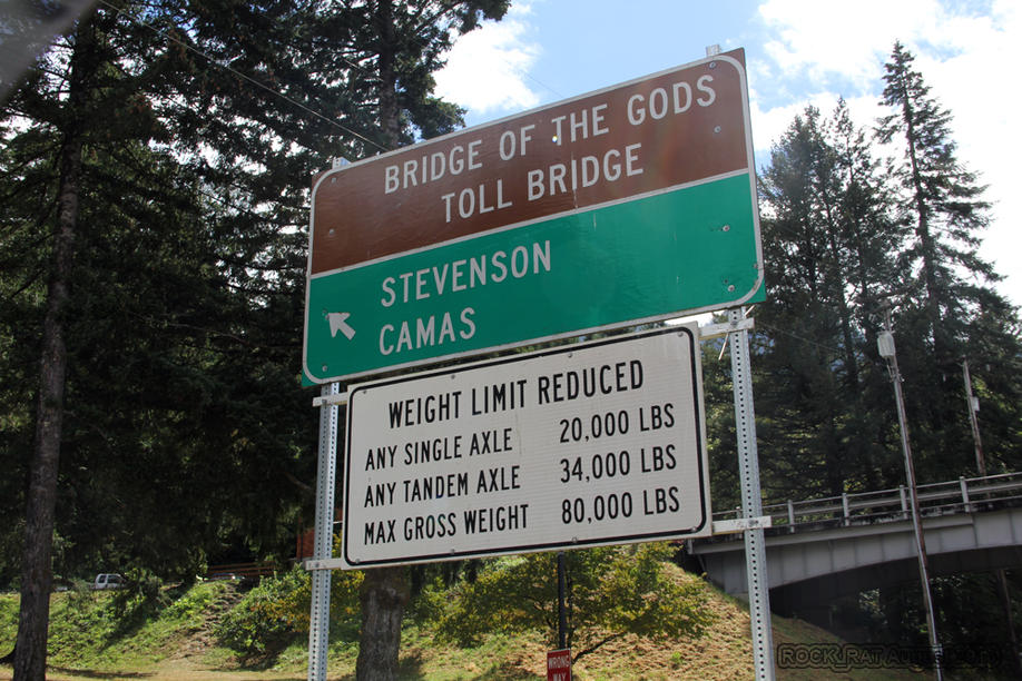
The great Columbia River joining Washington and Oregon is a majestic site. I can only imagine what Lewis and Clark felt when they came to this splendid area for the first time.
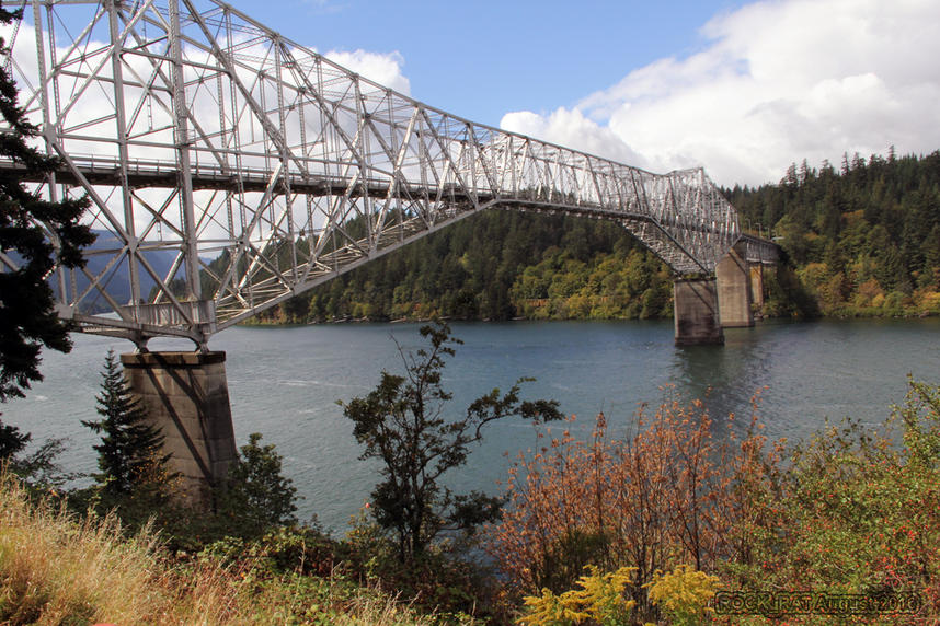
The Bridge of the Gods is also part of the Pacific Crest Trail bringing hikers from Oregon to Washington or visa versa. What an incredible site to see as PCT hikers continue on their journey across the bridge. We beeped the horn and gave them a big thumbs up.
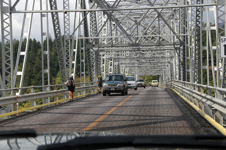
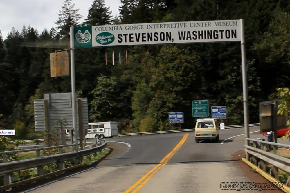
Although I could have taken SR 14 from my place to Stevenson, I just felt it would have been "cheating" the route. I had this need to do it from the official start across the river in Oregon via the Bridge of the Gods to Stevenson all the way to Canada. Now it's official!
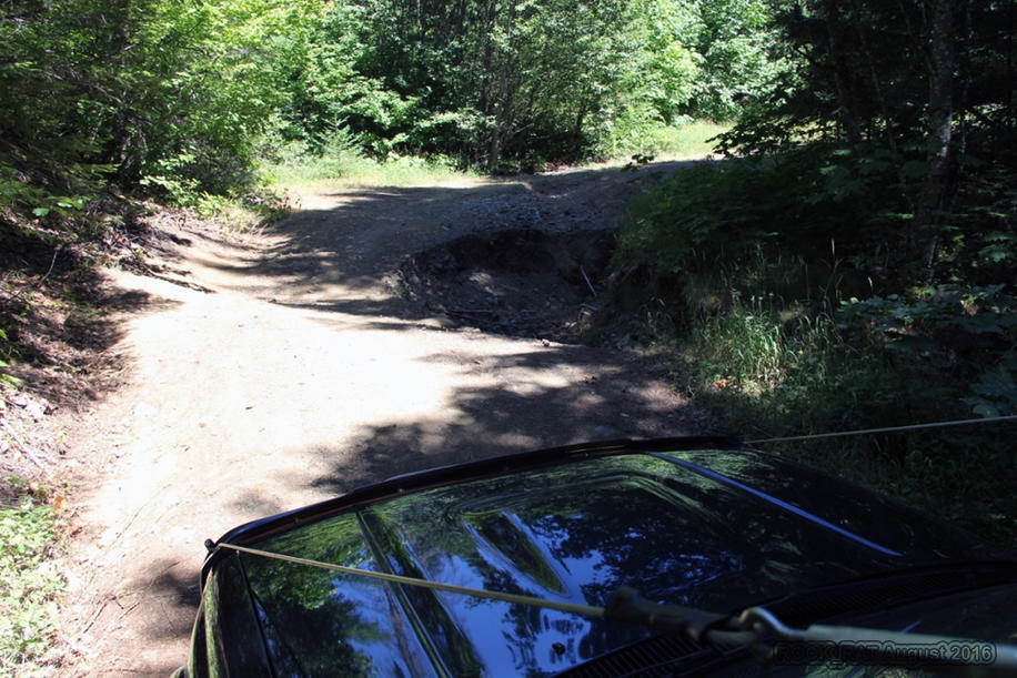
Wow! Our first challenge along the way! OK, nothing to get too excited about but hey, there's hope. My wife and kids insisted we take a picture of this first obstacle.
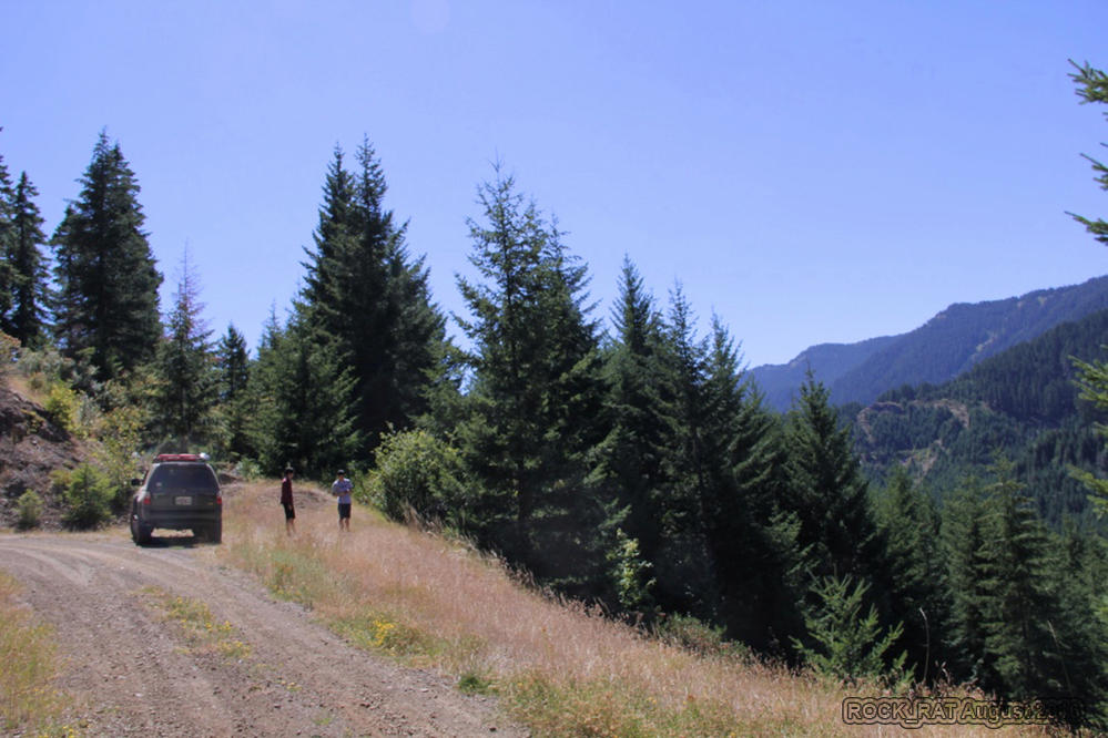
The first of many gorgeous views taken from the west side of the Cascades. Notice how green everything is on the west side. When you hear of average rainfall in Washington, it's important to remember that west of the Cascades it rains and is incredibly lush while east of the Cascades is predominately dry and brown.
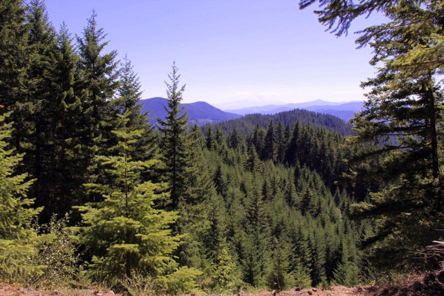
Our first fairly decent view of Mt Adams (You can barely see it) as we began our journey towards Trout Lake and eventually on to Packwood.
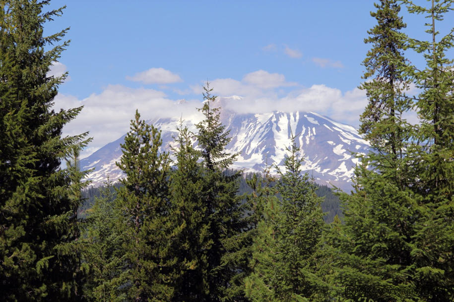
It had been a couple of years since I visited Mt Adams. The last time I was there it was with a climbing buddy. We attempted to climb the north face but the route was really falling apart. It was during one of the hottest summers on record. The time before that was with my family. We hiked all the way to Lunch Ledge and almost to the "false summit" before turning back. I think we'll climb it again next year along with Mt Rainier.
__________________
2001 Imperial Jade Gold Letter Sport Package - Original Owner
Last edited by Rock_Rat; 09-05-2016 at 12:58 AM.
|

|
 Reply With Quote Reply With Quote
|
|
09-04-2016, 01:54 PM
|
#2
|
|
Senior Member
|
|
Join Date: Nov 2014
Location: Cowlitz County, Washington
Posts: 1,776
Real Name: Mike
|
|
|
Senior Member
Join Date: Nov 2014
Location: Cowlitz County, Washington
Posts: 1,776
Real Name: Mike
|
Completion of the WABDR from Stevenson to Canada
Day Two: Section 2 - Packwood to Ellensburg
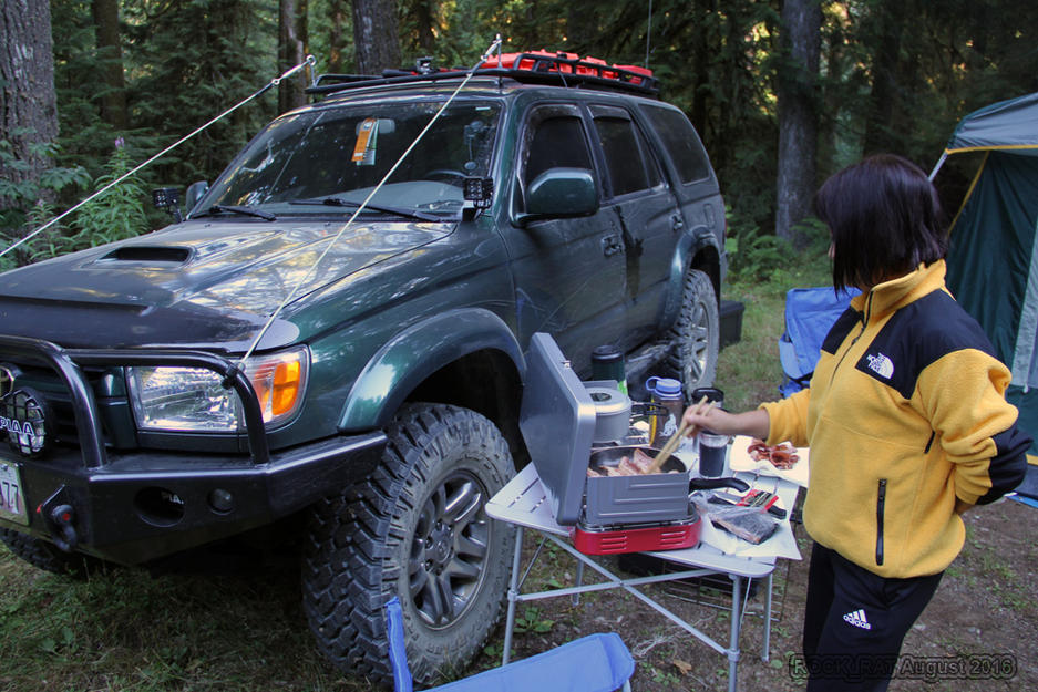
The night before, we found a secluded place to camp off of FS21. It was just five miles from Packwood right next to Glacier Creek near the Glacier Lake trailhead. What a gorgeous serene place. After a hearty breakfast of bacon and eggs and a friiiigid dip in the creek it was time to get on our way. So far I was pleased with how well my 3rd gen was performing with the additional weight in the cargo area and two additional passengers in the rear. I was glad I kept the storage boxes off the roof minimizing my increase in CG.
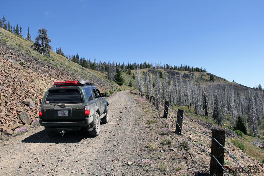
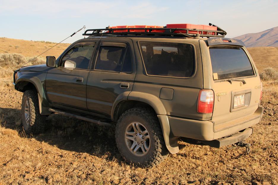
We arrived in Packwood quite early, fueled up, grabbed some Gatorade and another bag of ice and off we went along paved US12. I’ve taken US12 before but always got off at Morton on my way to Paradise in Mt Rainier. This would be my first time picking it up in Packwood. We were pretty excited about crossing White Pass along Rimrock Lake, but even more excited about getting onto the exposed Bethel Ridge. I've seen videos of this ridge using a fisheye lens and it looked pretty scary. As we climbed I monitored everything like a hawk, especially my radiator and transmission temps. My coolant temps stayed around 186 upwards of 208. I'm running a B&M 70264 transmission cooler in line with my radiator. My transmission temps maintained a solid 179 to around 222...until Umptanum. In the middle of August, ambient temperatures were above 100°. My transmission temps peaked at 271 twice during this section. It was time to give it a break for a while. Photo opportunity of an IJM turned desert tan 4runner. There is an optional bypass for Bethel and a bypass for Umptanum but once again, my OCD self wouldn't have anything to do with a bypass. I had to do the entire route as originally planned. I aired down to 18-20 on all forest roads.
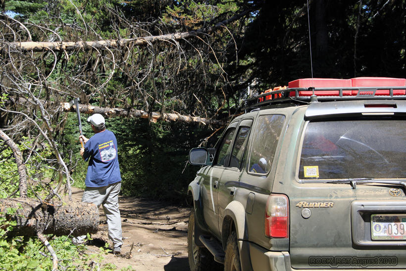
Much to our surprise, along our way we ran into a tree that hadn't been cleared. I thought all of the dead falls would have been cleared by now. This led me to believe that no too many 4x4's did the BDR yet. Thank goodness it wasn't too big as I decided to leave the chainsaw at the house. I did however bring along the Fiskars Axe. It fit nicely under my Hi-Lift that was mounted to my
@ Whitson Metalworks
rack. The boys and I cleared the tree and off we went again. The views of Mt Adams and Mt Rainier are absolutely spectacular high on the ridge above the Tieton River valley.
Coming off the ridge was long with ruts that still remained from the spring rains. We dropped into the town of Nile and turned left onto Hwy 410 only to travel a short distance and jump back up on the FS road again over the Cleman Mountains and back down to Wemas road. I knew my 3rd gen was getting ready to be tested. I watched many videos of of dual sport riders taking some serious spills on this section of the WABDR. The loose rocks and the deep ruts combined with the grade would be a challenge. This was the only time I actually needed 4WD. The runner was solid with the TRD headers, exhaust, and the 4.88 gears from ECGS paid for themselves on this section. It was a treeless landscape, hot and ever so arid. It had a beauty all it's own. I loved the challenge. Our destination for the night was the KOA campground in Ellensburg where we could take a shower and recharge for Section 3 onto Cashmere and Leavenworth.
Section 3 would prove to be a most harrowing experience as a Husqvarna rider laid his bike down in front of me and came close to putting an end to his life.
One of the best kept secrets of Section 1. The nicest camping area ever, tucked nicely away from civilization close to Glacier Creek and the Glacier Lake Trailhead. Ah yes, a waypoint placed on our GPS track.
Fantastic view of Mt Rainier as we continued our ascent towards Bethel Ridge.
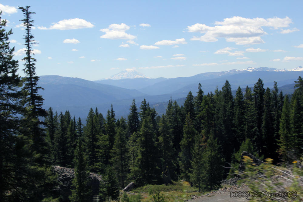
Bethel Ridge and it's wonderfully exposed landscape. Pictures don't do this section of the WABDR any justice. Bethel Ridge was everything I expected and more. There were shear cliffs where one mistake and it would be over. This section demand 100% of my focus.
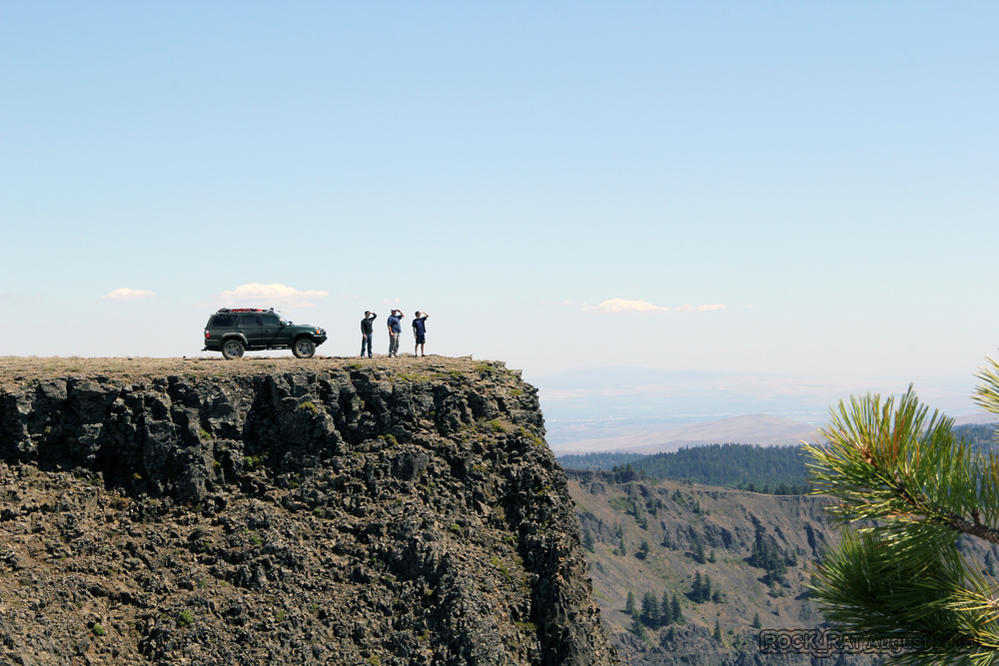
Here's a photo op I just couldn't pass up. Sitting high on the basalt rock, the result of ancient lava flows and erosion during the ice age is my 4runner, my boys, and myself looking off in the distance as far as the eye can see. What an amazing photograph by my lovely wife.
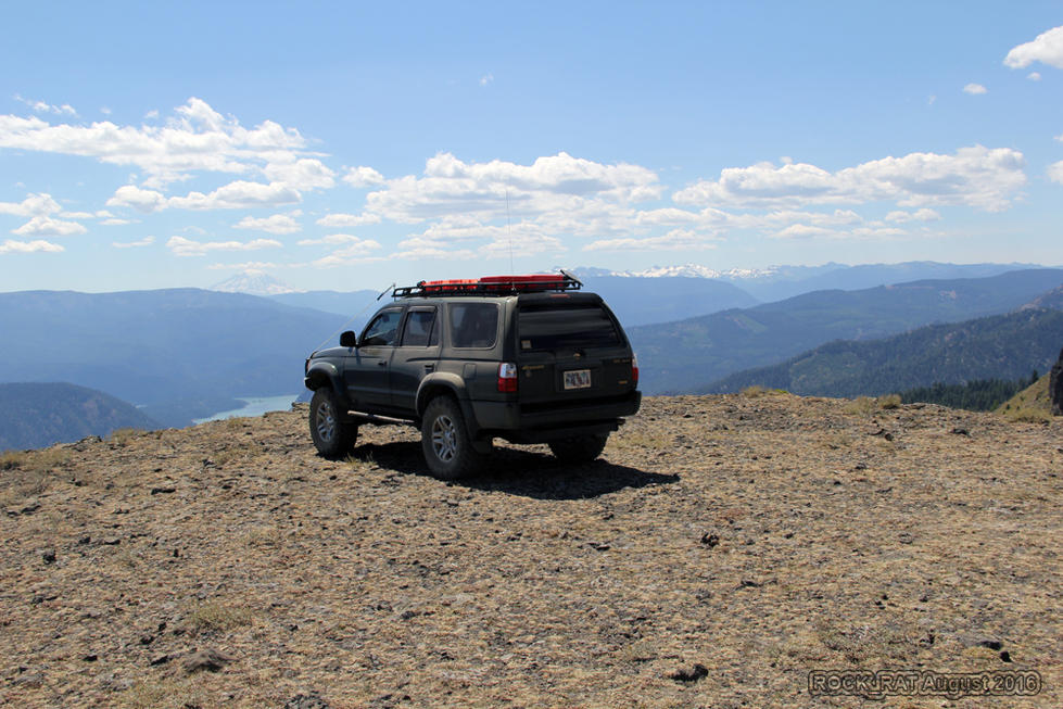
Off to the left you get a glimpse of Rimrock lake on the valley floor and Mt Rainier straight ahead. Paradise is on the southern slope of Mt Rainier and is home to the normal three day summit climb via Camp Muir, Ingraham Glacier & Disappointment Cleaver.
Our only uncleared dead fall of the entire trip was on Bethel Ridge. We each took turns swinging the axe until we were able to clear it. So glad it wasn't any bigger.
Time for a much needed break as we climbed up Umtanum. Not only did WE need a break but the 4runner desparately needed a break as I watched the transmission temps move as high as 271. It had been a long day for the rig. I had no idea that my IJM runner transformed into a desert tan runner. It was here that I gained complete respect for our dual sport riders. I can't imagine going up or down in this on two wheels. I also gained complete respect for my Grappler Trails and Sequoia wheels. Awesome combination. Never spun the tires.
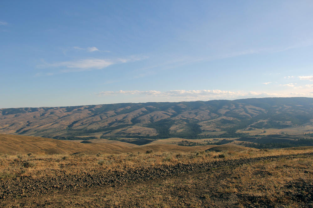
Great view of the Central/Eastern Washington landscape as we began our descent towards the KOA campground in Ellensburg, home to Central Washington University.
__________________
2001 Imperial Jade Gold Letter Sport Package - Original Owner
Last edited by Rock_Rat; 09-05-2016 at 10:56 AM.
|
|
|
Reply With Quote
|
|
09-04-2016, 01:55 PM
|
#3
|
|
Senior Member
|
|
Join Date: Nov 2014
Location: Cowlitz County, Washington
Posts: 1,776
Real Name: Mike
|
|
|
Senior Member
Join Date: Nov 2014
Location: Cowlitz County, Washington
Posts: 1,776
Real Name: Mike
|
Completion of the WABDR from Stevenson to Canada
Day Three: Section 3 - Ellensburg to Cashmere
This section of the WABDR was a bittersweet moment for me. On the one hand, I couldn’t wait to get on this section because I knew I would get to see one of the grandest peaks in the Enchantments – Mt Stuart. "Without a rival as the crown peak in the central Cascades of Washington, Mount Stuart has been pronounced the single greatest mass of exposed granite in the United States...its northern and eastern faces are the alpine climax of the Wenatchee Mountains. They make a powerful impact on first sight...The mountaineering problems are magnified by the mountain's massive dimensions and its complexity." by Fred Beckey, "Cascade Alpine Guide - Climbing and High Routes - Columbia River to Stevens Pass, Second Edition" On the other hand, it was the last section we would all share together as a family. Both of my boys were meeting friends in Leavenworth and would be on their way back to Seattle the following day after a hike and some rafting.
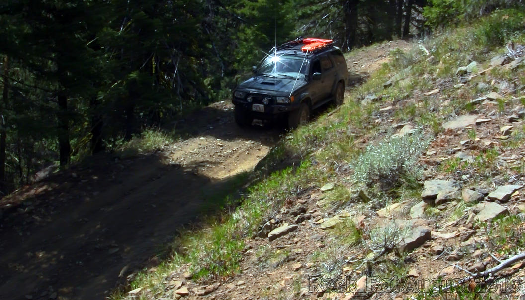
The drive out of Ellensburg was fairly straight forward until we began our ascent up FS 3500 towards Table Mountain. We saw a few cars and trucks along the way as this section of road was mostly paved, and littered with nice private homesteads tucked away in the mountainside. I was a little surprised to see a truck hauling a horse trailer along this route. Come to find out, they were leaving the Ken Wilcox Horse Camp at Haney Meadows. Once past Haney Meadows, the road became more of what I had expected - a 4WD road.
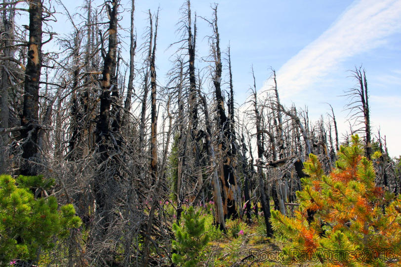
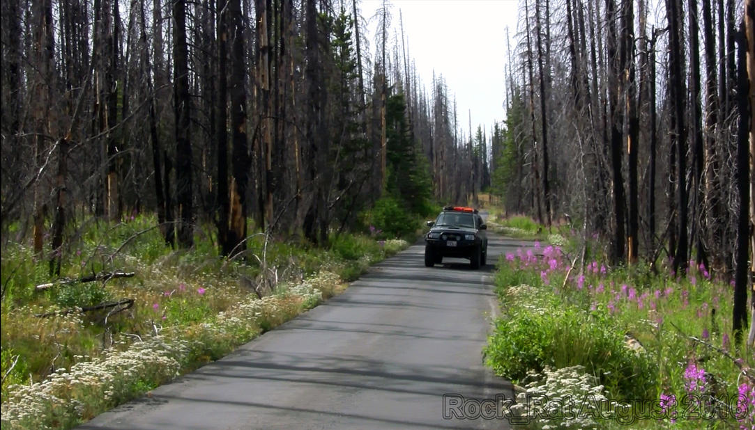
I was so thankful we were able to make it to this section of the WABDR. Here we were on Table Mountain passing through the charred remains of one of the most devastating fires in Washington State. In 2012, sparked by lightning, Washington had 1,342 fires. The Table Mountain fire destroyed 42,312 acres (66.11sq mi). It eventually joined with the Peavine Canyon fire in the south. As we drove through this incredible landscape, my wife commented “God has a sense a humor. Among the charred remains, He carpeted the forest floor with such beautiful flowers.” It was quite the sight to see as the regeneration began to take place.
It was on this paved road I picked up some pin striping on the passenger side. I’ll put it in the video. I had my son drop me off so I could get some video of him driving. After a few minutes, he backed up to pick me up but failed to notice the fallen debris on the passenger side. I yelled out "Chris!!!! Too late. We laughed as I said; “On a paved road?” We can’t be picking up pin-striping on a paved road. That’s just wrong.”
We had one other funny moment where I had him drop me off while I ran a little bit ahead of him so I could film him driving. Well, he never saw me up on the driver’s side of the hill filming as he blissfully kept on going. I started yelling; “HEY!!” “Hey you guys!!” I screamed; "HEYYYYYY!!!!" As they drove away they were all amazed at how far I must have ran ahead of them. Little did they know they left me way behind. My youngest finally heard me faintly in the distance but could hardly tell if I was above them or below them. Five or six switchbacks later I finally caught up to them after they heard my screams. Where were the handheld CB radios you may ask? You know…in the 4runner where they belong.
Another paved section of road brought us to the trail that would soon bring us head to head with a Husqvarna. Most of you know about that little story. The guy is lucky to be alive and my family is lucky we didn’t have a motorcycle or a body flying through our windshield. I thought for sure this was going to be the end of our trip. I also thought for sure the rider was dead.
Here are the links to that section of this journey:
WABDR Enduro Crash Thread on T4R
WABDR Enduro Crash Video
The beauty that's left behind in this forest. Absolutely amazing.
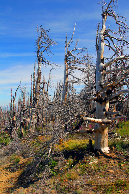
This photo is taken with my back towards the Stuart Range. The 4Runner had performed great for us so far. Seriously impressed.
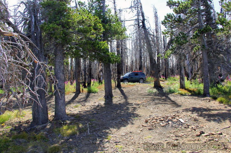
A gorgeous view of the regeneration and the growth that was taking place after all of the devastation that had taken place in 2012. God's sense of humor as my wife put it.
A wonderfully paved road on Table Mountain. I'm so glad I've had an opportunity to experience this. My oldest was driving while my youngest was navigating. Yup, pin-striping coming soon...
Hey guys I'm up here. Hey! Up Here! Hey, wait for me! Where are you guys going? HEY!!! HEY!!!! OMG they never saw me...I hope they stop pretty soon! Where's the CB radio when you need it?
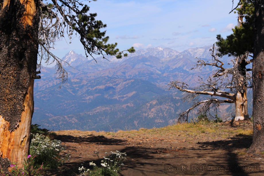
Here was the view I was waiting for! The Stuart Range in the Enchantments with Mt Stuart on the left. You can almost see the entire Cascadian Couloir on the southeast face. One day I would love to traverse this entire range.
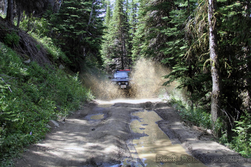
Ok, Let me OUT!!! You can't pass up this great photo op. I'll put the shutter on sports mode and see how it comes out! Oh yea! Love this one.
__________________
2001 Imperial Jade Gold Letter Sport Package - Original Owner
Last edited by Rock_Rat; 09-06-2016 at 06:16 PM.
|
|
|
Reply With Quote
|
|
09-04-2016, 01:55 PM
|
#4
|
|
Senior Member
|
|
Join Date: Nov 2014
Location: Cowlitz County, Washington
Posts: 1,776
Real Name: Mike
|
|
|
Senior Member
Join Date: Nov 2014
Location: Cowlitz County, Washington
Posts: 1,776
Real Name: Mike
|
Completion of the WABDR from Stevenson to Canada
Day Four: Section 4 - Cashmere to Chelan (almost)
It was Monday morning in Leavenworth. My boys took off for Seattle the night before. First thing I did was try and get my rig on a rack. This would determine if we continued the trip or headed back home after repairs. The latter option really wasn’t in my vocabulary. Seemed like every alignment shop within 50 miles was booked a week out. I found a place in South Wenatchee who could squeak it in before 11am. Sweet. Fingers crossed all is well. By 11am, Hugo had my rig perfectly aligned and ready to go. We left Wenatchee hoping to make it to Lake Chelan by the end of the day but I knew it would be a long shot. The journey was more important for us than the destination. I had some cushion built into our trip.
Without the boys it was my wife’s turn to take over the critical task of navigating for the remaining three sections. Following the little arrow on the Samsung Tablet became quite the challenge initially; "Turn right." "Stop!" "Go back and turn left!"..."Stop!" "I think we should've turned right back there." "I lost the arrow." I'm so thankful for her navigating! I couldn't imagine trying to navigate by myself.
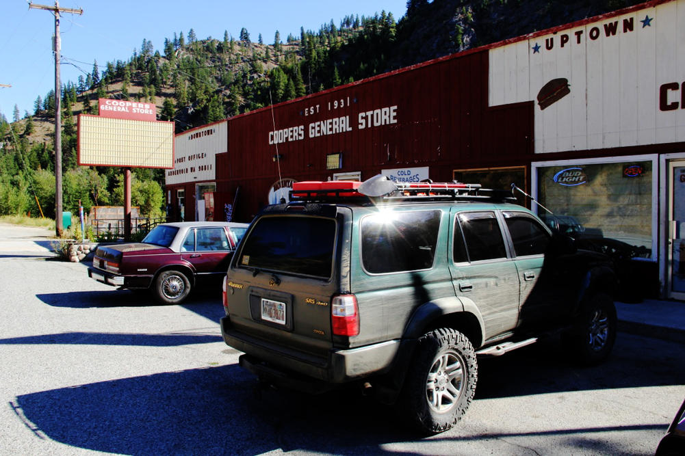
We were on our way north up Naham Canyon heading to the top of Chumstick Peak at 5810ft. It was a long uphill winding drive as we pushed up and over Roaring Ridge in the Entiat Mountains. We could see the remains of the fires in this area from 2014. The forest floor wasn't as picturesque as it was in Wenatchee. The trees, however, made up for it. We descended the steep switchbacks as we headed into the town of Ardenvoir, total population - one; there's a man who lives in the basement. This small town has a post office, Coopers general store, cafe, bar, and a gas station with two pumps.
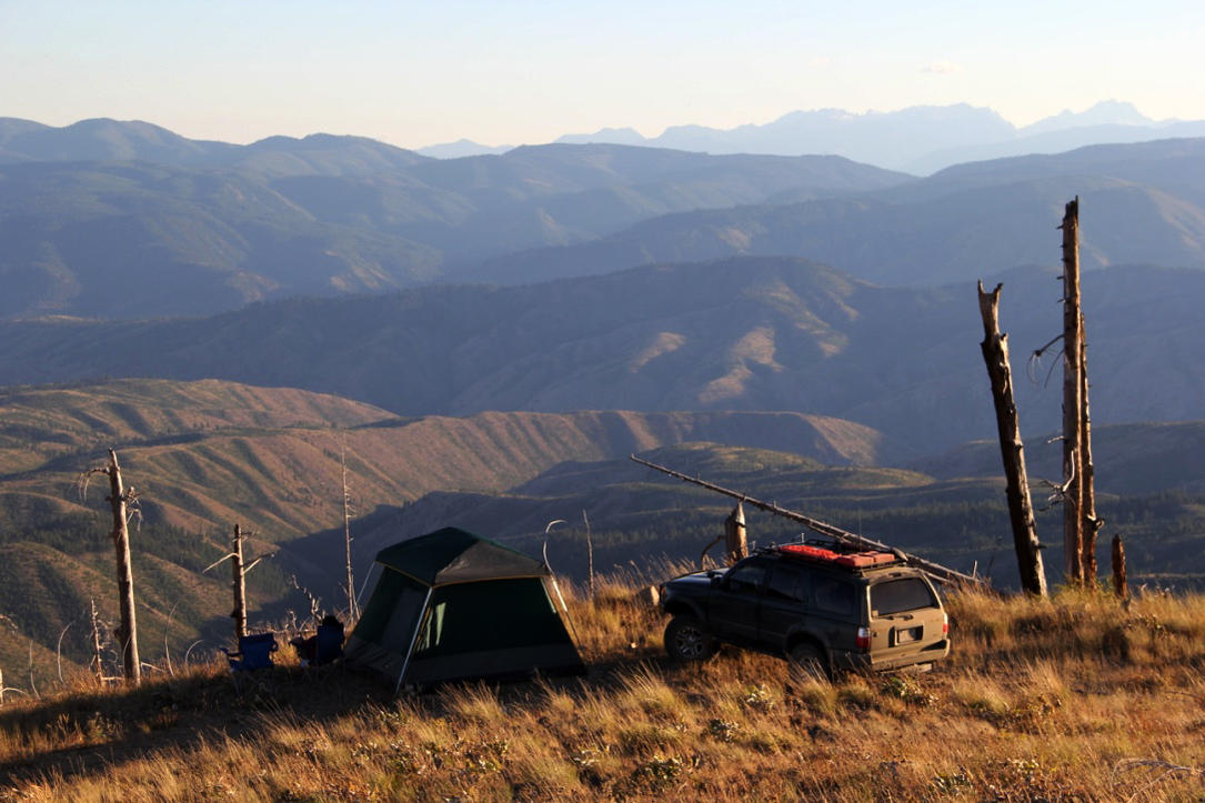
While we were there, my wife decided to order up some fried chicken. Little did we know they had to fire up the fryer as not many folks order fried chicken. It was also the first time the gal ever cooked fried chicken for a customer. Seemed like it took forever but it was well worth the wait. The chicken was awesome! It was a short drive to Mud Creek Road where we began our 4000 ft ascent up McKenzie Ridge and the Chelan Mountains. Once it leveled out for a bit at the top at around 5200ft we decided to take in the scenery and call it a day. Absolutely the best decision we made. We were just two hours shy of Chelan on top of the world. By far, it was the best night of the trip.
Driving up Naham Canyon on our way to Chumstick
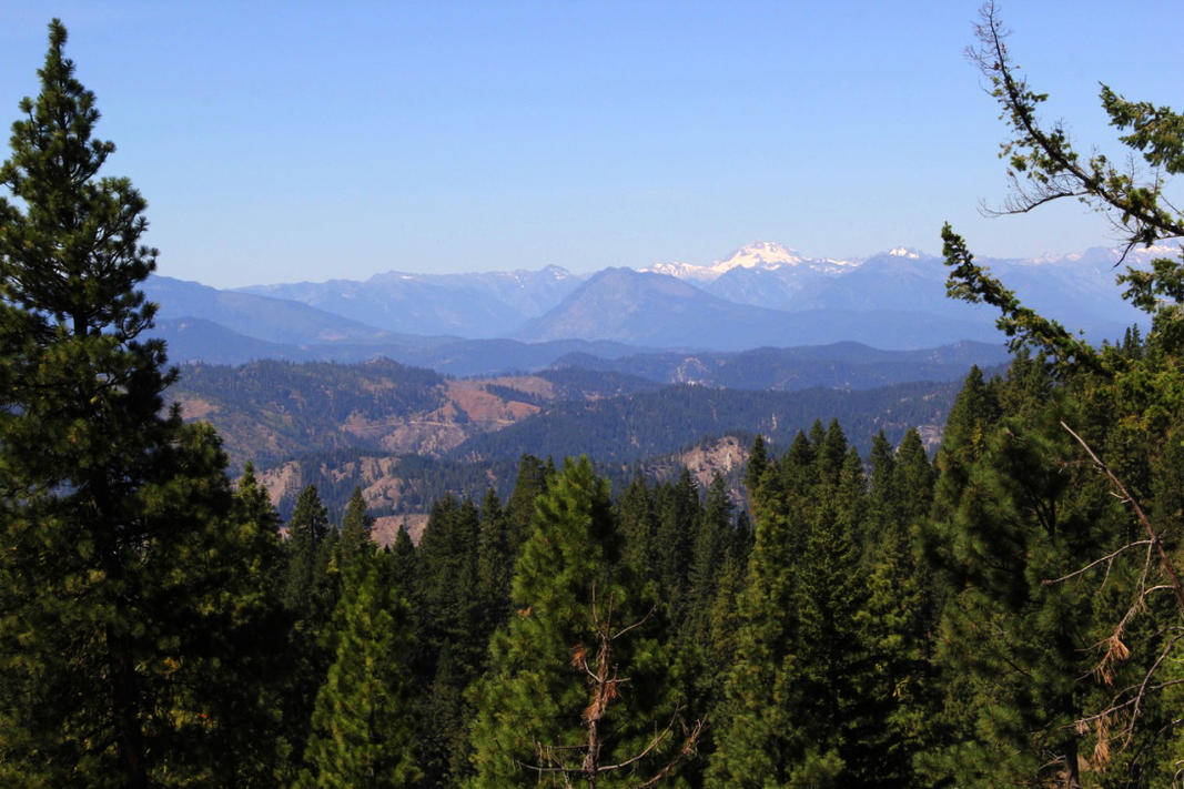
Mt Rainier off in the distance high on the ridge.
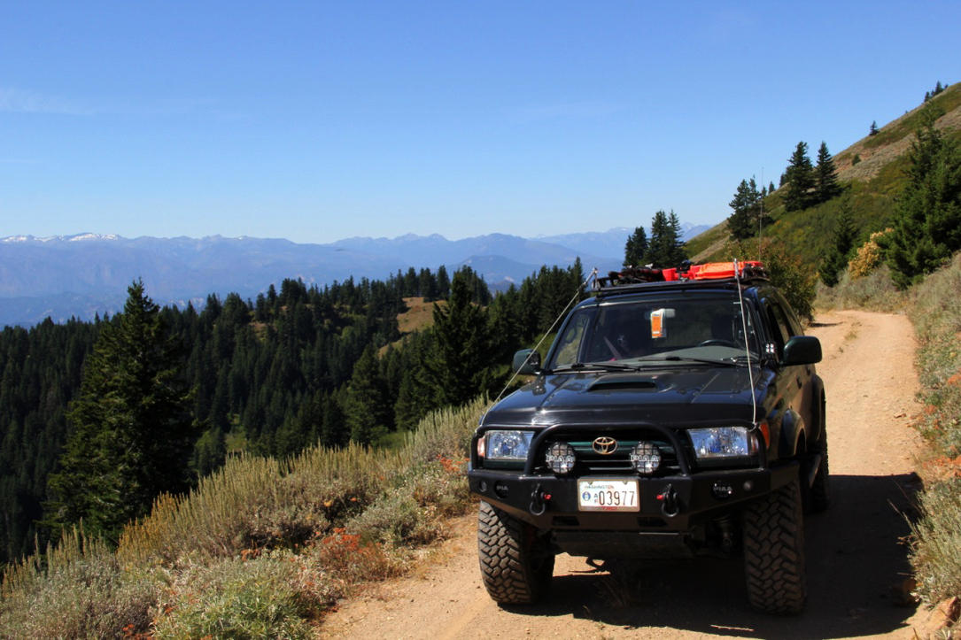
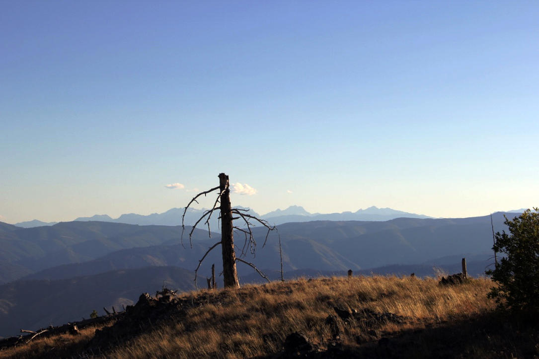
A still photographers paradise. Couldn't pass this up high on McKenzie Ridge
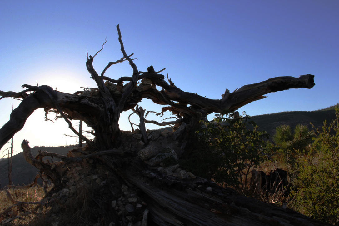
Another great model in this incredible landscape.
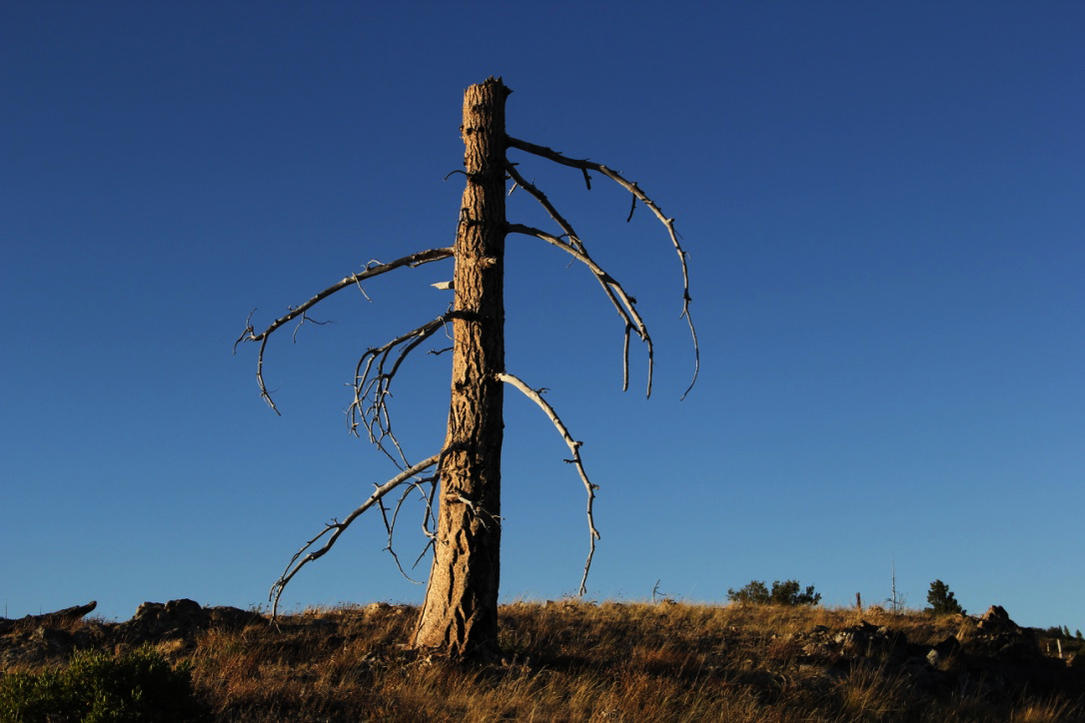
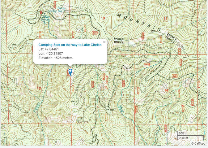
This is where we ended up camping. It was time to give the 4runner a break and time for my wife and I to relax and enjoy the serenity.
Welcome to one person town of Ardenvoir. Remember to call ahead so they can get the fryer going!
This was the most beautiful night of our trip. I was so thankful we didn't get to Chelan. I can't imagine this trip without this night.
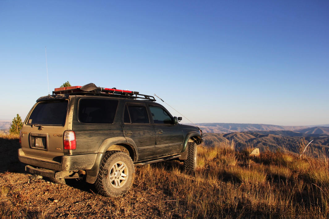
My 3rd gen doing what it likes to do best.
__________________
2001 Imperial Jade Gold Letter Sport Package - Original Owner
Last edited by Rock_Rat; 09-16-2016 at 08:45 PM.
|
|
|
Reply With Quote
|
|
09-04-2016, 01:56 PM
|
#5
|
|
Senior Member
|
|
Join Date: Nov 2014
Location: Cowlitz County, Washington
Posts: 1,776
Real Name: Mike
|
|
|
Senior Member
Join Date: Nov 2014
Location: Cowlitz County, Washington
Posts: 1,776
Real Name: Mike
|
Completion of the WABDR from Stevenson to Canada
Day Five: Section 5 - Chelan - Conconully
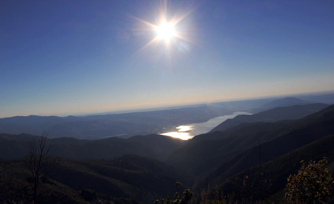
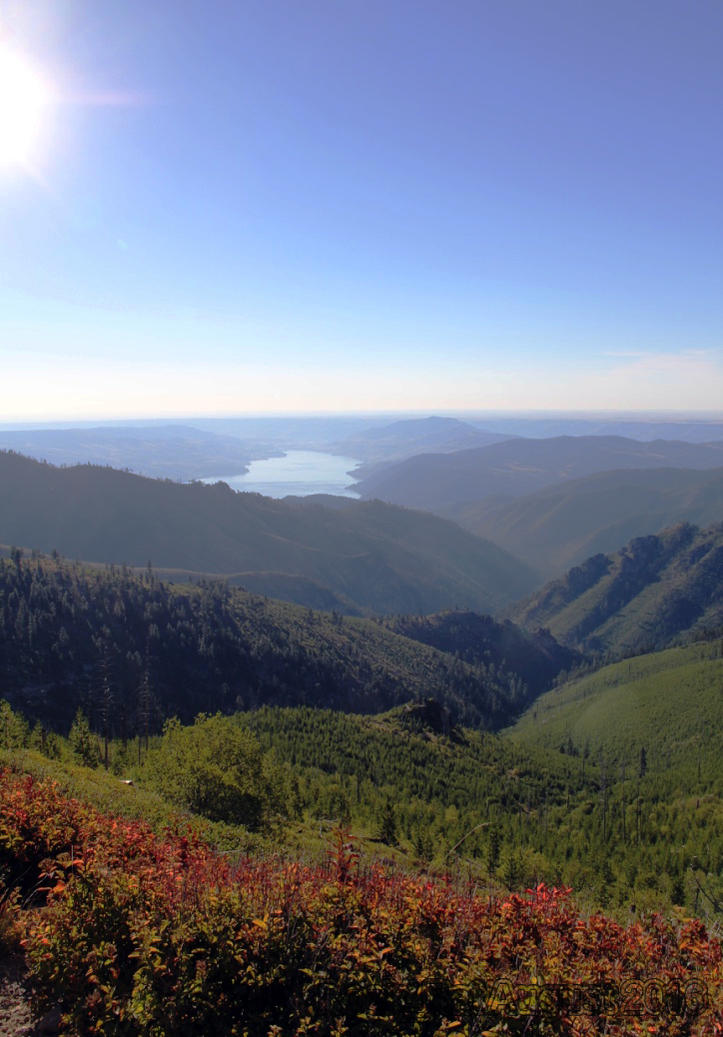
Day five consisted of finishing up Section four and if all went well, Section 5 to Conconully. After spending the night high on the ridge at just over 5000 ft, it was time to pack up and head to Chelan and then on to Conconully. We were only two hours shy of Chelan but looked forward to this next section. There was the 8410 by-pass and this time my CDO (OCD but the letters are in alphabetical order) was over-ridden by common sense. I heard the route was overgrown and there was no escaping the pin-striping unless I took the by-pass. Not willing to scratch up my rig unnecessarily, we took the by-pass. Great decision on our part as we were greeted by a magnificent view of the early rising sun glistening over Lake Chelan. For those that plan on doing this section of the WABDR, I highly recommend you plan on staying on the mountain and arriving in Chelan in the morning so as not to miss this great view. Every turn we made provided yet another spectacular view of the lake, almost better than the one before. We were so thankful we didn’t push through the night just to get to Chelan. To think, a late start coming out of Wenatchee after the alignment gave us such a fantastic section to this journey.
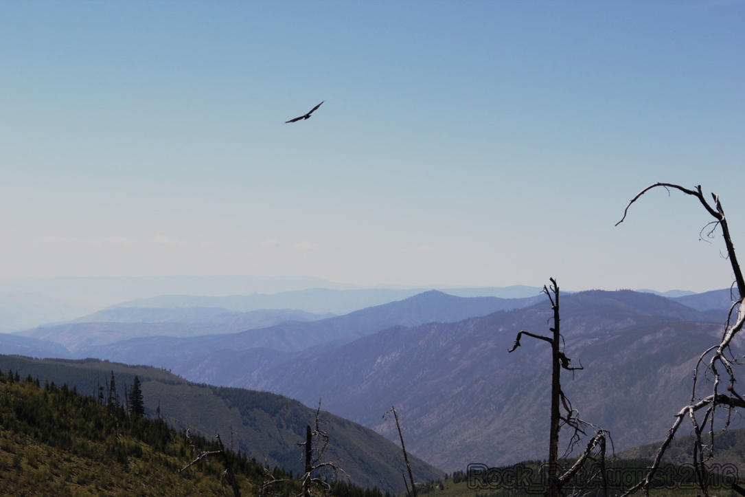
Lake Chelan is beautiful. I've heard this is a place so many companies take their folks to for a business retreat. I could understand why. It was very peaceful driving by the lake as cyclists and runners were hitting the pavement in stride. Once we fueled up and made a short pit stop in Chelan we began our ascent up Cooper Ridge Road past the Echo Valley Ski Area toward the 5,867 foot summit of Cooper Mountain. We were closely monitoring a fire in Chelan during this trip but thankfully it was under control. It began to dawn on me that we may actually be one of the lucky ones to complete this trip without having to take a diversion due to fire. The route then passed Black Canyon Creek and along Fox Peak before heading back to the paved road again. We went past the one-store town of Carlton up Benson Creek road past Thrapp and Woody Mountains. One of the more scenic sections of the route was Loup Loup Canyon Road in the Loup Loup State Forest. We spent quite a bit of time there taking in the scenery and observing how different this forest looked compared to the Wenatchee forest. It was a beautiful sight to take in as we observed two Osprey's following us along the Forest Road. We stopped to catch them on camera and on video. It was almost as if they were performing for us. This whole area was a bird watchers paradise. We would see a family of Ruffed Grouse and White Tailed Ptarmigan scurry across the road ahead of us every so often. I lost track of how many times we saw them.
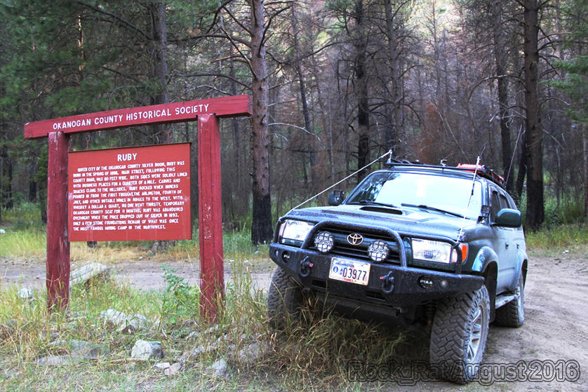
We finally came to the highlight of this section - the steep Ruby Grade. We slowly descended the ridge towards the old mining town where Ruby once existed. I must admit, I felt pretty accomplished after completing that section. I had to pose with my rig next to the old sign describing the bustling mining community that was the center of commerce in the Okanogan area until the market for silver collapsed in 1892. Coming off of Ruby concluded day five as we headed to the Conconully State Park to pack it in for the night. This was by far one of the best sections.
The early morning sun glistening across the calm waters of Lake Chelan
Around every turn there always seemed to be yet another great photograph that just had to be taken.
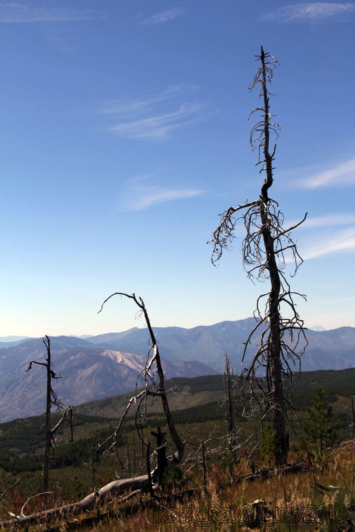
Weathered and worn over the years. You can't capture this beauty unless you're on the top of the mountain.
One of the two Osprey's entertaining us along the way.
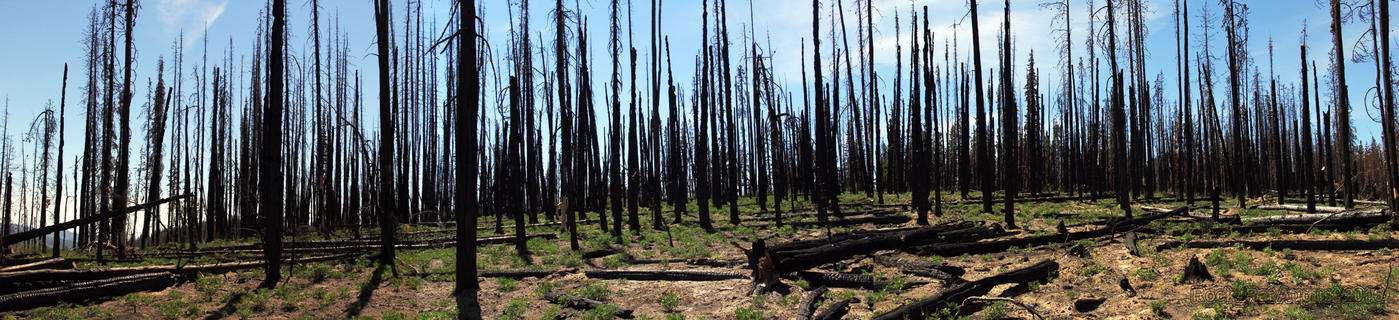
Fires raged across Okanogan County and the Wilderness in 2014 as homes were lost, hospitals evacuated, and hundreds fled. This is what remains of the old Douglas Firs and Ponderosa Pines on the mountain.
To me, this was a pretty big accomplishment. Ruby Grade (ridge) was not to be taken too lightly. A Forest Ranger recommended we by-pass this section. He said it was too difficult. My rig flexing for the photo-shoot.
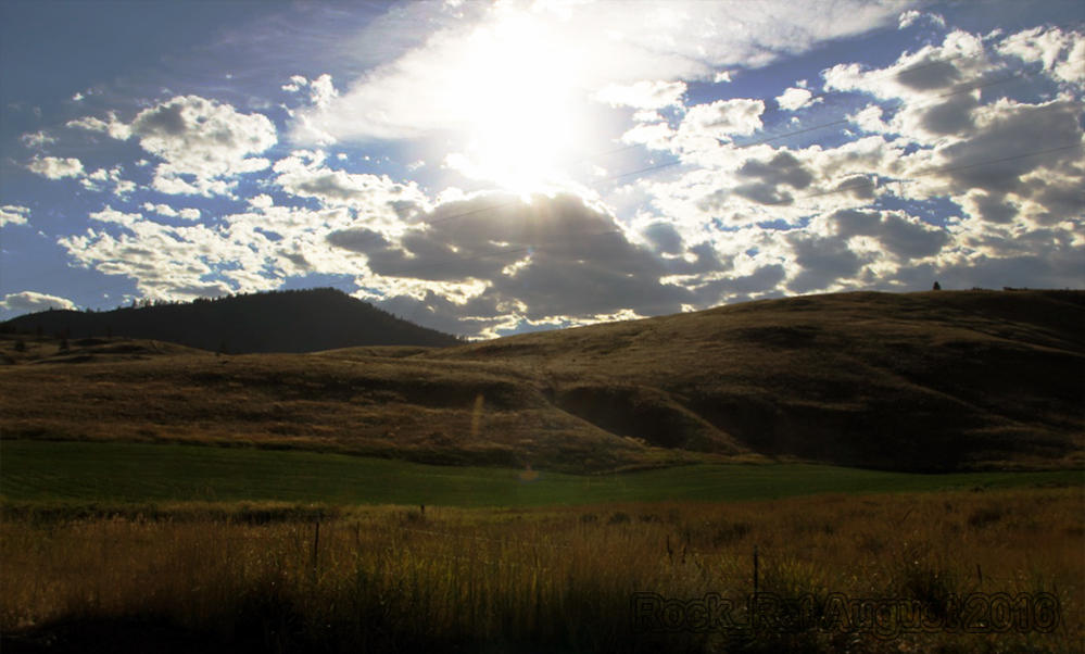
Dropping into the valley on our way to Conconully - breathtaking.
For those wishing to spend the night where we did before heading into Lake Chelan I've posted the topo and the coordinates. I can always send you the waypoint.gpx file if you want.
__________________
2001 Imperial Jade Gold Letter Sport Package - Original Owner
Last edited by Rock_Rat; 09-23-2016 at 02:11 AM.
|
|
|
Reply With Quote
|
|
09-04-2016, 01:56 PM
|
#6
|
|
Senior Member
|
|
Join Date: Nov 2014
Location: Cowlitz County, Washington
Posts: 1,776
Real Name: Mike
|
|
|
Senior Member
Join Date: Nov 2014
Location: Cowlitz County, Washington
Posts: 1,776
Real Name: Mike
|
Completion of the WABDR from Stevenson to Canada
Day Six: Section 6 - Conconully - Knighthawk (Canadian Border)
When we woke up this morning, we knew this would be the final leg of the WABDR. The distance was much shorter at just 101miles and slightly less spectacular, if that’s even possible, than the previous leg. We were excited knowing that we would be at the Candian border today successfully completing the entire route without having to be re-routed due to fires. We opted to stay at Conconully State Park on an RV pad with running water and electric. I had wished I brought a small collapsible garden hose just to get the dust off the 4Runner so we could access the rear lift gate. Instead, I filled up our large wash basin at least 100 times and “knocked” the dust off the entire rig. I also regretted not bringing a small power strip to charge the camera and video batteries, and the tablet. Especially the tablet with the GAIA GPS map! The small portable 12V inverter that I purchased from West Marine worked fine while driving, however, it was painfully slow.
During this leg of the trip, we continued through the Okanogan forest up North Fork Salmon Creek Road on our way to the highest point in the WABDR; Lone Frank Pass at 6700 ft. It wasn’t as exciting or as picturesque as some of the other passes we climbed. I was hoping for an “on-top-of-the-world” vantage point but it just wasn’t there. As we continued through the Okanogan, we wondered if there were any trees that were left unscathed by the fires…mile-after-mile, hour-after-hour, nothing but tall slender burnt trees reaching towards the clouds. After our incident in Cashmere, I frequented the Hella horns a little more often. I knew that this leg would be leg 1 for those opting to complete the route from north to south. Surprisingly enough, we only saw a couple dual sports coming from the north and one local JK travelling the same direction as we were.
Cows. Yup, cows and more cows would aptly sum up the last part of this leg as we headed towards Skull and Crossbones.. We would see cows at elevations you would least expect to see them. We would drive over cattle guards where we least expected. We never did find the old Skull and Crossbow cabin that you see in photos. We saw an old dilapidated cabin that just didn’t make it through the winter. I’m not sure if that was it or not. We were headed towards Nine Mile Creek Road as we left the Toats Coulee Recreation Area. This would eventually bring us between Juniper Point and the Chopaka Mountains as we descended into the small town of Loomis.
According to Wikapedia: On November 3, 1901, J.M. Haggerty was tarred and feathered in Loomis. He made comments to The Spokesman-Review about the lack of success of the Palmer Mountain Tunnel Company. The comments were resented and a mob was waiting for him when he stepped off the stage. During an impromptu mass meeting, "Suddenly a dozen men grabbed Haggerty, and before half the crowd knew what was happening a bucket of tar and pillows were produced." After half an hour of being paraded through the street covered in tar and feathers, he was released.
I didn’t know it at the time, but once we were on the paved road, this would be the end of our off-road experience. A drive around Palmer Lake along the Loomis-Oroville road brought us to our final destination of our journey – the US-Canadian border at Nighthawk. Success. What a great journey. I feel so privileged to experience such beauty with my wife and both of my boys in the state I call home – Washington State. We've spent many, many, many hours in our 4Runner since the day we purchased it new back in October 2000. This by far was one of our greatest experiences.
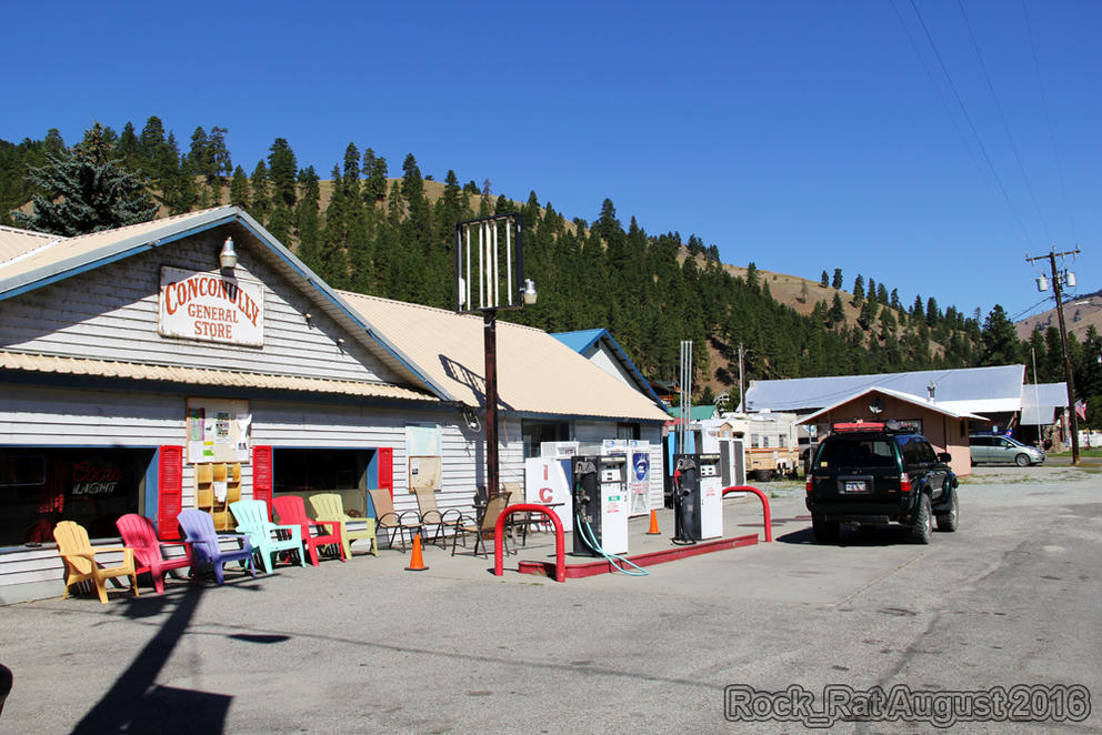
The small town of Conconully with a population of around 190-210. Originally a mining town back in the late 1800's the town was destroyed by fire and floods in the 1890's.
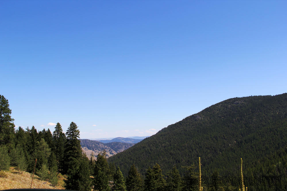
Another view of the Okanogan forest on our last leg.
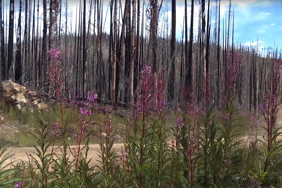
Miles of charred trees from the fires that decimated acres upon acres of the Okanogan Forest. Here's an interesting link that lists all the Washington Fires - You will be amazed.
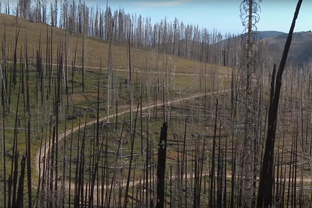
Some regeneration taking place.
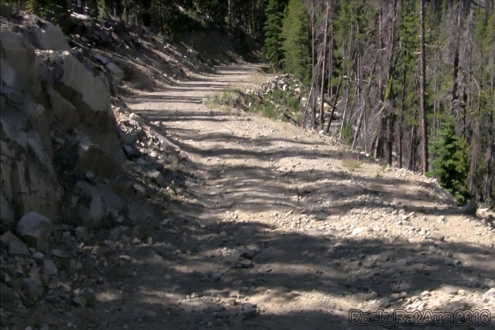
There were a few sections of the road that I couldn't wait to get by. This was one of them. I had visions of rocks crashing down on us as we drove by.
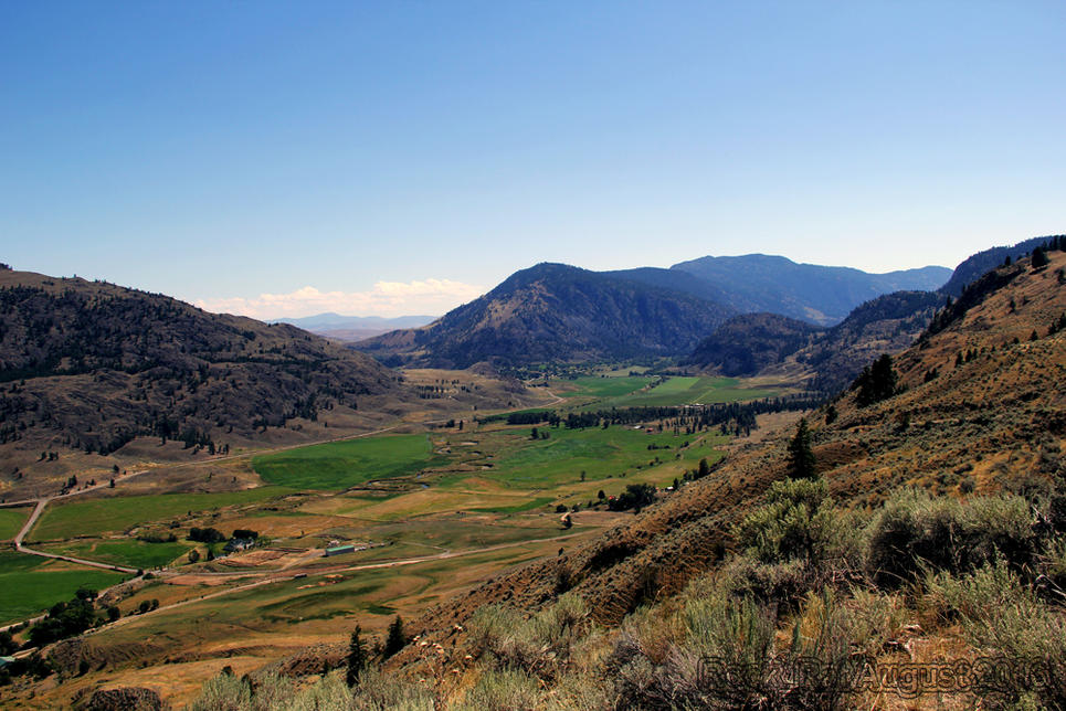
This was an absolutely gorgeous view of Loomis as we finished up our final leg of the route on dirt roads. My wife fell in love with this Fairy Tale setting. There's really no words to describe it.
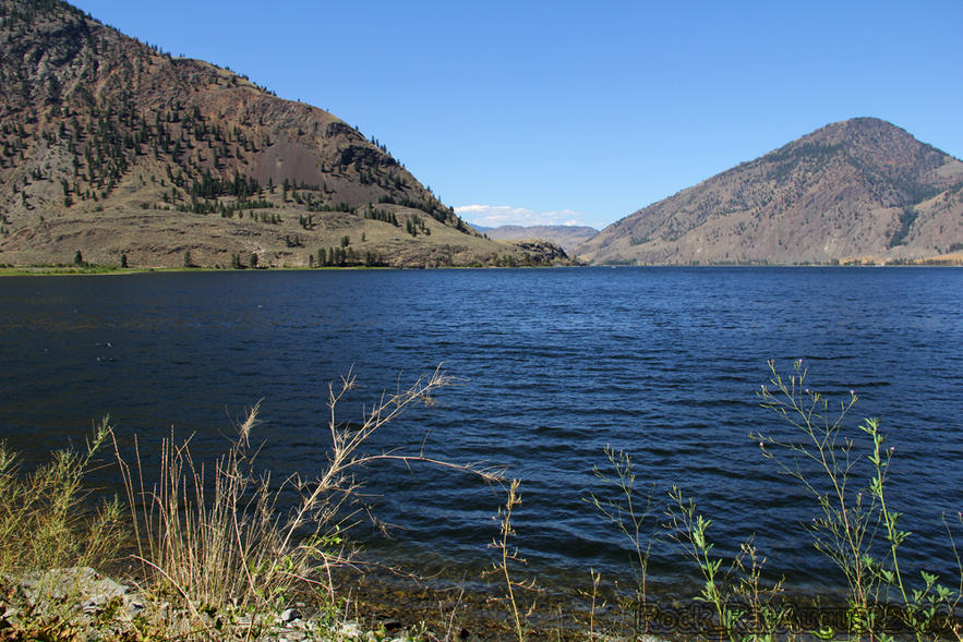
Driving along side Palmer Lake on the Loomis-Oroville road.
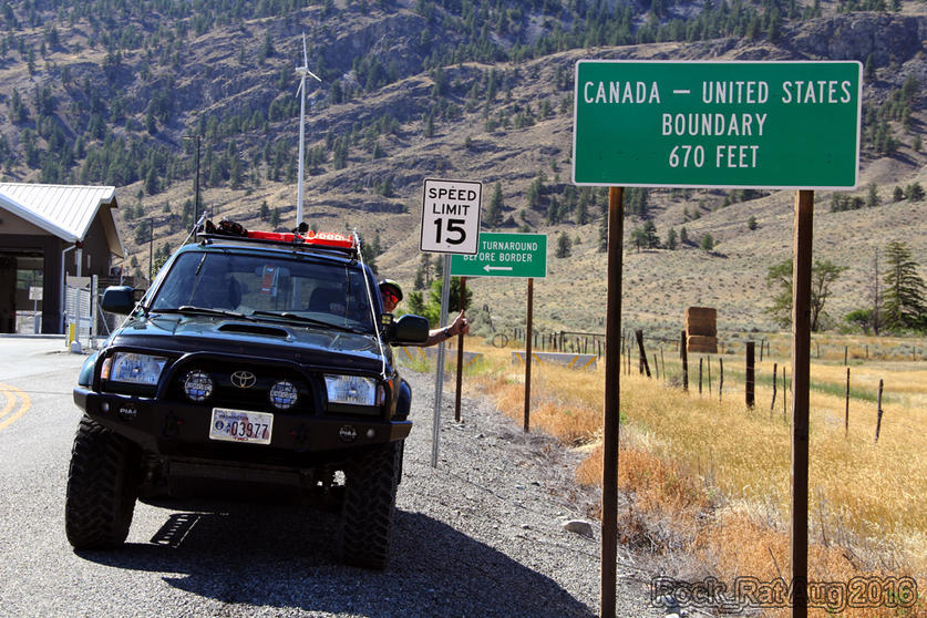
Our final stop at the US/Canadian border in the small town of Nighthawk. It was quite the trip for a 4runner with more than 340,000 miles on it.
__________________
2001 Imperial Jade Gold Letter Sport Package - Original Owner
Last edited by Rock_Rat; 11-12-2016 at 02:20 PM.
|
|
|
Reply With Quote
|
|
09-05-2016, 03:12 PM
|
#7
|
 |
Member
|
|
Join Date: Dec 2013
Location: High Park Colorado
Posts: 340
Real Name: Levi
|
|
|
Member
Join Date: Dec 2013
Location: High Park Colorado
Posts: 340
Real Name: Levi
|
Awesome . I just recently found out about these BDR,s and really want to do the COBDR . Did you find the times listed for motorcycles accurate or were you able to go faster-slower ?
__________________
96 SR5 5 speed, 4:88s with rear ARB , 255/85/R16s , some armor and lights
|
|
|
Reply With Quote
|
|
09-05-2016, 11:17 PM
|
#8
|
|
Senior Member
|
|
Join Date: Nov 2014
Location: Cowlitz County, Washington
Posts: 1,776
Real Name: Mike
|
|
|
Senior Member
Join Date: Nov 2014
Location: Cowlitz County, Washington
Posts: 1,776
Real Name: Mike
|
Quote:
Originally Posted by hounddogman

Awesome . I just recently found out about these BDR,s and really want to do the COBDR . Did you find the times listed for motorcycles accurate or were you able to go faster-slower ?
|
I thought the times listed for the WABDR were fairly generous. The bikes are faster. I usually left around 9/930 and arrived close to 4 or 5ish. My wife has all the details of the trip. I'll add the logistics to this as I populate the thread. Yea, it was about 100 miles of dirt roads each day.
__________________
2001 Imperial Jade Gold Letter Sport Package - Original Owner
|
|
|
Reply With Quote
|
|
11-05-2016, 08:07 PM
|
#9
|
 |
Junior Member
|
|
Join Date: Oct 2016
Location: Mount Vernon, WA
Posts: 16
|
|
|
Junior Member
Join Date: Oct 2016
Location: Mount Vernon, WA
Posts: 16
|
Good stuff, thanks for posting. Anxiously awaiting for day 6 to see if you made it!
Sent from my R1 HD using Tapatalk
|
|
|
Reply With Quote
|
|
11-06-2016, 03:44 PM
|
#10
|
|
Senior Member
|
|
Join Date: Nov 2014
Location: Cowlitz County, Washington
Posts: 1,776
Real Name: Mike
|
|
|
Senior Member
Join Date: Nov 2014
Location: Cowlitz County, Washington
Posts: 1,776
Real Name: Mike
|
Quote:
Originally Posted by elpete77
Good stuff, thanks for posting. Anxiously awaiting for day 6 to see if you made it!
Sent from my R1 HD using Tapatalk
|
I'll try and get it posted today. Been busy with home stuff. I won't spoil it for you. I'll keep you in suspense!
__________________
2001 Imperial Jade Gold Letter Sport Package - Original Owner
|
|
|
Reply With Quote
|
|
11-07-2016, 01:45 PM
|
#11
|
 |
Senior Member
|
|
Join Date: Oct 2015
Location: Lexington, Ohio
Posts: 1,858
|
|
|
Senior Member
Join Date: Oct 2015
Location: Lexington, Ohio
Posts: 1,858
|
Excellent report, sub'd
__________________
"How rare that we can point ourselves inevitably west and go, go, go. Run out the highway and the hills. Slide our fingertips over the creases and the valleys of the impossibility that is America. You can’t grasp its vastness from a plane. It’s diversity from a map. You have to put your feet on the ground. Your hands in the dirt." - Zach Bowman
Photos, mods & trip reports
|
|
|
Reply With Quote
|
|
11-10-2016, 12:37 PM
|
#12
|
 |
Senior Member
|
|
Join Date: Jul 2012
Location: Iowa
Posts: 3,138
|
|
|
Senior Member
Join Date: Jul 2012
Location: Iowa
Posts: 3,138
|
Sounds like an absolute blast! Thanks for sharing and the great trip log! Definitely on my list.
__________________
-2013 T4R SR5-MYSALSA-KO2's
-(SOLD)2006 T4R SR5. Nautical Blue Metallic. 255/70/17 General AT2. LED Interior Swap. Toytec Ultimate 3inch lift/Icon 2.0s Rear, SHROCKWORKS Front Bumper, OEM FJ wheels, WM Roofrack, slowly working it up. My Build thread HERE
-(SOLD)2005 Subaru Impreza WRX STi. BMW Mica Blue paint job. Cobb stage 2 tuning. Other modifications.

|
|
|
Reply With Quote
|
|
11-12-2016, 03:56 PM
|
#13
|
|
Senior Member
|
|
Join Date: Nov 2014
Location: Cowlitz County, Washington
Posts: 1,776
Real Name: Mike
|
|
|
Senior Member
Join Date: Nov 2014
Location: Cowlitz County, Washington
Posts: 1,776
Real Name: Mike
|
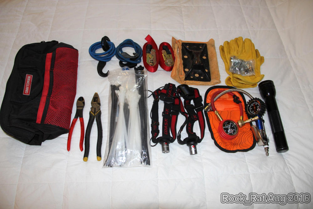
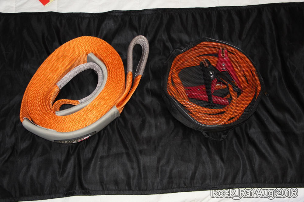
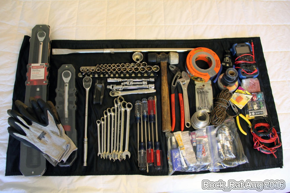
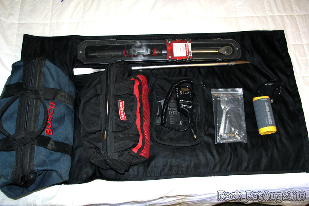
Essentials For the WABDR
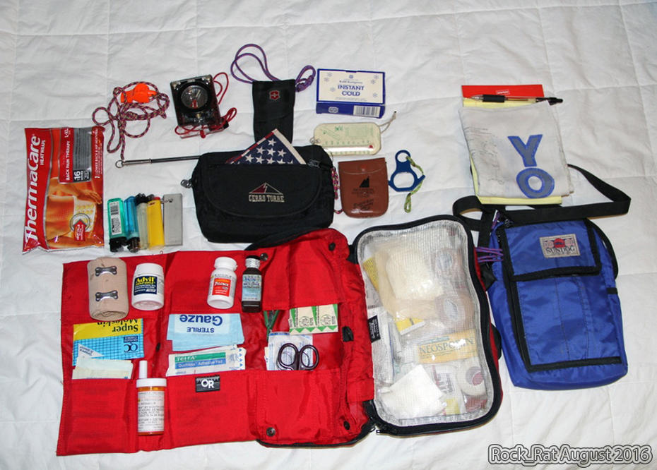
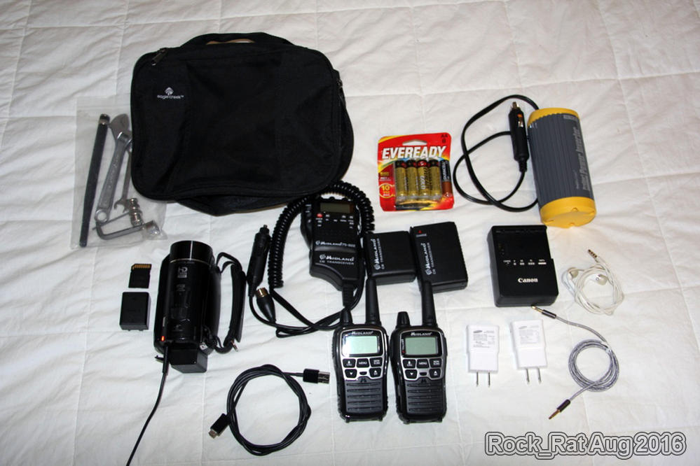
When it came to packing for the trip I had to really think about "need" v. "want." I also had to think about the "what if..." situation before I left it home. Below are several photos. When I get some time I'll actually break down all of the contents, item-by-item. For now, here's a rough idea:
BTW - I took these photos at the hotel in Leavenworth waiting to get my rig aligned the following day.
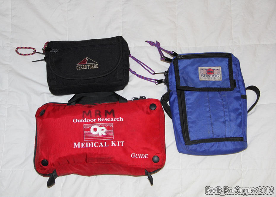
First Aid Kit- The bag is no longer made. It's one I used when I was a guide.
- Topical ointments/antibiotics
- Band aids
- Snake bite kit
- Bee sting kit
- Aspirin, Advil, Tylenol Extra
- Tweezers
- Scissors
- Thermometer
- Benadryl
- Amoxicillin
- Benzoin
- Norco-5
Unfortunately, I had to use the first aid kit to bandage up the rider after our encounter in Cashmere.
"Ten Essentials Bag"
Not needed but it's something I've never left the house without as a guide. It's the Black Cerre Torre bag in the photo and it has lighters, flint, Suunto Compass, rescue whistle, rescue mirror, American Flag, spectra chord, boulion cubes, multi-purpose knife, sewing kit and couple other items.
The Blue Sundog Bag- Pad and pencil/pen
- Cell phone
- Wallet
This was my "Catch all" bag for under the seat.
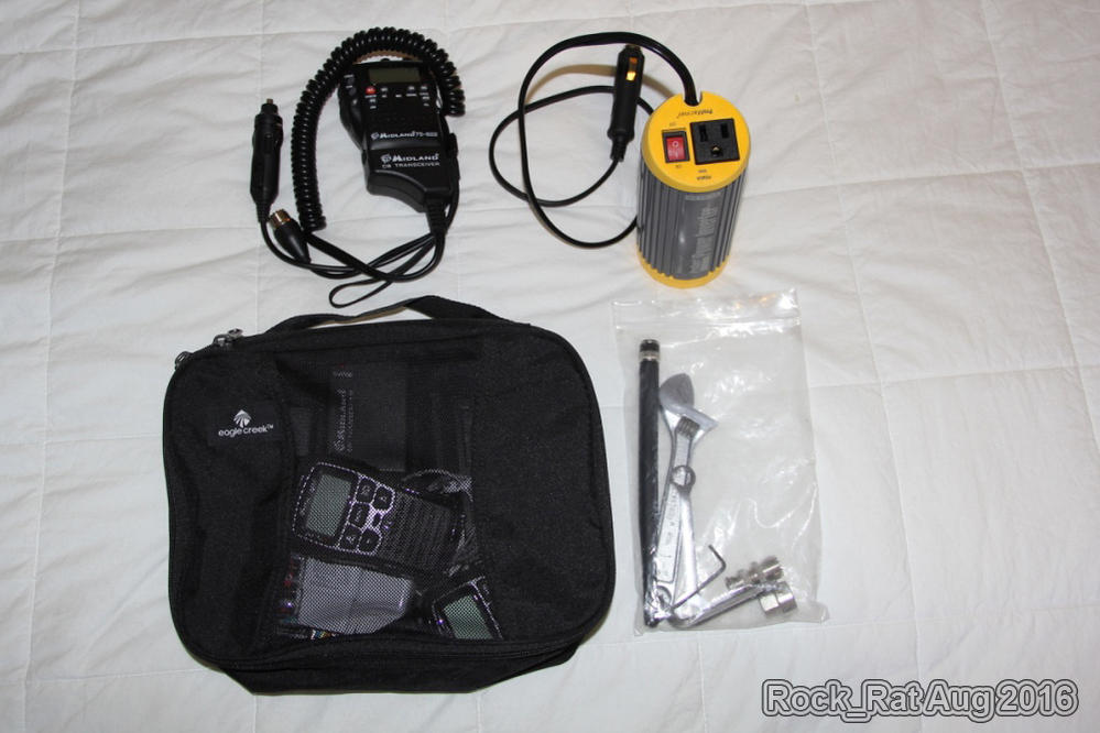
Radios and Video- Handheld Midland 75-822 with portable antenna
- Magnetic Wilson Lil' Will antenna
- Pair of Midland X-Talker XT T71VP3
- Camera was a Canon 60D DSLR with a EFS 18-135mm, UV and Poloraizer filters.
- Video camera was a Canon Vixia HF M50
- Extra 64G SD cards
- ProMariner ProSport Power Inverter (DC-AC)
- Antenna Adapter
- Small adjustable wrench for the Limb Risers in case of an emergency.
This was under my front seat.
Recovery Gear/Tire Kit- ARB Recovery Strap with two D rings on the front bumper and one in the receiver
- One set of MAXSA Escaper Buddy Traction Mats on the rack
- Hi-Lift on the roof
- Fiskar's Axe under the Hi-Lift
- Hand-held Gerber Machette with Sheath under front seat (I ordered a Fiskars 18" but was dissapointed to find out it didn't come with a sheath.)
- ARB USA 10000010 Speedy Seal Tire Repair Kit
- ARB ARB605 Blue Inflator with Gauge and Braided Hose
- ARB USA ARB505 E-Z Deflator Kit
- ARB Compressor - CKMA24 permanently mounted in my rear storage area
- Most of this was placed in the red Craftsman Bag right next to the air compressor. (zip ties, cotter keys, side-cutters, gloves, flashlight, headlamps, ratchet straps, etc...)
Tools- Electrical supplies (fuses, various sizes including a 40A)
- Electrical tape
- Innova 3340 Automotive Digital Multimeter
- Klein Wire Strippers
- Butt Splices
- Various lengths of 12 and 14G wire
- Fusion tape
- 3/8" drive sockets, ratchet, extensions, universals, torque wrench
- Spark plug socket with rubber boot attached to a "locking" extension
- 1/2" drive sockets, rathcet, extensions, universals, torque wrench
- Cross-point screwdriver - #2 and #3
- Common screwdriver
- 35mm socket for axle nut
- pry bar
- Mallet
- Allen wrenches
__________________
2001 Imperial Jade Gold Letter Sport Package - Original Owner
Last edited by Rock_Rat; 11-13-2016 at 08:07 PM.
|
|
|
Reply With Quote
|
|
11-14-2016, 01:43 AM
|
#14
|
 |
Senior Member
|
|
Join Date: Jan 2015
Location: WA.
Posts: 2,066
Real Name: Ryder
|
|
|
Senior Member
Join Date: Jan 2015
Location: WA.
Posts: 2,066
Real Name: Ryder
|
Thanks for posting your adventure Rock_Rat! That looked pretty epic! Great pics too!
|
|
|
Reply With Quote
|
|
01-21-2017, 12:50 AM
|
#15
|
 |
Senior Member
|
|
Join Date: Nov 2014
Location: Beacon Hill
Age: 40
Posts: 1,221
|
|
|
Senior Member
Join Date: Nov 2014
Location: Beacon Hill
Age: 40
Posts: 1,221
|
I'm shocked this isn't getting more replies! Your adventure is EPIC! I am considering the WABDR this summer but I'm confined to just doing segments at a time(weekends only) due to work. There is a lot of resources out there and I am a bit overwhelmed on where to start.
|
|
|
Reply With Quote
|
 Posting Rules
|
You may not post new threads
You may not post replies
You may not post attachments
You may not edit your posts
HTML code is On
|
|
|
|


 Linear Mode