JohnTheLuck's Adventures Thread

Day 7:

Start point: Las Cruces NM
End point: Las Cruces NM

Distance driven: 115 km
Distance hiked: 1.8 km

Today we went to the Prehistoric Trackways National Monument preserving an area where several traces of animals dating from around 280 million years are saved in the rock. As it is a new monument designated in 2009, there are still few indications where to find these tracks. Even the hiking trails are not very well documented.

We drove two off-road trails of intermediate difficulty. the Skyline and Apache Dam Roads described in JeepTheUSA.com. These were quite rocky and we were progressing quite slowly. At the beginning, we circulated near a wash having dug the very colored rock. The place was quite pretty and we stopped. We found shell fossils there.

49452605448_ea476f0822_o.jpg


49452884386_1348dbbbec_o.jpg


49453119167_17dda809cc_o.jpg


Continuing toward Skyline Road, we encountered some fun obstacles, this one requiring the rear locker to get through.

49453085961_40ebaa9cf4_o.jpg


The Skyline Road was supposed to lead to Robledo Mountains on the top of a ridge. We had to turn back because the place is now closed to vehicles.

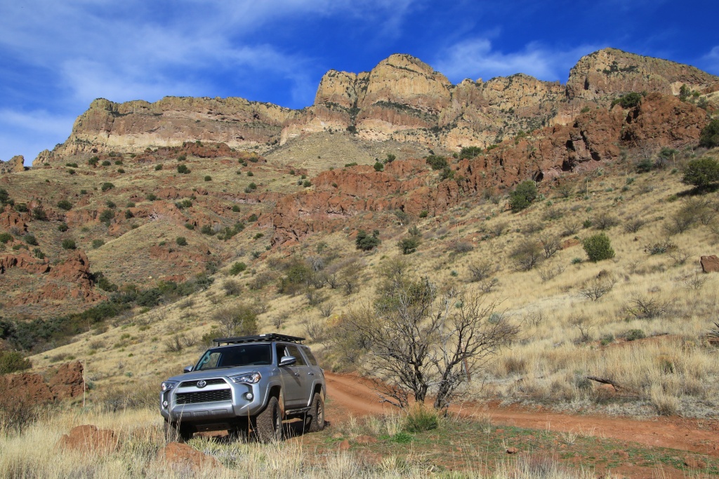
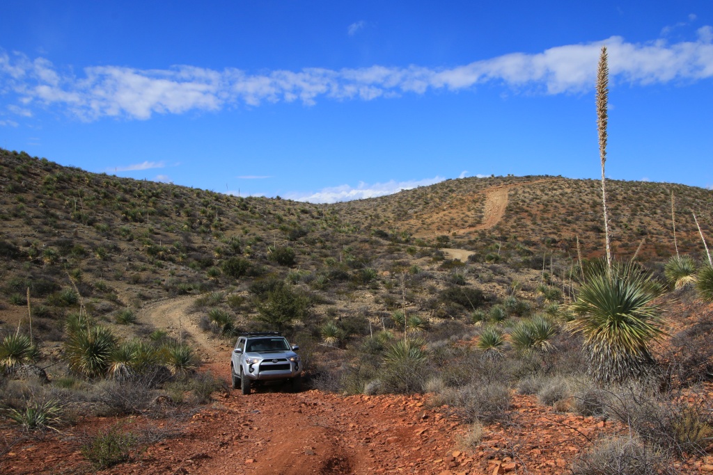
Continuing south onto Apache Dam Road, we finally had some period of sunshine, revealing the great colors of the rocks around us.
49452884311_f1d7e8a84c_o.jpg


49452884246_717e14e0c5_o.jpg


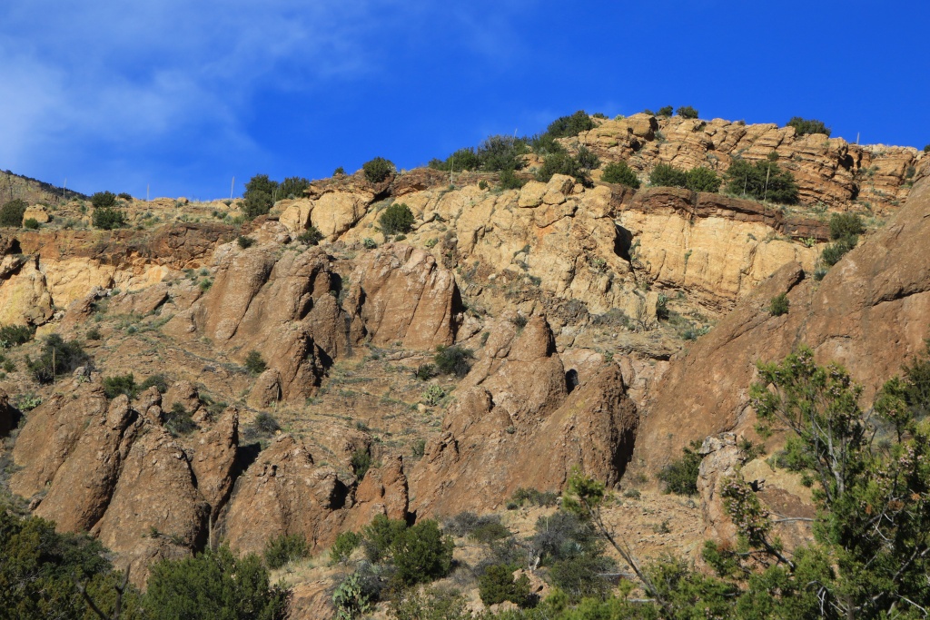
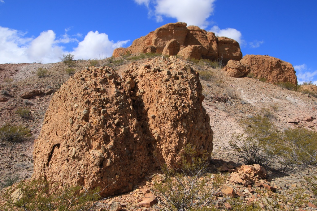
We began a long descent toward Apache Wash, very rocky and relatively wooded. Although I tried to avoid the branches often very close to the trail, the 4Runner has a few more decorations on its paint. Pretty eroded formations decorated the sides of the cliffs here and there.
49453118842_d5b6483431_o.jpg


Arrived in Apache Wash, we explored some places that we had identified with Google Map during our trip preparation. One of these places was a very sculpted secondary wash providing access to a promontory above Apache Wash.

49452884051_dd30878313_o.jpg


49452883976_05eab69e3c_o.jpg


49453118547_5940965472_o.jpg


Continuing along Apache Wash, we crossed very colorful areas with beautiful patterns.

49452883846_c0c5519ebb_o.jpg


49452883426_db65061066_o.jpg


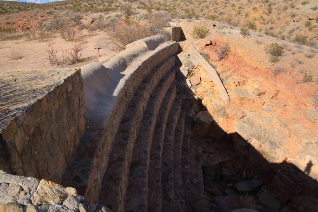
We then joined a series of old constructions in the wash probably used to create reservoirs to capture water during precipitation. I am guessing the last is called Apache Dam.
49453085831_e7dd3a2673_o.jpg


49452883626_2c72910874_o.jpg


We were not sure if we could leave the monument from the south. To our great satisfaction, after driving on a more recent dike we reached a barrier fortunately not locked. Otherwise, we would have had to return by the same path and pass through some rather delicate places, without counting the many more scratches on the vehicle.

After a stop at a restaurant, we went to Soledad Canyon in Organ Mountains-Desert Peaks NM to watch the sunset over the mountains. While we waited, we saw a horde of deer heading towards the mountains.

49452403408_873ca494e8_o.jpg


The setting sun tinted the mountains with an orange color, contrasting with the dark clouds in the distance.

49452403323_4ddf3e94ac_o.jpg


49452403228_868ca7ffdd_o.jpg


Tomorrow we will leave Las Cruces NM to finally reach our main destination of our trip, Arizona. We will travel to Tucson to begin.
.
 
Day 8:

Start point: Las Cruces NM
End point: Tucson AZ
States travelled: NM, AZ

Distance driven: 574 km
Distance hiked: 4.2 km

After about four hours on the I-10 interstate, we finally reached Tucson in the state of Arizona, where we will spend most of our trip. We will be in the vicinity of Tucson for the next three days.

Our first stop was in the Rincon sector of Saguaro National Park. The Scenic Loop runs through hills carpeted with saguaro and other cacti. We hiked the easy Mica View Loop, about 3.2 km.

49457421908_7e828bd9f8_o.jpg


Then we headed to the Catalina Mountains located north of Tucson in the Coronado National Forest. The Catalina Highway (sky Island Scenic Byway) begins in the desert at 3000 feet to reach the summit at 8500 feet. As the road reaches higher elevation, the desert gives way to other ecosystems normally found on northern latitudes.

49458129772_5f096cc5f0_o.jpg


49457897306_a3df17dc2c_o.jpg


49457897526_b7c5495ba9_o.jpg


As the desert leaves its place, the road joins an area where rocks shaped by erosion form chimneys. A series of viewpoints are set up along the road so that you can admire this magnificent landscape.

49458129692_e395c969c8_o.jpg


49458129657_3b5cbddec9_o.jpg


49457421548_65c2ef0ccd_o.jpg


Close to the summit, pines and other large trees thrive in large numbers.

49457421633_35f90824fd_o.jpg


The recreational village of Summerheaven offers downhill skiing for locals. Snow is currently present from around 7000 feet.

49458129647_b31bca47d5_o.jpg


We could not reach the summit because the access was closed by a barrier, probably because of the snow. We returned by the same route as the sun was about to set.

49457421593_129b440977_o.jpg


49457421518_afc0cd73f3_o.jpg


Tomorrow we should do a fairly long hike in the morning and drive some off-road trails north of Tucson in the afternoon.
.
 
Day 9:

Start point: Tucson AZ
End point: Tucson AZ

Distance driven: 171 km
Distance hiked: 11.1 km

To start the day on a good note, what could be better than a little health walk at sunrise. We went to Sabino Canyon Recreation Area to undertake the hike to Blackett's Ridge which is approximately 10.4 km and 540 meters of elevation gain. This trail begins with a long trek before joining the start of the ascent itself. Going up was still manageable considering the elevation at the start which is already 1000 meters while we live about at 40 meters in Montreal.

It is a very beautiful hiking trail circulating among the saguaro cacti and others. Conditions were perfect, although a little chilly at first with a meager 4C in the parking lot. All along the climb, the view was magnificent.

49462099918_794f16af15_o.jpg


The trail ends on a promontory with the precipice on three sides. We were a few people to rest while admiring the landscape.

49462588301_c4dfb7fe99_o.jpg


After a well deserved break, we took the opposite path to descend, while enjoying the view once again.

49462121518_6938c661be_o.jpg


The round trip took us exactly five hours. To rest our feet, we went to cross the Redington Road passing to the east of the Santa Catalina Mountains we had just climbed. This route is easy and very little used.

49462844952_c82986a6ae_o.jpg


49462849102_0b5e2cc3bf_o.jpg


Here again, the road passes successively through various plant areas, with many saguaros to the south, and none more as we climb towards Redington Pass.

49462852597_d9015c9db6_o.jpg


49462146908_76d4a71fac_o.jpg


Redington Road is a very easy road but recent rains have dug many channels and our progress was rather slow.

49462142988_803784de81_o.jpg


As the sun went down on the horizon, we saw the San Pedro River valley making it possible for crops and pastures for cattle.

49462634886_3ae66a0070_o.jpg


49462865242_309a401fef_o.jpg


49462149788_da2c5a9879_o.jpg


Tomorrow, we hesitate between respecting the itinerary that we have established, or going with recommendations from hikers with whom we exchanged during our hike on Blackett's Ridge.
.
 
Day 10:

Start point: Tucson AZ
End point: Tucson AZ

Distance driven: 201 km
Distance hiked: 0 km

Although we wanted to split our day between hiking and off-roading, we spent the whole day exploring the area north of Tucson in the 4Runner. We visited the Historic Copper Creek Mining District near the town of Mammoth AZ.

The route begins in a canyon before going up the mountain range. The road along a ridge offered a panoramic view at each detour. The vegetation was surprisingly green. Even the ground was carpet of small plants similar to grass.

49466734277_ec2264782a_o.jpg


49466741622_2e5691625e_o.jpg


49466753027_8fee3f9682_o.jpg


The road then descends into the heart of the mountains to reach Copper Creek.

49466532981_a2c2d0c530_o.jpg


The vegetation was composed of saguaro, including this specimen displaying an anomaly (in English crested or cristate saguaro).

49466536306_1b89225388_o.jpg


Another less fortunate was revealing its rigid internal structure.

49466539116_d5f6560467_o.jpg


We explored several side roads going up the mountains.

49466051003_80e1ac95dc_o.jpg


From these elevated viewpoints we could see the traces of the old mining sites having been in operation between 1890 and 1941.

49466769762_d18159825f_o.jpg


49466774442_dd084e7cc4_o.jpg


49466804097_d5c2169844_o.jpg


49466069023_47b3349ecb_o.jpg


Several rocks suggested the coveted wealth, here copper oxide in green. In addition, the place was also exploited for lead and silver.

49466554486_d7c989654d_o.jpg


Peter Massey's book we used to plan this route was published in 2006. The route was supposed to form a loop but after talking to a group of Jeep owners, we were informed that the road was closed further by a locked barrier. These grounds are sometimes private and the owners have their full right to prohibit or allow access, depending on the actions of visitors. So we came back on the same route.

Tomorrow we will do one last hike around Tucson before leaving for another region.
.
 
Day 11:

Start point: Tucson AZ
End point: Willcox AZ

Distance driven: 181 km
Distance hiked: 13.7 km

As planned, we spent the entire day hiking in the Tucson Mountains District of Saguaro National Park. This hike having been highly recommended by other hikers, we decided to replace the one that we had originally planned in our schedule.

The trail from Kings Canyon Trailhead uses an old railway grade once used by mining operations in these mountains. After a while, our goal was finally revealed to us in the distance, Wasson Peak the highest point of the Tucson Mountains.

49470236953_bb3fe3d88f_o.jpg


After reaching a small plateau, we took another climbing trail to Wasson Peak. This offered a very nice view in the distance on our previous trail.

49470236933_f1ce3d76a3_o.jpg


Still continuing on the same trail, Wasson Peak was getting closer and closer.

49470236853_d02dcd0b0f_o.jpg


49470236793_d011f468ac_o.jpg


After a well-deserved break and some discussions with other hikers present, the time has come to come back. We used another trail to form a loop, allowing us to see other landscapes and attractions.

49470236388_921e321e3b_o.jpg


49470236713_f33afbbb5f_o.jpg


When we arrived in Tucson area, we were told that he had more in the past few weeks. This should have a positive effect on the appearance of wild flowers. We are starting to see a few. Maybe we will see a lot more, especially as the weather forecast seems to indicate precipitation coming in a few days.

49470727136_461d8e186e_o.jpg


49470953257_25151fc38a_o.jpg


49470953207_7edd149294_o.jpg


Our return path followed a long ridge whose nature of the rocks was very different from those composing the other ridge that we followed during the ascent. In several places, colored bands followed one another.

49470236523_123f04b773_o.jpg


We saw several old mines during the ascent and descent, but the last that we saw, Gould Mine, is the most important and the most recent since it ceased its operations in 1954.

49470236463_294581134d_o.jpg


49470726886_10a43e7d8d_o.jpg


After this fairly long hike of almost 13.7 km and 550 m elevation, covered in 6 hours, we hit the road leaving Tucson to join Willcox AZ where we will spend the next three days. On the menu, more off-roading and (for my wife...) some hiking.
.
 
Day 12:

Start point: Willcox AZ
End point: Willcox AZ

Distance driven: 262 km
Distance hiked: 7.5 km

We again had a great day with a cloudless sky and a very comfortable temperature around 18C.

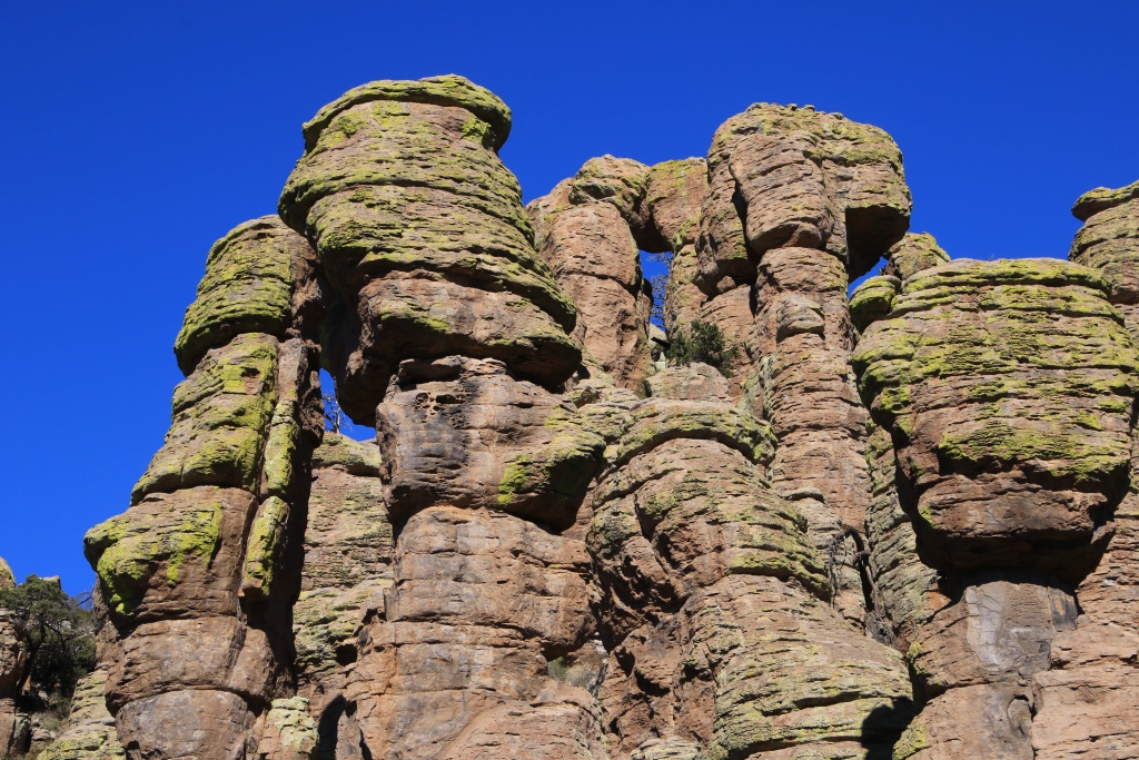
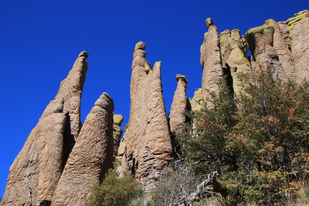
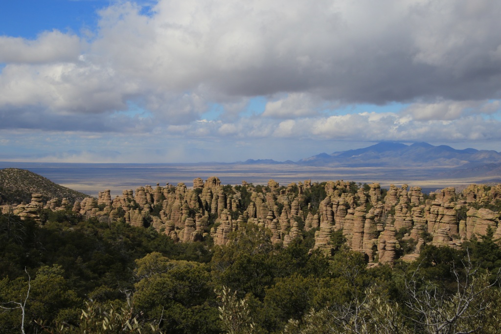
Our main destination for the day was the Chiricahua National Monument, located in the southeast corner of Arizona. This monument protects a region whose rocks, originally composed of successive layers of volcanic ash, have been eroded by water and wind by forming columns of various shapes.

We started our visit by taking the scenic route leading to Massai Point located on the summit.

49475590691_a0cc82184b_o.jpg


49475108563_030c3bee71_o.jpg


Our original plan was to do the very long hike around the area containing the rock formations. Since we were still feeling tired from yesterday's long hike, we instead hiked the shorter but much more popular Echo Canyon Loop.

49475590616_37b2461c63_o.jpg


We reached a place called Echo Canyon Grottos, where columns are still joined, the erosion did not already isolated them.

49475590646_d4133fc64f_o.jpg


49475108833_dd41b670a7_o.jpg


49475590566_a352ff9679_o.jpg


49475811622_c97467154d_o.jpg


49475811432_f16715509b_o.jpg


49475811597_8fe52ea89b_o.jpg


49475108698_847c3819c2_o.jpg


Back at the trailhead, we headed out of the park while stopping at a few pullout for a few more pictures.

49475811562_f6d6a0b51e_o.jpg


Then we headed east into Coronado National Forest to travel the Pine Canyon Road described in Peter Massey's book. Unfortunately, the right of way through Oak Ranch seems something of the past and a No Trepassing sign was clearly place on the gate.

So we headed instead onto Pinery Canyon Road. This very easy route crosses the Chiricahua Mountains from east to west, starting in the arid plain.

49475811532_224e9761b5_o.jpg


The road climbs to reach the forest of tall Douglas pines and the snow remaining from previous storms. Fortunately, the road was clear, apart from a few small patches of ice in the shaded areas. Obviously, the presence of trees greatly reduces views.

49475811492_bcded44ac6_o.jpg


49475108493_34f632e6b1_o.jpg


Having traveled this road from west to east, we then moved away from our hotel. We had about an hour and a half to drive.
.
 
Day 13:

Start point: Willcox AZ
End point: Willcox AZ

Distance driven: 144 km
Distance hiked: 1 km

Since the beginning of the trip, when we were traveling off-road tracks, I heard suspicious noises seeming to come from the front suspension. I did not have peace of mind so this morning I managed to find an alignment workshop open this Sunday. After checking, the mechanic did not find anything suspicious. This reassured me a bit but I will do a more detailed check at a Toyota dealership later in the next few days.

We then continued with our planned route, a road from Peter Massey's book in a fairly remote corner of the Galurio Mountains to reach the Jackson Cabin.

The road circulates in various places, starting in a heavily wooded conservation area. We surprised four deer who quickly disappeared behind the many trees. Then the road climbs over ridges offering extremely spectacular views.

49480516788_e3bf8c9701_o.jpg


49481215832_259a37efd7_o.jpg


49480516573_0c82baf24b_o.jpg


Jackson Cabin is nestled in a peaceful location at the far end of Jackson Canyon. To reach it, the road begins a long and slow descent in a section ravaged by the runoff of water during precipitation.

49481215512_ec2406fbc2_o.jpg


The cabin has been modified since its beginnings in 1890. The region was the scene of territorial disputes between two families which led to exchanges of gunfire (this reminds me of the Hillbilly Bears cartoons!). Nowadays, this cabin serves as a refuge for long distance hikers in this protected region.

49481214807_e609fa719d_o.jpg


After visiting the site and a small snack, we embarked on the long return, because it took us more than three and a half hours to reach the cabin. The sun was already starting to go down and the cliff made up of colored and textured volcanic rocks was shining. We probably took more photos on the way back because the sky was cloudy this morning, not bringing out the colors as much.

49480997701_1782631882_o.jpg


49481214377_b4fb48cf62_o.jpg


49481214067_f6f670ea5d_o.jpg


49480996936_388f94549e_o.jpg


As the return was still a little faster than the outward journey, we decided to take a closer look at a natural bridge in the volcanic stone.

49480996896_f47715b1bb_o.jpg


We then continued our return, still with resplendent landscapes.

49480514578_ef859d4b53_o.jpg


49480996446_bcbf29aa4d_o.jpg


49480514478_49bee8a52c_o.jpg


49480514193_9b9a6c1d3b_o.jpg


It was a very pleasant day exploring beautiful places with my favorite toy !!!

49480995976_7ab1954b3d_o.jpg


Tomorrow, as the weather forecast has improved, we should return to Chiricahua National Monument for another long hike. Wind may be a factor however, but at least no rain or snow.
.
 
Day 14:

Start point: Willcox AZ
End point: Willcox AZ

Distance driven: 182 km
Distance hiked: 12.3 km

Today we returned to Chiricahua National Monument for a long hike completely surrounding the sculpted rocky areas. In order to save us from footsteps and long climbs, we chose instead to use the park shuttle bringing hikers to the two starting points of the trails at the top.

Our goal was to hike the Ed Riggs, Mushroom Rock, Big Balanced Rock, Heart of Rocks, Sarah Deming, and finally Lower Rhyolith trails to the Visitor Center. We started the hike at Massai Point rather than Echo Canyon as during our hike two days ago, just to be different. The weather was fairly windy with lots of clouds.

49486199077_beb7b3e45e_o.jpg


49485496638_9351ee104c_o.jpg


Here is Mushroom Rock on the top of the cliff overlooking Mushroom Rock Trail.

49485985446_a912118a01_o.jpg


After a few kilometers on the Ed Riggs, Mushroom Rock and Big Balanced Rock trails, we finally saw in the distance the main goal of the hike, the Heart of Rocks sector, accessible only by this long walk. It was at this time that we became aware of the sandstorm in the valley below in the distance.

49485495588_e9fa3850fa_o.jpg


49485496363_fdd419d66d_o.jpg


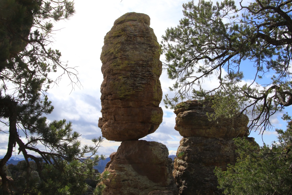
The intersection for the Heart of Rocks trail is easily identified by the Big Balanced Rock formation, a 1000-ton pebble in precarious balance.

49485985236_c6c6796539_o.jpg


Another rock formation whose days are numbered. In fact, this is true for the whole landscape, which is constantly being eroded by erosion. Several formations have appropriate names.

49486198562_d073d41dac_o.jpg


Pinnacle Balanced Rock.

49485496178_33fc2d0ea2_o.jpg


Camel Head Rock.

49485984991_9bb0932127_o.jpg


Punch and Judy Rocks.

49486198337_15755fbf60_o.jpg


Duck on a Rock.

49486197847_318eaf09bd_o.jpg


Having completed the Heart of Rocks loop, we continued on the Sarah Deming trail circulating in a canyon very wooded by large trees, then finally Lower Rhyolith, another beautiful trail perched on the side of another canyon. Fortunately, these two trails only went down.

49486198182_740f078734_o.jpg


49485984511_a2a911f09f_o.jpg


49485495768_7070a4c583_o.jpg


Then, as recommended by park staff, we tried to go see Sandhill Crane birds in wildlife refuges wetlands. Since the best place was too far south for today, we opted for places closer to Willcox. Although we did not see any of these cranes at the two locations we visited, we were still able to get a closer look at this still active sandstorm in the valley.

49485984461_728f4ee979_o.jpg


This beautiful day ended with a very beautiful sunset, despite the clouds still very present.

49485984311_78992520a5_o.jpg


Tomorrow we hit the road again to go near the Mexican border for the next few days.
.
 
Day 15:

Start point: Willcox AZ
End point: Sierra Vista AZ

Distance driven: 286 km
Distance hiked: 0 km

What a difference the sun can make on the beauty of the landscapes. Today when we left Willcox, the sky was overcast with a few breaks allowing a few timid rays of sun to pass. The air was charged with dust raised by the winds which were still quite present.

Our route took us on the roads of Rucker Canyon and Tex Canyon, two very easy gravel roads crossing the Pedregosa Mountains. As these mountains are not really high and the road remains in the valleys, the risk of encountering snow was very minimal, despite the not very encouraging view.

49490563487_f8c7bd6846_o.jpg


As we drove on Rucker Canyon Road, the breaks were a little more numerous.

49490352561_3da1fffe38_o.jpg


We stopped a few times hoping that the sun would even appear very briefly to allow the beautiful colors of the mountains to reveal themselves a little, but without success. This is a road to be better travelled in the opposite direction, SE to NW, with a clear sky.

49490352306_1d9763d33b_o.jpg


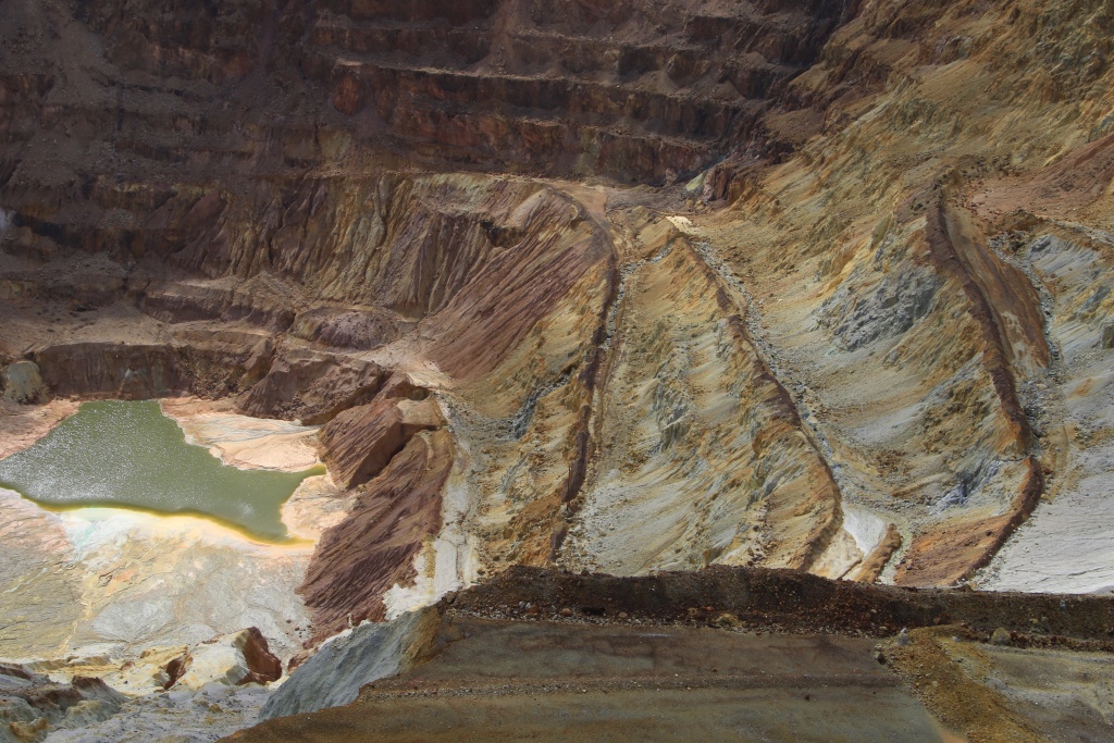
After reaching the US 80, we stopped at the Lavender Open Pit Overlook on the former copper Queen Mine near the town of Bisbee AZ.

49489853268_03a1290e77_o.jpg


49490352446_342e26af92_o.jpg


Nearby, the old settling tanks used to extract copper from the ores by chemical process. Today, there is a significant amount of arsenic in the runoff waters which must now be treated.

49489853308_4287801705_o.jpg


Bisbee, the former mining town, had to reinvent itself following the closure of the mine in 1974. Today, the town is very dynamic with a host of activities, restaurants, Bed and Breakfast and hotels. The remains of the mine are also highlighted as a tourist attraction.

49490563402_c75c64b938_o.jpg


49489853088_c364d91ec6_o.jpg


Continuing our route on US 80, we were to explore the Mule Mountains a little by climbing on Juniper Flats Road. We had a nice encounter there.

49489853063_d40c829984_o.jpg


The view of Bisbee was still interesting despite the little sun making it against the light and the dusty air.

49489853038_9f1e2dc50a_o.jpg


49489852943_fae855d658_o.jpg


We attempted to do the checks for the disturbing noise of the suspension at the Toyota dealer in Sierra Vista, but they did not have availability. We will try again later in the trip. Also, as it was quite early and our supply of clean clothes started to be rather limited, we took the opportunity to do the laundry.

Tomorrow we will continue our journey west along the Mexican border.
.
 
Last edited:
Day 16:

Start point: Sierra Vista AZ
End point: Nogales AZ

Distance driven: 243 km
Distance hiked: 1.7 km

The rather gloomy weather of the past few days has given way to a beautiful sky with an air clearer than yesterday. However, when we left the hotel, the temperature was only -5C. And yes, negative ... just a few km from the border with Mexico.

The day was mainly devoted to roads near the Mexican border. We made a short stop at the Coronado National Forest Ranger Station in Sierra Vista to inquire about the state of the roads and the safety aspect concerning the illegal immigration and smuggling activities. We were reassured that activity was very low these days.

We knew that the Carr Canyon Road near Sierra Vista was closed for the season due to the presence of snow on the high summit. We still hoped to be able to climb until the snow started but the road was closed almost at the start. It will be for another time.

The second route (Mexican Border Road in Peter Massey's book) generally runs along the Mexican border. At the beginning, this road crosses a plain located at the bottom of the mountains. We saw a group of javalinas hiding among trees in the distance.

49495062616_09f0fbd14c_o.jpg


49495062771_0d263a56b8_o.jpg


Then we made a short stop at the Coronado National Memorial, in honor of Francisco Vázquez de Coronado who led a very first reconnaissance expedition in 1540 for the King of Spain. He is considered to be the first European to enter Arizona.

Continuing on the road, it gradually climbs into the mountains via laces to reach the Montezuma Pass. We hiked the short hiking trail to Coronado Peak Overlook with a view to Mexico.

49494566898_7dd808256a_o.jpg


After Montezuma Pass, the road enters Coronado National Forest and gently descends to a large plain decorated with valleys and shallow canyon. It is a very beautiful place.

49494566743_01ce561920_o.jpg


49495281957_5125b57232_o.jpg


49494566458_935b5062c1_o.jpg


On several occasions, signs indicate that the place is sometimes subject to illegal immigration or smuggling. We saw several border patrol vehicles. The agents also have several remote-controlled cameras located on very high towers, distributed a few kilometers apart. We felt a little observed but it also added to the feeling of security.

49495062141_0f633d1698_o.jpg


Further on, while we were only a few dozen meters from the border, we crossed the practically ghostly little village of Lochiel. Apart from a few dilapidated houses, the school stood out in terms of its condition.

49495281737_199508ee00_o.jpg


Then, we made a short detour to go to the old mining sector including the Kansas Mine and its hopper (to load the trucks) and the ghost town of Duquesne.

49495281637_3da6b88247_o.jpg


Finally, the road descends from the mountains before ending near the town of Nogales AZ.

49495281477_2bda1461c4_o.jpg


As we still had a few hours of sunshine, we decided to explore a little towards our destination of tomorrow. We then headed for FR 39 (Ruby Road) in Coronado NF. At first, it circulates between the slightly colored hills and the landscapes become more and more sumptuous. We can easily guess the volcanic origin of the place by the porous texture of the pale beige rocks.

49494565583_9f2d4ba3af_o.jpg


49495275272_7ce7a7b2f9_o.jpg


49495274627_b2abc942f8_o.jpg


49495274277_baca2b7115_o.jpg


As usual, the animals become more active towards the end of the day. We saw a few coyotes, birds of prey, and more beautiful little deers.

49494558503_1f2feddc03_o.jpg


49495274762_5c7e365646_o.jpg


Having survived our two-day stay near the Mexican border, we will resume our westward journey tomorrow, after a short but demanding hike in the mountains of Coronado NF.
.
 
Last edited:
Day 17:

Start point: Nogales AZ
End point: Gila Bend AZ

Distance driven: 448 km
Distance hiked: 8.8 km

We again had a great day in the sun with a slightly cooler temperature than yesterday. We returned to Coronado National Forest to hike the trail to Atascosa Lookout overlooking the region. Our goal was the highest peak on the mountain on the right in the following photo.

49499936387_5089200d3e_o.jpg


At the beginning of the trail, hills masked our objective. It was only after crossing them that it appeared to us, well illuminated by the morning sun.

49499936207_a262001586_o.jpg


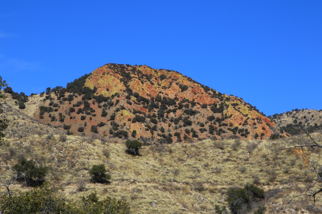
Continuing our ascent we crossed zones of very colorful volcanic rocks.

49499935717_16f53f487a_o.jpg


After a fairly demanding climb at the start and a much less steep part, we had before us the final ascent.

49499935307_a8f917af20_o.jpg


49499710866_6f3a88c9b4_o.jpg


49499710261_9ebecd3610_o.jpg


49499709401_7c766a9888_o.jpg


After a small snack to give us energy, we started the descent. After a few minutes, we saw an helicopter approaching us. A maintenance team for the antennas located at the top was arriving for work. After dropping them off and a few supplies, the helicopter left. If we had stayed at the summit a few ten minutes later we would have been even better placed to see their arrival. On the other hand, we would probably have been asked to get off the summit for the deposit of the material.

49499933222_845abe476d_o.jpg


After the hike, we then took the road toward the west of Arizona. Following the recommendation of Mark Doiron, a Jeep owner with a YouTube channel and inspiring us with his travels, we took the AZ 86 road rather than just the highway.

Along the way, we made a detour to see the astronomical observatories on top of Kitt Peak. About fifteen telescopes are installed there, operated by several government agencies and universities.

49499708716_f4ae40cb24_o.jpg


49499209473_b5496fc5aa_o.jpg


Back on AZ 86, some observatories were visible high on Kitt Peak.

49499209353_e928f7d35a_o.jpg


While the section of AZ 86 near Tucson is a bit featureless, the closer we got to its western end, the more interesting the landscapes became, with a fairly dense concentration of saguaro cacti.

49499707851_f6daf0fb54_o.jpg


We reached Gila Bend AZ when the sun was down and the night was well underway. Tomorrow, we will continue our journey west, with some off-road trails on the schedule.
.
 
Welcome to my back yard! Just for fund your of information, those were Javalina, not wild pigs. An overgrown, smelly, member of the rodent family. And, Oklahoma was filmed not too far from Lochiel. Hope you enjoyed the trip.

Edit: Wow, after looking at the rest of the posts, y'all really have done justice to the Southern Arizona area! Great pictures.
 
Last edited:
Welcome to my back yard! Just for fund your of information, those were Javalina, not wild pigs. An overgrown, smelly, member of the rodent family. And, Oklahoma was filmed not too far from Lochiel. Hope you enjoyed the trip.

Edit: Wow, after looking at the rest of the posts, y'all really have done justice to the Southern Arizona area! Great pictures.

You sure have a great backyard!!!

Thanks for pointing out my mistake on the javelinas. I will correct my post later.

The trip is a real blast so far. I just hope that all those pictures from hiking trails do not offense someone. As my wife prefer hiking than offroading, I have to do compromise. But they sure show how greeat is the landscape in Arizona.
 
Day 18:

Start point: Gila Bend AZ
End point: Ehrenburg AZ

Distance driven: 362 km
Distance hiked: 0.8 km

At the risk of repeating myself, the weather was still excellent. From now on, I think I will only talk about the weather when it is bad ... !!!

Our first stop of the day was the Painted Rock Petroglyph Site located a little west of Gila Bend. The region harbors now extinct volcanoes where ancient indigenous peoples have carved petroglyphs on a hill made up of large volcanic boulders.

49504252456_7e596f25a7_o.jpg


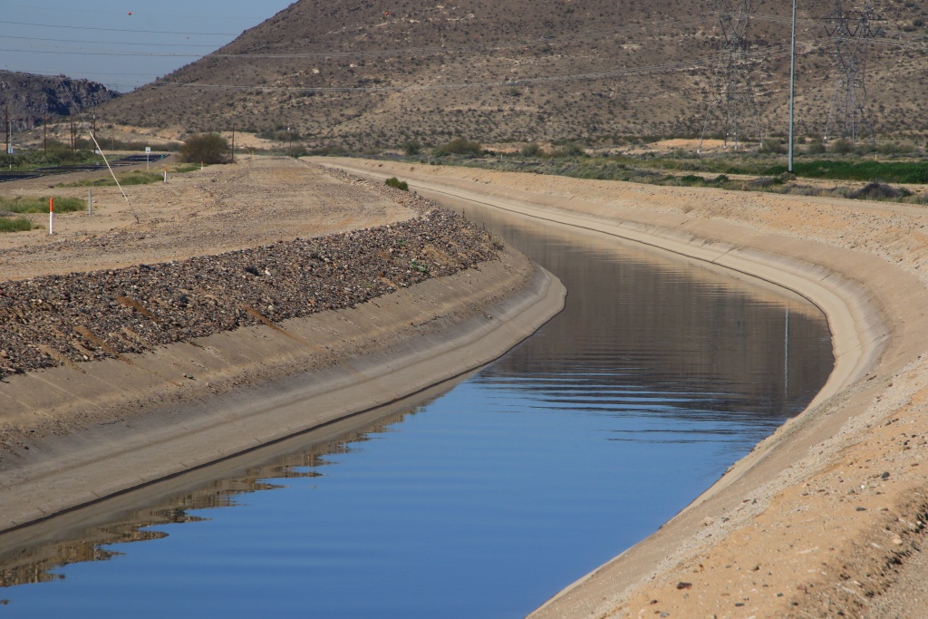
The region is irrigated by the Gila River originating from the mountains north of Phoenix. Along its route, it makes agriculture possible through multiple irrigation channels.

49504467387_479ba92eb6_o.jpg


Beneficial, it nevertheless constituted a major obstacle for travel when it flowed without restriction. When US Route 80 was built in 1926, the Gillepsie Dam Bridge was built to make travel easier. The US 80 had a major impact on the region, similar to that of the legendary US 66 located further north.

49504252406_10366abc38_o.jpg


The bridge takes its name from the Gillepsie Dam previously built in the 1920s to contain water for irrigation purposes. Part of the dam gave way in 1933 following heavy rain.

49503740973_35597505eb_o.jpg


49503741013_d83b16c47c_o.jpg


Nowadays, irrigation is rather done thanks to multiple channels transporting water throughout the valley. Water is pumped from the river into the main canal.

49504252196_647d60b32b_o.jpg


Next, we wheeled the trail along the Robbins Butte Wildlife Area. It crosses to the south a series of hills covered with volcanic rocks. These rocks seem to flow on the sides of the hills where some saguaro grow. Further north, the road joins a relatively humid and wooded area.

49504252121_d53dd63954_o.jpg


Then, we continued west to reach Saddle Mountain, certainly of volcanic origin with its multiple hills consisting of solidified lava who formed a plug, ending the eruption.

49503740663_1a1f6a5473_o.jpg


49503740678_416b68b91a_o.jpg


49503740598_d4a395887b_o.jpg


Peter Massey's book indicates that the loop around the mountain is no longer possible following a big storm that swept the track and that only extreme vehicles can now cross this obstacle.

As time went by and my wife wanted to hike on the other side, we turned around before reaching the obstacle. On the way back, we met Doug, an owner of an F-150. Although he found the road to be quite difficult, he wanted to continue because he did not want to repeat the road in reverse. His Delorme atlas indicated that the road was still passable. Since it is much less risky to travel with two vehicles on such road, we turned around again and continued the loop with him.

The book is not very precise as to the position of the obstacle. In the southernmost part of the road, we encountered a big one, but still passable after having piled up some rocks to soften the slope.

49503740553_210f3dd87e_o.jpg


Continuing west, Saddle Mountain was now lit by the lowering sun.

49504251711_9cf6329935_o.jpg


Approaching the last point of the book on the west side, we knew it was the moment of truth as to whether the previous obstacle was the one described in the book. Well no! We arrived at a wash about 5 meters deep. A more recent track made a slight detour, but the descent was perilous given the presence of round rocks, while the ascent was quite steep with sharp rocks in the middle. I was not convinced that this was passable. But Doug really not wanting to turn around, we once again moved rocks to improve the track. Doug drove down into the wash first while I was guiding him. The length of the dual-cab F-150 was problematic because it was necessary to turn sharply after the descent to go along the wash to reach the climb, also at right angle.

49504251646_503afc8a6e_o.jpg


Doug having managed to go up on the other side of the wash, it was my turn. The descent was carried out correctly without the 4Runner sliding on the rounded rocks. As for the climb, it was successful without too much difficulty too, to my surprise. I once read on a 4Runner forum someone who said: "Trust your 4Runner because it is much more capable than you think". Well, I agree with him!

49504466702_17a3984d9e_o.jpg


After completing the challenge , Doug and I had a few moments of celebration, my wife also I must say!

49503740078_1526ceb889_o.jpg


After a last look at Saddle Mountain and greetings to Doug for these exciting moments in his company, we hit the road to join Ehrenburg AZ, located on the border with California. So we are currently at our most westerly point on our route.

Tomorrow promises to be another exiting day when we will be joined by MAST4R to do some off-road trails near Quartzsite AZ. That will be great!
.
 
Day 19:

Start point: Ehrenburg AZ
End point: Ehrenburg AZ

Distance driven: 285 km

What a great day!!!

The day was spent entirely exploring the Kofa National Wildlife Refuge, located near the town of Quartzsite in southwestern Arizona. MAST4R and us agreed to meet at 9:00 am near the Vicksburg Road on I-10.

the objective of the day was to explore Engesser Pass Road, a road that our companion had already tried to travel in the past but was then struck by the damage of a thunderstorm which made the road impassable.

The road crosses wooded hills of saguaro, ocotillos, and cholla cacti. After a while, we reached Red Rock Pass.

49508432603_fbf5ac5b1d_o.jpg


Continuing, we made a short detour to see the Hoodoo Wash Cabin built in 1930 and recently renovated and accessible to the public.

49508432558_9becd3a793_o.jpg


While we were still driving on Engesser Pass Road, we had to stop because two vehicles were stopped on the road, blocking the passage. What was my surprise to recognize the 4Runner of a member of the Trails Offroad website team, a website that I regularly consult when preparing my trips to the American Southwest.

After discussion with them, we decided to make another detour to Yaqui Tanks, much longer this one. The more difficult road then borrows a wash covered with vegetation which left memories on the 4Runner paint as form of pinstripes. Well, that's why we bought it ...

49508940621_6a8c480bd4_o.jpg


49508940131_864f048356_o.jpg


49508432358_773b7f14bc_o.jpg


We came across a curious rock resembling a dragon's head with thorns.

49509167812_189d1f5003_o.jpg


We are stopped on a point of view over what we believed to be Yaqui Tanks. This is really in a remote area and we were glad we went there in two vehicles.

49509167732_28a352eb73_o.jpg


49509167687_c9396941dd_o.jpg


On the way back from Yaqui Tanks, we had to overcome an intimidating obstacle again. Again, the 4Runner proved to be more capable than its pilot !!!

49509167592_d9ab1b57fd_o.jpg


Further, we have reached Engesser Pass.

49509167547_0a3eaaef7f_o.jpg


Then we reached Courthouse Mountain, very colorful while lit by the late afternoon sun.

49508431828_fff2e48f7b_o.jpg


49508940266_d065814b40_o.jpg


Towards the end of Engesser Pass Road, our companion warned us by radion that he had to change a punctured tire. While we were busy replacing the wheel, my wife was taking pictures of the landscape.

49508431773_fe842e4481_o.jpg


After hitting the road again, we reached the end of Engesser Pass Road. Nearby, several old mines were visible. However, the sun was about to set and we still had to travel King Valley Road to reach the paved road.

49508431668_c7f1a22e02_o.jpg


After having diner with our companion, we returned to Ehrenburg quite late. Most likely we will take tomorrow more easy after this very beautiful but long day. I wish to thank MAST4R very much to come with us and be so patient with my slow driving!
.
 
Last edited:
Yes, what a great day! The colors at the end were as good as it gets.

Though we, too, drive solo, I was especially glad I did not do the side trail to the tanks alone. There is nothing difficult about it, but is extremely remote and just as annoying, which can be a recipe for issues.

Engesser Pass, by contrast, was a pleasant drive.

And, yes, after 3,020 offroad miles on SL Wildpeaks, the Sonoran Desert is about to put an end to the experiment. Which is a pity considering the tires' overall performance and price.

EDIT: can't wait to see pictures from Sunday!
 
Last edited:
Great trip & pictures, once again, this year!

I enjoy keeping up with your journey. Keep up the great work, and be safe!
 

Members online

No members online now.

Forum statistics

Threads
278,310
Messages
3,554,080
Members
248,016
Latest member
Advally Service

Trending content

Back
Top