JohnTheLuck's Adventures Thread

So glad you were able to visit this part of the country! Truly a gem My inlaws live, both retired Forest Service, just outside of the small town of Clayton (west of Challis) up one of the spurs of the Salmon. We live the area, massive and magnificent. Great pictures and wonderful story, as always. Thanks again for sharing

Thanks!

We passed by Clayton a few times during our stay in Challis. Nice little town with a lot of history. I have been dreaming for so long to do this Idaho trip. So unknown by most but so much to offer. People are also very nice and friendly.
 
Day 40:

Starting Point: Ketchum ID
Arrival point: Arco ID

Distance by vehicle: 369 km

We had another beautiful sunny day, with only a few clouds in the afternoon. Compared to yesterday, we had a more reasonable day, arriving at destination before sunset.

We left Ketchum ID and headed east on the southern end of the Peaks to Craters Scenic Byway. We passed Craters of the Moon National Monument, a park we have visited twice before. We only stopped at the viewpoints on the road without entering the park itself.

53261612268_0309d40e51_o.jpg


Our first attraction of the day was Mackay Mine Hill Tour, a road in the mountains joining the remains of the mines of the White Knob district which made Mackay ID prosperous in the early 1900s. From the start of the road, we seen the remains of a tramway used to bring ore down the mountains. The tramway stretched for more than 5 kilometers and had 36 towers supporting the cables. More than 30 kilometers of underground galleries crisscross the interior of the mountains on several levels.

53261612253_e4daf993d3_o.jpg


Further up the road, we reached a building at the Cossack mine which housed compressors, supplying compressed air to the pneumatic drills during the last years of operation.

53261796895_d17160e4bd_o.jpg


Right next to it, the entrance to the lowest tunnel of the mine.

53261315231_d0ac149221_o.jpg


A little further on, the buildings of the Horseshoe mine.

53261315106_4ca3773401_o.jpg


Continuing, we reached the remains of the upper tram terminal. The ore was transported by rail to the hopper on the left, before being poured into the ore-buckets of the tramway. This structure is very impressive and is the subject of stabilization work to counteract degradation.

53261796885_c62262d47b_o.jpg


53261666339_4e22d1cc7f_o.jpg


From this point the view of the valley and the Lemhi mountain range was spectacular.

53261796820_74e4e625f1_o.jpg


Unfortunately, access to a few sites was closed, perhaps because of the approaching winter. Too bad because the announced circuit could not be completed. Another time maybe.

Coming down from the mountain, we visited the Hard Rock Mining Exhibit displaying a host of tools used in the Mackay mines at various times. An interesting item was one of the ore-buckets from the tramway.

53261796825_3224e577e7_o.jpg


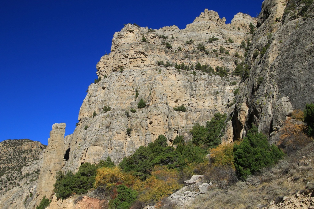
Having finished visiting the Mackay mining sites, we drove the Pass Creek Road crossing the Lost River Range. The road follows a narrow corridor carved by Pass Creek in an area with stunning rock formations.

53260436057_64d13d617e_o.jpg


53261314996_ee3dce5582_o.jpg


53261315006_354315862d_o.jpg


53261666224_f270e3c53c_o.jpg


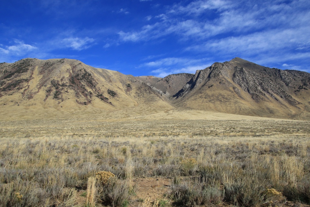
On the other side of the narrow passage, the road joins a long succession of very pretty hills before descending into the valley at the foot of the Lemhi Range.

53261314911_b6e2d76d56_o.jpg


53261796670_b6c90b5087_o.jpg


53260435962_d929525a86_o.jpg


After completing Pass Creek Road, we turned onto Little Lost River Highway and encountered a bunch of locals intrigued by our presence!

53261666154_c8a5cb4c2b_o.jpg


We finally reached the small town of Arco ID. It was the very first city powered solely by electricity generated by the EBR-1 nuclear reactor in 1951.
 
Day 41:

Starting point: Arco ID
Arrival point: Arco ID

Distance by vehicle: 222 km
Hiking distance: 2.1 km

We had a very beautiful day exploring the mountains northeast of Arco ID, under beautiful, fairly clear skies, with only a little haze at high altitude.

Our first destination of the day was the gravel road reaching the summits of Howe Peak, then Jumpoff Peak. This road is very spectacular with its rock formations whose strata approach vertical in places.

53264380555_615f742db2_o.jpg


53264195223_a0d1946733_o.jpg


53263024497_d331a30218_o.jpg


The road offers superb views at all times, including Middle Butte and East Butte which we will see more closely tomorrow.

53263024452_c964cd3b13_o.jpg


53264195168_d03658039a_o.jpg


53264255734_8814f572e1_o.jpg


53263904581_d755da4170_o.jpg


53263904531_c4d8fb3d30_o.jpg


The rocks forming these mountains appear to be of sedimentary origin, although the layers are difficult to discern. This had intrusions from another origin.

53264380465_e95aa93fbe_o.jpg


The view from Jumpoff Peak allowed us to see the agricultural fields in the Lost River Valley, as well as the end of the Lemhi Range, where our next attractions for the day were located. In particular, the alluvial fans formed by rock debris washed away during heavy precipitation.

53263904536_783332b497_o.jpg


Back in the valley, we drove a trail in Black Canyon Wilderness Study Area. To our great surprise, vehicle access is not prohibited. The trail enters the narrow canyon surrounded by steep cliffs.

53263024392_492b956387_o.jpg


53263023097_837446b023_o.jpg


53264193683_456c37307d_o.jpg


A specific rock layer, arranged almost vertically, showed particular signs of erosion.

53263023112_bc188faf17_o.jpg


As we retraced our steps, the narrowness of the passage was evident.

53264379125_420914427c_o.jpg


Then we drove another trail nearby, this one leading to Middle Canyon. The folds of the rock strata were very particular.

53264192963_07cefda622_o.jpg


Returning to the main road, we crossed one of the many canals carrying water from the mountains to the crops.

53264192968_51841abf09_o.jpg


Our last two trails formed a loop in an alluvial fan beginning with Fallert Springs Road and continuing toward Uncle Ike Creek Road. These two trails lead to canyons in which poplar trees grow, winding along the canyons.

53263022562_7159f6edd3_o.jpg


53264253544_61742ea273_o.jpg


Tomorrow we will leave Arco, approaching the buttes visible from the top of Howe Peak, then we will take some scenic drives around Idaho Falls ID.
 
Day 42:

Starting point: Arco ID
End point: Idaho Falls ID

Distance by vehicle: 426 km

Today we left Arco again under clear skies, but with intensifying winds.

Our first destination of the day was Big Southern Butte located south of Arco and which we had seen in the distance yesterday from Howe Peak. This ancient magmatic dome formed mainly of rhyolite is one of the largest mounds of its type in the world.

In order to reach the peaks, we took a very rocky track winding through a narrow canyon and climbing the steep slope. At our destination, the view stretched as far as the eye could see into the Snake River Plain, a large expanse of basalt created by numerous eruptions in the past. We can also see in the distance in the first photo the recent 6,500-year-old lava flows from Craters of the Moon National Monument.

53266858090_3ef961a58a_o.jpg


53266387401_20759d6082_o.jpg


Looking east in the distance were East Butte and Middle Buttes, the pair of buttes we had also seen yesterday.

53266387251_b23cec23a6_o.jpg


After enjoying the superb views, we began our long, slow descent.

53266858040_d11da12833_o.jpg


53266857930_02fa81a3af_o.jpg


53266736389_9c823c572b_o.jpg


After completing the descent, we decided to take another track going around the mound from the south so that we could admire it under the sun and not against the light.

53266670258_2200842cb3_o.jpg


53266857845_6fa95e1dc7_o.jpg


At one point we saw a side track joining a strange little blackened knoll. We took it and it went around a small volcanic cone. This cone was also used as a quarry to extract materials for the route we were driving. Up close, we also saw a lot of orange pumice.

53265495737_06e3b9c672_o.jpg


53266386976_68e348bac1_o.jpg


Having returned to the main track, we crossed several fields of old volcanic flows. Vegetation is gradually regaining the ground lost on the lava.

53266736224_91e31ef964_o.jpg


Further on, we got closer to East Butte and Middle Butte. East Butte is also another rhyolite dome, which explains its whitish tint.

53266736179_223ed7a164_o.jpg


Having joined the paved road, we wanted to visit the museum of the EBR-1 reactor, the first reactor used for peaceful purposes to produce electricity for Arco in 1951. Unfortunately, it is only open during the summer. We therefore continued east on route ID 22 along the mountain ranges and reached the town of Dubois ID (yes, another French-speaking name), starting point for the Lost Gold Trail Loop Scenic Byway. This road is so named because it follows the historic route used by gold prospectors to reach the deposits.

In Dubois, we saw one of the last markers formerly used to guide US Mail planes before the appearance of radio beacons. The site is made up of a 15.5 meter tower equipped with a rotating lighthouse, the original generator shed with site designator "24 SL-GF" on the roof, as well as a visual direction marker in the form of a 'an arrow with a length of 16 meters.

53265495527_9fec24a8cb_o.jpg


53266857635_31b076058a_o.jpg


Since the depletion of the region's gold deposits, the most coveted resource has been opal stones. We saw one of these mines far away in the mountains.

53265495597_fff2f56c2d_o.jpg


At the east end of the loop we saw one of the mountains we will approach tomorrow on a big loop north of Idaho Falls.

53266857555_7a3668099d_o.jpg


Tomorrow will be our last day in Idaho. We still have some interesting things to see before going back home.
 
Last edited:
Day 43:

Starting point: Idaho Falls ID
End point: Idaho Falls ID

Distance by vehicle: 524 km
Hiking distance: 2.3 km

Today we drove several scenic drives northeast of Idaho Falls. We saw a succession of very varied landscapes, ranging from sand dunes, lava fields, forests, alpine peaks, meadows, waterfalls, canyons. And all this under almost always clear skies.

Our first scenic drive was the Fort Henry Historic Byway. The road is named in honor of the first settlement during colonization in the area. This road crosses the St. Anthony Sand Dune State Recreation Area. We traveled there in a loop formed by Black Sand Road on the south followed by White Sand Road on the north. Given the early hour, fresh animal tracks on the dunes were visible.

53269094318_c2e002578e_o.jpg


53269162709_39ccd159ff_o.jpg


Further on, we planned to drive two more trails into the large expanse of lava fields, the Civil Defense Caves Road and the Ice Caves Road. However, recent rainfall had created large pools of mud and it would have taken us ages to get through them. So we decided not to go onto them.

Continuing north, we passed large pastures, one with a large herd of sheep and a few goats. A small trailer was parked in the pasture, probably the shepherd's.

53268807041_cd9fd71899_o.jpg


53269162679_e4a9846a9a_o.jpg


Continuing on, we came across Henrys Fork Snake River, a river we crossed a few times during the day.

53269094203_3ca5089efe_o.jpg


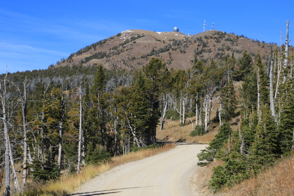
Also visible in the previous photo is the high summit of Sawtell Peak, our next destination, reached by a very good forest road.

53267913627_5b883f1570_o.jpg


53269162449_ba4513aac8_o.jpg


This peak is located on the edge of the immense Island Park Caldera, an ancient crater of a volcano that erupted more than a million years ago. This caldera, measuring 80 km by 65 km, is one of the largest in the world. Even from the top of Sawtell Peak, it was difficult to imagine the size of this caldera. We were then about 40 kilometers from Yellowstone National Park, containing another caldera of the same volcanic complex.

53269275890_d65e648628_o.jpg


53267913417_feefd540d3_o.jpg


Far to the southeast on the other side of the caldera could be seen the Teton Range, the youngest mountain range of the Rocky Mountains. In particular, the three peaks of the Grand Tetons, so named by French trappers lacking some affection...

53269162359_2aa3813322_o.jpg


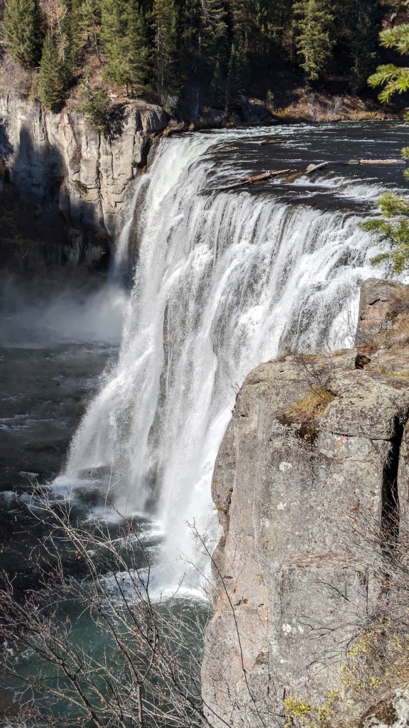
Leaving Fort Henry Historic Byway, we traveled along the Mesa Falls Scenic Byway. We stopped to see Upper Mesa Falls. Particularly, the rocks further away are of a different nature from those under the falls being very hard basalt. This testifies that the relief was created, then eroded and subsequently filled again by eruptions.

53269094043_180e141f19_o.jpg


53269162269_323927de83_o.jpg


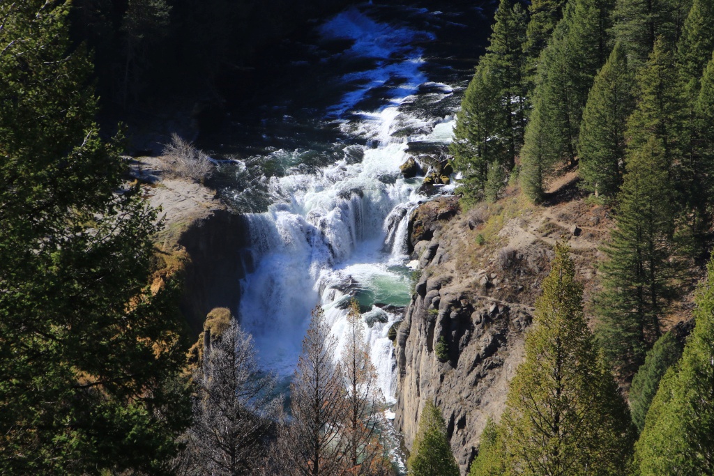
A little further south, we made another stop to see Lower Mesa Falls, from a much more distant viewpoint.

53269162289_67bcf22677_o.jpg


Finishing the Mesa Falls Scenic Byway, we continued on another scenic route, the Teton Scenic Byway, the star of which was obviously the Teton Range. This road runs through a lower altitude and is a very agricultural area.

53267913277_18f6849508_o.jpg


53267913282_94507fa66a_o.jpg


Today was our last day exploring Idaho. Tomorrow, we will head further east, slowly beginning our return toward home. We are still evaluating our options because one of the main attractions that we had planned is a forest road climbing to more than 2800 meters and which we cannot confirm if it is still passable given the presence of snow at 2200 meters today. One thing is certain, we want to avoid interstates as much as possible by taking secondary roads instead.

 
Day 44:

Starting point: Idaho Falls ID
End point: Pinedale WY

Distance driven: 431 km
Distance hiked: 3.9 km

We completed our visit to Idaho by deviating a little from the planned itinerary. Leaving Idaho Falls, we instead took a route we had never traveled, this one joining Palisade Dam and Palisade Reservoir. Like many other reservoirs we saw during the trip, the level of this one was very low.

53271385744_1020c96d0f_o.jpg


We then reached Wyoming and the small town of Alpine and continued on the road circulating in Hoback Canyon, once again following the Snake River. We made a stop at Kahuna Overlook. One of the two short trails joins the banks of the river. The river continues its eroding action, clearly visible by the patterns in the volcanic rock.

53271028951_7253dbd526_o.jpg


53271314568_2e66815b65_o.jpg


Further down the road, a viewpoint showed pretty colors of the tilted rock layers.

53271385694_e237e84f8e_o.jpg


After reaching Hoback Junction, we once again deviated from our planned route. We planned to drive the main road of Grand Teton National Park and then head east towards Dubois WY and take Union Pass Road south to Pinedale WY. However, Union Pass joins a plateau at high altitude and we could not confirm that it was passable given the snowfall of recent weeks. We opted instead to drive the southern segment near Pinedale, avoiding a very long detour if the road had been closed.

After starting Union Pass Road, we noticed that the road was only going to reach the high mountains very far away. In addition, the road was in very poor condition and our progress was quite slow. We turned around and reached an intersection we had also planned that runs along the Green River. We know this river well which joins the Colorado River in the Island in the Sky sector of Canyonlands National Park.

Along the road, we made a stop to see a unique habitat housing a species of small Kendall Dace fish whose species is on the endangered species list because they are only found in this spring, the Kendall Warm Spring. We saw these small fish whose maximum size is only 5 centimeters as adults, but they are much too agitated to be photographed properly!

53271385679_b45e3714d5_o.jpg


The Green River sometimes strayed into large areas, winding between multiple islets.

53270135627_633873f6b7_o.jpg


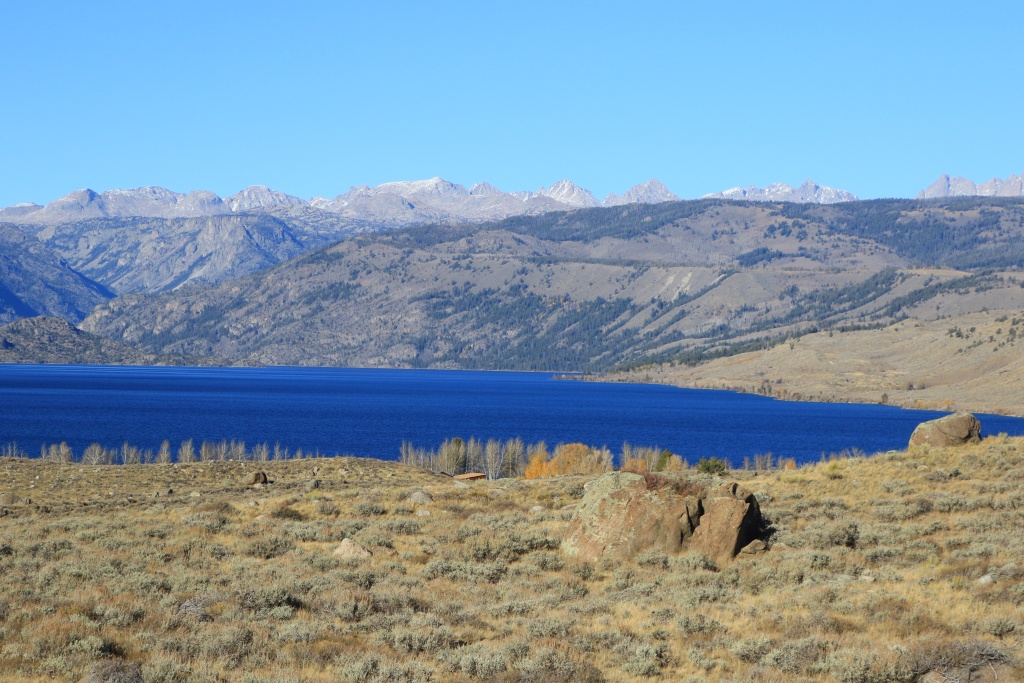
As the road made a long curve to the southeast, the tall snow-capped mountains of the Wind River Range finally came into view, as the Green River diminished in flow.

53270135697_c2cd78bbd9_o.jpg


53271385659_fda40102de_o.jpg


53271385639_a99ecba6bd_o.jpg


We finally reached the end of the road on the bank of Lower Green River Lake. The river continues at its end to join Upper Green River Lake, the source of Green River.

53271028841_e7c91899fa_o.jpg


53271314503_e81d22da52_o.jpg


53271314493_8af349ae70_o.jpg


As it was already getting late, we enjoyed the place and then began our return, without hiking along the banks of the lake. Maybe next time.

Back on the paved road, the high peaks of the Wind River Range played hide and seek behind closer hills. The high peaks region makes up the Wind River Wilderness, a protected area accessible by very long trails that can be traveled by non-mechanized means, either by horse or on foot.

53271314453_51deb40eea_o.jpg


Arriving in Pinedale, we drove the Skyline Drive, a road climbing the hills at the base of the Wind River Range. We made a short stop at Fremont Lake Overlook.

53271314458_8ca1c21b8f_o.jpg


The last segment of the road was undergoing major repair work and access had to be done with an escort vehicle after a long delay. A signaller who knew the area well informed us that the view was not better given the presence of many trees. So we turned around.

Tomorrow, we will deviate again from the established route when we had planned to do a very long hike starting from the top of Skyline Drive but the work zone and the delays involved, as well as the snow on the ground discouraged us. We will leave Pinedale and continue our slow progression toward the east, taking the time to visit Wyoming a little more.
 
Day 45:

Starting point: Pinedale WY
End point: Casper WY

Distance by vehicle: 715 km

We continued our return towards the house while sightseeing a bit. We still had a long journey because leaving Pinedale, we had to go around to the south of the Wind River Range mountains. These must have appeared like a long impassable wall to the pioneers setting out to discover the west. We took a slight detour to Eden Valley Reservoir.

53273851115_c8581a3609_o.jpg


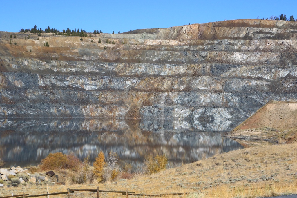
Continuing, we reached the mountains of Shoshone National Forest and saw the old Iron Mountain mine.

53273666878_e8204e0e89_o.jpg


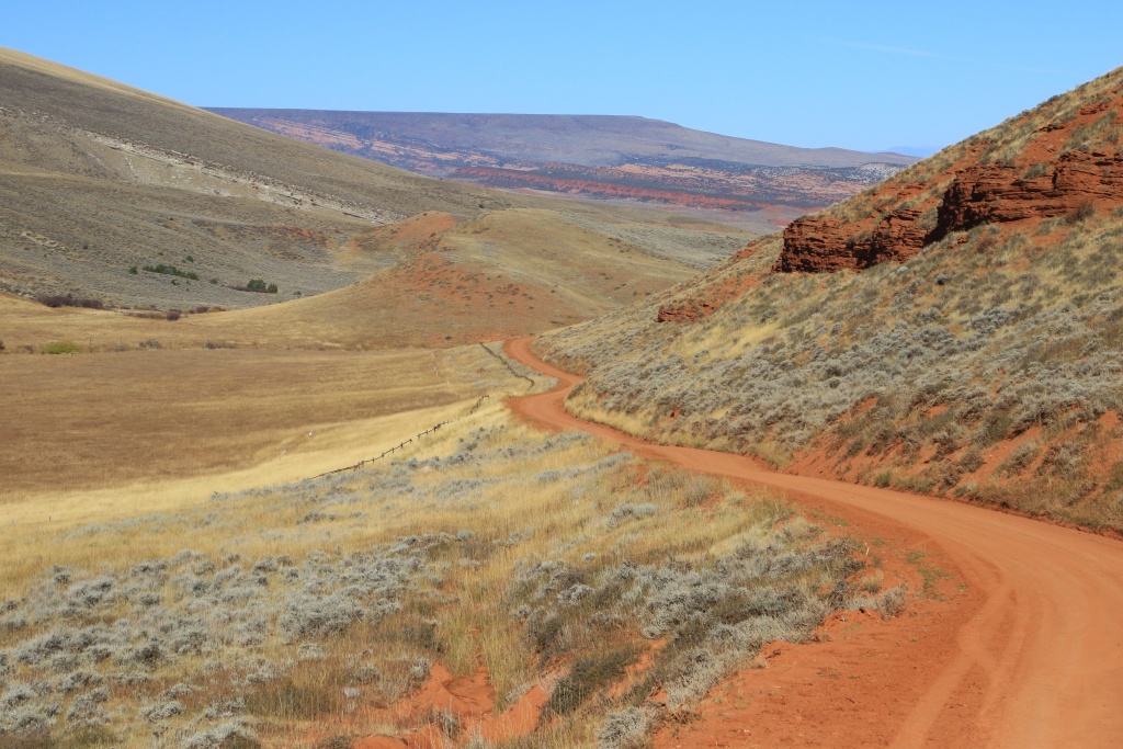
Continuing, we reach the Red Canyon Road. We had spotted this one during a previous trip and it was a bit by chance that we came across it today. As the conditions were ideal, we drove it. Even if it is a dirt road, by luck, it has been freshly graded.

53273740399_dd6fd4ed9f_o.jpg


53273666853_2a0b654d58_o.jpg


53273851095_e72bfbfb04_o.jpg


Further on, we took another detour to go along the Wind River Canyon Scenic Byway. At first, the road runs alongside Boysen Reservoir. In the distance, the Wind River Range bid us a final goodbye.

53273386961_781f3917f3_o.jpg


53273666838_e9515b3670_o.jpg


53272495577_3757804bf5_o.jpg


Then, the road enters the narrow canyon carved out by the Bighorn River. The road runs through the canyon on the east bank, while a railway runs on the opposite bank.

53272495547_8792e9783c_o.jpg


53273666808_9f8e5fd833_o.jpg


53272495522_07947597a1_o.jpg


The Wind River Canyon Scenic Byway ends at the town of Thermopolis. At this location, Hot Springs State Park protects the largest hot spring in the world with a daily flow of more than 11 million liters of water at a temperature of 57C. The spring emerges from the hills then joins three pools and the overflow flows to the river creating limestone formations somewhat similar to Mammoth Hot Springs in Yellowstone National Park.

53273386836_5ea894631c_o.jpg


53273666758_8229c94918_o.jpg


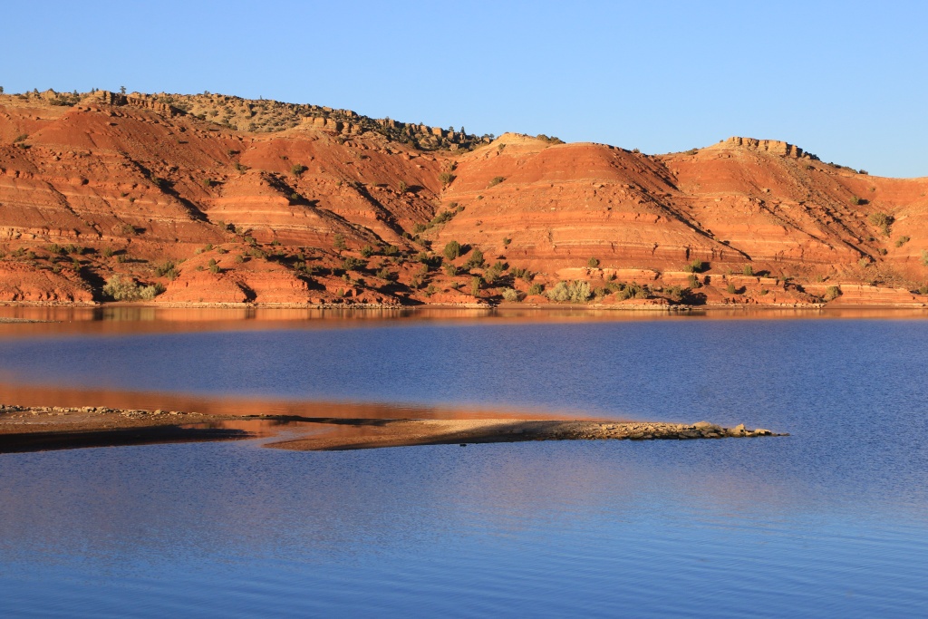
We then traveled Wind River Canyon SB in reverse and then made a final detour to Alcova Reservoir near Casper WY. This one is located in a very photogenic place with beautiful cliffs of a bright orange-red under the setting sun. Due to lack of time, we only traveled the road on the west bank.

53273850980_92b929116f_o.jpg


53272495462_ce058d9f8b_o.jpg


Tomorrow, unsurprisingly, we will continue our return. Once again, we will avoid the interstates by traveling successively on two other scenic byways. We don't really know what to expect from them and will explore at random.
 
Day 46:

Starting Point: Casper WY
End point: Vermillion SD
States traveled: Wyoming, Nebraska, South Dakota

Distance by vehicle: 879 km

Today we continued our long return home, avoiding the interstates as much as possible. The sky was still practically cloudless and the temperature rose to 19C.

Leaving Casper, Wyoming, we took US 20 to reach the border with Nebraska. We made stops at several historical markers along the route to learn a little more about the history of the area. One of these markers dealt with the tanks scattered along the old steam train routes to refuel the locomotives along the way. There would only be six remaining in the entire country, including this one located in Lusk.

53275538596_3bd63ab85d_o.jpg


Just before reaching the border with Nebraska, the somewhat monotonous hilly landscape was embellished with rock mounds formed from volcanic ash. Four days ago, while we were near the large calderas near Sawtell Peak, we read that large eruptions had covered a very large area stretching as far as St. Louis, Missouri with a thick layer of ash. It is very likely that the mounds were formed in this layer.

53274643697_81cbe79ac7_o.jpg


53276004030_44b4e8057e_o.jpg


After reaching Nebraska, we continued on US 20, designated as the Bridges to Hills Scenic Byway. The terrain became a little more rugged a little east of Harrison.

53276004035_46577871db_o.jpg


53276004010_c80a284a10_o.jpg


53275889624_03911617ab_o.jpg


53274643667_d83155c191_o.jpg


We also passed Fort Robinson State Park which we noted as a place to visit for a future trip.

All the way down Bridges to Hills SB we were wondering the reason for the name of the road. Arriving at the end of the road in Valentine, we continued a little further on US 20 and finally got our explanation. Three parallel bridges span the Niobrara River; the historic Bryan Bridge in metal structure dating from 1932 (see next photo), a modern steel and concrete bridge, and a high wooden railway bridge.

53275889619_c34e1437af_o.jpg


Next, we reached the west end of another scenic drive, the Outlaw Trail Scenic Byway. This long road runs along the border with South Dakota. It does not offer very notable scenery except near Niobrara State Park where it runs between portions of marshland.

Unfortunately, there was no daylight and we were unable to take photos. We had taken too long in the morning on the other scenic route and on top of that we changed time zones, losing an hour. We are now in Central Daylight Time, one hour behind Montreal.

We finally reached Vermillion in South Dakota. Tomorrow we will complete the Outlaw Trail SB before taking the interstates to speed up our return a little.
 
Day 47:

Starting Point: Vermillion SD
Stopping Point: Bourbonnais IL
States traveled: South Dakota, Nebraska, Iowa, Illinois

Distance by vehicle: 885 km

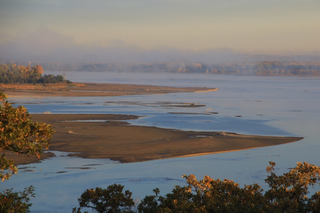
Today we started the day with a brief stop at the Mulberry Bend Overlook in Missouri National Recreation River Park as the sun was just coming up. The morning mist began to slowly dissipate.

53278497039_66bb932e12_o.jpg


53278497034_c17e8b95dd_o.jpg


Then, we joined and completed the Outlaw Trail Scenic Byway started yesterday, frankly more beautiful during the day than at night!!!

After reaching Sioux Falls, our GPS suggested we take US 20 rather than I-80. We did well because US 20 is a divided road with two lanes in each direction. It runs on the top of an entirely cultivated plateau. The view was beautiful, and very few trucks used it.

We finally joined I-80 still with little traffic, except towards the end of the afternoon approaching the Chicago area. As we wanted to avoid today's traffic, but especially tomorrow's, Monday, we decided to stop a little further south of Chicago, a good distance from I-80.
 
Day 48:

Starting point: Bourbonnais IL
End point: Erie PA
States traveled: Illinois, Indiana, Ohio, Pennsylvania

Vehicle distance: 778 km

Today, we continued our return journey, mainly taking the interstates under an almost cloudless sky. The vegetation, so different during the trip, begins to resemble that of the Montreal region, although we imagine that the leaves still present in the trees have probably already fallen at home.

Somewhere this morning, we also reached the eastern time zone, that of Montreal.

As we reached Pennsylvania, we left the highway to travel the Great Lakes Seaway Trail Scenic Byway, a road that sort of runs along Lake Erie south shore. However, it unfortunately remains out of sight the majority of the time due to vegetation.

We took a detour to go along the road to the Presque Isle State Park located on a peninsula. This park offers several piers for fishing as well as numerous beaches. An unusual fact was the presence of floating houses in one of the bays.

53280927851_9ebe59a71a_o.jpg


53280946091_298fe2aab6_o.jpg


We are in Erie, Pennsylvania for the last night of the trip. Tomorrow afternoon, we will return to our usual routine until the next adventure!
 
We finally arrived home without any problems. Queue of only two vehicles at customs on I-81, then a long line of trucks on ON 401, several passing at the same speed as the one in the right lane.

It was a very beautiful trip, diverse and somewhat different from the many we have done in the American southwest. Idaho turned out to be a very beautiful destination with a lot to offer. It is a destination to discover that we recommend without hesitation.

While waiting for the next trip, in March or April to see the total solar eclipse, we have a lot of photo classification to do, and a little maintenance to do on the 4Runner.

Thank you to everyone who followed us during this adventure, and see you next time!

Starting point: Erie PA
Endpoint: Montreal QC
States/provinces traveled: Pennsylvania, New York, Ontario, Quebec

Distance driven: 758 km
 
I always enjoy following along. Thanks for sharing! I've definitely made note of a few of these locations that I would love to visit.

Thanks for following us! Idaho proved to be a really great destination with a lot of variety. Landscapes and fauna were spectacular, every day bringing a new discovery.

On the off-road side, there was an interesting mix of trails from easy gravel roads to really rocky ones which were really hard on tires by looking at the incredible number of cuts on them.

On the hiking side, it is bad that I had some issues with altitude. I am not surprised since we live at about 34 meters above sea level!
 
2023-09 Western Canada, Idaho trip recap

Oops! Time is flying so fast... I completely forgotten to post my usual trip recapt. Here it is finally!


Highlights:

- Great trip in a spectacular region relatively new for us;
- Nice weather not impacting too much our activities;
- The presence of many hunters made us uncomfortable sometimes to go hiking off trails;


Statistics:

Trip duration: 49 days

Provinces visited: Ontario, Manitoba, Saskatchewan, Alberta, British Columbia
States visited: Idaho, Montana, Washington, Oregon, Wyoming, Nebraska, Pennsylvania
Pictures taken (mostly using 3 shots exposure bracketing): 15035 / 74.5 GB

Distance driven (real): 20459 km (12713 miles)

Fuel used: 2713 liters (717 US gallons)
Consumption disp: 13.8 l/100 km (17.0 mi/US gal)
Consumption real: 13.3 l/100 km (17.7 mi/US gal)

Ontario:

- Parks/Monuments/Forests visited:
  • Pukaskwa NP
  • Thunder Bay Area: Marina Park
  • Thunder Bay Area: Terry Fox Memorial
Manitoba:

- Parks/Monuments/Forests visited:
  • Winnipeg Area: Assiniboine Park
Saskatchewan:

- Parks/Monuments/Forests visited:
  • Grasslands NP
- Off-Road trails driven:
  • Grasslands NP: West Block, Ecotour Scenic Drive
  • Grasslands NP: West Block, Backcountry Loop
Alberta:

- Parks/Monuments/Forests visited:
  • Writing-On-Stone PP
  • Waterton Lakes NP
- Off-Road trails driven:
  • Waterton Lakes NP: Bison Paddock Loop
- Scenic Roads driven:
  • Crownest Pass Hwy
  • Waterton Lakes NP: Akamina Parkway
  • Waterton Lakes NP: Chief Mountain Hwy
  • Waterton Lakes NP: Entrance Parkway
  • Waterton Lakes NP: Red Rock Parkway
British Columbia:

- Parks/Monuments/Forests visited:
  • Hosmer Area: Coal Mines Provincial Heritage Site
- Scenic Roads driven:
  • Hot Springs Circle Route (partial)
Idaho:

- Parks/Monuments/Forests visited:
  • Bitterroot NF
  • Boise NF
  • Caribou-Targhee NF
  • Coeur d'Alene WMA
  • Crater of the Moon NM
  • Dworshak NFH
  • Harriman WR
  • Idaho Panhandle NF
  • Kootenai NWR
  • Land of the Yankee Fork SP
  • Lucky Peak Lake RA
  • Nez Perce NHP (many locations)
  • Nez Perce-Clearwater NF
  • Payette NF
  • Pend Oreille WMA
  • Proctor Mountain Chairlift NHP
  • Salmon-Challis NF
  • Sandpoint: Sandpoint Beach Park
  • Sawtooth NF
  • St. Anthony Sand Dunes SRA
- Off-Road trails driven:
  • Arco Area: Big Southern Butte Road
  • Arco Area: Big Southern Butte Lookout Road
  • Bitterroot NF: Magruder Corridor Road
  • Boise NF: James Creek-Rocky Bar Road
  • Boise NF: Middle Fork Road
  • Boise NF: Prairie Road
  • Boise NF: West Blacks Creek Road
  • Challis Area: Bradshaw Basin Road
  • Challis Area: Little Bradshaw Basin East Overlook Road
  • Challis Area: Little Bradshaw Basin South Overlook Road
  • Challis Area: Malm Gulch Road
  • Challis Area: Pennal Gulch Road
  • Challis Area: Road Creek Road
  • Challis Area: Spar Canyon Road
  • Challis Area: Walker Way Road
  • Caribou-Targhee NF: Quartzsite-Sawmill Canyon Road
  • Howe Area: Black Canyon WSA Road
  • Howe Area: East Canyon Road
  • Howe Area: Fallert Springs Road
  • Howe Area: Fallert Springs-Uncle Ike Road
  • Howe Area: Middle Canyon Road
  • Howe Area: Saddle Mountain Viewpoint Road
  • Howe Area: Uncle Ike Creek Road
  • Idaho Panhandle NF: Loop Creek Road
  • Idaho Panhandle NF: Moon Pass-North Fork St. Joe Road
  • Idaho Panhandle NF: Rainy Creek-Cliff Creek Road
  • Nez Perce-Clearwater NF: Burnt Knob Lookout Road
  • Nez Perce-Clearwater NF: Chair Point Lookout Road
  • Nez Perce-Clearwater NF: Magruder Corridor Road
  • Nez Perce-Clearwater NF: Seven Devils Road
  • Pahsimeroi Valley Road
  • Payette NF: Black Lake Road
  • Payette NF: Burgdorf Road
  • Payette NF: Goose Lake Road
  • Payette NF: Kleinschmidt Grade Road
  • Payette NF: Landore Road
  • Payette NF: Lick Creek Road
  • Payette NF: Sheep Rock Road
  • Payette NF: Smith Knob Lookout Road
  • Payette NF: South Fork Salmon River Road
  • Payette NF: Warren Wagon Road
  • Payette NF: Warren-Profile Gap Road
  • Salmon-Challis NF: Allison Creek Road
  • Salmon-Challis NF: Bayhorse Creek Road
  • Salmon-Challis NF: Beaver Creek Road
  • Salmon-Challis NF: Birch Springs Road
  • Salmon-Challis NF: Custer Motorway Adventure Road
  • Salmon-Challis NF: Custer Road
  • Salmon-Challis NF: Doublespring Pass Road
  • Salmon-Challis NF: Feltham Peak Road
  • Salmon-Challis NF: Horseheaven Pass Road
  • Salmon-Challis NF: Howe-Jumpoff Peaks Road
  • Salmon-Challis NF: Indian Springs Road
  • Salmon-Challis NF: Leaton Gulch Road
  • Salmon-Challis NF: Lewis and Clark BCB
  • Salmon-Challis MF: Lime Creek-Grouse Creek Road
  • Salmon-Challis NF: Mackay Mine Hill Tour
  • Salmon-Challis NF: Pass Creek Road
  • Salmon-Challis NF: Pinyon Peak Loop Road
  • Salmon-Challis NF: Rio Grande Road
  • Salmon-Challis NF: Spud Basin Road
  • Salmon-Challis NF: Trail Creek Road
  • Salmon-Challis NF: Twin Peaks Road
  • Salmon-Challis NF: Upper Pahsimeroi Road
  • Salmon-Challis NF: Yankee Fork Road
  • Sawtooth NF: Bald Mountain Road
  • Sawtooth NF: Nip and Tuck Road
  • Sawtooth NF: Railroad Ridge Road
  • Sawtooth NF: Smiley Creek Road
  • Wallowa-Whitman NF: Pittsburg Road
- Scenic Roads driven:
  • Boise NF: Warm Lake Road
  • Fort Henry HB
  • Lake Coeur d'Alene SB
  • Lost Gold Trails Loop SB
  • Mesa Falls SB
  • Northwest Passage SB
  • Panhandle Historic Rivers Passage SB
  • Payette River SB
  • Peaks to Craters SB
  • Pend Oreille SB
  • Ponderosa Pine SB
  • Sacajawea HB
  • Salmon River SB
  • Sawtooth SB
  • St. Joe River SB
  • Teton SB
  • White Pine SB
  • Wild Horse Trail SB
  • Wildlife Canyon SB
Montana:

- Parks/Monuments/Forests visited:
  • Kootenai NF
  • Lolo NF
Washington:

- Off-Road trails driven:
  • Asotin Area: Couse Creek Road
Oregon:

- Parks/Monuments/Forests visited:
  • Wallowa-Whitman NF
- Off-Road trails driven:
  • Inmaha Area: Johnson Lane-Camp Creek Road
  • Wallowa-Whitman NF: Dug Bar Road
  • Wallowa-Whitman NF: FR46 Road
  • Wallowa-Whitman NF: Hat Point Road
- Scenic Roads driven:
  • Hells Canyon SB
Wyoming:

- Parks/Monuments/Forests visited:
  • Boysen SP
  • Bridger-Teton NF
- Off-Road trails driven:
  • Bridger-Teton NF: Green River Lakes Road
  • Bridger-Teton NF: Union Pass Road
  • Lander Area: Red Canyon Road
- Scenic Roads driven:
  • Bridger-Teton NF: Skyline Drive
  • Wind River Canyon SB
Nebraska:

- Parks/Monuments/Forests visited:
  • Fort Niobrara NWR
  • Fort Robinson SP
  • Missouri NRR
- Scenic Roads driven:
  • Bridges to Buttes SB
  • Outlaw Trail SB
Pennsylvania:

- Parks/Monuments/Forests visited:
  • Presque Isle SP
- Scenic Roads driven:
  • Great Lakes Seaway Trail SB

In conclusion, it was a very enjoyable trip in a lesser known region. We crossed this region a few times during previous trips, but never took the time to explore deeper. Idaho proved to be a spectacular destination away from the crowds. For sure, we are not done with Idaho and the Pacific Northwest yet. We will be back in a near future.
.
 
Upcoming Utah trip

After a few months at home and a relatively quiet holiday season, we are ready to hit the road again for another adventure in Uncle Sam country.

Some will say that we are not very original, but we remained hungry after returning from our last winter trip, during which the very inclement weather allowed us to accomplish less than 40% of the activities we had planned. We therefore had a feeling of an unfinished business and the decision to return there was obvious.

Our trip, expected to last 7 weeks, will take us mainly to Utah, after a brief stop in New Mexico.

On our return, we should cross the path of the total solar eclipse of April 8. Although it crosses the extreme southeast of Quebec, I have no confidence in the weather in Quebec, which is too often gloomy during such events. Hopefully the far northeast of Texas will be more suitable, because that's the place we chose to observe it, far from big cities.

Stay tuned because the planned departure date is February 21!
​.
 
Day 1:

Starting point: Montreal QC
End point: Stauton VA

States/provinces traveled: Quebec, Ontario, New York, Pennsylvania, Maryland, West Virginia, Virginia

Distance driven: 1110 km

As planned, we hit the road early this morning for a whole new adventure. As usual, we crossed the border in the Thousand Islands region. At the border, we were all alone, having the choice between two gates just for us! Then we spent the rest of the day on the I-81.

The weather conditions were perfect, with a meager -11C at the start, but a very comfortable +11C at the end of the afternoon. We were finally able to leave the snow behind as we crossed into West Virginia.

Tomorrow we will continue southwest on I-81 to join I-40 due west.
 
Day 2:

Starting Point: Stauton VA
End point: Memphis TN

States traveled: Virginia, Tennessee

Distance traveled by vehicle: 1115 km

We continued our route by completing the I-81, then continued onto the I-40 which would take us to our destination in three days.

The variable sky of the morning became completely cloudy and we also had a few light showers without much consequence.

However, we have a concern regarding the 4Runner's fuel consumption which seems abnormally higher than usual. We changed retailers and grades of gasoline to see if that had an impact. Not really. Other basic points like air filter seems ok. I also checked with my OBD II diagnostic tool and no error codes were reported. We will readjust the tire pressure tomorrow morning before taking the road again.

We'll see if we go to a Toyota dealership for checks. On the other hand, we are approaching the weekend and that could complicate things.
.
 
Day 3:

Starting Point: Memphis TN
Ending Point: Shamrock TX

States traveled: Tennessee, Arkansas, Oklahoma, Texas

Distance traveled by vehicle: 1035 km

Before hitting the road again, we took some time to increase the tire pressure, hoping to resolve the overconsumption problem. Leaving the house in the dead of winter, we usually inflate the tires to a slightly lower pressure, in case we encounter snowfall in upstate New York near the Great Lakes.

Then we continued on westbound Interstate I-40. We were slowed down a few times but without much consequence. An accident caused us to lose about 15 minutes in Oklahoma City. We reached Shamrock in Texas a little before 6:00 p.m.

Tomorrow, we will reach New Mexico, the first tourist destination of the trip. We always plan for two unforeseen days when we move west. If no problems arise, as was the case, we have two more days of visits!!! So we need to plan what we will do.
.
 
Day 4:

Stating point: Shamrock TX
End point: Farmington NM

State travelled: Texas, New Mexico

Distance driven: 937 km
Distance hiked: 2.3 km

We left our hotel at sunrise, very happy to experience this last day of travel to reach our favorite playground, the American Southwest. Thus, we completed the crossing of Texas and reached New Mexico.

After a little over four hours on the endless I-40, we left it to finally reach our first attraction of the trip, the Pecos National Historic Park. This site protects the ruins of an ancient village of the Ancestral Puebloans, as well as that of a church built by the Spanish in order to assimilate them.

Very little remains of the village other than the bases of the walls. Their homes were very advanced despite the rudimentary materials used. The dwellings were up to four stories high and the village had almost 2000 inhabitants.

53550645995_954426858a_o.jpg


Very close to the ruins of the church was a restored kiva, an underground room used for the religious practices of the Ancestral Puebloans, a scene representing the cultural shock that these Native Americans suffered following the arrival of the Spanish.

53550396218_3557ba28be_o.jpg


The visitor center contains a museum exhibiting a host of objects found during archaeological excavations of the site.

53550203381_4c9d9a0466_o.jpg


We then continued north. After crossing Santa Fe without stopping there, we crossed the Abiquiu Reservoir formed by the dam of the same name. The water level is so low that the dam seems useless at present. The mountains in the distance present the colors we affect.

53549333597_f04bb22376_o.jpg


Further on, as we traveled on a high plateau, other colorful cliffs caught our eye. Although barely visible in the following photo, the traces of snow were very well present at this altitude of 2400 meters.

53550396223_4b85a2e1a8_o.jpg


We continued our journey and reached Farmington, our place of residence for the next three days. We will take advantage of these to do several hikes in order to loosen our legs which greatly need it after these four days on the road.
 
Day 5:

Starting point: Farmington NM
End point: Farmington NM

Distance driven: 297 km
Distance hiked: 5.8 km

We took advantage of the superb weather to go explore the region southeast of Farmington, made up of high plateaus with colorful canyons. The sandy roads were in relatively good condition as they are frequently used by maintenance vehicles from the oil industry which are very active in this region.

The route we had decided to take had a bridge crossing over the Largo Wash but it was closed. So we had to improvise somewhat by taking a slightly more picturesque secondary trail.

53551645947_923f824357_o.jpg


53552503031_e83b4049b9_o.jpg


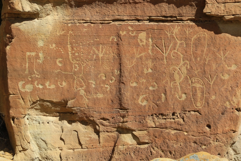
Our first destination of the day was the Crow Canyon Archaeological District preserving several ruins of Ancestral Puebloans which also produced numerous petroglyphs. We hiked there three trails in Crow Canyon.

53552842654_8b35e1070c_o.jpg


The first hike was to 44 Panel, a set of petroglyphs including one resembling the number 44. Another illustrated a bowhunting scene.

53552503036_a65737f919_o.jpg


53552702558_64172ccea2_o.jpg


The second hike led to Big Warrior Panel, which featured, as the name suggests, a large warrior as well as several other smaller but very well defined petroglyphs.

53552502806_65a85d7b9c_o.jpg


53552842414_dd293ba47b_o.jpg


53551645682_fe88518eb3_o.jpg


53552502566_caf51b20a5_o.jpg


We then hiked the Main Panel Trail leading to several groups of petroglyphs.

53552502571_b71ae6d988_o.jpg


53552949880_1f8ccdf345_o.jpg


53552702243_655e28d7fb_o.jpg


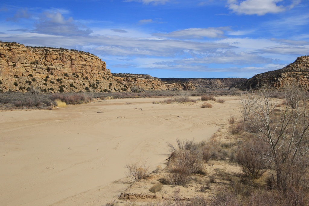
After these three hikes, we took the road again to reach the paved road via a road further south. We then followed the large dry creek called Largo Wash.

53552502191_2cfd8d4a3c_o.jpg


We encountered a few closed fences, no trespassing signs, and secondary roads too less used. We finally managed to reach another main road. We had a surprise which could have been unfortunate because a small bump in the road masked a large muddy pool about 10 meters long. We wouldn't have had enough time to stop without entering this one. In summary: we go for it or we get stuck! So, let's go!!! We passed with a large splash covering the entire windshield.

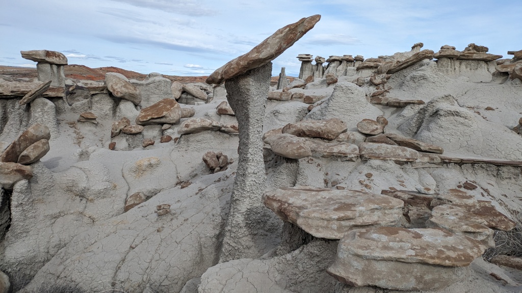
We continued and reached our second attraction of the day, the hoodoo area located a little east of Valley of Dreams. We visited this place during our winter 2023 trip and Nancy ardently wanted to return. Arriving at our destination, we noticed the new beige paint of our silver 4Runner!!!

53552702038_1ae4c71bc0_o.jpg


53552841829_2ce42114d7_o.jpg


53552956394_50f6c41972_o.jpg


53551645152_1b589d55b2_o.jpg


We then returned to Farmington and gave the 4Runner a quick wash, knowing well that it would probably get dirty several more times during the trip.

Tomorrow, we will continue to explore the surrounding of Farmington.
.
 

Members online

Forum statistics

Threads
278,310
Messages
3,554,080
Members
248,016
Latest member
Advally Service

Trending content

Back
Top