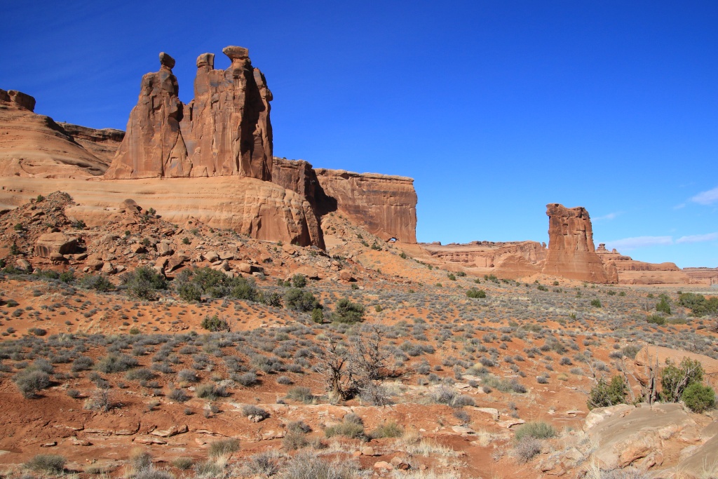
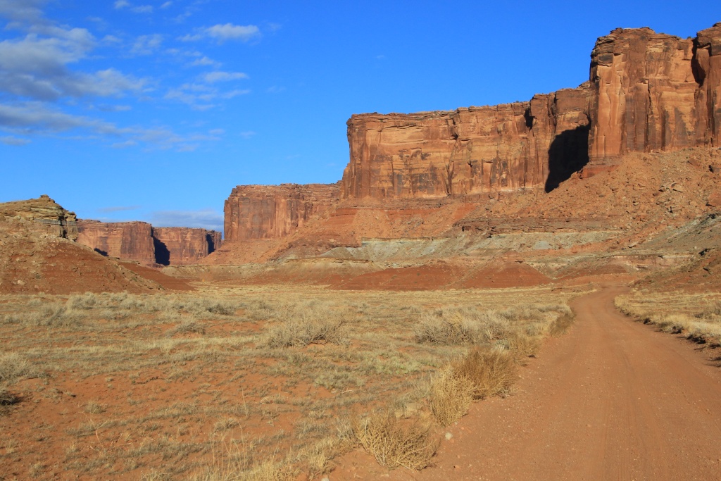
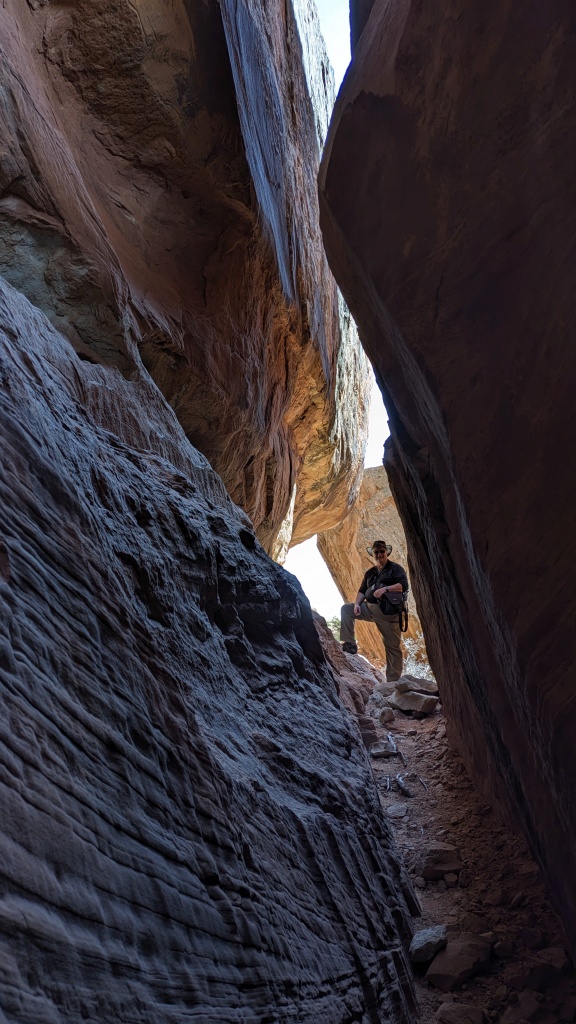
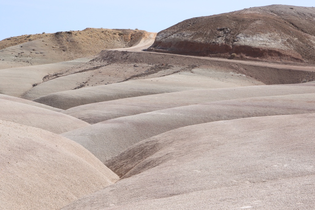
JohnTheLuck's Adventures Thread

Day 6:

Starting point: Farmington NM
Ending point: Farmington NM

Distance driven: 216 km
Distance hiked: 9.4 km

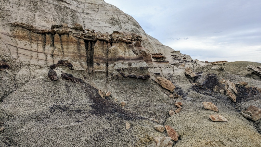
Although the weather was less beautiful than the last few days, we decided to start the day with an off-trail hike in an area called Fossil Forest. This region is made up of bentonite clay hills. The variety of colors and some hoodoos made it an interesting hike.
53555268215_f290b4490e_o.jpg


53555159049_a87c92d3ca_o.jpg


Our route made a loop starting in the plain, then climbing the bentonite clay hills, offering a superb view of the area.

53555268205_bfb502d731_o.jpg


53553968507_e4d48a36fb_o.jpg


53555022068_c6ee4c8d66_o.jpg


53555022048_172b3fe078_o.jpg


Although the name of the place refers to a forest, we saw very little petrified wood. The most beautiful specimen was this stump broken into several pieces.

53554821766_3f37bf5694_o.jpg


In order to complete the loop, we descended towards the plain on the other side of the bentonite hills. It should be noted that Nancy having moved away a little to go see the group of hoodoos visible in the following photo, she surprised a kit fox who quickly ran away, leaving no time for a photo, obviously.

53555158964_301726c8a5_o.jpg


Having completed the hike, we went to a viewpoint overlooking the De-Na-Zin sector of Bisti/De-Na-Zin Wilderness Area, another sector with very colorful badlands. This viewpoint was located on a rocky promontory sculpted by the effect of wind erosion having created curious monoliths. For the curious, last winter, we hiked in the Bisti sector. This is an area we will definitely explore in a future trip.

53554821726_8a778bcfd6_o.jpg


53555021978_fa928a3fac_o.jpg


With a little time left, we went to visit Aztec Ruins National Monument, located in the town of Aztec NM. This park protects the ruins of a very large complex built by the Ancestral Puebloans around the 1100s. It is one of the best examples of the know-how of this people. This village, located on the banks of the Animas River, was then home to around 2000 inhabitants.

A small promontory made it possible to appreciate the extent of the site.

53555158789_2cd4fedfd3_o.jpg


53555021793_91abe7bf40_o.jpg


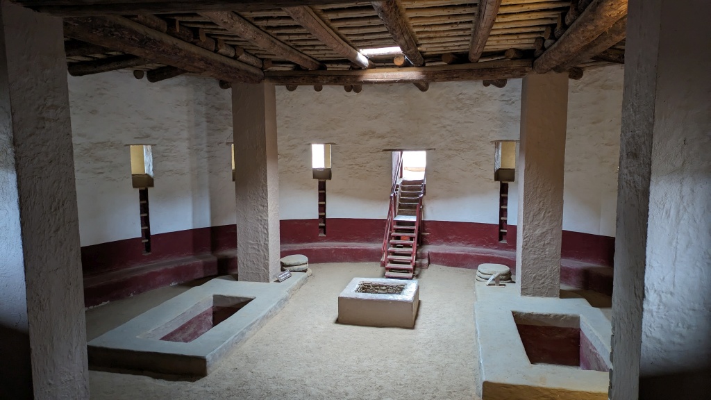
We entered the large kiva, a circular place of worship visible in the previous photo. It was rebuilt according to the construction methods of the time. The structure is impressive with its roof weighing more than 75 tonnes.
53555267905_fa93dda2ab_o.jpg


The site has a host of other kivas, without their original roofs.

53555158884_67fdc9516f_o.jpg


The route of the visit passes through a succession of rooms that served as housing or storage.

53555267955_de824bcc0e_o.jpg


Some of the rooms even had their original roofs dating back over 900 years!

53555158754_46a8081457_o.jpg


The know-how of the builders of this site was clearly evidenced by the quality of the walls, some of which contained lines of green stones.

53555021798_a38cf77ee3_o.jpg


It was a varied and busy day. Tomorrow we will leave New Mexico to reach Utah, the main destination of the trip.
 
Day 7:

Starting point: Farmington NM
Ending Point: Bluff UT
States traveled: New Mexico, Colorado, Utah

Distance driven: 303 km

We left Farmington under clouds and light showers, and still fairly strong winds. We only had a two-hour drive to reach our next destination, Bluff, Utah.

The main attraction of the day was a meeting with Mark Doiron, the renowned traveler and YouTuber (DxD Overland (Mark Doiron) - YouTube) whom we had already met in 2016. Mark inspired us to many times and provided us with numerous recommendations and indications. We wanted to spend some time with him to share our common passion for the American Southwest.

We decided to go to Muley Point in Glen Canyon NRA, which Mark had never been to before.

Along the way, we made a stop at the intersection of the US 163 and UT 261, a place where the chevron patterns of Raplee Ridge are visible.

53555926967_69659da016_o.jpg


We then climbed the impressive climb of Moki Dugway, while the temperature dropped significantly as a cloud mass passed with a few showers.

53557229050_2b6cdd4168_o.jpg


53557229010_3ed321c5a5_o.jpg


We then reached some viewpoints located at Muley Point. The deep canyon carved by the San Juan River took the central place of the landscape with the monoliths of Monument Valley in the background. What a breathtaking view!

53556775426_49934ab974_o.jpg


53556775361_96312a303d_o.jpg


53557115859_78686338f0_o.jpg


53556775336_d3b3e309a5_o.jpg


53556975543_2086763346_o.jpg


53556975508_640bec02d0_o.jpg


The following picture was taken by Mark Doiron and used with his permission; Nancy and me in front of our 4Runner, and Mark in front of his Gladiator, with Monument Valley in the distance.

53558870116_0bd07e593c_o.jpg


We then returned to Bluff for a well-deserved meal with Mark, discussing potential destinations in the region and beyond. We then said goodbye with the promise of meeting again. We had a great time. Thanks Mark, and have a good trip. We look forward to watching your videos of your current trip.
 
Last edited:
Day 8:

Starting point: Bluff UT
Ending point: Bluff UT

Distance driven: 155 km
Distance hiked: 2.3 km

We got up to a sky without any clouds, but a temperature of only -8C, fortunately without any wind. This made for a great day exploring the area around Bluff in Bears Ears National Monument. A few roads lead to viewpoints overlooking the canyon carved by the San Juan River.

53558892643_7656fa5728_o.jpg


We took a track down near the river and following the cliff. Along the way, we saw some petroglyphs and the ruins of a granary built by the Ancestral Puebloans.

53558693521_3d4b398efc_o.jpg


Further on, while we were still following the canyon cliff, we surprised a group of three horses, probably wild, because they were frightened by our approach.

53559138650_753cc4ea7a_o.jpg


All along the canyon cliff were many visible petroglyphs.

53559138630_4afc97eb11_o.jpg


After returning to the plateau, we headed to another viewpoint, this one overlooking the confluence of Lower Butler Wash Canyon and the San Juan River, with the jagged Comb Ridge as a backdrop.

53559029589_e9ff5a4611_o.jpg


53559029569_2a1fc06633_o.jpg


We had planned to hike down the canyon towards the river, but several attractions of this hike were visible from this point of view, including the ruins. So we decided not to go through it this time.

53557837652_2b84a8f5cf_o.jpg


Next, we returned near Muley Point in Glen Canyon National Recreation Area to drive a trail to several overlooks above Johns Canyon. From this location we could see Johns Canyon Road which we had traveled on our Fall 2016 trip.

53557837617_3681ba1f1a_o.jpg


We could also see on the far side of the canyon the huge rock fall that occurred a little before our 2016 trip, and which then constituted our turnaround point.

53559029524_f9e71fa96d_o.jpg


53557837597_9f2153e939_o.jpg


53559138555_4c6f0e9192_o.jpg


Then we returned to Bluff to visit the Bluff Fort Museum. The latter relates the incredible adventure of the Mormon pioneers who were sent by their religious leaders to colonize the Four Corners region. These, leaving from the town of Escalante (which we will reach in a few weeks) must have accomplished wonders in order to climb or descend steep canyons and crossed the Colorado River. They eventually settled and founded the town of Bluff. The museum offers a multitude of artifacts and reproductions of period buildings.

53557837557_fe18d0ee3f_o.jpg


Their collection even includes a wagon that took part in the legendary pioneer journey.

53558892548_065be086f9_o.jpg


53558892543_41d57b4b0c_o.jpg


We received a very warm welcome from Melodie, a Canadian volunteer working at the museum. Funny fact, six of us Canadians found ourselves in the projection room of a film recounting the epic of the pioneers. In the next photo from left to right, a visiting couple from Alberta, Melodie and her husband, also from Alberta, then Nancy and I from Quebec.

53557837542_307276432f_o.jpg


Tomorrow we will leave Bluff which we really discovered this trip to reach the off-road mecca that is Moab UT.
 
Last edited:
Day 9:

Starting point: Bluff UT
Ending point: Moab UT

Distance driven: 346 km
Distance hiked: 4.5 km

We left Bluff under a sky still bare of clouds, our heads full of good memories and promises to return.

Our first destination of the day was The Needles area of Canyonlands National Park. We had planned to do an off-road trail and an off-trail hike, activities that we had already attempted during our winter 2023 trip. The heavy snowfall during last winter made these activities impossible. Unfortunately, once again, there was still some snow and the ground was far from dry. We decided not to waste our time and turned around well before reaching the park. We will be able to do these activities later towards the end of the trip.

We instead chose to head to the Island in the Sky area, also in Canyonlands NP located very close to Moab.

Rather than take the paved road, we instead chose to re-travel the Long Canyon Road starting near the Colorado River and climbing onto the plateau where the Island in the Sky area is located. We have driven this route many times, but the views are simply spectacular. The road had probably just been maintained because it was in impeccable condition, and we had it to ourselves!

53560804034_a096105b47_o.jpg


53560673723_8b397787d9_o.jpg


Having reached the plateau, we headed towards another off-road trail on Big Flat and leading to the Malboro Point Overlook. From this tour location near Dead Horse State Park, the panorama of the canyon carved out by the Colorado River and its tributaries is incomparable.

53560804029_322d90ab23_o.jpg


53560673703_fe57b2455c_o.jpg


We finally reached the Island in the Sky visitor center to do some checks on the conditions of certain roads that we want to travel during our stay in Moab.

Next, we headed to the Aztec Butte Trail hiking trailhead. This hike climbs two hills having some ruins of buildings made by the Ancestral Puebloans. Although the hills are not that high, access to their summit is not necessarily very easy.

We hiked the trail to Aztec Butte, the farthest butte. Access is quite difficult given the presence of several steep and sometimes exposed passages, making progression quite intimidating. We can see in the next second photo a couple descending in the most difficult section.

53560476701_70792888d0_o.jpg


53560673598_82688f7562_o.jpg


On the other hand, the path ran around the edge of the mound and offered striking views.

53559618012_f67a70596b_o.jpg


We saw the ruins of a house there as well as granaries.

53560803959_4a698bc3a8_o.jpg


53559617987_efdf843f22_o.jpg


After successfully descending Aztec Butte, we came back onto the trail and climbed the first butte. Access was much easier and the butte was lower and less steep than Aztec Butte. Other granaries were also located on this mound.

53560476666_b77fa94a65_o.jpg


53560673608_b0009f3ac3_o.jpg


53560673603_a2d493300a_o.jpg


After the hike, we returned to Moab for a nice meal at Pasta Jay's, a classic for us.

Tomorrow we will explore a new area for us, traveling the western segment of the legendary White Rim Road, having secured a permit for a day visit. However, we will have to deal with increasing winds, but clear and fairly warm skies, around 19C.
 
Day 10:

Starting Point: Moab UT
End point: Moab UT

Distance driven: 245 km
Distance hiked: 2.0 km

We had another great day, mostly cloudless, but with winds becoming more intense in the afternoon.

Contrary to what we had planned yesterday, we actually went again onto the east side of the White Rim Road in Canyonlands National Park. We changed our plans because we wanted to complete the segment on the east side that we had not covered in 2016. We therefore drove without much (...) stopping in order to reach our 2016 turnaround point.

So we started a little after sunrise on the Island in the Sky road and hiked the Shafer Switchbacks, descending the cliff for almost 400 meters. As they are mostly in the shade, there was still a little snow in some places on the sides.

53562829845_8f7fbfc98d_o.jpg


Further on, we came across a herd of bighorn sheeps who did not seem very intimidated by our presence.

53562829850_cf9605e585_o.jpg


The conditions were so beautiful that we couldn't resist and made a few quick stops to enjoy the scenery.

53562707909_a3e2976909_o.jpg


After going around a rocky outcrop, the famous Washer Woman formation revealed itself to us (second peak).

53562383186_bd68e78011_o.jpg


53562829835_3d030feecd_o.jpg


Much further on, we reached Monument Basin, a canyon containing a very large number of rocky spurs. We turned around at this location in 2016.

53562383171_f5c5d6f00e_o.jpg


Continuing on the part of White Rim Road new to us, we reached the southern point of the road and took the road leading to the White Crack campsite. Its name comes from several cracks between monoliths in the whitish rock layer on which the White Rim Road runs. In the distance we could see the rocky outcrops of The Needles area of Canyonlands NP.

53562707874_fcfceff3d1_o.jpg


53562829790_449af1cb33_o.jpg


View of White Crack towards the west, the area that we would discover in the next few moments.

53562578898_2df6dd9604_o.jpg


Even further, we saw other monoliths in an adjacent canyon. Very far behind, we saw rock formations of The Maze sector of Canyonlands NP. The rocky spire is located very close to the monoliths called Chocolate Drops.

53561524047_a6eca807c0_o.jpg


Next, we set off on the western section of the White Rim Road. Unlike the canyons visible on the eastern section which are carved by secondary streams flowing into the Colorado River, the canyons visible on the western section are tributaries of the Green River. The confluence is located a little south of White Crack.

53562578878_84473f4c8e_o.jpg


We then reached the escarpment called Murphy's Hogback. The climb is very steep and single-lane with no possibility of overtaking. Additionally, it has a bend approximately halfway up making impossible to see if there are vehicles coming in the opposite direction. Priority is given to vehicles going up the slope. Try to imagine going up part of the slope backwards to give way to another part going uphill... Sick! We were blessed because we were completely alone then.

53562829735_27e5fe8d93_o.jpg


The view at the top of Murphy's Hogback is superb, with White Rim Road continuing northwest and Candlestick Tower on the left.

53562707769_b2a37d85ec_o.jpg


After hesitating whether to continue on the western section of the White Rim Road, or to turn around and return to our starting point, we opted for the latter because it offered fewer unexpected events.

So, after turning around, we made a stop just before beginning our descent of Murphy's Hogback. We can clearly see in the following photo the bend that the road makes, hiding the bottom of it. As we did not see or hear any motor vehicle, we began our descent. It was not a vehicle that we encountered, but a group of 5 or 6 cyclists climbing the slope while pushing their bikes. At the bottom, we came across two vehicles accompanying them. It's lucky that the cyclists got on before these trucks, otherwise we would have had to go back...

53562383056_5b96b37455_o.jpg


Continuing our return, we came across a remarkable young woman for a third time. She was training for an endurance race by running a loop of about 20 miles, having descended from the plateau on a trail, then taking the White Rim Road to join another trail going back up on it. Remarkable or insane?

53562578808_17ce832930_o.jpg


We finally pulled up the Shafer Switchbacks just as the sun was setting. It was a long day, but so memorable!
 
Day 11:

Starting point: Moab UT
Arrival point: Moab UT
States traveled: Utah, Colorado

Distance by vehicle: 436 km

This morning, the winds were already very strong, stirring up sand and dust. We quickly realized that hiking would definitely not be enjoyable with sand in our eyes.

We took the opportunity to do a little cleaning in the 4Runner, and especially the mess that occurred yesterday during our journey on the bumpy White Rim Road; two containers of peanuts and nuts were overturned and opened, spilling their contents into the rear and being crushed by the movements of the luggage. In short, a great waste which deprives us of part of our reserves.

Then, as we had decided to go for a "little" drive, we went south to see the La Sal Mountains up close with their snow-capped peaks, hoping to escape the winds a little. As these mainly came from the south, we were able to benefit from beautiful sunshine. We started on Pole Canyon Road.

53564580635_131cd08cc2_o.jpg


Then we went to a promontory where communications towers are installed. From this point of view we were able to appreciate the whole region, including the Island in the Sky sector of Canyonlands NP which we passed from the south on the White Rim Road yesterday, visible on the horizon on the far left.

53564462929_8bd037ffd4_o.jpg


53564333118_2723076547_o.jpg


We then connect to the Black Ridge Road, winding around the base of the La Sal Mountains passing several canyons and through beautiful golden-colored meadows.

53564333093_92d201346a_o.jpg


We finally reached the UT 46 route that we had attempted to travel last winter, and which was one of our many failures of this trip, the snow becoming too intense. This year, the only obstacle we encountered was rather picturesque, a convoy of cows led by cowboys on horseback.

53564580625_3e5520d123_o.jpg


We continued on UT 46 to eventually reach Colorado and the CO 90 road running through Lion Canyon. Further on, we turned off the paved road onto the River Road, taking one last look at the La Sal Mountains in the distance.

53564580585_fa79ae952c_o.jpg


53564580615_36516bf0f2_o.jpg


The Dolores River has carved a deep, narrow canyon through which River Road runs.

53563286277_520861eee4_o.jpg


53564144501_85b051c1d5_o.jpg


At one point, we spotted strange structures high up the canyon walls. We saw a sign informing us about their nature. The Hanging Flumes are canals built in wood in 1888 to transport river water by gravity to gold refining facilities. A short section has been restored to show how it was built then.

53563286242_b8de174eda_o.jpg


53563286222_d8b430a2b0_o.jpg


Further north, other remains of old gold mines were visible on the heights.

53564462799_c9c7392211_o.jpg


53564144396_339219d33a_o.jpg


We finally reached the paved route CO 141, the Unaweep/Tabeguache Scenic and Historic Byway. We stopped at a viewpoint overlooking the Hanging Flumes.

53564144461_3ef37171c6_o.jpg


53564144446_757a0bec63_o.jpg


This road is very spectacular and crosses areas formed by reddish sandstone rocks and multicolored bentonite clay. In the distance in the next photo, the start of the Rimrocker Road allowing reaching Moab via the mountains and canyons, without using paved roads. For another time because this one is too high for the current season.

53563286162_8e4d255aa3_o.jpg


Nearby, we saw a small kiln, an oven formerly used to make charcoal by incomplete combustion of wood due to a lack of oxygen.

53564144421_4a91ca5ebc_o.jpg


We climbed the slope of Rimrocker Road for a bird's eye view of the Dolores River Valley.

53564332923_fbc83698d9_o.jpg


Continuing on the Unaweep/Tabeguache Scenic and Historic Byway, we climbed higher into the mountains and saw the ruins of Driggs Mansion, where the sandstone rocks had given way to metamorphic rocks with beautiful stripes.

53564580455_301800e62e_o.jpg


Having completed the Scenic Byway, we reached Grand Junction CO, then took I-70 to Utah and UT 128, the Upper Colorado River Scenic Byway. This road is very spectacular, but today offered an unusual sight. The strong winds kicked up so much dust that the Castle Valley monoliths were lost at times.

53564332878_de56283d12_o.jpg


For an unplanned day that was shaping up to be rather lousy, we found that we managed to have a very pleasant day with some great discoveries.
 
Day 12:

Starting point: Moab UT
Ending point: Moab UT

Distance driven: 117 km
Distance hiked: 4.0 km

Last night we received a bit of precipitation and there were about 1 centimeter of snow on the vehicles when we got up. It all melted away quickly but we were concerned that the off-road trails would be too muddy.

So we decided to go to Arches National Park to hike the Park Avenue Trail mostly on slickrock. We started at Courthouse Trailhead and went up following Courthouse Wash. A few puddles added to this already extraordinary landscape.

53566381368_361824b8c2_o.jpg


53566509789_61dbb11064_o.jpg


53565335397_bd9539c275_o.jpg


53566381353_e2ba9b6812_o.jpg


Arriving at the Park Avenue Trailhead, we turned around and hiked the trail again. The beautiful blue sky at the start of the hike was beginning to be eclipsed by increasingly cloudy clouds.

53566509759_24fc1f6dce_o.jpg


On the way back, we stopped several times to admire patterns in the sandstone rock eroded by the waters of Courthouse Wash. The breaks in the patterns were probably formed by sliding of the soil when it was still friable.

53565335382_227e162300_o.jpg


53566626370_92a0512dd9_o.jpg


Back at the 4Runner, we drove along the main road and stopped at a few viewpoints to admire the rocks sculpted by water and wind, including this one near Rock Pinnacles.

53565335367_62e20b9025_o.jpg


Next, we decided to go explore the Cache Valley Road starting in Arches NP but exiting to reach the summit of Dry Mesa. Although the beginning is fairly easy, the climb to Dry Mesa is rated severe, so beyond the reach of our 4Runner and my skills.

Cache Valley Road travels near Cache Valley Wash and through an area composed of bentonite clay with a wide variety of colors.

53566509709_5e3d88bfd4_o.jpg


53565335332_2daeb6c531_o.jpg


53566191766_0425b9e1ef_o.jpg


53566626320_07000c1244_o.jpg


53566191746_5143c3a96c_o.jpg


Back on the main park road, we saw the Windows area playing hide and seek among the clouds, as the La Sal Mountains continued their winter season.

53565335287_f79c9c83b5_o.jpg


To round off another great day, we used Kane Creek Road to reach the start of Kane Creek Canyon Trail, an off-road trail that we initially knew we wouldn't be able to complete given its extreme level of difficulty. We traveled about 2 km before encountering a rocky and very narrow passage which we considered unnecessary to attempt the passage. We wisely turned around.

53566626315_437aaa4853_o.jpg


Tomorrow we will get up very early to return to the White Rim Road, this time for real on the west section. We will try to reach Murphy's Hogback, our turnaround point from three days ago.
 
Day 13 (part 1):

Starting point: Moab UT
Ending point: Moab UT

Distance driven: 232 km
Distance hiked: 2.2 km

At the risk of repeating myself, we had another incredible day. We got up very early again to attempt to drive the western portion of the White Rim Road in Canyonlands National Park.

Along the way, we had serious doubts caused by the thin layer of snow covering the ground and even the road. At the highest point around 1800 meters, the snow depth approached 1 centimeter. Nothing major, but as it melted, it had the potential to turn the hard surface into an extremely slippery mud. We then had in mind our multiple setbacks from last winter.

53568532036_288d05cfb3_o.jpg


We hoped that the snow would disappear as we lost a little altitude, and that's what happened. At the top of the switchbacks on Mineral Bottom Road at an elevation of about 1600 meters, the snow was mostly gone.

53568973240_6001e4dc05_o.jpg


At the bottom of the switchbacks at Mineral Bottom, we quickly reached the bank of Green River. We followed it for a good distance. The color pallet was sublime.

53568854949_f0f7631122_o.jpg


53568532376_d42e29125f_o.jpg


53568532341_3a7b09f637_o.jpg


Further on, we reached a series of very narrow shelf roads crossing very colorful areas of yellow and green, at the foot of high cliffs. Fortunately, we did not encounter any other vehicles traveling in the opposite direction.

53568729958_b6d0272670_o.jpg


53567682197_e38078a6de_o.jpg


53568854879_d49ec84eb2_o.jpg


Again today, we met an athlete of the day, a young woman on a bike whom we met for the first time a little before the switchbacks while we were riding in the snow. Her goal for the day is to cover the entire White Rim Road, more than 160 km!!! We came across her a few times.

53568532316_0a3698e8c1_o.jpg


Having reached the rock layer that gave its name to the White Rim Road, we made several stops on the edge of the Green River canyon or secondary canyons.

53568854859_2140541ab7_o.jpg


53568729908_6748b0323f_o.jpg


We made another stop near a rock called Turks Head, around which the Green River makes a large bend. Nearby, Black Crack, a long crack of more than 600 meters separates the edge of the cliff from the rest of the plateau. Several water pockets had filled following overnight precipitation.

53568973130_1f4de81c19_o.jpg


53567682082_9869f4df52_o.jpg


Further on, we skirted a series of secondary canyons, sometimes on very bumpy rocky surfaces. The yellow color was very dominant on this side, in opposition to the eastern portion which is practically devoid of it.

53567681987_e852a8a340_o.jpg


The landmark rock formation of the place, Candlestick Tower, was visible at times but backlit. From where we were, it finally shone in the sun.

53568532111_1b3214c8a0_o.jpg


Finally, after another narrow, steep, ledge climb, we finally reached the summit of Murphy's Hogback, linking up with our trip three days ago via the eastern portion. From this point, the view revealed an area that is now familiar to us.

53568532101_7044d0c541_o.jpg


53567681962_71da9633d6_o.jpg


(... part 2 in next post)
.
 
Day 13 (part 2):

As time flew by, we began our return by the same route, stopping a few more times for views we had missed before or which were better lit than on the way out.


53568854639_2d49976a37_o.jpg


53568854629_4c5a540d7c_o.jpg


53568729628_fc6bebb6f5_o.jpg


Then we reached again the area called Hardscrabble. This is one of the most intimidating places on the road because it is very narrow and the abyss is always very close.

53568532021_8bb3d2a75b_o.jpg


Further on, we crossed the washes of Upheaval Canyon and Taylor Canyon again. Following precipitation, these two dry streams can flow and represent a major obstacle because the water level can be high. Not today as both were completely dry.

53568854604_412257eb81_o.jpg


We finally saw the high cliffs bordering Green River near Mineral Bottom, meaning we were approaching the long way up the switchbacks.

53568854599_53f6bd0665_o.jpg


We finally reached our starting point, very happy to have finally managed to cover the famous White Rim Road in its entirety, even if we did it in two separate round trips. We have been dreaming of this moment for almost 14 years already.
 
Day 14:

Starting point: Moab UT
Ending point: Moab UT

Distance driven: 102 km
Distance hiked: 3.2 km

As the low clouds completely covered the sky when we got up, we took the opportunity to do our first laundry of the trip. Then, a little shopping to replenish our reserves, then a quick dinner while the sky cleared to make way for the sun.

In the afternoon we explored an area we had hardly visited before, located a little north of Moab UT.

We started on Bartlett Wash Road running past beautiful sandstone hills lightly streaked with white.

53570410541_6eb5708483_o.jpg


53570410536_86d35e0254_o.jpg


It is a very popular region for cycling as several trails run through these hills.

53570846650_f15fe13c65_o.jpg


We took a short detour to drive through Hidden Canyon on sandy trails often in dry streams.

53569553057_67ca34c038_o.jpg


53570607088_6de91aa765_o.jpg


Heading back towards Bartlett Wash Road, we were intrigued by some attractions marked on the GaiaGPS software map we use, located on The Pickle trail. We headed off by vehicle only to quickly realize that we didn't have exactly the right rig to continue (this track is level 7/10, severe)!!! So we explored it on foot instead.

53570607093_905c2ac88c_o.jpg


53570607083_f44f1ba736_o.jpg


A large rock resembling a candlestick was miraculously still standing, its entire mass only resting on an area of about 1 meter by 0.5 meter.

53570846620_ed0b1fe463_o.jpg


Back on Bartlett Wash Road, we continued north out of the sandstone hill area and into the large expanses of bentonite clay. Several roads crisscross the area and traveling them is very easy because the surface is very hard when dry. When wet, this surface becomes impassable, as we experienced last winter.

53570607063_1d13217a17_o.jpg


Further on we took the Tusher Tunnel Road and took another short detour to reach a promontory offering a superb view of the area with Arches NP and the La Sal Mountains clearly in evidence.

53569552972_14583cb972_o.jpg


53570846560_6f14d1c4bb_o.jpg


The white rock layer at the top of the promontory, as well as that visible in the distance, is the same layer on which the White Rim Road travels. We can clearly see the work of water erosion fracturing the surface and creating countless monoliths. A good example was our next attraction, Tusher Tunnel, dug naturally and with a length of approximately 60 meters.

53569680837_b511ac675e_o.jpg


53570607043_df991e571f_o.jpg


53570846550_910ed78041_o.jpg


After returning to the 4Runner, we continued on Bartlett Wash Road and drove between hills of greenish bentonite clay.

53570733904_314a77b584_o.jpg


Having completed Bartlett Wash Road, we still had some time left and headed to a viewpoint overlooking Sevenmile Canyon, made famous by recent Jeep commercials. We could see Arches NP in the distance including North Window and South Window, two arches located in The Windows sector.

53570733909_8d6fa4848f_o.jpg


53569552952_71bc1f6a7c_o.jpg


Although we only had half a day, we made the most of it. Tomorrow we should return to Arches NP to do a long hike.
 
Last edited:
Day 15:

Starting point: Moab UT
Ending point: Moab UT

Distance driven: 183 km
Distance hiked: 11.9 km

This morning, the sun was shining and the sky was a beautiful blue, encouraging us to go for the long hike to Dark Angel in Arches National Park. We had hiked part of it on a previous trip in the summer of 2011 in somewhat uncomfortable heat. Today the maximum temperature was 14C, very comfortable in the sun.

Beginning at Devil's Garden Trailhead, the trail reaches a viewpoint of the impressive Landscape Arch with a span of almost 100 meters.

53572878674_775dde3469_o.jpg


Then we continued on the primitive loop and climbed one long ridge, then walked to the summit of another. What a magnificent view!

53572756568_4b50384203_o.jpg


53571691952_57e59a0eea_o.jpg


53571691947_ac32c5fc03_o.jpg


Further on, we reached Double-O Arch, two superimposed arches.

53572756578_3aed49ece7_o.jpg


Nearby, our objective of the hike was revealed to us in the distance, the Dark Angel rock formation, a dark-colored rock spur visible to the left in the following photo.

53572995365_06a9ac89b9_o.jpg


53571691932_6f6c719995_o.jpg


From the base of Dark Angel, the panorama is superb with the ridges and the La Sal Mountains once again shrouded in clouds.

53572554311_673435ec32_o.jpg


We then began our return, following a group of twenty-five young people, probably on Spring Break vacation, with Double-O Arch visible in the distance.

53572554301_f500f5caa4_o.jpg


Still on the way back, we took a short detour to see Pine Tree Arch and Tunnel Arch, as the clouds grew more and more insistent.

53571691887_39a86bd29f_o.jpg


53572554286_cec0318d00_o.jpg


Arches NP preserves more than two thousand natural sandstone arches, but also contains other treasures of human origin. We saw several petroglyph panels during the day, ranging in age from a few hundred years to over a thousand.

53572878604_19a274771a_o.jpg


53572995295_2df5608a6c_o.jpg


53572995300_a8c6dd86ba_o.jpg


53572878584_a697bbe33b_o.jpg


Back at the 4Runner in the afternoon, and since there were still a few hours left, we decided to drive the Spring Canyon Road. This road, located north of Moab, crosses large expanses of grass between a few sandstone hillocks. The road then joins the outskirts of Spring Canyon before descending along the wall towards Spring Canyon Bottom and joining the bank of Green River.

53572756548_6d39f806eb_o.jpg


53572995285_4aa6071f65_o.jpg


53572995275_67306b5e0b_o.jpg


53572756488_9e61a58127_o.jpg


53571691852_6837a3a3f6_o.jpg


It was another beautiful day and doing this long hike did us good. On the other hand, tomorrow we should rest our legs a little and cover other trails by vehicle.
 
Day 16:

Starting Point: Moab UT
End point: Moab UT

Distance driven: 169 km
Distance hiked: 5.1 km

The Green River was in the spotlight this morning as we took advantage of the continued good weather to explore some viewpoints on Deadman Point a little north of Moab. The Deadman Point plateau is skirted by the Green River which makes long bends at the bottom of the deep canyon.

The first viewpoint was located at the start of Deadman Point, on the south side and in front of a 180 degree bend in the Green River.

53574603619_edb8e69efa_o.jpg


The second point, still at the start of Deadman Point, was on the north side. From this place, we were able to see the road we traveled yesterday at the end of the day, that of Spring Canyon Bottom joining the bank of Green River.

53574722390_5b085dbbf0_o.jpg


53573418727_e2abb3dfcc_o.jpg


As we progressed down Deadman Point Road toward the end, we recognized the needle we saw up close in Mineral Bottom as we traveled the western portion of the White Rim Road. Menacing clouds then invaded this sector in the distance.

53574603594_6939f5fb91_o.jpg


Our third viewpoint, also located on the north side of Deadman Point, allowed us to see the narrow rocky strip connecting the Bowknot Bend peninsula to the west bank of Green River. At this point, the river flows in both directions separated by only 350 meters. In the next photo, if you look closely, you can make out the distant canyon where the river flows on the far side.

53574722385_2b4a7189d1_o.jpg


53574278396_f2437d0d22_o.jpg


Then the next viewpoint was on the south side of the end of Deadman Point, across from Horseshoe Canyon, a now dry former bend of the Green River.

53573418602_873c44a1c4_o.jpg


In the same place, a rock located precariously on the edge of the chasm had been sculpted by the wind.

53574486868_10e1dd24aa_o.jpg


We then left Deadman Point under a few drops of rain and hail, the threatening clouds seen earlier having moved closer. The sky remained mostly cloudy for the rest of the day, with some sunny spells.

As we headed towards our next planned attraction, we noticed this beautiful rock with a very colorful rock band, located southwest of Dubinky Point. We took a secondary trail to try to get closer.

53574603569_9bbf00b092_o.jpg


53574603554_195fe3b8db_o.jpg


53573418652_db4fc736f0_o.jpg


53574486863_2b34a005a7_o.jpg


53574278361_f65a47774c_o.jpg


53574486843_5329a673a9_o.jpg


Nearby Tombstone Butte is a natural landmark visible from afar. We can see a little of the yellowish band crossing it horizontally, partly masked by the brownish dust of the rest of the mound.

53574603474_5de55ef6d1_o.jpg


Eventually we took the trail leading to Dellenbaugh Tunnel. This descends a long, fairly rugged section of whitish rock. With skill and patience, we managed to reach the start of the hiking trail leading to the natural cave.

53573418597_bb57b1d8ab_o.jpg


53574603479_e6dc06f0cf_o.jpg


For the return, rather than going the opposite way on Dellenbaugh Tunnel Road, we instead opted for another trail to the east and much less rugged. Further on, we joined Spring Canyon Road as a huge cloud dumped precipitation on Moab.

53574278346_f7b1e2e3c6_o.jpg


Today was our last day in Moab. Tomorrow, we hit the road again to reach our next stop, the small town of Green River.
 
Day 17:

Starting point: Moab UT
Ending point: Green River UT

Distance driven: 208 km
Distance hiked: 3.6 km

This morning we left Moab and its enchanting scenery to head a little north towards the town of Green River UT. We had on our itinerary a few roads and tracks allowing us to reach this city practically without traveling on paved roads.

Leaving Moab, we took US 191, then Tenmile Road, which we had attempted to do last year, but the presence of bentonite clay had forced us to turn back. Today, it was very dry despite a few clouds dropping light showers nearby.

Then we turned onto Tenmile Point Road leading to some overlooks of Green River. Several ends of the roads leading to these viewpoints are now closed to motorized traffic, so we did some pleasant walking in these settings. Try to find the 4Runner hiding in the second photo below.

53576366824_040b21f60a_o.jpg


53576252263_d2e160e225_o.jpg


We reached another viewpoint, this one overlooking Tenmile Canyon.

53575174177_a87f278cb7_o.jpg


Then another diversion brought us to Trin Alcove Bend, where the Green River bends a little more than 180 degrees, forming a point whose narrowest point is only a little over 100 meters. Last winter, we reached a point opposite on the other side of the river.

53576481850_dd063a0c92_o.jpg


53576481855_c7fb3583ab_o.jpg


53575174157_e665e884ec_o.jpg


Nearby, another viewpoint overlooking this time Junes Bottom, with pretty rocks shaped like hamburgers!

53575174152_585a87e726_o.jpg


53576041546_000bbacf14_o.jpg


We then retraced our steps a bit on Tenmile Point Road to reach the start of Red Wash Road, a road running through red-brownish hills.

53576481830_4569d0b4ea_o.jpg


53576366844_eb7c9d937a_o.jpg


We then joined an area dedicated to off-road sports enthusiasts, the White Wash Sand Dune OHV Area. Although the sun was virtually obscured by clouds, the contrast between the pale sand and the reddish sandstone cliffs made for a striking effect.

53575174107_2c073b5a3b_o.jpg


We circulated in this wide, dry stream with loose white sand which narrowed as it got closer to its source. We reached a place where driving with the 4Runner was precarious given the narrowness of the canyon. At this location, some puddles were present.

53576366819_30f5cfc773_o.jpg


53576366834_a7f37a81d5_o.jpg


On the way back out of the canyon, the sun came out.

53576252198_07aafc5ceb_o.jpg


Then we took Ruby Ranch Road to Old Highway a little north of I-70, then Green River.

As we still had a little time left and the sun was shining on the Book Cliffs, we went along Coal Canyon Road, without really knowing what the attractions were.

53575174097_30f5cfc773_o.jpg


Our progress was interrupted by a barrage of Tumbleweeds, these dry shrubs rolling in the wind to spread their seeds. We started to take them off but there were way too many and the sun was going down quickly. So we bypassed them.

53576252218_63a4dbafd7_o.jpg


Further on, as we approached the mouth of the canyon, we saw our first pronghorn antelope of the trip. What magnificent animals.

53576041516_6df5538790_o.jpg


53576041511_894a426d38_o.jpg


Towards the end of the canyon we encountered another obstacle, this one made by some cows coming our way. As the sun was already very low, we decided to turn around.

53576481790_1e9fa5f513_o.jpg


Tomorrow, we will explore the surroundings of Green River, by vehicle but also by hiking.
 
Day 18:

Starting Point: Green River UT
Endpoint: Green River UT

Distance by vehicle: 258 km

We had another great day, with no clouds at all and a very pleasant temperature of 13C. We spent the day exploring roads west of Green River.

To begin, we reached the south end of Jerry's Flat Road, then continued onto Swasey's Leap Road. The landscapes with beautiful yellowish hills and such a blue sky were mesmerizing.

53577877656_a4e16fb66c_o.jpg


At the end of a bend, we arrived very close to two wild burros who paid us very little attention. These were once used for mining, but were released when their operations ceased. Unfortunately, as is often the case with species introduced by humans, they have a negative impact on the native environment with their annoying habit of wanting to protect water points, thus preventing native fauna from drinking properly.

53577877651_a00f482706_o.jpg


We had planned to hike to Swasey's Leap. According to legend, Sid Swasey jumped a 14-foot-wide ravine at this location following a bet with his brother involving an entire herd. He succeeded and got the herd. Unfortunately, the road had suffered significant damage from recent precipitation and would have required quite a bit of time piling up rocks to pass the steps that were too high for the 4Runner. We decided we had better things to do and turned back. These obstacles are always a balance between time and value of place.

We then joined Black Dragon Wash Road, joining a narrow and very colorful canyon.

53578095633_ab82e0060f_o.jpg


53577877631_400ab10650_o.jpg


Apart from the beautiful landscapes, one of the major attractions of this route are undoubtedly the superb pictographs (paintings), at the turn of a huge alcove.

53578095608_cf1654e483_o.jpg


53577015782_d80c911aaf_o.jpg


53578095603_e342a689af_o.jpg


53577877626_1b6004882a_o.jpg


We met a young guy called Pierre Verville, originally from Thetford Mines in Quebec, and now studying in Utah.

Having completed Black Dragon Wash Road, we joined Hatt Ranch Bypass Road, a road running along the base of the San Rafael Swell, this immense fold in the earth's crust, a place where we will return in the coming days for some hikes.

53578095588_8117ea8c15_o.jpg


53577015797_dd6076e182_o.jpg


We then joined Lower San Rafael Desert Road, a road that the presence of snow had forced us to partially travel during our winter 2023 trip. We wanted to travel the north portion which we had not been able to do then.

Several side roads lead to overlooks of the Green River, including this one on Irvin Ranch Road. We can see the snow-capped La Sal Mountains in the distance as well as the famous Tombstone Butte rock on the far right in the following photo.

53578203449_e9e3fb2202_o.jpg


Back on Lower San Rafael Desert Road, we passed Horse Bench Reservoir offering some great photo opportunities.

53578203459_c0331db283_o.jpg


A little further north, another secondary road brought us to Crystal Geyser Overlook, a viewpoint on Crystal Geyser that we had visited during our April 2015 trip. This artificial geyser was created following drilling into the aquifer of groundwater.

53578323535_00a87533ce_o.jpg


Then we came back to Green River and had a nice meal. As there was still about an hour before the sun set, we drove along the Hasting Road along the Green River, at the bottom of a long canyon. This must be very beautiful when sunny, but as it was getting late, we had to make do with a few sunny spots on the top of the cliffs.

53577877581_a0fbfeecd4_o.jpg


The road reaches Nefertiti Point, named upon a rock resembling the ancient Egyptian queen seen in profile.

53577015772_fd2029e08d_o.jpg


Nearby, other petroglyphs in a surprising condition.

53578203424_4d8ab4eb7b_o.jpg


Having reached the end of the road, we returned after the sun had already set for a while. The Green River seemed to be telling us that it was quite late and that our day had already been quite full.

53577877576_eb8814fc24_o.jpg


Tomorrow we will leave Green River to reach our other destination, Hanksville UT where we will stay for the next eight nights.
 
Day 19:

Starting point: Green River UT
Ending point: Hanksville UT

Distance driven: 171 km
Distance hiked: 6.1 km

We had another superb sunny day with a light cloudiness in the afternoon. We spent the day exploring and revisiting the stunning and colorful sites of the San Rafael Swell.

We again drove the northern section of Hatt Ranch Bypass Road along the San Rafael Swell near its base.

53580138368_ebf2d51e17_o.jpg


53580243824_c74b9edd4d_o.jpg


We then reached our first activity of the day, a hike in Little Spotted Wolf Canyon, one of the very rare passages that allowed the pioneers to cross this wall of rock. Hiking in the canyon allows us to step back in time as we pass through the different rock strata.

53580368805_8f802d9997_o.jpg


53580243739_a6fb17a67e_o.jpg


Although the canyon floor was mostly dry, a few puddles remained from recent precipitations, especially in cavities dug by torrents during heavy downpours.

53579058332_82a3311f0c_o.jpg


53579058327_cb3f9cd705_o.jpg


53579925661_8b2348f3f3_o.jpg


53579058282_6f45038e83_o.jpg


53579925591_f1b322b3e0_o.jpg


After crossing a good part of the fold, the dry stream separates into two branches. We opted for the one on the right going up the slope to get an elevated viewpoint. The other branch was probably to continue in a less abrupt manner.

53580243759_ed47d350c2_o.jpg


Back at the 4Runner, we completed Hatt Ranch Bypass Road and joined Wild Horse Road, also running along the San Rafael Swell. We have traveled this route many times and never tire of looking at these colorful landscapes. Our objective was first of all to do some scouting for our activities for the next few days.

53579058202_de3402434f_o.jpg


Wild Horse Road, a paved road at first, continues through a dry wash through the very beautiful Wild Horse Canyon.

53579925456_04441cfd77_o.jpg


53579058217_e900d24c31_o.jpg


After a while the road leaves the wash and ascends onto the plateau to reach striped bentonite clay hills.

53579058122_17002c8634_o.jpg


53579925316_24ea7a1ddc_o.jpg


53579058007_41f4eeb75a_o.jpg


53580138028_ddc36e8cc5_o.jpg


Eventually we reached Muddy Creek and checked if it was possible to cross it, which we did without problem. This will allow us to take Factory Butte Bench Road to reach this location, rather than having to take a long detour via Wild Horse Road.

53580368400_3d0c54a48c_o.jpg


We finally reached Hanksville where we will spend the next eight nights.
 
Day 20:

Starting point: Hanksville UT
Ending point: Hanksville UT

Distance driven: 229 km
Distance hiked: 10.7 km

We had an incredible day, fulfilling a wish we had dreamed of for several years, to hike Horseshoe Canyon in The Maze area of Canyonlands NP. This special hike allows you to reach four pictograph panels of exemplary quality, all in a spectacular canyon. You will be pampered by another photo festival.

We started the hike under a hazy sky, perfect for clearly seeing the pictographs. At the trailhead, we followed an old prospector road down toward Horseshoe Canyon, not yet visible from this location.

53581432432_889fe39bf0_o.jpg


Further down, before the final descent, we finally saw the canyon and the dry wash ahead leading us towards the different panels.

53582524353_f791d66157_o.jpg


The first panel, the High Gallery, is, as its name suggests, located a little higher up. Unlike several other pictographs representing animals, those of Horseshoe Canyon represent spirits or gods, without arms or legs. These were always drawn in larger size compared to the other silhouettes representing humans.

53582745190_51889c699b_o.jpg


As we approached the second sign, we were joined by Glenn and Michele, two volunteer guides from Idaho. They provided us with a lot of information regarding the pictographs and other attractions of the place.

The second panel, called Horseshoe Shelter Gallery, is even more impressive in terms of the number of pictographs.

53582745170_3b0d8675f2_o.jpg


53581432412_1b4e81e399_o.jpg


53582524303_45911e46df_o.jpg


Thanks to Glenn and Michele who know the place well, they pointed us to another small panel hidden a little away from the main one. Interestingly, this represents a hunting scene in which we see, painted in white to the left, the spirit of the animal ascending to the heavens.

53581432347_89f246fe8d_o.jpg


Then, we continued our progress towards the other two panels, always accompanied by our dedicated guides.

53582623479_381eecd076_o.jpg


A little further on, we reached Alcove Gallery, located at the back of a huge alcove. I must admit that it was quite impressive to be under these thousands of tons of rock defying gravity and capable of collapsing at any moment. The alcove being hollowed out by the wind swirling in the canyon, the sand had an abrasive effect on the pictographs and are therefore much less defined.

53582745020_a1983994a1_o.jpg


53582524163_c7694ae97c_o.jpg


Continuing our hike, we reached the highest point, the Great Gallery, offering the most impressive pictographs. Their effect is striking and inspires a certain respect.

53582299111_7aefd6ab2b_o.jpg


53582524253_17bc9f6f33_o.jpg


53582745110_6ca109ec68_o.jpg


53582745095_4d852d3d95_o.jpg


53582745090_e866f0f68b_o.jpg


After contemplating this last panel, we turned around and began our long return, enjoying the beauty of the canyon and these magical moments.

53582524193_4d21611494_o.jpg


And then, we joined the long climb to reach the parking lot located at the very top of the canyon wall. We obviously took several photo breaks and to rest a little, although the climb is very gradual.

53582744990_baa224bea7_o.jpg


Having rejoined the 4Runner, and since we still had several hours before sunset (thanks to the change to daylight saving time!), we decided to travel the Robbers Roost Road leading to Hans Flat Ranger Station. This is the best place to be able to chat with a Ranger to plan our next days. We suspected that we would arrive too late after closing for the day.

So we continued towards Millard Canyon Overlook, a viewpoint towards one of the many canyons in The Maze sector, while the sun was peeking out, just at the right time.

53582524148_15cd19576b_o.jpg


The road continued towards other viewpoints but we still had quite a way to go in the opposite direction so we judged it better to come back at another time. This did not prevent us from enjoying the beautiful landscapes on the way back.

53581432252_807248e23c_o.jpg


53582744985_5aa520346f_o.jpg


We arrived back in Hanksville a little after 6:00 p.m., just in time for a nice meal.

Tomorrow we will decide based on the latest weather forecast as clouds are currently forecast near Hanksville. Most likely we will be hiking a section of the Flint Trail Road, starting in the south and going up towards Hans Flat Ranger Station. On the other hand, there would still be snow and ice on the way up, but I very much doubt that we would be able to reach this point.
 
Day 21:

Starting point: Hanksville UT
Ending point: Hanksville UT

Distance driven: 239 km
Distance hiked: 3.0 km

We spent the day exploring an area that was quite unfamiliar to us, the Robber's Roost region. This place is a maze of difficult-to-access canyons where the famous Butch Cassidy and his gang hid from the authorities on numerous occasions. Today, it is a heaven for canyoning. The roads we traveled were in excellent condition given the recent maintenance.

We began our exploration by taking Blackburn Wash Road. This has the advantage of avoiding a long detour to the north before reaching the canyons. Our first stop was at Buck Canyon Overlook, with the Henry's Mountains visible in the background.

53584698889_bce6c07a75_o.jpg


Continuing, we deviated slightly from our planned route to reach another viewpoint, Robber's Roost Canyon Overlook, using a slightly less traveled road.

53584374516_07333e278a_o.jpg


We walked along the ridge offering views on three sides.

53584821700_87f6d35543_o.jpg


53584596818_0f69668e85_o.jpg


53584596793_a685d50648_o.jpg


53584698819_c7f01423dd_o.jpg


After returning and completing Blackburn Wash Road, we took the main Lower San Rafael Desert Road which we traveled yesterday. Then head south to Ekker Ranch Road. This area is very sandy and close to the sand dunes we saw yesterday.

53584821635_629ef1977d_o.jpg


We continued further on Angel Point Road. Along the way, we traveled through a narrow passage, offering a beautiful view on both sides, one towards the Henrys Mountains, the other towards the Flattops Buttes in the distance.

53584374241_5c8124e263_o.jpg


53584374106_0d4c371473_o.jpg


Further on, another short stop at another canyon along the road, allowing you to see part of the maze of canyons in the region.

53584374256_168ec2d289_o.jpg


We finally reached Angel Point, a viewpoint and start of a hike down to Dirty Devil River. Last year, we hiked the southwest portion of this hike, on the other side of the river, unfortunately without being able to reach the bank. We then wanted to reach the base of the imposing vertical cliff visible in the distance.

53584374321_4563e37804_o.jpg


53584821625_a769f28d70_o.jpg


Again here we walked along the cliff on both sides.

53583511292_72314760c4_o.jpg


53584596693_9f7f72dddc_o.jpg


We then reached a point in front of an isolated promontory.

53584374261_7b06107824_o.jpg


Nancy and I said we would have to be very careful not to fall because the rocks on the surface were very sharp. Paying a little more attention, I noticed that these rocks came from a few interbedded layers of more uniform rocks. I finally understood that the sharp rocks were in fact coral fossils having been buried by sand repeatedly in an episode when the region was a shallow sea.

53584374351_3e3538c7f0_o.jpg


After returning to Ekker Ranch Road, we quickly moved onto Bull Pasture Overlook Road, as more threatening clouds approached closer and closer. The road runs at a certain point in a wide dry wash and you must not be distracted and miss the exit from this because the step is very high before the bottom of the ravine.

53584698504_6afaaa78df_o.jpg


53584596463_d243d33a47_o.jpg


The Bull Pasture Overlook point of view allows you to clearly see the complexity of the terrain and why the outlaws took refuge there, knowing well that the authorities would not dare venture there.

53584596458_1ecf11b29b_o.jpg


Tomorrow, if the weather forecast holds, we should have a beautiful day. We should take the opportunity to continue our exploration of The Maze sector of Canyonlands NP.
 
Day 22:

Starting point: Hanksville UT
Ending point: Hanksville UT

Distance driven: 301 km
Distance hiked: 1.1 km

We got up early because we had a pretty long day planned. However, mother nature played some tricks on us, preventing us from doing everything we had planned.

Our main goal for the day was to drive as far as possible the Flint Trail, a route in Glen Canyon NRA leading to The Maze area of Canyonlands NP. We knew that the final climb to Hans Flat Ranger Station would not be possible given the presence of ice in the north facing areas. Due to lack of time during our winter 2023 trip, we had only traveled the beginning of this long road.

At sunrise, there were a lot of clouds, but we still had several nice sunny spells. As we drove along UT 95, just before the start of the Flint Trail, the cliffs near Hite were resplendent, with the Colorado River visible at their base.

53586393391_1632bef79f_o.jpg


The start of the Flint Trail is very beautiful, but the cloudy and backlit conditions did not allow us to take beautiful photos. We therefore preferred to continue and photograph on our return.

After going around several long mesas, we finally reached a large plain.


53586720559_34909530c0_o.jpg


Further on, we began a long climb towards an intermediate plateau. This climb travels through layers of bentonite clay and is on the mountainside. This is a place known to be very dangerous when the ground is wet. Fortunately for us, it was very dry and safe.

53586720554_a0f9b8efee_o.jpg


At the top of the climb, we were finally able to see The Maze sector, but also The Needles and in the distance Island in the Sky with Junction Butte.

53586841255_15ee46eb4b_o.jpg


53586841245_37f532f3fe_o.jpg


53586720504_61dcf5f5c7_o.jpg


We then reached the base of the switchbacks climbing towards the plateau on which Hans Flat Ranger Station is located. At this point, we came across two hikers who had just come down and confirmed the presence of ice. We still covered the first bend before turning around, just to have a last elevation view.

53586841215_0462b5e475_o.jpg


At that very moment, large clouds appeared above the high cliff and strands of snow began to fall. We quickly turned around because we wanted to avoid driving on wet bentonite clay. We were quite lucky as the precipitation seemed to pass a little further north.

After descending the bentonite clay area without problems, the sky cleared up a little, at least above our heads because the cliffs hid our view of where the clouds were coming from. We then decided to continue on Poison Springs Canyon Road west. We had hiked the portion west of Dirty Devil River in the winter of 2023. Well, that was our plan until mother nature acted up again...

53586720494_70e2af1589_o.jpg


Fortunately, this hail melted quickly and what little fell was not enough to wet the surface. We continued a little further than Sunset Pass, while the landscapes in the distance were very inviting.

53586393326_a3d24eabdb_o.jpg


From the point where we were, we would have had about 30 km to go to reach the river. As we were not sure that it could be crossed given the flow but also depending on the conditions of the banks, we would have run out of time. Along with the appearance of other threatening clouds, we decided to turn around.

On the way back on Flint Trail, the sky was getting much clearer and the beautiful rock formations were well lit.

53586393306_553db29ea4_o.jpg


We were attracted by the road leading to Fiddler Butte Wilderness Study Area, a place that we had already noticed and piqued our curiosity. We crossed the plain then the canyon to arrive at a large amphitheater bordered by cliffs.

53586613788_e9cf6a5a77_o.jpg


53586393281_c85c568df1_o.jpg


Back on Flint Trail, we reached the section near UT 95 with its many monoliths.

53586720459_5834662d00_o.jpg


53585531477_9f5c800e54_o.jpg


53586720434_c657a80d85_o.jpg


53586393261_10788a75fe_o.jpg


Back on the paved road UT 95, we took a short walk on the Hite Crossing Bridge spanning the Colorado River.

53586720394_06e8476ae9_o.jpg


On our way back to Hanksville, we made a final stop at the Hite Overlook, offering one of the most extraordinary views of the American southwest. Every time we are near, we can't help but go and contemplate this grandiose landscape.

53586720399_04134bb559_o.jpg


53586720389_c1ee8330e5_o.jpg


53586393201_e4b3ac94ed_o.jpg


We returned to Hanksville as more large clouds shed a little liquid and a little solid precipitation. Hopefully this will not harm our activities tomorrow because the next few days look set to be problematic.
.
 
Day 23:

Starting point: Hanksville UT
Ending point: Hanksville UT

Distance driven: 159 km
Distance hiked: 8.2 km

We spent the day exploring the area around Factory Butte, a little west of Hanksville. At the start of the day, we had some nice clearings, but the clouds became more and more present in the afternoon, fortunately without any precipitation.

To reach our first activity of the day, we took Factory Bench Road, a maintained road passing near the famous Factory Butte. This spectacular road crosses lunar-looking areas.

53587522222_b9dc858ce7_o.jpg


53588390366_d027a530f8_o.jpg


We crossed Muddy Creek again to reach the start of our activity.

53588601608_900712b3f9_o.jpg


Our first activity of the day was an off-trail hike in the bentonite clay hills of Hunt Mesa located in Muddy Creek Wilderness. We had hiked a loop located a little further east during our winter 2023 trip. Since we loved the place, we decided to hike another loop, crossing the one from last year.

53588710929_a2a07034aa_o.jpg


53587522167_3881386a66_o.jpg


53588710824_789b5f64c9_o.jpg


As sometimes happens, our route planning with Google Earth does not always allow us to avoid certain hurdles like these dry falls. Fortunately, we managed to climb the rocks to cross it. This is not always so easy.

53588390301_6dd1134ceb_o.jpg


53588838070_c7ea0d0c50_o.jpg


53588838020_1a922fc66d_o.jpg


Towards the northeast end of our loop, we reached a beautiful area of small bentonite clay valleys, an area that we loved last year, with Factory Butte as a backdrop. Unfortunately, the clouds obscured the sun and the colors became much duller.

53588838005_eae7bea346_o.jpg


53587522032_4137b80e6a_o.jpg


53588601423_57218f7126_o.jpg


After the hike, we crossed Muddy Creek again to return to Factory Butte Road. We then took a short diversion down Coal Mine Pit Road.

53588837835_8fec5f569c_o.jpg


Next, we decided to go along a short road that we had previously identified, Red Desert Road. This is accessible from Cathedral Valley Road.

53588601293_fc7aa7f744_o.jpg


53588710529_10be0842f1_o.jpg


After crossing a narrow corridor, the landscape opened up onto a large space bordered by cliffs similar to that of Cathedral Valley located nearby.

53588390046_4d8eff1870_o.jpg


53588601278_5b18716fd3_o.jpg


Back on Cathedral Valley Road, we turned onto West Factory Road, another extremely scenic road once again running between the bentonite hills, skirting the San Rafael Swell. We had traveled this route before in the fall of 2016, but in the other direction. We much better appreciated traveling from south to north.

53588601103_af58f9fa79_o.jpg


53588837695_c3303b705d_o.jpg


The coal seam, mined at Coal Mine Pit, was also visible on West Factory Road.

53588389881_455d97e55b_o.jpg


Our itinerary is likely to be seriously disrupted for the rest of our stay in Hanksville because rain and a little snow are expected. Let's hope these predictions don't come true.
 
That shot of Factory Butte is so interesting. I couldn't get a sense of scale, but looking it up the butte is gigantic! Topping out above 10,000 meters.
 

Members online

Forum statistics

Threads
278,310
Messages
3,554,080
Members
248,016
Latest member
Advally Service

Trending content

Back
Top