JohnTheLuck's Adventures Thread

I'm glad I found this thread because you're doing what I'm planning to do.

I just bought my 4Runner on Monday but every site I've been to since then implies that you have to buy a tremendous amount of "upgrades" to make the 4Runner usable.

Thanks for the awesome pictures, from the places I'd like to visit, in a stock 4Runner.


(I created an account basically just to say thank you)

Don B.

Thanks Don, and welcome aboard!

The 4Runner is a very capable vehicle in its stock form. If you don't plan to do rock crawling but easy to moderate trails like I do in my current trip, I would only advice you to change to stock tires for something more robust against rocks sharp edges.
.
 
Inspiring trips John! We have been at L’Anse aux Meadows with our 34ft 5th wheel but it was 4C in the campground in Aug. Utah and Arizona are on the list for wheeling. We did rent Jeeps in Death Valley and Vegas (Logandale rock climbing). Kids are now out of the house and bought a new 4runner so we will be keeping your thread bookmarked for trip ideas.

Thanks!

Utah and Arizona are amazing.
.
 
John: That photo of the gap in the cliffs with the moon centred in it is pure art. Fantastic! - Ted

Thanks for the compliment.

While driving out of Canyonlands, I was looking for this opportunity. After a while, I got it and put the brake pedal to the floor, took the camera, and clic!!! It is only a mater of timing. In two days, I will be in Monument Valley with the full moon. I wish I will be also lucky that night!!!
.
 
Day 23:

Start point: Blanding, UT
End point: Blanding, UT

Half way in the trip, already...

Today was a purely hiking day. I was hoping for some wheeling, but with the ever shortening daylight these days, my itinerary is difficult to respect. We decided to swap this wheeling to another day, cancelling something we already seen before during another trip. You will see what in two days.

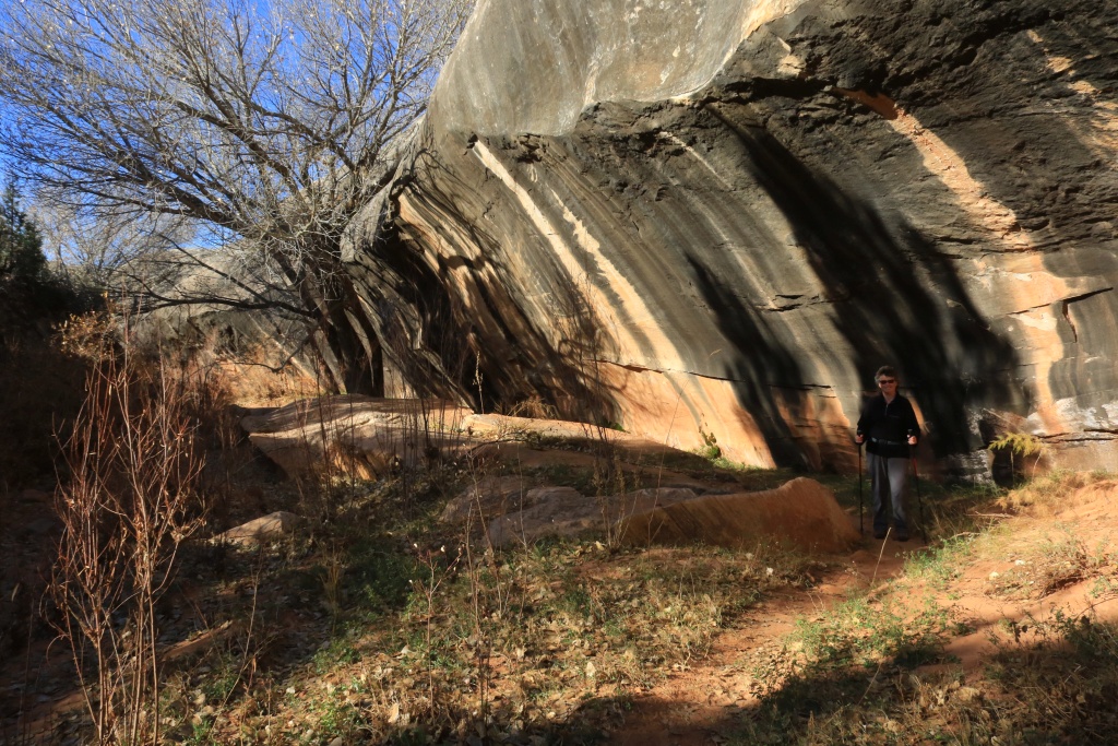
Our hiking destination was from the Kane Gulch Ranger Station up to the Grand Gulch Junction. This is an 8 miles trail, in and out, in the gulch.

37726405162_2668b8bd5a_o.jpg


Near the Junction, two Ancestral Puebloans ruin sites can be visited. Well, at least the part near the ground level since these sites have other ruins high above in the cliff. The Indians were using long ladders or ropes to access them.

37726404112_d9beeefde5_o.jpg


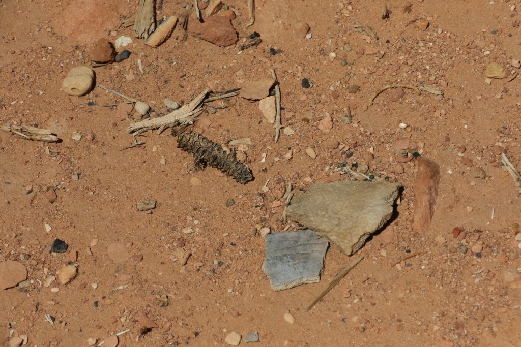
These sites are exceptional, with artifact of the presence of their inhabitants on the ground; pottery pieces, corn core, charcoal, and more.

23905356248_494148572e_o.jpg


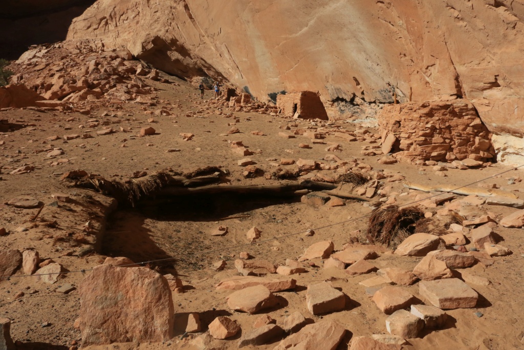
The second site even had a kiva with part of the roof still visible.

37726401812_3ab9d93c37_o.jpg


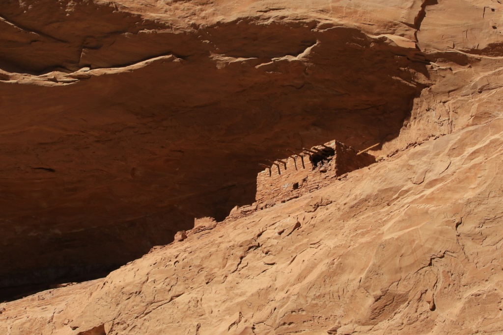
Again, high in the cliff, a superbly preserve habitation.

37049167914_9583b84e76_o.jpg


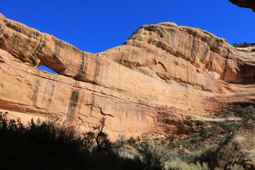
We reached the small arch near the junction, the turned around to rejoin the trailhead.

23905354518_a9fefdce22_o.jpg


Since there was only an hour of daylight left, we took this cool and came back to Blanding.
.
 
Last edited:
Wow, more awesomeness! I didn't realize there were so many native ruins in Utah that you can actually walk right up to them. I always had the impression that any significant ruins were pretty restricted.

The shot of the moon rising over the red cliffs is spectacular!
 
Totally hooked John...you could have your own travel show! Will you be doing Bryce Canyon and Zion on this trip?
 
Wow, more awesomeness! I didn't realize there were so many native ruins in Utah that you can actually walk right up to them. I always had the impression that any significant ruins were pretty restricted.

The shot of the moon rising over the red cliffs is spectacular!

Thanks again!

There are so many cliffs dwellings, some are protected inside National Parks or National Monuments, but many others are outside. The law protects them, but there is no surveillance, sadly.

Today we visited more ruins. Stay tuned!
.
 
Totally hooked John...you could have your own travel show! Will you be doing Bryce Canyon and Zion on this trip?

Thanks!

Bryce Canyon and Zion are not on my itinerary for this trip since we already visited them many times. I will go back probably during another trip.
.
 
Day 24:

Start point: Blanding, UT
End point: Blanding, UT

Today was our last day around Blanding. Again, sunshine across the board, no clouds. You guys must live a good life to be blessed with this temperature!!!

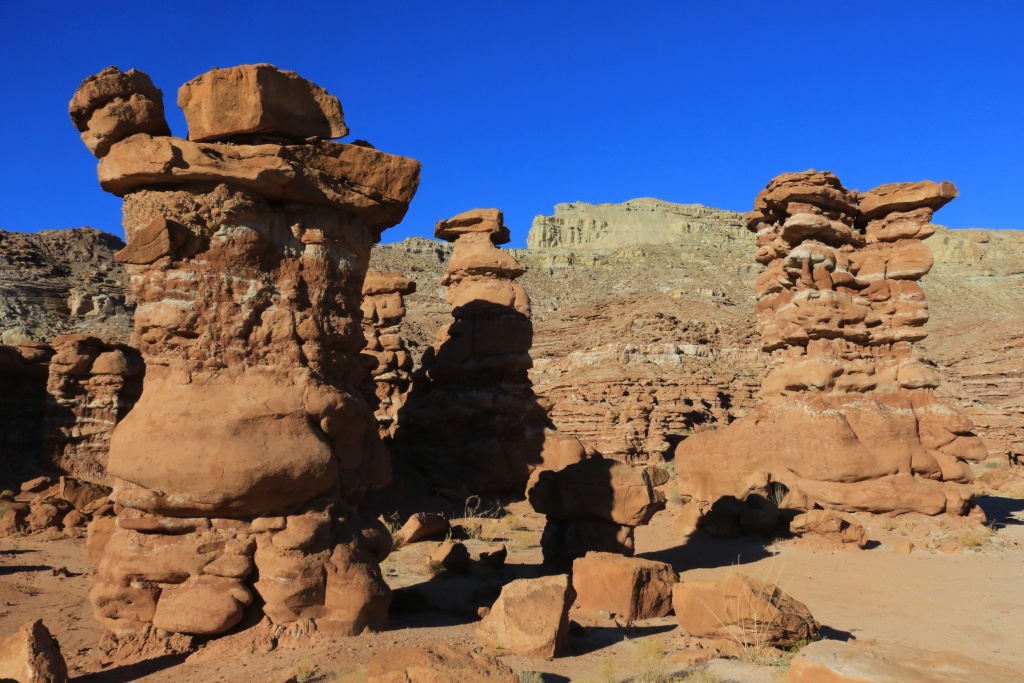
Our first destination of the days was a mostly unknown place called Recapture Pocket, south of Blanding near the town of Bluff. There are formations similar to Goblin Valley SP near Hanksville.

37500335460_4177d78b8c_o.jpg


37726737572_cf86dec13a_o.jpg


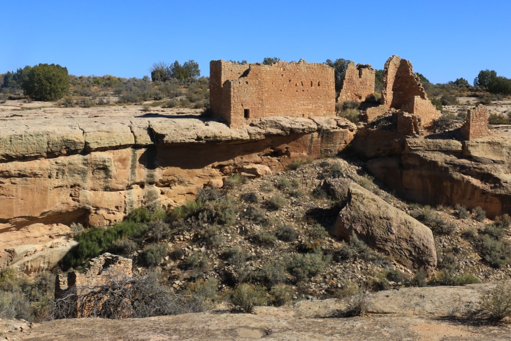
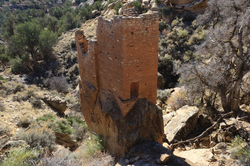
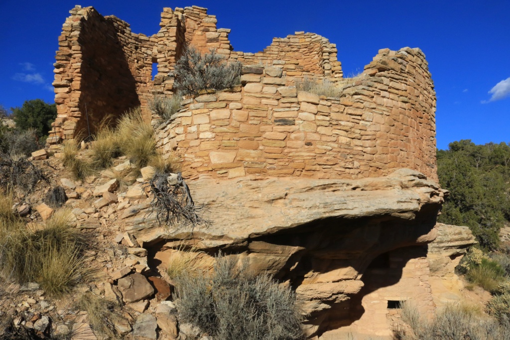
After, we headed toward Hovenweep National Monument, located over the border of Utah and Colorado. This is one of the least visited park from the National Park Service. It is a shame since the ruins found there are really impressive by their height and quality of stone work. Many towers are many stories high.

The park has several units over almost 20 miles, starting at the Visitor Center in Utah toward the northeast in the Colorado. At the Visitor Center, a 2 miles trail go around the small canyon who host the ruins along the periphery.

37726736932_f5b457ae78_o.jpg


Except for ruins near the Visitor Center, all the other are accessible using good dirt roads, except for the farthest one from the Visitor Center which needs high clearance. That was easy in the 4Runner.

37049611174_3b9c636b78_o.jpg


37726736432_5566b30682_o.jpg


37049608164_6c6d4a1fb0_o.jpg


Tomorrow it wheeling time again. Stay tuned!
.
 
Last edited:
Indian stonework

John: Thanks for more superb photos. I was especially impressed with the great stonework that the Indians could turn out. They certainly built some very impressive structures, and your photos bring them to life! - Ted
 
John: Thanks for more superb photos. I was especially impressed with the great stonework that the Indians could turn out. They certainly built some very impressive structures, and your photos bring them to life! - Ted

Thanks! These structures are amazing, like many other sites in this region. Mesa Verde NP and Chaco Canyon NM among others are incredibly impressive.
.
 
Day 25:

Start point: Blanding, UT
End point: Monument Valley, UT

We finally left Blanding where we had a great stay at Stone Lizard B&B. Craig and Luke are amazing.

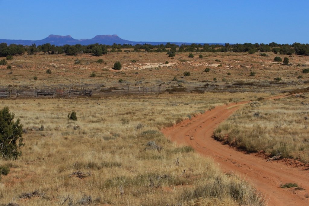
We headed toward Cedar Mesa again, this time to do some wheeling on the Point Lookout Road. The road starts as an excellent dirt road, circulating on a very wooded area of Cedar of course.

Looking back on the road, we could see the Bear Ears mountains.

37093035473_e88f08c24f_o.jpg


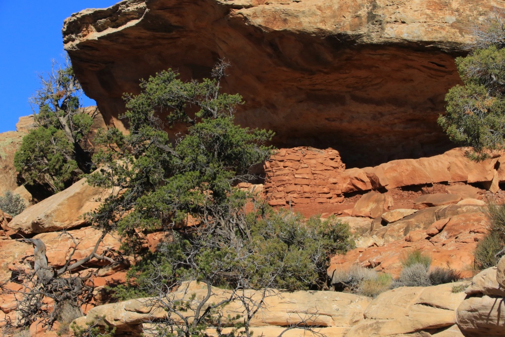
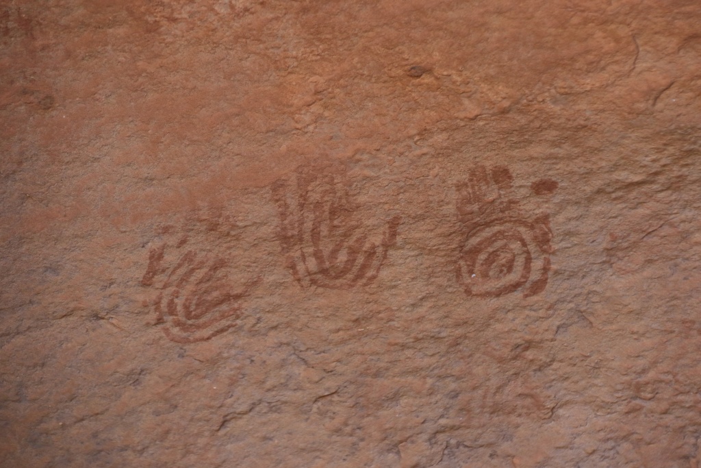
Continuing, we arrived at a wash where there is supposed to be some cliff dwellings. Unfortunately, we couldn't find them but found a granary and also some pictographs.

23910169818_cac6f56dcb_o.jpg


37504745790_f3d65c4fe7_o.jpg


After passing some very rocky sections that makes this road an intermediate one, we finally arrived at the Point Lookout Overlook, high above John's Canyon Road, which we should be doing in the next few days.

37093036333_91326c1159_o.jpg


37504744740_42ce4196c7_o.jpg


37763307421_f9be5fe0c6_o.jpg


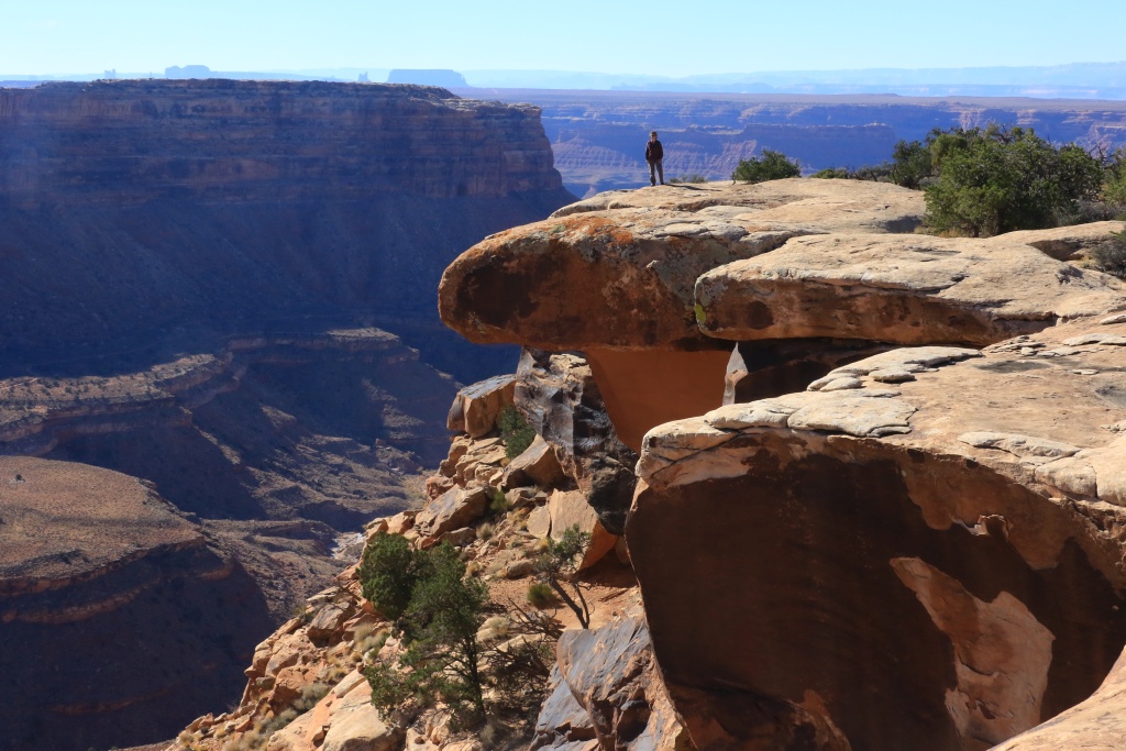
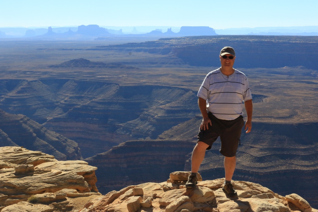
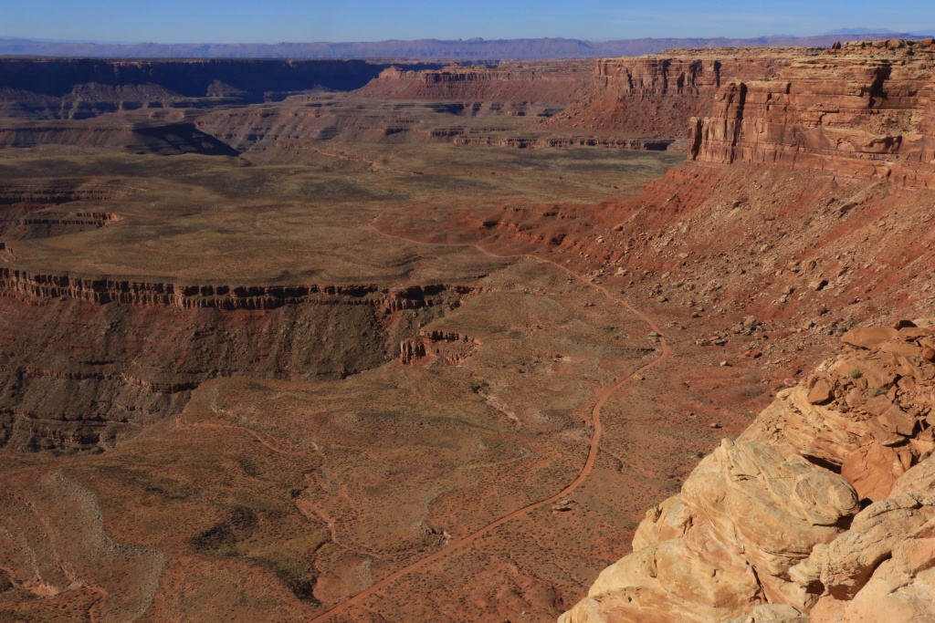
After coming back on the pavement, we headed south on UT261 to go to Muley Point Road, on the opposite side of John's Canyon. From that point, we could clearly see Monument Valley.

37093034003_5d7f6d330c_o.jpg


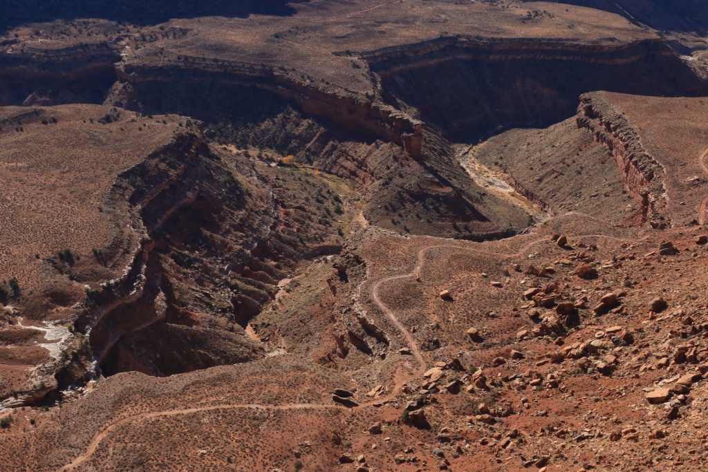
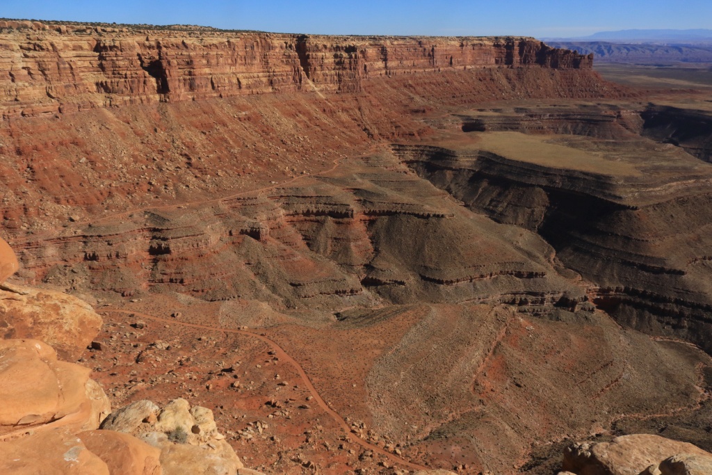
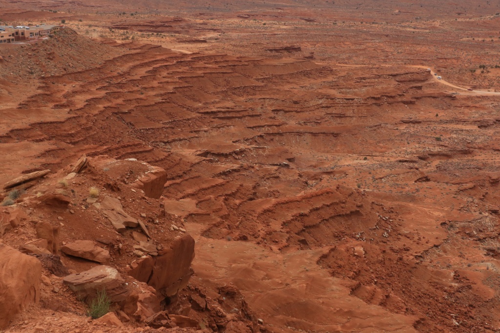
Looking East, then west, with John's Canyon Road still visible.

37763303641_cbf939be49_o.jpg


37504744000_cb1d1a58e4_o.jpg


Some amazing scenery down below.

37763305141_c8c54380b8_o.jpg


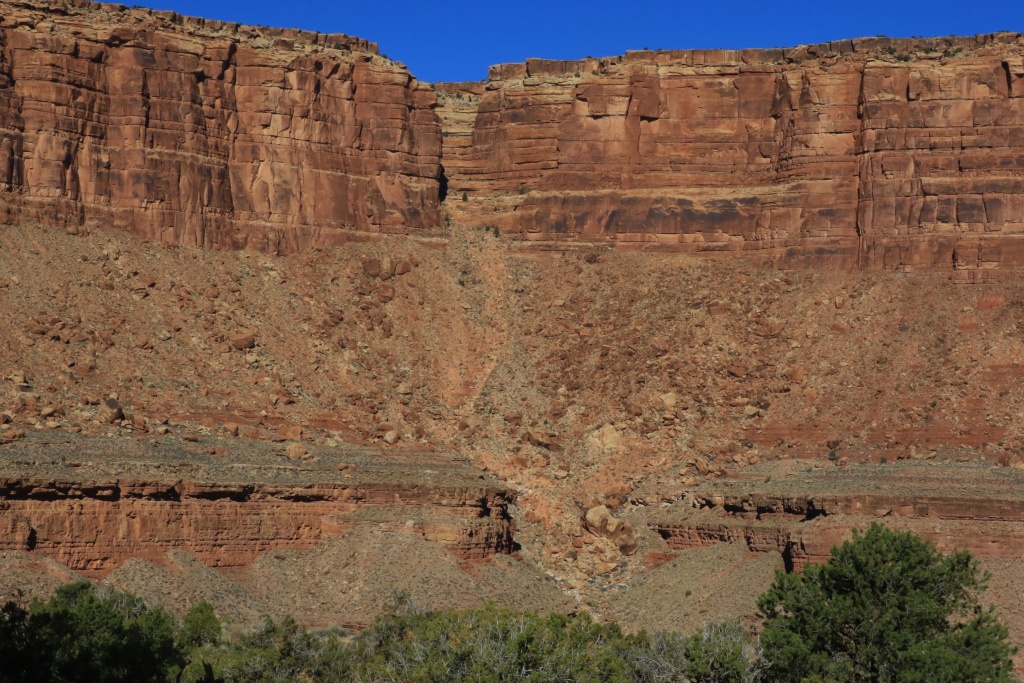
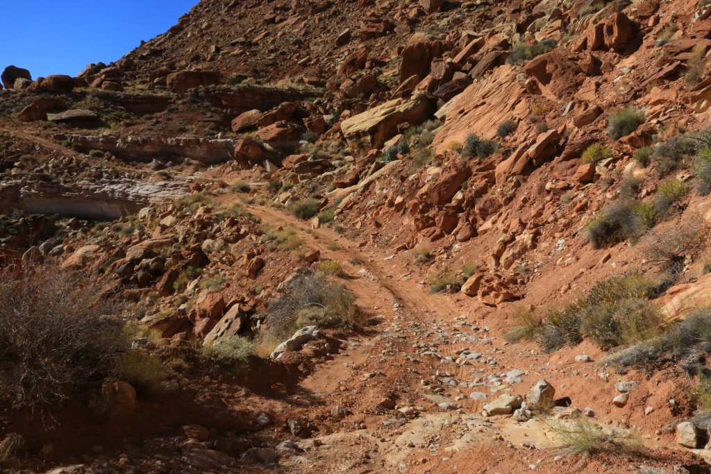
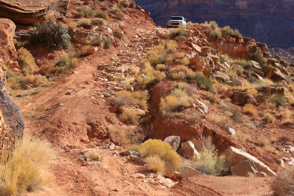
We then went down Moki Dugway, a gravel slope with switchbacks going down on the valley below, arriving near Valley of the Gods with its intriguing monoliths.

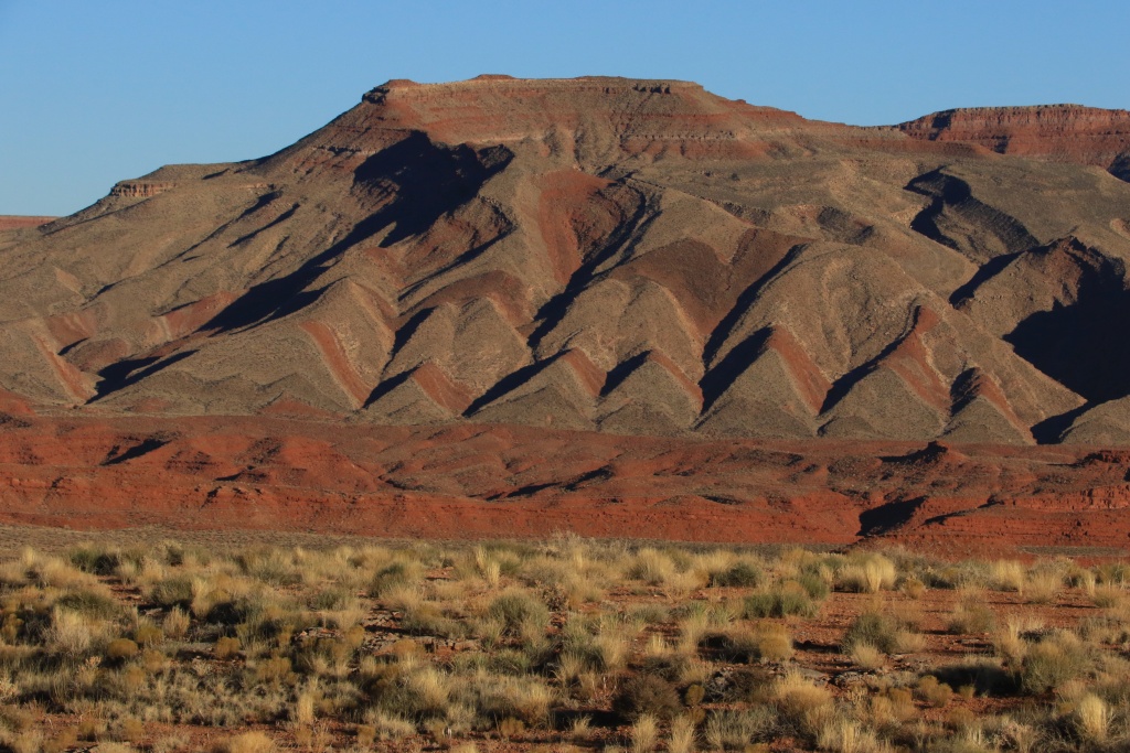
After rejoining th US163 Scenic Byway, we witness a formidable work of art from mother nature herself, near Mexican Hat.

37504743210_ae8699871c_o.jpg


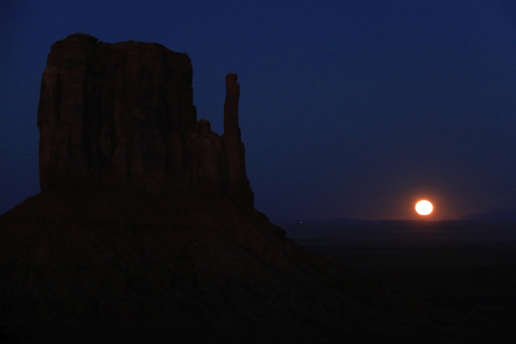
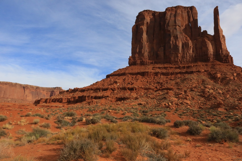
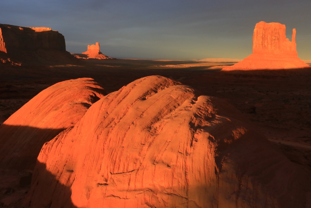
We arrived soon enough at Monument Valley to wait for the moonrise, the largest moon of the last 70 years. What a view with the mittens rock formations.

37763302861_6dc898c370_o.jpg


We will be exploring the surroundings of Monument Valley in the next few days.
.
 
Last edited:
Day 26:

Start point: Monument Valley, UT
End point: Monument Valley, UT

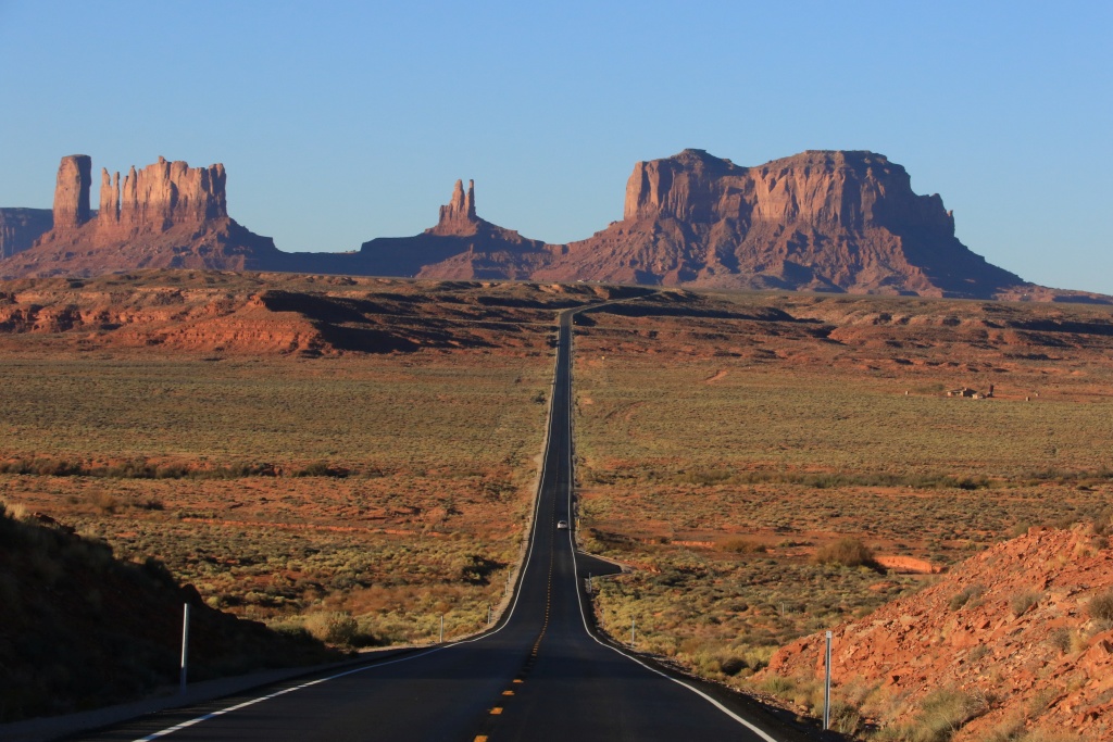
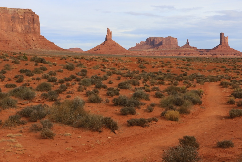
Today was another wheeling day. We left Monument Valley to go north on US163. Every time I pass this point, I can't resist; a classic view.

23913770968_d3f3dd6f1d_o.jpg


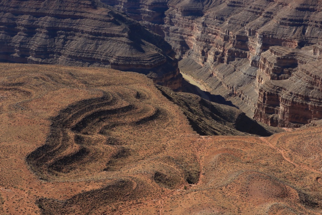
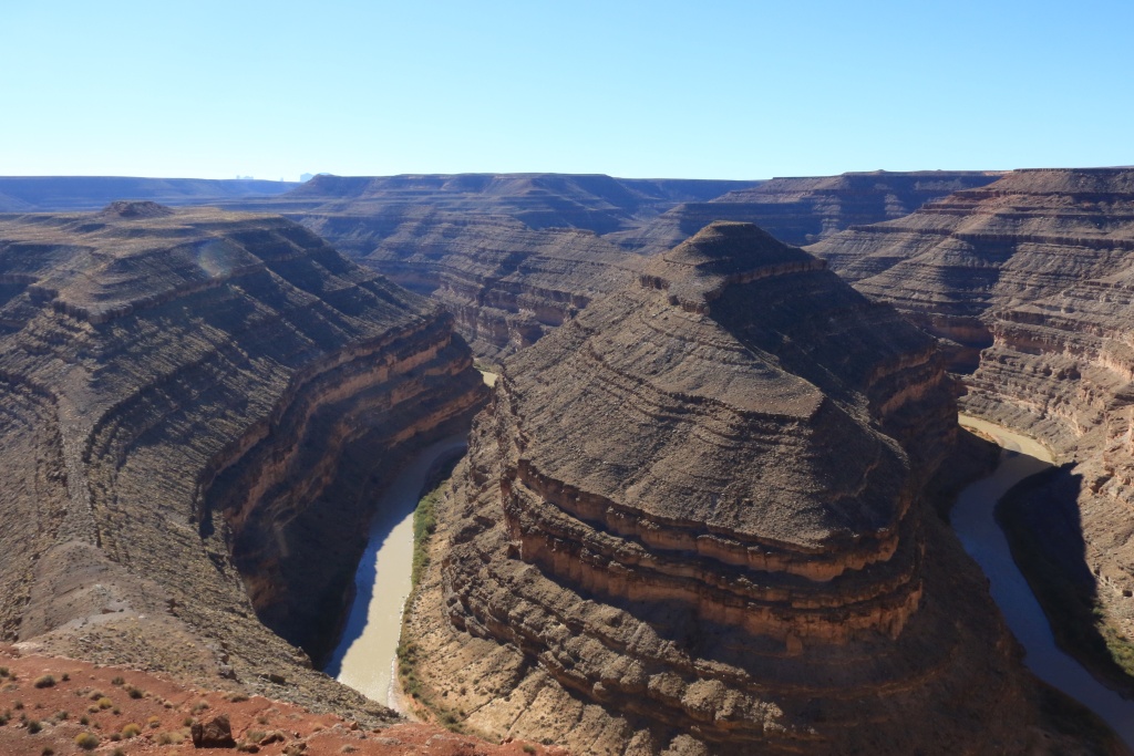
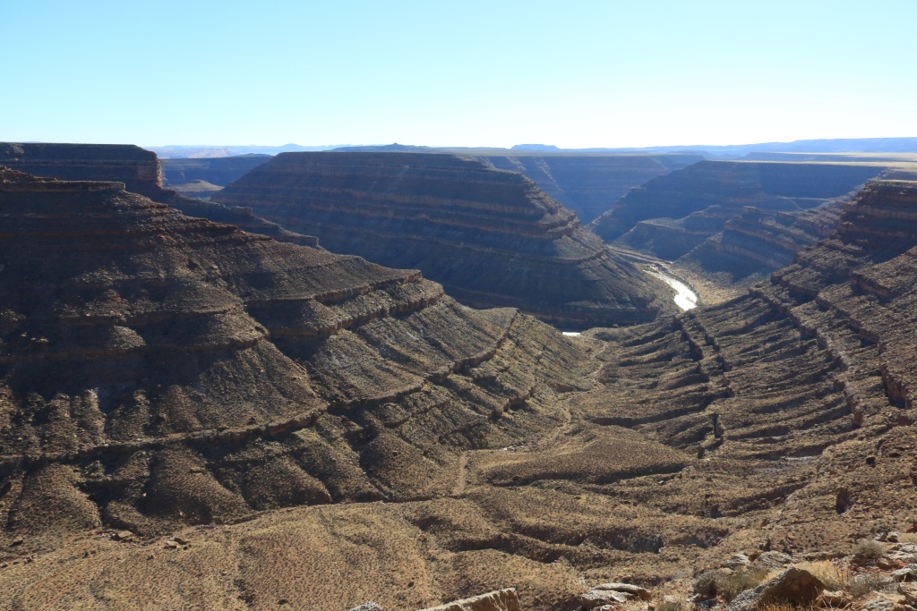
Our first real stop was Goosenecks State Park, where the San Juan River make three closed loops.

37718484006_f092af9726_o.jpg


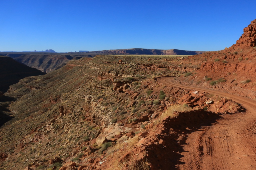
We then headed onto the John's Canyon Road, as seen from above yesterday. This road starts as an easy gravel and dirt road, traveling right beside the cliffs of Cedar Mesa.

37718488006_8e724921c4_o.jpg


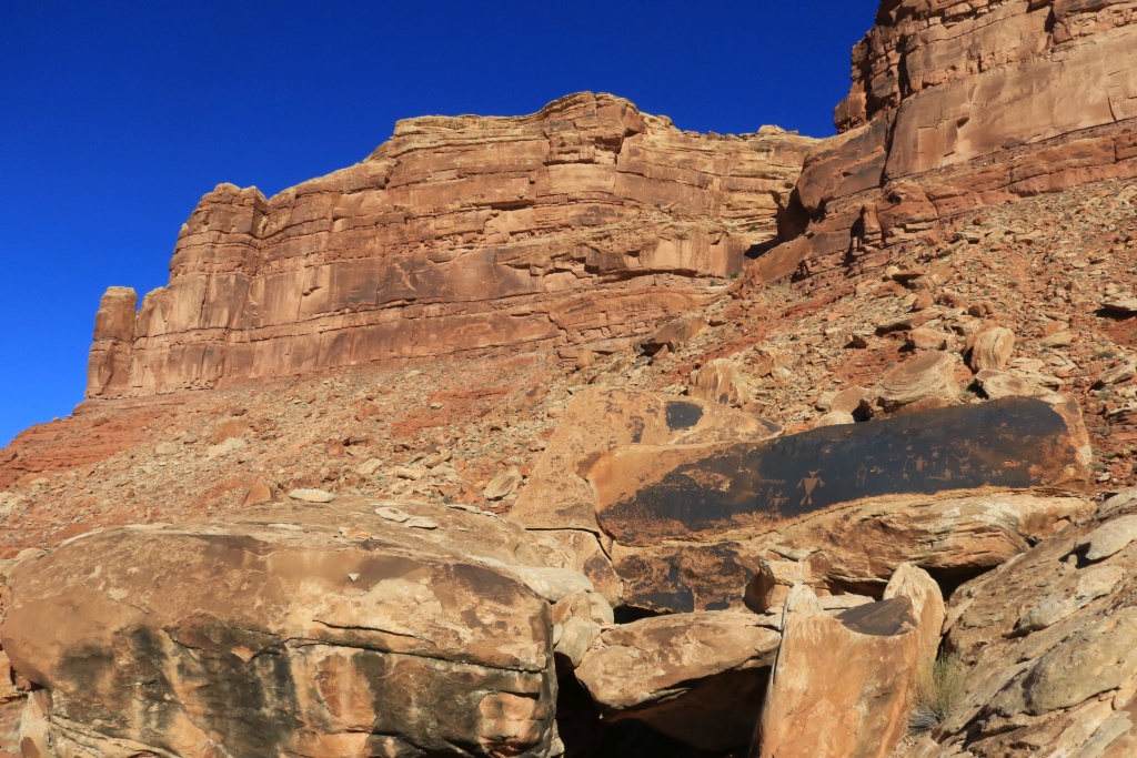
Continuing, we encountered a few rocky spots, but nothing too serious. After a while, we saw our first petroglyph panel. It is always interesting to try to find the meaning of their symbols. Some are evident, but others are mysterious.

37718487486_8bba9edfec_o.jpg


23913770228_dfc06e52fc_o.jpg


We then entered John's Canyon. On the other side, a past landslide marking probably our return point since it was not clear if the road was cleared from debris. The right portion is also our hiking trail from yesterday.

37718486396_73cbdb4bc3_o.jpg


Further up in the canyon, the road crosses a small creek. Celebration! This was the first water crossing (...!!!) of my 4Runner.

23913769618_f0586ae909_o.jpg


After this point, the road becomes more rocky with some points needing more attention. This section gives the moderate rating of this trail. We finally arrived at the landslide area. At our surprise, the road was effectively cleared from debris.

37718485276_541670e7c4_o.jpg


It was not the landslide who made us turn around, but the steep and eroded section of the road just before. Since we didn't spend an hour building a descent ramp, we turned around there.

37718484676_92fcdbdf2f_o.jpg


Once back on the pavement, we headed to the Lime Ridge Road that I found on Google Map. I saw this road was going nearby an ancien meander of the San Juan River.

23913767978_3aa0906b13_o.jpg


37508359220_9accb7f16d_o.jpg


The road deteriorate rapidly after the grader ended its work, so we turned around. Our planned exit point also was blocked by a fence.

After all this wheeling, when decided to take a walk. We headed back onto John's Canyon Road to reach the Honaker Trail. This steep trail was built around 1930 to reach the San Juan River. Mules were used to descend mineral to the river. The trail was abandoned when judged too steep for these mules.

23913767178_86fa6d0690_o.jpg


Tomorrow will be our last day around Monument Valley. I guess there will be some hiking involved, after the last two excellent wheeling days.
.

 
Last edited:
Such amazing scenery and wide open spaces! I love it!

Are you camping out at night, or staying in motels? How far out from "civilization" have you gone -- has finding gas been a problem at all?

Most of my travels have been in Nevada, and gas stations there are few and far between. Many of the small towns don't have gas available anymore. I have to carefully plan my travels to avoiding running out of gas many miles from the nearest station.
 
Fantastical!

John - Thanks for another great series of photos. You certainly are very adventurous in your travels! I would like to be too, but I'll be 84 when we hit the trails next spring. So I have to be a bit more careful these days and stick to the easier ones. Drive safe and keep the fantastical photos coming. - Ted
 
Such amazing scenery and wide open spaces! I love it!

Are you camping out at night, or staying in motels? How far out from "civilization" have you gone -- has finding gas been a problem at all?

Most of my travels have been in Nevada, and gas stations there are few and far between. Many of the small towns don't have gas available anymore. I have to carefully plan my travels to avoiding running out of gas many miles from the nearest station.

No camping on this trip. I will do camping when I will have an RTT, next summer. Doing camping on the ground in this region, with all these little crawling friends like lizards, spiders, scorpions, snakes, ... not for me. The worst thing I am used are mosquitos, even then...

The far out I went was probably Beef Basin Or Cathedral/Mussentuchit Valley. We had a 5 gallons extra tank which I didn't use. With the type of trails I am doing, I found I use only a small fraction more than on the highway. Apart from that, gas is available without concerns.
.
 
John - Thanks for another great series of photos. You certainly are very adventurous in your travels! I would like to be too, but I'll be 84 when we hit the trails next spring. So I have to be a bit more careful these days and stick to the easier ones. Drive safe and keep the fantastical photos coming. - Ted

Thanks! I am always very prudent and never adventure too far. These are easy trails for most, and I carry enough food, water, gas, and recovery tools. If I get stuck, that because I was really stupid, or the 4Runner broke, which is probably the real danger since it had only stock armor.
.
 
Day 27:

Start point: Monument Valley, AZ
End point: Monument Valley, AZ

We spent the day in Monument Valley Tribal Park doing hiking and driving the Scenic Drive. The weather was mostly cloudy in the morning, and overcast in the afternoon.

First destination was the Wildcat Trail, going around the West Mitten Butte. This trail allows a more personal view of the monuments.

23920369168_3651677f20_o.jpg


37724850046_9fd374ed28_o.jpg


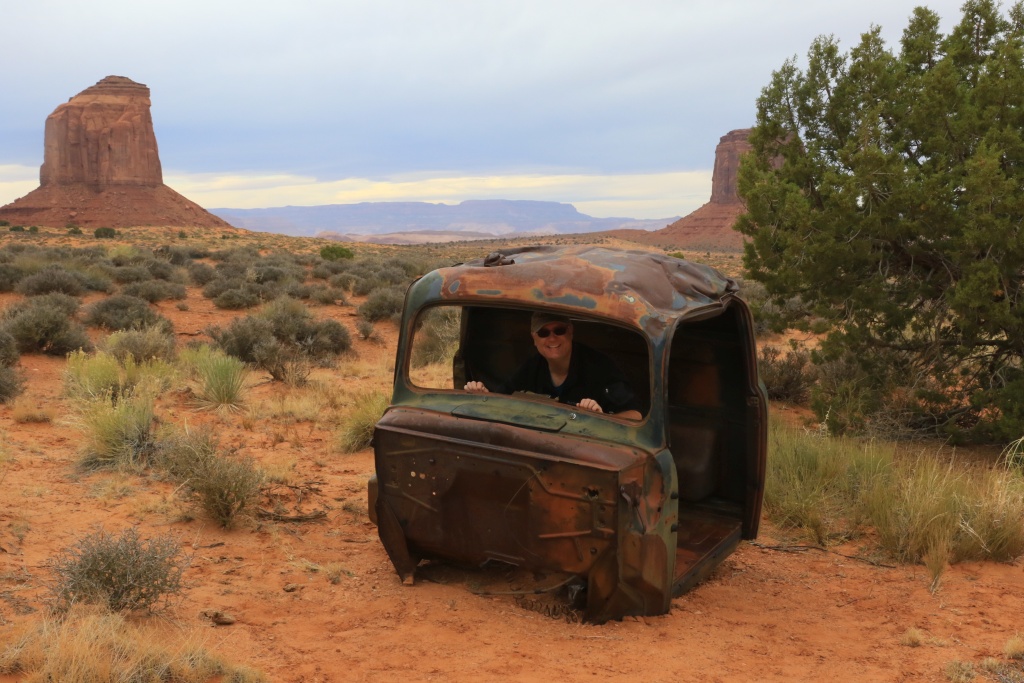
After, we hiked the Lee Cly Trail, traveling along a mesa. It offered a less impressive view that the Wildcat Trail. The trail passes nearby remains of some old cars and a truck.

23920368768_e2e486e21e_o.jpg


Connecting on the Lee Cly Trail is the Mesa Rim Trail, going up the vertical portion of the mesa. The view from there is really good.

37724848466_17c6193fbc_o.jpg


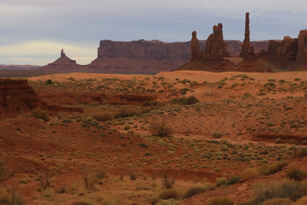
Then, we drove the Scenic Drive again, our fourth time. We didn't take many pictures but concentrates on formations we had hard time photographing in the past due to the sun position. One of my favorite is Totem Pole.

37064131384_e0a17c1be5_o.jpg


We had a rare sunny moment when we were back to the Visitor Center, giving a surreal look to this already great scenery.

37064130864_0b76347083_o.jpg


Tomorrow, we will leave Monument Valley to go to Page, Arizona.
.
 
Last edited:

Members online

Forum statistics

Threads
278,310
Messages
3,554,080
Members
248,016
Latest member
Advally Service

Trending content

Back
Top