JohnTheLuck's Adventures Thread

Day 8:

Start point: Logan UT
End point: Laurel MT

We left Logan and Utah under a beautiful cloudless sky. We avoided the interstate to see more of the back country. This region has a lot of agriculture fields with small hills. Note how the vegetation on the hills grows only on the side opposed to the sun.

36649214131_af116fa225_o.jpg


After entering Wyoming, we arrived at Grand Teton NP. Because of lack of time, we only passed by but surely we will be back to explore it.

36649213891_c4802b61ce_o.jpg


We made a small detour to go see the Gros Ventre Slide which occurred in 1929 when 50 million cubic yard of mountain debris raced 50 mph down the valley and blocking the Gros Ventre River by a 250 feet high barrage and formed a 5 mile long lake. No one was hurt at that time.

Unfortunately, two years later, the natural dam yield partially and the water from the lake rushed toward Kelly town downstream and destroying almost everything on its way. This caused 6 death.

36649213551_c33e2ce974_o.jpg


36649214001_8eb531dccc_o.jpg


Continuing toward the north, we arrived at Yellowstone NP which we visited two times already. We decided to stop briefly at West Thumb to take a break. This area, located near the Yellowstone Lake, doesn't have geysers but have multiple hot water pools, mud pools, and vapor events.

36649213841_17fd17248b_o.jpg


36649213781_428279059d_o.jpg


We then drove along the Yellowstone Lake and stopped at an overlook. This region was burnt by a forest fire a few years ago. The forest is recovering slowly.

36649213711_6ec2baecdd_o.jpg


After leaving the Yellowstone NP by the East Entrance, the road becomes the Buffalo Bill Cody Scenic Byway. It climbs to Sylvan Pass at more than 8000 feet before going down in a scenic canyon of volcanic rocks carved by the North Fork Shoshone River. The scenery is then an infinite succession of spires and dykes.
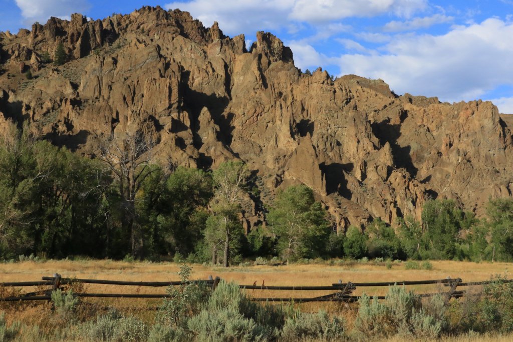
36649213651_e3b4e60553_o.jpg


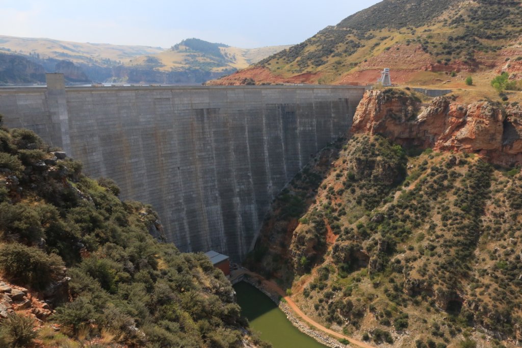
The water from the North Fork Shoshone River the arrive at the Buffalo Bill Reservoir formed by the Buffalo Bill Dam (obviously!). After its completeness, this dam was the highest in the world. Sorry for the bottomless picture; it was too late and I had no time to get my wide angle lens.

36649213611_c96d9283e1_o.jpg


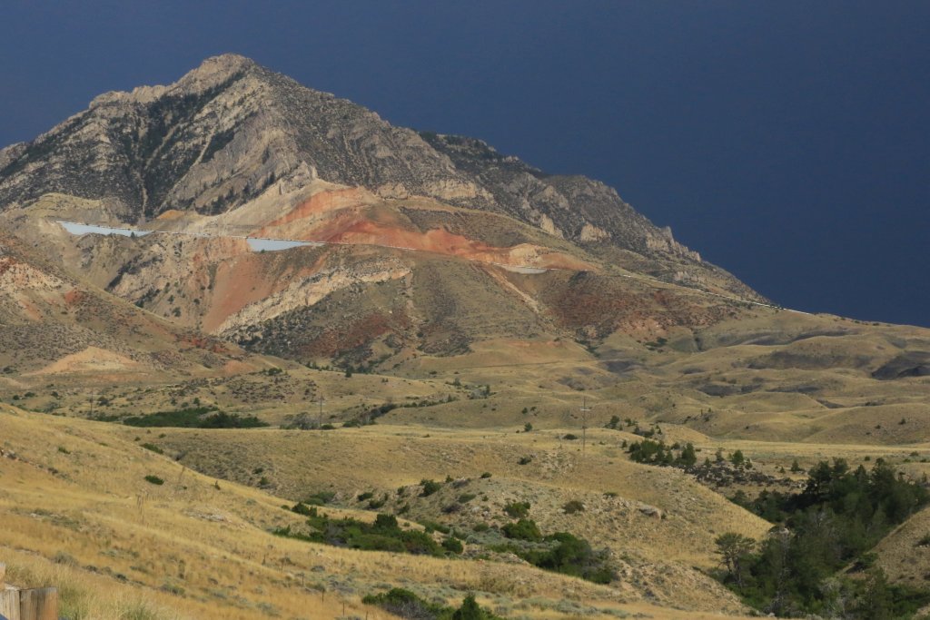
After a quick meal in Cody WY, we headed north again and follow the Beartooth Range which was covered with threatening clouds. Curiously, the last time we passed there, we had to change our plan because of a snow storm, also in August...!!!

36788215345_5585ed6406_o.jpg


Tomorrow, we will do a loop in the vicinity, with a few hikes and some historic sites as well.
.
 
Last edited:
Day 9:

Start point: Laurel MT
End point: Laurel MT

Today we performed a long loop in the Bighorn County. Our first destination was the Little Bighorn Battlefield National Monument. At this location in June 1876, Lt Col Custer attacked a very large group of Lakota and Cheyennes Indians who resisted signing the 1868 Treaty creating reserves. This was the last big battle involving Indians. During this battle, Custer and 253 soldiers lost their lives and the battle.

Two memorials honor those who lost their lives, on for the soldiers and one for the Indians. The memorials are located one beside the other on Last Stand Hill where Custer died.

35999264083_b3aefeb6ae_o.jpg


35999263993_4274aba4d7_o.jpg


The Tour Road allows to visualize the important events of the day. Along this road, white stones mark the location where soldiers died, while red stones are used for Indians.

36668796561_dbb7bce757_o.jpg


36668796651_b60a96418d_o.jpg


After, we headed toward Bighorn Canyon National Recreation Area to see the Yellowtail Dam.

35999263953_909a050b2b_o.jpg


The dam is located in the north section of the National Monument. To reach the south section, no direct road follows the canyon. We drove the Medicine Wheel Passage Scenic Byway, high on the top of the Bighorn Mountains. The climbing on the east side is pretty gradual, but the descend on the west side is a lot more impressive with a 10% drop on 9 miles. While we descended, we escape a large cloud.

36668797001_7b229a5174_o.jpg


We finally arrived at the canyon overlook with the sun masked by thick clouds with some rain and heavy winds.

36668796921_9235eaee0c_o.jpg


A few minutes later, when we began hiking the Sullivan's Knob Trail, the sun emerged for a few minutes. We even saw a nice rainbow over the canyon.

36668796761_dfd0bd9cdc_o.jpg


36668796681_bf1561a7d2_o.jpg


36668796431_b48ec040b2_o.jpg


Tomorrow, we are heading north west toward Boseman and will probably begin to do more hiking.
.
 
Last edited:
Day 10:

Start point: Laurel MT
End point: Dillon MT

We left Laurel MT this morning to reach our first destination, Palissade Falls Trail in Gallatin National forest, near Boseman MT. This trail is paved (...!!!) because it is a short walk very popular with families. After 1 km, the trail arrive to the beautiful water fall cascading over basalt columns.

36661924992_0a3721c105_o.jpg


Our second destination, Sacajawea Peak Trail is reach by a gravel road to the Fairy Lake campground. The road is in relatively bad condition so even if we didn't planed some off-roading today, we did a few miles!

The trail climbs continuously giving almost no break. Since it gains a lot of elevation in a relatively short distance, there is a lot of switchbacks.

35998155844_f4a135c2d1_o.jpg


After 1,7 miles, the trail arrive at a pass between Sacajawea Peak and Hardscrabble Peak.

35998155844_f4a135c2d1_o.jpg


when we reached the top, the view is simply incredible except for the fog masking everything in the distance.

35998155154_58a0923c75_o.jpg


36023100383_0e6a93f9d6_o.jpg


When we began our descent, three mountain goats crossed the trail between us and another hiker group. Someone told us before that we should stay away from goats since they are really protecting their young.

35998154544_05090f2a86_o.jpg


After a while, the goats decided to continue toward the top, before the hiker group.

36023100203_cd2bc5d89f_o.jpg


Later, that group of young hikers passed us during our descent. They told us the goats defended their position at the top with determination, and the were never able to reach it. The goats won the battle!!!

Tomorrow, we will take a break of hiking and explore the area around Virginia City.
.
 
Day 11:

Start point: Dillon MT
End point: Dillon MT

Today, we explored a series of ghost towns and learnt a lot about the hard life of the habitants of these small mining town. Special thanks to [MENTION=146827]TBBrewer[/MENTION] for his contribution to the preparation of my itinerary for today.

Our first destination was the Robber's Roost Tavern, a stage station along the road from Bannack to Virginia City. Here, Sheriff Henry Plummer and his cutthroat associates, who called themselves "Innocents", planned their crimes by identifying travelers that would be robbed later on the road.

36048948913_f303da175f_o.jpg


The population formed the Vigilance Committee of Alder Gulch to combat Plummer gang. They hanged Plummer in Alder and many more in the town around.

Around the town of Alder and Ruby, the sign of massive gold exploitation can be seen with dredge tailing along the road.

36048948573_d7fb5a3efc_o.jpg


In Nevada City, the remains of one of these dredges now resides in a museum.

36023375394_f4bd36d0ef_o.jpg


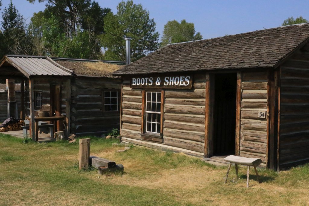
We stopped to visit Nevada City. To my opinion, this is a real gem that is unfortunately not well advertises or known. This place protects many original buildings and many others that were moved for their protection. Many volunteers were doing animation and answered questions about the life of the residents.

36686936672_9807a97eac_o.jpg


36023375754_322fae9f87_o.jpg


36686935782_79d367d5bc_o.jpg


Later, we arrived in Virginia City. This is our second visit in this city. While it preserve many original building, the presence of vehicle along the buildings and the overwhelming tourism orientation annoyed us as before. We preferred by a lot Nevada City than Virginia City, even if it is less known.

We went to Boot Hill Cemetery overlooking Virginia City. Here are buried five members of the Innocents gang after being hanged. After they were put into ground, the population didn't want to bury their relative there. A second cemetery was then built.

36023373824_e32ef15e53_o.jpg


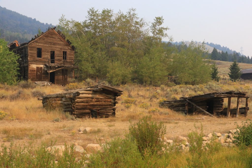
After, we went to visit Bannack State Park, protecting all original building of this old mining town. Bannack was founded in 1862 after the first discovery of gold in Montana. Later, it served as a starting point toward many other cities like Nevada City and Virginia City. Their sheriff was Plummer, the head of the Innocents gang.

The cities of Bannack and Dillon (where we reside) were competing to get the courthouse. Bannack had built a brick building to accommodate it, but it was the town of Dillon, accessible by rail unlike Bannack, which got it. The building was later used as a hotel.

36461524630_5337208335_o.jpg


36023373004_276f858b94_o.jpg


36461523460_2465a05a7e_o.jpg


There is so much history in these old mining cities, and unfortunately, it is not the most noble one. But this was a really good representation of what was the live during the west conquest.
 
Day 12:

Start point: Dillon MT
End point: Butte MT

We left Dillon this morning with this veil of smoke coming from many forest fires in Idaho and Montana. It is a bit unfortunate because the visibility is limited to a few kilometers at most. The high mountains are masked except when we are close by.

Our first attraction of the day was the northern part of the Salmon River Scenic Byway. We will travel the southern part on our return to the south in three weeks. The road winds through the valley dug by the Salmon River. The landscapes are contrasting, with water flowing in abundance and arid soils burned by the sun.

36075369013_1b40ce5911_o.jpg


As we approached our second destination, Blodgett Canyon Overlook Trail, the visibility was steadily decreasing and a slight smell of dust or smoke was becoming more noticeable. Arriving at the parking lot at the trailhead, the smell was really present and the visibility very affected. We decided not to walk the trail for obvious visibility and health reasons.

36075368503_e115f62841_o.jpg


Continuing our route and taking us away from the smoke, we visited the Big Hole National Battlefield, commemorating a battle between Indians Nez Perce and the American cavalry. This occurred in 1877, nearly 14 months after the Battle of Little Bighorn National Battlefield that we visited a few days ago.

At Big Hole, US troops attacked a Nez Perce encampment before sunrise. The plan was to surprise them so that they surrendered, but an American volunteer a little nervous of the trigger fired before all the soldiers were in place. This caused carnage as the soldiers fired on everything that moved, home, wife, and even children. After a fierce battle with many victims on both sides, the surviving Nose Perce capitulated and finally had to accept to live on reserves.

36075368143_5727dc63b5_o.jpg


Continuing our route, we arrived near the town of Anaconda under a thick smoke and a sunshine reddened. The chimney of a mine is the highest human structure in Montana.

36075367713_f866d57830_o.jpg


We finally arrived in Butte, Montana, a little ahead of our schedule as we had not traveled the trail. We took the opportunity to take a lead on tomorrow and take a city tour. Butte is an active mining town, but its beginnings date back to the late 1800s as a gold and silver mining camp. At the turn of the century with the industrial era, the city has grown with exploitation of copper that continues today. Headframes, vestiges of old underground mines are still present all over the city.

36049827104_0a4d47c7ce_o.jpg


36049827384_edb694c2c1_o.jpg


36049826894_1dc4d0d5f9_o.jpg


The 4Runner looks really good under the reddish sunset, as vie from the side. The front is less attractive with all the insects I had killed.

36049827764_c8dc0e60e0_o.jpg


Tomorrow, we will spend a bit more time in Butte before leaving for Great Falls.
.
 
Day 13:

Start point: Butte MT
End point: Great Falls MT

This morning we started our day by continuing our visit of Butte by walking along an urban path overlooking the old copper mines. The trail is equipped with information panels on the history of the mines in Butte.

36736661452_56d4a99492_o.jpg


The trail leads to a site commemorating a fire in June 1917, which killed 168 people.

36736661612_8b742f5bf4_o.jpg


Some victims had time, during their long agony for lack of oxygen, to write letters to their relatives.

36736661512_95cbc078ff_o.jpg


Then we left Butte to get to our next destination, the ghost town of Comet. The buildings are in fairly good condition, especially those related to the mine operations.

36736661332_eeff9d59e4_o.jpg


36736661262_e0f4ffc9a5_o.jpg


36736660912_5c7cd88264_o.jpg


36736661012_9dd195ed7a_o.jpg


36736661092_68429570d1_o.jpg


As we continued our route on the interstate, we decided to take a secondary road leading us along the Missouri River, a preview to tomorrow. At this point, the river flows slowly between the mountains. The presence of smoke was always felt.

36736660822_91ca2deeb8_o.jpg


We finally arrived in Great Falls, where the Lewis and Clark expedition, mandated by President Jefferson to discover a waterway between the Atlantic and Pacific oceans, encountered major falls while navigating the Missouri River heading west.

36736660672_30d8f71958_o.jpg


We visited the Lewis & Clank Interpretive Center, reporting the expedition from St. Louis in 1804 to the Pacific Ocean in 1805, as well as particular attention to the portage passage of the five waterfalls . The portage of more than 18 miles took almost a month, through rugged terrain.

36736660752_e3fd3728a6_o.jpg


Tomorrow we should go and explore the Missouri River in the Upper Missouri Breaks National Monument, taking a road, or rather a track, along its banks.
.
 
Nice pics and story. They bring back memories of our 2004 trip with our kids pulling a travel trailer where we went to many of the same places in Wyoming and Montana. In that trip we covered over 10k.

The 4Runner looks great in the old mining buildings. How is the new suspension working out?
 
Great pics! That ghost town is my kind of place -- I should try to get up there someday.

The miner's letters are so sad.

Thanks! This is my first ghost town with a mining facility that I was able to explore a bit.

Every death of a miner in a mine is a tragic event, even if they all know it is a dangerous job. Really sad indeed.
 
Nice pics and story. They bring back memories of our 2004 trip with our kids pulling a travel trailer where we went to many of the same places in Wyoming and Montana. In that trip we covered over 10k.

The 4Runner looks great in the old mining buildings. How is the new suspension working out?

Great! Our trip should be well over 22000 km. We may reach the 10000 km tomorrow.

The suspension is awesome. No more nose dive and it reacts really good on most terrains, even washboard. I would buy it again. But I am not an expert and maybe Icon, Fox or King would be better. But I just want to drive my 4R !!!
 
Day 14:

Start point: Great Falls MT
End point: Great Falls MT

Today, we traveled a lot to reach the Upper Missouri River Breaks National Monument, protecting the Missouri River and the cliffs along it. The Lewis and Clark expedition sailed to this specific location in 1805. Many thanks to [MENTION=168275]MissouriBreaks[/MENTION] for his advice during the planning of the trip.

Our goal was to travel the Missouri Breaks Back Country Byway, along the cliffs and the river. We had to be very careful about the precipitation because the type of soil on which the road is located turns into slippery mud when wet and the road is quite impassable. No precipitation were expected and the mercury is soaked up to 38C at the thermometer. Unfortunately, the sky was still slightly smoky with forest fires.

We started our day by going to the Upper Missouri Breaks Interpretive Center to see if the road was passable. A really nice ranger confirmed that yes, and even suggested another interesting place near the Judith River that joins Missouri. Thanks to him (I don't remember his name...).

Then we had to drive two and a half hours to get to the starting point since there is no direct road to that place. We finally joined the departure around noon.

After a long way in farmland where mostly cereals are grown, we have finally reached a more interesting areas.

36097118704_748f195aa4_o.jpg


After seeing the Missouri River from a distance, we attempted to reach it by a side road descending on its banks. Unfortunately, we ran into a dry creek but a bit too deep to be crossed without hanging. We could have pulled out the shovel and worked the road a bit, but we thought we would try further.

36097118584_2153d8d752_o.jpg


36097118424_b3bb9412cb_o.jpg


Our second attempt was not more successful; a landslide having taken away this other secondary road and it was barred approximately in the middle of the descent. However the landscapes were still worth the detour.

36097118314_30357f6e1b_o.jpg


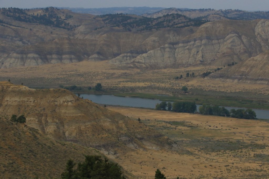
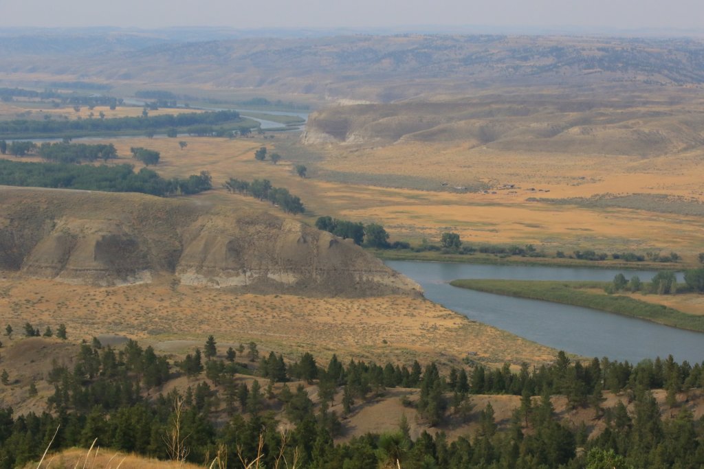
Continuing on the main road, we saw the Missouri River several times, as well as beautiful cliffs.

36097118074_b5462877f1_o.jpg


36097117974_52fde6ab48_o.jpg


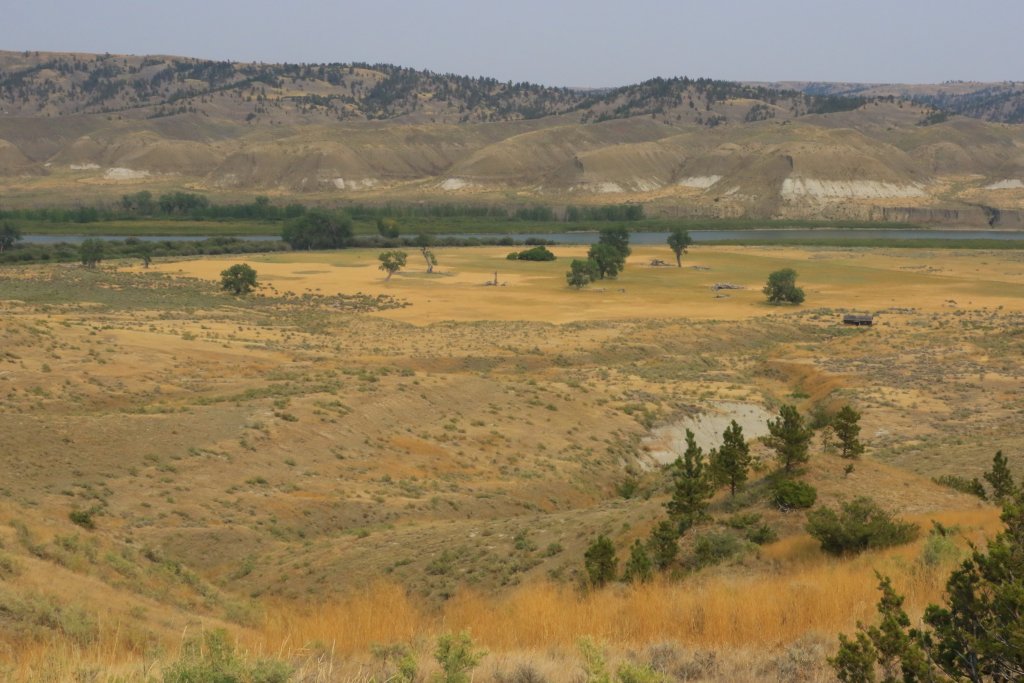
Our third attempt to reach the Missouri River was more fruitful, except that we could not reach the water directly. We have nevertheless joined a plain of low grasses or an old habitation testifies of the human presence. The inner floor of the house was covered with mud, the result of the winds or the flood of the waters, who knows.

36097117884_73d29c4bdd_o.jpg


36931208235_f8f6d8cc27_o.jpg


36931208205_3997e67c18_o.jpg


Continuing along the main road, we traveled among juniper trees before reaching a descent to the Two Calf Creek which we had to cross, before going up the steep slope on the other side. The creek was dry and was decorated by white salt deposits.

36931208155_02d5711960_o.jpg


36931208025_19d39572d4_o.jpg


36931207955_80b8ab26f5_o.jpg


Before we started, we forked to see the confluence between Two Calf Creek and Missouri River. We were finally able to approach the waters of Missouri, but without touching it because the banks were too steep.

36931207895_256d03012a_o.jpg


Once climbed to the other side of Two Calf Creek, the road runs on a narrow ridge. This is the place we preferred.

36931207815_349ee14cd5_o.jpg


36931207725_9b2f0eb60b_o.jpg


Finally, the road descends a little towards the river before ending on the paved road MT-191. At this point, a visible bridge over the far left spans the Missouri River.

36931207625_6bd2e4e068_o.jpg


We had a great time driving this mostly easy road. The scenery is fantastic, and thinking Lewis and Clark traveled these waters in their quest is really inspiring.
.
 
Day 15:

Start point: Great Falls MT
End point: Shelby MT

This morning we left Great Falls still under a veil of smoke from the forest fires to the west, and with a cloud cover almost complete. We joined Glacier National Park, our destination for the next few days. We were apprehensive about this day because we were afraid that the smoke would spoil the whole show. Fortunately, we were mistaken. Also, during our very first visit to this park in 2009, we had pouring rain and haze, in addition to road reconstruction and associated delays.

After viewing an introductory film at the St. Mary Visitor Center, we drove the scenic Going to The Sun Road. This route runs the park from east to west, climbing the mountains to the Logan Pass at 6647 feet. At first, the smoke was present, but it gave way to a beautiful clear sky, the mountains forming a wall against the smoke.

Finished blah blah, place to the show !!!

36951401205_86a982ac4c_o.jpg


36555035750_dc353fbe31_o.jpg


36951401275_35975d6a87_o.jpg


36555035420_ae20aef2e4_o.jpg


36951401025_43348f4a4c_o.jpg


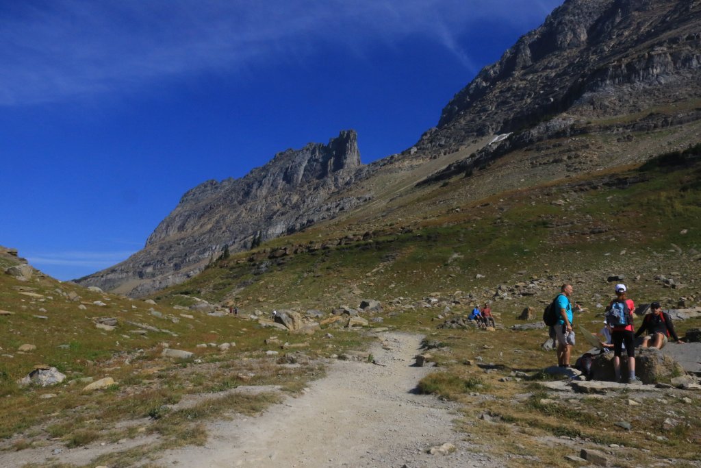
Back at the Logan Pass Visitor Center, we managed to find a parking spot after about 15 minutes to turn in circles between the aisles. We then started the Hidden Lake Trail. In order to protect the fragile wetlands, a footbridge was built at the beginning of the trail.

36811677641_c6ff368598_o.jpg


Up until reaching Hidden lake Overlook, there was too many hikers on the trail. The view from there was spectacular.

36951400495_44b19a3157_o.jpg


After the overlook, the number of hikers decreases significantly as few descend to reach the edge of the lake. A note then says that we are entering the grizzly bear territory. Reassuring...

While we were somewhat isolated, a young solitary hiker named Kaithlin, a native of Maine, came up to us and asked if she could join us because she was afraid to walk this trail alone because the attacks of grizzly bears almost involves single people. We accepted with joy because the bigger the groups, the less risk. In addition, Kaithlin had his bear spray while we had left it in the 4Runner (brilliant ...).

As we walked towards a series of switchbacks leading to the lake shore, the smoke from a forest fire nearby in the park was passing right by us.

36555034920_f8296c8325_o.jpg


36555034820_ec533690ea_o.jpg


36951400655_1ce262c401_o.jpg


We began our return, without having seen the slightest trace of bear. The sky was increasingly clear.

36951400575_a1f57f4e76_o.jpg


Back at 4Runner, we took the Going to the Sun route in the opposite direction and crossed the thick plume of smoke from the park fire. The sun was shining brightly red as during the sunset, but it was only 5:30 pm.

36811677391_54252a124e_o.jpg


Tomorrow, we should do more hiking. Sorry guys, off-roading will have to wait a bit.
.
 
Day 16:

Start point: Shelby MT
End point Shelby MT

We returned for our second day at Glacier National Park. We got up very early to make sure we had room in the limited parking lot of the Logan Pass Visitor Center, the starting point for our Highline Trail.

At first, the trail overlooks the Going to the Sun road, traveling on a rather narrow escarpment with a cliff on one side and the mountains on the other. Further, the cliff leaves its place on a steep slope, but less intimidating. All along the trail, the view to the mountains and the valley is simply incredible.

36783305096_592b1152bb_o.jpg


36783304896_3dcc6fc10d_o.jpg


After a few kilometers practically level, we embarked on a climb to a pass near Haystack Butte, where we had planned to turn around.

36783304746_2d37c02950_o.jpg


36783304526_fcf7b14467_o.jpg


By consulting an information sign at the trailhead, we saw that it would be possible to continue and rejoin the road further and return using the park shuttle. This section is almost always downhill. So we decided to continue, and the original 10 km trek was then transformed into a more than 20 km long.

Shortly after passing Haystack Butte, the trail stays level and stays along the slope toward the valley, but is always picturesque.

36783303576_a7c9341a8b_o.jpg


36783302746_b6d864d742_o.jpg


As we were approaching a refuge, we reached the intersection with a side trail going to an overlook of a glacier. This would have added 6 kilometers to an already long hike, so we didn't go. Some said later the view was incredible.

36783302566_ca5b6d7455_o.jpg


36783302256_abf978e949_o.jpg


We made a short stop at the refuge. When talking with other hikers, some told us that 30 minutes earlier, two grizzlies were on the trail. The Park Rangers came and managed to direct these to a remote area a kind of plain lower than the trail.

Returning to our walk, we began the long descent towards the road. At this point, the trail runs successively through an area of ​​spruce, followed by areas covered with bushes. As we were a little apprehensive, we followed several groups.

36783301766_1c6268707e_o.jpg


This trail is incredible and ranks very high among all the trails we had a chance to hike.
.
 
Day 17:

Start point: Shelby MT
End point: Shelby MT

Today was another day of hiking in Glacier NP (sorry, no 4Runner pictures again...).

We went to the Many Glaciers area. As the name suggests, there are at least for the moment, several glaciers. At the rate where global warming is felt, experts believe that all the glaciers of this park will have disappeared around 2030. Notice to climate-septic; Hurry up and come and see them.

When we arrived, the smoke plume of the forest fire in the park joined the entrance and we were afraid of having to walk the path or simply not to go through it. Fortunately, as for Logan Pass, the plume is diverted into secondary valleys and the air was breathable.

36154140694_489ba21220_o.jpg


Our destination of the day was the Iceberg Lake Trail. The trail begins in wooded terrain, followed by alternating open and wooded areas. It is a sector recognized for the presence of grizzly bears so caution and attention were required. The final destination, Iceberg Lake, is surrounded by high cliffs protecting the glacier from the high temperatures of summer. It lies behind the whitish mountain far off on the right.

36849684461_90af200a70_o.jpg


A little further, the location of the lake became obvious, with the high cliffs surrounding it.

36154140134_ffdd7dca57_o.jpg


We finally reached our destination. The lake waters was slightly tinted of green from the minerals from the glaciers.

36154140574_4f90297fa3_o.jpg


36592778390_e902c02095_o.jpg


36592778240_1a44582915_o.jpg


This was another formidable hike in Glacier National Park. We came back to the hotel with a few blisters so maybe tomorrow we should be more on the road.
.
 
Day 18:

Start point: Shelby MT
End point: Shelby MT

We decided to take a break from hiking and to go tow lakes located in glacier valleys in Glacier NP. To get there, we avoided the expected congestion on the Going to the Sun route and instead opted for US-2 bypassing the park from the south.

36177082084_900dcd44c5_o.jpg


36872232281_3214151f4b_o.jpg


The Inside North Fork road was partially closed due to forest fires, forcing us to use the paved Camas road. Later, we reached the village of Polebridge on the border of Glacier NP. In fact, it is more like a relay for campers and hikers than a village proper.

36872231961_9dea6f0282_o.jpg


After Polebridge, we crossed the river and join the Inside North Fork road again which is now narrower. The road passes by pretty dry meadows of bright yellow grass, with the high mountains of the park and clouds of smoke in the background.

36177081774_c100416aa1_o.jpg


This road leads to two lakes in glacial valleys. When we arrived at the northernmost, Kintla Lake, the small parking lot was full and a Ranger told us to retrace our steps after allowing us to take a single picture on the shore. On our way back we were able to park at a parking lot for a trailhead leading to the lake shore. We were able to enjoy it at our leisure.

36872232201_11b49ba046_o.jpg


36872232061_3239ce9049_o.jpg


Previously, when we arrived at the gate, the ranger told us that the road to the more southerly lake, Bowman Lake, was closed towards the lake because the parking lot was already congested. We hoped that on our return from Kintla Lake we could have gone to this second lake. Unfortunately, the road was still closed. It is a bit sad because the valley is directly in line with the parking giving a more spectacular view.

Starting our return, as it was late in the afternoon and the park should have begun to empty gradually for the night, we wanted to pass onto the Going to the Sun route to see the portion we had not seen on our first day in the park. Another failure and of this size: the road was now closed because of the proximity of the forest fires inside the park, so it should be named Going to the Smoke for now... For us, the impact was minor, but for visitors to Logan Pass who were staying on the west side, this required a detour of at least two hours.

As we traveled past the park, we noticed that the smoke was even more important than in previous days. As we wanted to return to Many Glaciers for a trail leading to a glacier, but this trail runs near the lake or passes smoke, we are tempted to shorten our stay at Glacier NP and continue further west to the state of Washington. We'll see tomorrow!
.
 
It looks like you and your wife are enjoying the trip. Glad you were able to drive the Missouri Breaks Back Country Byway! The Two Calf Creek crossing was open for your journey, which was good for you (as I had to backtrack at that point).

I just returned from a quick business trip to Hailey, Idaho (Sun Valley area). I drove from Chicago to Hailey, but not in my 4Runner :cry2:(work provided rental for the trip).

I have enjoyed reading your trip posts and after my business meeting in Hailey, I drove north on Idaho Route 75 through the Sawtooth Wilderness area and caught the Salmon River Scenic Byway and followed that to Montana and then stopped at the Big Hole National Battlefield. It was great scenery.

I read in your posts about your plans to drive more of the Salmon River Scenic Byway in a couple of weeks. I would definitely recommend it and recommend that you drive Idaho Route 75 to Ketchum/Hailey/Sun Valley area, if you can. The scenery was great!
 
It looks like you and your wife are enjoying the trip. Glad you were able to drive the Missouri Breaks Back Country Byway! The Two Calf Creek crossing was open for your journey, which was good for you (as I had to backtrack at that point).

I just returned from a quick business trip to Hailey, Idaho (Sun Valley area). I drove from Chicago to Hailey, but not in my 4Runner :cry2:(work provided rental for the trip).

I have enjoyed reading your trip posts and after my business meeting in Hailey, I drove north on Idaho Route 75 through the Sawtooth Wilderness area and caught the Salmon River Scenic Byway and followed that to Montana and then stopped at the Big Hole National Battlefield. It was great scenery.

I read in your posts about your plans to drive more of the Salmon River Scenic Byway in a couple of weeks. I would definitely recommend it and recommend that you drive Idaho Route 75 to Ketchum/Hailey/Sun Valley area, if you can. The scenery was great!

I am glad you enjoyed reading my posts. Thanks for your suggestion for route 75. We already planned to travel north from Shoshone to Stanley on Sawtooth Scenic Byway, and then east on Salmon River Scenic Byway. This will be in about two weeks.

We are now in Spokane and it is decision time since we are deep into the smoke. We are hoping the air will clear for tomorrow.
.
 
Day 19:

Start point: Shelby MT
End point: Spokane WA

Distance driven: 728 km
Distance hiked: km

The theme of the day was "smoke". We left Shelby under a cloudy sky. As we approached Glacier National Park, we saw for the first time the mountain range not masked by smoke. Where did it go?

36227926413_6b640bdfed_o.jpg


Again, we skirted Glacier National Park from the south to reach the north end of Lake Koocanusa Scenic Byway. This road runs along the southern part of the reservoir of a dam built in 1974. The lake formed by the dam ends north in British Columbia, Canada. There, we crossed the longest and highest bridge of Montana, as the smoke began to settle around us.

36227926063_fd64e08908_o.jpg


The road is very beautiful, at least of what we have seen. It is often on the heights, overlooking the lake, and bordered by magnificent large conifers. In the distance we could see higher mountains, but the smoke more and more masked the landscape.

36847402296_17bc66454e_o.jpg


We then joined the Libby Dam dam which formed Lake Koocanusa. It is a fairly imposing concrete work.

36227924403_f1d1b4cc6e_o.jpg


Continuing, we passed Kootenay Falls, a very popular stop given the number of vehicles parked. It aroused our curiosity and we stopped because we had a little time because the smoke had inclined us not to walk a trail previously. In Kootenay Falls, the smoke was much less dense and the sun was showing the tip of the nose, a little shy anyway. A short path led us to the falls, as well as a bridge suspended above the gorge.

36847402026_47f73aa7c4_o.jpg


36200501204_f635f7ff8d_o.jpg


As we left Kootenay Falls, the smoke was really intensified. We joined the Pend Oreille Scenic Byway and reached Idaho. The landscape was a succession of hills with lakes, rivers and marshes. The smoke gradually masking the view and created mysterious and very spectacular landscapes.

36227924483_f125a483f1_o.jpg


36227924073_eaee4cfd73_o.jpg


As we were a little ahead of our schedule, and we had gain an hour crossing Idaho and entering Pacific Time, we took the opportunity to visit a place we wanted to spend some time tomorrow, the Riverside Park in Spokane. Upon entering the city and noticing the number of homeless, we moved away from this destination.

We are in the suburbs of Spokane for tonight. Tomorrow we have two options, either exploring around Spokane if the smoke is dissipating, or heading west, hoping that we finally leave the smoke.
.
 

Members online

Forum statistics

Threads
278,312
Messages
3,554,083
Members
248,016
Latest member
Advally Service

Trending content

Back
Top