
JohnTheLuck
Member
Day 8:
Start point: Logan UT
End point: Laurel MT
We left Logan and Utah under a beautiful cloudless sky. We avoided the interstate to see more of the back country. This region has a lot of agriculture fields with small hills. Note how the vegetation on the hills grows only on the side opposed to the sun.

After entering Wyoming, we arrived at Grand Teton NP. Because of lack of time, we only passed by but surely we will be back to explore it.

We made a small detour to go see the Gros Ventre Slide which occurred in 1929 when 50 million cubic yard of mountain debris raced 50 mph down the valley and blocking the Gros Ventre River by a 250 feet high barrage and formed a 5 mile long lake. No one was hurt at that time.
Unfortunately, two years later, the natural dam yield partially and the water from the lake rushed toward Kelly town downstream and destroying almost everything on its way. This caused 6 death.


Continuing toward the north, we arrived at Yellowstone NP which we visited two times already. We decided to stop briefly at West Thumb to take a break. This area, located near the Yellowstone Lake, doesn't have geysers but have multiple hot water pools, mud pools, and vapor events.


We then drove along the Yellowstone Lake and stopped at an overlook. This region was burnt by a forest fire a few years ago. The forest is recovering slowly.

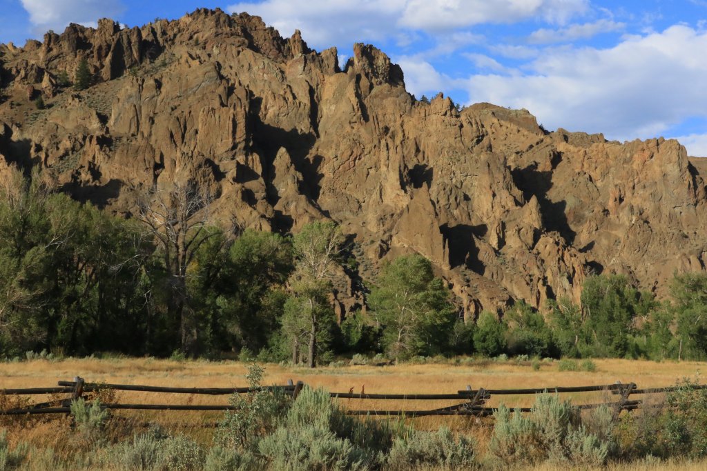
After leaving the Yellowstone NP by the East Entrance, the road becomes the Buffalo Bill Cody Scenic Byway. It climbs to Sylvan Pass at more than 8000 feet before going down in a scenic canyon of volcanic rocks carved by the North Fork Shoshone River. The scenery is then an infinite succession of spires and dykes.
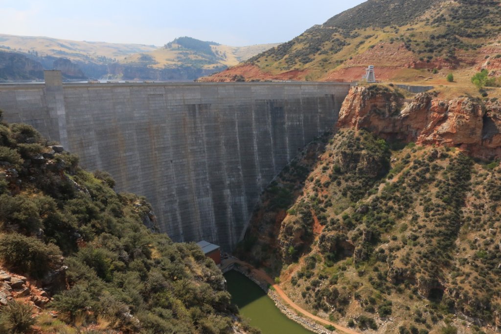
The water from the North Fork Shoshone River the arrive at the Buffalo Bill Reservoir formed by the Buffalo Bill Dam (obviously!). After its completeness, this dam was the highest in the world. Sorry for the bottomless picture; it was too late and I had no time to get my wide angle lens.

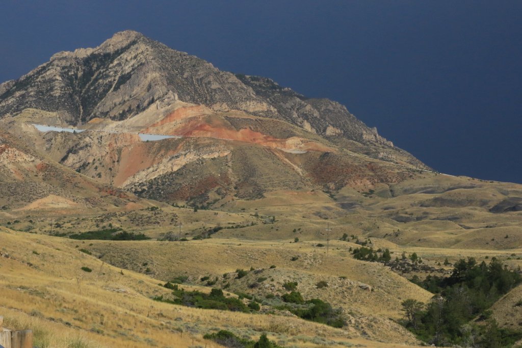
After a quick meal in Cody WY, we headed north again and follow the Beartooth Range which was covered with threatening clouds. Curiously, the last time we passed there, we had to change our plan because of a snow storm, also in August...!!!

Tomorrow, we will do a loop in the vicinity, with a few hikes and some historic sites as well.
.
Start point: Logan UT
End point: Laurel MT
We left Logan and Utah under a beautiful cloudless sky. We avoided the interstate to see more of the back country. This region has a lot of agriculture fields with small hills. Note how the vegetation on the hills grows only on the side opposed to the sun.
After entering Wyoming, we arrived at Grand Teton NP. Because of lack of time, we only passed by but surely we will be back to explore it.
We made a small detour to go see the Gros Ventre Slide which occurred in 1929 when 50 million cubic yard of mountain debris raced 50 mph down the valley and blocking the Gros Ventre River by a 250 feet high barrage and formed a 5 mile long lake. No one was hurt at that time.
Unfortunately, two years later, the natural dam yield partially and the water from the lake rushed toward Kelly town downstream and destroying almost everything on its way. This caused 6 death.
Continuing toward the north, we arrived at Yellowstone NP which we visited two times already. We decided to stop briefly at West Thumb to take a break. This area, located near the Yellowstone Lake, doesn't have geysers but have multiple hot water pools, mud pools, and vapor events.
We then drove along the Yellowstone Lake and stopped at an overlook. This region was burnt by a forest fire a few years ago. The forest is recovering slowly.
After leaving the Yellowstone NP by the East Entrance, the road becomes the Buffalo Bill Cody Scenic Byway. It climbs to Sylvan Pass at more than 8000 feet before going down in a scenic canyon of volcanic rocks carved by the North Fork Shoshone River. The scenery is then an infinite succession of spires and dykes.
The water from the North Fork Shoshone River the arrive at the Buffalo Bill Reservoir formed by the Buffalo Bill Dam (obviously!). After its completeness, this dam was the highest in the world. Sorry for the bottomless picture; it was too late and I had no time to get my wide angle lens.
After a quick meal in Cody WY, we headed north again and follow the Beartooth Range which was covered with threatening clouds. Curiously, the last time we passed there, we had to change our plan because of a snow storm, also in August...!!!
Tomorrow, we will do a loop in the vicinity, with a few hikes and some historic sites as well.
.
Last edited:
















 work provided rental for the trip).


