JohnTheLuck's Adventures Thread

Yup, that's awful and it is the issue with KO2 offroad. They should do better at 15-18 psi but they are not a hybrid tire. [MENTION=140439]Decipher[/MENTION] knows a thing or two about the KO2s in mud :)

Sadly, there are not many choice of tires than meet all my requirements: snowflake pictogram for winter conditions, confortable for long strtch on interstate, resistant for rocks, good traction in sand and mud (... not the KO2 ...), etc

Most of the time I am leaving my hometown during winter but end-up where it is already the summer (for me!).
 
Day 35:

Start point: Mesa AZ
End point: Prescott AZ

Distance driven: 238 km
Distance hiked: 10.0 km

After getting out of bed quite slowly, we hit the road after early morning traffic and under a completely clear sky. We originally planned to do one last hike in the Mesa area, but we changed our mind. Our destination was Prescott AZ, a little north of Phoenix but in the mountains. We then left for a few days the Sonoran desert and its beautiful saguaro.

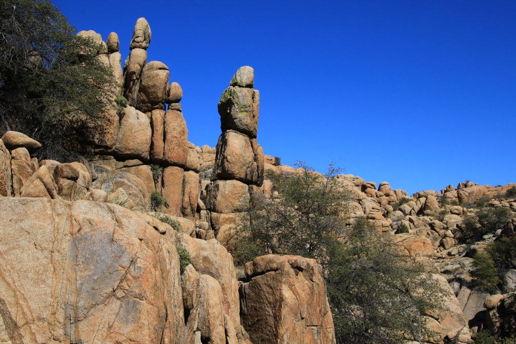
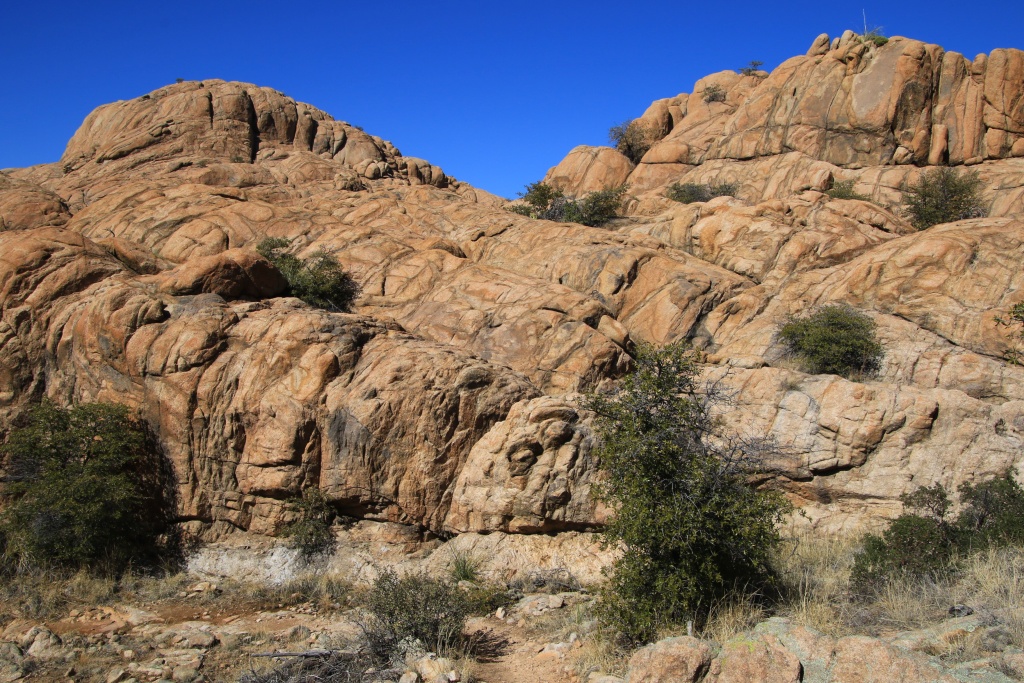
Our only activity of the day was a loop hike around Watson Lake. This artificial reservoir is bordered to the north by a superb area of ​​rounded granite rocks.

49581967626_2826cf6e9d_o.jpg


49581471328_15de186a2c_o.jpg


The lake was formed following the construction of the dam around 1935 on the northern part.

49581471578_55ff4ecaa1_o.jpg


Throughout this section, rocks of various shapes appeared after each turn and formed a real labyrinth. Luckily, the trail is fairly well indicated by numerous signs and markers on the rock.

49581967496_1777784600_o.jpg


49581471548_4035ed397f_o.jpg


After having skirted the lake from the north, the trail reach an area of ​​gentle slope without these beautiful rocks.

49581471498_0fedc7b505_o.jpg


However, this section offers refuge to several bird species thanks to sheltered areas of shallow water.

49581967206_2cefef4a10_o.jpg


49582200222_c9830d036b_o.jpg


49581471473_92505ff169_o.jpg


Back near our starting point, we crossed a Disc Golf course, a kind of game / sport in which the golf ball and sticks are replaced by an assortment of Frisbee, each of slightly different shape for either long distance or for shorter ones. Instead of holes in a green, baskets located about 1 meter high form the goals to be achieved. Prescott's course is an 18 holes of difficulty par 3.

After completing the loop, we stopped on a promontory to admire once again this enchanting setting, bathed in the light of the sun falling on the horizon.


49582200012_4484d2d9b3_o.jpg


49582199972_ee35a69855_o.jpg


49582200027_13389f99a5_o.jpg


We are in Prescott for the next four nights. Tomorrow we will go on a long off-road trail in a region of volcanic origin. After two days without precipitation, the conditions of the slopes in the region should have returned very good.
.
 
Last edited:
Day 36:

Start point: Prescott AZ
End point: Prescott AZ

Distance driven: 248 km
Distance hiked: 2.3 km

Our only destination for the day was the 60 km long Bloody Basin Road. This begins in Agua Fria National Monument and ends in Tonto National Forest. This road is in excellent condition at the start as we crossed the first mountains.

49586329652_eda768f716_o.jpg


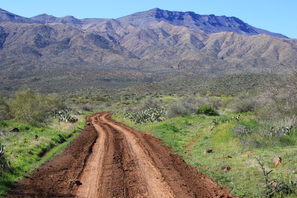
However, while crossing Bloody Basin, traces of precipitation from three days ago were still very apparent with many muddy areas. We had identified several points of interest on secondary roads but the condition of these was even worse. So we decided to try to visit them when we returned.

49586091606_f5950d57ae_o.jpg


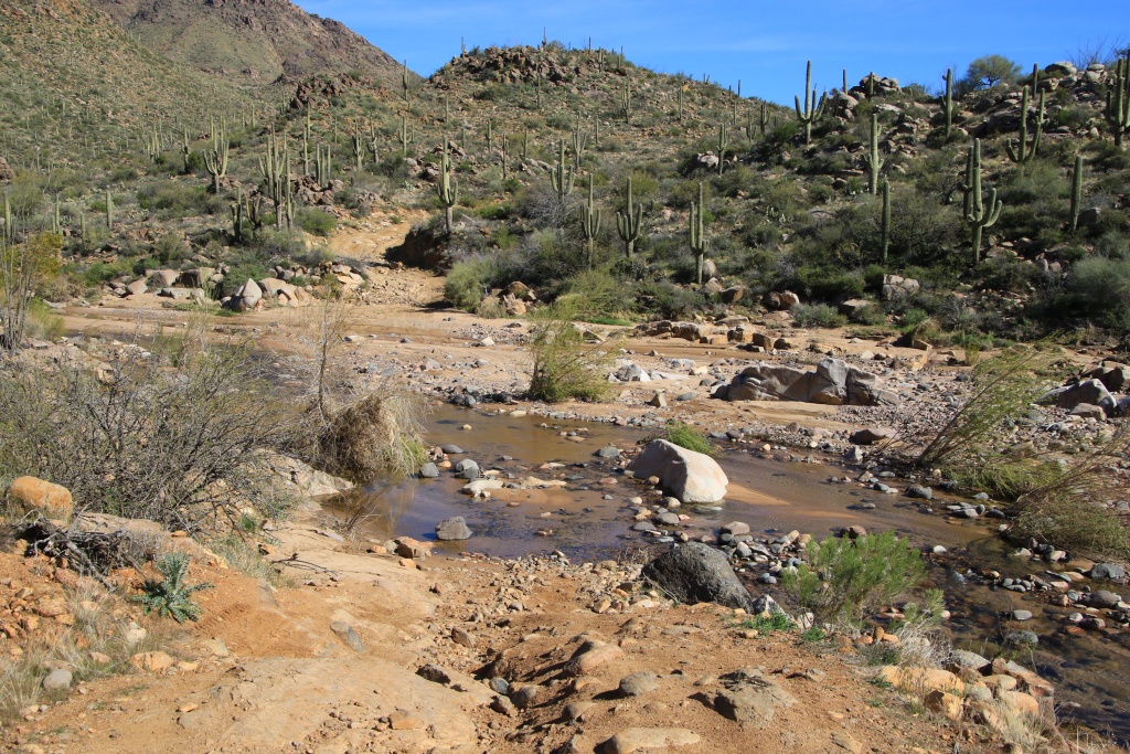
Further on, the road crosses other mountains before descending into a valley by long switchbacks. We also crossed several streams where clear water was flowing.

49586091801_92184f9f14_o.jpg


49586091561_18b4423a78_o.jpg


49585754818_de7395bc53_o.jpg


Then we crossed another mountain range. The road then became much more rocky.

49586091781_ab0cc99ccb_o.jpg


49586329877_2ac4fb7c32_o.jpg


In addition, the vegetation has once again become that of the Sonoran desert with its majestic saguaros and a few flowers here and there.

49586252971_753052d796_o.jpg


49586091466_dee7bf7877_o.jpg


Towards the end of the road, the type of rock changes from volcanic origin to granite.

49585593833_1641095a7f_o.jpg


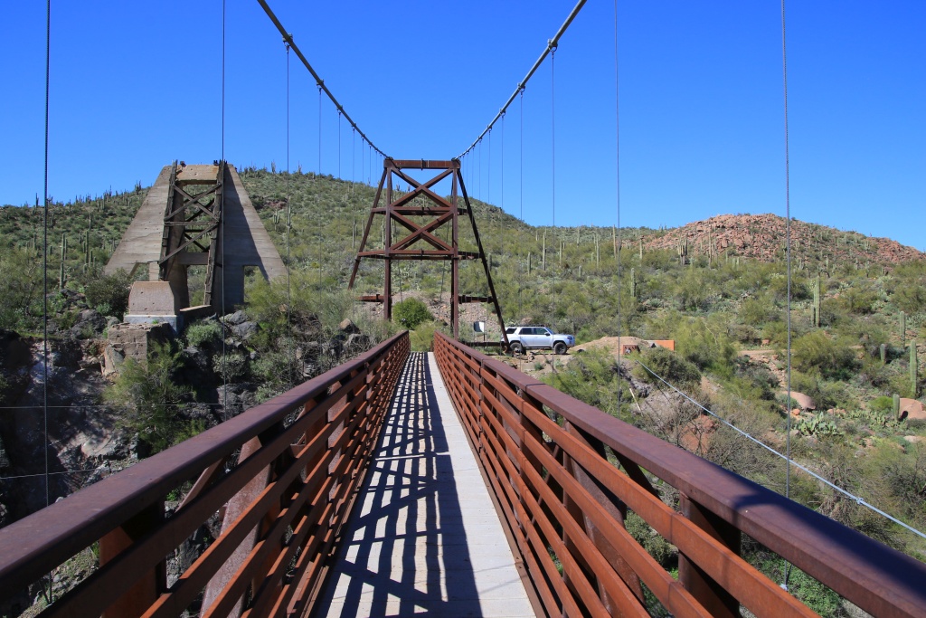
Our final point of interest at the end of the road was the Sheep Bridge over the Verde River.

49586492727_66855465ea_o.jpg


49585593968_ea9c1c58da_o.jpg


On the way to Sheep Bridge, we encountered a person in a Jeep who gave us directions to walk to a hot spring near the bridge. To our great astonishment, we found the path leading to a passage arranged in reeds and leading to an artificial basin in which flowed warm and clear water.

49586091666_2b25b69c43_o.jpg


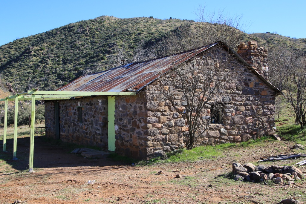
On our return, we went to see a stone cabin at the end of a short side road.

49586329702_79fd346727_o.jpg


Our last point of interest was the Pueblo La Plata, the ruins of an ancient Native American village that occupied the plateau around the 1300s. Although the ruins are in a fairly deteriorated condition, the presence of countless pieces of pottery made the visit very interesting. The decor was also very beautiful and we can imagine the difficult life that the occupants had. Agua Fria NM protects around 400 archaeological sites from this period.

49586091431_4ac0d84d6a_o.jpg


Tomorrow, we should be travelling a scenic forest road and doind a few hiking trails around Prescott.
.
 
Day 37:

Start point: Prescott AZ
End point: Prescott AZ

Distance driven: 274 km
Distance hiked: 4.1 km

Today, we explored the surroundings of Prescott by driving two loops, one to the southwest and the other to the northeast.

To start, we drove the White Spar Road (AZ 89) in Prescott National Forest. This winding road crosses the mountains lined with tall pines before descending into the neighboring valley.

49590627632_69c64fbb1e_o.jpg


49590627592_b739d306e6_o.jpg


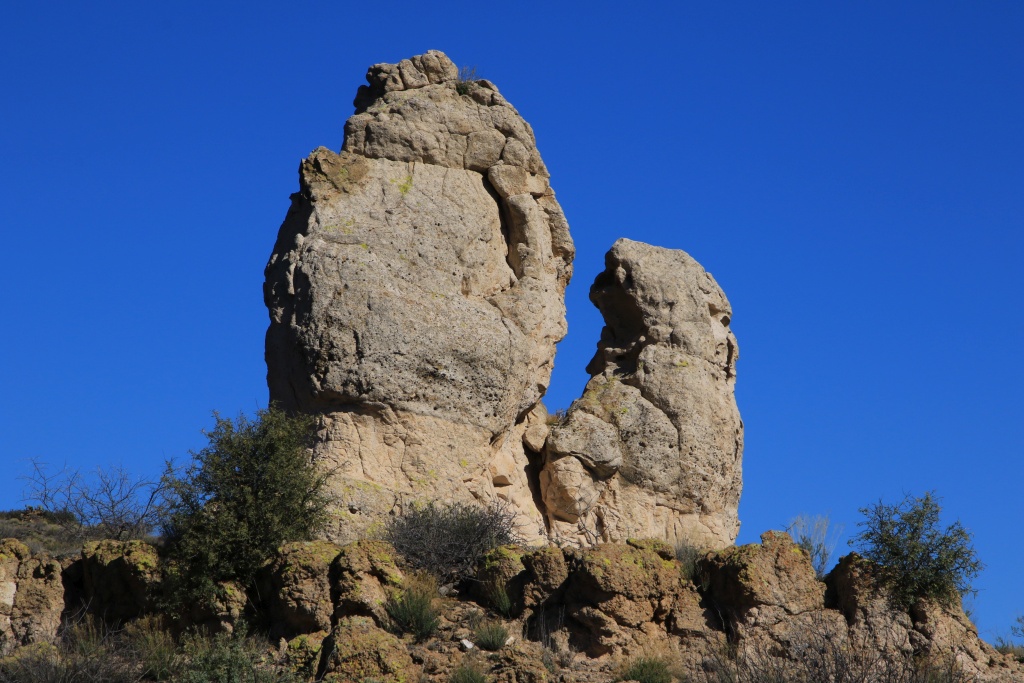
To complete this first loop, we returned by Iron Springs Road. Near the small village of Kirkland, we crossed an area where the rocks formed of volcanic ash were carved into pinacles of various shapes. We can easily imagine that the name of the neighboring village, Skull Valley, comes from the shape of one of these promontories.

49589895258_71c56cdbbd_o.jpg


49589895233_9ecbc731dc_o.jpg


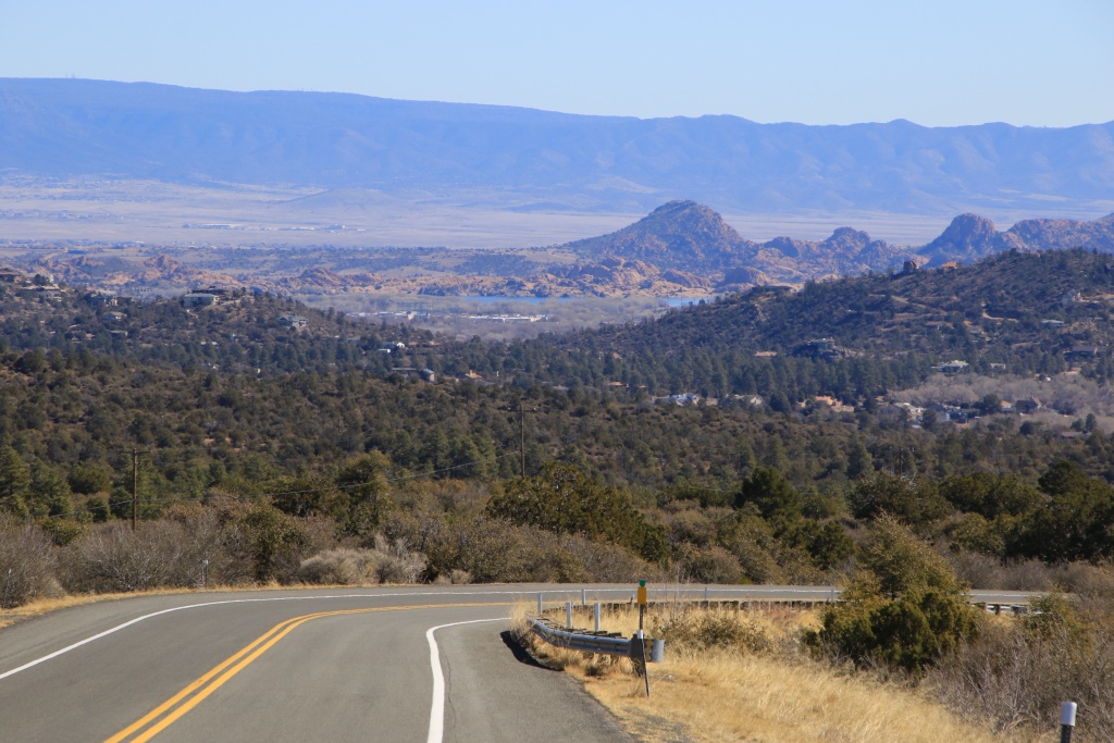
As we approached Prescott, our next destination became visible, Willow Lake, another artificial reservoir bordered by spectacular rocks.

49590627527_26f0beef98_o.jpg


As with Watson Lake which we visited two days ago, Willow Lake represents a privileged place for aquatic fauna and birds.

49589895193_1573f2cf83_o.jpg


We hiked a portion of the Willow Lake Loop trail. The view of the lake, the shape but above all the textures, colors, and patterns of the rocks were really spectacular.

49590627477_0f2418a1b0_o.jpg


49590627447_0ba9dee294_o.jpg


49589894958_d16cd579dc_o.jpg


49590627402_422510226c_o.jpg


49589895023_33c5a782c7_o.jpg


After returning to the 4Runner, we headed to the ancient mining town of Jerome located in the mountains via the Mingus Mountain Scenic Road (AZ 89A). As the road descends with switchbacks towards Jerome, a stop allow admiring the spectacular landscape in the distance, bordered by the cliffs of a canyon; the cliffs of the Red Rock Country in which the famous town of Sedona is located.

49590387256_73644cff4e_o.jpg


The former mining town of Jerome was founded in the late 1800s. The mine finally ceased operations in 1950.

49589894878_25194278d2_o.jpg


We then continued our loop by crossing a portion of the Dry Creek Scenic Road from Jerome to Cottonwood. As the sun was about to set, we returned by Camp Verde then on AZ 169 and AZ 69 to complete this second loop.

Tomorrow we should go onto some off-road tracks a little further south.
.
 
Day 38:

Start point: Prescott AZ
End point: Prescott AZ

Distance driven: 304 km
Distance hiked: 2.8 km

We had another great day exploring the mountains north of Phoenix. This time we drove the Table Mesa (New River) off-road trail in Tonto National Forest. This long route generally runs along the New River either up close at the bottom of the canyons, or further up the mountain ridges. As we traveled from west to east, several of the photos were taken in a west direction opposite to the morning sun.

At first, the state left something to be desired given the damage caused by the vehicles that had driven it while it was still muddy. Today, it was practically dry over its entire length, apart from the numerous crossings of the New River, of course.

49594376816_9dfd3c0bc8_o.jpg


49593876438_d68d49498e_o.jpg


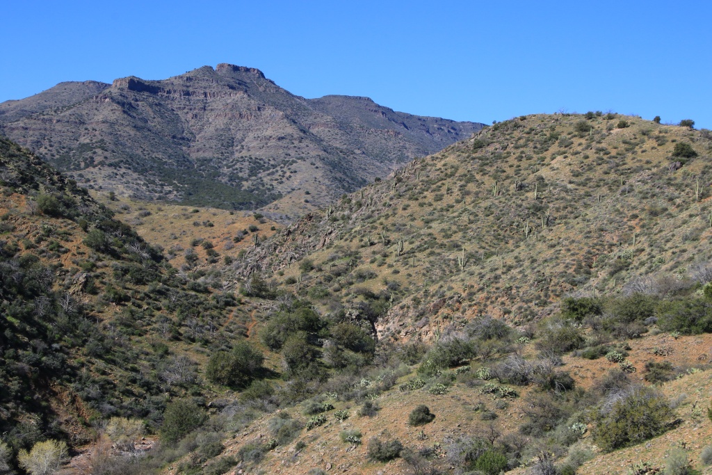
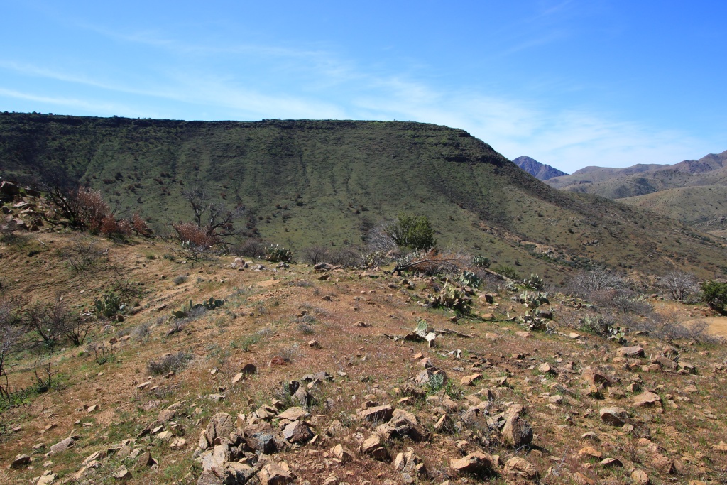
The road alternates between fairly high passages and other at the bottom of the canyons. The table-shaped mountains of volcanic origin surrounded us on practically all sides. The saguaros were once again very present.

49594376706_ace8e894b1_o.jpg


49593876338_c874b5fbdc_o.jpg


49594623132_701003dd37_o.jpg


In some places, the last rain a few days ago had left traces of fairly significant road erosion, leaving very little room to pass.

49594375901_442746c2d4_o.jpg


We then reached an area mainly composed of large granite rocks. Given the proximity of the river, it is assumed that the volcanic rocks deposited on them have been eroded over time.

49594622957_4a21ea50d3_o.jpg


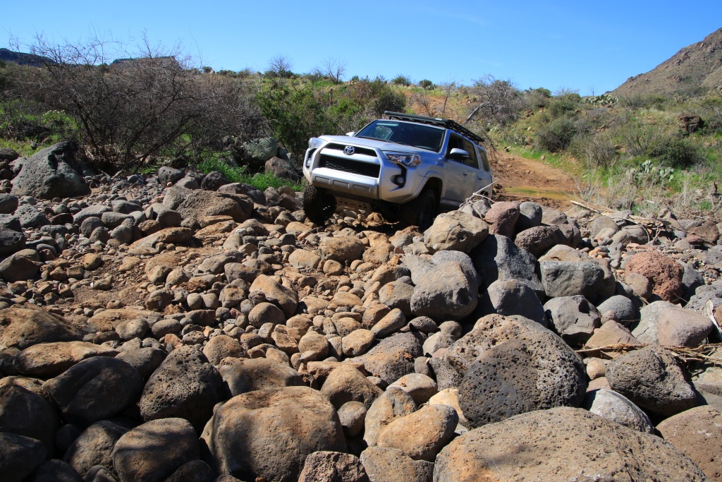
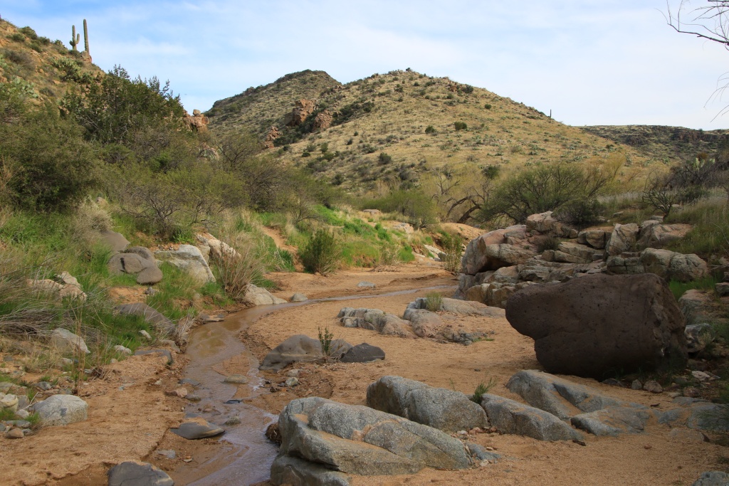
Further on, a succession of dry streams with large rocks presented a certain degree of difficulty in crossing them, but nothing insurmountable with a good choice of trajectory and a fairly slow speed.

49594376456_da6dddd211_o.jpg


Luckily, several of these passages had already been improved by drivers of vehicles having traveled the road before us. In this kind of terrain, we don't usually take a chance and my wife is kind enough to act as a spotter.

49594376376_92739ce283_o.jpg


49593876108_89e547f143_o.jpg


We crossed a few small streams still flowing a little and allowing different vegetation to grow and brighten up the landscape with vibrant colors.

49594622822_0018985f7e_o.jpg


While we were at two-thirds of the way, this goes up on the ridges and would normally have allowed a faster pace. This is without counting the unobstructed views and the magnificent landscapes, causing numerous stops for pictures! [MENTION=306890]MAST4R[/MENTION] there are no fast going roads around here for us !!!

49593875948_e9d2466e2b_o.jpg


49593875913_364f820d43_o.jpg


49594622637_38df8fb2ba_o.jpg


49594622577_c71475b5ac_o.jpg


49593875798_2611880f6c_o.jpg


At the end, New River Road joins Camp Creek Road. Towards the north, it eventually joins Bloody Basin Road which we traveled two days ago. Since we wanted to have enough time for a hike, we instead took Camp Creek Road south and reached the northern suburbs of Phoenix.

We then hiked the Badger Springs Trail in Agua Fria National Monument. This relaxing trail follows a small creek in which a thin trickle of water flowed and eventually joins the Agua Fria River.

49593875768_0ecc8cc0e7_o.jpg


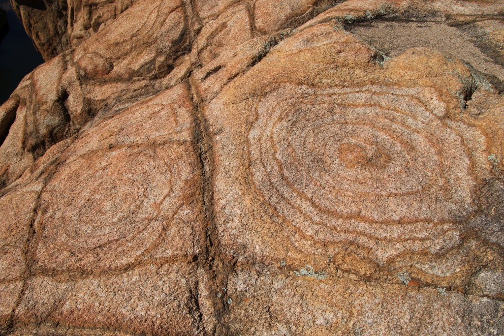
At the confluence, we could admire this pretty river and its waterfalls in rocks of volcanic origin, rounded by the waters. Nearby, we saw several petroglyphs.

49594375971_3a2a082f5a_o.jpg


49594375781_954466f5a7_o.jpg


Tomorrow we have an appointment at a Toyota dealer north of Phoenix for the oil change, tire rotation, but also to check the front suspension and annoying noise.
.
 
Day 39:

Start point: Prescott AZ
End point: Payson AZ

Distance driven: 380 km
Distance hiked: 4.2 km

The beautiful clear sky of the last few days has given way to the clouds with a few small breaks at the end of the day. But at least it's not snowing and I'm in shorts!

We had an appointment with a Toyota dealer north of Phoenix for oil change, tire rotation, and verification of suspicious front-end noise. As nothing abnormal was found, the noise must come from something minor. It should be noted that there were more 4Runners in the yard than what my dealer is selling in a full year ...

Our first destination of the day was Mount Ord in Tonto National Forest near Payson AZ. The top of the mountain is accessible by a well maintained road and giving access to the multiple telecommunications facilities installed there. Strange rocks drew our attention to a wall while climbing the road.

49598336506_afc9f2acec_o.jpg


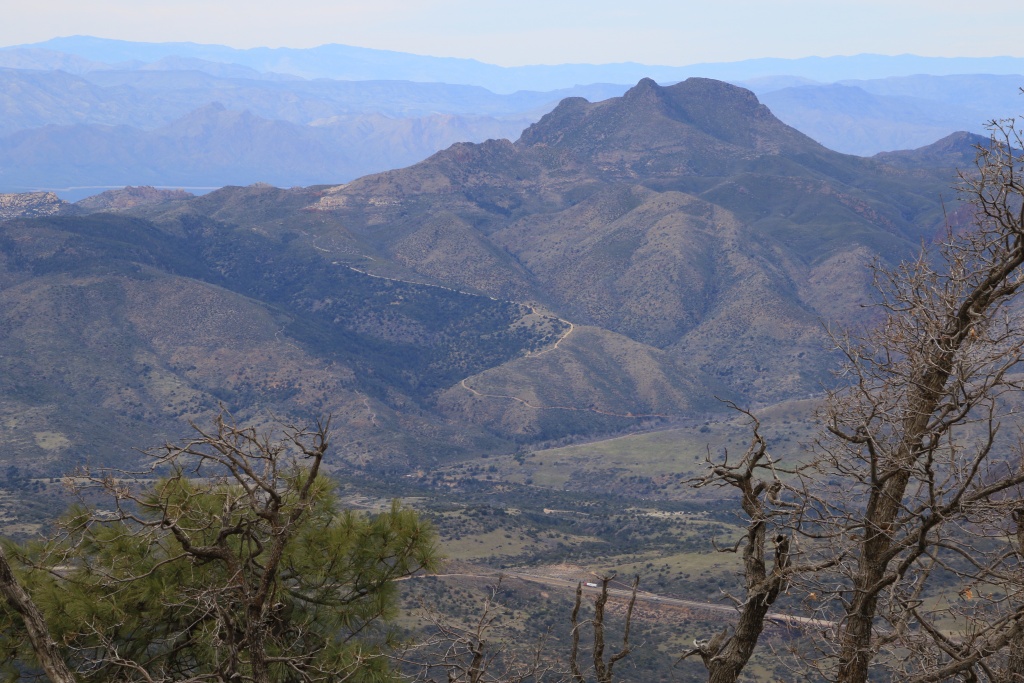
The last portion must be done on foot along the road for about 1.4 km. The cold wind blew persistently and, despite the superb view of the surroundings, we did not linger too long. In the distance, the Roosevelt reservoir was visible, as well as the Four Peaks mountain which we should see more closely tomorrow.

49597840448_52a85d8a78_o.jpg


The AZ 87 road we had just travelled was visible below in the distance, as well as the start of the access road to Mount Ord.

49597840203_69dc24c425_o.jpg


A road climbing in the heights on a nearby summit attracted the attention of my wife who made it our next destination.

49598336546_35026c2d7a_o.jpg


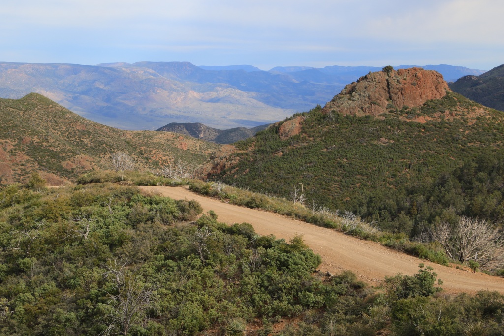
This road is part of the Sunflower OHV Trail System, also in Tonto National Forest. We drove the NF 201, a narrow shelf road climbing on the edge of the mountain and giving access to some trailheads.

49598588032_d92c32e151_o.jpg


49598336306_9c9d1eb790_o.jpg


49598336191_91744a0d0d_o.jpg


At the end of the road, we reached the Mount Peely Trailhead and hiked a short segment for a nice view towards the mountains.

49598336401_6411460c14_o.jpg


After descending, we then headed onto the NF 25 road that my wife has spotted while we were on Mount Ord, clearly visible from this point.

49598587787_fe3f439771_o.jpg


49598587727_334586ec01_o.jpg


After, we reached Payson where we will spend the next two nights.
.
 
Day 40:

Start point: Prescott AZ
End point: Prescott AZ

Distance driven: 314 km

We had an amazing day exploring Tonto National Forest near Tonto Basin. We drove two easy offroad trails crossing sublime landscapes. Be careful, and prepare yourself for an avalanche of pictures ...

The first trail, Four Peaks Road, climbs and descends gradually between the mountains along the Four Peaks Wilderness, before finally descending towards the Roosevelt reservoir. Four Peaks is a mountain with, you guessed it, four peaks. Unfortunately, as the road passes north of Four Peaks, we were not favored by the position of the sun for photography.

49602631336_060ee456df_o.jpg


49602129603_d0b7729c08_o.jpg


Towards the middle of Four Peak Road, we branched off onto Edwards Peak Road leading to an area with several mines. The slightly more difficult route offers at the beginning very beautiful views of the Roosevelt reservoir and the north slope of Four Peaks and its traces of snow still present.

49602893152_88b5dac344_o.jpg


49602129488_f5c2006784_o.jpg


After a while we decided to turn around because the progress was slower and we were in a very wooded valley with no interesting view.

Back on Four Peaks Road, we started the long descent toward the Roosevelt reservoir. The road then runs on ridges or mountainsides and offers an incomparable view at every turn.

49602629931_2c462f1a1f_o.jpg


49602631106_f1b2216098_o.jpg


49602129393_3e6086a363_o.jpg


Having reached the end of Four Peaks Road, we decided to make the most of the superb weather and travel the A-Cross Road (FR 60) that we had planned for tomorrow morning. In addition, the position of the afternoon sun was much more advantageous. This route was not described in our reference books, but a website we use had it.

At the beginning, the road crosses Tonto Creek which still flowed a lot following recent precipitations. A sign indicated that the road was closed. When we got to the bank of the crossing, we hesitated for a long time seeing the water level and the presence of sediment. As recommended in these conditions, my wife generously offered herself to walk and check the depth and nature of the soil.

49602892887_783b9807d9_o.jpg


Although the central part seemed quite firm and rocky, the water level was too high towards the end. At the same time, a group of local people driving side by sides arrived and actually recommended that we not cross there. They told us that there were other possible crossings upstream of the river. We followed them. The second passage was also impassable.

However, while we were evaluating the third pass, several other vehicles arrived one after the other and crossed it without even hesitating. We followed them without encountering any problems. Seen from the other side, this passage was still intimidating.

49602892837_eb6eee204d_o.jpg


Having crossed this major obstacle, we reached a fairly fertile area with even a few orchards and several fields covered with wild flowers.

49602630961_4417b1fdf4_o.jpg


Further, the road joined an area of ​​bentonite rocks formed of volcanic ash. This soil is very hard when dry, but completely impassable when wet. Deep ruts on the road testified to the difficulties of certain vehicles during the last days. On the hills, we had noticed these strange white lines in the distance while we were on Four Peaks Road.

49602629856_dd8d15332b_o.jpg


49602892762_32937cd862_o.jpg


Other areas of erosion and vegetation formed interesting patterns.

49602630836_424a008846_o.jpg


49602892537_648ec25a0a_o.jpg


49602630556_1618f0e819_o.jpg


As for Four Peak Road, the A-Cross Road offers superb views of the Roosevelt reservoir.

49602630456_e31fe13508_o.jpg


Farther along we skirted the canyon carved by Salima Creek and presenting beautiful whitish columns.

49602128853_8412024e14_o.jpg


Although Salima Creek flowed relatively significantly, its passage is facilitated by the presence of a concrete span.

49602336278_73d2731acd_o.jpg


49602891857_a3bb21a43c_o.jpg


Towards the end of A-Cross Road, mine tailings on Asbestos Point look like the wings of an angel.

49602629776_1701ac57a6_o.jpg


Tomorrow we will leave the Sonoran Desert and climb on the Colorado Plateau for the rest of the trip. We will therefore say our goodbyes to the saguaros, while the other varieties of cactus will still be present. However, we will gain in color because the rock will become reddish.
.

 
Day 41:

Start point: Prescott AZ
End point: Holbrook AZ

Distance driven: 414 km
Distance hiked: 0.7km

We left Payson this morning to go a little further towards the northeast of Arizona to join Holbrook.

Sometimes chance does things right; Since we had traveled the A-Cross Road yesterday rather than this morning, we instead took the AZ 188 road bordering the Roosevelt reservoir to the south. Having a few empty containers, we made an unplanned stop at the Tonto National Monument to drop them in a recycling container. Well, what a cry my wife did when she saw the sides of the canyon covered with poppies, these pretty orange-yellow flowers.

49607572961_7c6f39d1bf_o.jpg


49607572921_995042ae35_o.jpg


49607820092_c3dc4656bb_o.jpg


Continuing on route AZ 188, some areas of poppies were also in bloom, but a little less dense than in the canyon of Tonto NM.

49607059993_0268a9ecfd_o.jpg


Then we branched off onto AZ 288, the Desert to Tall Pines Scenic Byway. This road goes up towards the mountains and eventually joins the top of the Mogollon Rim, an escarpment of several hundred kilometers forming the southern base of the Colorado Plateau.

At the beginning of this route, we made a very first meeting with an inhabitant of the American southwest, a Gila Monster, a poisonous reptile but not mortal for the humans. It was warming up quietly on the paving. I was able to approach him close enough before he decided to join the side of the road.

49607059943_46f973ab41_o.jpg


Continuing on Desert to Tall Pines SB, the Four Peaks mountain and the Roosevelt reservoir have become visible in the distance. Plains of dried grass have become more and more frequent.


49607572781_3ed12e5c94_o.jpg


We did a little detour on a short secondary trail leading to extraordinary wilderness camping sites near Parker Canyon, a place nicknamed Roosevelt Vista on some websites.

49607059853_28b09a2461_o.jpg


49607059798_a251de9fd4_o.jpg


At this location, we also said goodbye to the last saguaro cacti growing precariously on the high cliffs. Sad moment ...

49607820327_cfc54b412d_o.jpg


We also tried to reach another point of view above Parker Canyon but the deteriorated state of the access track discouraged us a little and we decided to abandon this destination.

Further on, as we reached the top of the mountains, the pines became predominant, a view a little too similar to our Quebec landscapes. To add to this, when we reached the top of the Mogollon Rim, the snow still partially covered the forest floor although it was still 10C. Sorry, no photo of this ...


49607572671_3fbfc829e4_o.jpg


49607059658_a7074d3932_o.jpg


Arriving near Holbrook, our final destination of the day, we still had a little time to go in the southern sector of Petrified Forest National Park. This park protects an area where trees nearly 220 million years old have been fossilized by minerals present in the soil of volcanic origin.

49607059743_15b553686e_o.jpg


49607059713_20193bd4c7_o.jpg


49607059623_4a98bd32f6_o.jpg


For the next three days, we will attempt to hike some Off the Beaten Path hikes, that are park-approved off-trail hikes. One of them requires a special permit which is issued only 3 times a week. Hope we are lucky.

Our visit will be a bit complicated by the fact that the main park road is blocked for work in the middle, separating the park into two parts.
.
 
Day 42:

Start point: Holbrook AZ
End point: Holbrook AZ

Distance driven: 171 km
Distance hiked: 15.1 km

We got up early this morning so that we could be at the Painted Desert Visitor Center in Petrified Forest National Park as soon as it opened and try to get one of the three permits issued per week to hike the Off the Beaten Path hike of Devils Playground. Luckily, we were able to obtain the last permit of the week!

Access to this trail is restricted due to the fragility of the hoodoos formations and the very brittle soil. To reach the start of the trail, we had to take a track located outside the park. Nothing difficult but the 4Runner proved to be handy.

As we prepared for this fairly long hike, a few flakes fell from the very large clouds filling the sky. In the distance there were some openings but the weather forecast indicated rather a full cloud in the afternoon.

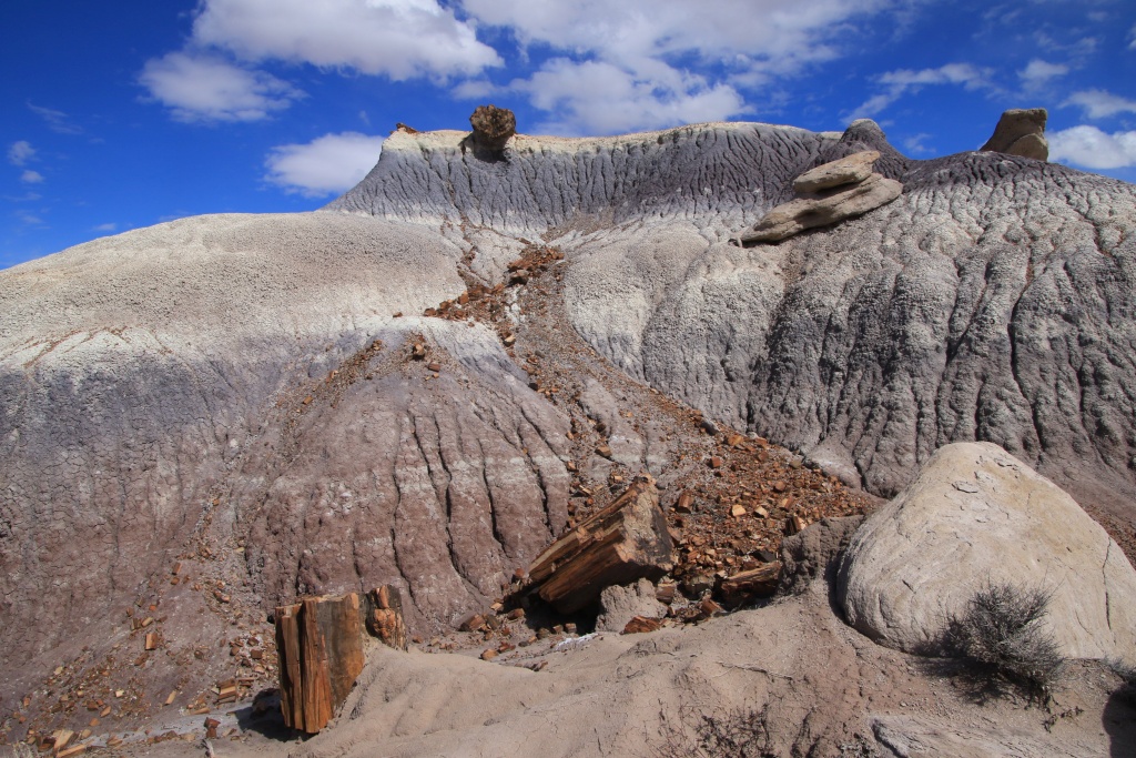
The first section of the trail is a bit monotonous. Markers then indicate the route to follow. After crossing a wash whose soil was slightly damp, we crossed a long sandy plain with small bushes. Along the way, we received a few drops when the sky was quite threatening. After crossing a pass between two hills, we finally went down to a very colorful area with a carpet of fragments of petrified wood.

49612292337_6acbdfb3d7_o.jpg


49612034866_07cf4e97ab_o.jpg


49612365392_6399d94ebb_o.jpg


From there, there were no more landmarks and we had to rely on our GPS. Continuing, we walked along a ridge with many rocks and a few small islands of wood here and there.

49612292182_354bbb0ec7_o.jpg


As we joined the area called Devils Playground and the hoodoos began to be more and more numerous, the sky was completely clear, allowing us to fully appreciate this incredible place.

49612034731_d5a7f857f2_o.jpg


49611517388_3cc03b5c84_o.jpg


49612034616_248c5550f8_o.jpg


49611517263_72121163e0_o.jpg


49611517183_5305dd6ecc_o.jpg


49612034441_a543a3fd1e_o.jpg


This region has very few large petrified trunks of trees, unlike others that we should cover in the coming days.

49612034406_8525151f4b_o.jpg


After completing the loop and rejoining our vehicle, we rested our legs on the northern part of the main park road. The sun was very present despite the dark clouds in the distance. We visited the Painted Desert Inn, a historic building that once welcomed the first visitors.

49612291737_8bfb564feb_o.jpg


49611516988_3b32d2b168_o.jpg


49612291712_333cdec56b_o.jpg


Tomorrow we should once again hike at least one other Off the Beaten Path in Petrified Forest NP. To tell the truth, to fully appreciate this park I think that such hikes are advantageous because although the different points of view are spectacular, they do not allow the same discoveries.
.
 
Last edited:
What a great thread!

Just discovered your fantastic thread. This is such a great thread showing how your T4R is really getting used for adventures. Looks like a lot of fun. I wonder if the mods could create a new category for 'adventure' or 'trip' posts only, to encourage more posts like this?

Keep it up!

b
e
n
 
Just discovered your fantastic thread. This is such a great thread showing how your T4R is really getting used for adventures. Looks like a lot of fun. I wonder if the mods could create a new category for 'adventure' or 'trip' posts only, to encourage more posts like this?

Keep it up!

Thanks! I am really glad you like my adventures thread.

During our visit of Petrified Forest NP the 4Runner will not be the center piece but that should change later. We still have a few offroad trails to do before the end of the trip.

About creating a trip sub-forum, I am guessing the moderators were already asked to create one. The problem is that all generations would be mixed together. Many people also use their build thread for there own adventures. There is no perfect solutions.
 
The flowers are very cool.

Yes indeed they are very cool.

During last year trip in Southern California, there was a lot more flowers. This year, we decided to start a bit later and longer. The flowers are only beginning to appear. I am afraid that we will miss, again, the best time to see them.

Unless we stay longer...
 
Day 43:

Start point: Holbrook AZ
End point: Holbrook AZ

Distance driven: 82 km
Distance hiked: 11.8 km

Today, we returned to Petrified Forest National Park to hike another Off the Beaten Path hike, the one leading to Onyx Bridge, a petrified tree trunk under which the water has dug a little wash.

Unlike yesterday, the sky was completely clear but it was a little cold with a meager 3C at the start.

The trail begins at the Painted Desert Inn and descends in laces towards the plain below. The surrounding hills are mainly composed of red soil, with some bands of bright white.

2020-03-03 09-04-38 IMG_5235_1024px by Jean Lachance, on Flickr


After reaching the plain, the normally easiest way is to walk in the washes but with the recent rains the soil was still very humid and there were even some puddles. We then had to rather follow these washes.

49615504388_6941c7395b_o.jpg


To reach Onyx Bridge, we had to circulate in secondary washes, several of which were literally littered with petrified logs that had rolled down the slopes after being dislodged by erosion.

49615504188_62fe104046_o.jpg


After going up towards the whitish layer, Onyx Bridge revealed itself to us over its entire length of at least 30 meters. On each side, the tree continues in the hills so we imagine according to the diameter at these places that it is perhaps twice as long.

49615504358_644f11bc83_o.jpg


After contemplating Onyx Bridge, and as the region further north is superbly composed of pink hills, we decided to continue and go up and reach a long ridge.

49616276997_86fd4a1780_o.jpg


49616277167_92851e7531_o.jpg


While we were still walking on the ridge, we saw a thin layer of fossilized shells. As these were located higher than the level of Onyx Bridge, we think that the area was alternately out of the water and then submerged.

49616021511_fd22b47471_o.jpg


After descending further from the ridge, we crossed an area very rich in large trees. Later, when talking to another hiker, we learned that this region is called Angel's Garden. This hiker also confirmed to us that we could continue and reach our starting point as he traversed the loop in the opposite direction from us.

49616021491_dfe7b94197_o.jpg


49615504288_c7dc567557_o.jpg


49616276967_f5d5656cc9_o.jpg


Continuing, we began a slow descent into the white rock. The erosion had created small slot canyons.

49616276982_0babe6e461_o.jpg


When it was not the action of water, it was that of the wind which had sculpted the rocks near a pass.

49616021391_70eb752297_o.jpg


49616021431_4a679cfd4b_o.jpg


The hiker we spoke with previously also told us that there were petroglyphs a little lower. As his indications could not be very precise verbally given the rugged terrain, we wandered here and there to find it. We were looking for hard rocks that could support petroglyphs, but most were too fragile.

49616277077_978ae9736b_o.jpg


Our patience paid off after a while.

49616277072_b5bc6ef6ba_o.jpg


49616021341_359d4da4e3_o.jpg


We then joined the slope going up towards the Painted Desert Inn. It was once again a superb hike in astonishing landscapes.

49616276932_d6ab91346a_o.jpg


Tomorrow will be our last full day in Petrified Forest NP, with a few more hike, at the great pleasure of my wife. I am eager to go offroad again with the 4Runner ...
.
 
Great pics, it is such a nice park. We have been a few times but not recently.

Yes it is a great park, even if it is a bit unknown. It is our third time here but this time we decided to stay a bit longer and hike many long trails. Again, travelling the scenic road ans hiking short trails are great but doesn't reveal what could be see on the Off the Beaten Path hikes.

For sure, this park may become for us a mandatory stop along the long road to the southwest from home.
 

Forum statistics

Threads
278,312
Messages
3,554,089
Members
248,016
Latest member
Advally Service

Trending content

Back
Top