JohnTheLuck's Adventures Thread

Day 61:

Start point: Olive Branch MS
End point: Hickory NC

Distance driven: 1004 km
States travelled: MS, TN, NC

We decided to make a slight diversion from our return route by going for a short section on the famous Blue Ridge Parkway. This road runs through the mountains over a length of more than 700 kilometers. We decided to only hike the south end.

So we left very early after a quick lunch at the hotel. Our first task was to join and especially cross the interminable state of Tennessee from west to east on I-40. The presence of many trucks and especially the terrain becoming more and more mountainous delayed us somewhat.

The other challenge, and this one we noticed on entering, was to cross the small tourist town of Pigeon Forge TN which organizes a modified car event, the Spring Rod Run, starting today. Everything was congested as visitors drove down the main street to look at the cars on display along it. Towards the end of the village, a break in the long car procession of visitors allowed us to see a few on the right of the following photo, taken from the 4Runner's traffic camera.

52815339627_e2aefdc4fe_o.jpg


Then, as the end of the Blue Ridge Parkway begins east of Great Smoky Mountains National Park, we took the opportunity to visit it quickly, a first for us, by traveling the Newfound Gap Road. At the bottom of the mountains, the leaves of the trees were already well advanced.

52816310150_db731f731d_o.jpg


Higher up, the buds of the trees had not yet hatched, but the clumps of wild rhododendrons lining the road caught the attention of my co-pilot, being jealous of the climate of the region compared to that of Montreal.

52815899926_b1cbc46545_o.jpg


After climbing the mountain to Newfound Gap and back down the other side, we reached the southern start of the Blue Ridge Parkway. The road has a large number of stops for viewpoints. Unfortunately, the clouds rolled in and the few colors of the leafless forest seemed to fade, while a faint whitish film caused by the humidity dulled the sharpness. In short, these photos aren't great, but that's what we saw.

52816310270_7b6880e086_o.jpg


52816352788_cdb354999c_o.jpg


52815900106_8a62283077_o.jpg


My co-pilot's botanist's keen eye also spotted several flowering trees and shrubs, including several species that she was unable to identify.
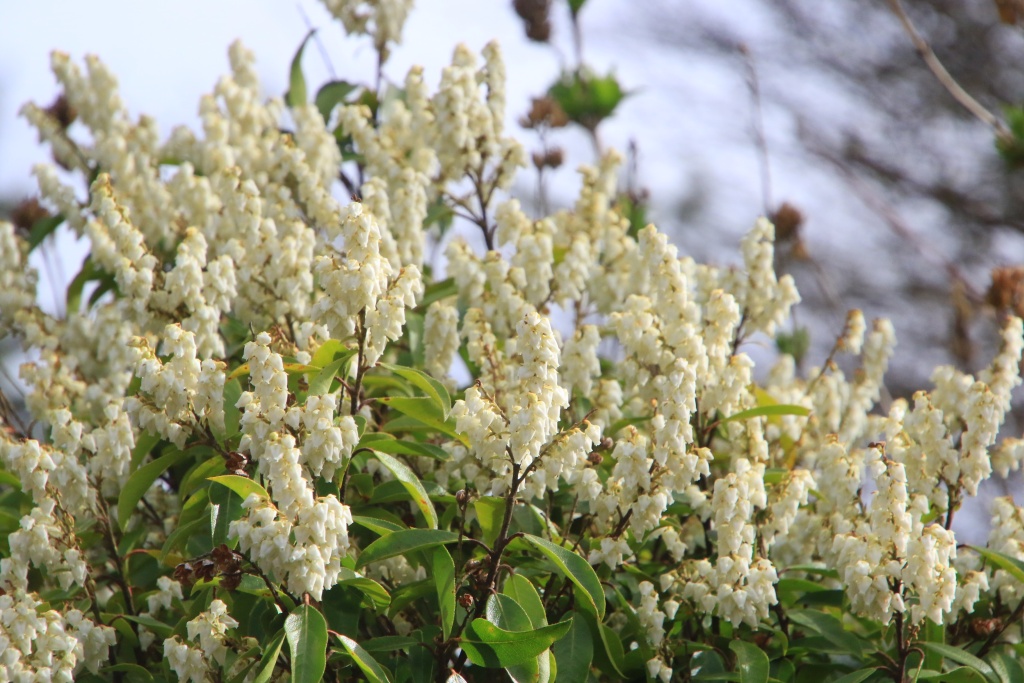
52816310200_d70bb4c20c_o.jpg


Further on, the sun made timid breakthroughs.

52816352668_d122e9da05_o.jpg


Along the way, the road contains several tunnels adding to the undeniable charm of this very scenic high road.

52815339497_1a0807af53_o.jpg


52816309895_e28a4babce_o.jpg


As we still had a bit of road to reach our hotel, we left Blue Ridge Parkway near Asheville NC. This side trip was very informative and we might be back someday.
 
Thanks for this, I have never driven the Parkway. Considered it when I lived in Michigan, but never did it.
 
Thanks for this, I have never driven the Parkway. Considered it when I lived in Michigan, but never did it.

We pass nearby numerous times without going to take a look. We might do another part when trees will have leaves and the sky clearer. That would help a lot.
 
Day 62:

Start point: Hickory NC
End point: Clarks Summit PA

Distance driven: 1000 km
States travelled: NC, VA, WV, MD, PA

We spent the day on I-81 interstate, with a short detour to Frederick MD to pick up some 4Runner accessories at Trail Grid Pro. Another day with lots of trucks, but that's the norm here in the US. We were treated to numerous rain showers this morning and variable and very hot skies in the afternoon. The rain was welcome because although we had done a truck wash as we left Farmington, there were still several more difficult spots to get this lovely dried bentonite mud off the truck.

We are in Clarks Summit, a suburb of Scranton, Pennsylvania. Tomorrow, we will finally reach the house in the afternoon.
 
Day 63:

Start point: Clarks Summit PA
End point: Montreal QC

Distance driven: 578 km
States travelled: PA, NY, ON, QC


We took the I-81 highway from Pennsylvania, Ney-York, Ontario, and then finally to Quebec and home. Being the weekend, there was much less traffic, and especially fewer trucks. Although we didn't manage to do most of the activities we had planned, we had a very nice trip.

We have a lot of work to do on the 4Runner for the next trip. Our goal is to modify it so that we can sleep inside on occasion.

In the next few days, I will write a trip summary for reference.

Thanks to all who followed us during this trip.
.
 
2023-02 Arizona, Utah, Nevada, New Mexico trip recap

Its been a few weeks after we came back home from our trip in Arizona, Utah, Nevada, and New Mexico. Here is my usual recap:


Highlights:

- First trip since the long COVID-19 pause;
- Longest trip duration ever for us;
- Snow, rain, mud and cold temperature impacted deeply our planned activities. We had to improvise a lot;
- Some wildflowers but the cold winter probably impacted them also;


Statistics:

Trip duration: 63 days
States visited: Arizona, Southern Utah, Eastern Nevada, Northern New Mexico, Tennessee
Pictures taken (mostly using 3 shots exposure bracketing): 18121 / 74.5 GB

Distance driven (real): 22072 km / 13715 miles

Fuel used: 3142 liters / 830 US gallons
Consumption (displayed): 14.6 l/100 km / 16.1 mi/US gal
Consumption (real): 14.2 l/100 km / 16.5 mi/US gal

Arizona Off-Road trails driven:
- Fredonia Area: Gunsight Point Road
- Glen Canyon NRA: Stud Horse Point Road (partial)
- Navajo IR: Cane Valley Road
- Navajo IR: Cattle Canyon Road (partial)
- Navajo IR: Piute Creek Road
- Vermilion Cliffs NM: Ferry Swale Canyon Road
- Vermilion Cliffs NM: Lee's Ferry Overlook Road
- Vermilion Cliffs NM: Paria Overlook Road
- Vermilion Cliffs NM: Thousand Pockets Access Road

Arizona Scenic Roads driven:
- Among the People Navajo SR
- Flat Mesa Rock SB
- Kayenta to Monument Valley SR
- Navajo Mountain RS

Arizona Parks/Monuments/Forests:
- Canyon de Chelly NM
- Monument Valley TP
- Petrified Forest NP
- Vermilion Cliffs NM

Utah Off-Road trails driven:
- Arches NP: Salt Valley Road
- Arches NP: Willow Flats Road
- Bears Ears NM: Arch Canyon Overlook Road (partial)
- Bears Ears NM: Arch Canyon Road (partial)
- Bears Ears NM: Black Mesa Butte Road
- Bears Ears NM: Black Mesa Road
- Bears Ears NM: Black Rock Canyon Road
- Bears Ears NM: Butler Wash Road (partial)
- Bears Ears NM: Comb Ridge Overlook Road
- Bears Ears NM: Comb Wash Road
- Bears Ears NM: Decker Road
- Bears Ears NM: North Comb Wash Road (partial)
- Bears Ears NM: Posey's Trail Road
- Bears Ears NM: Snow Flat Road
- Bears Ears NM: South Comb Wash Road
- Bears Ears NM: Tank Mesa Road
- Bears Ears NM: Valley of the Gods (partial)
- Blanding Area: Montezuma Canyon Road (partial)
- Bullfrog Area: Big Thompson Mesa Road
- Bullfrog Area: Burr Trail Road (partial)
- Bullfrog Area: Eggnog-Starr Springs Road (partial)
- Bullfrog Area: Hansen Creek Road
- Bullfrog Area: Shootaring Canyon Road
- Bullfrog Area: Ticaboo Mesa Loop Road
- Caineville Area: Cathedral Valley Road
- Caineville Area: Mussentuchit Road
- Caineville Area: The Hartnet Road
- Glen Canyon NRA: Alstrom Point Road
- Glen Canyon NRA: Crosby Canyon Road
- Glen Canyon NRA: Flint Trail Road (partial)
- Glen Canyon NRA: Muley Point Road (partial)
- Glen Canyon NRA: Nipple Creek Road (partial)
- Glen Canyon NRA: Smoky Hollow Road (partial)
- Glen Canyon NRA: Smoky Mountain Road (partial)
- Glen Canyon NRA: Sit Down Bench Road (partial)
- Glen Canyon NRA: Tibbett Canyon Road (partial)
- Grand Staircase-Escalante NM: Cottonwood Canyon Road (partial)
- Grand Staircase-Escalante NM: House Rock Valley Road (partial)
- Grand Staircase-Escalante NM: Shute Point Road
- Green River Area: Lower San Rafael Desert Road
- Hanksville Area: Bull Creek Pass BCB (partial)
- Hanksville Area: Cow Dung Road
- Hanksville Area: Factory Bench Road
- Hanksville Area: Poison Springs Wash Road (partial)
- Hanksville Area: Keg Knoll Road
- Hanksville Area: Lookout Point Road
- Hanksville Area: North Blue Valley Road
- Hanksville Area: Sand Slide Road
- Hanksville Area: Sand Wash Road (partial)
- Kanab Area: Five Mile Mountain Road (partial)
- Kanab Area: Inchworm Arch Access Road
- Kanab Area: Moccasin Access Road
- Kanab Area: Red Canyon Road
- Kanab Area: Lower Kanab Creek Road (partial)
- Mexican Hat Area: Lime Ridge Road
- Mexican Hat Area: Recapture Pocket Road
- Moab Area: Hurrah Pass Road (partial)
- Moab Area: Mineral Point Road (partial)
- Moab Area: Potash-Shaffer Trail (partial)
- Moab Area: Salt Valley Gorge Road
- Moab Area: Salt Wash Overlook Road
- Moab Area: Yellow Cat Road and Trail
- Moab Area: West Valley Jeep Road (partial)
- Moab Area: Winter Camp Ridge Road
- Navajo IR: Copper Canyon Road (partial)
- Navajo IR: Douglas Mesa Road
- Navajo IR: Piute Canyon Road (partial)
- Navajo IR: Piute Farms Road
- Navajo IR: Piute Mesa Road
- San Rafael Swell: Salt Wash Road
- San Rafael Swell: Temple Mountain Road (partial)
- San Rafael Swell: Wild Horse Road
- Sand Mountain Open OHVA: East Entrance Road
- St. George Area: Warney Valley Road

Utah Scenic Roads driven:
- Bicenntenial Highway
- Capitol Reef Country SB
- Dead Horse Mesa SB
- Dinosaur Diamond Prehistoric Hwy (partial)
- Indian Creek Corridor SB
- Markagunt High Plateau SB (partial)
- Monument Valley to Bluff SB
- Notom-Bullfrog SB
- Potash-Lower Colorado River SB
- Utah 12 SB
- Upper Colorado River SB
- Zion Park SB

Utah Parks/Monuments/Forests:
- Arches NP
- Bears Ears NM
- Canyonlands NP
- Dead Horse Point SP
- Edge of the Cedars SP
- Glen Canyon NRA
- Grand Staircase-Escalante NM
- Zion NP

Nevada Off-Road trails driven:
- Caliente Area: Carp Siding Road (partial)
- Pahranagat NWR: Alamo Road (partial)

Nevada Scenic Roads driven:
- Valley of Fire SP: Valley of Fire SB
- Valley of Fire SP: White Domes SB

Nevada Parks/Monuments/Forests:
- Valley of Fire SP

New Mexico Off-Road trails driven:
- Angel Peak SA: Angel Peak Rim Road
- Bloomfield Area: Angel Peak Badlands Road
- Nageezi Area: King of Wings Access Road
- Nageezi Area: Valley of Dreams Access Road

New Mexico Scenic Roads driven:
- Jemez Mountain Trail SB (partial)

New Mexico Parks/Monuments/Forests:
- Ah-shi-sle-pah WSA
- Bisti/De-Na-Zin Ws

Tennessee Scenic Roads driven:
- Blue Ridge Parkway (partial)

Tennessee Parks/Monuments/Forests
- Great Smoky Mountain NP


In conclusion, even considering the huge impact of the weather on our planned activities, we had a good time with the discovery of many new places and revisiting some others. We were not able to visit many places we originally planned, so we keep them for another year.
 
Upcoming Idaho trip

After a relatively busy spring and summer seasons around the house, here we are only a few days away from another long journey to the country of Uncle Sam. The objective of this one is to explore mainly the state of Idaho. We will take advantage of the trip to visit several national parks of Canada that we have not explored previously.

Idaho is a state in the Pacific Northwest region located just south of British Columbia and Alberta, and further traversed by the Rocky Mountain range. The northern part is very wooded, while the climate becomes more and more desert towards the south.

We intend to concentrate mainly in the mountainous regions, having explored the desert part a bit on two previous trips. Our route will briefly take us through the states of Washington and Oregon.

We will have to deal with certain constraints, such as the period of forest fires which generally slows down in early September (hopefully this will also be the case this year), and the arrival of precipitation in the form of snow in the mountains towards the end of October. Another constraint is obviously that of the need to prepare the house for our Quebec winter.

Stay tuned because the scheduled departure date is September 6th!
 
I hope the departure today goes well! Looking to lots of awesome pictures and a great trip report!
 
I hope the departure today goes well! Looking to lots of awesome pictures and a great trip report!

Yep, everything went well. I have a huge checklist that makes packing things in an organized manner.

Thanks for the pressure to post great pictures and report!!! Just kidding. This trip, while very different from my usual trips in the southwest, should be very interesting. I have high expectation for the scenery.

Incoming report of the day. Stay tuned!
 
Day 1:

Start point: Montréal QC
End point: Sault Ste-Marie ON

Distance driven: 953 km
Provinces travelled: Québec, Ontario

And here we are on the way! We left the house early this morning to avoid Montreal's bad traffic of the beginning of September.

The sun was shining, adding to the humid heat of the heat wave. We encountered a few mist banks near the Ontario border. We were a little slowed down crossing Ottawa at the end of the morning rush hour.

In the afternoon, the clouds associated with the cold front from the north began to gradually darken the sky. The cloudiness ended around 3:00 a.m. when the rain, sometimes heavy, began to fall. The temperature also plummeted from 30C to reach a low of 19C.

Although my wife would have liked to stop on the side of the road to take a picture of a field of sunflowers, we continued to complete our long journey to reach our destination for the night, Sault Ste-Marie ON. So no photo today. You know that we will recover during the trip!!!

Tomorrow, we will continue towards Thunder Bay ON, with an afternoon stop to stretch our legs.
 
Day 2:

Start point: Sault Ste-Marie ON
End point: Thunder Bay ON

Distance driven: 739 km
Distance hiked: 4.4km
States travelled: Ontario

We left Sault Ste-Marie quite early, still under the clouds. Along the way we had a few short showers. The temperature at the start was 13C and as we headed north around Lake Superior it dropped to 6C... Not hot in shorts!!!

After about five hours of driving on the Lake Superior Circle Route (ON-17, the Trans-Canada Highway), we reached Pukaskwa National Park located on the shores of Lake Superior. This park protects a coastal area made up of rocks chiseled by the action of glaciers, as well as a few beaches.

We hiked two trails, Southern Headland Loop Trail and Manito Miikana Loop Trail. These wind between rocks and often require stairs. The rock on the right of the next picture shown interesting patterns causes either by erosion from water of glacier.

53172328475_ed994bb092_o.jpg


For the uninitiated, Canada's national parks all offer a few pairs of red chairs placed in places offering unusual views.

53171308352_7e4453942d_o.jpg


Several footbridges help protect the most fragile areas.

53171308322_d7ab24a5e6_o.jpg


53171308317_38c79f4121_o.jpg


53172381648_760cb286bb_o.jpg


At the end of the Manito Miikana trail loop, a grandiose view of Lake Superior awaited us. This lake contains approximately 10% of all fresh water on the planet...

53171308312_589057d518_o.jpg


After completing the trails, we hit the road again. About an hour later, the sky cleared very quickly, helping to raise the temperature a little, and morale too!

Further on in Nipigon, we made a short stop to climb onto an observation platform.

53171308302_ef2f24fc49_o.jpg


From the footbridge we had a beautiful view of Nipigon Bay, but also towards the modern cable-stayed bridge that we had just crossed. A short path allowed us to approach it.

53172093529_3d6a98e7ec_o.jpg


We finally reached Thunder Bay around 6:00 p.m. After dinner, we went to a park on the edge of Lake Superior, very close to the port of Thunder Bay to watch the sunset (at 8:29 p.m. here...).

53172381628_b74ee9a1ce_o.jpg


Tomorrow, we hit the road again to reach the province of Manitoba.
 
Day 3:

Start point: Thunder Bay ON
End point: Winnipeg MB

Distance driven: 723 km
Distance hiked: 3.1km
States travelled: Ontario, Manitoba


We left Thunder Bay around 7:45 a.m., immediately after sunrise. After only a few minutes of driving, we entered a thick fog. It was impossible for us to overtake on the dotted lines because the low visibility did not allow us to see incoming vehicles. We therefore had to wait for the dedicated overtaking lanes, fortunately quite frequent on this road.

As the fog cleared, we reached several long construction zones, forcing us into alternating traffic which delayed us even more. Fortunately, we didn't have an excessively busy day.

At the beginning of the afternoon, we finally reached the Manitoba border, ending with the endless province of Ontario which we completely crossed from east to west.

Our visit for the day was Assiniboine Park, located in Winnipeg. This large park contains several thematic attractions, including a zoo, and several gardens and play areas. This site having been chosen by my loving wife, and knowing her interests, you have undoubtedly guessed that it involved gardens and flowers. So we first visited the Leo Mol Sculpture Garden.

53173294607_bccb161be4_o.jpg


53174326295_a923a2424e_o.jpg


53173294612_df19717076_o.jpg


53174377038_fe50744f27_o.jpg


53174089269_af3fb4e868_o.jpg


Then, still in Assiniboine Park, we visited The Leaf, just inaugurated at the end of 2022. The place presents two habitats, one humid tropical and the other Mediterranean, in addition to a butterfly garden.

53173889466_b5619370c6_o.jpg


In the tropical biome, a tall tower with a lookout offers a bird's eye view of the vegetation. A waterfall begins under the belvedere and reaches the ground, three floors lower in a small pond where large goldfish swim.

53173889436_2f2b55bd07_o.jpg


53174377028_f8c079e956_o.jpg


53174377023_0dcdf0a71c_o.jpg


In the Mediterranean biome, in addition to a large collection of typical plants, several sculptures made of plants were on display, as well as a large mural.

53173294582_9abc86c74e_o.jpg


53173294587_bc2f219eb2_o.jpg


Tomorrow, we will continue further west to reach Saskatchewan.
 
Day 4:

Starting point: Winnipeg MB
End point: Swift Current SK
States/provinces traveled: Manitoba, Saskatchewan

Distance by vehicle: 809 km


We left Winnipeg and headed west, under mostly clear skies. The fields followed one another, in an almost flat terrain. Several of the fields had already been harvested, and the plants in others were showing obvious signs of maturity.

Shortly after reaching the province of Saskatchewan, while we were filling up with gas, we discovered that we had just changed time (Saskatchewan remains on Central Time all year round). We are now two hours behind Quebec.

The terrain of Saskatchewan is more hilly than that of Manitoba, at least from what we have seen so far. There seems to be less agriculture and more cattle ranching.

Near the town of Chaplin SK, we temporarily left the Trans-Canada Highway by taking a gravel road running between salt marshes. Potash production occupies a significant part of Saskatchewan's economy to the point of being the largest producer in the world.

53176281390_da591f94a9_o.jpg


53175842381_ae1edaee07_o.jpg


53176337258_b47e5d6620_o.jpg


53175842376_a18f15f5d9_o.jpg


On our way back toward the Trans-Canada Highway, we had to give way to a procession of agricultural machines coming in the opposite direction, leaving little room for our poor little 4Runner!

53175253022_41c29889bb_o.jpg


In the distance, we saw the processing plant of the potash extracted from the marshes.

53176045864_0fa40b130a_o.jpg


53176337183_ab7a7c89b2_o.jpg


Heading west again, we made a short stop at Reed Lake Lookout, a tower offering a view of another body of water providing habitat for several colonies of migratory birds. In the background, a long succession of wind turbines, all immobile given the lack of wind.

53175253037_49ff584440_o.jpg


After reaching Swift Current, we went to have dinner at Sister's Family Restaurant. I rarely mention the restaurants where we eat, let alone promote them. I will make an exception for this one because the Vegetable Stir-Fry with chicken that we ate was sublime.

Tomorrow we are going to a national park that we have never visited, before heading to Medicine Hat in Alberta.
 
Last edited:
Day 5:

Starting point: Swift Current SK
End point: Medicine Hat AB
States/provinces traveled: Saskatchewan, Alberta

Distance driven: 564 km
Distance hiked: 4.1 km


We had a superb day, practically cloudless with a temperature around 23C, and very low humidity. This contrasts with other days, and especially the climate in Montreal.

As we had some time before our main destination opened, we took our time to appreciate the road crossing a very large expanse of cultivated fields, most of which were already harvested. The beautiful landscapes followed one after the other.

53179186119_9362699f31_o.jpg


53179429600_d12c5a0d95_o.jpg


The crops were varied, ranging from hay to various cereals, and even sunflowers. Can you spot the intruder in the following photo?

53178396577_532b070bee_o.jpg


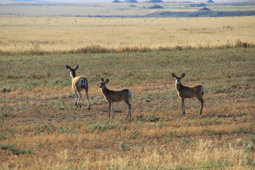
We also saw several other animals, very active at this early hour, such as these:

53179489523_164f3e4b36_o.jpg


And also a salamander getting dangerously heated in the sun, right in the middle of the road. Oddly enough, it was the first time I saw one in the wilderness, if we can say so about the road!

53179429655_9586d68452_o.jpg


We finally reached the visitor center of Grasslands National Park, our main attraction of the day. This park is made up of two isolated sectors, the East Block and the West Block. It protects one of the rare parts of prairies in its native natural state, the rest having been transformed into crop fields by man. It also protects fossils, a large number of archaeological sites, as well as wildlife including bisons and several prairie dog colonies.

The landscapes are magnificent with the unobstructed view. The relatively flat landscape was carved by meltwater from glaciers more than 12,000 years ago, digging deep valleys called coule (from the French word couler meaning flowing).

Due to lack of time, we focused our visit on the West Block, located near the village of Val Marie SK where the visitor center is located. We started our visit by driving the Eco-circuit panoramic road. It offers 7 interpretation stations, several of which have a short hike.

This road runs along the valleys at the beginning before descending to the bottom of it. One of the first viewpoints allowed us to see some bison in the distance.

53179185979_6fc86143e1_o.jpg


Further on, another stop allowed us to walk among a large colony of prairie dogs. These are the most northerly ones in North America.

53179489473_78b9504aa1_o.jpg


Other stops served as starting points for long hikes into the hills and valleys. Due to lack of time, we did not go through any this time, but we took notes for a possible second visit during a future trip.

53179429360_edd272ba31_o.jpg


Being quite late in the season, many of the plants were dried out and yellowed. On the other hand, others, in fewer numbers, were in flower.

53179185814_05c65cd489_o.jpg


53179429345_4ee61907ab_o.jpg


53179185714_1db02cd5f5_o.jpg


Some of the plants were somewhat familiar to us, found in the American southwest states, like this cactus.

53178396227_37cff69d84_o.jpg


Continuing on the Eco-circuit road, it leaves the plateau and joins the Frenchman River. On the other side of the river, a deer was grazing quietly, not at all disturbed by our presence.

53179489238_c10b97eb35_o.jpg


Even further at another stop, a trail led to a promontory with the famous red chairs installed by Park Canada. Please note, of the four parked vehicles including ours, three had Quebec license plates!

53179489208_78e855489d_o.jpg


Having completed the Eco-Circuit, we traveled the Backcountry Loop, a road running between the hillocks. The scenery was very beautiful but as the animals are less active in the middle of the day, we didn't see many.

53178396217_156010625b_o.jpg


Then we hit the road toward Medicine Hat, Alberta. Tomorrow we will visit a provincial park protecting petroglyphs, then head to Waterton Lakes.
 
Last edited:
Day 6:

Starting point: Medicine Hat AB
End point: Waterton Lakes AB

Distance driven: 423 km
Distance hiked: 5.5 km


We had another lovely sunny day, with the temperature rising to 26C, a little too hot for my confort. We had a pretty busy day, with two visits and several hours of driving between them. Get ready for another photo fest!

Our first destination of the day was the Writing on Stone Provincial Park located in Alberta, very close to the American border and the state of Montana. This park, listed as a UNESCO World Heritage Site, protects a large area of native meadows containing cliffs, several of which bear engravings and rock paintings.

We hiked the Hoodoo Trail running between rock formations created by water erosion of layers of sandstone beneath a harder layer.

53182059503_54f93a21ca_o.jpg


53180966962_678d90647a_o.jpg


53182059563_1309e6fe1e_o.jpg


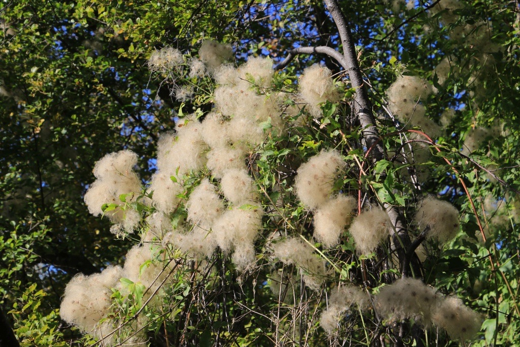
The trail crosses some areas of vegetation, with some of the plants being unknown to us, like this one clinging like a vine to the bushes and trees.

53181557646_6ebb373f46_o.jpg


We saw some panels of petroglyphs (engraving on the rock) and pictographs (painting on the rock), probably relating exploits of the common life of the peoples who created them.

53182059568_aeb9a1cb89_o.jpg


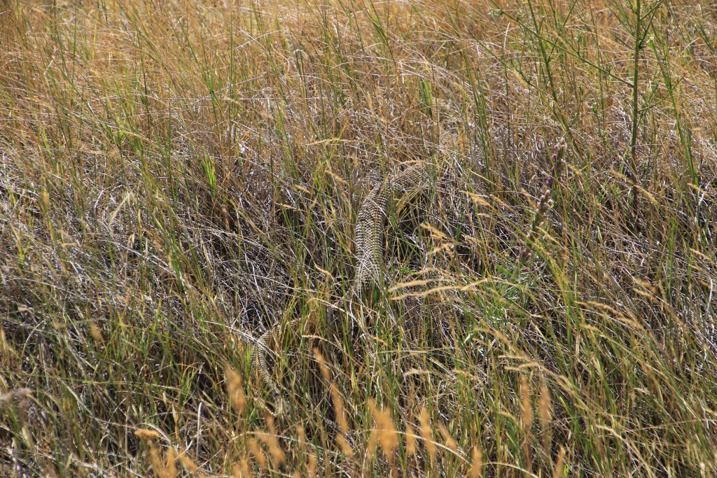
At the visitor center and a few other places, there was mention of the presence of migrating rattlesnakes, and the danger of running over them on the road. After completing Hoodoo Trail, we returned by road to save some time. Well, what a good choice because we were able to see our very first rattlesnake in the wild, despite our many previous trips to areas where they thrive. Finally!

53180967077_d1f023ff55_o.jpg


Having finished our first visit of the day, we headed back west. We saw a group of pronghorn antelope resting in plain sight in a cultivated field. We have seen them often in the past during our travels in the American southwest.

53181747849_4ddb7c188d_o.jpg


After a while we saw the wall of the Rocky Mountains appear, our playground for the next few weeks as they continue into Idaho.

53180966932_097958acaa_o.jpg


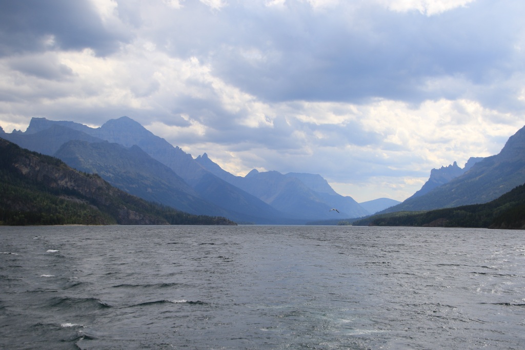
Our second visit was to Waterton Lakes National Park, protecting high mountains and glacial valleys, as well as several lakes. We stopped at the Prince of Wales Hotel located on a promontory offering a breathtaking view of Lake Waterton.

53181998355_a4ffc6185d_o.jpg


53182059513_ebf19e0c10_o.jpg


After being at the park's visitor center, we went near the harbor to join another pair of red Canada Park chairs. Again here, the view did not disappoint!

53181747924_b6f7f85955_o.jpg


53181747829_1321476956_o.jpg


53181998330_d556b4323e_o.jpg


As we went to take possession of our room, we had to confront the reception committee guarding access! Impossible to pass without their consent...

53182059383_70ca3ea57f_o.jpg


Next, we drove the scenic Akamina Parkway climbing between the mountains to eventually reach Cameron Lake. On it, we find the historic site of the first oil well in Canada.

53182059378_64456b5a49_o.jpg


As the presence of clouds masked the sun's rays, the colors of the mountains were a little dull, we hardly took any photos. As we are in this park for the next three days, we will have the opportunity to take plenty of them.
 
I highly recommend hiking Crypt Lake if you can fit it into your schedule (needs a full day). Definitely one of the more memorable hikes I've done in my life during a similar 3 day trip up that way.
 
I highly recommend hiking Crypt Lake if you can fit it into your schedule (needs a full day). Definitely one of the more memorable hikes I've done in my life during a similar 3 day trip up that way.

I was considering it but my wife has a knee injury and she don't feel comfortable going on a such remote trail. Maybe for anther trip. I will keep this in mind. Thanks for the advice.
 
Day 7:

Starting point: Waterton Lakes AB
End point: Waterton Lakes AB

Distance driven: 102 km
Distance hiked: 5.9 km


We spent the day exploring Waterton Lakes National Park, by vehicle, boat and hiking.

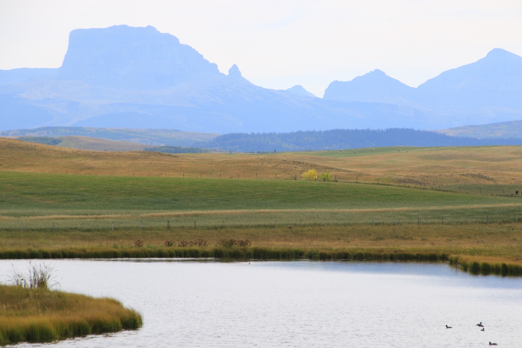
After purchasing our tickets for a lake cruise this afternoon, we went to a few lookouts on the park's beautiful scenic drives, starting at Maskinonge Lookout on the Chief Mountain Highway (AB 6). From the viewpoint, a short path joins the edges of the lake.

53184400413_daf67026b6_o.jpg


53184027101_2e1fc3d97a_o.jpg


Then we drove again along Akamina Parkway leading to Cameron Lake, enjoying the morning light, despite there being a lot of clouds.

53184400423_1503283e5a_o.jpg


53184400398_5cd7f9d360_o.jpg


53183317247_7de7f87c6d_o.jpg


We then returned to Waterton Lakes to have dinner and prepare for our short cruise on Upper Waterton Lake. Our cruise was the "Canada-USA Border Cruise" offered by the company Waterton Shoreline Cruises.

53184230240_e75d7f1369_o.jpg


The cruise begins at the port of Waterton Lakes and crosses the border between Canada and the United States for a short foray into Glacier National Park in Montana.

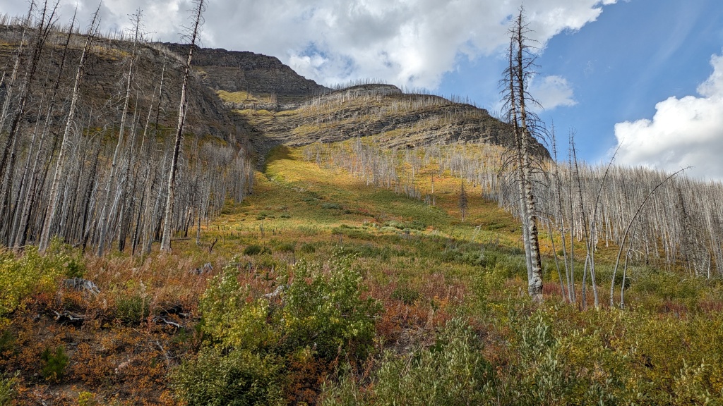
This allows a very different point of view of the park, in addition to providing explanations on a host of subjects including forest fires. The last fire in 2017 ravaged more than 70% of the park's surface area. This explains the quantity of dead trees in the landscapes. Incidentally, the previous major forest fire was in 1937, so the majority of trees destroyed by the 2017 fire were around 90 years old.

Thanks to the hard work of the firefighters, the village was protected thanks to sprinklers powered by lake water, forming a barrier, while other firefighters extinguished the embers falling near the buildings. No buildings in the city were destroyed.

53183317272_d35816bcdd_o.jpg


53184230210_88f0dca08c_o.jpg


53184400358_e4dfe91fba_o.jpg


The border is clearly visible because a zone of vegetation is cleared all along it by the border protection services of the two countries.

53184027056_6c30528447_o.jpg


After the cruise, we returned to Cameron Lake to hike the Cameron Lakeshore Trail.

53184092109_bcf8318b2f_o.jpg


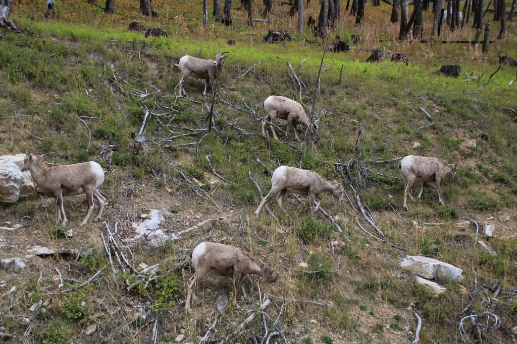
On the way back to Waterton Lakes, we saw a group of bighorn sheep on the side of the road, completely unconcerned by our presence.

53183317242_922a037f9f_o.jpg


Tomorrow, we will continue our exploration of the park with a long hike.
 
I was considering it but my wife has a knee injury and she don't feel comfortable going on a such remote trail. Maybe for anther trip. I will keep this in mind. Thanks for the advice.

Fair enough. It was reasonably strenuous from what I remember and you're on a clock since you have to make it up to the lake and back down to the dock before the boat left. I seem to remember at least 10 to 20% of our group ending up turning around without making it to the lake.

If you are over that way again and feel up for it though, you'll have a great time :).
 

Members online

Forum statistics

Threads
278,312
Messages
3,554,083
Members
248,016
Latest member
Advally Service

Trending content

Back
Top