JohnTheLuck's Adventures Thread

Day 37:

Start point: Kanab UT
End point: Page AZ

Distance driven: 161 km


Our beautiful sun seemed far away today, while clouds and rain showers were there with a frankly quite chilly temperature. So we had a day with very slow flow. We did a short historic visit to Kanab before hitting the road to Page, with a detour to Glen Canyon National Recreation Area on the way.

Before leaving Kanab, we went to Heritage House Museum, a Victorian house built in 1892 and now a museum. This tells the story of the city, seen through the lives of the families who occupied this house before it was given to the city of Kanab to preserve it.

52761291384_c7c06cda9e_o.jpg


The original owner was a Mormon teacher and merchant and lived there with his first wife. His other wives lived elsewhere (polygamy was common among Mormons in those days, though persecuted by the federal government). His business had to be very profitable to be able to build such a house.

The interior was very modern for its time, decorated tastefully but without excess.

52761291549_c630533f32_o.jpg


52761291539_f681dba662_o.jpg


52760498712_06473573fe_o.jpg


The many children of this first marriage lived on the second floor, the roof and the walls being not insulated, apart from some newspapers attached to the walls and dating from the 1930s. This was perhaps an incentive for them to leave and build their own home!

52761040381_e4ca4bb48b_o.jpg


52761531018_caa869656e_o.jpg


We then took the road to Page, about an hour and a half from Kanab, in relentless rain and a temperature dropping as we gained a little elevation.

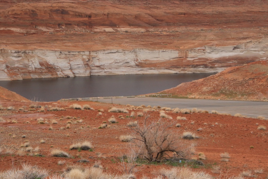
As we approached Page the rain stopped and we even had a few sunny spells. We took a short detour into Glen Canyon National Recreation Area to see Lone Rock in Wahweap Bay, a much more photogenic sight a few years ago when it was surrounded by water. Since our first trip in the region, in April 2010, Lake Powell water level dropped more than 35m.

52761040261_76474308b5_o.jpg


Further on, we reached Wahweap Overlook overlooking Wahweap Bay and Wahweap Marina, one of the few still open, given the very low water level of Lake Powell.

52761447165_bcf86b8147_o.jpg


Further, we traveled the Lakeshore Drive along Wahweap Bay. A few houseboats circulated in the narrow, still navigable channel to reach the vast Lake Powell.

52761530878_4d5c0f4984_o.jpg


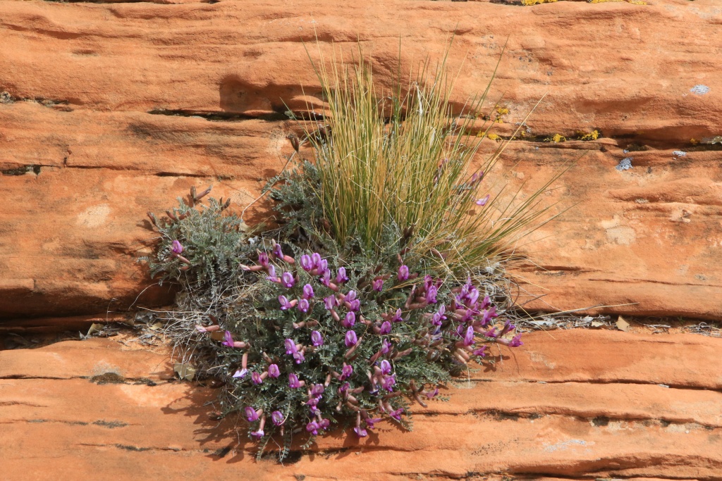
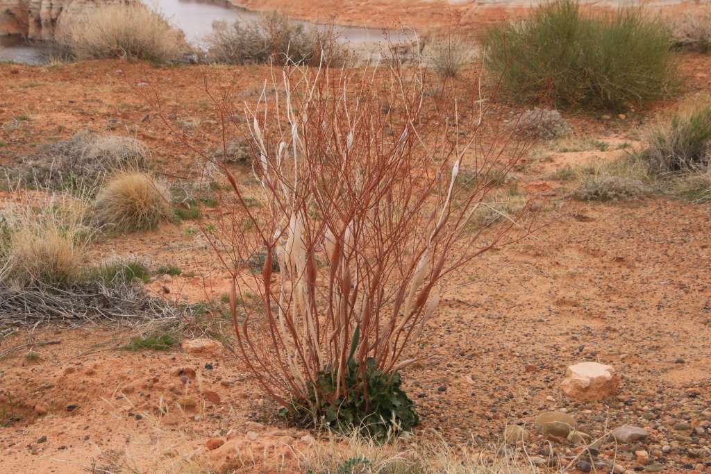
A sign that spring is coming, we started to see several types of roadside flowers. The very rainy winter will certainly favor the growth of these plants, hoping that we will not be gone already.

52761530903_e52f772b38_o.jpg


52761291244_6c8b90cca6_o.jpg


Continuing towards Page, we made a short stop at the Glen Canyon Dam, blocking the Colorado River flow and forming the Lake Powell reservoir.

52761291214_79333224a8_o.jpg


More precipitations are expected tomorrow for most of the day. We will therefore have another quiet day, before a beautiful sequence of several sunny days.
 
Last edited:
Day 38:

Start point: Page AZ
End point: Page AZ

Distance driven: 110 km


As expected, the rain was present all day, with rare and short sunny spells in the afternoon. Perfect scenario for a laundry chore. Then, we tried to visit a few attractions inside, but those that interested us were either closed for renovations or simply closed on certain days because of the off-season.

We still took advantage of a slight lull to go see the state of the Smoky Mountain Road leading to several trails that we had planned to do in the next few days in Glen Canyon National Recreation Area. It will be necessary that the conditions improve a little because currently, that is not very promising with the level of Wahweap Creek having to be crossed at the very beginning. The landscape is representative of our day, gray, foggy, and colorless.

52762619867_7e19d9f186_o.jpg


Then we went to see Antelope Point, also in Glen Canyon NRA. The marina is one of many closed due to lack of water. The end of the ramp is about 15 to 20 meters above the current water level.

52763414364_8094ddf12e_o.jpg


52762619842_e6aa972235_o.jpg


The weather forecast is much better for the next few days. We will try to reach the start of a long off-trail hike which should be spectacular.
 
Day 39:

Start point: Page AZ
End point: Page AZ

Distance driven: 54 km
Distance hiked: 8.1 km


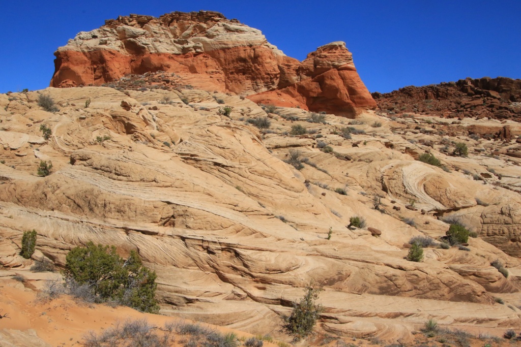
We had a superb and mostly sunny day, the first of a long streak of days without precipitation. How good that is! We chose to explore a sandy, clay-free area in Vermilion Cliffs National Monument, until the ground dried out after all the rain.

Our first destination was a loop hike, adjacent to the one we hiked in March 2020 while exploring Thousand Pockets. By this time, we had abandoned the westernmost sector because our journey for the day had already been long enough.

Today's loop joined the Big Red Rock area, a series of reddish sandstone promontories topped by a layer of black boulders.

52765704690_176cb7bfba_o.jpg


52765781908_10814cb363_o.jpg


We explored somewhat haphazardly, sometimes descending to the base of the promontories, other times reaching viewpoints at the top. Our progress was facilitated by the absence of major washes in this sector.

52764755782_4f13a17b14_o.jpg


At some point we came across a very large field of Moki Marbles, concretions forming in specific layers of sandstone. They were everywhere!

52765295211_ed9d941798_o.jpg


We finally reached the westernmost point of our route and the highest point of the hike. From this place, the view was magnificent and allowed to see the many red buttes that we had passed, and Navajo Mountain in the distance under the snow and the clouds.

52764754792_be8d0efe34_o.jpg


On the other side of a major wash that caused us some detours in March 2020, we could see the Thousand Pockets mounds, a set of cavities and mounds capturing water from precipitation.

52765295111_1e0ee12778_o.jpg


For the return to our vehicle, we chose to reach the big wash, being careful not to go down there before having circumvented a dry fall of several meters. Exploring this wash alone is worth a hike.

52765295071_2f0b36e49f_o.jpg


Back in the vehicle, we continued further down the road to Ferry Swale Canyon Road leading to some high viewpoints of the Colorado River and the Lee's Ferry area in Glen Canyon National Recreation Area. We had already explored this area below during multiple trips, including the one in December 2013.

52765294776_20a9a222a4_o.jpg


We had a prime view of the confluence of the Paria River, its sediment-laden waters flowing into the clear waters of the Colorado River.

52765545979_8f9c7aa55d_o.jpg


Our first vantage point was located near the communications towers. The wind there was extremely strong to the point of being unpleasant.

52765545964_5733d0cc0e_o.jpg


The return was made by the same route. Although this road has been worked to allow the installation of communication towers, the fact remains that the elements have degraded it in some places. With an adapted vehicle and a little precaution, it is still passable even if certain passages are more delicate.

52765702140_80b780cc18_o.jpg


After descending the steepest sections, we continued on Ferry Swale Canyon Road toward US89 near Page. We circulated in washes whose sand was still a little wet, causing a slight concern without more. Further on, the signs of nearby civilization became more and more present.

52764754072_e464a2f969_o.jpg


We wanted to check the condition of Ferry Swale Canyon Road as we plan to return there tomorrow for an even longer hike that promises to be spectacular, well we hope so.
 
Day 40:

Start point: Page UT
End point: Page UT

Distance driven: 127 km
Distance hiked: 10.2 km


We returned to Paria Canyon-Vermilion Cliffs Wilderness to do another off-trail hike, Nancy's creation. While the weather forecast was encouraging, the sun was quickly eclipsed by multiple cloudy periods that refreshed us with a few drops and even a fine hail in the form of Styrofoam.

We took the Ferry Swale Canyon Road back to the starting point of the hike. At some point, we saw in the distance the objective of the day, a huge sand dune nestled in a valley, separated from Paria Canyon by a high cliff.

52767515634_47eefe4872_o.jpg


Our hike started by crossing a sandy expanse populated by low bushes, before reaching a wash that we followed for a good part of the hike. As we had guessed, several rocky passages formed dry falls with residual pools of water, impossible to cross. However, we always easily found workarounds.

52767262496_355ed4bd88_o.jpg


The big clouds appeared above the high hills as we reached an area with a fairly large rise in elevation in a narrow pass. We watched the clouds and especially the precipitations. The danger of flash floods was very low because the surroundings of the wash offered a multitude of slopes that could be climbed quickly if necessary.

52766725177_1027bc9644_o.jpg


At one point we stopped under a cedar tree as hail was falling. When it stopped, we resumed our walk under a still gray sky. Another large cloud arrived and dumped a mixture similar to the first. Doubt began to animate us. What's the point of hiking in these conditions, especially since the sandstone rock gets somewhat slippery when wet.

But having decided to continue, our efforts were rewarded, when we had just crossed the last obstacle and joined the small valley at the foot of the sand dune, the sun showed its nose above the cliff.

52767675735_7e0b15fe90_o.jpg


At the foot of the dune, another cloud appeared. The silence was broken by the faint sound of hailstones hitting nearby cliffs. The cloud brushed past us without affecting us too much. After it passed, a clearing illuminated the wet rocks.

52767262316_0b2e9ffc6d_o.jpg


We did not climb the dune given its height and its inclination. On the other hand, I couldn't resist climbing a long sandstone ridge offering a beautiful view.

52767515594_c67df447da_o.jpg


On the return trip, by the same path, we were gifted by the presence of the sun between small cloudy passages. Fortunately, the heat of the sun had quickly dried the rocks.

52767262271_3fa96fd32d_o.jpg


52767515539_e6cd6ec342_o.jpg


After crossing the most difficult passages again, new clouds appeared again behind us above the hills.

52766725132_6b1603f27f_o.jpg


52766725122_ff727f76e7_o.jpg


52766725102_bf7c8d5042_o.jpg


Back at the 4Runner, we headed back to Page for a combined dinner-supper. Then, wanting to take advantage of the few remaining hours, we went to check out the was of Smoky Mountain Road in Glen Canyon National Recreation Area. We have several points of interest accessible by this road. However, it crosses clayey and impassable areas after heavy rainfall. Some sections were in a state requiring a little more vigilance. Luckily, the sun of the last two days has greatly helped to dry it out.

52767751473_9a1c41ce9c_o.jpg
[

52767515239_692c6f0cc9_o.jpg


52767261946_1da2075405_o.jpg


We reached the intersection with Crosby Canyon Road, an area that we will explore again tomorrow, weather permitting. We had visited this place in March 2013.
 
Day 41:

Start point: Page AZ
End point: Page UT

Distance driven: 248 km


When we left the hotel this morning, the pavement was wet. Several showers surrounded Page and very few sunny openings between them. This caused us a lot of hesitation.

We still tried to reach Crosby Canyon in Glen Canyon National Recreation Area. We passed a van whose driver informed us that the road was impassable further. Although we had covered this segment late yesterday afternoon, the overnight showers had turned the clay into as slippery a substance as possible. Like the driver we had met, we wisely turned around, especially since other precipitation was heading towards the area.

Then, we hesitated between a few possible destinations, including Cockscomb Wilderness Study Area, a little further west towards Kanab. We had slightly explored this place during our January 2020 trip. On the other hand, when we reached this place, clouds and rain were present. We will have better opportunities to explore it under the sun.

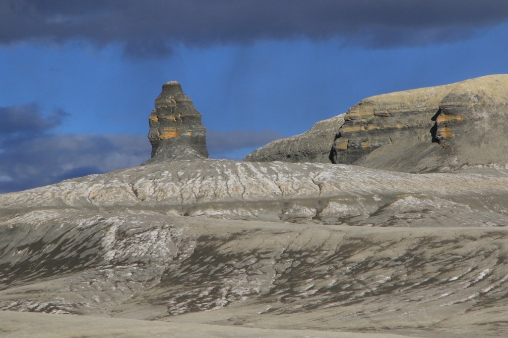
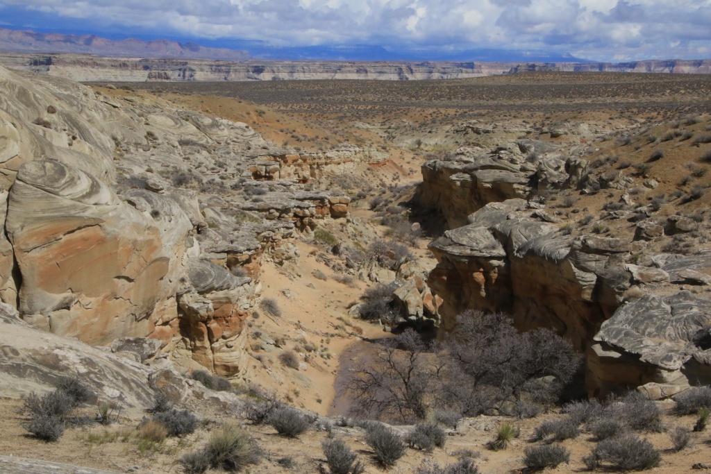
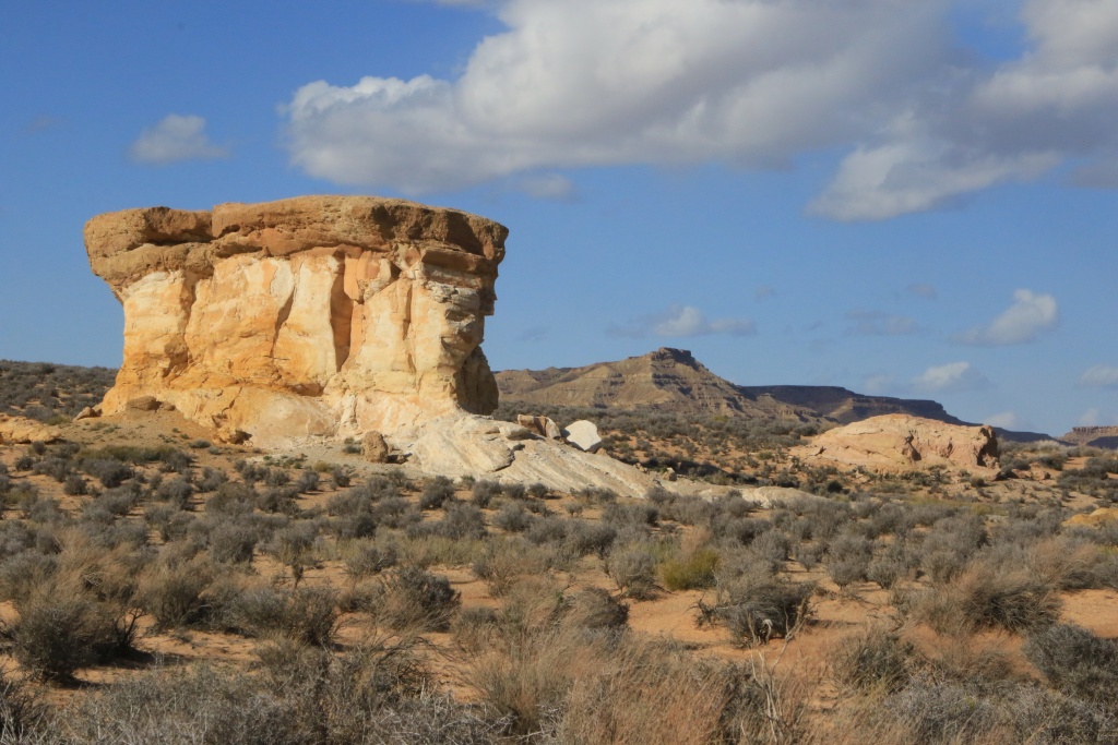
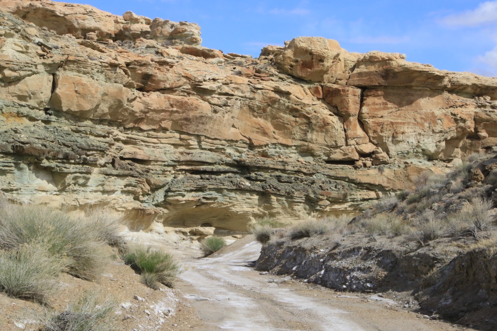
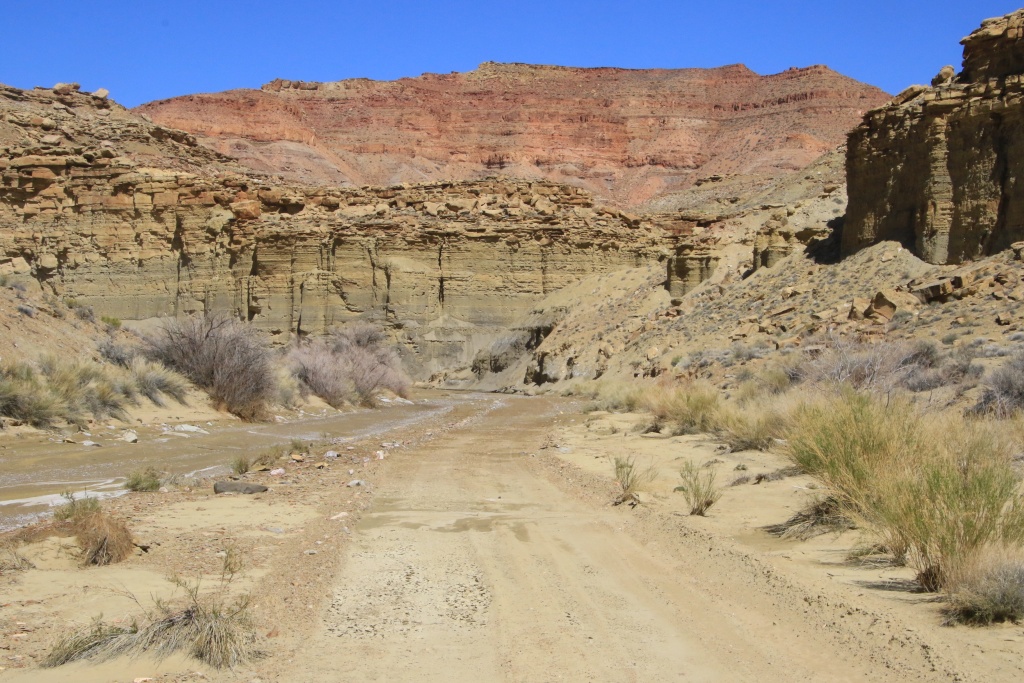
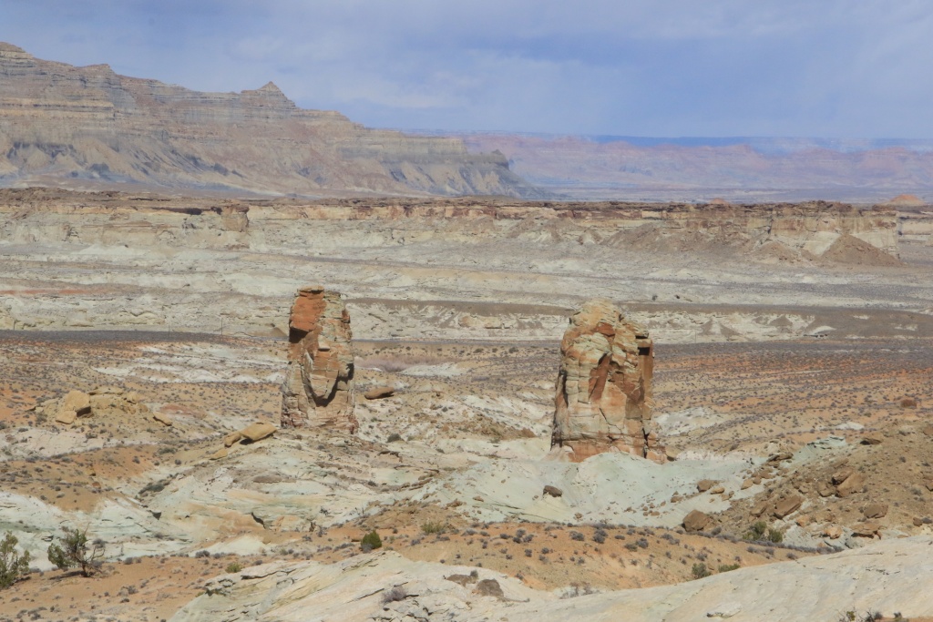
We came back to Page as the sun broke more and more. We then decided to explore the sandy roads north of US89, not far from those we had taken in the last two days. This sector has beautiful cliffs of gray-greenish rocks, conducive to the formation of hoodoos, these pillars supporting a harder rock.

52769165691_cbeca56e39_o.jpg


52769580790_78d527e65a_o.jpg


We reached a promontory offering a view of an area of colored rocks, a candidate place for another Nancy vintage hike.

52769421404_c8fa738097_o.jpg


We continued by reaching the sector of Stud Horse Point, composed of the same type of rocks.

52769653833_2669f99000_o.jpg


52769580770_3328eb58d3_o.jpg


We then joined a sector even further west. We were drawn to a road that climbed uphill and offered a view of the sandy valley we were exploring. Continuing, it led us to Paria Canyon Overlook Road, a road we traveled in October 2016. We turned around at this point.

52769580760_85c457c1a1_o.jpg


52769614965_78901f8fb4_o.jpg


Back on the road in the valley, we continued, getting closer to the gray-greenish hills.

52768627697_3922d3f29c_o.jpg


52769653753_090dffecaa_o.jpg


52769580690_1ed0d52e0a_o.jpg


52769421234_4d39bc785f_o.jpg


The weather is so inaccurate these days that it is difficult to plan what we will do tomorrow. One thing is certain, the number of days remaining in the Page area is rapidly diminishing, and we have done very little of the things included in our itinerary. On the other hand, we made some great discoveries. But quickly, full sunny days!!!
 
Day 42:

Start point: Page AZ
End point: Page AZ

Distance driven: 156 km
Distance hiked: 6.4 km


We finally had a full day without any precipitation. This will greatly help to improve the conditions of the tracks and trails. We took the opportunity to hike in a wilderness, and return to some viewpoints on a high plateau overlooking Paria Canyon.

Our first destination of the day was the promontory overlooking the Lee's Ferry area in Glen Canyon National Recreation Area, a place we had explored a few days ago, but since the sunshine conditions weren't great, we wanted to go back a sunny morning. Unfortunately, yesterday's high winds had deposited an additional layer of dry sand on the roads and as we were the very first vehicle to drive there, progress was very difficult. We gave up on the idea.

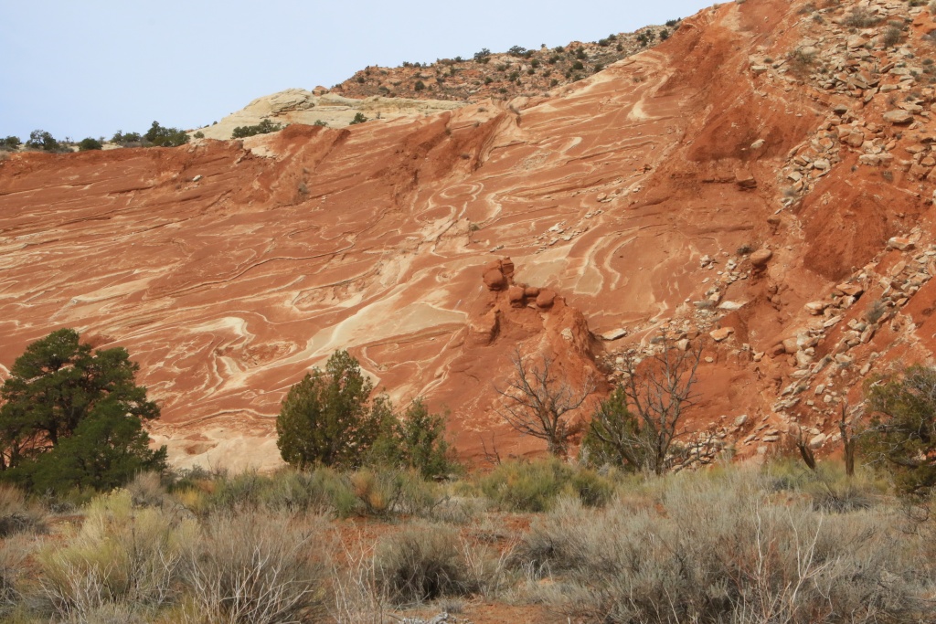
Instead, we headed to The Cockscomb Wilderness Study Area to take an off-trail hike through an area of bentonite cliffs, easily eroded and sculpted by rainfall. We followed a long wash, slightly damp at first. On the west side rose the colored cliffs sloping from a fold of the earth's crust.

52770776277_4159b62228_o.jpg


52771722990_319250923e_o.jpg


The erosion of different layers has sculpted random shapes of astonishing beauty. The wash was getting narrower and narrower and a thin trickle of water was constantly flowing. The mud stuck to our shoes but didn't slip too much.

52770776242_56ee38e954_o.jpg


52770776237_b048a89f04_o.jpg


52771722940_e35a3a92a0_o.jpg


We reached a place where our progress was no longer possible and we returned by the same route. The sun was becoming more and more present, bringing out the colors even more.

52771722910_62787327e7_o.jpg


52771565364_7f3fbc3198_o.jpg


52771565349_1fefdafb3b_o.jpg


Back in the vehicle, we decided to head back to Paria Canyon Overlook Road, taking the section of Cottonwood Road through the Flat Top area. Paria Canyon Overlook Road offers a series of viewpoints over the canyon carved out by the Paria River. Together with Buckskin Gulch, which we explored a few days ago, this canyon separates the Paria high plateau. We had traveled this route in November 2016, but very early in the morning. The dazzling sun and the shadow of the cliffs prevented us from appreciating the beauty of the place.

52771309256_1e5356566f_o.jpg


52771309226_b8160099a2_o.jpg


From these headlands we were able to see some familiar spots, such as the viewpoints overlooking Lee's Ferry in the distance, the Lee's Ferry area in Glen Canyon NRA, and the Paria River. In March 2020 we had hiked along the cliff to the left on the series of sloping plateaus. At this time, the colors of the bentonite hills were vivid when viewed up close.

52770776162_35f2df6588_o.jpg


The cliffs of Paria Canyon are very sculpted and steep.

52770776142_b152baff4e_o.jpg


Tomorrow we will make another attempt to explore Glen Canyon NRA via Smoky Mountain Road. Today's beautiful temperature may have been enough to make it passable again.
 
Looking at the horrible reality presented by your Lake Powell pictures, you should NOT want to go down Crosby Canyon.

Just don't. It will be dreadful, aesthetically. A place that has never had the water is different but one where it used to and now does not....

As for Smoky Mountain Rd, the smooth dirt road that goes right where Smokey continues north and that ends at the intersection where Croton heads north and Grand Bench going to the lake is a very nice drive through gorgeous "lunar" terrain. I really like that one, and it is fast.

Croton elicits mixed views, it really depends on suspension and what exactly you do. The five miles north from the intersection are similar to the WHite Rim Road in Canyonlands and I rank them very, very high for scenery. Mild rocks. The majority of the trail, once you gain elevation is not very interesting and anything but a top suspension will make you feel the rocks.

Smokey Mountain itself is great up to the point on the top of the climb and is a fun drive for several more miles. After that it is pretty awful, with nothing really to see and lots and lots of embedded rock.

Knowing your suspension and usual speeds, I would suggest not driving any of the main sections of either Croton or Smokey. The southern climb/descents of each are glorious but the rest is forgettable. You can loop Smokey Mtn with Smokey Hollow going up the latter and down the former. That makes for a very nice loop.

As for Grand Bench...it is about as remote as anything in the lower 48 so gotta be careful. I had a suspension hit, very hard near the far end and my face froze for a few seconds till I made sure I had not broken anything. Of course you could drive slower and stay at the end of that trail overnight. But going out and back in one day in daylight is not easy.

Good luck and stay safe, almost nobody goes to Grand Bench/Croton.
 
Looking at the horrible reality presented by your Lake Powell pictures, you should NOT want to go down Crosby Canyon.

Just don't. It will be dreadful, aesthetically. A place that has never had the water is different but one where it used to and now does not....

As for Smoky Mountain Rd, the smooth dirt road that goes right where Smokey continues north and that ends at the intersection where Croton heads north and Grand Bench going to the lake is a very nice drive through gorgeous "lunar" terrain. I really like that one, and it is fast.

Croton elicits mixed views, it really depends on suspension and what exactly you do. The five miles north from the intersection are similar to the WHite Rim Road in Canyonlands and I rank them very, very high for scenery. Mild rocks. The majority of the trail, once you gain elevation is not very interesting and anything but a top suspension will make you feel the rocks.

Smokey Mountain itself is great up to the point on the top of the climb and is a fun drive for several more miles. After that it is pretty awful, with nothing really to see and lots and lots of embedded rock.

Knowing your suspension and usual speeds, I would suggest not driving any of the main sections of either Croton or Smokey. The southern climb/descents of each are glorious but the rest is forgettable. You can loop Smokey Mtn with Smokey Hollow going up the latter and down the former. That makes for a very nice loop.

As for Grand Bench...it is about as remote as anything in the lower 48 so gotta be careful. I had a suspension hit, very hard near the far end and my face froze for a few seconds till I made sure I had not broken anything. Of course you could drive slower and stay at the end of that trail overnight. But going out and back in one day in daylight is not easy.

Good luck and stay safe, almost nobody goes to Grand Bench/Croton.

The lowering of Lake Powell water level is, sadly, a reality we have to live with it meanwhile we address climate change and reverse its effects. Crosby Canyon is a really nice canyon with a wide variety of colors and textures. We visited this canyon in March 2013 with a rented vehicle. See my French Blog for great pictures (I didn't own the 4Runner at that time).

We also drove Smoky Mountain Road and Sitdown Bench Road up to the intersection with Croton Road in October 2016. See my T4R post here.

Now, for embedded rocks and suspension; it is mostly a mater of the speed of the vehicle. You know I am nos a speed demon as, humm... you! ;)

My plan is to explore near the Croton and Grand Bench intersection, not too far since we have to come back during daylight. Weather will decide for tomorrow. Looks promising, hoping everything is not ruined during the night with slight chance of rain.

Thanks for the comments and advices.
 
Last edited:
Day 43:

Start point: Page AZ
End point: Page AZ

Distance driven: 215 km
Distance hiked: 3.5 km


We started the day by heading down Cottonwood Canyon Road located in Grand Staircase-Escalante National Monument. Some portions of this road are assumed to still be impassable. We wanted to see the state for ourselves because it leads to several hikes that we wanted to do.

Funny fact; on this road, we passed a car stuck in deep ruts. Someone was helping him out. The rear wheels did not turn; he didn't know he was driving with the emergency brake on!!!

This road follows the folds of the earth's crust that we walked along yesterday during a hike. It's one of the most spectacular roads in Utah, in my opinion. The arrangement of colors and the turbulent geological past make it a very special place.

52773813919_0204c4cd47_o.jpg


52773023972_64556a2ae5_o.jpg


In the distance we could also see Yellow Rock, a place we hiked in March 2013.

52773557356_ae58205e51_o.jpg


We reached the Hackberry Canyon Trailhead point before returning, not because it was impassable, but because we had other activities planned. On the way back, we met a group of Longhorns.

52774041118_ab3ff565f8_o.jpg


Our next activity, still on Cottonwood Canyon Road, was the short hike to Hoodoos Forest, recommended by a very nice tourist we met yesterday. After about a kilometer of walking on the plateau, we reached the stop of this one. At this location, multiple whitish hoodoos were visible. Our tourist had advised us that the descent to the hoodoos was difficult. We decided not to attempt it because it was not only difficult, but downright dangerous. We opted instead to walk along the edge of the cliff.

52773813834_c7447b5875_o.jpg


52773557021_d461e62ce3_o.jpg


Returning to our vehicle, we headed to Glen Canyon National Recreation Area. Luckily, the very low rainfall of the last few days, but also the sun and the winds have greatly improved Smoky Mountain Road leading to Crosby Canyon, our next destination. This canyon is very beautiful, and very similar to Wiregrass Canyon Trail which we hiked in March 2020, the last activity before our forced return caused by the pandemic.

The road gradually descends to Lake Powell but also to the lower geological layers. At the beginning, a layer of coal of a few meters thick is visible.

52774041003_76e2a7a1bc_o.jpg


Then the road joins the whitish layer of hoodoo rocks.

52774040973_7dfcee577d_o.jpg


Further down, a greenish layer has appeared.

52773023527_f68c47a64d_o.jpg


Even lower, the road intersects with a harder layer of rock, forming large recesses under which the road travels.

52773023477_6a491388f2_o.jpg


Finally, we reached the mouth of Crosby Canyon, where the water of Lake Powell was located a few years ago. Instead, we reached a large plain where tamarisks once grew, dead from lack of water. We saw the water in the distance, but without getting really close. Witnesses of a bygone era, many seashells were visible on the sandy ground.

52773974885_2f1be3df9e_o.jpg


On the other hand, the presence of multiple large clouds encouraged us to start our return in a somewhat hasty way because we were still quite far on the roads on the famous bentonite. Precisely, one of these clouds left us with a little aftertaste of winter that we have been desperately trying to escape since the start of the trip... Fortunately, we only brushed past it without consequence.

52774040758_a36c017191_o.jpg


Tomorrow, the weather conditions seem to become much more favorable than today. We should try to go further on Smoky Mountain Road. Crossed fingers...
 
Day 44:

Start point: Page AZ
End point: Page AZ

Distance driven: 238 km
Distance hiked: 1.1 km

We had a superb day, without any cloud, enough to cheer us up a bit. We took the opportunity to drive a few roads in the splendid region of Glen Canyon National Recreation Area. However, we had to deal once again with some impassable segments. This changed our original itinerary somewhat and led us back to some familiar places. Expect a photo fest in this post!

We took the Smoky Mountain Road again, then turned onto Sitdown Bench Road. This road skirts very colorful hills, formed of bentonite clay. The road itself mostly runs on this lovely bentonite. The beautiful temperature of the last few days had dried up the clay, leaving immaculate white salt deposits, but also deep ruts from vehicles having circulated while it was still wet.

52776425234_61edfab782_o.jpg


52776167171_7c6df1b0dc_o.jpg


52776425189_a093e32ac5_o.jpg


52776577575_2739650454_o.jpg


As we progressed, the state of the road deteriorated, becoming gradually wetter. The inevitable happened when we joined a very long section of road still flooded, partially frozen, and frankly impassable. It was with great disappointment that we turned around. We had long dreamed of the wonders further up the road. That will be for another time.

52776573395_869e02f0b8_o.jpg


On the way back, the sun highlighted the beautiful colors of the hills.

52776643728_ee9ac0b622_o.jpg


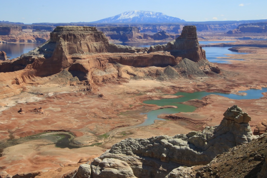
We then decided to return to Alstrom Point, a promontory located on a long point overlooking Lake Powell. Well, this was when the water level was sufficient to reach the foot of the high cliffs.

52776419844_4011ac9da6_o.jpg


At this location, we met four Californians, owners of heavily modified 4Runners, who were camping there for a few days. I took the opportunity to chat, collecting ideas for future modifications of our own 4Runner.

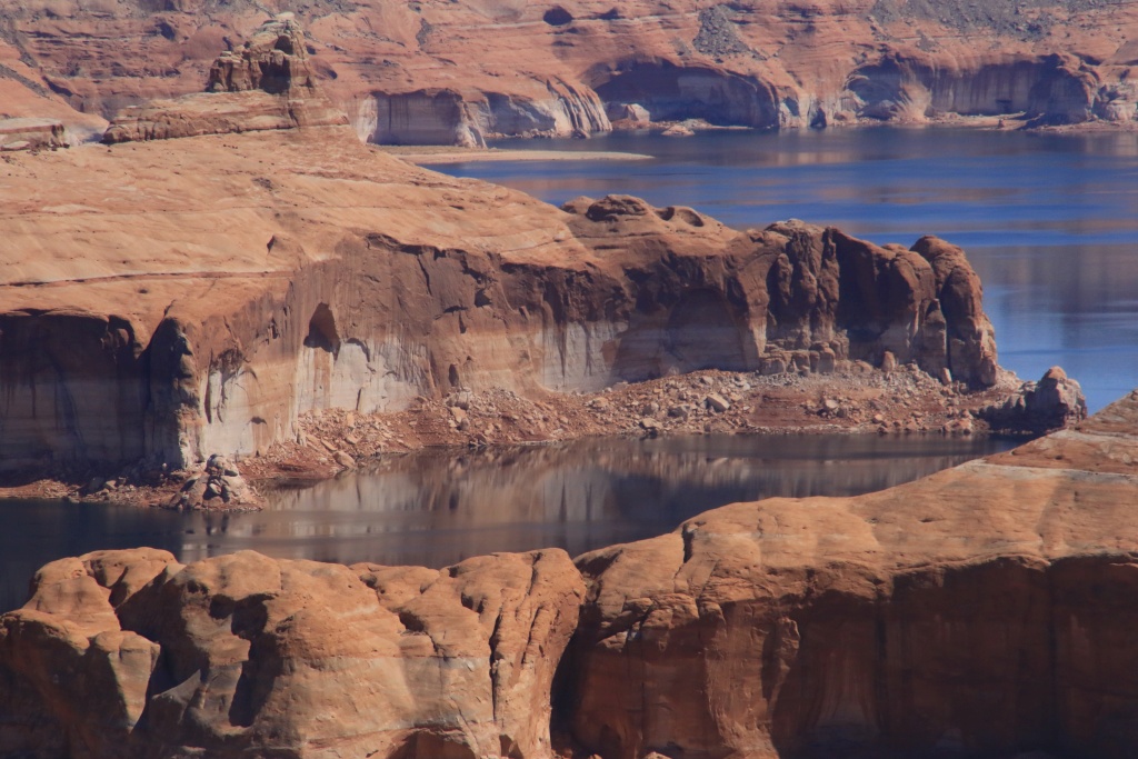
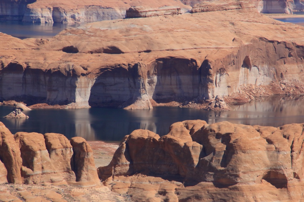
Afterwards, we paused at the top of a cliff overlooking a bay adjacent to Alstrom Point. What a beautiful view we had!

52775628327_32a7696aa4_o.jpg


52776421264_8e17002100_o.jpg


52776163166_e8a5867a82_o.jpg


We then headed up Smoky Hollow Road, a road up through the bottom of a canyon to the high plateau of Smoky Mountain. Here again, the cliffs were brilliantly colored.

52776643673_b164e74467_o.jpg


52776643648_52d432f92c_o.jpg


On several occasions, the road borrows the bed of a creek. As we gained altitude, the water became more present, again. We crossed and skirted this creek on a few occasions, but our progress became more and more hazardous. Yes, yet another U-turn...

Decided to get up to the plateau, we then headed down Smoky Mountain Road which climbs the cliff steeply at a place called Kelly Grade. It's a generally fairly well-maintained road, but somewhat intimidating considering the cliffs it skirts. Yes, there is a road that climbs the cliff in the following photo!

52775628272_fb9d2802e4_o.jpg


At the top of the first section, the road intersects a coal seam.

52775628262_d832d16252_o.jpg


The road then continues its ascent, but in a much more gradual way, always skirting the cliff and making long loops.

52776162761_ccfc636412_o.jpg


Finally at the top, we stopped at a viewpoint toward the road we had just traveled, with Crosby Canyon visible above the ridge of the cliff.

52776163026_d3bb3a9e48_o.jpg


And on the opposite direction, the plain of the high plateau covered with bushes and far away, the mountains near Escalante UT. What a contrast! We had hoped to travel this road from Escalante to reach Kanab more than two weeks ago, but the presence of snow made driving impossible. Another time maybe.

52776573220_55f3c15777_o.jpg


After some distance we took a side track to two viewpoints over Burning Hills Wilderness Study Area.

52775628187_1bfaa04a6f_o.jpg


We also explored a few other opportunities for an upcoming trip before embarking on our return. On the way back down Kelly Grade, we made a few stops to take in the scenery. Below, a hoodoo with a funny hat cast its shadow, stretched out under the lowering sun.

52776642103_434aef1234_o.jpg


Although we didn't manage to see and do what we had planned, we had a great day nonetheless.
 
Day 45:

Starting point: Page AZ
End point: Kayenta AZ

Distance driven: 338 km


We had another great day, as an early morning haze lifted, giving way to beautiful blue skies. We left Page to reach Kayenta AZ, about an hour and a half away. However, we preferred to do a long loop on main roads in Navajo territory instead.

We left the AZ98 road, the Among the People Scenic Byway, to take the Navajo BIA-16 road, a paved road that joins the community of Navajo Mountain, located in Utah. This route could certainly be designated as a scenic route by the Navajo government. Unfortunately, it is very winding and offers very few parking opportunities. Navajo Mountain, a sacred mountain to the Navajo, still wearing its winter coat.

52777715682_f1838f46bf_o.jpg


We had some doubts about the legality of our presence on these roads. The Navajo Nation website indicates that the presence of a Navajo guide is required to accompany non-residents. On the other hand, we spoke with all the drivers of the vehicles we met and all confirmed that there was no problem for us to travel on these roads. We sometimes have a reflex of apprehension towards the Amerindians, but all the Navajo with whom we exchanged were extremely courteous and friendly.

Back at Navajo Mountain, we continued on Piute Creek Road, a spectacular drive down to the bottom of Piute Creek Canyon, before climbing back up Piute Mesa on the other side.

52778726378_5de635d676_o.jpg


52778711738_db95f9de59_o.jpg


Towards the bottom of the descent, we took a short side trip down Piute Canyon Road, a road descending along Piute Canyon leading to the San Juan River. The road deteriorates rapidly and becomes a track of off-road vehicles smaller than our 4Runner. Luckily we could see the river in the distance.

52777701457_e53e875241_o.jpg


52777701422_735c4d840e_o.jpg


Back on Piute Creek Road, we completed the descent and crossed the bridge over Piute Creek.

52778485294_a6e1ae49cc_o.jpg


We then began the ascent to Piute Mesa, offering an exceptional view of the descent we had just completed.

52778227181_5298aff05d_o.jpg


52778644420_9ed31873a1_o.jpg


52778485069_dfea5a393f_o.jpg


Once the rocky ascent on Piute Mesa was completed, we made a second side trip by taking, you guessed it, Piute Mesa Road (these Navajos have consistent ideas!). This road leads to two viewpoints of Nokai Canyon and the San Juan River in the distance.

52778711458_ae575606de_o.jpg


On the other side of the canyon, No Mans Mesa occupied the horizon. We imagine that no road exists to reach the summit, hence the name.

52778226976_5f90a8c830_o.jpg


Back on Piute Mesa Road, we began our return south. The road slowly continues its ascent to Tall Mountain and offers some opportunities to see Navajo Mountain again.

52777701077_26355c17f1_o.jpg


The road surface is mostly made up of well-compacted sand, providing a very pleasant ride. Vigilance is required because several rocks are outcropping. In several places, we had to cross wet or muddy areas, caused by the melting of the residual snow.

52777701047_0cf9e7d743_o.jpg


We sometimes had some doubts about having to turn around because we had contradictory information on the state of the road between the different drivers we questioned. We finally made it to Shonto AZ and completed the planned loop without major hitches.

Tomorrow, we will stay around Kayenta to continue our exploration of this new region for us. Although very close to Monument Valley Tribal Park, we won't be returning there as we've visited it many times before.
 
Day 46:

Start point: Kayenta AZ
End point: Kayenta AZ

Distance driven: 361 km


We spent the day exploring Navajo territory around Kayenta AZ, being careful to stay on the main roads. The morning sun left us around the middle of the day. We traveled three roads revealing beautiful attractions.

We started by driving BIA-6460 through Cane Valley and skirting the Comb Ridge Earth's Crust Fold. We saw several features of volcanic origin, including old volcanic cores like Agathia Peak on the right of the next photo, as well as several dykes.

52780923483_7901c66df6_o.jpg


52780868955_9b286049a4_o.jpg


52779917327_0402de8e28_o.jpg


We had planned to take a short hike near Comb Ridge, but being in Navajo Reservation and seeing the presence of residences nearby, we were uncomfortable being on private land. Out of respect for the residents, we have decided to let it be.

Back on the US160 road, we passed a site called Baby Rocks, similar to Goblin Valley SP in Utah, but much less extensive.

52780452551_f2b8c499e8_o.jpg


Then we headed down Piute Farms Road, a road that runs along No Mans Mesa seen yesterday and reaches the San Juan River.

52780452521_881ea6fe11_o.jpg


We reached a large floodplain now dry considering the water level of Lake Powell.

52780703544_0ae160c70e_o.jpg


When we arrived on the bank, what was our astonishment to see a waterfall of several meters with a fairly high water flow. Utah Wildlife Service researchers were working taking samples.

52780703579_c34373cb53_o.jpg


52780868710_407766566c_o.jpg


After returning to the paved road, we headed for BIA-6450 then BIA-6420 circulating in the bottom of a canyon bordered by high sandstone cliffs.

52780452281_d87fc86ac9_o.jpg


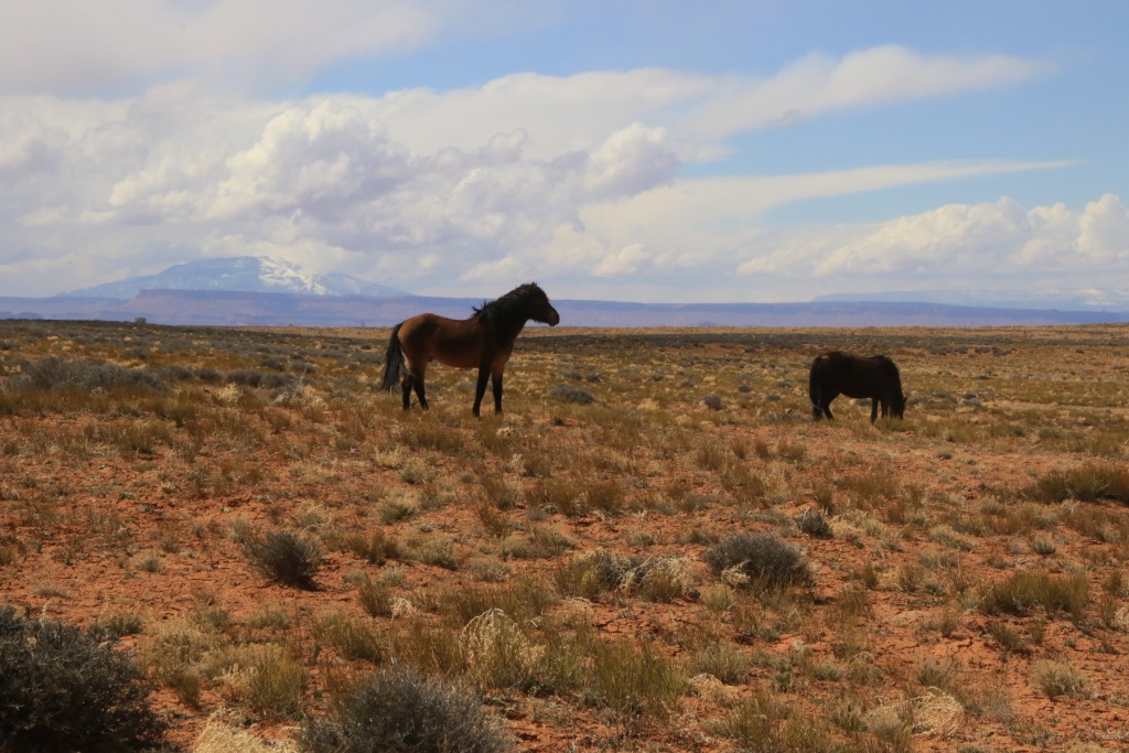
As in several other places in Navajo territory, we saw several groups of horses on the loose.

52780452231_8efe865e89_o.jpg


52780452181_b9d6ab0161_o.jpg


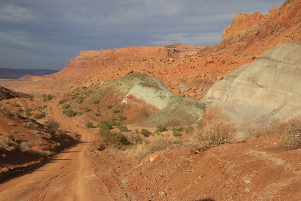
At a certain point, the road leaves the wash at the bottom of the canyon to go up on top of a plateau, crossing pretty bentonite hills, fortunately well lit during our passage.

52780703209_21ebbd64a3_o.jpg


Du for lack of time, we turned around long before reaching the destination point we had set ourselves.

Tomorrow, we will leave Kayenta to reach Mexican Hat in Utah for a few days.
 
Day 47:

Start point: Kayenta AZ
End point: Mexican Hat UT

Distance driven: 212 km


We had a two-tone day, as our planned activities were disrupted by a major weather system that swept through the region, bringing with it very strong winds, snow, and rain. As our first planned destination was in the mountains, we encountered snow en route and wisely turned back as we wouldn't have been able to see anything anyway.

We instead drove to Monument Valley and waited in the parking lot for the precipitation to stop and the sky to clear, as the system was not expected to impact us for very long. After about an hour we could start seeing West Mitten Butte again.

52782461156_3d9a0f5c3e_o.jpg


About another half hour later, the sky quickly cleared. What a contrast! We then decided to once again take the Scenic Drive winding near the park's mounds.

52782922413_cf87b59145_o.jpg


52782922153_309c5efecc_o.jpg


Then we headed to Douglas Mesa Road, located in Navajo territory. Unlike the other regions outside the reserve where we very often encountered cows, here we encountered horses, donkeys, and mules roaming free, with Navajo Mountain in the distance. Concept!

52782921728_bf668d5275_o.jpg


The road gradually gains elevation as it progresses across the plateau. Monument Valley was visible in the distance, as well as Raplee Ridge towards Mexican Hat, another fold of the earth's crust that we will visit in the next few days.

52781915602_b17aeb672d_o.jpg


52781916082_66b2faa537_o.jpg


Douglas Mesa Road joins several side trails along the cliffs above the San Juan River below at the bottom of the canyon.

52782921178_97976e7c95_o.jpg


52782702599_7f1e537b56_o.jpg


52781914932_52794c118f_o.jpg


52782920533_5111ba96fe_o.jpg


52782459161_c06004fdf9_o.jpg


52782861625_577f231828_o.jpg


52782701549_3313dcb867_o.jpg


We then reached Mexican Hat where we will spend the next four nights. After connecting to the Internet at our hotel, we saw a message from a good old friend who was also traveling in Utah. We will have the great pleasure of seeing him and his wife again after too many years without contact. See you tomorrow Alain and Francine!
 
More great pics, thanks for sharing! My understanding is that all dirt roads on the reservation require a permit. Piute Creek Road sure looks good.
 
More great pics, thanks for sharing! My understanding is that all dirt roads on the reservation require a permit. Piute Creek Road sure looks good.

Thanks!

Since many or the main roads are dirt roads, I doubt a permit is required for those. But for more remote or secondary, That might be the case.

On our way in, we stopped at Window Rock to get this clarification. Unfortunately, all offices were closed so we didn't get any clear answers. We did respect the privacy of residents, and we didn't hike at some places we felt was not appropriate. Next time, I will try to get this answer to be sure.
 
Day 48:

Start point: Mexican Hat UT
End point: Mexican Hat UT

Distance driven: 116 km
Distance hiked: km


We had a wonderful day in very good company with Alain and Francine, friends from the Montreal area. Thanks to our blog, they were able to follow us and see that our routes intersected in Mexican Hat. What a great surprise we had!

After a bit of catching up on the long years of not seeing each other, we decided to hike off trail to a headland on Comb Ridge, tower near Bluff UT. The view was magnificent, despite the strong wind.

52784047367_1017cfe060_o.jpg


52785051683_804a6f81bf_o.jpg


52784047937_e1429c4a81_o.jpg


52785051433_037faa821e_o.jpg


We are still waiting for flowers to bloom, although we have seen some.

52784837099_b23a3bde75_o.jpg


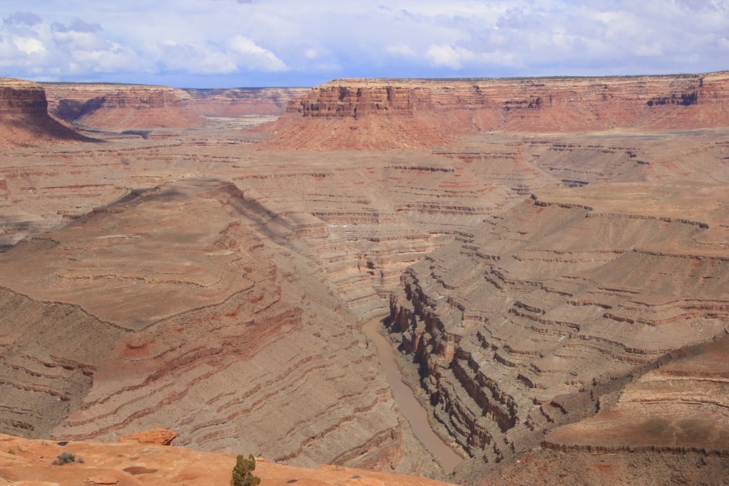
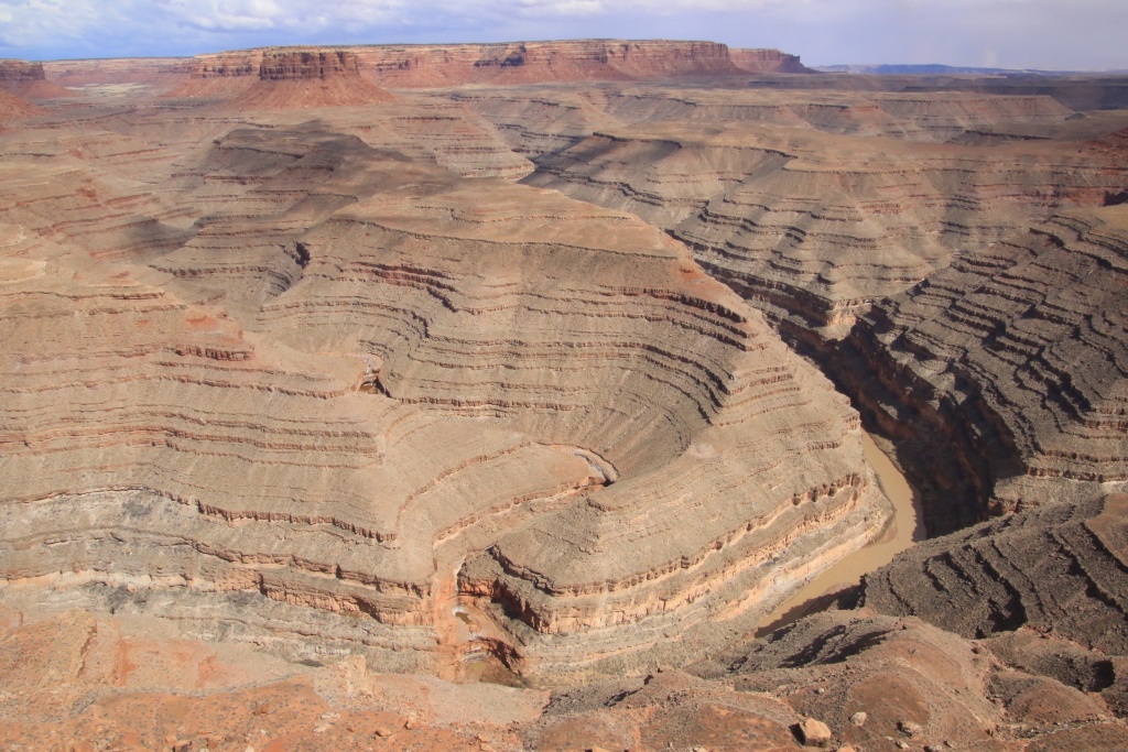
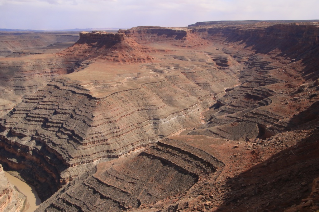
After returning to our vehicles, we acted as guides for Alain and Francine to show them some attractions in the region, such as Gooseneck State Park near Mexican Hat. At this point, the San Juan River makes three long meanders at the bottom of a deep gorge, thus traveling 10 km to advance only 2.5 km.

52784598121_df41edfe1b_o.jpg


Then we climbed the long slope of Moki Dugway, gaining over 300 meters in elevation. From the top, the view is superb, allowing to see Valley of the Gods below, with Raplee Ridge in the distance, place which we will explore during our stay in Mexican Hat.

52784992755_5379cf0ebc_o.jpg


52784992855_d6141293fb_o.jpg


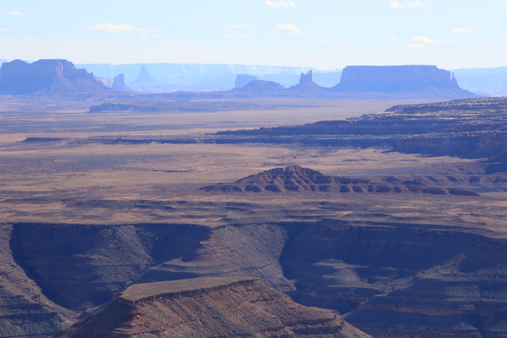
We continued and joined Muley Point in Glen Canyon National Recreation Area, offering several viewpoints along this point. We could see the buttes of Monument Valley, as well as in the distance Agathia Peak near Kayenta AZ.

52785050328_a467984944_o.jpg


Coming back to Mexican Hat, at the intersection of UT 261 and US163, the chevron patterns of Raplee Ridge were vibrantly colored. What an exceptional work of Mother Nature!

52784597606_46a0f5262a_o.jpg


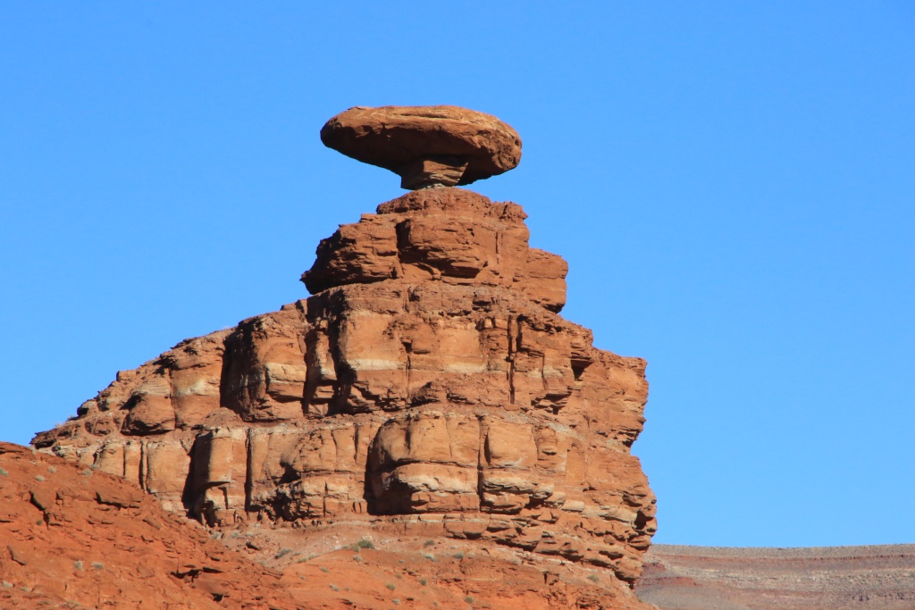
To end the guided tours, we joined the emblem par excellence of Mexican Hat, the hoodoo in the shape of a Mexican hat located near the village.

52784046452_a925706fc0_o.jpg


We then had a very good meal at the Swinging Steak Restaurant, whose name comes from the cooking grill for steaks, swinging like a swing to cook them over the flame without them burning. Original!

52785049983_1e1830ebdb_o.jpg


We left Alain and Francine, promising to meet again when we returned to Quebec, but also during future trips.

Tomorrow, as the good weather persists, we will take the opportunity to further explore the Mexican Hat region.
 

Members online

No members online now.

Forum statistics

Threads
278,310
Messages
3,554,080
Members
248,016
Latest member
Advally Service

Trending content

Back
Top