who wants to go wheeling?

I'm leaving the mud for now. It should mostly come off tomorrow in the rain. Then I'll take it to the coin-op car wash and use their brush to get the rest off....

No accidents on the way back. Kiddo did pretty good!

Good times today. That was the farthest back I've been over at Butcher Jones so that was a nice change of pace.

_coder
 
Wife and I did a last minute run through the the Florence trails, saw some huge mine building off a cliff trying to get to Telegraph canyon trail. Came to a massive washout of the trail and had to turn back. Also found that I got more trimming to do and need extended bump stops on the rear.
 
Wife and I did a last minute run through the the Florence trails, saw some huge mine building off a cliff trying to get to Telegraph canyon trail. Came to a massive washout of the trail and had to turn back. Also found that I got more trimming to do and need extended bump stops on the rear.

Did you take Ajax Mine road to try and get there? I've been thinking about doing a Telegraph run (either from superior down or from Ajax up).

_coder
 
Did you take Ajax Mine road to try and get there? I've been thinking about doing a Telegraph run (either from superior down or from Ajax up).

_coder

I'd be down for doing that trip! I have GPS for exactly that route too starting at the Cottonwood canyon entrance and it stops off at an Amethyst mine and the Ajax Mine itself on the way.

When would you like to do that run?
 
yep we went on Ajax. Just reviewed the topo maps. it got really hairy in a few spots and the trail we were on went along a cliffside and we came to a halt, Vanessa had to spot me in revers all the way back down the trail. we would have needed bridging material to go further. There was a really cool huge cement building on a cliffside we wanted to explore but it got dark and we decided to not push it since we were alone.

going N to S from telegraph would be a nice long trip. There is so much to explore out there it's crazy.

This is about where we were halted.
ddf0c76f80fe085693d793ac308efc00.jpg
 
Last edited:
I believe that huge mine building is the Ajax mine. Shame about the washed out area. About how much of the road was gone? Something we could "bubba up" with some 4x4 boards and simple truss support underneath?

Absent that, I guess that means if we want to try this it will need to be North to South starting out at Superior and a return trip the same way.

_coder
 
Next weekend the wifey wants to go play in the snow now that we got tires. Don't know where yet.

A lot of the forest service roads are closed for the winter now. Check out this page for a list of closures: Coconino National Forest - Home

You could also drive up to the mormon lake area. even with the closures off the major highways, there are still open roads off of Lake Mary Road and Mormon Lake Road. And there should be ample snow up there this weekend from the storms this week... Might be a great time to go.

_coder
 
Last edited:
I believe that huge mine building is the Ajax mine. Shame about the washed out area. About how much of the road was gone? Something we could "bubba up" with some 4x4 boards and simple truss support underneath?

Absent that, I guess that means if we want to try this it will need to be North to South starting out at Superior and a return trip the same way.

_coder

It looked like a ton of water runoff ate through the trail, it was 5-6 feet across from the cliff down into the wash below and went from 2 feet deep to about 5 feet deep.
 
yep we went on Ajax. Just reviewed the topo maps. it got really hairy in a few spots and the trail we were on went along a cliffside and we came to a halt, Vanessa had to spot me in revers all the way back down the trail. we would have needed bridging material to go further. There was a really cool huge cement building on a cliffside we wanted to explore but it got dark and we decided to not push it since we were alone.

going N to S from telegraph would be a nice long trip. There is so much to explore out there it's crazy.

This is about where we were halted.
ddf0c76f80fe085693d793ac308efc00.jpg

So this was definitely on Tonto Forest land? I volunteer with the Tonto Recreation Alliance; we recently opened the Sunflower Mine Loop again after doing some work to make the trail safer and we could likely do the same out near Ajax, but would need to see it first. Do you have a GPS waypoint?
 
I believe that huge mine building is the Ajax mine. Shame about the washed out area. About how much of the road was gone? Something we could "bubba up" with some 4x4 boards and simple truss support underneath?

Absent that, I guess that means if we want to try this it will need to be North to South starting out at Superior and a return trip the same way.

_coder

Yes, it's the old Ajax Mine processing center.

Please don't "bubba up" anything.
 
Yes, it's the old Ajax Mine processing center.

Please don't "bubba up" anything.


There was a little sign saying leaving public land, no fence, no posts, no barrier, then maybe less than a quarter mile it says entering public land again. It was after that we came to the washout.


I did not breadcrumb my route on GPS, sorry.
 
I'm out this weekend... too many other things going on. Which is unfortunate as there is a ton of snow up north to go play around in.

_coder
 
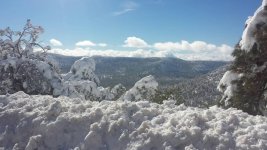
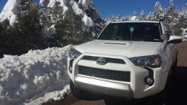
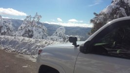
Happy jack today. Even pulled out a Honda

uploadfromtaptalk1452368955570.jpguploadfromtaptalk1452368967317.jpguploadfromtaptalk1452368977138.jpg
 

Attachments

  • uploadfromtaptalk1452368955570.jpg
    uploadfromtaptalk1452368955570.jpg
    88 KB · Views: 254
  • uploadfromtaptalk1452368967317.jpg
    uploadfromtaptalk1452368967317.jpg
    91 KB · Views: 270
  • uploadfromtaptalk1452368977138.jpg
    uploadfromtaptalk1452368977138.jpg
    70.6 KB · Views: 278

Members online

No members online now.

Forum statistics

Threads
278,316
Messages
3,554,120
Members
248,016
Latest member
Advally Service

Trending content

Back
Top