
You are using an out of date browser. It may not display this or other websites correctly.
You should upgrade or use an alternative browser.
You should upgrade or use an alternative browser.
Dirtco's 1999 4Runner Build
- Thread starter Dirtco
- Start date

Dirtco
New member
Is that roof dent something that could get pushed back if you took the roof liner off and applied some force?
Yep, and it's already done! I just needed a little time to think about it.

I removed the sunglass holder/map light and I was able to get a pry bar in there and pop the largest dent out. The small dings are still there but it looks a lot better than it did.


Last edited:

theesotericone
New member
I consider these "character" dents. I try my hardest to keep the truck straight and not mess the body up, but things happen when your running hard trails and taking the hardest lines. Every dent and scratch has a story, and I'm proud of that!
Right on man. If your not breaking shit or denting the rig, you're not trying. You where trying for sure. Great tunes in that snow wheeling vid too.


Dropzone
New member
Big slow bullet you dodged on that one:whoo:
I am sure you know this but your old turbo 4Runner sold recently
I am sure you know this but your old turbo 4Runner sold recently
Dirtco
New member
I am sure you know this but your old turbo 4Runner sold recently
I knew he was selling it but I didn't realize it sold already, I was trying to talk [MENTION=63986]Volcom[/MENTION] into buying it. Whoever bought it got a good deal, it needed some TLC but all the parts were there.
Dirtco
New member
I went out and ran a different snow wheeling trail this weekend, this trail is extremely popular with snowmobiles so I can only run it early and late season. The area is known to get a lot of snow, so I was hoping to find some deep drifts up towards the top.
I really hate mud, but it's just part of spring snow wheeling. I drove probably two miles before I hit the first major snow field. I aired down to 4 psi and started my journey.
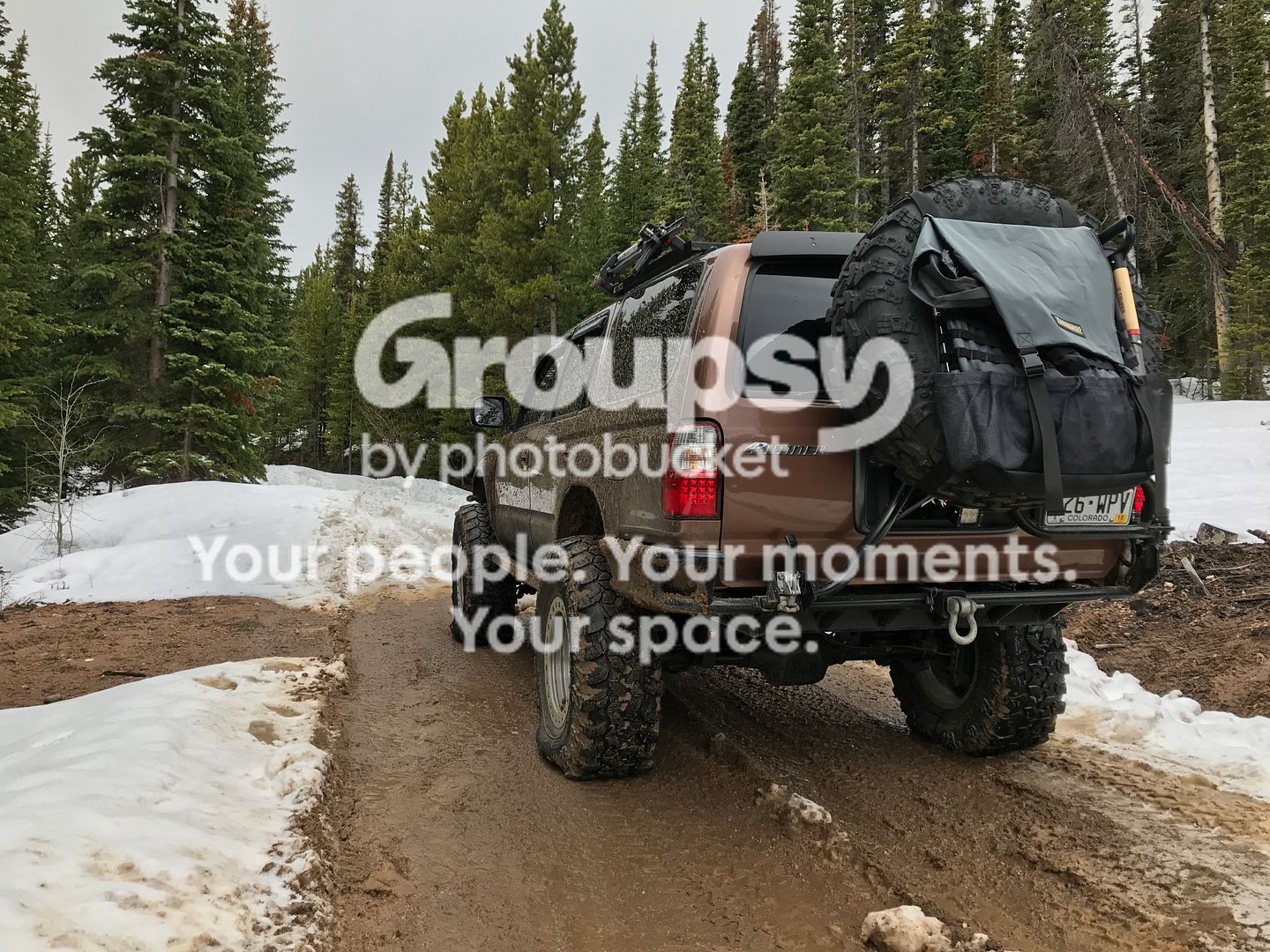

Snow moving in
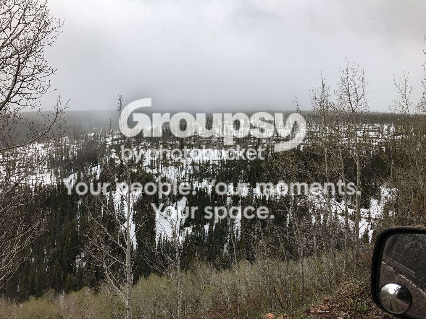
If you don't like off camber driving then spring snow wheeling is not for you!
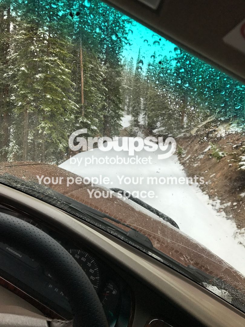
A small break in the weather
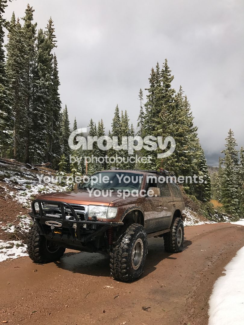
I really hate mud, but it's just part of spring snow wheeling. I drove probably two miles before I hit the first major snow field. I aired down to 4 psi and started my journey.


Snow moving in

If you don't like off camber driving then spring snow wheeling is not for you!

A small break in the weather

Dirtco
New member
It wasn’t long before the snow pack got deeper and there was no dirt to be found anywhere. This is one of my favorite parts of snow wheeling, when you get to the point where you know your alone and there is a very good chance your not going to run into another human.


And the snow only got deeper, if you look to the right side of the 4Runner that is a Forest Service sign just barely peeking up from the snow.


And the snow only got deeper, if you look to the right side of the 4Runner that is a Forest Service sign just barely peeking up from the snow.


Dirtco
New member
It wasn’t long before I hit the end of the trail, at least for the day. The trail dropped down a hill and into a valley, I probably would have been okay but I have a strict rule about breaking trail downhill by myself. So I turned around and headed back home.

But the fun wasn’t over yet! On the way up the trail I saw a massive snow drift that I had to climb up…


But the fun wasn’t over yet! On the way up the trail I saw a massive snow drift that I had to climb up…


Dirtco
New member
I guess it’s time for an update…
First, it seems that Photobucket has changed their policy on 3rd party hosting, and if you want to link pictures it’s going to cost $400 a year. I’m not paying that, nor do I have the time or desire to replace every picture in this thread. If there are any pictures you guys want to save now is the time to do it. If (or when) the pictures go down I will not be updating this thread anymore, I’ll probably just make a new one for my trail adventures.
Now, on to more enjoyable stuff…
A few weeks ago I ran a couple trails close to my house, the last trail I wanted to run had a locked gate so I had to turn around and head home. But, it turns out I was only a couple miles from Trough Trail so I decided to go check it out before I went home. I’ve never run it in this truck, only my past 1st Gen 4Runners. The trail gets very little traffic and reminds me of Carnage BV back before the washout, it’s just a narrow canyon with a bunch of rocks and boulders.
Trail Info > https://web.archive.org/web/20160705105535/http://www.traildamage.com:80/trails/index.php?id=193
<a data-flickr-embed="true" data-header="true" href="https://www.flickr.com/photos/156493849@N03/35584387211/in/dateposted-public/" title="IMG_4405"><img src="https://farm5.staticflickr.com/4100/35584387211_06f403354a_b.jpg" width="1024" height="768" alt="IMG_4405"></a><script async src="//embedr.flickr.com/assets/client-code.js" charset=“utf-8"></script>
<a data-flickr-embed="true" data-header="true" href="https://www.flickr.com/photos/156493849@N03/35675725036/in/dateposted-public/" title="IMG_4409"><img src="https://farm5.staticflickr.com/4129/35675725036_79019b2bc8_b.jpg" width="1024" height="768" alt="IMG_4409"></a><script async src="//embedr.flickr.com/assets/client-code.js" charset=“utf-8"></script>
<a data-flickr-embed="true" data-header="true" href="https://www.flickr.com/photos/156493849@N03/35584424051/in/dateposted-public/" title="IMG_4410"><img src="https://farm5.staticflickr.com/4020/35584424051_6842ccfeb0_b.jpg" width="768" height="1024" alt="IMG_4410"></a><script async src="//embedr.flickr.com/assets/client-code.js" charset="utf-8"></script>
Here is the entrance to the upper fork, being alone I didn’t even try it
<a data-flickr-embed="true" data-header="true" href="https://www.flickr.com/photos/156493849@N03/35584396941/in/dateposted-public/" title="IMG_4407"><img src="https://farm5.staticflickr.com/4009/35584396941_4014178954_b.jpg" width="768" height="1024" alt="IMG_4407"></a><script async src="//embedr.flickr.com/assets/client-code.js" charset="utf-8"></script>
And here is what my steering rack bushings looked like after the trip!
<a data-flickr-embed="true" data-header="true" href="https://www.flickr.com/photos/156493849@N03/35590327591/in/dateposted-public/" title="IMG_4435"><img src="https://farm5.staticflickr.com/4215/35590327591_a67695dcf7_b.jpg" width="768" height="1024" alt="IMG_4435"></a><script async src="//embedr.flickr.com/assets/client-code.js" charset=“utf-8"></script>
<a data-flickr-embed="true" data-header="true" href="https://www.flickr.com/photos/156493849@N03/35590317741/in/dateposted-public/" title="IMG_4437"><img src="https://farm5.staticflickr.com/4109/35590317741_9f090d1384_b.jpg" width="1024" height="768" alt="IMG_4437"></a><script async src="//embedr.flickr.com/assets/client-code.js" charset="utf-8"></script>
First, it seems that Photobucket has changed their policy on 3rd party hosting, and if you want to link pictures it’s going to cost $400 a year. I’m not paying that, nor do I have the time or desire to replace every picture in this thread. If there are any pictures you guys want to save now is the time to do it. If (or when) the pictures go down I will not be updating this thread anymore, I’ll probably just make a new one for my trail adventures.
Now, on to more enjoyable stuff…
A few weeks ago I ran a couple trails close to my house, the last trail I wanted to run had a locked gate so I had to turn around and head home. But, it turns out I was only a couple miles from Trough Trail so I decided to go check it out before I went home. I’ve never run it in this truck, only my past 1st Gen 4Runners. The trail gets very little traffic and reminds me of Carnage BV back before the washout, it’s just a narrow canyon with a bunch of rocks and boulders.
Trail Info > https://web.archive.org/web/20160705105535/http://www.traildamage.com:80/trails/index.php?id=193
<a data-flickr-embed="true" data-header="true" href="https://www.flickr.com/photos/156493849@N03/35584387211/in/dateposted-public/" title="IMG_4405"><img src="https://farm5.staticflickr.com/4100/35584387211_06f403354a_b.jpg" width="1024" height="768" alt="IMG_4405"></a><script async src="//embedr.flickr.com/assets/client-code.js" charset=“utf-8"></script>
<a data-flickr-embed="true" data-header="true" href="https://www.flickr.com/photos/156493849@N03/35675725036/in/dateposted-public/" title="IMG_4409"><img src="https://farm5.staticflickr.com/4129/35675725036_79019b2bc8_b.jpg" width="1024" height="768" alt="IMG_4409"></a><script async src="//embedr.flickr.com/assets/client-code.js" charset=“utf-8"></script>
<a data-flickr-embed="true" data-header="true" href="https://www.flickr.com/photos/156493849@N03/35584424051/in/dateposted-public/" title="IMG_4410"><img src="https://farm5.staticflickr.com/4020/35584424051_6842ccfeb0_b.jpg" width="768" height="1024" alt="IMG_4410"></a><script async src="//embedr.flickr.com/assets/client-code.js" charset="utf-8"></script>
Here is the entrance to the upper fork, being alone I didn’t even try it
<a data-flickr-embed="true" data-header="true" href="https://www.flickr.com/photos/156493849@N03/35584396941/in/dateposted-public/" title="IMG_4407"><img src="https://farm5.staticflickr.com/4009/35584396941_4014178954_b.jpg" width="768" height="1024" alt="IMG_4407"></a><script async src="//embedr.flickr.com/assets/client-code.js" charset="utf-8"></script>
And here is what my steering rack bushings looked like after the trip!
<a data-flickr-embed="true" data-header="true" href="https://www.flickr.com/photos/156493849@N03/35590327591/in/dateposted-public/" title="IMG_4435"><img src="https://farm5.staticflickr.com/4215/35590327591_a67695dcf7_b.jpg" width="768" height="1024" alt="IMG_4435"></a><script async src="//embedr.flickr.com/assets/client-code.js" charset=“utf-8"></script>
<a data-flickr-embed="true" data-header="true" href="https://www.flickr.com/photos/156493849@N03/35590317741/in/dateposted-public/" title="IMG_4437"><img src="https://farm5.staticflickr.com/4109/35590317741_9f090d1384_b.jpg" width="1024" height="768" alt="IMG_4437"></a><script async src="//embedr.flickr.com/assets/client-code.js" charset="utf-8"></script>
Dirtco
New member
With a fresh set of steering bushings installed it was time to plan out the next trip. I know of a local trail that has several water crossings, and if you run it early enough in the season the entire lower section of the trail is a river. On average it was less than a foot deep, but a couple of the crossings came up to my headlights. I spent a solid 25 minutes driving up the river, and it was super tight with all the fresh willows and plant life. I didn’t get any pictures due to being in a river, but I did have the GoPro going.
<a data-flickr-embed="true" href="https://www.flickr.com/photos/156493849@N03/35684599786/in/dateposted-public/" title="fullsizeoutput_31f"><img src="https://farm5.staticflickr.com/4206/35684599786_c6f94fffdd_b.jpg" width="1024" height="574" alt="fullsizeoutput_31f"></a><script async src="//embedr.flickr.com/assets/client-code.js" charset=“utf-8"></script>
<a data-flickr-embed="true" href="https://www.flickr.com/photos/156493849@N03/35684600926/in/dateposted-public/" title="fullsizeoutput_320"><img src="https://farm5.staticflickr.com/4230/35684600926_a1b12d804f_b.jpg" width="1024" height="574" alt="fullsizeoutput_320"></a><script async src="//embedr.flickr.com/assets/client-code.js" charset="utf-8"></script>
I continued on down the now dusty trail until I started seeing some patches of snow and mud.
<a data-flickr-embed="true" href="https://www.flickr.com/photos/156493849@N03/35337698320/in/dateposted-public/" title="fullsizeoutput_321"><img src="https://farm5.staticflickr.com/4112/35337698320_b623ab9717_b.jpg" width="1024" height="768" alt="fullsizeoutput_321"></a><script async src="//embedr.flickr.com/assets/client-code.js" charset="utf-8"></script>
<a data-flickr-embed="true" href="https://www.flickr.com/photos/156493849@N03/35337712850/in/dateposted-public/" title="IMG_4441"><img src="https://farm5.staticflickr.com/4086/35337712850_04cf73ece6_b.jpg" width="1024" height="768" alt="IMG_4441"></a><script async src="//embedr.flickr.com/assets/client-code.js" charset="utf-8"></script>
Then I hit the first real snow field of the trail, it was an up hill section of slushy snow so I aired down to 5 psi and gave it a shot. I made it, but it wasn’t easy.
<a data-flickr-embed="true" href="https://www.flickr.com/photos/156493849@N03/35556086972/in/dateposted-public/" title="IMG_4447"><img src="https://farm5.staticflickr.com/4069/35556086972_aa6c100d91_b.jpg" width="1024" height="768" alt="IMG_4447"></a><script async src="//embedr.flickr.com/assets/client-code.js" charset=“utf-8"></script>
It wasn’t long before I could see the end of the trail, but to get there I had to climb one hell of a snow bank. Some ATV’s had made an illegal bypass to get around the snow, but I don’t do that crap so I had drive the real trail through all the snow.
<a data-flickr-embed="true" href="https://www.flickr.com/photos/156493849@N03/34888084924/in/dateposted-public/" title="fullsizeoutput_322"><img src="https://farm5.staticflickr.com/4215/34888084924_8489621acd_b.jpg" width="1024" height="768" alt="fullsizeoutput_322"></a><script async src="//embedr.flickr.com/assets/client-code.js" charset=“utf-8"></script>
I knew I was pushing my luck getting up and over the snow bank but what the hell, that’s why I was there! So I aired down to 1 psi, yes a pound, and gave it a shot.
<a data-flickr-embed="true" href="https://www.flickr.com/photos/156493849@N03/34888075894/in/dateposted-public/" title="IMG_4450"><img src="https://farm5.staticflickr.com/4216/34888075894_8d07eaac42_b.jpg" width="768" height="1024" alt="IMG_4450"></a><script async src="//embedr.flickr.com/assets/client-code.js" charset=“utf-8"></script>
Surprisingly I made it without much drama, I got to the top aired my tires back up a little, flew the drone around and made my way down into Camp Hale. It was only mid-afternoon so I decided to head up Holy Cross and see how far I could get before I hit snow.
<a data-flickr-embed="true" href="https://www.flickr.com/photos/156493849@N03/35706024546/in/dateposted-public/" title="IMG_4457"><img src="https://farm5.staticflickr.com/4074/35706024546_91b3df2110_b.jpg" width="1024" height="768" alt="IMG_4457"></a><script async src="//embedr.flickr.com/assets/client-code.js" charset=“utf-8"></script>
I ran the first and second obstacles without an issue and made it all the way up to French Creek before I hit snow. The snow drift was on the other side of the creek (where it normally is this time of year), I thought about crossing the creek and breaking trail but it was getting late and I was by myself. I decided to call it a day while the truck was still in one piece and head back home.
<a data-flickr-embed="true" href="https://www.flickr.com/photos/156493849@N03/35359015340/in/dateposted-public/" title="IMG_4462"><img src="https://farm5.staticflickr.com/4242/35359015340_24ac2b2254_b.jpg" width="768" height="1024" alt="IMG_4462"></a><script async src="//embedr.flickr.com/assets/client-code.js" charset=“utf-8"></script>
<a data-flickr-embed="true" href="https://www.flickr.com/photos/156493849@N03/35684599786/in/dateposted-public/" title="fullsizeoutput_31f"><img src="https://farm5.staticflickr.com/4206/35684599786_c6f94fffdd_b.jpg" width="1024" height="574" alt="fullsizeoutput_31f"></a><script async src="//embedr.flickr.com/assets/client-code.js" charset=“utf-8"></script>
<a data-flickr-embed="true" href="https://www.flickr.com/photos/156493849@N03/35684600926/in/dateposted-public/" title="fullsizeoutput_320"><img src="https://farm5.staticflickr.com/4230/35684600926_a1b12d804f_b.jpg" width="1024" height="574" alt="fullsizeoutput_320"></a><script async src="//embedr.flickr.com/assets/client-code.js" charset="utf-8"></script>
I continued on down the now dusty trail until I started seeing some patches of snow and mud.
<a data-flickr-embed="true" href="https://www.flickr.com/photos/156493849@N03/35337698320/in/dateposted-public/" title="fullsizeoutput_321"><img src="https://farm5.staticflickr.com/4112/35337698320_b623ab9717_b.jpg" width="1024" height="768" alt="fullsizeoutput_321"></a><script async src="//embedr.flickr.com/assets/client-code.js" charset="utf-8"></script>
<a data-flickr-embed="true" href="https://www.flickr.com/photos/156493849@N03/35337712850/in/dateposted-public/" title="IMG_4441"><img src="https://farm5.staticflickr.com/4086/35337712850_04cf73ece6_b.jpg" width="1024" height="768" alt="IMG_4441"></a><script async src="//embedr.flickr.com/assets/client-code.js" charset="utf-8"></script>
Then I hit the first real snow field of the trail, it was an up hill section of slushy snow so I aired down to 5 psi and gave it a shot. I made it, but it wasn’t easy.
<a data-flickr-embed="true" href="https://www.flickr.com/photos/156493849@N03/35556086972/in/dateposted-public/" title="IMG_4447"><img src="https://farm5.staticflickr.com/4069/35556086972_aa6c100d91_b.jpg" width="1024" height="768" alt="IMG_4447"></a><script async src="//embedr.flickr.com/assets/client-code.js" charset=“utf-8"></script>
It wasn’t long before I could see the end of the trail, but to get there I had to climb one hell of a snow bank. Some ATV’s had made an illegal bypass to get around the snow, but I don’t do that crap so I had drive the real trail through all the snow.
<a data-flickr-embed="true" href="https://www.flickr.com/photos/156493849@N03/34888084924/in/dateposted-public/" title="fullsizeoutput_322"><img src="https://farm5.staticflickr.com/4215/34888084924_8489621acd_b.jpg" width="1024" height="768" alt="fullsizeoutput_322"></a><script async src="//embedr.flickr.com/assets/client-code.js" charset=“utf-8"></script>
I knew I was pushing my luck getting up and over the snow bank but what the hell, that’s why I was there! So I aired down to 1 psi, yes a pound, and gave it a shot.
<a data-flickr-embed="true" href="https://www.flickr.com/photos/156493849@N03/34888075894/in/dateposted-public/" title="IMG_4450"><img src="https://farm5.staticflickr.com/4216/34888075894_8d07eaac42_b.jpg" width="768" height="1024" alt="IMG_4450"></a><script async src="//embedr.flickr.com/assets/client-code.js" charset=“utf-8"></script>
Surprisingly I made it without much drama, I got to the top aired my tires back up a little, flew the drone around and made my way down into Camp Hale. It was only mid-afternoon so I decided to head up Holy Cross and see how far I could get before I hit snow.
<a data-flickr-embed="true" href="https://www.flickr.com/photos/156493849@N03/35706024546/in/dateposted-public/" title="IMG_4457"><img src="https://farm5.staticflickr.com/4074/35706024546_91b3df2110_b.jpg" width="1024" height="768" alt="IMG_4457"></a><script async src="//embedr.flickr.com/assets/client-code.js" charset=“utf-8"></script>
I ran the first and second obstacles without an issue and made it all the way up to French Creek before I hit snow. The snow drift was on the other side of the creek (where it normally is this time of year), I thought about crossing the creek and breaking trail but it was getting late and I was by myself. I decided to call it a day while the truck was still in one piece and head back home.
<a data-flickr-embed="true" href="https://www.flickr.com/photos/156493849@N03/35359015340/in/dateposted-public/" title="IMG_4462"><img src="https://farm5.staticflickr.com/4242/35359015340_24ac2b2254_b.jpg" width="768" height="1024" alt="IMG_4462"></a><script async src="//embedr.flickr.com/assets/client-code.js" charset=“utf-8"></script>

Mr.Rick
New member
I love that you have a pressure gauge that will even register a single pound.... might as well just drive around on 4 flats brotha, beadlocks FTW! and by the way, after our last conversation, I'm still not convinced that you needed a new bushing. That thing looked fully salvageable :lmao: I think you're just too cautious with your truck..... :lol:
b.moore2011
New member
I want

4-Ripcord
New member
Great recent pics! You are a machine my friend.
Would you be interested in attempting to run Mosquito pass with [MENTION=129084]Flemster[/MENTION] and I on sunday 7/16 or Monday 7/17? I say attempt because we have heard there is still a little bit of snow at the top, we are considering trying to shovel our way through it if its melted enough yet.
Or if you have any other info on the trail that would be of huge help.
Would you be interested in attempting to run Mosquito pass with [MENTION=129084]Flemster[/MENTION] and I on sunday 7/16 or Monday 7/17? I say attempt because we have heard there is still a little bit of snow at the top, we are considering trying to shovel our way through it if its melted enough yet.
Or if you have any other info on the trail that would be of huge help.


smallfry
New member
Great recent pics! You are a machine my friend.
Would you be interested in attempting to run Mosquito pass with [MENTION=129084]Flemster[/MENTION] and I on sunday 7/16 or Monday 7/17? I say attempt because we have heard there is still a little bit of snow at the top, we are considering trying to shovel our way through it if its melted enough yet.
Or if you have any other info on the trail that would be of huge help.
Mosquito Pass is a nice trail, make sure to stop and check out the old mining areas.
Dirtco
New member
Great recent pics! You are a machine my friend.
Would you be interested in attempting to run Mosquito pass with [MENTION=129084]Flemster[/MENTION] and I on sunday 7/16 or Monday 7/17? I say attempt because we have heard there is still a little bit of snow at the top, we are considering trying to shovel our way through it if its melted enough yet.
Or if you have any other info on the trail that would be of huge help.
Thanks Jim! You might be pushing your luck getting over Mosquito Pass, the snow drift is usually in a small valley after the switchbacks on the Leadville side, and after the big mine on the Fairplay side. You might want to call the Forest Service office in that district and see if they have more info. I checked Bushducks.com and the last update was the end of June, there was still at least two large snow drifts blocking the trail. I've seen people snowboarding that spot in August before! I am available both Sunday and Monday to run a trail or check it out.
I take it that this is part of a larger trip? You could always take Weston Pass, it also goes from Leadville to Fairplay just a little further down the mountain range. It might be a small detour from your route but not too far, and it is dirt.
Dirtco
New member
I'm still not convinced that you needed a new bushing. That thing looked fully salvageable :lmao: I think you're just too cautious with your truck..... :lol:
Next time I'll just spray expanding foam all over the steering rack, that should hold it in place!

4-Ripcord
New member
Thanks Jim! You might be pushing your luck getting over Mosquito Pass, the snow drift is usually in a small valley after the switchbacks on the Leadville side, and after the big mine on the Fairplay side. You might want to call the Forest Service office in that district and see if they have more info. I checked Bushducks.com and the last update was the end of June, there was still at least two large snow drifts blocking the trail. I've seen people snowboarding that spot in August before! I am available both Sunday and Monday to run a trail or check it out.
I take it that this is part of a larger trip? You could always take Weston Pass, it also goes from Leadville to Fairplay just a little further down the mountain range. It might be a small detour from your route but not too far, and it is dirt.
The forest service is absolutely horrible at answering the phone, we have tried. The ranger district just says "there's still some snow up there" but cant clarify how much when I called them.
Yeah it is a part of a trip that [MENTION=129084]Flemster[/MENTION] , me, and 2 other friends are doing. We are trying to go from the front range to Ouray, hitting as many passes and trails as possible in route to FJ summit. We are filming a video for the trip, so mosquito was going to be a really cool part of it being the highest pass in the state. We will probably still check it out to asses the condition, if you are interested. Weston pass is indeed our backup for that part of the trip. I don't have your number but I think you and Alex have each others info? If not, send me a PM.
Similar threads

- Replies
- 0
- Views
- 281


- Replies
- 0
- Views
- 2K

- Replies
- 2
- Views
- 3K
- Replies
- 2
- Views
- 10K


