
JohnTheLuck
Member
Day 53:
Start point: Page AZ
End point: Page AZ
Distance driven: 204 km
Distance hiked: 4.6 km
When we got out of bed, the rain had stopped and a few breaks in the clouds were visible. We were confident that we would have a great day. When we left the hotel, we decided to go for a hike in The Cockscomb Wilderness Study Area where we were a few days ago. This time, we wanted to go along the wash which runs along the inclined plane. Driving west and gaining altitude, we saw thick clouds towards our destination. So we abandoned and turned around.
We tried our luck on Smoky Mountains Road in Glen Canyon National Recreation Area. The first six kilometers are maintained and made of gravel. It was in fairly good condition. We then encountered a Jeep Wrangler covered in mud. The driver told us that the road was really slippery further and he even turned around. We still continued to reach the end of the maintained section. This road is very photogenic even under the clouds.


Then we returned to the Carl Hayden Visitor Center near the Glen Canyon Dam and the bridge over the Colorado River.


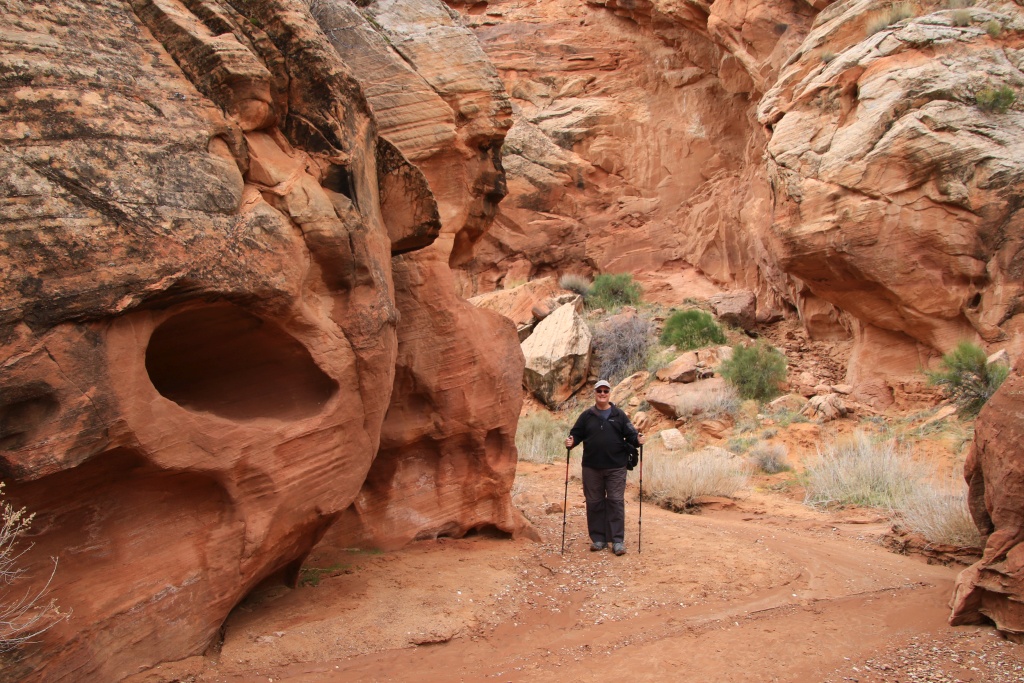
After a good meal, we tried our luck once again for The Cockscomb Wilderness Study Area. Again, the threatening clouds appeared as we reached the entrance. We have once again given up. Instead, we headed to Catstair Canyon located nearby. A short hike leads to a usually dry fall.

On our way back to Page, we stopped at the Big Water Visitor Center. There, we saw a great exhibit about dinosaurs, mostly excavated from the Kaiparowitz Plateau in Grand Staircase-Escalante National Monument.

We then returned to Page resolved to enjoy some sun. When we arrived, it was once again masked by clouds. Certainly, we were not due to see the sun of the day. We still went for a walk on the hills of The Chains, bordering Lake Powell in Glen Canyon National Recreation Area.


As the precipitation has stopped for a few days, we hope that the roads are dry enough to reach our destinations and do our activities.
.
Start point: Page AZ
End point: Page AZ
Distance driven: 204 km
Distance hiked: 4.6 km
When we got out of bed, the rain had stopped and a few breaks in the clouds were visible. We were confident that we would have a great day. When we left the hotel, we decided to go for a hike in The Cockscomb Wilderness Study Area where we were a few days ago. This time, we wanted to go along the wash which runs along the inclined plane. Driving west and gaining altitude, we saw thick clouds towards our destination. So we abandoned and turned around.
We tried our luck on Smoky Mountains Road in Glen Canyon National Recreation Area. The first six kilometers are maintained and made of gravel. It was in fairly good condition. We then encountered a Jeep Wrangler covered in mud. The driver told us that the road was really slippery further and he even turned around. We still continued to reach the end of the maintained section. This road is very photogenic even under the clouds.
Then we returned to the Carl Hayden Visitor Center near the Glen Canyon Dam and the bridge over the Colorado River.
After a good meal, we tried our luck once again for The Cockscomb Wilderness Study Area. Again, the threatening clouds appeared as we reached the entrance. We have once again given up. Instead, we headed to Catstair Canyon located nearby. A short hike leads to a usually dry fall.
On our way back to Page, we stopped at the Big Water Visitor Center. There, we saw a great exhibit about dinosaurs, mostly excavated from the Kaiparowitz Plateau in Grand Staircase-Escalante National Monument.
We then returned to Page resolved to enjoy some sun. When we arrived, it was once again masked by clouds. Certainly, we were not due to see the sun of the day. We still went for a walk on the hills of The Chains, bordering Lake Powell in Glen Canyon National Recreation Area.
As the precipitation has stopped for a few days, we hope that the roads are dry enough to reach our destinations and do our activities.
.
Last edited:


 .
.

