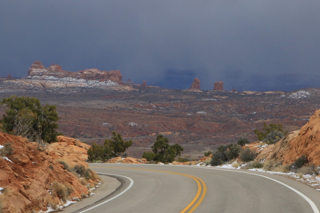
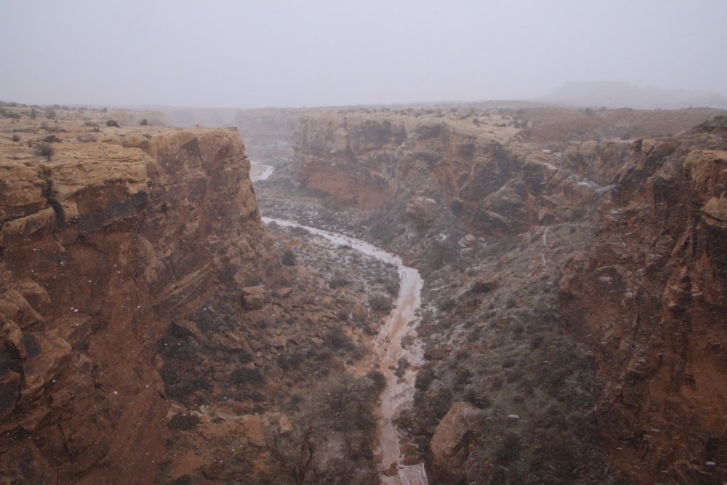
JohnTheLuck's Adventures Thread

Day 1:

Start point: Montréal QC
End point: Lexington VA

Distance driven: 1165 km
States travelled: QC, ON, NY, PA, MD, WV, VA

Finally, the big day for a new trip has finally arrived, after an enforced break of almost three years. How good it feels, even if today we only drove on the highways!

So we left the house around 6:15 this morning under a slightly overcast sky. Quickly, the clouds gave way to a completely clear sky, with mercury slightly above the freezing point.

Everything was fine until I checked the fuel gauge. I had taken good care to reset it when I left the house. Horror and consternation when I read 17.5 l/100km... Usually when I drive around town, with traffic lights, it is quite common for it to indicate around 15, but this one goes down very quickly around 12 to 13 delivered on the highway.

Looking for a reason:
- I checked the tire pressure; normal.
- I checked the temperature of the wheels near the brakes to verify that none of them were stuck; normal.
- No suspicious sound, nothing abnormal.
- I closed the headlights because the sun was rising; no effect.
- Gasoline that is too old; I filled the tank the day before yesterday.
- Heavier load than usual; Not really.

So we hit the road again, without any obvious explaination.

I had to change the truck's battery a few weeks ago because the old one was showing signs of weakness, being already 7 years old. I realized this when it was completely flat. Maybe the fuel supply computer didn't like it and needs to re-learn. This reason seems to be logical because the consumption starts to go down again and currently indicates 14.3 l/100km. We will follow the situation.

The sky becane overcast and the rain began to fall steadily and the temperature plummeted from the maximum of 8C to reach 0C. At this time, a few flakes were falling with the rain. The trees were covered in a very thin layer of ice.

We have just returned to our hotel for the night, in Lexington, Virginia.

Tomorrow, we continue a little on the I-81 freeway to join the I-40 which will lead us to Arizona in three days.

Stay tuned for more interesting things to read and my usual picture festival!
 
Last edited:
Day 2:

Start point: Lexington VA
End point: Memphis TN

Distance driven: 1068 km
States travelled: VA, TN

It was a day with the temperature in a roller coaster!

This morning, before leaving Lexington, Virginia, it was -1C and the 4Runner was completely icy. Luckily, I had brought a scraper just in case! The sky was partly clear but the sun had not yet risen.

The road was a little slippery on the road leading to I-81. On this one, everything was fine. The temperature soared to 8C.

After an hour or two, we started noticing snow covered vehicles moving in the other direction. The road then climbed a mountain range and a band of clouds loomed over their summit. The temperature then drops to 0C. Luckily, we passed very close to the band of clouds but without experiencing any precipitation. Around us, an all too familiar completely snow-covered landscape surrounded us under about 5cm of freshly fallen snow. In Virginia!!!

Continuing, we finally joined the I-40 highway to lead us in two days to Arizona. The temperature kept climbing as we progressed, reaching a more than comfortable 21C in Tennesse. We have also changed time zones; we are therefore one hour behind Montreal.

Tomorrow we continue west on the I-40.
 
Day 3:

Start point: Memphis TN
End point: Shamrock TX

States traveled: TN, AR, OK, TX
Distance driven: 1035 km

We hit the road again under an overcast sky, a little worried about the bad weather to come. A very vigorous cold front was to cross our route, bringing with it gusty winds of up to 80 km/h.

As we stayed in Memphis, we quickly left the endless state of Tennesse to reach Arkansas. The fairly heavy and sustained rain started around 10 a.m. and lasted about two hours. We had to slow down a few times. The drizzle raised by the very many trucks bothered us a little.

Thereafter, the sky cleared up and the roadway dried quickly. This clearing brought with it strong winds and gusts. Several truck drivers preferred to park in the rest areas and on-ramps, leaving us the road practically to ourselves. The winds hit the front of the 4Runner at a slight angle and the engine worked hard to maintain a respectable speed (so underpowered these things...). Bye bye acceptable fuel consumption.

When reaching the Texas panhandle, the wind began to decrease rapidly.

Tomorrow, we will reach our first destination of the trip, at the end of the day however.
 
Day 4:

Start point: Shamrock TX
End point: Holbrook AZ

Distance driven: 1013 km
States traveled: TX, NM, AZ


We left Shamrock TX while it was still dark. Once the sun rose, we had a very beautiful light with a completely clear sky. The winds were very calm.

We then reached New Mexico, and made another time zone change; we are therefore now two hours behind Montreal. We will keep this gap for the rest of the trip.

Further into New Mexico, the road climbs to cross a high plateau. The clouds appeared and the temperature began to drop. A light snow began to fall, but without accumulations on the roadway.

Approaching Albuquerque, the high mountains nearby caused noticeable snowfall. The vehicles were loaded with snow and the landscape all white. To say that we are in this region to escape the Quebec winter...

Albuquerque is located at the bottom of a valley between two plateaus. Normally the temperature is quite warm. Well, we had the hottest temperature of the day there, a very meager 2C. We went to a Ranger Station, local office of a national forest to try to buy an annual pass allowing free access to all the national parks. The offices were closed due to "bad weather".

As we got back on the road, a road sign informed us that the I-40 highway was closed in Holbrook AZ because of the snow... Precisely our destination. Great...

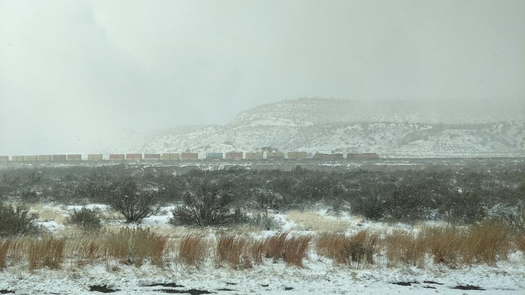
Still continuing on I-40, we experienced heavy snowfall as we approached Gallup NM, located very close to the Arizona border. Here's a capture from the 4Runner's traffic camera (which doesn't do it justice as usual).

52692143483_04661bd0f3_o.jpg


And another through the passenger side window.

52692143548_27301d265c_o.jpg


We stopped to refuel in case we had to wait a long time on the road. At that time, the snow was falling very hard and the wind had picked up. We even discussed the possibility of looking for accommodation for the night, as recommended on another road sign.

We decided to press on to try our luck, having an uncancellable reservation for the night in Holbrook AZ. Good decision because the snow stopped and the sun made several short appearances.

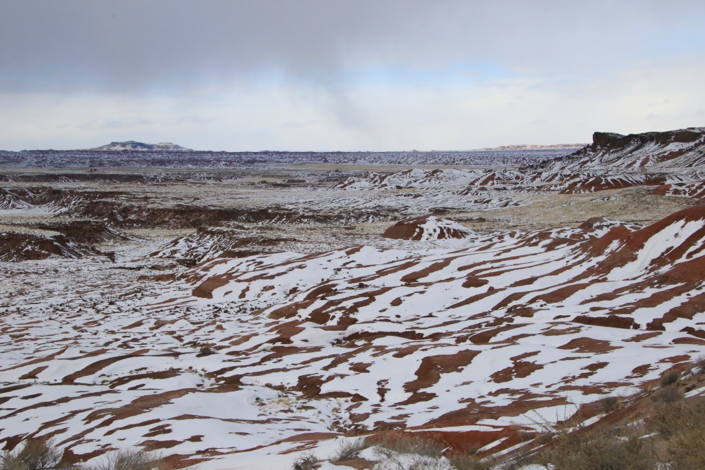
We finally reached Petrified Forest National Park, our first destination of the trip, located near Holbrook. During a stop at the Visitor Center, they confirmed that the I-40 was closed at Holbrook, and that there was a very long waiting line. The Ranger told us that it would be advantageous to cross the entire park to join Holbrook by a secondary road, allowing to bypass the queue. We took the opportunity to stop at a few viewpoints. What a change from the usual view, when everything was covered in snow.

52691654101_b47427b9d5_o.jpg


52692070005_e6ba29c8a4_o.jpg


52691654121_f9040915a4_o.jpg


52692069915_3a39f5ccde_o.jpg


We followed the Ranger's directions to reach Holbrook with no problem. Passing under the I-40 overpass, we noticed that it was then reopened to traffic.

The presence of snow will complicate our activities, especially since the mercury should drop overnight to reach -13C. Brrrrrr.
 
Day 4:

Start point: Shamrock TX
End point: Holbrook AZ

Distance driven: 1013 km
States traveled: TX, NM, AZ


We left Shamrock TX while it was still dark. Once the sun rose, we had a very beautiful light with a completely clear sky. The winds were very calm.

We then reached New Mexico, and made another time zone change; we are therefore now two hours behind Montreal. We will keep this gap for the rest of the trip.

Further into New Mexico, the road climbs to cross a high plateau. The clouds appeared and the temperature began to drop. A light snow began to fall, but without accumulations on the roadway.

Approaching Albuquerque, the high mountains nearby caused noticeable snowfall. The vehicles were loaded with snow and the landscape all white. To say that we are in this region to escape the Quebec winter...

Albuquerque is located at the bottom of a valley between two plateaus. Normally the temperature is quite warm. Well, we had the hottest temperature of the day there, a very meager 2C. We went to a Ranger Station, local office of a national forest to try to buy an annual pass allowing free access to all the national parks. The offices were closed due to "bad weather".

As we got back on the road, a road sign informed us that the I-40 highway was closed in Holbrook AZ because of the snow... Precisely our destination. Great...

Still continuing on I-40, we experienced heavy snowfall as we approached Gallup NM, located very close to the Arizona border. Here's a capture from the 4Runner's traffic camera (which doesn't do it justice as usual).


We followed the Ranger's directions to reach Holbrook with no problem. Passing under the I-40 overpass, we noticed that it was then reopened to traffic.

The presence of snow will complicate our activities, especially since the mercury should drop overnight to reach -13C. Brrrrrr.

warming trend this week. you guys are gonna get to enjoy the true az winter now :hat:
 
Day 5:

Start point: Holbrook AZ
End point: Holbrook AZ

Distance driven: 158 km
Distance hiked: 9.5 km


When we woke up, it was a tiny -16C, here in Arizona... Colder than in Quebec... The world turned upside down.

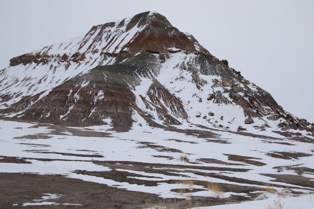
We spent the whole day at Petrified Forest National Park. The landscapes were magical, the cold of the night and the humidity of yesterday having covered everything with an envelope of frost.

52694005753_59a18b3dd8_o.jpg


52693781619_04219d2216_o.jpg


Given the snow cover and the presence of ice, we opted to hike on maintained trails, contrary to our original plan which was to do some Off the Beaten Path hikes. It felt good to walk, especially after those four days on the road.

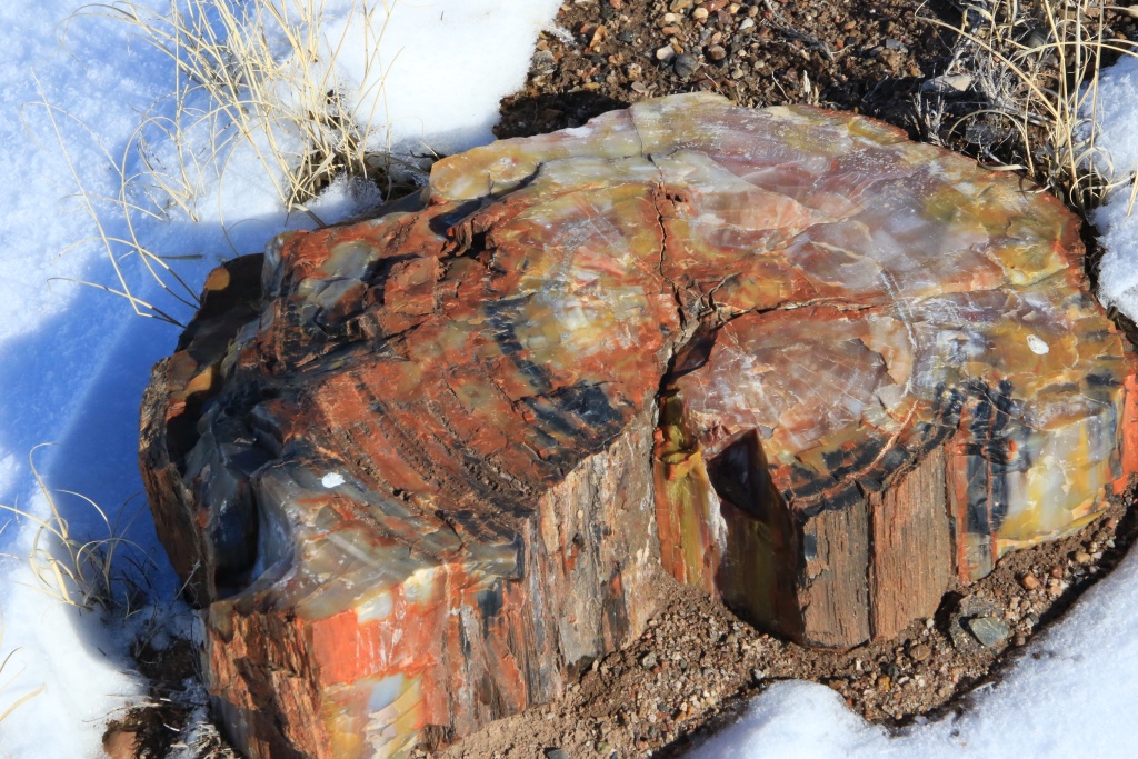
The first trail we hiked was the Crystal Forest trail. The snow on the ground showing the pieces of petrified tree trunks, dating back more than 278 million years.

52693925725_e0ef35fc97_o.jpg


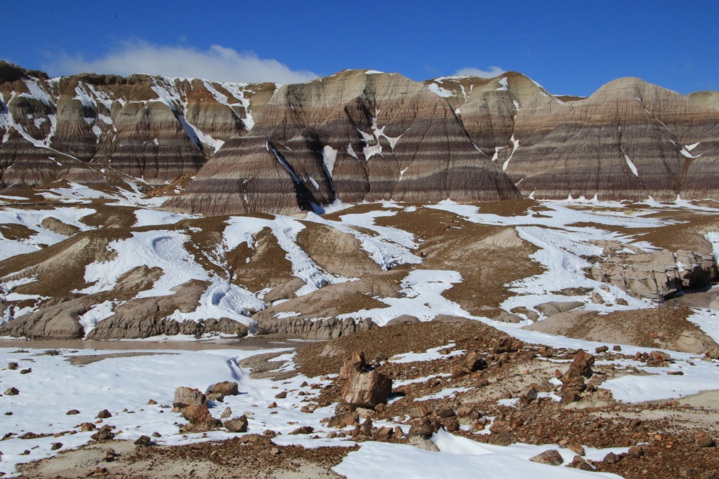
Then we hiked the Blue Mesa trail we had done on our last trip. The presence of snow brought out the reliefs and the colors.

52694005703_7f9b2db89d_o.jpg


52693781574_c4c8b0c1e5_o.jpg


Finally, we hiked the Long Logs and Agate House trail. The size of the trunks and their large number were impressive.

52693925690_483e70fb1e_o.jpg


52693515891_e3e3f04156_o.jpg


Agate House is a dwelling that was built by Native American Ancestral Puebloans around the year 1100. Archaeologists thought this building was unique, but more than a hundred others have been discovered in the park.

52693781509_9bd4fe7153_o.jpg


Tomorrow we will return to Petrified Forest NP for more hiking. Unfortunately, this snow may have an impact on our off-roading planned for this trip. I hope the melting will not make mst of them impassable due to erosion. Will see.
 
Day 6:

Start point: Holbrook AZ
End point: Holbrook AZ

Distance driven: 239 km


NOTE: The backroads and hiking trails conditions forces us to visit things accessible only from paved roads. This thread begins to turn as a vacation report, which I don't specifically like. I hope we can start off-roading soon when this snow melt and the ground dries up.


Today we went back to Petrified Forest NP, with the goal being to focus on the northern part of the park. We had originally planned to do other long hikes but the snow still on the ground, the temperatures above zero turning everything into mud, and the strong winds got the better of us. In addition, the sky remained very cloudy all day, a slight disappointment compared to the magnificent conditions of yesterday.

We once again traveled the park route from north to south stopping at a few viewpoints. From Kachina Point, you could see the trail to Onyx Bridge, which we hiked in March 2020. Couldn't hike it today.

52694688862_f0837cdaeb_o.jpg


Also at Kachina Point, we visited the interior of the Painted Desert Inn, a former hotel that has become a National Historic Site.

At the southern end of the park, we visited the Rainbow Forest Museum, providing a lot of information on the geological history of the park, but also that of its ancient inhabitants, the ancestors of the dinosaurs aged over 210 million years.

52695725378_4e9460aa57_o.jpg


We then returned to Holbrook to visit the Navajo County Historical Society museum, presenting the history of Holbrook and the region in a historic building.

52695695053_a7a030a31e_o.jpg


This place served several vocations, including the prison and the courthouse.

52694688822_0e159d6323_o.jpg


52695695028_03aafa3f90_o.jpg


Several rooms adjoining the court room served as a library of legal books, the oldest of which dated from 1850.

52695469434_b7256118f7_o.jpg


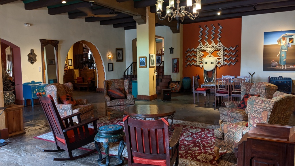
In the afternoon, we went to Winslow AZ to visit the historic La Posada hotel. It was built when the arrival of the railway allowed a marked growth of the city. It was then considered the most luxurious in the region. The hotel is still in operation.

52695694978_92459d6666_o.jpg


52695694963_bbc9249c6e_o.jpg


52695469379_f87e6f60f5_o.jpg


The last two days consisted of a reserve in case we had suffered unforeseen events between Montreal and Arizona. Tomorrow we set out on the established itinerary of the actual trip. We will then visit some sites in the Navajo reservation, including their capital Window Rock.
 
Last edited:
Day 7:

Start point: Holbrook AZ
End point: Chinle AZ

Distance driven: 400 km
Distance hiked: 2.8 km


This morning we left Holbrook AZ under cloudy skies. We came back a bit west near the New Mexico border to take the Among the People Scenic Byway starting on Hwy I-40 in Lupton AZ.

This road joins Window Rock AZ, the capital of the Navajo Nation. We wanted to find out about the regulations regarding access to certain roads that we hope to travel later in the trip.

We also wanted to visit the Navajo Nation Museum to learn more about this native nation. Unfortunately, the museum was closed on weekends for this time of year.

We went to see the Window Rock Tribal Park, located at the base of a cliff with a large opening, the Window Rock. This park honors Navajo veterans who participated in the Second World War, as well as the Navajo Code Talker, soldiers whose task was to encrypt messages in order to thwart the Japanese.

52697570140_531a564e3e_o.jpg


Several Navajo Nation government buildings located in Window Rock are very beautiful, such as the Navajo Nation Council Chamber.

52697152661_fb113408f6_o.jpg


Continuing on the Among the People Scenic Byway, the road skirts a long sandstone cliff.

52697152636_377f04f68e_o.jpg


The road gains greatly in altitude and joins forests of tall pines. In some places, the snow of the last few days had caused significant accumulations and the icy road surface made traffic a little perilous. This did not bother horses grazing peacefully on the side of the road.

52697640703_07f0213c62_o.jpg


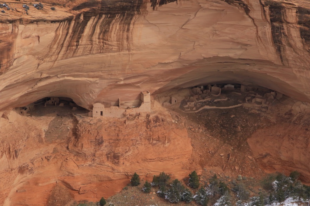
The last segment of this road consists of the North Rim Drive of the Canyon de Chelly National Monument. This park, created in concert with the Navajo Nation, protects several ruins of homes of the Ancestral Puebloans, the ancestors of today's Navajos. We visited this park in April 2010 on our very first trip to the American Southwest. At that time, there was no snow like today.

52696634637_8a944d94d0_o.jpg


52697640668_9a0364c8ab_o.jpg


After completing the North Rim Drive, we made a brief stop at the Visitor Center where we saw a replica of a traditional Navajo dwelling.

52697640643_5101fbd77d_o.jpg


52697152551_73463cc02b_o.jpg


We then traveled the South Rim Drive allowing us to see, from elevated vantage points, the canyon and the Navajo settlements occupying it today, as well as other ruins. It is possible to visit the bottom of the canyon when accompanied by a local guide.

52697410804_3b8ac380d2_o.jpg


The end of the South Rim Drive allows you to see Spider Rock, a huge monument in the center of the valley.

52697152536_981f390e2e_o.jpg


52697569980_995a2b8e69_o.jpg


Tomorrow, we continue our journey north to join Moab in Utah.
 
Great posts as always. I would personally rather have Moab like what the canyons look in the picture than melting. What I see is fine for easy and moderate trails.

I drove much of the Yellow Cat area in the Outback and with another Subaru often breaking snow and did a lot in the 4Runner including breaking snow on Tower Arch trail and Deadman point. We also drove Rainbow Terrace which is now rated difficult due to one spot breaking snow but we were 3 vehicles for that one. I did turn back from a moderate trail with an icy, steep rock to descend, so no thanks there but otherwise the entire trip was fine.

Of course I did not plan on driving Hells Revenge or Fins and Things or similar on that one.

So I would not personally consider snow a show stopper for many of the trails and often there is no snow on rocky steps and the like as the sun bakes them and folks spin enough to clear them up :)

Also, the sun is strong enough to change conditions from frozen to mud and from mud to dry between early morning and late afternoon so there is that, too.
 
Last edited:
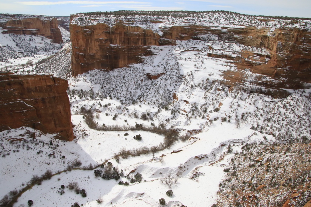
I would like to know from valuable members of this forum who live in these regions what are the current conditions.

Thanks!

Glad to see you doing another round! I wish I would have seen this post sooner and could have let you know to expect cold and snow in a lot of southern Utah (and well the whole state really) We have been having a banner snow year, especially along the Wasatch!

Safe travels!
 
Great posts as always. I would personally rather have Moab like what the canyons look in the picture than melting. What I see is fine for easy and moderate trails.

I drove much of the Yellow Cat area in the Outback and with another Subaru often breaking snow and did a lot in the 4Runner including breaking snow on Tower Arch trail and Deadman point. We also drove Rainbow Terrace which is now rated difficult due to one spot breaking snow but we were 3 vehicles for that one. I did turn back from a moderate trail with an icy, steep rock to descend, so no thanks there but otherwise the entire trip was fine.

Of course I did not plan on driving Hells Revenge or Fins and Things or similar on that one.

So I would not personally consider snow a show stopper for many of the trails and often there is no snow on rocky steps and the like as the sun bakes them and folks spin enough to clear them up :)

Also, the sun is strong enough to change conditions from frozen to mud and from mud to dry between early morning and late afternoon so there is that, too.

Thanks! As you will see in today's post later, there is a lot of snow on the ground near Moab. Our original plan was to explore trails north of Moab, including Yellow Cat, Dellembaugh Tunnel, and so on.

As a Canadian. I am pretty well trained to drive in snow. The problem is these damned KO2 which are about useless on ice. I agree with you that driving on fresh snow and being the first on a road is really fun.

Now, with temperatures climbing above zero every day, there is a lot of mud. We could see that with some trucks. I don't care about mud on the truck, it is again these KO2 that convert to slick tires when the threads fills with mud.
 
Glad to see you doing another round! I wish I would have seen this post sooner and could have let you know to expect cold and snow in a lot of southern Utah (and well the whole state really) We have been having a banner snow year, especially along the Wasatch!

Safe travels!

Thanks! I am pleased you like to follow my adventures!
 
Day 8:

Start point: Chinle AZ
End point: Moab UT

Distance driven: 411 km
Distance hiked: 6.6 km


We left Chinle AZ on US 191 heading north under nearly cloudless skies. The temperature was -5C, already much warmer than the last few days.

Very close to Chinle AZ, we took a side road to see an arch, Window Rock (another one...) and curious formations of sandstone mounds, at least seen on Google Earth. Being still in Navajo territory, and regulations for non-residents states that one should be accompanied by a Navajo guide to explore, it is not clear if we are allowed to travel on these secondary roads alone . The people we met simply greeted us. However, we preferred to remain wisely in our vehicle and admire the very beautiful landscapes.

52699705934_079815f95b_o.jpg


52699936118_ba360bc635_o.jpg


52699705899_155a3fa234_o.jpg


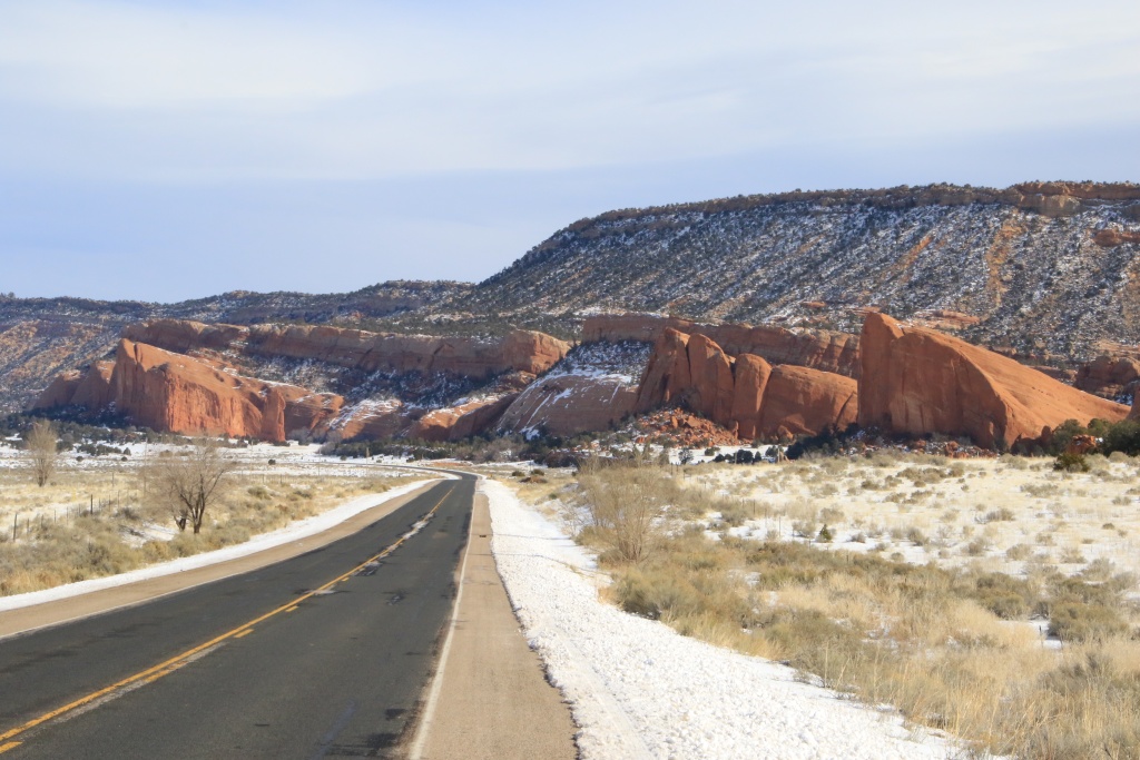
We then took the US191 northbound, designated there as the Flat Mesa Rock Scenic Byway. We had already traveled this route in April 2010 in the middle of a sandstorm when we simply couldn't see anything. Two days later, we hiked it again but very early in the morning when it was still dark. This road is really spectacular.

52698922537_3c86c6f74b_o.jpg


52699439686_7eb3502b1a_o.jpg


52699858425_3a4605e438_o.jpg


We then reached Utah, where we will spend most of the rest of the trip. At Bluff UT, the Navajo Twins (Twins Rocks) greeted us. We were just passing through as later towards the end of the trip we will be back to explore this place.

52699858415_90c43116d2_o.jpg


Still continuing on the US191 road, Church Rock in an unfamiliar white landscape did not foresee anything very good for our activities for the next few days. The view was still nothing short of spectacular, with the La Sal Mountains in the background.

52699439641_ca2b31c1c1_o.jpg


We eventually reached Moab UT. How nice to see this enchanting setting that we had not seen since our interrupted trip in March 2016, when after only a few days, we had to suddenly return home following the death of my father.

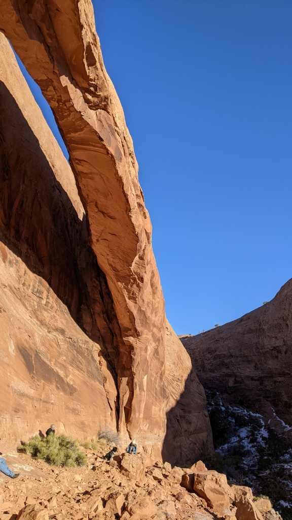
Since we had a few hours of daylight left, we decided to take a hike to see Longbow Arch and walk back up Poison Spider Mesa Trail. This hike offered great views of the Colorado River and the sandstone hills surrounding Moab.

52699935948_63c3ef6602_o.jpg


After just over 2km, Longbow Arch came into view on top of a tall sandstone mound.


52699858330_7e17409562_o.jpg


52699705739_5e554ded69_o.jpg


On our way back, the sun was already low on the horizon. We climbed up a high sandstone knoll to see the Behind the Rock area lit up in the orange rays of Golden Hour, photographers' favorite time.

52699439566_db60bd4995_o.jpg


Tomorrow, we will continue our discoveries around Moab. We will certainly try to see if the off-road trails that we want to travel are at least somewhat passable. Otherwise, there are so many possibilities for hiking that we will have no trouble occupying our time in this region.

It's good to be back in Moab!!!
 
Dellembaugh Tunnel is precisely the trail I did NOT do due to ice on a steep rock. So, yes, there are exceptions.

I would personally do Yellow Cat Trail and Road just as I have in the Outback. There is nothing there that would cause me to worry. The easy Massey version of Dome Plateau has a minor ledge on the final portion of the trail that I did in the Outback in dry conditions. It is small but extremely remote so if you are worried you can always hike that last section, it is short, like half a mile from what I recall (it has been 6-7 years).

The Dome Plateau as in Wells is a completely different trail that only shares that last portion with the Massey version. The Wells trail is now rated difficult, used to be moderate, and it does have a very steep and not short rock climb/descent and a bunch of lesser obstacles. I never tried it in the Outback and have not had a chance since getting the 4R. That one maybe not a good idea for a solo vehicle in winter.

But the main Yellow Cat trail and road have no rock crawling. If you prefer not to be solo in a remote area, that's another question. However, it is hard to think of suitable alternatives. Another network of trails I have done in winter is the area further west and north of I-40 which is really a network of dirt roads with optional trails that range from easy to difficult. The Trail Damage site covers it extensively. The main arteries are easy dirt roads but they are still very remote.

In short, the easier trails like Yellow Cat area tend to be remote while the shorter ones tend to be harder :) So when solo there is always something to consider. It is surely better to be safe than get in trouble far offroad.
 
Last edited:
Today, before our activities, we went north onto Salt Wash Road on which Yellow Cat Road starts, and good news, there is no snow there and the road was completely dry. We did only a very short distance, but it seems very encouraging.

As you suggested, the plan for tomorrow is to do Yellow Cat Trail and Road, from east to west direction.
 
Day 9:

Start point: Moab UT
End point: Moab UT

Distance driven: 236 km
Distance hiked: 7.4 km


Before starting our activities for the day, we went to the north of Moab to check if the ground conditions would allow us to explore this region or not. To our delight, the snow was absent and the off-road trails seemed to be dry.

Then we came back near Moab to see the remains of an old mine, Ruby's Ladder. A short off-road track brought us close to the place. Since there is no formal hiking trail and the information we had was not very precise, we took the time to research, and also admire the landscape. We found the remains of an aerial tramway used to bring up the ores, as well as a wooden ladder.

52701113272_cb695312e7_o.jpg


52701634991_97788853f9_o.jpg


52701635016_116d304beb_o.jpg


We then headed to another trail, also accessible by another off-road track. The trail portion went very well, but when we got to the start of the hike, the presence of snow, water, and mud strongly discouraged us. Rather than get dirty and probably ruin the rest of the day, we decided to forfeit.

Continuing, we reached Canyonlands National Park, one of my favorite park of all those I had the opportunity to visit. From the top of the high snowy plateau, the view is splendid in all directions. We can see in the following photos the Shafer Trail road, winding up the plateau. This spectacular road was closed due to winter conditions.

52702122193_8440270185_o.jpg


52701890814_b9d5754c0c_o.jpg


Further on we hiked the White Rim Overlook Trail leading to a point overlooking the famous White Rim Road which we partially drove in March 2016. The end of this hike offers nearly 360 degree views of this beautiful area, including Buck Canyon and Monument Basin.

52702122138_acfe45dcff_o.jpg


52701113112_4ab20f91e6_o.jpg


52701634861_72e78c9560_o.jpg


A white pick-up was just approaching a spectacular spot on this road below, giving an idea of the grandeur of the place.

52701634841_a2faafae67_o.jpg


In the distance, the Colorado River was visible, surrounded by snow-capped canyons.

52701890704_be273b4182_o.jpg


On the way back, the sun lowering towards the horizon and the clouds then very present formed an outstanding composition.

52701634781_9de9529f6e_o.jpg


Tomorrow we should explore a long off-road trail north of Moab to take advantage of good trail conditions before the expected mid-week rainfall.

Distance by vehicle: 236 km
Hiking distance: 7.4 km
 
Day 10:

Start point: Moab UT
End point: Moab UT

Distance driven: 235 km
Distance hiked: 3.4 km


We hit the road at sunrise to be able to take full advantage of it, before the clouds arrived in the afternoon.

We took UT 128, designated Upper Colorado River Scenic Byway, a most spectacular route. We made a brief stop at a place called Cave House, an unfinished and abandoned house carved into the rock. Although the idea was brilliant, the work had to stop following the collapse of the ceiling which led to the revocation of the building permit.

52704089323_4a903286b8_o.jpg


52703859564_19308182de_o.jpg


Pursuing on the UT 128 road, we had to make a forced stop as a herd of sheep blocked the road. The watchdog did his job well in forcing the sheep off the road.

52704089278_be6d3f71bb_o.jpg


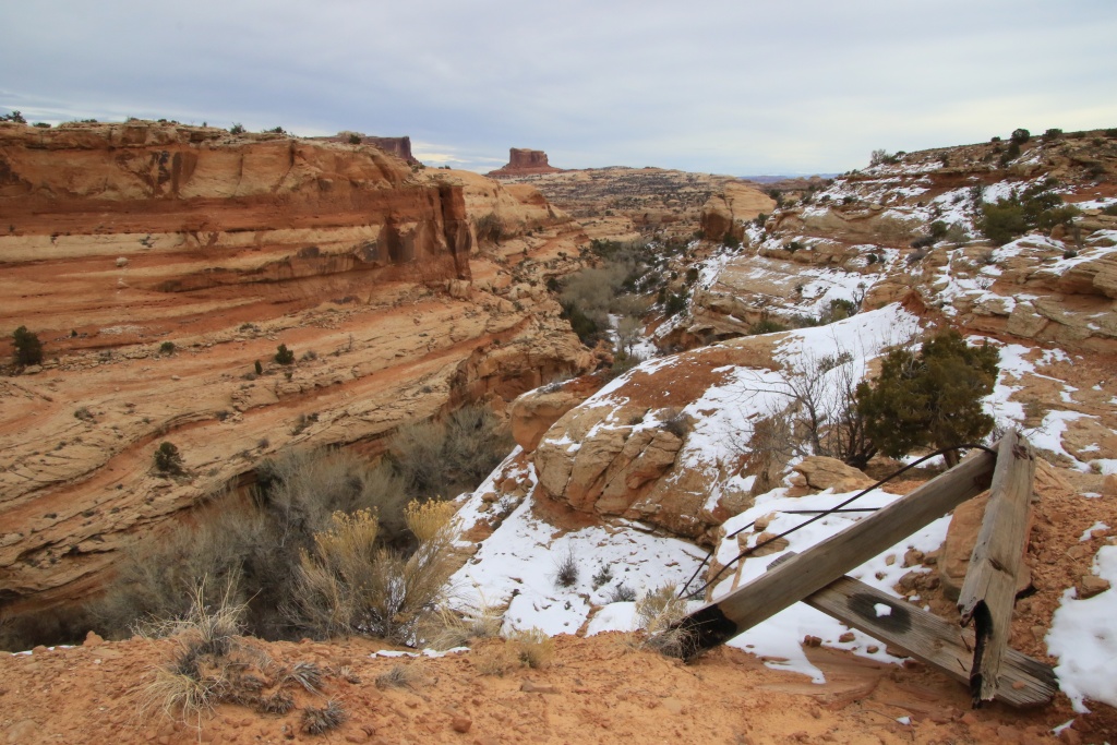
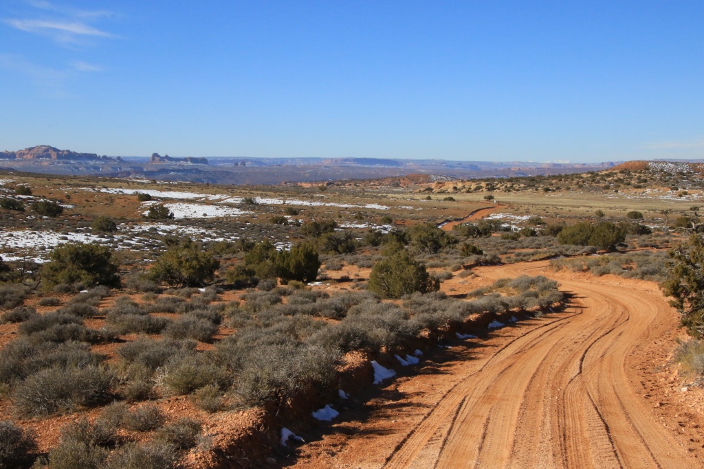
We finally arrived at the main attraction of the day, the Yellow Cat Road and Yellow Cat Trail, as well as two diversions on these. We crossed a large plain and reached a high plateau. Our first diversion was the Winter Camp Ridge Road, descending to a cliff on the edge of Arches National Park.

52703604491_acdf54e944_o.jpg


The cliff, at least 100 meters high, was sculpted with pretty rounded shapes, probably by the work of the wind. In the distance, you could easily make out arches in the park, including the famous Delicate Arch.

52703859449_2c3f2b8c96_o.jpg


52704024610_c89f9e37ab_o.jpg


52705506881_f65605d281_o.jpg


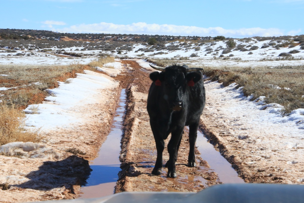
On the way back toward Yellow Cat Road, as we crossed one of the trickiest places given the presence of snow and mud, a group of cows blocked the way. By slowing down (something not to do in the mud...) all the cows moved on the sides, except this big stubborn male with horns! Full stop, for the time for Monsieur to drink some water and for Nancy to say a few kind words to him!!!

52703604441_bbc1b25303_o.jpg


Back on Yellow Cat Road, we passed remnants of several small uranium mines dating back to the 1950s. In this area, beautiful hills of crumbly rock called bentonite are very pretty, but quickly become a nightmare when the ground is wet. , the whole turning into an impassable ice rink.

52703859399_a459c125f1_o.jpg


52703082252_5fd85c1a5a_o.jpg


We then joined our second diversion by taking Salt Wash Overlook Road toward a second cliff overlooking Salt Wash. This cliff was much lower than the previous one, but how much less defined.

52703604401_5d0535aa01_o.jpg


52704089078_50b72d41b6_o.jpg


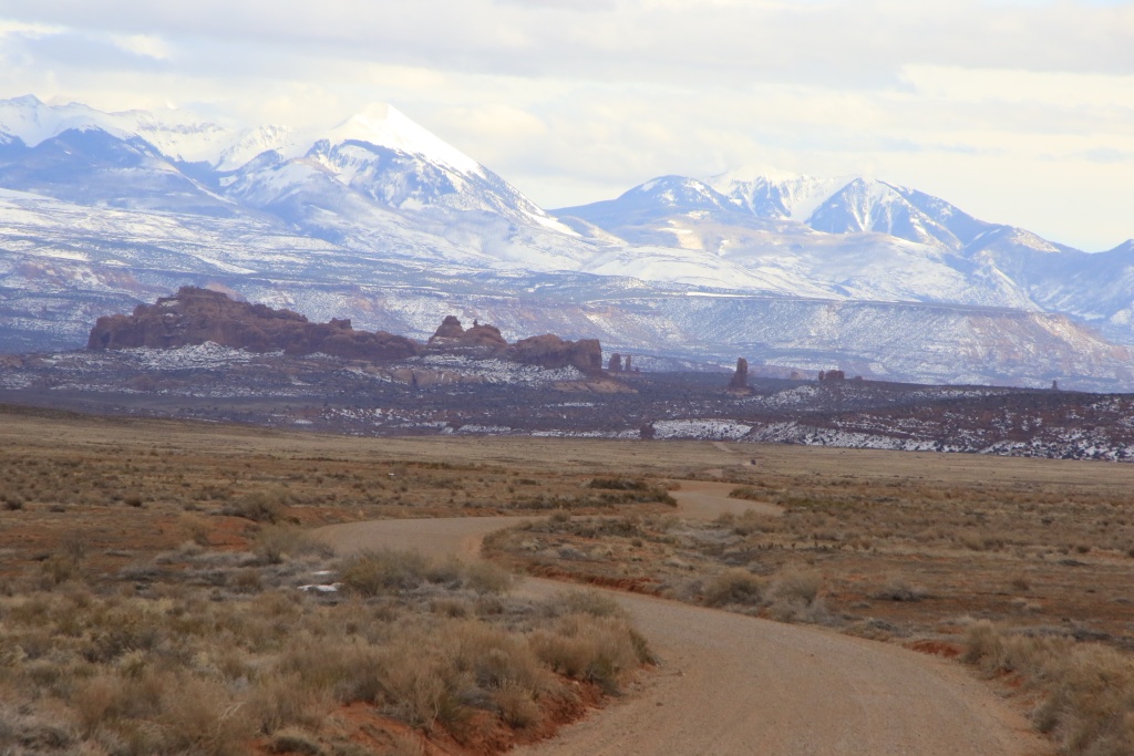
We then came back on Yellow Cat Trail Road and joined Salt Valley Road leading to Arches NP. The sky was then overcast and the wind had picked up. In the distance, the La Sal Mountains were resplendent.

52704089043_d19d9397ac_o.jpg


We then drove back to Moab via the park's scenic drive, bringing back some great memories of memorable hikes.

Tomorrow, the weather forecast is not pleasant. We may took the opportunity de do some laundry, after 10 days on the road, already.
 
Last edited:
Day 11:

Start point: Moab UT
End point: Moab UT

Distance driven: 143 km


Very early this morning, a thunderstorm crossed the region, leaving behind a soil stuffed with water. Impossible to drive off-road tracks and hike. So we took the opportunity to make our laundry.

After, we went to visit the Moab Museum relating the history of the city, from the first Amerindian occupants to today. Although we have already visited Moab several times, we learned several aspects that were unknown to us. For example, in the 1950s, the city was considered the world capital of uranium due to its rich deposits present in the Chinle formation, apparent on the surface in the surroundings.

The refining process generates Yellowcake, an intermediate by-product. The contents of the bottle were refined in Moab in 1956.

52705976250_8701b1f5b8_o.jpg


For nearly 150 years after its discovery, uranium has been used as a coloring agent in ceramics and glazed finishes, with hues from greenish, to yellow, orange, and red. Its use declined during the Cold War due to scarcity.

52706052583_bc7d2cf488_o.jpg


At the height of its exploitation during the Cold War, thousands of miners joined Moab, increasing its population by a factor of five. This rapid growth has created new challenges; inadequate sewage system, shortage of drinking water, schools running several shifts a day, and a waiting list to place phone calls.

Then we hit the road as the sky threatened. As we wanted to remain on paved roads, without gaining too much in elevation to avoid snow, we went to Arches National Park. As we have visited this park several times, we have not photographed the arches, but rather other features.

The weather conditions quickly changed between periods of sunshine and clouds. On the other hand, the winds were very high, to the point of discouraging us from doing any hikes.


52705506866_17f0fed1df_o.jpg


52705996158_95834cd3da_o.jpg


52704982742_081abb8e02_o.jpg


52705758814_8047f33be7_o.jpg


52705758799_a7447eb9aa_o.jpg


52705758754_f32dd9f3c4_o.jpg


52705996038_c63818cc2a_o.jpg


As other precipitations are expected in the region during the night, we do not yet know what we will be able to do tomorrow. We will decide tomorrow morning.
 
Last edited:
Day 12:

Start point: Moab UT
End point: Moab UT

Distance driven: 290 km
Distance hiked: 2.1 km


Winter conditions continued as the weather forecast did not mention the multiple snow showers we experienced today. This affects our planned activities in our itinerary, and forces us to improvise a bit.

Following our visit to the Moab Museum the day before, we took a look at the site of the former uranium processing plant, located at the entrance to the city near the Colorado River. This is the subject of a major decontamination project. The soil layer and part of the rock layer are taken and transported by train to Green River UT further north.

52707447856_9db12a20b6_o.jpg


52706922092_aaf8fb901a_o.jpg


Then we headed back into Arches NP to hike a short off-road trail to the Eye of the Whale arch. The conditions were very good despite some lightly snowy portions.

52707930443_d2bdfc9030_o.jpg


52707724364_e6c046e2e6_o.jpg


Continuing a bit further down the trail, we saw another arch, Beckwith Arch. We didn't see an obvious path to reach it.

52707930408_78f560fbe9_o.jpg


We then came back on our way to take Salt Valley Road another time to try to reach the 4WD trailhead for Tower Arch. The off-road track leading to it had been washed away by rain and was impassable. We did not even reach the point where we had turned around during our trip in March 2016 when our 4Runner was still stock. So we turned around again.

We then decided to drive the Willow Spring Road leading to US191, the main road into Moab. We saw the Willow Spring Dinosaur Tracks site with footprints left by dinosaurs about 165 million years ago.

52707856425_58849dfb47_o.jpg


52707447766_0f48b92099_o.jpg


Continuing on Willow Spring Road, the sky darkened again.

52707447721_1746c2776c_o.jpg


Once on the US191, we decided to go see Sevenmile Canyon located nearby. This location is visible in a Jeep commercial currently airing on television. We see someone doing base-jumping. As we arrived at the rim of the canyon, the snow began to fall so much that we could no longer see arches of Arches NP in the distance and the La Sal Mountains in the distance. We will try to go back there in the next few days.

52707447706_55f3fa5da7_o.jpg


52706921962_8a75741b6c_o.jpg


To reach this place, Nancy had to open two barriers, one of which was quite heavy to handle. So we tried to take the Copper Ridge Jeep Trail, but ran into an obstacle that was too difficult and eventually got back on our way. Again.

We then decided to go on the UT46 road south of Moab, thinking that we would see beautiful cliffs. On the contrary, the road climbs over the foothills of the La Sal Mountains to reach a pass before descending to Paradox Valley. Before reaching the pass, we passed a broken down grader that had to clear the road. Obviously, the snow having accumulated, we decided to turn around. Again and again...

With about two hours left before sunset, we headed up Kane Creek Road along the Colorado River at first, then Kane Creek. It is a winding road on the side of a cliff in a rather deep canyon and which joins Kane Spring Canyon.

52707786209_cbc2707993_o.jpg


We stopped for a closer look at Devil's Golf Ball, a hoodoo shaped like a golf ball on its tee.

52707930343_785588f650_o.jpg


At the same place, on the heights in the cliff, Nancy spotted a ruin of an old mine used to load trucks (visible on the right in the previous photo). I get shivers down my spine thinking someone has ever driven to this place.

52707856320_cde51b183f_o.jpg


We continued a bit further toward Hurrah Pass but turned back as time was starting to run out and the road was very muddy and banked in places. We will come back to this later when it is dry.

More snowfall is expected tonight for just under 2 cm. It's not much for us used to the Canadian winter, but here on the trails, it has a lot more impact. So more questions for tomorrow.
 

Members online

No members online now.

Forum statistics

Threads
278,310
Messages
3,554,080
Members
248,016
Latest member
Advally Service

Trending content

Back
Top