
You are using an out of date browser. It may not display this or other websites correctly.
You should upgrade or use an alternative browser.
You should upgrade or use an alternative browser.
JohnTheLuck's Adventures Thread
- Thread starter JohnTheLuck
- Start date

JohnTheLuck
Member
Starting at 28USD... 40CAD... Of course, before taxes and tip.Haha, yeah, I have had a steak there. What does it cost nowadays?
JohnTheLuck
Member
Day 49:
Start point: Mexican Hat UT
End point: Mexican Hat UT
Distance driven: 159 km
Distance hiked: 4.5 km
We were once again very thankful for the superb weather and a temperature around 20C, which allowed me to put on my shorts!!! We took full advantage of it to explore some off-road tracks as well as some short hikes to see archaeological sites of Ancestral Puebloans.
Our first destination of the day was the Lower Comb Wash trail in Bears Ears National Monument, leading to several sites of Native American dwelling ruins, as well as several petroglyph panels. The track runs along Comb Wash and crosses it several times. The approaches to the crossings were sometimes very abrupt following the heavy rains of the last weeks having eroded them.

The trail also follows the route of a Mormon expedition to establish a community at what is now Bluff UT. At one point, this task seemed like a miracle when climbing a long, steep incline. The horses were tied one after the other in line, and allowed to help each other when some lost a little grip.

A junction on the track leads to a plateau offering an interesting view towards our next destination.
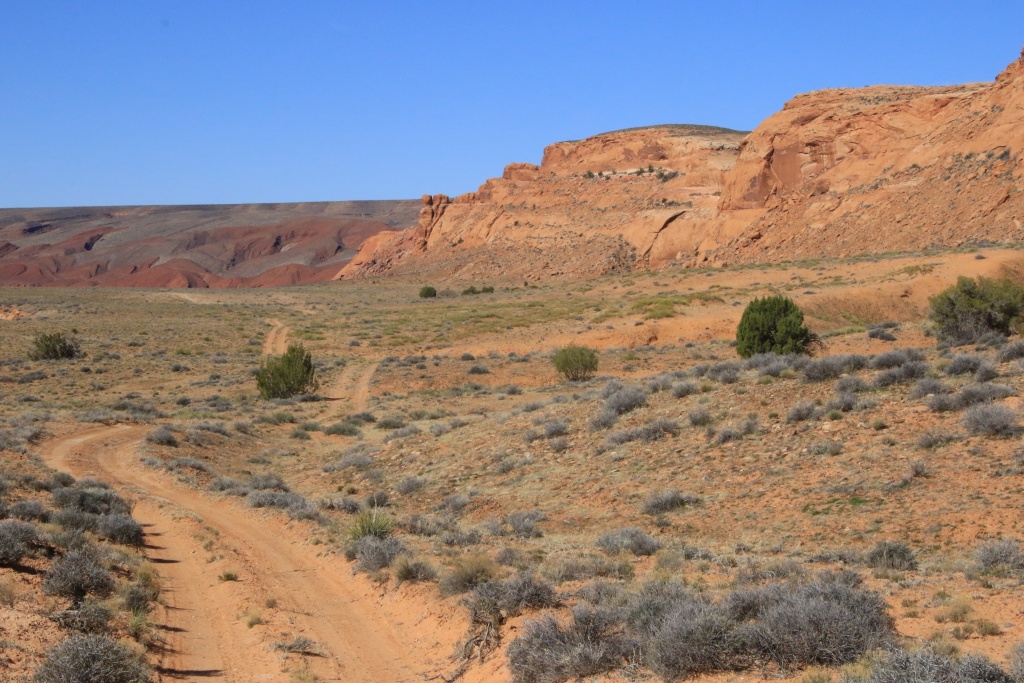
Back on the main trail we saw River House cliff dwelling ruins. A staircase made it possible to see them more closely while even exploring a few rooms. Impressive construction, and what a beautiful view of the valley.

The ruins are built on a long shelf where some petroglyphs can be seen.

Further along the main track, it approaches the San Juan River and we passed through a tamarisk grove forming a tunnel of almost perfect dimensions for our 4Runner. This one also probably has new memories in the form of pinstripes. Well, more experience...

At the end of the track, we walked along a path along a very long petroglyph mural, the Kachina Panel. The condition of these and their beauty certainly make it one of the finest examples of these rock works. A River Ranger who docked for a stopover with his son briefly explained to us that the petroglyphs were made during different eras, dating between 800 and 4000 years ago.

After returning to our starting point, we headed down Lime Ridge Road, a track on the high plateau lined with herringbone patterns seen yesterday. Although the main track is in fairly good condition, the secondary tracks leading to several viewpoints are much rockier. We had started one of these secondary tracks in October 2016, but since our vehicle had practically no protection against impacts, we had to turn around. Not today!
A side track joined a San Juan River lookout overlooking Lower Comb Wash Road that we had just hiked, but also a place in Navajo territory that we had considered doing a long off-trail hike, but a sign saying no access prompted us to abandon this project.

Further on, the viewpoints are much higher and deep canyons have been carved out by the San Juan River or its tributaries.
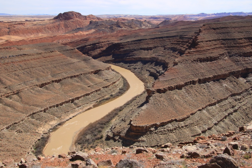
Returning to another viewpoint, drifting along the current of the San Juan River, we could see several groups of boats. These seemed a little lost in the immensity of the landscape. These people certainly must not have thought that they were being watched by us from these exceptional vantage points.


Moreover, we had an unusual view from the top of our plateau towards Monument Valley.
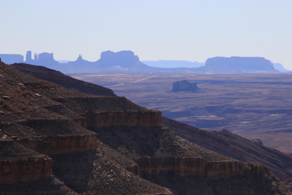
Having completed the long loop on Lime Ridge Road, we headed to another off-road track, Lime Creek Road. This joins the base of Raplee Ridge and its herringbone patterns.

Unfortunately, a past flood completely washed away the ground near Lime Creek and made the trail inaccessible past that point.
Tomorrow, we will reach the high plateau of Grand Gulch to explore other off-road tracks, but also a hike to a site of ruins accessible by permit that we were lucky enough to obtain.
Start point: Mexican Hat UT
End point: Mexican Hat UT
Distance driven: 159 km
Distance hiked: 4.5 km
We were once again very thankful for the superb weather and a temperature around 20C, which allowed me to put on my shorts!!! We took full advantage of it to explore some off-road tracks as well as some short hikes to see archaeological sites of Ancestral Puebloans.
Our first destination of the day was the Lower Comb Wash trail in Bears Ears National Monument, leading to several sites of Native American dwelling ruins, as well as several petroglyph panels. The track runs along Comb Wash and crosses it several times. The approaches to the crossings were sometimes very abrupt following the heavy rains of the last weeks having eroded them.
The trail also follows the route of a Mormon expedition to establish a community at what is now Bluff UT. At one point, this task seemed like a miracle when climbing a long, steep incline. The horses were tied one after the other in line, and allowed to help each other when some lost a little grip.
A junction on the track leads to a plateau offering an interesting view towards our next destination.
Back on the main trail we saw River House cliff dwelling ruins. A staircase made it possible to see them more closely while even exploring a few rooms. Impressive construction, and what a beautiful view of the valley.
The ruins are built on a long shelf where some petroglyphs can be seen.
Further along the main track, it approaches the San Juan River and we passed through a tamarisk grove forming a tunnel of almost perfect dimensions for our 4Runner. This one also probably has new memories in the form of pinstripes. Well, more experience...
At the end of the track, we walked along a path along a very long petroglyph mural, the Kachina Panel. The condition of these and their beauty certainly make it one of the finest examples of these rock works. A River Ranger who docked for a stopover with his son briefly explained to us that the petroglyphs were made during different eras, dating between 800 and 4000 years ago.
After returning to our starting point, we headed down Lime Ridge Road, a track on the high plateau lined with herringbone patterns seen yesterday. Although the main track is in fairly good condition, the secondary tracks leading to several viewpoints are much rockier. We had started one of these secondary tracks in October 2016, but since our vehicle had practically no protection against impacts, we had to turn around. Not today!
A side track joined a San Juan River lookout overlooking Lower Comb Wash Road that we had just hiked, but also a place in Navajo territory that we had considered doing a long off-trail hike, but a sign saying no access prompted us to abandon this project.
Further on, the viewpoints are much higher and deep canyons have been carved out by the San Juan River or its tributaries.
Returning to another viewpoint, drifting along the current of the San Juan River, we could see several groups of boats. These seemed a little lost in the immensity of the landscape. These people certainly must not have thought that they were being watched by us from these exceptional vantage points.
Moreover, we had an unusual view from the top of our plateau towards Monument Valley.
Having completed the long loop on Lime Ridge Road, we headed to another off-road track, Lime Creek Road. This joins the base of Raplee Ridge and its herringbone patterns.
Unfortunately, a past flood completely washed away the ground near Lime Creek and made the trail inaccessible past that point.
Tomorrow, we will reach the high plateau of Grand Gulch to explore other off-road tracks, but also a hike to a site of ruins accessible by permit that we were lucky enough to obtain.
JohnTheLuck
Member
Day 50:
Start point: Mexican Hat UT
End point: Mexican Hat UT
Distance driven: 151 km
Distance hiked: 5.8 km
We had a day in two parts, efforts and strong emotions, then relaxation and contemplation. The emotions came from a pretty daunting hike through a canyon to see ruins of Ancestral Puebloan dwellings. Then, we walked around Mexican Hat to conclude our visits to this area.
To start the day, we went to Kane Gulch Ranger Station in the Grand Gulch area of Bears Ears National Monument to get our permit validated for our hike to Moon House.
When this administrative step was completed, we took Snow Flat Road. This track was in decent condition at the start, with its share of deep ruts, but at least dry. It crosses a large expanse of short cedars, and some clearings, the flats.
We then took a secondary track to reach the start of the hike to Moon House. Although the trail is marked, it is very intimidating as it skirts the walls of the canyon to reach the bottom, then back up to reach the ruins on the other side, on a plateau in the canyon. Several passages are a bit tricky and very sandy, while others are sloping towards the abyss.

We were the first of twenty visitors admitted daily to Moon House. The arrival of other visitors gave us the opportunity to see the impressive descent from one level to another in the distance. The most difficult part of the hike has two stages. The first is a slope without too many holds to reach a narrow landing (two light bands surrounding a dark one towards which the lowest person is heading). Descent on the buttocks hoping not to go straight. Then, you have to reach the pile of rocks piled up in a way that is too precarious .

The Moon House ruins are in excellent condition, and a few rooms are even allowed to be entered.


The name given to this ruin comes from the drawings representing the phases of the moon painted in two places, including here in one of the rooms.

We then reached other ruins located on the same level as Moon House.

We then hike the opposite way to return to the 4Runner. Although the climbs are usually easier, this one was particularly taxing given the rapid elevation gain compounded by the altitude, and given the difficult passage that proved even more daunting with the lack of holds. Finally, we returned quite exhausted to the vehicle.
Continuing on Snow Flat Road, we took another short hike to Snow Cave, also located in a canyon. However, access is much easier as it is located near plateau level. This large alcove contains two sources of water flowing through the rock formed from sandstone. We saw ruins of basins once installed by cowboys to catch water dripping from the ceiling.


The Snow Flat Road trail follows the Immigrant Trail, a trail built by Mormon pioneers to found Bluff UT. Yesterday we saw a segment of it near the San Juan River. Imagine the difficulties to cross this kind of terrain. They had to suffer and toil.
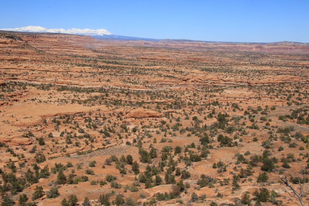
At its eastern end, Snow Flat Road joins Comb Wash Road, a track we drove last on our March 2016 trip, before returning home following the death of my father. This beautiful trail skirts Comb Ridge for the west.

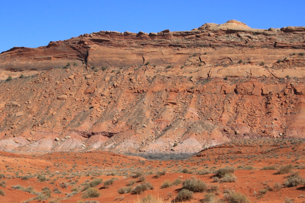
Having completed Snow Flat Road and Comb Wash Road, we explored around Mexican Hat Rock. A typical Old West scene was these Tumbleweeds, bushes withered and spreading their seeds as they rolled, blown away by the wind. Often they get captured by a fence or a ravine.

Further, the chevron patterns of Raplee Ridge and the San Juan River flowing at its base.

Tomorrow we leave Mexican Hat to join Blanding UT not far, a little closer to the mountains. The weather forecast for tomorrow calls for cooling with strong winds and a low chance of precipitation. We'll let you know tomorrow morning.
Start point: Mexican Hat UT
End point: Mexican Hat UT
Distance driven: 151 km
Distance hiked: 5.8 km
We had a day in two parts, efforts and strong emotions, then relaxation and contemplation. The emotions came from a pretty daunting hike through a canyon to see ruins of Ancestral Puebloan dwellings. Then, we walked around Mexican Hat to conclude our visits to this area.
To start the day, we went to Kane Gulch Ranger Station in the Grand Gulch area of Bears Ears National Monument to get our permit validated for our hike to Moon House.
When this administrative step was completed, we took Snow Flat Road. This track was in decent condition at the start, with its share of deep ruts, but at least dry. It crosses a large expanse of short cedars, and some clearings, the flats.
We then took a secondary track to reach the start of the hike to Moon House. Although the trail is marked, it is very intimidating as it skirts the walls of the canyon to reach the bottom, then back up to reach the ruins on the other side, on a plateau in the canyon. Several passages are a bit tricky and very sandy, while others are sloping towards the abyss.
We were the first of twenty visitors admitted daily to Moon House. The arrival of other visitors gave us the opportunity to see the impressive descent from one level to another in the distance. The most difficult part of the hike has two stages. The first is a slope without too many holds to reach a narrow landing (two light bands surrounding a dark one towards which the lowest person is heading). Descent on the buttocks hoping not to go straight. Then, you have to reach the pile of rocks piled up in a way that is too precarious .
The Moon House ruins are in excellent condition, and a few rooms are even allowed to be entered.
The name given to this ruin comes from the drawings representing the phases of the moon painted in two places, including here in one of the rooms.
We then reached other ruins located on the same level as Moon House.
We then hike the opposite way to return to the 4Runner. Although the climbs are usually easier, this one was particularly taxing given the rapid elevation gain compounded by the altitude, and given the difficult passage that proved even more daunting with the lack of holds. Finally, we returned quite exhausted to the vehicle.
Continuing on Snow Flat Road, we took another short hike to Snow Cave, also located in a canyon. However, access is much easier as it is located near plateau level. This large alcove contains two sources of water flowing through the rock formed from sandstone. We saw ruins of basins once installed by cowboys to catch water dripping from the ceiling.
The Snow Flat Road trail follows the Immigrant Trail, a trail built by Mormon pioneers to found Bluff UT. Yesterday we saw a segment of it near the San Juan River. Imagine the difficulties to cross this kind of terrain. They had to suffer and toil.
At its eastern end, Snow Flat Road joins Comb Wash Road, a track we drove last on our March 2016 trip, before returning home following the death of my father. This beautiful trail skirts Comb Ridge for the west.
Having completed Snow Flat Road and Comb Wash Road, we explored around Mexican Hat Rock. A typical Old West scene was these Tumbleweeds, bushes withered and spreading their seeds as they rolled, blown away by the wind. Often they get captured by a fence or a ravine.
Further, the chevron patterns of Raplee Ridge and the San Juan River flowing at its base.
Tomorrow we leave Mexican Hat to join Blanding UT not far, a little closer to the mountains. The weather forecast for tomorrow calls for cooling with strong winds and a low chance of precipitation. We'll let you know tomorrow morning.
JohnTheLuck
Member
Day 51:
Start point: Mexican Hat UT
End point: Blanding UT
Distance driven: 407 km
Distance hiked: 3.1 km
We had a day that started under clear skies with calm winds, but that didn't last. The winds have intensified and the sky has become much more opaque due to the dust raised. We had about a hundred miles to go to reach Blanding UT.
When we left Mexican Hat, we went briefly to Valley of the Gods Road to greet the Seven Sailors, until next time.

As the winds were increasing, we replaced some hikes we had planned and instead hiked the Montezuma Creek Road, with a normally very easy dirt road. This runs through the wide Montezuma Canyon which offers some protection from the winds.
This canyon contains several petroglyph sites. In the first group, we saw a scene that we interpret as a party with individuals dancing in front of a crowd. Also note how these works have been treated in the past with gunshot marks on the right.

In some places, the ground was carpeted with small pink flowers.

Some rocks on the top of the cliff had strange shapes, including this one in the shape of a reptile's head.

The second petroglyph site contained carvings of birds. Indeed, we have seen a few birds resembling these flying a little before, with the same beak slightly curved downwards.
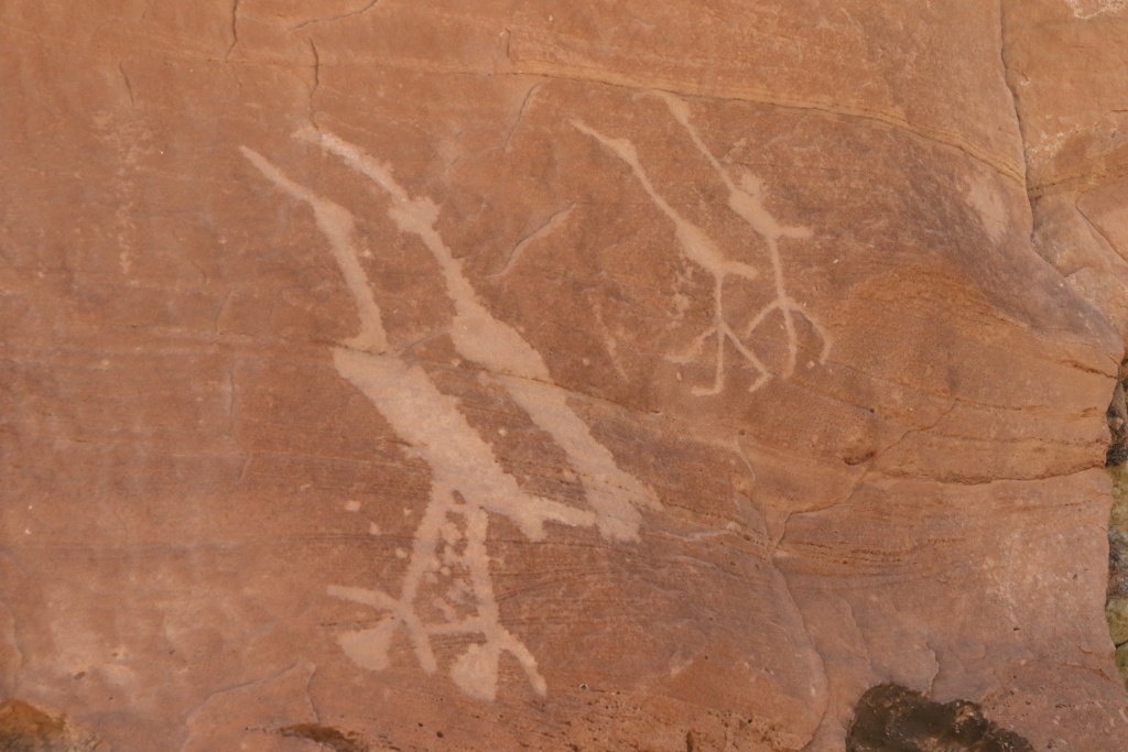
Most of these sites were easily identifiable by the presence of vehicle parking footprints. Several even had primitive trails to climb the embankment at the bottom of the cliffs to the petroglyphs.

Another site featured a hunting scene. The Ancestral Puebloans had no horses, these having been brought to North America by the Spanish first. This scene probably shows the first contact with the Spaniards mounted on horseback and hunting bison and antelope.

After driving about a third of Montezuma Canyon Road, we ran into a big obstacle; Montezuma Creek was flowing with a strong flow, bringing some debris with it and creating noticeable waves. Since the waters were loaded with sediment, it was impossible to visually assess the depth. I slowly advanced the 4Runner; the front wheels were already at axle height while the rear wheels were still out of the water. We wisely turned around.
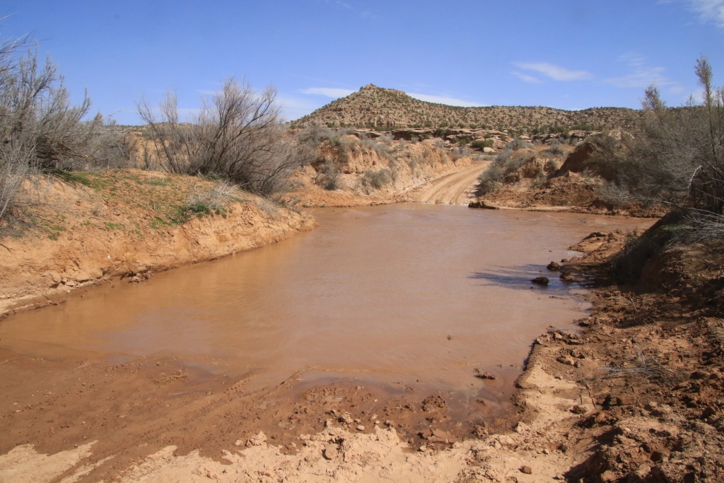
Nearby, we saw a rancher busying himself with some chores. We spoke to him and strongly advised against attempting to cross this passage and the other streams, these being swollen by melting snow around the nearby Abajo Mountains. We therefore followed his recommendations and took a main gravel road leading directly to Blanding.
Then, looking to escape the strong winds and dust, we decided to reach The Needles sector of Canyonlands National Park. We had visited this one a few times before but not very often as it is quite remote. Unfortunately, winds and dust were also present there. We hiked the Scenic Drive and did some very short hikes. We should also go back there during our stay in Blanding.


The area is so named due to the presence of tall needle-like towers.

When we return, North Six-Shooter Peak seems to be fighting the dust to stay visible.

Tomorrow, the temperature will be much colder and the sun will be rare in Blanding. We will try to find an attraction a little far from the mountains to hope to find better weather.
Start point: Mexican Hat UT
End point: Blanding UT
Distance driven: 407 km
Distance hiked: 3.1 km
We had a day that started under clear skies with calm winds, but that didn't last. The winds have intensified and the sky has become much more opaque due to the dust raised. We had about a hundred miles to go to reach Blanding UT.
When we left Mexican Hat, we went briefly to Valley of the Gods Road to greet the Seven Sailors, until next time.
As the winds were increasing, we replaced some hikes we had planned and instead hiked the Montezuma Creek Road, with a normally very easy dirt road. This runs through the wide Montezuma Canyon which offers some protection from the winds.
This canyon contains several petroglyph sites. In the first group, we saw a scene that we interpret as a party with individuals dancing in front of a crowd. Also note how these works have been treated in the past with gunshot marks on the right.
In some places, the ground was carpeted with small pink flowers.
Some rocks on the top of the cliff had strange shapes, including this one in the shape of a reptile's head.
The second petroglyph site contained carvings of birds. Indeed, we have seen a few birds resembling these flying a little before, with the same beak slightly curved downwards.
Most of these sites were easily identifiable by the presence of vehicle parking footprints. Several even had primitive trails to climb the embankment at the bottom of the cliffs to the petroglyphs.
Another site featured a hunting scene. The Ancestral Puebloans had no horses, these having been brought to North America by the Spanish first. This scene probably shows the first contact with the Spaniards mounted on horseback and hunting bison and antelope.
After driving about a third of Montezuma Canyon Road, we ran into a big obstacle; Montezuma Creek was flowing with a strong flow, bringing some debris with it and creating noticeable waves. Since the waters were loaded with sediment, it was impossible to visually assess the depth. I slowly advanced the 4Runner; the front wheels were already at axle height while the rear wheels were still out of the water. We wisely turned around.
Nearby, we saw a rancher busying himself with some chores. We spoke to him and strongly advised against attempting to cross this passage and the other streams, these being swollen by melting snow around the nearby Abajo Mountains. We therefore followed his recommendations and took a main gravel road leading directly to Blanding.
Then, looking to escape the strong winds and dust, we decided to reach The Needles sector of Canyonlands National Park. We had visited this one a few times before but not very often as it is quite remote. Unfortunately, winds and dust were also present there. We hiked the Scenic Drive and did some very short hikes. We should also go back there during our stay in Blanding.
The area is so named due to the presence of tall needle-like towers.
When we return, North Six-Shooter Peak seems to be fighting the dust to stay visible.
Tomorrow, the temperature will be much colder and the sun will be rare in Blanding. We will try to find an attraction a little far from the mountains to hope to find better weather.
JohnTheLuck
Member
Day 52:
Start point: Blanding UT
End point: Blanding UT
Distance driven: 132 km
Distance hiked: 3.1 km
As expected, the weather was gloomy today with frequent snow showers and temperatures near freezing, but luckily no accumulations. We took the opportunity this morning to do our last laundry chore of the trip. Then, we visited a museum then took the road towards the south to try to join a more clement weather for the afternoon.
Our visit for the day was the Edge of the Cedars State Park, right here in Blanding. It allows a better understanding of the different periods of occupation dating back more than 4000 years to the present day. This museum exhibits an impressive collection of artifacts from archaeological sites in the region, including an array of vases and other pottery objects.


The museum also exhibits various pieces such as sandals made with yucca fibers. Imagine that these date back several hundred years, preserved by the dry climate of the region.

The exhibition also contains a unique piece, a braided rope belt made of macaw feathers. As these birds are native to Mexico, this suggests that the Ancestral Puebloans practiced the trade on a large scale. Radiocarbon dating has confirmed a date of 1150 AD.

Even the walls and stairwells are decorated with reproductions of petroglyphs found in the region, such as those of Horseshoe Canyon near Hanksville (we had planned to visit them, but the road was impassable). We also saw the reproduction of a sign we saw yesterday in Montezuma Canyon (7th photo from yesterday's post)!

The museum is adjacent to the ruins of an ancient village. Some parts were excavated and made accessible to visitors, while others were buried after the excavations to preserve them for the future.
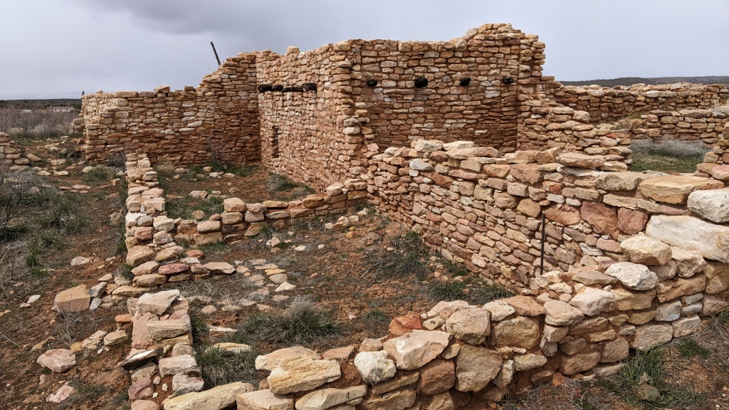
To follow up on the visit to the museum, a visit that we highly recommend given its educational nature, we decided to go for a few short hikes near Bluff UT, looking for the sun which was to make brief appearances at the end of the afternoon.
Both short hikes were located in Sand Island Recreation Area, bordering the San Juan River. Several petroglyph panels were visible from these trails. The origin is diverse, going back around 4000 years.
The first trail, the shorter of the two, led to Sand Island Petroglyph Panel. This is located on the edge of the campground.

The second trail, the Upper Sand Island Petroglyphs, had a lot of signs of different ages. The trail runs along a cliff facing the San Juan River. We were pampered because the sun was starting to show its nose at this time.

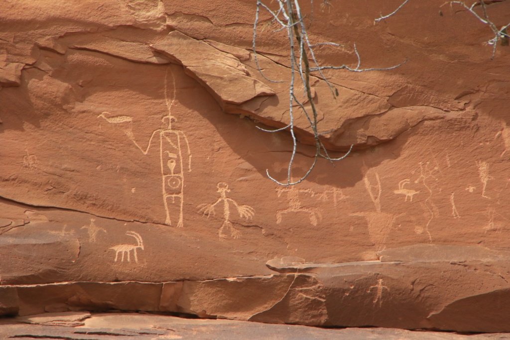


Finally, we went back to see Recapture Pockets not far away, a site we had visited quickly during our trip in October 2016, but at sunrise when the lighting conditions were not optimal.

Tomorrow, we will have to deal with the remnants of the weather system that affected us today. We'll see tomorrow morning where we're headed.
Start point: Blanding UT
End point: Blanding UT
Distance driven: 132 km
Distance hiked: 3.1 km
As expected, the weather was gloomy today with frequent snow showers and temperatures near freezing, but luckily no accumulations. We took the opportunity this morning to do our last laundry chore of the trip. Then, we visited a museum then took the road towards the south to try to join a more clement weather for the afternoon.
Our visit for the day was the Edge of the Cedars State Park, right here in Blanding. It allows a better understanding of the different periods of occupation dating back more than 4000 years to the present day. This museum exhibits an impressive collection of artifacts from archaeological sites in the region, including an array of vases and other pottery objects.
The museum also exhibits various pieces such as sandals made with yucca fibers. Imagine that these date back several hundred years, preserved by the dry climate of the region.
The exhibition also contains a unique piece, a braided rope belt made of macaw feathers. As these birds are native to Mexico, this suggests that the Ancestral Puebloans practiced the trade on a large scale. Radiocarbon dating has confirmed a date of 1150 AD.
Even the walls and stairwells are decorated with reproductions of petroglyphs found in the region, such as those of Horseshoe Canyon near Hanksville (we had planned to visit them, but the road was impassable). We also saw the reproduction of a sign we saw yesterday in Montezuma Canyon (7th photo from yesterday's post)!
The museum is adjacent to the ruins of an ancient village. Some parts were excavated and made accessible to visitors, while others were buried after the excavations to preserve them for the future.
To follow up on the visit to the museum, a visit that we highly recommend given its educational nature, we decided to go for a few short hikes near Bluff UT, looking for the sun which was to make brief appearances at the end of the afternoon.
Both short hikes were located in Sand Island Recreation Area, bordering the San Juan River. Several petroglyph panels were visible from these trails. The origin is diverse, going back around 4000 years.
The first trail, the shorter of the two, led to Sand Island Petroglyph Panel. This is located on the edge of the campground.
The second trail, the Upper Sand Island Petroglyphs, had a lot of signs of different ages. The trail runs along a cliff facing the San Juan River. We were pampered because the sun was starting to show its nose at this time.
Finally, we went back to see Recapture Pockets not far away, a site we had visited quickly during our trip in October 2016, but at sunrise when the lighting conditions were not optimal.
Tomorrow, we will have to deal with the remnants of the weather system that affected us today. We'll see tomorrow morning where we're headed.
JohnTheLuck
Member
Nice to have so much time to explore! Did you not plan on hiking out to the Citadel, or have you done that before?
Thanks for following us!
Hum, according to GJHikes.com, and mostly after scrambling down and up to Moon House, I am not very confident I could hike to the end of this one...
"Getting down from the mesa to the land bridge requires scrambling down a section of slickrock where there is considerable exposure to the canyon below. The exposure is more than some hikers feel comfortable with and they end up turning around at that point."
Anyway, thanks for the suggestion. I am sure there are other amazing site to visit, but so little time. Maybe during another trip.
ShermanOlsen
Member
Thanks for sharing your trips. I would check this thread periodically during the pandemic because I was hoping that you were traveling again and wanted to tag along. I look forward to visiting these areas so I appreciate the inspiration, and in the meantime I get to travel vicariously!
JohnTheLuck
Member
Thanks for sharing your trips. I would check this thread periodically during the pandemic because I was hoping that you were traveling again and wanted to tag along. I look forward to visiting these areas so I appreciate the inspiration, and in the meantime I get to travel vicariously!
Thanks for following us!
Being a very cautious man, this is our first very first trip since the pandemic.
JohnTheLuck
Member
Day 53:
Start point: Blanding UT
End point: Blanding UT
Very good American food got the better of me; indigestion all night with going back and forth between the bathroom and my bed. This continued for part of the day. So zero photos, zero hikes.
Hopefully tomorrow I'll be better.
Start point: Blanding UT
End point: Blanding UT
Very good American food got the better of me; indigestion all night with going back and forth between the bathroom and my bed. This continued for part of the day. So zero photos, zero hikes.
Hopefully tomorrow I'll be better.
JohnTheLuck
Member
Day 54:
Start point: Blanding UT
End point: Blanding UT
Distance driven: 181 km
Distance hiked: 2.1 km
Having somewhat recovered from my very bad day yesterday, we explored the Black Mesa area a little south of Blanding UT. Our route included several viewpoints, with just a little bit of walking for a man who was still weak from yesterday.
Leaving US191, we took Deckers Road west and then took Tank Mesa Road south.

Our vantage point allowed us to revisit San Juan River near Bluff UT, but especially Comb Ridge and Butler Wash Road. This road provides access to a large number of ruins located in the deep gorges of Comb Ridge, a place now protected again by the restoration of the original borders of Bears Ears National Monument.

On the way back on Tank Mesa Road, the view was splendid with the Abajo Mountains freshly snowed in from the precipitation of the last few days and the endless winter, even here.


Then we took Black Canyon Road to reach the top of Black Mesa. This location was used in the 1960s to launch Pershing missiles toward White Sands Missile Range in New Mexico. Perhaps this inspired the creators of the game Half-Life. Who knows.
Black Mesa offers several other viewpoints located at a higher altitude than the previous ones. Comb Ridge dominated the landscape, with Butler Wash Road below.

A sign that spring is well underway, the flowers are beginning to bloom, despite the fairly high altitude.


Further north, still on White Mesa, more viewpoints of Comb Ridge and the surrounding area, a fascinating place.


At the last viewpoint, we could see in sequence the US191 road, Comb Ridge, the Comb Wash canyon and the Mule Canyon, a possible destination for tomorrow, and the two mesas of Bears Ears.

After completing Black Mesa Road and rejoining US191, we traveled Upper Comb Wash Road. Secondary trails in this area, including Arch Canyon Road, were badly damaged by recent rainfall and a few destinations we had planned were out of reach. So we continued further north on Upper Comb Wash Road to the intersection with Posey's Trail. The few vehicle footprints towards the climb of the cliff, and given the state of the other tracks in the sector, convinced us not to attempt the ascent.

Tomorrow, for my birthday, my wife leaves me the choice of the activities. In fact, it is much more my state of health and my level of energy that will dictate our destination.
Start point: Blanding UT
End point: Blanding UT
Distance driven: 181 km
Distance hiked: 2.1 km
Having somewhat recovered from my very bad day yesterday, we explored the Black Mesa area a little south of Blanding UT. Our route included several viewpoints, with just a little bit of walking for a man who was still weak from yesterday.
Leaving US191, we took Deckers Road west and then took Tank Mesa Road south.
Our vantage point allowed us to revisit San Juan River near Bluff UT, but especially Comb Ridge and Butler Wash Road. This road provides access to a large number of ruins located in the deep gorges of Comb Ridge, a place now protected again by the restoration of the original borders of Bears Ears National Monument.
On the way back on Tank Mesa Road, the view was splendid with the Abajo Mountains freshly snowed in from the precipitation of the last few days and the endless winter, even here.
Then we took Black Canyon Road to reach the top of Black Mesa. This location was used in the 1960s to launch Pershing missiles toward White Sands Missile Range in New Mexico. Perhaps this inspired the creators of the game Half-Life. Who knows.
Black Mesa offers several other viewpoints located at a higher altitude than the previous ones. Comb Ridge dominated the landscape, with Butler Wash Road below.
A sign that spring is well underway, the flowers are beginning to bloom, despite the fairly high altitude.
Further north, still on White Mesa, more viewpoints of Comb Ridge and the surrounding area, a fascinating place.
At the last viewpoint, we could see in sequence the US191 road, Comb Ridge, the Comb Wash canyon and the Mule Canyon, a possible destination for tomorrow, and the two mesas of Bears Ears.
After completing Black Mesa Road and rejoining US191, we traveled Upper Comb Wash Road. Secondary trails in this area, including Arch Canyon Road, were badly damaged by recent rainfall and a few destinations we had planned were out of reach. So we continued further north on Upper Comb Wash Road to the intersection with Posey's Trail. The few vehicle footprints towards the climb of the cliff, and given the state of the other tracks in the sector, convinced us not to attempt the ascent.
Tomorrow, for my birthday, my wife leaves me the choice of the activities. In fact, it is much more my state of health and my level of energy that will dictate our destination.
JohnTheLuck
Member
Day 55:
Start point: Blanding UT
End point: Blanding UT
Distance driven: 180 km
Distance hiked: 3.1 km
The good news, my health condition is improving. The bad news is that it's Nancy's turn to suffer the same problems, but two days late. She had promised to let me choose the day's activities for my birthday; well as she stayed in bed, I decided everything!!! Of course, being alone, I chose not to venture too far and avoid complicated things, especially since I wanted to come back to the bedroom occasionally to see if she needed help.
My first activity of the day was a short hike to Butler Wash Ruins Overlook located in Bears Ears National Monument. We had visited this site in October 2016, but at the end of the day when the ruins located at the bottom of natural cavities were obviously in the shade. The ruins occupy several cavities located on several rocky levels.

Then I headed down a trail along a long ridge overlooking Upper Comb Wash that we partially hiked yesterday. Two outstanding vantage points gave me a great view of the valley below, with Arch Canyon visible to the far right in the next photo, and also Posey's Trail disappearing into shadow, and Comb Ridge appearing to continue to the infinity.


At the south end of the trail, the second vantage point practically overlooked road UT95 and the huge cut in Comb Ridge carved out to allow the passage of vehicles.


On the way back, the Abajo Mountains dominated the landscape once again.

Inspired by these two magnificent points of view, I let myself be tempted by a third. On the other hand, this one was not accessible by an easy maintained track like the first two, but rather by a real track winding between the cedars before joining a long expanse of slightly chaotic petrified dunes.


This last viewpoint, the most northerly, is located very close to the end of Comb Ridge as it disappears into the foothills of the Abajo Mountains.


After a short visit with Nancy and a light meal, I returned to the Edge of the Cedars State Park Museum to visit the outer ruins. The only room accessible to the public is a kiva, or place of worship, an underground place accessible by a ladder.


Then I took a road connecting Blanding and the viewpoint area I had visited this morning. This canyon side route descends and ascends several of these parallel canyons composed of crumbly rock and very colorful bentonite clay.

With some time left, I headed down Texas Flat Road to try to reach a viewpoint overlooking Arch Canyon where we had hoped to take a long hike. Unfortunately, the viewpoint being at a higher altitude, I joined the snow and mud and turned back again.
Tomorrow we will leave Utah for our last leg of the trip, a short (too short in Nancy's eyes) sojourn in the badlands near Farmington, New Mexico. We will see the rest according to our state of health and our ability to cover the long hikes planned.
Start point: Blanding UT
End point: Blanding UT
Distance driven: 180 km
Distance hiked: 3.1 km
The good news, my health condition is improving. The bad news is that it's Nancy's turn to suffer the same problems, but two days late. She had promised to let me choose the day's activities for my birthday; well as she stayed in bed, I decided everything!!! Of course, being alone, I chose not to venture too far and avoid complicated things, especially since I wanted to come back to the bedroom occasionally to see if she needed help.
My first activity of the day was a short hike to Butler Wash Ruins Overlook located in Bears Ears National Monument. We had visited this site in October 2016, but at the end of the day when the ruins located at the bottom of natural cavities were obviously in the shade. The ruins occupy several cavities located on several rocky levels.
Then I headed down a trail along a long ridge overlooking Upper Comb Wash that we partially hiked yesterday. Two outstanding vantage points gave me a great view of the valley below, with Arch Canyon visible to the far right in the next photo, and also Posey's Trail disappearing into shadow, and Comb Ridge appearing to continue to the infinity.
At the south end of the trail, the second vantage point practically overlooked road UT95 and the huge cut in Comb Ridge carved out to allow the passage of vehicles.
On the way back, the Abajo Mountains dominated the landscape once again.
Inspired by these two magnificent points of view, I let myself be tempted by a third. On the other hand, this one was not accessible by an easy maintained track like the first two, but rather by a real track winding between the cedars before joining a long expanse of slightly chaotic petrified dunes.
This last viewpoint, the most northerly, is located very close to the end of Comb Ridge as it disappears into the foothills of the Abajo Mountains.
After a short visit with Nancy and a light meal, I returned to the Edge of the Cedars State Park Museum to visit the outer ruins. The only room accessible to the public is a kiva, or place of worship, an underground place accessible by a ladder.
Then I took a road connecting Blanding and the viewpoint area I had visited this morning. This canyon side route descends and ascends several of these parallel canyons composed of crumbly rock and very colorful bentonite clay.
With some time left, I headed down Texas Flat Road to try to reach a viewpoint overlooking Arch Canyon where we had hoped to take a long hike. Unfortunately, the viewpoint being at a higher altitude, I joined the snow and mud and turned back again.
Tomorrow we will leave Utah for our last leg of the trip, a short (too short in Nancy's eyes) sojourn in the badlands near Farmington, New Mexico. We will see the rest according to our state of health and our ability to cover the long hikes planned.
JohnTheLuck
Member
Day 56:
Start point: Blanding UT
End point: Farmington NM
Distance driven: 430 km
Distance hiked: 0.6 km
Having fortunately both recovered from our sickness of the last few days, we left Blanding UT to reach New Mexico temporarily passing through Arizona. We decided to explore a bit and take some side roads we had never taken.
A sign that my wife has returned to nature, I was treated to "Turn left, no, the other left...", and very scenic shortcuts turning into an impassable track...


The dyke, visible in the mountain in the first photo, introduced us to our next destination of the day, Shiprock Peak. This ancient volcanic plug is visible for more than a hundred kilometers around and has long served as a landmark for travelers. From Shiprock emanate three radiant dykes at about 120 degrees each, one of which is crossed by the paved road BIA-13.


We then took a trail along this long radiant arm to Shiprock for a closer view.

Up close, this monolith is truly imposing. A car had joined its base, giving an idea of the dimensions.


Our track led us to a passage crossing the first dyke. From this high point, we could see the other dyke heading southwest, with the high mountains of Colorado close in the background.

Next, we headed to Angel Peak Scenic Area, a recreational area overlooking a large basin of badlands carved out of bentonite clay. Unfortunately, the lack of sun didn't help the color and all pictures seems washed out. We visited a few viewpoints on the perimeter of the canyon.


Like several other places in the region, the badlands around Angel Peak are exploited for oil by fracking. A lot of equipment was visible here and there. On the other hand, the presence of these equipment also implies a network of access roads. We took one down to the bottom of the basin and went around to see some points that Nancy had identified before.


We will be in this area for the next two days.
Start point: Blanding UT
End point: Farmington NM
Distance driven: 430 km
Distance hiked: 0.6 km
Having fortunately both recovered from our sickness of the last few days, we left Blanding UT to reach New Mexico temporarily passing through Arizona. We decided to explore a bit and take some side roads we had never taken.
A sign that my wife has returned to nature, I was treated to "Turn left, no, the other left...", and very scenic shortcuts turning into an impassable track...
The dyke, visible in the mountain in the first photo, introduced us to our next destination of the day, Shiprock Peak. This ancient volcanic plug is visible for more than a hundred kilometers around and has long served as a landmark for travelers. From Shiprock emanate three radiant dykes at about 120 degrees each, one of which is crossed by the paved road BIA-13.
We then took a trail along this long radiant arm to Shiprock for a closer view.
Up close, this monolith is truly imposing. A car had joined its base, giving an idea of the dimensions.
Our track led us to a passage crossing the first dyke. From this high point, we could see the other dyke heading southwest, with the high mountains of Colorado close in the background.
Next, we headed to Angel Peak Scenic Area, a recreational area overlooking a large basin of badlands carved out of bentonite clay. Unfortunately, the lack of sun didn't help the color and all pictures seems washed out. We visited a few viewpoints on the perimeter of the canyon.
Like several other places in the region, the badlands around Angel Peak are exploited for oil by fracking. A lot of equipment was visible here and there. On the other hand, the presence of these equipment also implies a network of access roads. We took one down to the bottom of the basin and went around to see some points that Nancy had identified before.
We will be in this area for the next two days.
JohnTheLuck
Member
Day 57:
Start point: Farmington NM
End point: Farmington NM
Distance driven: 243 km
Distance hiked: 11.8 km
Today, the sun was there, as well as the physical form; the perfect combination for a few hikes in the badlands located southeast of Farmington.
Our first destination was the area named Valley of Dreams. We did a long loop, meandering through formations of different colors and textures, all of which had multiple hoodoos. The presence of petrified wood also surprised us.


Several of these hoodoos had very precarious rock supports, their lifespan being certainly well counted.

Some of these hoodoos have been baptized with evocative names, like this one called Alien Throne.


Then, we headed close to an area that Nancy had identified through Google Earth as potentially interesting, located a little east of Valley of Dreams. Here, the rocks forming the hoodoos were mostly brownish while their bases were on a black layer. We thought it was coal, but we saw several clues that it was more volcanic in origin.


Then, as we still had a few hours, we headed a little north to see a famous hoodoo, King of Wings. Based on our information, the trail was supposed to be about 3 miles round trip. We got lost in a sandy area erasing the steps of previous visitors and further on the relief forced us to make many detours to cross deep crevasses between the bentonite mounds.

Having finally found the track, we reached the astonishing hoodoo, holding up by miracle.


Tomorrow should be our last day of visit before starting our long return home. Unless we let ourselves be tempted by an unforeseen extension!
Start point: Farmington NM
End point: Farmington NM
Distance driven: 243 km
Distance hiked: 11.8 km
Today, the sun was there, as well as the physical form; the perfect combination for a few hikes in the badlands located southeast of Farmington.
Our first destination was the area named Valley of Dreams. We did a long loop, meandering through formations of different colors and textures, all of which had multiple hoodoos. The presence of petrified wood also surprised us.
Several of these hoodoos had very precarious rock supports, their lifespan being certainly well counted.
Some of these hoodoos have been baptized with evocative names, like this one called Alien Throne.
Then, we headed close to an area that Nancy had identified through Google Earth as potentially interesting, located a little east of Valley of Dreams. Here, the rocks forming the hoodoos were mostly brownish while their bases were on a black layer. We thought it was coal, but we saw several clues that it was more volcanic in origin.
Then, as we still had a few hours, we headed a little north to see a famous hoodoo, King of Wings. Based on our information, the trail was supposed to be about 3 miles round trip. We got lost in a sandy area erasing the steps of previous visitors and further on the relief forced us to make many detours to cross deep crevasses between the bentonite mounds.
Having finally found the track, we reached the astonishing hoodoo, holding up by miracle.
Tomorrow should be our last day of visit before starting our long return home. Unless we let ourselves be tempted by an unforeseen extension!
JohnTheLuck
Member
What a neat area. Will definitely add that to my list of places to visit one day.
Yes, it is a very special place. When we first planning this trip, my wife included eight days in the area, exploring badlands. Maybe this was a bit too much!!! We went again today, but after two days in this area, I think that's enough for this time. We will keep the rest for another trip.
JohnTheLuck
Member
Day 58:
Start point: Farmington NM
End point: Farmington NM
Distance driven: 257 km
Distance hiked: 12.6 km
For our last day of planned activities for this trip, we returned to explore other areas in the badlands southeast of Farmington. The sky was a beautiful pure deep blue, with no apparent humidity, and the ideal temperature this morning, but frankly a little too hot for a Canadian at this time of the year!
Our first destination of the day was Ah-Shi-Sle-Pah Wilderness Study Area, an area protected by bentonite hills and numerous hoodoos. The hills showed a bit of color, but were much less present than in Valley of Dreams visited yesterday. On the other hand, the hoodoos were very numerous.


At one point our trail passed through a depression between two bentonite hills. The winds had blown a lot of thumbleweeds there. We had to clean up a bit to make our way and continue. Otherwise, we would have had to make a detour of about a kilometer.

Having completed our first hike of just over 7 km, we reached the starting point of our second hike, this one in Bisti Wilderness. We had briefly hiked the southern sector during a trip in October 2012. Today we concentrated our efforts in the slightly less traveled northern sector. As the heat had already reached a fairly high level and with the blazing sun, we covered a shorter distance than this morning.
The colors are more present in Bisti than in Ah-Shi-Sle-Pah visited this morning.


A few hoodoos looked familiar, albeit less imposing than King of Wings seen yesterday.


From the top of a promontory, the tints of colors became more apparent.

Tomorrow, we are back on the road towards the house, while making a few stops to assess the level of certain attractions that we had identified in the past and that we still have to visit.
Start point: Farmington NM
End point: Farmington NM
Distance driven: 257 km
Distance hiked: 12.6 km
For our last day of planned activities for this trip, we returned to explore other areas in the badlands southeast of Farmington. The sky was a beautiful pure deep blue, with no apparent humidity, and the ideal temperature this morning, but frankly a little too hot for a Canadian at this time of the year!
Our first destination of the day was Ah-Shi-Sle-Pah Wilderness Study Area, an area protected by bentonite hills and numerous hoodoos. The hills showed a bit of color, but were much less present than in Valley of Dreams visited yesterday. On the other hand, the hoodoos were very numerous.
At one point our trail passed through a depression between two bentonite hills. The winds had blown a lot of thumbleweeds there. We had to clean up a bit to make our way and continue. Otherwise, we would have had to make a detour of about a kilometer.
Having completed our first hike of just over 7 km, we reached the starting point of our second hike, this one in Bisti Wilderness. We had briefly hiked the southern sector during a trip in October 2012. Today we concentrated our efforts in the slightly less traveled northern sector. As the heat had already reached a fairly high level and with the blazing sun, we covered a shorter distance than this morning.
The colors are more present in Bisti than in Ah-Shi-Sle-Pah visited this morning.
A few hoodoos looked familiar, albeit less imposing than King of Wings seen yesterday.
From the top of a promontory, the tints of colors became more apparent.
Tomorrow, we are back on the road towards the house, while making a few stops to assess the level of certain attractions that we had identified in the past and that we still have to visit.
JohnTheLuck
Member
Day 59:
Start point: Farmington NM
End point: Shamrock TX
Distance driven: 940 km
Today we started our journey back toward home. We took advantage of the beautiful weather and the sun to check the relevance of certain attractions that we had identified in the past, especially since we were taking the US550 road passing very close to them.
The first attraction was Lybrook Fossil Area. We reached a viewpoint overlooking the area we had identified. The colors and the presence of many hoodoos confirmed our interest in this place.


Further along US550 we noticed an ancient volcanic area protected by Cabezon Wilderness Study Area, a candidate region for future exploration.
Continuing on the US550, we reached the region of Ojito NM. We had identified a few potential hikes in Ojito Wilderness Study Area, protecting part of a fold in the earth's crust, exposing brightly colored rock layers.


Then we put away our camera and hit the I-40, drove through Albuquerque and then out of New Mexico, and practically drove through Texas Panhandle. As a result, we now have only one hour time difference compared to Quebec.
We are in Shamrock for the night. Tomorrow we should reach Tennessee.
Start point: Farmington NM
End point: Shamrock TX
Distance driven: 940 km
Today we started our journey back toward home. We took advantage of the beautiful weather and the sun to check the relevance of certain attractions that we had identified in the past, especially since we were taking the US550 road passing very close to them.
The first attraction was Lybrook Fossil Area. We reached a viewpoint overlooking the area we had identified. The colors and the presence of many hoodoos confirmed our interest in this place.
Further along US550 we noticed an ancient volcanic area protected by Cabezon Wilderness Study Area, a candidate region for future exploration.
Continuing on the US550, we reached the region of Ojito NM. We had identified a few potential hikes in Ojito Wilderness Study Area, protecting part of a fold in the earth's crust, exposing brightly colored rock layers.
Then we put away our camera and hit the I-40, drove through Albuquerque and then out of New Mexico, and practically drove through Texas Panhandle. As a result, we now have only one hour time difference compared to Quebec.
We are in Shamrock for the night. Tomorrow we should reach Tennessee.
JohnTheLuck
Member
Day 60:
Start point: Shamrock TX
End point: Olive Branch MS
Distance driven: 1041 km
States travelled: TX, OK, AR, MS
We spent the day on the road under a beautiful blue sky. Leaving Texas, the greenery became more and more present. In Oklahoma and Arkansas, the green grass, the flowers of the fields, the trees with new leaves of a beautiful tender green and even completely in bloom, all this made us feel that spring was well underway here. It will be another thing going north when we see the delay of about a month between here and home.
We are in Olive Branch, Mississippi for the night. This is the very first time that we have set foot in this state. One more!
Start point: Shamrock TX
End point: Olive Branch MS
Distance driven: 1041 km
States travelled: TX, OK, AR, MS
We spent the day on the road under a beautiful blue sky. Leaving Texas, the greenery became more and more present. In Oklahoma and Arkansas, the green grass, the flowers of the fields, the trees with new leaves of a beautiful tender green and even completely in bloom, all this made us feel that spring was well underway here. It will be another thing going north when we see the delay of about a month between here and home.
We are in Olive Branch, Mississippi for the night. This is the very first time that we have set foot in this state. One more!
Similar threads
- Replies
- 0
- Views
- 2K
- Replies
- 1
- Views
- 2K
- Replies
- 34
- Views
- 11K


