JohnTheLuck's Adventures Thread

Day 8:

Starting point: Waterton Lakes AB
End point: Waterton Lakes AB

Distance driven: 61 km
Distance hiked: 12.9 km


We spent the whole day again exploring Waterton Lakes National Park. the main activity was the long hike to Bertha Lake located high between mountains. When we left, it was sunny but this quickly disappeared to give way to light showers. The trail climbs along the mountainsides and offers a superb view of Upper Waterton Lake.

53186032554_3265056318_o.jpg


After a little over 3 kilometers with a very moderate climb, we reached Bertha Falls.

53186338103_4c7f32bd68_o.jpg


We continued further towards Bertha Lake, an ascent of an additional 325 meters, via a series of switchbacks with a steeper climb. From that moment on, the sky became clearer and clearer. We had several views towards the Waterton lakes, but also up the steep mountain sides.

53186032449_cb3bdc697c_o.jpg


After another 4 kilometers, we finally reached Bertha Lake. This is surrounded by high mountains on three sides.

53185966431_393ba32b57_o.jpg


53186032549_b2f3ce325f_o.jpg


53186338228_769e130f39_o.jpg


The surroundings of the lakes are quite wooded and offer little space to settle down for a good rest. We had a small snack then began our long descent back.

One of the viewpoints allowed us to see Lower, Middle and Upper Waterton Lakes at the same time.

53186338193_33afa00f5f_o.jpg


While it is sad that a wildfire burned most of the park's forests, this provides an opportunity for new flora to thrive. In addition, the view is much less obstructed this way.

53185966516_cf84a23ea4_o.jpg


After completing this superb 12+ kilometer hike, our first long hike and considering the altitude, we needed to rest our knees and feet. So we decided to go and drive the Bison Enclosure Loop.

53185303177_611ce6573b_o.jpg


53185256162_23b4e354b6_o.jpg


Next, we drove the Red Rock Canyon Parkway. We had already traveled this route during our first lightning visit on August 12, 2009, in the rain.

53185256122_8083a1f5b5_o.jpg


53185256137_b23e46f8c8_o.jpg


53185966401_9b6f1bd40f_o.jpg


Back on the road towards Waterton Lakes, the views of the lakes and mountains were superb.

53186032404_3fe6141645_o.jpg


Tomorrow morning we will return to Red Rock Canyon to hike two short trails. Then, we will say goodbye to Waterton Lakes and hit the road for a short stay in British Columbia.
 
Day 9:

Starting point: Waterton Lakes AB
End point: Fernie BC
States/provinces traveled: Alberta, British Columbia

Distance driven: 240 km
Distance hiked: 4.1 km

This morning we left Waterton Lakes where we have been staying for the last three days. We stayed in a small lodge with a fairly intimate atmosphere given the small number of rooms. As we left, we said goodbye to Barry and Heather, a very friendly couple from British Columbia with whom we had the opportunity to interact on several occasions.

Then, we concluded our visit to Waterton Lakes National Park by driving again the scenic Red Rock Canyon Parkway which, with the morning lighting and a crystal blue cloudless sky, made the place shine.

53187318352_def152b8aa_o.jpg


53188130494_40ee9de0fd_o.jpg


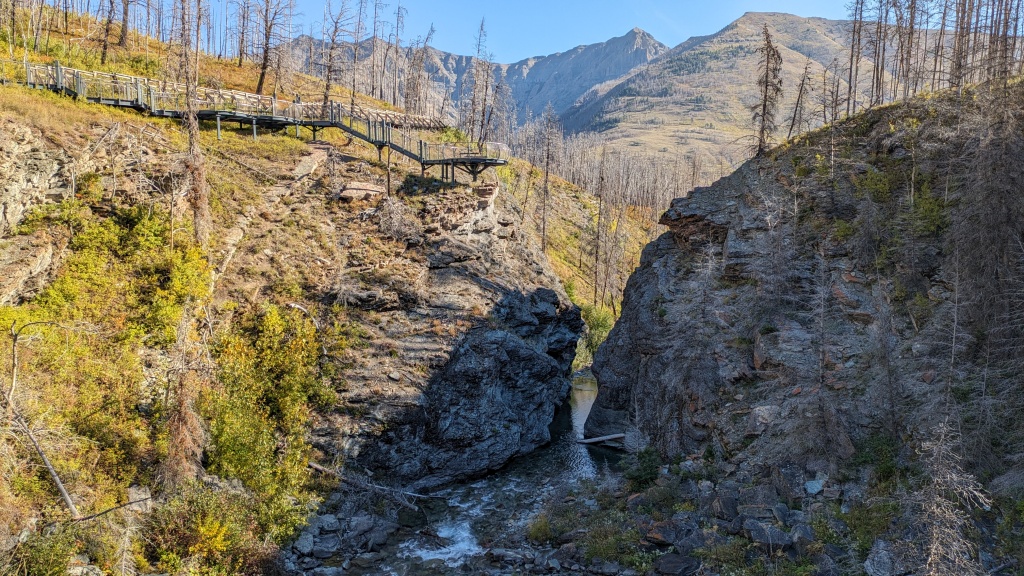
At the end of the road, we walked the short trail towards Blackiston Falls offering a few observation points to observe the falls as well as the narrow canyon that the stream has carved out.

53188034126_0e6ec03871_o.jpg


53188234555_fbae8ae5f8_o.jpg


We then hiked the loop around Red Rock Canyon. The sun, still low on the horizon, unfortunately formed a shadow on one side.

53188402463_07d66374b0_o.jpg


53188234435_0b81a236a6_o.jpg


We then left the park for good, heading west using the southernmost route. This leaves the mountains momentarily, joining an area of rolling meadows housing several groups of wind turbines.

53188100094_cc97cccf6a_o.jpg


Arriving at Pincher Station, we turned onto the Crownest Highway. We quickly realized that the place was full of historical attractions of all kinds. Fortunately we had some time available, because we had not planned any visiting time on this route.

The first interesting and somewhat unusual point is The Burmis's Tree, a pine tree approximately 700 years old which has always marked the start of Crownest Pass to the east. The tree was considered a witness of endurance by the local residents. The tree died in 1970 and in 1998 it was uprooted by very strong winds. Residents refused to let this symbol fall into disrepair and joined forces with different levels of government to straighten the tree by inserting stems anchored into the trunk and the ground. The tree can still welcome visitors and greet residents today.

53188313105_9b4da4a470_o.jpg


A little further on, we made a short stop at Leitch Collieries Provincial Historic Site, the site of a former coal processing plant extracted from the nearby mine. Several stone buildings stand the test of time.

53188100069_b642d12629_o.jpg


Further on, we reached the site of the ancient town of Frank, made infamous by a massive landslide in 1903. A section of a Turtle Mountain ridge 1 kilometer long, 425 meters wide and 150 meters thick broke away and rolled down the cliff to engulf part of the town, the mine entrance and processing plant. About 90 people died, making it the deadliest landslide in Canada.

53188402378_7848bab1e2_o.jpg


The interpretation center, located on a hill, allows you to become aware of the volume of rocks that have rolled down the slope.


53188033956_ac2e724b52_o.jpg


Arriving in Sparwood BC, we stopped at the Visitor Information Center for tour suggestions. The Hosmer mine site was suggested to us. This site is currently being developed but there is still a lot of work to make it really interesting. We saw two large concrete processing plant buildings, unfortunately sporting a host of graffiti, wisely masked by Nancy.

53188100039_d82b08f957_o.jpg


We also took a track following the old route of the train carrying the coal ores from the A level of the mine in the mountain to the factory. At the end of the narrow wooded track with overgrown vegetation, we saw a dilapidated building about to be swallowed up by vegetation.

Back on pavement, we were able to see the series of coal ovens used to purify the coal of its impurities. There were two long series of ovens, some of which were still in excellent condition.

53188100049_9e5e028b83_o.jpg


We finally reached Fernie BC, our stop for the night. Tomorrow, we will reach our main destination of the trip, the state of Idaho in the United States.
 
Day 10:

Starting point: Fernie BC
End point: Ponderay ID
States/provinces traveled: British Columbia, Idaho, Montana

Distance driven: 247 km
Distance hiked: 3.1 km

Today we were on our last segment in Canada before heading to the United States for the next few weeks. Goodbye to Tim Hortons and Ketchup chips! We had another cloudless and windless day, while the thermometer even allowed itself to climb up to 28C briefly.

We left Fernie BC a little after sunrise when some rivers were covered by a thin wisp of mist.

53190591310_baf35f6ef1_o.jpg


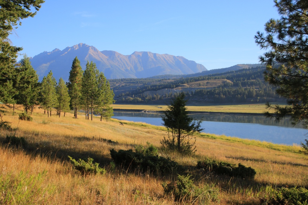
We took a small detour to go to Wardner Provincial Park to see the Kootenay River near the mouth of the Koocanusa, a lake created by the Libby Dam in Montana. We drove along this lake in Montana during our August 2017 trip. The name of the lake comes from the contraction of Kootenay-Canada-USA.

53190733638_af1d24766a_o.jpg


Reaching Cranbrook BC, we joined the scenic Hot Springs Circle Route which we followed to Creston BC, before heading due south towards the Port Hill border crossing in Idaho. Along the way, we changed time zone once again to join the Pacific Daylight Time (3 hours difference with Montreal).

We then reached the charming little town of Bonners Ferry ID, named in honor of the first occupant to operate a cable ferry. A succession of bridges were built and replaced until the current concrete bridge. They wisely retained the south approach of the old bridge to create a lookout overlooking the Kootenay River.

53189911717_7c428a6f49_o.jpg


Next, we drove the Auto Tour road in the Kootenay National Wildlife Refuge near Bonners Ferry ID. This road runs mainly on a dike erected to drain a plot of land for agricultural purposes. We were blessed to be able to see several animals.

53190560645_94e99feea6_o.jpg


53190170429_f43dd6689b_o.jpg


53190560615_6e046d1737_o.jpg


53190368561_63e1c31809_o.jpg


During our trip in August 2017, we were very bothered by the smoke from active forest fires in the region. We had traveled several beautiful roads without being able to appreciate them at their true value. We promised ourselves we would drive them again, and that’s what we did today.

So leaving Kootenay NWR we headed to Libby Montana and then took the Bull River road. We made a stop at Kootenay National Forest to stretch our legs by hiking the Ross Creek trail. This very popular trail runs through a wood of immense coniferous trees.

53190733458_bc54572f0a_o.jpg


53190733463_ddc5396f8e_o.jpg


53189911662_90ec6aca2e_o.jpg


Continuing on the Bull River road, we made a short stop in front of Mirror Lake which lived up to its name very well today.

53189911572_1c2635c382_o.jpg


Then we reached Idaho by traveling the Pend Oreille Scenic Byway, following the Clark Fork River and Lake Pend Oreille.

53190560540_1a62a5c256_o.jpg


We finally reached Ponderay ID after a pretty busy day. Tomorrow we will stay nearby to do a fairly long hike.
 
Day 11:

Starting point: Ponderay ID
End point: Ponderay ID

Distance driven: 210 km
Distance hiked: 10.2 km

We had once again been blessed with another superb cloudless and windless day, with a maximum temperature of 30C but fairly dry air. As the nights are quite cool, with temperatures around 6C, we took advantage of the morning freshness to go hiking in the Idaho Panhandle National Forests, leading to Harrison Lake. This lake of glacial origin is perched at an altitude of 1890 meters surrounded by granite mountains on three sides.

The trail starts at 1450 meters and climbs steadily while circulating in the coniferous forest, the scent of them was so pleasant. There were long sections of rounded rock making the walking a little trickier.

53192132492_a6d6f97efe_o.jpg


The trail climbed along a long slope of a valley and we had some rare views between the tall trees. We can see the action of the glaciers on the mountain opposite, on the other side of the valley.

53192394064_968839e8a3_o.jpg


As we neared the goal, the last section proved to be quite tough with a significant elevation gain in a very short distance.

53192394044_c5e5db22d9_o.jpg


Almost arriving at the lake, an immense rock was precariously balanced on a very thin rocky stand.

53192132462_788aacb150_o.jpg


Eventually we reached Harrison Lake. The place was incredibly beautiful and the water incredibly clear. Originally, we had hoped to be able to climb the slope on the opposite side of the lake, but access was really too difficult due to the presence of countless blocks of stone that had fallen away from the cliffs. We chose instead to sit and soak up the tranquility of the place.

53192786570_235cae476d_o.jpg


53192958253_73951461b5_o.jpg


Funny enough, as we began our long descent, we came across a group of five young hikers with backpacks. They got lost yesterday while trying to reach Harrison Lake and spent the night in the forest. What was their joy when they saw us as they found the path! GPS maybe next time...

We completed the 8.6 kilometer hike in just over four hours.

After a well-deserved lunch, we drove the Idaho Panhandle Historic Rivers Passage Scenic Byway. This road runs along the Pend Oreille River which was a route favored by explorers during the conquest of the West, but also by Native Americans for millennia. Today, a succession of hydroelectric dams have radically transformed the river into a series of reservoirs.

53192786515_9ece9318e4_o.jpg


We stopped at a few places to relax, including the small Crystal Lake Recreation Area. A small, flattering quay allowed access, but moving on it would generate small ripples breaking the perfect reflection.

53192958248_8931a3a8a1_o.jpg


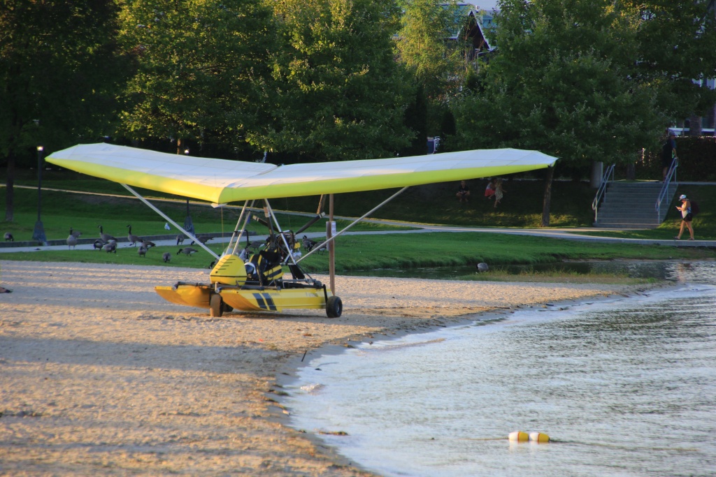
Finally, we were briefly at Sandpoint City Beach Park. We saw a rather unusual machine, an amphibian paramotor.

53192393999_405a5f1012_o.jpg


Tomorrow we will leave the Sandpoint ID region and join the Coeur d'Alene ID region. On the menu, hiking and panoramic route.
 
Day 12:

Starting point: Ponderay ID
End point: Liberty Lake WA

Distance driven: 460 km
Distance hiked: 4.8 km

How do you transform a day that was originally very relax into one that was far too long? Well, by talking to local people who suggest attractions without much detail! Especially since these attractions were already planned for tomorrow!!!

We left Ponderay to reach the Coeur d'Alene ID area. Our first attraction was the Lake Coeur d'Alene Scenic Byway which follows the large lake to the southeast. The place is very popular for water activities and as a vacation spot. Near the town, the bank of the lake is completely occupied by residences and practically no place is set up to be able to contemplate it.
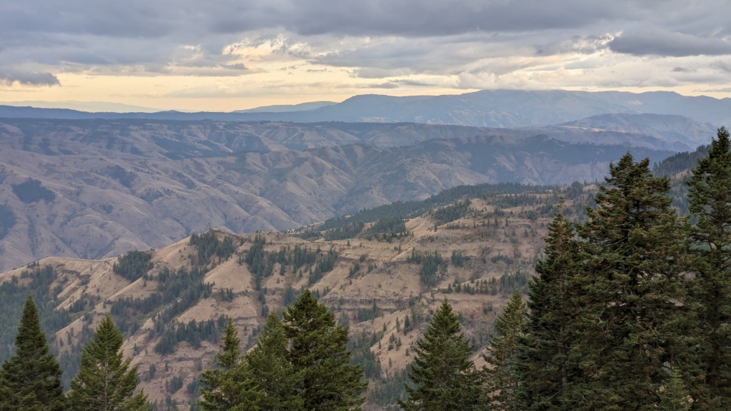
We made a stop at the Mineral Ridge National Historic Trail, an interpretive hike climbing long switchbacks to the top of a ridge offering some views of the lake and surrounding area. The trail runs through a mature coniferous forest.

53195519555_b6fbaf1bb4_o.jpg


53195131294_e460b160a0_o.jpg


Arriving at the top, we talked a little with the man walking his two blue-eyed Husky dogs, visible in the photo above. He is the one who mentioned an attraction to us that we decided to add further.

The forest was primarily Douglas Fir and Ponderosa Pine. The trunks of the latter have a beautiful color and present an abstract work created by mother nature.

53195519590_0ee1792d6f_o.jpg


The end of the point offered a beautiful view of Lake Coeur d'Alene.

53195690743_dfea7ee0ab_o.jpg


After completing the hike, we completed the Lake Coeur d'Alene Scenic Byway. It ends on another scenic route, the White Pine Scenic Byway which we took towards the northeast. We came across several access points to Trail of the Coeur d'Alene, a very long cycle path built on an old railway line. This trail travels in a corridor near the Coeur d'Alene River that provides prime habitat for wildlife.

53195325861_859b565635_o.jpg


The attraction that the dogs' owner suggested to us is a long gravel road running through the mountains, the Moon Pass Road. This road combines with the Milwaukee Railroad and passes through seven tunnels and two bridges.

53195325836_a3633398ee_o.jpg


53195519435_468a1cbe69_o.jpg


53195519440_806559f453_o.jpg


53195131209_f51ecb6d5c_o.jpg


A small secondary road allowed us to descend near the river below, allowing us to appreciate the height of the bridge we had just crossed.

53195325831_e755a70695_o.jpg


Moon Pass Road ends south on the St Joe River Scenic Byway, a scenic route we were supposed to drive tomorrow. As it was already too late, we drove it without stopping. We will go back tomorrow.
 
great road and trail reports!
some beautiful places you've experienced.

pretty sure this is a species of Clematis, commonly known as virgin's bower.


here's some examples: Observations
* iNaturalist
 

Attachments

  • 53181557646_6ebb373f46_o.jpg
    53181557646_6ebb373f46_o.jpg
    142.2 KB · Views: 158
Day 13:

Starting point: Liberty Lake WA
End point: Clarkston WA
States traveled: Washington, Idaho, Montana

Distance driven: 438 km
Distance hiked: 4.8 km

At the risk of repeating myself, we had another very beautiful day, with a few clouds to start with but which dissipated quickly. The temperature even reached 27C, but as we spent most of the day in the mountains it was a bit cooler. Later in the afternoon, the wind picked up and reduced visibility.

We started our day by taking I-80 to completely cross Idaho from the Washington border into Montana.

It is in East Portal, Montana that the Trail of the Hiawatha begins, the long cycle path that we saw yesterday. We had the track entirely to ourselves because yesterday was the last day it was open. Employees were busy dismantling the installations for the winter. This is also where St. James Pass Tunnel, the longest tunnel of the old railway line is located, measuring 2.7 kilometers long. We were allowed to go see the entrance.

53197377852_7c7be7984f_o.jpg


The air inside the tunnel was cold and humid. We could hear lots of water seeping and flowing into the gutters on both sides. During the construction of the tunnel in 1909, workers operate in these difficult conditions for more than a year to complete the work.

53198174870_b2147a12af_o.jpg


We then took the vehicle back to reach West Portal located in Idaho, the other end of the tunnel.

53198174685_6f4b9554a2_o.jpg


53197377962_e53a52540f_o.jpg


We continued to reach a place where the Trail of the Hiawatha intersects the FR 326 road between two tunnels. From this location we took a short hike on the bike path, passing through tunnel #26 (208m long) and joining bridge #224 over Turkey Creek (151m long, 45m high). Note that all the originally wooden bridges were destroyed by a huge forest fire in 1910, and rebuilt in iron shortly after.

53197377792_07c4223296_o.jpg


53198174885_506022129f_o.jpg


We continued on the road along the bike path and joined Moon Pass Road that we drove yesterday, crossing tunnels #30 to #36 again to reach Avery ID.

53198060533_c6d21a9406_o.jpg


Having joined the St. Joe River Scenic Byway, we took the time to appreciate this very beautiful road, including the Slate Creek Bridge in Hoyt ID, a typical structure.

53198174845_89907ce7b9_o.jpg


53197377657_38dec267f9_o.jpg


Having completed the St. Joe River Scenic Byway in St Maries ID, we headed south using another scenic route, the White Pine Scenic Byway. This crosses a mountainous area covered by a coniferous forest, with several large scars left by clearcutting, unfortunately. The road is named in honor of the tall pines that populated the area, before the logging barons of yesterday decimated them and a fungus from Europe practically completed the extermination.

We stopped at Giant White Pine Campground in Nez Perce-Clearwater National Forest to see one of the latest victims, a huge 600-year-old white pine, which died in 1998. We think we saw a still-living specimen nearby.

53198060223_1aa181bbf0_o.jpg


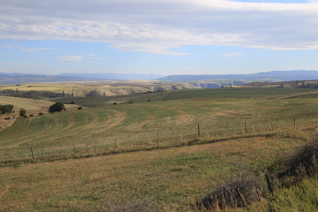
Leaving the place, we began a long descent and reached an agricultural region. The wind was blowing very hard and dust filled the air. Luckily, it's not forest fire smoke, which would have brought back bad memories. We briefly left the paved US 95 road to drive among the fields.

53197377642_b0c097fdd2_o.jpg


We then reached the edge of a large canyon at the confluence of the Clearwater and Snake Rivers. The town of Lewiston ID is named in honor of the explorer Lewis of the famous Lewis and Clark expedition which was commissioned by the United States government in 1803 to explore the territories west of St. Louis for attempt to reach the Columbia River, between the present states of Washington and Oregon.

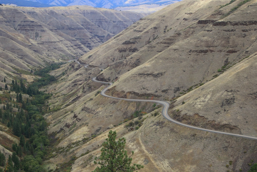
In 1917 a spectacular 16 kilometer road down the 600 meter escarpment was constructed. We went down it to reach Lewiston ID.

53198174455_7011ed5e2b_o.jpg


We are in Clarkston, Washington for the night, located on the west bank of the Snake River. Tomorrow, we will discover several historical sites linked to the Nez Perce Native American people.
 
Day 14:

Starting point: Clarkston WA
End point: Clarkston WA

Distance driven: 462 km
Distance hiked: 1.5 km

We had another beautiful day, despite the presence of clouds and a little smoke, because indeed it was smoke from the forest fires in Washington and Oregon which reduced visibility. Fortunately, yesterday's strong winds were a thing of the past.

The main theme of the day was the Nez Perce National Historical Park, composed of 38 distinct sites relating to the Nimíipuu Native American people, incorrectly named Nez Percés by French trappers. These peaceful people helped the Lewis and Clark expedition in their exploration of the western territories. They practically saved their lives when the members of the expedition were starving and exhausted. They helped them make canoes out of tree trunks so that they could continue their quest by canoeing rather than crossing the forests.

Today, the Nimíipuu are trying to find their roots and their language, after the difficult times following the attempt at integration that they had to undergo in the past. As with many Native American peoples, in the United States and also in Canada, they were forbidden to speak their language and practice their customs.

We travelled the Northwest Passage Scenic Byway, a road mainly along the Clearwater River. Our first stop was the park Visitor Center.

53200043159_6bb07094b2_o.jpg


After watching a short film recounting their history and the exhibition, we hit the road again to discover the different sites.

One of the first sites was the Ant and Yellowjacket Arch, a basalt arch on the bluff along the Clearwater River. According to Nimíipuu legend, Ant and Yellowjacket were arguing over who would gain the resources. The coyote, having exceptional powers, decided to put an end to the fight while the two belligerents grabbed each other by the jaw, their backs arched.

53200458538_c3609c6542_o.jpg


Continuing, we detoured onto another scenic route, the Gold Rush Historic Byway, climbing over high plateaus covered with meadows and cultivated fields. On this, we reached the site of the Camas Prairies, the place where the first contact between the whites people of the Lewis and Clark expedition and the Nimíipuu. Exhausted from crossing the Bitterroot Mountains, they saw three children playing in the meadow. These led them to their leader and after regaining strength, led them to the Clearwater River.

Camas is a plant whose roots constitute an important part of the traditional diet of the Nimíipuu. At the end of May, the meadow is covered in blue with the flowering of camas. By September the plant is mostly dried with only the dark brown stems remaining.

53200458523_9781dc29cb_o.jpg


This road passes through an area that saw an intense gold rush near Pierce ID, with several less glorious episodes. Like many other mushroom towns, the exploitation of gold brought a lot of prosperity, unfortunately very short-lived when the deposits were exhausted. Pierce is where Idaho's first courthouse was built.

53200237686_fbd2179b16_o.jpg


On the way back to continue onto Northwest Passage SB, on the long descent near Greer ID, we had a nice view of the canyon that the Clearwater River carved out of the basalt.

53200572545_aea228c513_o.jpg


Further on Northwest Passage SB, the sun finally appeared. The road ran on one bank of the Clearwater River, while a railroad ran along the other bank.

53200043069_71cb7bd83c_o.jpg


We then made a brief stop at the Heart of the Monster site. According to the Nimíipuu creation story, the Coyote killed a large monster along the Clearwater River near present-day Kamiah, creating different tribes in the area, including the Nimiipuu. This rock formation represents the heart of the monster described in the legend. This site is sacred to the Nimíipuu people.

53200043034_e6bf95f8b6_o.jpg


Having completed the south branch of Northwest Passage SB, we took US 95 and then took another diversion onto Graves Creek Road, descending into a long canyon with cliffs composed of several layers of basalt, witness to the important volcanic past of the region. The canyon is visible in the distance in the following photo.

53200043004_27db1d4923_o.jpg


53200458348_a73ae123f7_o.jpg


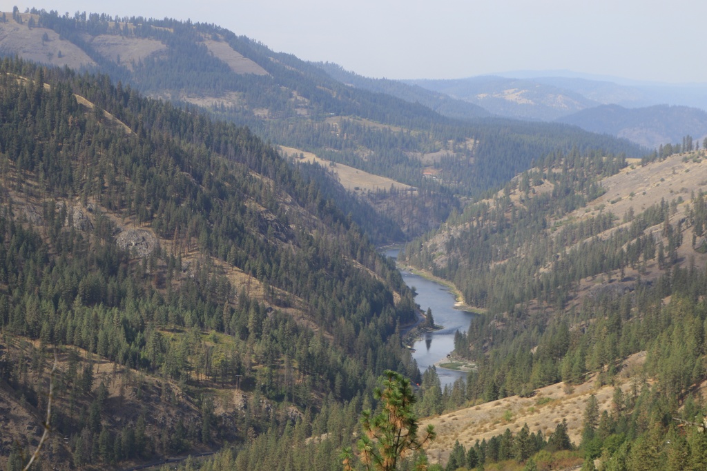
At the bottom of the canyon, the road runs along the Salmon River. We will find this again later in the trip on a few occasions.

53200458343_67b5ff25ea_o.jpg


53200572470_b2d5f4dc52_o.jpg


Back on US 95, we passed some views of the region's railway history as several bridges spanning valleys were visible. Some were made of iron or steel, while other older ones were made with wooden beams.

53200572380_d4f0477066_o.jpg


53200042964_872046e8b0_o.jpg


Tomorrow we will visit some attractions near Lewiston ID before heading to the famous Hells Canyon, separating the state of Idaho from those of Washington and Oregon.
 
Last edited:
Day 15:

Starting point: Clarkston WA
End point: Enterprise OR
States traveled: Washington, Oregon

Distance driven: 335 km
Distance hiked: 1 km

The day started with beautiful bursts of sunshine, but these became more and more rare as the day progressed. We ended our day in the rain, fortunately just after completing our activities. With the rain came much colder weather as the temperature reached a low 5C near our destination located near the mountains.

For our activities, we abandoned the few points of interest that we had planned in Lewiston to take advantage of the few clearings. To reach our first activity of the day, we took a road along the Snake River. It flows into a deep canyon which is the beginning of the famous Hells Canyon which will be the main point of our next three days.

53202565638_99dda0e007_o.jpg


53202647424_ddbb2ee1b3_o.jpg


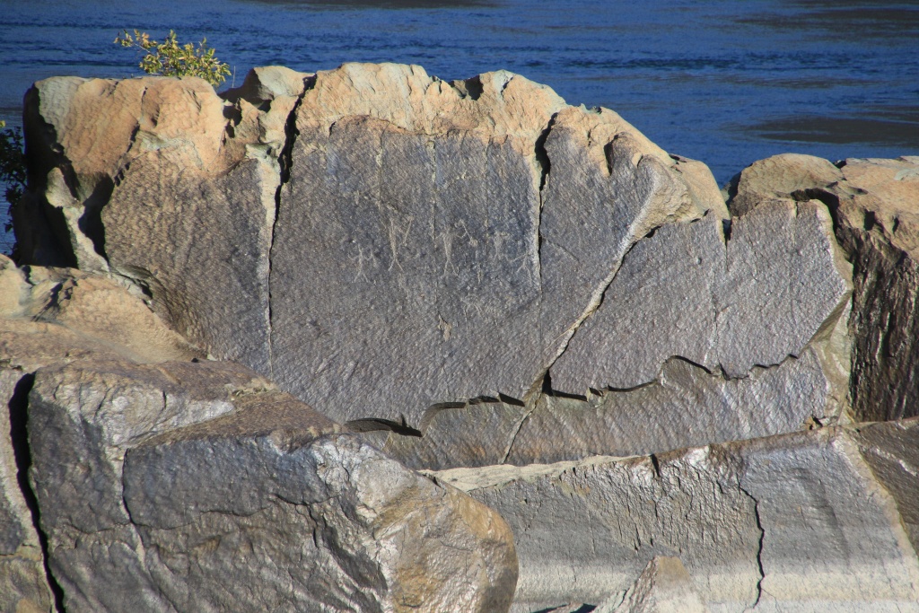
Our first attraction was the Buffalo Eddy petroglyph site, part of the Nez Perce National Historic Park, on the banks of the Snake River. The age of these is estimated between 300 and 4500 years.

53202677310_dca1dbbbf7_o.jpg


53202677290_a7bba66fdd_o.jpg


We then took Couse Creek Road to join our main route south. Couse Creek Road was not originally included in our itinerary, but it was a great surprise. This winding road climbs a secondary canyon of the Snake River.

53202389421_f4d8ea61ce_o.jpg


After traveling along Couse Creek Road, we joined the main road WA 129, a paved road descending and climbing canyons in sequence and offering great views, including one over Grande Ronde River.

53202341751_e91d3845b9_o.jpg


53202341761_e91d3845b9_o.jpg


53202341756_9b417fff2e_o.jpg


Reaching Oregon, the road changes its name to OR 3. The road becomes much less winding and passes through a dense coniferous forest. We made a stop at Joseph Canyon Overlook, the winter site of the Chief Joseph Band of the Nez Perces (Nimíipuu). The canyon provided warmer weather and all the resources needed to get through the winter.

53202341721_29b6c82751_o.jpg


We then drove NF 46 into Wallowa-Whitman National Forest. This gravel road climbs high hills as it approaches Hells Canyon. We reached two old fire lookouts. The first was the Red Hill Fire Lookout, and the second was the Buckhorn Fire Lookout.

53201376572_c74e221a44_o.jpg


53201376582_12ea045d58_o.jpg


From Buckhorn Overlook, the view toward the canyons of Hells Canyon National Recreation Area was simply incredible.

53202647354_a9dd9436e6_o.jpg


53202565493_491bcec27a_o.jpg


Continuing on FR 46, the forest gives way to large meadows used for cattle breeding.

53202565423_d5e9bc95ba_o.jpg


As FR 46 became busier, washboard bumps appeared. We decided to take Johnson Lane-Camp Creek Road, a side trail that we thought could serve as a shortcut later in the trip. Well, this track is far too rocky to be able to save time by avoiding the detour. On the other hand, it presents superb landscapes.

53202341601_be23960a50_o.jpg


53202341621_69e40037cb_o.jpg


53202341606_8f1a9bab1e_o.jpg


We then reached the paved road OR 350 and then Enterprise in heavy rain, our place to stay for the next three nights.
 
Day 16:

Starting point: Enterprise OR
End point: Enterprise OR

Distance driven: 515 km

As expected, we woke up to light but continuous rain. The low clouds did not bode well. But since we had to do some a laundry after two weeks on the road, we took advantage of it. We arrived first at the laundry and everything was completed quickly.

As the weather forecast called for a gradual clearing early in the afternoon, we decided to head towards the sun. Starting at Enterprise OR, we took the Hells Canyon Scenic Byway west. The clouds seemed to want to remain clinging to the mountains.

53204916933_e842a8d825_o.jpg


The road passes through several small villages, each with its own attractions, but the gloomy weather had somewhat dampened our mood for visiting. In Elgin OR, we came across the Opera House, a renovated historic building.

53204995754_23ea8116c6_o.jpg


Upon reaching La Grande OR, we reached the northwest end of the Hells Canyon SB loop around the Wallowa Mountains. We took the opportunity to have dinner and plan the rest of the day. We had originally thought about turning around and heading back to Enterprise, but since the sun seemed to be peeking out to the southwest, we decided to join the other end of the Hells Canyon SB loop and complete it.

What a good decision, because when we arrived in Baker City OR, the sun was very bright. This portion of Hells Canyon SB crosses an area of canyon and hills with very varied vegetation. We crossed growing areas, forests, and semi-arid areas with landscapes typical of Utah with its stunted grayish shrubs. In the distance, the Wallowa Mountains struggled to get rid of the clouds.

53203732427_587e416c25_o.jpg


53204615311_9f17e0ed70_o.jpg


Further on, we reached the site of a large landslide that occurred in 1984, before burying the old road and completely blocking the course of the Powder River.

53204615281_8b6847fcd6_o.jpg


We then entered the famous Hells Canyon by taking the winding road leading to the Hells Canyon Power Dam. The road offers exceptional views of the reservoir and the canyon cliffs.

53204916883_41ba6a2360_o.jpg


53204916833_22fa3584e3_o.jpg


53204615246_76ce289072_o.jpg


We arrived too late to visit the dam visitor center. However, we were able to see this one at our ease.

53204615251_906c9b26e1_o.jpg


To complete the Hells Canyon SB loop, we retraced our steps to join Route FR 39 which crosses the Wallowa Mountains in the Wallowa-Whitman National Forest. This winding road took us to an altitude of 1860 meters. No snow in sight, this fell last night probably melted during the day.

Near the summit, we took a short detour to check out Hells Canyon Overlook in Hells Canyon National Recreation Area, a high viewpoint from which to admire the scenery around the canyon. On the other hand, it was not possible to see the waters of the reservoir or the river.

53203732357_df1d0143dd_o.jpg


Back on FR 39, the clouds and the late hour, combined with the rain that had started to fall, made driving less pleasant. We finally joined Joseph, then Enterprise after dinner.
 
Day 17:

Starting point: Enterprise OR
End point: Enterprise OR

Distance driven: 346 km
Distance hiked: 2.8 km

We had a very nice day in terms of the attractions visited. On the other hand, weather-wise, we could have had better because the clouds persisted towards the north, the location of our main attraction. Luckily we had some nice sunny spells and didn't get any precipitation. Stay seated, the photo fest starts now!!!

As we left our lodging in Enterprise OR, we could finally see the Wallowa Mountains between the clouds.

53206815051_7340119cf8_o.jpg


Further on in Joseph OR, we stopped along the main street to see several bronze sculptures.

53206815056_28a1f16034_o.jpg


53207193164_5a83c790e3_o.jpg


53206814981_5327528993_o.jpg


We also went to see Wallowa Lake, bordered by long hills created by glaciers around 40 thousand years ago.

53207317490_9bb0e2e349_o.jpg


Continuing towards Imnaha OR, we reached our main attraction of the day, the long road leading to Dug Bar on the banks of the Snake River in Hells Canyon National Recreation Area. Here is a destination of choice for lovers of shelf roads, winding climbs and descents, grandiose landscapes, panoramic views at all times, and a somewhat exotic destination given its remote location.

53206814976_40baeae47d_o.jpg


53207193119_9c577e3899_o.jpg


53207111788_2f04261c77_o.jpg


53205930882_f31d8e55e0_o.jpg


At one point, we could see the Snake River at the bottom of the deep canyon it carved out, from a high promontory.

53207317415_0ef74b5022_o.jpg


53207192984_a6c933d90d_o.jpg


After much more time than expected, due to the reduced speed imposed by the road and especially the many photographic stops, we finally reached Dug Bar on the banks of the Snake River. It was here that the band of Nez Perce led by Chief Joseph crossed the river in the spring to escape the cavalry who were pursuing them. Despite the force of the spring river, humans and horses all managed to cross, but the livestock were much less fortunate, suffering heavy losses.

53207111688_f8e653322c_o.jpg


53207111693_9d0c24d2aa_o.jpg


This road is truly exceptional and is certainly one of the twenty most beautiful roads that we have had the opportunity to travel during our travels. Unfortunately, the photos don't do enough justice to the beauty of the place.

After a short break, we turned around and began our return. We had planned a long hike along the Imnaha River, but due to lack of time we had to abandon it.

On the other hand, we still had enough time to travel the road up to Hat Point, also in Hells Canyon NRA. This gravel road is very well maintained and our progress was rapid.

53206814771_fa2112f085_o.jpg


53207111683_1eef4de42f_o.jpg


At the end of the road at Hat Point, a short trail circles the point around the wildfire lookout tower. We were able to see the Snake River below.

53205976757_da0d40b352_o.jpg


53207364230_47ddbe7dc4_o.jpg


53205976712_a920f05679_o.jpg


On the way back, the sun was about to disappear behind the Wallowa Mountains. We decided to wait for the sunset which promised to be beautiful. We were not disappointed!

53205976722_3145ecd592_o.jpg


53207239344_63ea5d3fd3_o.jpg


The autumn equinox occurred yesterday, so the days are getting shorter and shorter. Waiting for the sunset obviously had the consequence that we descended the 1500 meters in the dark. We had dinner at Joseph OR and finally arrived at our accommodation around 9:00 p.m., much too late.

Tomorrow we will leave Enterprise and Oregon to continue our discovery of Idaho.
 
Last edited:
Day 18:

Starting point: Enterprise OR
End point: McCall ID

Distance driven: 478 km
Distance hiked: 2.3 km

We got up with a bright sunshine, but a low 2C in Enterprise OR. We had originally thought of taking route FR 39 through the Wallowa Mountains to reach the Snake River and Idaho, but this road being very winding and damaged in places, we decided instead to go around to the west and south, as we did it two days ago. It was slightly longer, but we also erred on the side of caution since the temperature at the summit would likely have been below freezing and the danger of ice was real.

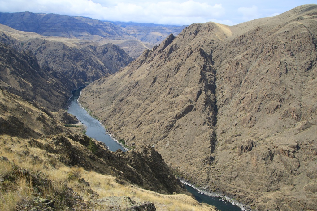
After reaching Idaho, we took the Hells Canyon Dam road and then began a long climb out of the canyon on the Kleinschmidt Grade road in Payette National Forest. This ledge road offers virtually constant views of Hells Canyon and the Snake River. I took several photos of the canyon while Nancy was rather busy with another subject (see 2nd photo)...

53209303994_c5466456cb_o.jpg


53209303974_7d59c0dee7_o.jpg


Having completed the climb, we continued on Sheep Rock Road leading to Sheep Rock, a protected promontory overlooking Hells Canyon. The high altitude of the place means that the climate is alpine, with an impressive amount of flowers and bright autumn colors.

53209303989_0637078c18_o.jpg


53208924451_60d40cc018_o.jpg


Returning to Sheep Rock Road, we took a short side trip to Kinney Point, another promontory on which a fire lookout once stood. This is located at the end of a large meadow allowing you to appreciate the surrounding mountains.

53209433820_3a49d43473_o.jpg


It was also at this point that we said goodbye to the Snake River which we would not see again for the rest of the trip.

53208924356_ea98e2c1a6_o.jpg


Still on Sheep Rock Road, another side trip took us to Horse Mountain Fire Lookout. Some of these towers located in remote locations are still in use today during the active forest fire season.

53208924226_60b6e6569d_o.jpg


Next we took the road to the Black Lake Fire Lookout. This one is located even higher than the others with an altitude of more than 2440 meters. The very last portion of the road is too narrow that it is reserved for ATV vehicles. So we climbed up walking to reach it. We obviously suffered the effect of the altitude.

53209433710_3c9b872278_o.jpg


53209230573_e7208461d4_o.jpg


53209433720_6af294604d_o.jpg


We finally arrived in McCall ID around sunset, our place to stay for the next three nights. It was too long a day, especially since it was cut by an hour because we reached the Mountains time zone.

Tomorrow we should explore the area around McCall, an area that is completely unknown to us.
 
Day 19:

Starting Point: McCall ID
End point: McCall ID

Distance driven: 192 km
Distance hiked: 9.1 km


As the weather forecast called for cloudiness towards the end of the morning, we chose to drive the scenic gravel Lick Creek Road in Payette National Forest. This road climbs into the mountains to reach an area of alpine vegetation with rocks sculpted by the passage of ancient glaciers.

Along the way, we passed Little Payette Lake Reservoir. The level of it was very low and revealed countless stumps of cut trees. Surprising or even shocking, but when you think about it, it's probably to prevent trunks from floating between two waters and boats from hitting them.

53211501976_d73ff0e826_o.jpg


Further on, we reached the surroundings of Slick Rock, one of the highest climbing walls in Idaho, very popular with mountaineers. On the other hand, there was no one there when we visited.

53211885839_544bcc988c_o.jpg


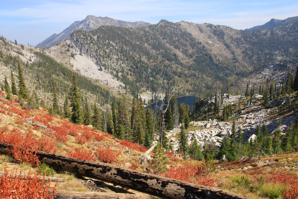
Further on, we hiked the very pretty Hum Lake Trail. Once again, the trail runs through a wooded area that was ravaged by a forest fire several years ago, meaning the view was almost never obstructed. The ground was covered with a large quantity of flowers and the shrubs took on their autumn color. The trail climbs steadily but very gradually in multiple switchbacks.

53210620847_affc248043_o.jpg


53211885834_59361115c6_o.jpg


53211807798_5fd85cbbfc_o.jpg


As we progressed along the trail, Duck Lake became more and more visible. This lake is accessible by another junction on the same trail as the one we were traveling on.

53210620697_ab71d51d6e_o.jpg


53211885624_3905624bea_o.jpg


Continuing, we reached an area with obvious marks of the passage of glaciers on the granite rocks. In the distance we could also see the scenic road that had brought us to the trailhead below.

53210620682_5a8953f437_o.jpg


We finally reached our objective of reaching the pass allowing us to see Hum Lake. It probably doesn't shows well in the photo, but Hum Lake would have been reached after a descent of more than 350 meters that we would have had to climb back up afterwards. Not for us today, our physical form and adaptation to the altitude are not good enough yet.

53211501686_07a0010389_o.jpg


We had a small snack while admiring the scenery in front of us. Not a worse view, isn't it!

53211807418_8600c1e620_o.jpg


On the way back, the sun still managed to break through the thin cloud layer, making the vegetation shine.

53211807398_8d357205e2_o.jpg


We finally reached our starting point of the hike, not without taking a little pause after my wife felt and hit her head on a rock. A lot of bleeding fur such a small hole!!! Nothing too serious...

Then we continued on Lick Creek Road with a long descent, as the clouds became more and more present. This section of road was quite rocky with plenty of potholes as well.

53212013200_974b336c4b_o.jpg


Further on, we joined the South Fork Road along the South Fork Salmon River. To our great surprise this single lane road was paved and in impeccable condition. This road runs along the river to eventually reach Warm Lake further south.

53211885239_eef1ceb9c4_o.jpg


53210620242_e1f9f66b8f_o.jpg


53211885169_82f066f2aa_o.jpg


53211501291_578152e410_o.jpg


Tomorrow we will drive a very long gravel road deep into Payette National Forest. This route is full of historical attractions and the landscapes promise to be exceptional.
 
Day 20:

Starting Point: McCall ID
End point: McCall ID

Distance driven: 239 km
Distance hiked: 1.1 km

As expected, we had another beautiful day, with just a bit of clouds. The temperature even rose to 27C at the bottom of a deep canyon. We returned to Payette National Forest to drive the Warren Wagon Road, a historic road which is paved at its beginning then gravel.

A little before the small village of Warren ID, we took a short detour onto a secondary road crossing Warren Meadows. The place was once the site of a mining operation using a dredge, a sort of floating platform scraping the bottom of a watercourse to remove gravel containing gold and separate it. The large gravels are removed and thrown behind the dredge, forming arcs of rocks.

53213962996_f853132caa_o.jpg


The trail gave us a little surprise, but nothing too difficult.

53213962936_fc93bc0228_o.jpg


The dredge was in a very deteriorated state and quite difficult to access. We see in the foreground in the following photo the bucket line used to dig the bed of the river.

53214347079_a67dd6597d_o.jpg


Back on Warren Wagon Road, we had a visit from this charming bird.

53214346979_d03488d23b_o.jpg


Next, we walked a short trail leading to an ancient Chinese cemetery. They exploited on a small scale the mines deemed not profitable anymore by the big players of the time. The bodies of the deceased were buried temporarily until they were returned to their families in China. In the foreground in the following photo, a canal used to transport water from the mountains for the mine's operation.

53214473505_563ed3b0a7_o.jpg


We then reached Warren, a very picturesque old mining village. Several buildings could use a little love.

53214473395_73a6dd7fba_o.jpg


53214346839_7bd305f090_o.jpg


53213962786_9637e248e7_o.jpg


We continued on Warren Wagon Road to reach the multiple intersection located at Warren Summit. We then headed towards Smith Knob Fire Lookout, site of a former forest fire watchtower. The shelf road ran along mountains in areas previously ravaged by forest fires.

53213079092_be823df463_o.jpg


53214346794_64cd273397_o.jpg


53213079052_421db1fbaf_o.jpg


This site is located immediately adjacent to the Frank Church-River of No Return Wilderness, a huge territory protected from human activities, only accessible by non-mechanized means except for a few roads and the river.

You can also see in the following photo in the distance, going down towards the Salmon River, the road leading to Mackay Bar Ranch. This place was one of the filming locations for a television show broadcast on Discovery Channel and which made us know a little about the place. During the summer, the preferred means of transport is the water jet boat given the shallowness of the river. We will follow this river tomorrow and on other occasions during the trip.

53214473175_71d8136d36_o.jpg


Here is the beast on the concrete slab, the only remnant of Smith Knob Fire Lookout.

53214587305_f50f5bc8b6_o.jpg


Back at the intersection at Warren Summit, we continued toward South Fork Ranch, another filming location for the Discovery Channel show. This is reached by another long ledge road which descends the steep 1200 meter cliff to reach the banks of the South Fork Salmon River.

53213078982_3866b2fd67_o.jpg


53213078967_a22653e1a3_o.jpg


After crossing South Fork Salmon River by a pretty metal bridge, the road continues much further south. Due to lack of time, we turned around and began our return to McCall ID.

53214266493_0ea055ecb4_o.jpg


Very early tomorrow morning we are going to go to a garage to have a tire checked which has a deep cut which probably occurred on another day as the tires haven't really been used today.
 
Day 21:

Starting Point: McCall ID
End point: Lucille ID

Distance driven: 272 km
Distance hiked: 12.2 km

I got up early to go to a garage to have a tire checked and probably try to replace it. It should be replaced as not viable in the long term, especially for a four-day return on the Interstates. Unfortunately, no garage holds BF Goodrich tires in McCall. We'll try it later in the trip, hoping it holds up.

We then left McCall to join another long hike in Payette National Forest, accessible by a road running through white granite mountains.

53216856298_a2d686bb05_o.jpg


53217051250_cf95926918_o.jpg


The hike we chose was Lava Ridge starting at Clayburn Trailhead. The trail crosses some valleys that suffered a forest fire in 1994 to eventually climb Lava Ridge.

53217051255_571964c855_o.jpg


As we began the hike, we quickly noticed the reason for the destination's name, seeing that the rocks were of volcanic origin. The slope to reach Lava Ridge was quite steep, the trail being also used by motorcycles, hence the absence of switchbacks which would have made the ascent easier. We nevertheless reached Lava Ridge, offering a spectacular view of the surrounding area.

53215668877_6df59200cd_o.jpg


Having reached the end of Lava Ridge, the view towards Lava Lakes was astonishing with their varied colors. We had to wait for clearings between the clouds which were becoming increasingly rare. The winds were quite strong and hail even started to fall. We didn't stay very long because we were way too cold.

53216856143_a9cca19293_o.jpg


53217051100_6988eed598_o.jpg


53216856073_e6c58fef53_o.jpg


On the way back, more threatening clouds rolled in and the hail intensified as we approached the vehicle.

53217051010_e8a741da9f_o.jpg


Returning to the vehicle, we went the other way and then headed north to the small town of Riggins ID. It is located at the confluence of Salmon River and Little Salmon River. An exceptional road runs along the deep canyon carved by Salmon River.

53216855933_2a8e01b54e_o.jpg


53217050950_937c68c5a3_o.jpg


53216933544_7638a8f46e_o.jpg


At a bend, we frightened a group of bighorn sheep that were on the road. In no time, they climbed the cliff with disconcerting ease, jumping from one rock to another.

53216855868_9e49b98eb1_o.jpg


The road changes banks several times via bridges of various types. This one, the most recent of all, has an asymmetrical shape.

53217050840_478c787859_o.jpg


53216544281_0d36f783f8_o.jpg


We finally reached the end of the road at Vinegar Creek. This place is the departure point for excursion boats on Salmon River, but also for shuttles to villages like Mackay Bar, one of the rare villages on the river accessible by land. We just saw it yesterday in the distance in a photo.

53216544276_38bbe5781a_o.jpg


Tomorrow we will explore the area west of Riggins near Hells Canyon National Recreation Area, if the weather cooperates, which is not guaranteed.
 
Day 22:

Starting point: Lucile ID
End point: Lucile ID

Distance driven: 250 km
Distance hiked: 0.9 km

At daybreak, the weather forecast did not bode well, with a well-overcast sky and showers. We decided to follow our itinerary anyway, hoping that the announced partial clearance would take place. Our planned activities were all in the Seven Devils Peaks region in Nez Perce-Clearwater National Forest. As we climbed Seven Devils Road, we began to see the few expected clearings.

53219159705_6e99443eff_o.jpg


Further on we reached a point called Windy Saddle. We had planned two hikes there, but it was only a measly 3C and extremely windy. The temperature felt must have been well below freezing. Madame didn't feel comfortable enough with the cold and we decided not to go through them.

We then continued to Heaven's Gate Overlook, one of the best high elevation viewpoints in Idaho overlooking Hells Canyon.

53217774107_afbd0de120_o.jpg


From this location we had a view towards some of the peaks of Seven Devils Peaks. The wind was even stronger there and the third hike was also put aside.

53219159730_7c50f9194a_o.jpg


As we returned down onto Seven Devils Road, the clearance became more and more established.

53218650361_cca0d796ee_o.jpg


53219034484_ed3f008bf0_o.jpg


Having not done the planned hikes, we then had time to hike a few routes we had scouted before. As these two routes started on the road along Salmon River, we happily returned to this one.

53217774057_e448e0693e_o.jpg


The first road was Burgdorf Road, running along French Creek. This road goes up the long slope in a series of long parallel switchbacks. We were hoping to be able to see Salmon River as we climbed up, but that wasn't possible.

53218960298_4f66485fc5_o.jpg


On the way back down, we encountered a caravan of six vehicles heading up the narrow road in the opposite direction. As they had spotted us, they all lined up in a wider area until we reached them.

53218650241_cfa4582662_o.jpg


53219159575_2a7490c028_o.jpg


Then, to stretch our legs a little, we stopped to walk on the sandy bank of Salmon River. The sand transported by the river is deposited in several places in the curves of it, forming places called "bars".

53219159610_c2e8914676_o.jpg


Continuing on Salmon River Road, we encountered this charming local resident, our first Idaho rattlesnake, measuring approximately 3 feet long. He was relaxing quietly on the road pavement. As he approached him to say hello, he probably felt a little threatened. He raised his head ready to strike, while moving towards the roadside grass. He even made us swing his tail, making us hear his characteristic sound. We still kept a good distance.

53217774012_5b3f536d38_o.jpg


Finally, we traveled one last forest road, Chair Point Road climbing up a mountain to reach Chair Point Fire Lookout, another forest fire lookout.

53218650086_cdfe4e5b3b_o.jpg


53217773862_3cc48bb4fc_o.jpg


53217773937_111a36d234_o.jpg


Tomorrow we will continue north visiting some historical sites.
 
Day 23:

Starting point: Lucile ID
End point: Kamiah ID

Distance driven: 190 km
Distance hiked: 3.9 km

We had another very beautiful sunny day with only a few cloudy periods and a very pleasant temperature. This day was not going to be very busy...

Leaving Lucile ID, we followed the Salmon River winding at the bottom of its canyon. Near White Bird ID, we turned off to travel the road towards Pittsburg Landing. This forest road climbs through not very high mountains to reach a pass and descend via numerous switchbacks towards the Snake River.

53221329255_30784d4466_o.jpg


53220822881_898e32ea36_o.jpg


We went to see the boat ramp on the Snake River. Fishing trips on the river depart from this location.

53220823446_f16aef0b1a_o.jpg


Then we continued along the river a short distance to see the Pittsburg Rockart Interpretive Site, some of which are estimated to be over 7,000 years old.

53220823471_5475c1dd06_o.jpg


53220823266_81c731b405_o.jpg


At the end of the road is the starting point for a very long hike along the bank of the Snake River, to the bottom of Hells Canyon and even reaching the Hells Canyon Dam. We only covered a few meters at most to get an idea.

53220823111_11126563bf_o.jpg


On the way back, we drove a short trail in the opposite direction into the canyon. It was somewhat of a temporary goodbye because Snake River rises near the Wyoming border, a place we will visit later at the end of the trip before leaving Idaho.

53219952232_7600cf6f1e_o.jpg


On the way back to Pittsburg Landing Road, several places allowed us to admire the winding route of the road below.

53221328540_85663c9a09_o.jpg


53221133223_d04e5b1ce6_o.jpg


53219951847_282135947d_o.jpg


Back on the main road, we hiked to the historic site of the Battle of White Bird where the Nimiipuu band, led by Chief White Bird, convincingly repelled the first cavalry attack of the war from 1877. The hike offers several explanatory panels of the events as it climbs towards the promontory in the middle left in the following photo.

53221207274_7e982aacc8_o.jpg


53219951692_dba28000dd_o.jpg


The US 95 road climbs out of a large canyon onto a high altitude plain. The cliff along the road testified to the region's very volcanic past with beautiful basalt columns forming when a thick layer of stagnant lava slowly cooled.

53219951797_93e0beef32_o.jpg


Our last stop on our route was Tolo Lake, the largest lake on the greater Camas Prairie. This place often served as a gathering place for the different bands of Nimiipuu to socialize and celebrate. During the last regrouping, they knew well that this would not happen again because this place was now outside the limits of the reserve imposed in 1863.

53219951512_a03a8d91e1_o.jpg


We then joined Grangeville ID. After a quick meal, we stopped at an auto supply store to buy some adhesive to try to patch the deep cut in one of the tires. With the salesman, we noticed that it seemed to want to extend onto the side of the tire, probably making driving precarious, especially since many gravel roads await us in the coming days.

They graciously called about 20 stores in the area to try to find a BFG KO2 275/70R17 replacement tire, but were unsuccessful. I then decided to go to a workshop and swap the tire on the spare with the cut one. Since my spare tire is mounted on the OEM steel rim with a different offset than my FN Wheels rims, I had to swap the tires and not only the wheels together. The job was done in about two hours, consuming the rest of the afternoon. At least now we have a tire that is a little worn, but at least intact.

Tomorrow we should drive a very long historic and scenic gravel road through the mountains to Montana, hoping the weather cooperates once again.
 
Day 24:

Starting point: Kamiah ID
End point: Darby MT

Distance driven: 327 km
Distance hiked: 3.6 km

We got up early so as to leave as soon as the sun rose because we knew we had a very long day. The objective of the day was to cross almost all of Idaho from west to east using a route that had been used in the past by the Nimiipuu during their seasonal migration between Idaho and Montana.

To begin, we reached the small village of Elk City ID, located deep in the mountains. After a stop at the Ranger Station to check that the road was passable, we took a final paved road crossing a region fertile in historical remains connected to mining passes, such as the Gold Point Mines camp near Elk City.

53223042821_eae229d10a_o.jpg


We then joined the beginning of the Magruder Corridor Road, a very long gravel road crossing the mountains between the Frank Church-River of No Return Wilderness and Selway-Bitterroot Wilderness.

53223352148_7af925795c_o.jpg


Further on, we reached the road leading to Burn Knob Fire Lookout, perched on a rocky promontory. The access road is rated difficult given the deep ruts and large rocks. We progressed a fairly good distance with the 4Runner, paying close attention to the many rocks with sharp edges. As our progress was quite slow, we decided to park the vehicle and continue the long climb on foot to save some time.

53223042796_3143f465a4_o.jpg


53223425289_c656e35ff6_o.jpg


The view from the top of Burnt Knoll is considered one of the best in the region, and for good reason.

53223352123_b93f42dd14_o.jpg


53223425304_7567817967_o.jpg


53223352083_283f6cf29c_o.jpg


Continuing, we reached Dry Saddle, a high pass from which several hiking trails start. We had planned to do one but had to let it go due to lack of time.

53222171732_be6763502d_o.jpg


Farther than Dry Saddle, the road became extremely rocky and our progress was very slow. Then we reached Bitterroot National Forest and the quality of the road has greatly improved with recent maintenance work. We then traveled very long stretches of narrow shelf road with no obvious possibility of overtaking. Fortunately, we didn't come across anyone. Further on, the road improved further and became a little wider.

53222171737_992189a46b_o.jpg


53223352093_e971cfff3d_o.jpg


We then began a long, very long, too long descent towards US 93 which would take us to Darby MT. We arrived as it was getting quite dark. When we arrived at our place of residence, we found that there was no office. We had to activate our data temporarily, while we managed to contact the contact person.

Tomorrow, we will reach Idaho in the afternoon, after having covered some trails in the Darby MT region.
 

Members online

No members online now.

Forum statistics

Threads
278,311
Messages
3,554,082
Members
248,016
Latest member
Advally Service

Trending content

Back
Top