JohnTheLuck's Adventures Thread

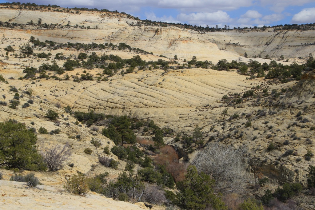
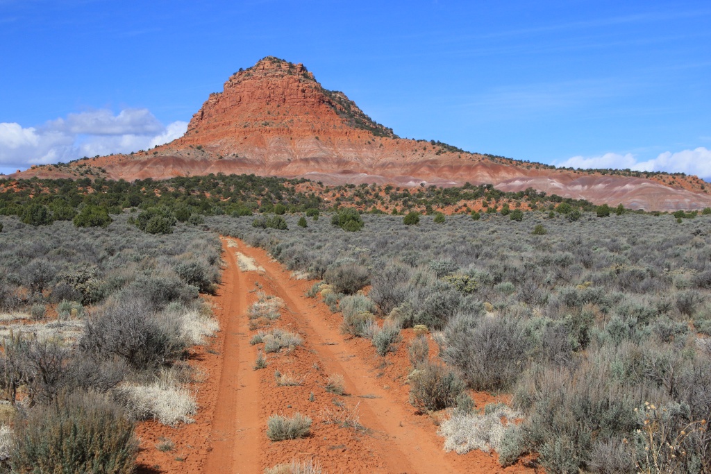
That shot of Factory Butte is so interesting. I couldn't get a sense of scale, but looking it up the butte is gigantic! Topping out above 10,000 meters.

In fact it is not that high, the base is at 1460 meters while its top is stands at 1930 meters. Its surrounding is a landscape out of this world! Today, as you will see later, it was a lot different!!!
 
Last edited:
Day 24:

Starting point: Hanksville UT
Ending point: Hanksville UT

Distance driven: 321 km

When we got up, the 4Runner had a light coating of snow and it was raining. We took the opportunity to do another laundry chore, just to be ready for the sunny days ahead. As the forecast was better towards the north, we went to Green River where there is a Landromat.

On the way back, we saw some faint clearings towards Hite, but not enough to be tempted to go there. Towards the west, it was a completely different scenario considering the mountains nearby. Factory Butte and North Caineville Mesa were playing hide and seek in the clouds, with their fresh white robes.

53590046696_9f689e5483_o.jpg


We opted to head towards Capitol Reef National Park, slightly higher in elevation. Scenic Byway 24 is such a beautiful drive, with very varied scenery, especially with today's snow.

53590251053_9a716d9b53_o.jpg


53589171287_148a7e6d3d_o.jpg


53590362664_bf61cd4e6a_o.jpg


Further on, we entered Capitol Reef NP, traveling through the narrow canyon along the Fremont River. At this time, the temperature was approaching the freezing point.

53589171312_2b84dce6ec_o.jpg


53590362644_223244eddd_o.jpg


53590251038_232b4933cb_o.jpg


We were hoping to be able to ride a section of the Scenic Drive, but it was closed immediately after the campsites. We continued on SB 24 to Chimney Rock then turned around.

53590046616_193b4557b4_o.jpg


The forecast is for an appreciable amount of rain this evening and night, but with a temperature around 4C. The snow should therefore continue to melt, swelling rivers and washes. This will certainly hamper our activities tomorrow, but at least the precipitation will be a thing of the past. Then it should be nice and warmer.
 
Day 25:

Starting Point: Hanksville UT
Ending Point: Hanksville UT

Distance by vehicle: 375 km
Hiking distance: 3.6 km

After checking the weather forecast for the day and seeing that we wouldn't be well off staying near Hanksville, we headed southeast toward Hite via Scenic Byway UT 95, another very spectacular route.

We made a stop at Hog Springs Recreation Area, a short stop in the portion of the canyon carved out by North Wash. The latter, usually dry, flowed in torrents colored by the sediments it carried. We were hoping to walk a short trail leading to some petroglyphs and pictographs, but the presence of water forced us to admire them from the road.

53592355669_2d493eef83_o.jpg


53591165712_0fba6c0fa2_o.jpg


Further along UT 95, we hoped to do a short hike in White Canyon, but once again the presence of water made us decide against it. However, nice sunny openings were starting to appear, giving us hope for the rest of the day.

53592242493_70a5b14fec_o.jpg


We continued a little further on UT 95 to the start of Blue Notch Road going towards Lake Powell. As the ground was still very wet, the presence of a large quantity of mud prompted us to turn around. We then decided to head instead on UT 276 going further south.

53592484255_482d62965a_o.jpg


Route UT 276 passes very close to several mountains that have received a lot of snow in recent days.

53592355264_c0b9ce8e73_o.jpg


53592036636_519ecc828e_o.jpg


At the end of the road, in Bullfrog UT, we explored the roads near Stanton Canyon leading to the shores of Lake Powell.

53592355144_78a31677b8_o.jpg


To the great joy of Nancy (who chose the photos for this thread...), many flowers covered the ground, as well as numerous shells, witnesses to water levels historically much higher than those currently present.

53592036766_f28f4557f4_o.jpg


53591165282_97b498a615_o.jpg


53591165292_64ac944832_o.jpg


We walked along the bank, on rocks often having the imprints of wavelets created when the place was once a shallow sea, a curious coincidence as today a dam has recreated similar conditions several tens of millions years later.

53592483795_7566fe6295_o.jpg


53591165242_22670f1e7f_o.jpg


There were, all around the area, multiple isolated monoliths, the last representatives of a now eroded geological layer. The sun was shining with warm rays and the temperature even reached 14C, even making me want to convert my pants into shorts!

53592355084_1657315305_o.jpg


53592355069_a7d657590c_o.jpg


We then went to Bullfrog Marina. Several boats were afloat, and a very large number of houseboats parked further from the shore, certainly awaiting the return of vacationers during the summer.

53592036546_023989314c_o.jpg


We then took the road back to Hanksville. We did, however, do a short section of Trachyte Point Road leading to a point overlooking North Wash and UT 95. At first the surface was sand and frequent mud holes, but at some point we reached an area bentonite clay still very wet and slippery. In addition, as big clouds were very close, we wisely turned around but as we really liked the landscapes, we will complete it another time.

53592483750_899e752c24_o.jpg


We have not yet decided on our activities for tomorrow, our last before leaving Hanksville. We will advise tomorrow morning according to the latest weather information.
 
Day 26:

Starting point: Hanksville UT
Ending point: Hanksville UT

Distance driven: 512 km
Distance hiked: 1.1 km

What a day! We experienced all four seasons, had a little rain, snow, and hail, sun, and a lot of clouds. We had a lot of difficulty choosing our destination because the forecasts were not encouraging in all directions.

We headed toward Green River in hopes that the announced clearance would materialize. We had some good clearings as we visited Sego Canyon and it's very beautiful pictographs, a site accessible by a paved road.

53594306236_6319d48245_o.jpg


53594628644_84e3510135_o.jpg


53594628749_cae3d24f61_o.jpg


53593432392_3d4220c656_o.jpg


53594753645_467343f93a_o.jpg


We continued a little further on Sego Canyon Road, but quickly realized that was a really bad idea, going through bentonite clay hills. So we made a well-advised U-turn.

As we exited Sego Canyon, located in the cliff range called Book Cliffs, the sun's rays were hot enough to evaporate the water contained in the bentonite clay slopes, creating long clouds following the top of the cliff. .

53594306221_edd038a457_o.jpg


We were hoping to continue to another route up the Book Cliffs, but we abandoned that idea following our experience of Sego Canyon Road.

Realizing we had to stay on paved roads, we decided to go further west, taking the I-70 and stopping at multiple view areas. The first stop overlooked Black Dragon Wash and the route we traveled about a week ago was visible.

53593432372_fcb4f60270_o.jpg


Another stop, Chimney Rock View Area, overlooked South Fork Coal Wash. Since we had just gained a lot of altitude, the snow appeared.

53594306216_5b128d3c4f_o.jpg


Further on, we left I-70 to go along Miller Canyon Road, a place we had never visited before.

53594306211_8c51806197_o.jpg


53594753600_44e87c1423_o.jpg


Some local residents greeted us as we passed.

53593432322_f42a8aa85c_o.jpg


Then we continued south on UT 72, climbing to an elevation of over 2600 meters. Here, it was definitely winter and a few people were enjoying it, some of them on snowmobiles. The high mountains created a lot of clouds.

53594628699_0f711fd37f_o.jpg


At the summit at Logan Pass, we were surprised to see that the snow stretched as far as the eye could see, including Capitol Reef National Park in the distance.

53593432302_7f46b208d4_o.jpg


53594306166_035ee779a3_o.jpg


Having reached Capitol Reef NP, the snow was very present, to our great disappointment because tomorrow we will move to nearby Torrey to hike in this park. Hopefully the sun will make it all disappear quickly. Chimney Rock that we photographed a few days ago, now surrounded by snow.

53594511993_29b40465ed_o.jpg


53593432222_c9e70fc600_o.jpg


Near Panorama Point (closed for the day).

53594628634_81f3f07d43_o.jpg


Even in Fruita, an ancient Mormon village and center of the park, snow was present, although in much less quantity. In fact, the thickness of it decreased as we went eastward and away from the mountains.

53593432232_078330ee71_o.jpg


We went shortly onto the Scenic Drive and of course, it was still closed.

A little further east of Fruita, in the canyon carved by the Fremont River, we saw several waterfalls starting from the top of the cliff, with Pectol Pyramid in the distance.

53594628629_c0282c87b4_o.jpg


With all this snow, tomorrow we will have to deal with the ground conditions once again.
 
In fact it is not that high, the base is at 1460 meters while its top is stands at 1930 meters. Its surrounding is a landscape out of this world! Today, as you will see later, it was a lot different!!!

LOL, I'm not sure why 10,000 meters did not trigger second thoughts--I saw 6000 feet and did my a mileage conversion in reverse! Sigh.
 
Day 27:

Starting point: Hanksville UT
Ending point: Torrey UT

Distance driven: 277 km
Distance hiked: 3.6 km

Finally, we had a superb sunny day, with only a few inconsequential clouds, and a temperature of 14C. As we were on our last day officially around Hanksville (more on this below...) we took the opportunity to do some activities along UT 95 southeast of Hanksville.

Our first activity of the day was a hike in Leprechaun Canyon. This can be partially explored by hiking, but is especially popular with climbing enthusiasts. Nevertheless, we were pleasantly surprised by the beauty of the place, which is earned with slight challenges.

53596905583_b5a5591d82_o.jpg


The wide canyon gives way to a narrow slot just wide enough to pass at ground level, but a few tens of centimeters higher. During floods, the water level must rise very high.

53597018629_3f346b9e67_o.jpg


53596694076_19809452e5_o.jpg


53597018619_1ae17f4a34_o.jpg


53595818387_f803780c0e_o.jpg


We then returned to Trachyte Point Road, a road that we had partially traveled two days ago when the ground was still too wet. Today the conditions were ideal and we were able to explore it thoroughly. This road overlooks UT 95 which we have taken many times. However, we were only able to partially glimpse it in only a few places because lower benches masked it. One of the first viewpoints allowed you to see Hog Spring Rest Area.

53596905593_cf4a6e2dcd_o.jpg


Further on, we had some slight challenges, with rocky areas to cross, but nothing insurmountable.

53596905543_afa89814dd_o.jpg


Further on, we reached another viewpoint towards the Hite region, with Lake Powell visible in the distance.

53597148470_7713bc17b2_o.jpg


Even further, we followed the cliff and a final plateau revealed itself to us. The descent to this proved a bit intimidating as the road leaned a bit to the side, but safe nonetheless.

53597018554_4442393b7b_o.jpg


53597148475_99e93ff96e_o.jpg


After reaching a point further than we had planned, we began our return. The Henry Mountains stood proudly before us with their recent blanket of snow.

53597148430_8c82251b55_o.jpg


Having rejoined the UT 276 road, we drove quite slowly because our tires were aired down. We then reached the start of another road, South Turkey Knob Road leading to Cedar Point.

We reached a viewpoint overlooking Stair Canyon.

53597018504_83e1ab266e_o.jpg


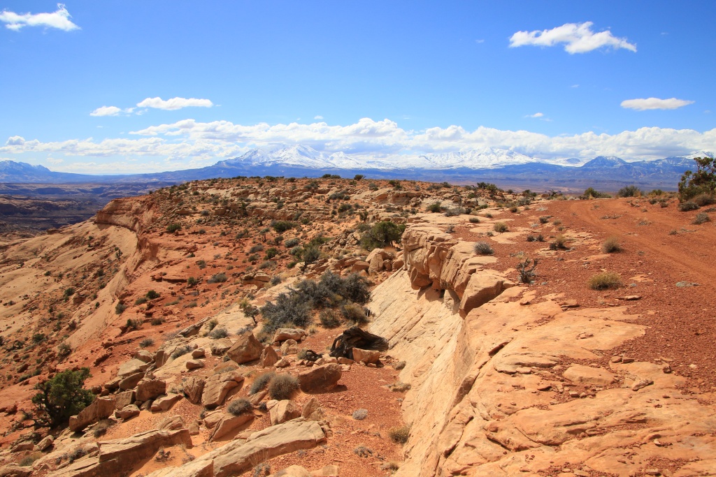
Then, further on, we reached the superb viewpoint of Cedar Point. From this spot we could see now familiar places, like Poison Springs Canyon that we hiked last winter, Dirty Devil River winding all the way down below.

53597148410_02afb7060b_o.jpg


53596693946_d64139a535_o.jpg


53597018474_9fde3e59e4_o.jpg


Also visible in the distance are Sunset Pass and Gunsight Butte, the place where we experienced a hailstorm while exploring Flint Trail Road and the east end of Poison Springs Canyon Road.

53596693931_1bc9fc210b_o.jpg


Further down the road we reached Poison Springs Canyon Overlook. The road visible toward the center of the next photo and around the tip of Bert Mesa is certainly a destination for a future trip as it connects to Happy Canyon, a fairly popular destination for long-distance hikers.

53595818227_f05ca85baf_o.jpg


We continued on a much less traveled segment, as we crossed stretches of small sand dunes. We finally joined UT 276, re-inflated the tires and took the road towards Torrey.

As we passed through Capitol Reef National Park, we checked to see if the Scenic Drive was finally open and it was. With the colors resplendent with the setting sun, we couldn't miss this chance and trekked it. In several places, meltwater laden with reddish sediment crossed the road.

53597018469_57f12a4174_o.jpg


53596785296_df99fa526c_o.jpg


The presence of snow will certainly limit our choice of activities that we had planned in Capitol Reef NP. Arriving at our hotel in Torrey, we tried unsuccessfully to shorten our stay here, hoping to return to Hanksville where conditions are much better. So we are going to stay in Torrey for the next three nights. We might drive back to Hanksville area every day.
 
Day 28:

Starting point: Torrey UT
Ending point: Torrey UT

Distance driven: 297 km
Distance hiked: 5.2 km

We hit the road without much of a well-established objective, the presence of melting snow compromising our activities that we had planned around Torrey. So we headed to Hanksville, giving ourselves about an hour to think about it better. Along the way, we decided on our first activity of the day, a hike to the base of San Rafael Swell.

As we traveled a short dirt road to the trailhead, we noticed a road traveling through a canyon crossing the rock barrier. After some consultation of the Trails Offroad application, we decided to partially travel it.

53598729826_6b25df04ef_o.jpg


53598939018_9888f2f2f5_o.jpg


It was such a good choice that we pursued it much further. At the exit of the canyon stood Temple Mountain in all its splendor. We imagine that its name was given in reference to the Temple located in Salt Lake City.

53597856367_c80ac5bf53_o.jpg


Then, again thanks to our friends from Trails Offroad, we continued with another road joining mining remains. Based on the nature of the rock layer exploited, we believe that these were uranium mines dating from the 1940s-1950s.

53598939003_62894e81ce_o.jpg


53598938993_33c285e979_o.jpg


After a few more critical passages since the road had suffered some damage following recent precipitation, we joined the main road Temple Mountain Road. We then moved on with Behind the Reef Road, which, as the name suggests, runs behind San Rafael Reef in a very spectacular setting. After some distance, our second activity of the day came into view, Crack Canyon in Muddy Creek Wilderness, also crossing San Rafael Reef.

53598938983_277022da75_o.jpg


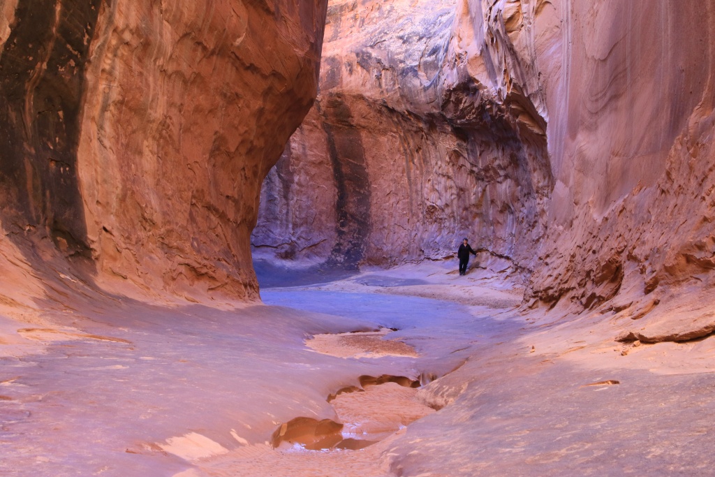
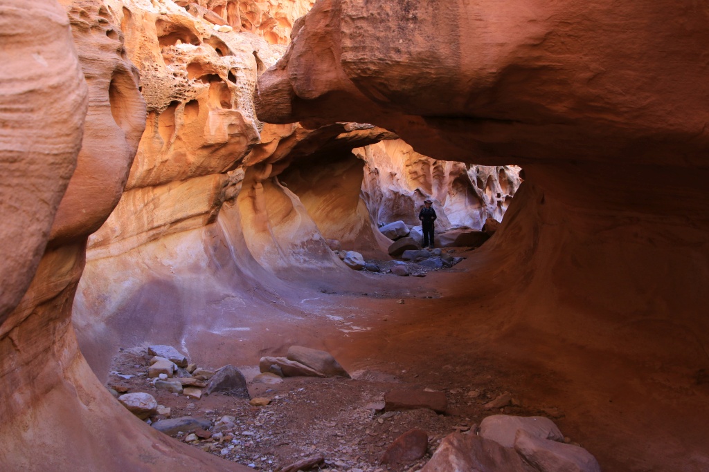
It is a very spectacular canyon, with many places that erosion by wind and water have carved countless holes, called tafoni.

53599188790_0022a149d1_o.jpg


53598938973_2fcdb51706_o.jpg


53599188775_66062251ed_o.jpg


53598729781_a76c39ac0f_o.jpg


At one point, as the canyon passes through a somewhat harder layer of rock, the water has hollowed out the underlying rock and formed a long tunnel of sorts, with a narrow slit in its ceiling. Awesome!

53599060344_4b34161d00_o.jpg


Further on, we reached an interesting obstacle, a depression bordered by rocks with a tree trunk installed on an inclined plane to allow passage. A little challenge of the day!

53599060394_c7be7be75b_o.jpg


53597856302_9e15d6777c_o.jpg


Further on, the canyon becomes very narrow and numerous water-filled depressions encouraged us to turn around. The return was made with the same wonder.

53599188740_40839d7d47_o.jpg


53599188730_330bdb7275_o.jpg


53599188685_4fe06387a5_o.jpg


After the hike, we took a chance on Cow Dunk Road, a road that winds through the bentonite clay hills. You now know my apprehension for this type of soil that is slippery when wet. We wanted to check if three days without precipitation was enough to explore certain areas that we had not yet reached. Although some places were still wet (this ground is so impermeable that water remains on the surface), the passage of other vehicles had dried most of it.

We saw NASA Mars Research Station once again.

53599060324_c1c6d9b805_o.jpg


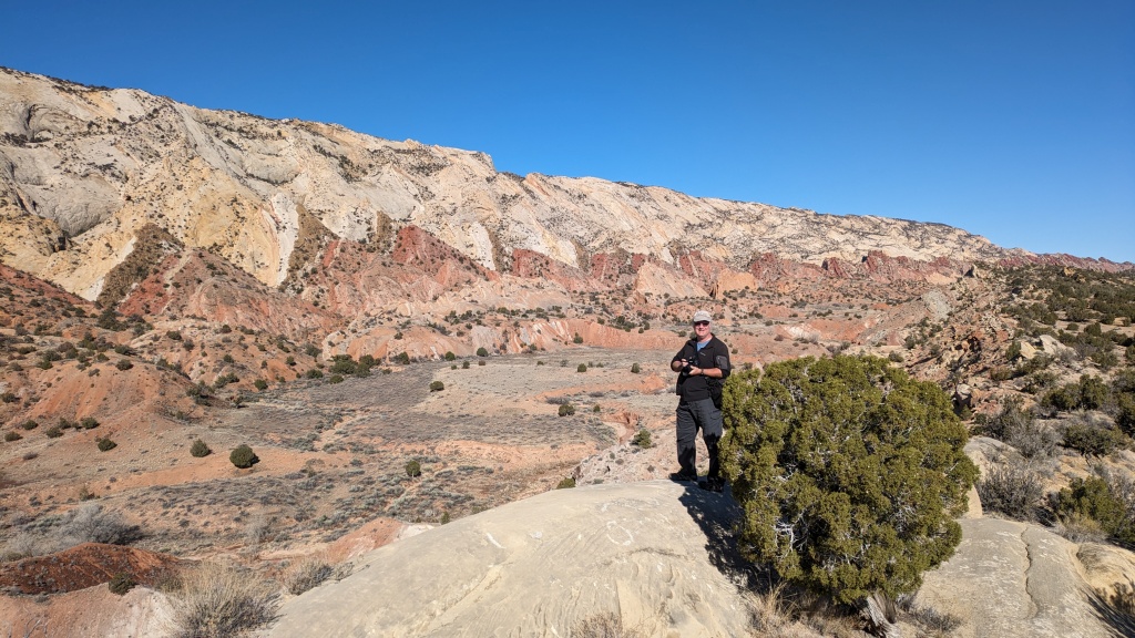
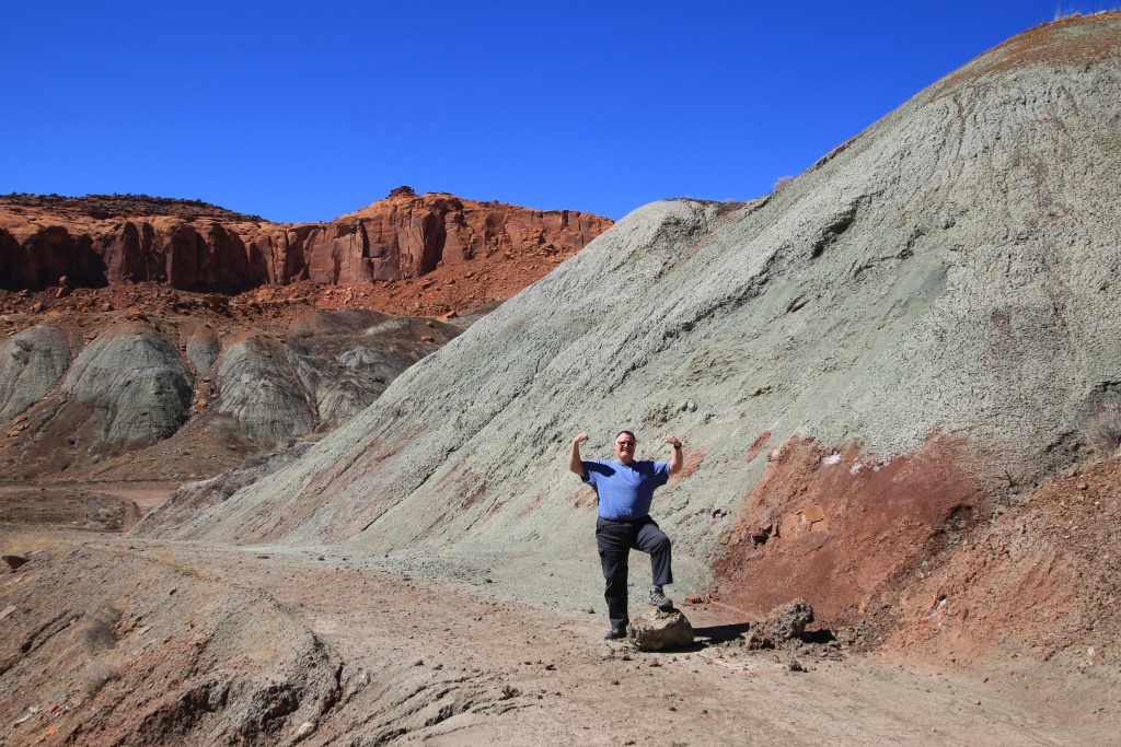
Further on, we took a cross track leading west toward North Blue Valley Road, and continued on it north. At the foot of the Factory Butte plateau and Moon Overlook lies a wide expanse of grayish hills, with San Rafael Swell in the distance. A landscape from another world.

53598938893_99173e1646_o.jpg


We drove a short distance on North Blue Valley Road before turning back out of caution as the road descended a long, still wet slope. On the way back, the sinking late afternoon sun lit up this special landscape, with the Henrys Mountains in the background.

53598938903_9eb93986b3_o.jpg


We are still deciding on our activities for tomorrow because the snow is still too present to be able to enjoy it around Torrey.
 
Day 29:

Starting point: Torrey UT
Ending point: Torrey UT

Distance driven: 289 km
Distance hiked: 12.7 km

We had another beautiful sunny day, with barely a few clouds in the afternoon. The temperature even rose to 18C, a bit warm in the blazing sun.

To start the day, hoping to get some useful information, we made a stop at the Capitol Reef National Park visitor center to get the status of the roads we wanted to travel. The Ranger who greeted us said that they had no recent information on the state of these roads, but that given the recent precipitation, it must be very muddy, even impassable, and that she would not even dare to go there with your personal vehicle. I have to say they are more concerned with covering their behinds than providing useful information. All the roads we wanted to travel on were in exemplary condition. We even saw a Dodge Charger at the Wolverine Canyon trailhead! Waste of time... Okay, enough venting, let's move on to the interesting stuff!

So we started our day by traveling through Notom-Bullfrog Scenic Byway. This road runs along the Waterpocket Fold for some distance. Among other things, we wanted to check the accessibility of certain potential activities. We stopped and climbed a hill for a spectacular view of this fold in the earth's crust.

53601282549_71aff7769c_o.jpg


53600941261_04090ef129_o.jpg


At the top of the Waterpocket Fold, Peek-a-boo Arch stood proudly in this splendid setting.

53601406865_9547d244cc_o.jpg


We recognized other points that we saw up close when we hiked one of the most beautiful hikes in Capitol Reef NP, the Upper Muley Twist Canyon Loop (see message from March 29, 2013). From this high point, the view is simply extraordinary.

53601282519_18ee0301aa_o.jpg


Further on, we joined Burr Trail Road and its long switchbacks climbing to the top of Waterpocket Fold.

53600072157_1faa389201_o.jpg


Next, we joined the east end of Wolverine Loop Road, then continued onto Wolverine Cutoff Road, then joined the southern section of Wolverine Loop Road. This area is very spectacular with its high colorful cliffs.

53601406805_33690a0462_o.jpg


53601406795_c810afe4b3_o.jpg


53600072092_97c20c8877_o.jpg


We then reached the start of Horse Canyon Road, running through a narrow canyon and the end of which must be hiked because it is included in the North Escalante Canyons Instant Study Area. Unfortunately, we ran into a long section that was still flooded and muddy, so we turned back.

53601406760_f4e812e732_o.jpg


So we decided to go do another hike in a nearby canyon, backtracking a bit on Wolverine Loop Road then taking Moody Creek Road then Silver Falls Road.

53601152858_f8f1478601_o.jpg


We sometimes encounter small pitfalls without too much seriousness. It feels good to get out of the vehicle to stretch your legs and arms!

53600941116_b54d9afd3b_o.jpg


A little further, the road ends at the border with Glen Canyon National Recreation Area. We prepared for a moderately long hike up Silver Falls Creek, but it turned out to be much longer than expected, despite it already being late.

At first, Silver Falls Creek is lined with bentonite clay hills, but as you progress, the canyon closes in and tall cliffs line it.

53601282264_003b11061e_o.jpg


53601282329_b3dfca87c4_o.jpg


We came across some large pieces of petrified wood, probably from the nearby Wolverine Petrified Forest.

53600941061_ffc56ff242_o.jpg


Our turnaround point was some petroglyphs in the canyon. However, since we hadn't planned to hike this hike, we only had rough coordinates and no description. So we didn't find them and turned back. The return took place while the sun was beating down in the canyon without any wind. Additionally, we were heading back toward the headwaters of Silver Falls Creek, adding to the effort.

53600941056_331b34b323_o.jpg


53601152738_78d7a45682_o.jpg


The hike originally estimated between 6 to 8 km therefore turned out to be 11.2 km. When I got to the vehicle, I felt unwell, probably due to the heat and too little meal this afternoon. After eating and drinking a lot, my form returned and we took the road in the opposite direction. It was then already 6:15 p.m.

After reaching the Burr Trail Road, which was paved at this point, we decided to stay on paved roads because we knew the sun would set long before we were back in Torrey. We therefore joined the UT 12 road heading north. We thought we had made a good choice, but the presence of a large number of deer along the road slowed us down on many occasions.

We finally arrived in Torrey and quickly reached the Subway restaurant, only 20 minutes before closing at 9:00 p.m. A day way too long...

 
Day 30 :

Starting point: Torrey UT
End point: Escalante UT

Distance driven: 287 km

Still feeling a little tired from our long day yesterday, we decided to take a drive on Cathedral Valley Road in Capitol Reef National Park. This is another route that the Rangers at the Visitor Center did not recommend yesterday morning...

At first the route runs alongside Caineville Wash which was still slightly wet in places. It then circulates in an area of bentonite clay, which is completely dry today.

53601872122_3a2a33d060_o.jpg


53602955393_fff46c71f8_o.jpg


53603213115_4a2ee2907d_o.jpg


Queen of the Wash, a high mound of bentonite is visible from a very distance, with in the background the high reddish cliffs bordering Middle Desert to the north.

53602745721_85e01609bf_o.jpg


As we only had a few hours before having to hit the road back to where we will be staying for the next few nights, we only explored the area of Temple of the Sun, visible in the center of the next photo, and Temple of the Moon a little to the left and partially hidden.

53603213045_9f2a9b24bf_o.jpg


53603212970_ee6fdc0c59_o.jpg


Temple of the Moon is a little less imposing. These two monoliths are remains of the eroded cliff.

53601871997_6783fe1eda_o.jpg


Nearby, a natural curiosity, the astonishing Glass Mountain, a mound formed of gypsum crystals.

53603085119_96ec4c55ea_o.jpg


53602745496_abdd0160be_o.jpg


53601871892_0347a85a7b_o.jpg


Unusually, as we were looking at Glass Mountain, two other vehicles arrived in quick succession, two more 4Runners, so the only vehicles in this place were 4Runners! We talked a bit with these people, exchanging tips and recommendations. The shopping list is growing!

We then took Cathedral Valley Road in the opposite direction to head towards Escalante. We again drove along the cliffs at the foot of which runs West Factory Road, which we took a few days ago.

53602745476_7ef8021020_o.jpg


Back on UT 24, we opted to take Old Notom Road then Notom-Bullfrog Road which we had traveled yesterday.

We then made a small detour onto Spring Canyon Road, a rather pretty unused track leading toward the top of a plateau overlooking Strike Valley.

53602955008_a75b4251e3_o.jpg


53603212805_7fa85587d0_o.jpg


53602954973_851229bb0c_o.jpg


Although the road was in good condition at the beginning, its condition deteriorated when we reached a large area of bentonite clay, with deep cracks and some muddy passages. The tires sank about 10 centimeters into the soft ground.

Further on, we reached the edge of a stream that should be dry, but with the moisture in the ground and the melting of the recently fallen snow, the bentonite was too muddy to continue. There were only old and not very obvious tracks to follow. This is what I was able to see on Google Earth during our planning. We turned around, having to go through the same obstacles again.

53602745371_7e63d9cd6e_o.jpg


We joined Notom-Bullfrog Road again heading south towards Burr Trail Road. Clouds were appearing but we were blessed with a rare clearing as we crossed one of the most spectacular point of this route.

53603212660_fc2281fdc6_o.jpg


Rejoining Burr Trail Road, we once again ascended the many switchbacks, reaching the paved section just as a light downpour hit us. Further on, the section of Red Canyon that we hiked yesterday with the sun setting in our faces, too tight in time to be able to enjoy it.

53602745356_f4abccf4ca_o.jpg


53602745366_2754154ed7_o.jpg


We then completed Burr Trail Road in Boulder UT, then took the beautiful UT 12 route, but under the clouds. As we will certainly return to this route during the next four days, we did not stop.
 
Day 31:

Starting point: Escalante UT
Ending point: Escalante UT

Distance driven: 89 km
Distance hiked: 15.3 km

We once again had a wonderful day, with the main attraction being hiking a portion of the famous Boulder Mail Trail. This 24 kilometer long trail was established in 1902 to transport mail and other goods by mule between the isolated towns of Escalante and Boulder. In 1911, the Forest Service installed a telegraph line between trees and poles as needed. The line was used until 1955 when a microwave link replaced it. In 1940, when UT 12 was built, the Boulder Mail Trail was abandoned.

This magnificent hike is normally completed in a few days. We simply started near its northern end in Grand Staircase-Escalante NM and reached a point overlooking Death Hollow Creek in Phipps-Death Hollow Outstanding Natural Area.

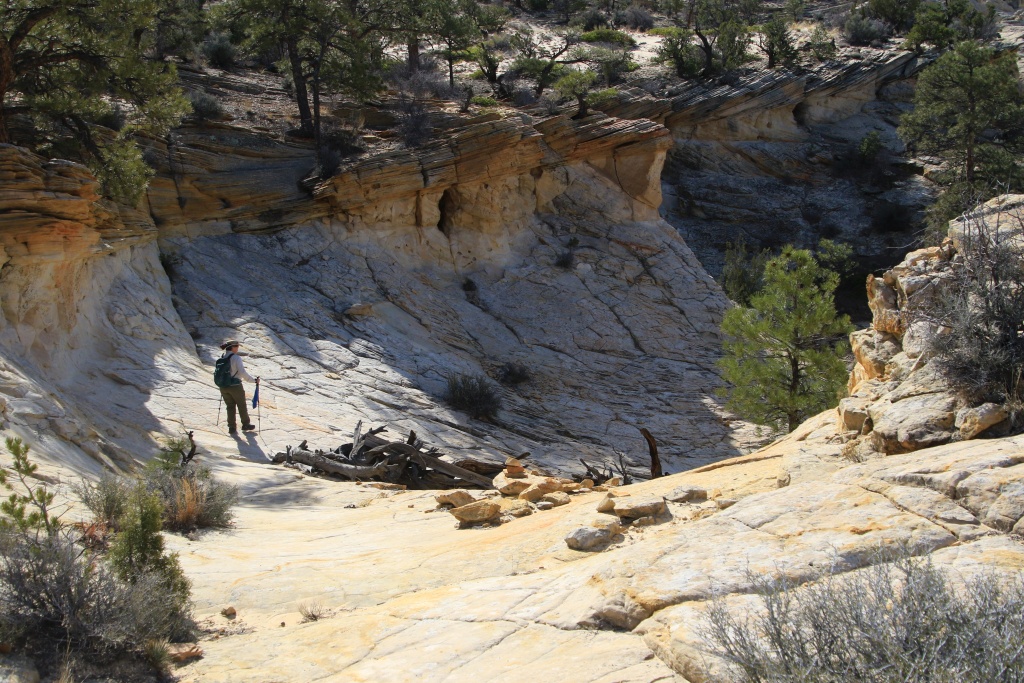
We saved a few miles by starting on McGath Point Road. After a little over half a kilometer, we joined the Boulder Mail Trail and a little further, began the descent on the petrified dunes of white, yellow and a little orange.

53605054214_12a2f073c0_o.jpg


The very popular path is very well marked with cairns. This is very useful because at certain times, without these landmarks, it would have been difficult to get your bearings.

53603839887_fecfd6fdb8_o.jpg


53604715601_a1fd517a13_o.jpg


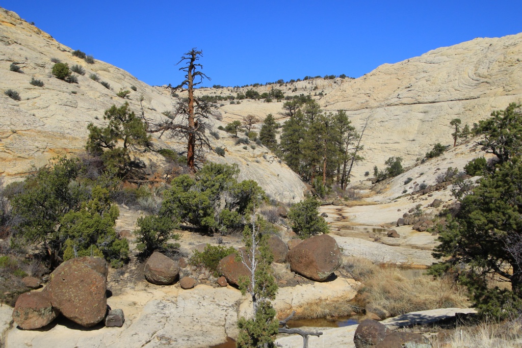
We continued our descent towards Sand Creek. At this location, rocks of volcanic origin have become very present, accumulated in the low points.

53604928523_fdcbcb3cf5_o.jpg


A sign of spring which has finally arrived, a few shy flowers were growing in crevices to collect a little water during precipitation. There were also many conifers, including large pines, and numerous clusters of cacti.

53603839847_62b2447818_o.jpg


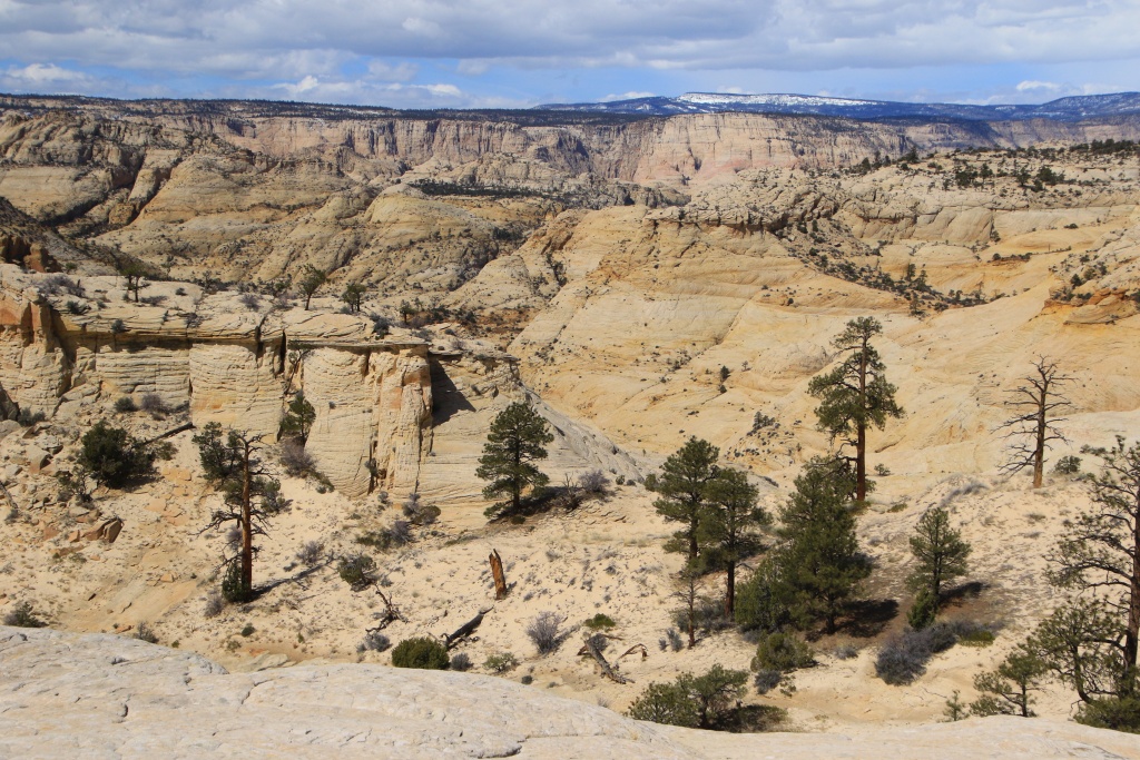
The landscapes are grandiose, with numerous mounds, patterns similar to brain cells, waves, etc.

53604715586_d21196e8f8_o.jpg


53605175630_bafe7c62d5_o.jpg


53604715541_ac6d21169d_o.jpg


At some point we joined the route of the telegraph line, with the single wire attached to the trees with insulators.

53603839817_b7689d8a3a_o.jpg


After crossing Sand Creek which was flowing with a good flow of very clear water, we regained altitude to reach Slickrock Saddle.

53604715546_63efbfa0a8_o.jpg


We deviated a bit from the official trail to reach a point overlooking Death Hollow. We then had more than 7.5 kilometers covered. We took advantage of the place, in the shade of a large pine tree, to have a good snack and to rest. At that moment, we heard screams coming from below Death Hollow. A group had likely just crossed Death Hollow Creek and was heading up the other side.

53605054144_e40893ac16_o.jpg


53604928398_1dd32500dc_o.jpg


Then, given the distance and the significant difference in altitude to go down and up, we began our return following the same route. As is often the case, clouds began to form near the surrounding mountains, providing us with some welcome shade on several occasions.

53605175575_2b4530389b_o.jpg


Further on, we saw Sand Creek and the long line of vegetation taking advantage of the presence of water.

53603839772_a52cb6081e_o.jpg


As we departed Sand Creek and began our ascension, one of its tributaries carved out the rock with a certain elegance.

53605175515_257e45796a_o.jpg


53603839732_3c662891c0_o.jpg


We continued the long climb, with more insistent clouds in the distance.

53605175510_46d8415388_o.jpg


We finally reached the 4Runner, after a superb hike of almost 7 hours. We had dreamed to do this trail since several years.

As we were quite tired and it was getting quite late, we headed back towards Escalante, stopping a few times on the side of the UT 12 Scenic Byway, between the clouds becoming very insistent.

53604715456_301bd85d67_o.jpg


Tomorrow, we should cover more distance by vehicle because we are going to rest our legs and knees a little.
 
Day 32:

Starting point: Escalante UT
Ending point: Escalante UT

Distance driven: 174 km
Distance hiked: 5.5 km

Our first goal of the day was to reach some viewpoints overlooking Death Hollow, the point at the end of our long hike yesterday. As we were still feeling a little tired from yesterday, we did one hike of a few kilometers in addition to many shorter ones.

The first viewpoint is accessible by hiking an old abandoned road that runs along the cliff, offering spectacular views all along its route.

53605905432_463f8691ce_o.jpg


53605905422_b5e5ed0985_o.jpg


The Escalante River is visible in the next photo, along with a series of cascading, water-filled pools just a little higher than the river. Also visible are some hikers' trails down in the canyon. We knew that it was possible to descend towards the river at this point, passing through a series of ledges and plateaus. We think we know the route and perhaps this will be a hike for a future trip.

53607243965_d17a06fc0b_o.jpg


53606778591_bcc248c76b_o.jpg


53606989978_984f689eb9_o.jpg


The second viewpoint allowed us to see the confluence between Escalante River and Sand Creek which we crossed during our hike yesterday, but a few kilometers further up towards its source. Sand Creek is the stream that carved the canyon into the reddish rocks.

53606989973_9e25ed4933_o.jpg


53606778531_23680aabf3_o.jpg


53606778521_554065c5b3_o.jpg


Very close on the same trail, we went to see this series of hoodoos. We wanted to go to the other side to get better lighting from the sun, but we quickly changed our mind because they are located right on the edge of the cliff!

53607119784_0178fdd975_o.jpg


53605905357_8669e1e68c_o.jpg


After a real meal in Escalante, we headed to Alvey Wash Road and Smoky Mountain Road. We wanted to check its status in preparation for our next trip to Page AZ in two days. This 124 kilometer long road between Escalante and Big Water UT is quite isolated. Although at first it was in immaculate condition, we went through some snow and mud as we gained altitude. We turned around because the clouds were too present to highlight the landscapes. We should be able to cover part of it starting from Big Water in few days.

53605905342_e5be3f3fea_o.jpg


53605905322_4e56b9079f_o.jpg


53607243975_a3740403b6_o.jpg


Back in Escalante, we continued on Cedar Wash Road, then onto Hole in the Rock Road. We checked the water level in Harris Wash for a possible hike into Bighorn Canyon, but it seems to be still too high. We continued onto Hole in the Rock Road which crosses very beautiful and varied landscapes.

53606989908_f8a9573e38_o.jpg


Further on, we turned off Harris Wash then Buckaroo Flat Road, wanting to explore a little randomly. This road runs between reddish hills and large flats.

53606989913_71e4637544_o.jpg


53607243905_06a6048d3e_o.jpg


53606778371_cd96eabe23_o.jpg


We took a short track leading to a promontory overlooking Aetschi Baetschi Tower, a rock formation marked on maps in our navigation software, GaiaGPS. This rocky spur is surrounded by very colorful hills sculpted by erosion.

53606989863_eb01b6ffb9_o.jpg


53606778401_959098ff2d_o.jpg


As some precipitation is expected tonight, we don't know exactly what we will do yet. We'll see tomorrow morning.
 
Day 33:

Starting point: Escalante UT
Ending point: Escalante UT

Distance driven: 308 km
Distance hiked: 4.1 km

In search of blue, and white... We got up under the clouds, with a strong wind and a low 1C. We had planned to do a hike a little to the east, but as it was a little rainy, combined with the discomfort of the temperature we felt, we hesitated. Then we noticed a clearing heading west, that of Bryce Canyon National Park, so the decision was quickly made to head towards that place.

So we headed out on the UT 12 Scenic Byway, stopping at various viewpoints, including this one towards Powell Point, a future off-road destination, but definitely not this trip!

53608250137_c54bf70361_o.jpg


Arriving at Bryce Canyon NP, we hiked a short section of the Rim Trail near Sunrise Point. The fresh snow from the night was beginning to melt and had turned the trail into a field of very slippery mud and puddles. But all this had little importance in view of the grandiose panoramas of the place.

53608250142_90fcc2cfa6_o.jpg


Looking towards Sunset Point, we noticed a few hikers risking the descent. From experience during our trip in April 2010, I would not dare to hike in these conditions. We then completed a loop, starting early before the sun melted the snow. At some point during the climb back up, one of my feet had slipped and I almost fell towards the descending slope. Not fun at all, this memorable memory.

53609127026_dc9a2bb511_o.jpg


53609465599_12fa6eb390_o.jpg


After, we went to Sunset Point.

53609465594_78c09c9b5c_o.jpg


53609465579_8f318c809d_o.jpg


53608250032_6ee9eb3d0c_o.jpg


As we were so close, we continued on UT 12 towards the Red Canyon area in Dixie National Forest. Among other things, we wanted to check if it would be possible to hike tomorrow morning as we head towards Page AZ. Although some areas appeared dry, others were still covered in snow.

53609584010_020db9d98a_o.jpg


53609465549_877e5244e8_o.jpg


We then turned around and decided to check if Cottonwood Canyon Road, located in Grand Staircase-Escalante National Monument, would be a possible option for our trip tomorrow to avoid a long detour of more than 200 kilometers on paved roads.

53609336653_84661a15ff_o.jpg


At one point, we encountered massive congestion!

53609465524_d7c6387e95_o.jpg


Further on, we stopped to see the spectacular Grosvernor Arch again.

53608249917_5a98f3b463_o.jpg


Further south, the road enters Cottonwood Canyon proper, one of the most spectacular sections.

53609583880_36b42509cc_o.jpg


53609465519_ecba0b003f_o.jpg


53609465499_0a38a0bb94_o.jpg


53609336428_8319ed3c60_o.jpg


We covered almost half of it, about 35 kilometers without any problems, then turned around to return to Escalante. Unfortunately, as we did not encounter any vehicles coming in the opposite direction, we cannot be certain that a section further south and which is often problematic is passable. We'll find out tomorrow morning!

53609336453_bf98e37d49_o.jpg


53609336443_ca3159cee5_o.jpg


Back on UT 12, the sun sinking towards the horizon illuminated the cliffs.

53609336423_3bc3a569ac_o.jpg


Tomorrow we will leave Escalante towards Page AZ. Our plan is to drive the entire Cottonwood Canyon Road, making several stops to see certain points of interest. If we have to turn around because of the problematic section, we have several options. In this case, it is likely that tomorrow's message will be delayed a bit!
 
Day 34:

Starting point: Escalante UT
Ending point: Page AZ

Distance driven: 253 km
Distance hiked: 2.4 km

We left Escalante UT with a few clouds clinging to the distant mountains to the north, while the sky was mostly cloudless to the south, the direction we were heading in Grand Staircase-Escalante NM. As hoped, we were able to drive the entire Cottonwood Canyon Road as its condition was very dry and minimally damaged.

As always, it is unthinkable to travel this route without marveling at the festival of colors and shapes.

53611909840_81ae3a5012_o.jpg


53611909790_f6f6f6d22d_o.jpg


53610586292_30fd9c9325_o.jpg


We took a break to go hike to Purple and White Hogback, a photogenic hill. We were careful not walk over it to prevent further erosion because it is made of very friable rock.

53611797259_0011be850b_o.jpg


53610586327_366ec432d6_o.jpg


53611460161_05eecd988a_o.jpg


53611460141_21da1ca87c_o.jpg


A little further south, we took Brigham Plains Road climbing steeply up the mountainside to reach the Brigham Plains plateau. The climb offers a spectacular view of The Cockscomb, an other fold in the earth's crust, similar to the Waterpocket Fold that we saw in Capitol Reef NP.

53611460106_13365010b5_o.jpg


53611460086_cc3b780f7d_o.jpg


Although the panorama is unrivaled, the undisputed star of the place is the view towards the splendid Yellow Rock, located on the other side of The Cockscomb. We hiked to this one during our March 2013 trip.

53611909735_431622e1e4_o.jpg


53611797279_2489b42992_o.jpg


Not knowing the conditions at the other end of Brigham Plains Road, and since the climb we had just climbed was somewhat eroded, we decided to return to Cottonwood Canyon Road. We then crossed the area which could be problematic, this large expanse of gray bentonite clay giving a somewhat unreal appearance to the landscape, with The Cockcomb in the background.

53610586207_ce3ddb2d4b_o.jpg


Finally wanting to know the condition of the descent from the Brigham Plains plateau, we reached the east end of Brigham Plains Road and entered the canyon carved by Coyote Creek in which the trail runs. We quickly noticed that it is not maintained and we encountered some more delicate passages.

53610586182_2ca8dbe79b_o.jpg


53611671323_437c269cfa_o.jpg


We went over a few, but realized that if it wasn't maintained there, the descent wouldn't be either and certainly in much worse shape. Although a few old trails seemed to continue, we decided to turn back.

We then completed Cottonwood Canyon Road and joined US 89 and headed towards Page AZ. We were curious to see the effect of the increased water level in Lake Powell. So we took a detour into Glen Canyon National Recreation Area to see Lone Rock up close. Last winter, a thin stream of water flowed at its foot. Today, Lone Rock had become an island again.

53611671318_6fa98bc858_o.jpg


Finally, we made one last classic stop at Wahweap Overlook, overlooking Wahweap Marina in Glen Canyon NRA.

53611909715_d820042d6b_o.jpg


Despite the late afternoon clouds, the weather for the next few days is good and we will take the opportunity to go on long hikes, as well as some fairly remote roads.
 
Day 35:

Starting point: Page AZ
Ending point: Page AZ

Distance driven: 135 km
Distance hiked: 10.9 km

A dream come true! Today we finally completed a long hike in the Paria-Hackberry Wilderness that Nancy had planned back in 2019. During our Winter 2020 trip, we planned to hike it on March 15, 2020, which is when we decided to end to our trip due to the COVID-19 pandemic. A little over four years later, we made it!

The hike begins on Cottonwood Canyon Road and quickly reaches a steep and grueling ascent of the oblique layers of The Cockscomb (as the slope was in shadow, I preferred to take photos on the descent at the end of the day). Once at the top of the slope, the view was magnificent.

53612850877_56e5bddbca_o.jpg


Then, we continued the ascent and reached an area of very beautiful rocks sculpted by the wind.

53614062619_781c954257_o.jpg


53614062634_0f6f37d3a9_o.jpg


Nearby, we reached a promontory overlooking the yellowish layer similar to that of nearby Yellow Rock. Here too, the rock had beautiful colored patterns. At the very top of this slope sat the Cottonwood Hoodoos.

53614174410_4bb31d7469_o.jpg


53614063509_2f9454a022_o.jpg


Towards the north, the yellowish layer continues in the hills.

53613934338_a03603d60e_o.jpg


53614175510_4386a92f85_o.jpg


Continuing with a much more moderate climb, we followed a long ridge offering very beautiful views of the hills and Castle Rock.

53614059204_2cc29aaa21_o.jpg


53613929793_a1ddda4d81_o.jpg


Further on, we reached another promontory in front of Castle Rock. We had a good snack in front of this great landscape.

53614171440_f451a45a8d_o.jpg


A little further on we reached another viewpoint, this one towards Hackberry Canyon.

53613929768_d65ca1a656_o.jpg


53613722466_ca90231a35_o.jpg


We planned to continue further towards another promontory overlooking Hackberry Canyon. However, the terrain had become quite uneven and it would have taken us a long time to reach the point. As the place where we were already offered a beautiful view, we took advantage of it and then began our return.

Visible in the distance is Yellow Rock and the Paria River Valley area, an area we should visit in a few days.

53614170750_c350a7ac97_o.jpg


Further on, we crossed Cottonwood Hoodoos rock again. We were a little hesitant to take a little detour, but as it was already getting a little late, we postponed it for another time, perhaps.

53613718406_6c75edbb2b_o.jpg


As we approached the final descent, with a little apprehension I must say, we took one last look at an area just to the north, with other beautiful wind-sculpted formations.

53614059334_e84c1f7621_o.jpg


Then we reached the top of the steep slope. The descent seemed to us to be more intimidating than the ascent. On the other hand, I was surprised by the grip offered by the ground. Slowly but surely we made our way down the slope without any problems.

53612847457_df6f97b369_o.jpg


53613718396_d4e69d1bf9_o.jpg


Tomorrow, we hope to be able to cover a long road that we have already covered, and push even further to discover other sumptuous landscapes.
 
Day 36:

Starting point: Page AZ
Ending point: Page AZ

Distance driven: 198 km

We got up quite early because we wanted to do a fairly long drive in Glen Canyon National Recreation Area and Grand Staircase-Escalante National Monument. We had previously traveled Warm Creek Road and Sitdown Bench Road on our fall 2016 trip, but turned around when we reached the intersection of Croton Road as well as Grand Bench Road. The objective of the day was to explore these two routes.

We made a few stops on Sitdown Bench Road, a very spectacular road running through areas of very colorful bentonite clay. During our trip in February 2023, we were forced to turn around on several attempts because the road became impassable. Today, although it sometimes showed deep traces of vehicles having had difficulty traveling, the road was completely dry and therefore passable.

53615966969_1276bc742d_o.jpg


We had planned a hike following the bed of Last Chance Creek but there was still a lot of water and mud. We postponed this until next time and continued further on Sitdown Bench Road.

53614781627_8d374dc355_o.jpg


53614756542_e9147b6614_o.jpg


53615627341_b614920288_o.jpg


53615835318_ecea4defd2_o.jpg


After reaching our turnaround point on our fall 2016 trip, we continued on Croton Road. This rises in altitude to eventually join Smoky Mountain Road. Our goal was only to drive the climb to the top of the mountains and admire the different viewpoints.

53616077560_fbc7148182_o.jpg


53615627266_c950244a76_o.jpg


53614756457_948fa2bd06_o.jpg


53615966829_f74ae2f94a_o.jpg


Near the summit we began to see Lake Powell in the distance. At this point, a more delicate passage awaited us, but we passed it without too much difficulty. This is the only place requiring special attention, apart from a large rock on the road which left us very little space to pass by near the edge of the precipice!

53615627226_bde9558c4c_o.jpg


Even in these remote and high altitude places, flowers are starting to become more and more present.

53614756427_4d721c901b_o.jpg


After returning to the intersection, we continued on Grand Bench Road.

53615627221_5edce79c43_o.jpg


We were surprised to see that the road joined a horse enclosure, with living quarters in containers and breeding equipment. We were uncomfortable crossing the enclosure at the risk of one or more of the five horses escaping, despite the fact that there was a sign indicating to keep the fences closed. As the most difficult portion, the descent and ascent of a canyon, was just after this enclosure, it would have been necessary to cross it and risk returning immediately if the road was impassable. And to add, I am extremely allergic to horses.

53616077495_3fa3d16405_o.jpg


We reluctantly turned back, feeling frustrated that someone would set up like this on a public road in a park.

On the way back, we thought about doing other activities nearby, but the presence of clouds covering the beautiful blue sky that we had had since the morning discouraged us a little. Since we were greatly due for another laundry task, we returned to Page early to do it.
 
Day 37:

Starting point: Page A-Z
Ending point: Page AZ

Distance driven: 172 km
Distance hiked: 12.6 km

As our main activity for the day, we did a long hike in the area called White Rocks, very close to Church Wells UT. In the past, it was possible to reach this beautiful area by vehicle, but since its designation as a Wahweap Wilderness Study Area, access must be done on foot. We traveled a large loop going clockwise, starting with a large wash. We saw a local resident who, oddly enough, stayed quietly to pose.

53617558506_c83b8c7a83_o.jpg


As its name suggests, the White Rocks is mainly composed of a very friable immaculate white rock, with several layers of different colors. The main attraction is undoubtedly the high number of hoodoos.

53617893084_06627f315c_o.jpg


53617765078_509a98a776_o.jpg


53617765033_fb2c694aa9_o.jpg


Several of the formations or hoodoos have names, including this one aptly named Zebra.

53617765068_7ace0d675e_o.jpg


We left the wash to reach the top of the plateau. The white rock then gave way to harder and colored rock.

53618004610_ef9f2bb25e_o.jpg


53616684257_41ee497a43_o.jpg


After walking a short distance, we reached White Valley with an impressive number of hoodoos, very often with striped pod.

53617765003_ca25d7cf75_o.jpg


53616684187_f8e88e4376_o.jpg


White Ghost Hoodoo and his little brother at his feet.

53617558416_751b112dca_o.jpg


53617558406_83c91a3a26_o.jpg


After crossing White Valley, we reached an intermediate area at the foot of the highest cliff.

53617764948_093d3398c6_o.jpg


We found the right place to climb onto the highest plateau, taking a relatively tricky passage, probably easier going up than going down. On the plateau, we found yellowish rocks streaked with pink patterns, similar to those of Yellow Rock.

53616684142_98f8018caa_o.jpg


We then took a track running along the cliff and allowing us to enjoy a beautiful view of the valleys and canyons below.

53617892914_f810b7f188_o.jpg


Back to the 4Runner, we still had some time to spare. We went to do a little scouting in Paria Valley for our activities tomorrow which will mainly be in this sector.


53616684147_39ee7af084_o.jpg


Tomorrow, we will get back to Paria Valley for short hikes and a few offroad trails.
 
Day 38:

Starting point: Page A-Z
Ending point: Page AZ

Distance driven: 275 km
Distance hiked: 1.0 km

As planned, we returned to Paria River Valley to start the day.

53619685626_9531a254df_o.jpg


We planned to do two short hikes in two canyons surrounded by colorful hills formed of bentonite clay. Once there, the colors were duller than those of the main canyon and did not please the co-pilot and we continued our route by taking Paria Breaks Road, a road that we had partially traveled during our winter 2020 trip.

53619892768_d200a33d3b_o.jpg


53619685526_4914c3cda6_o.jpg


Further on, we took a short detour on Eightmile Pass Road to get closer to pretty hills well lit by the morning sun.

53620129065_4f7587605f_o.jpg


53618808402_a7171e25ba_o.jpg


Next, we completed Paria Breaks Road and continued on Kitchen Corral Road, then Starlight Arch Road, transitioning from the reddish rock layer to the more yellowish one. This road is more of a narrow track running between numerous cedars on excessively sandy soil. The 4Runner will keep good memories in the form of multiple scratches, adding to the many it already has.

As we gained altitude, the view improved over our goal, a hill named Mollie's Nipple (who is Mollie?). This very recognizable hillock is visible from a long distance and serves as a landmark for long-distance hikers.

53620128590_657be63b87_o.jpg


53620019909_c616b10805_o.jpg


We were able to reach the base of Mollie's Nipple and did a short hike on a small part of its contour, the terrain turning out to be much more rugged than we had estimated.

53620019794_2fb303e4dd_o.jpg


53619685161_a095307c02_o.jpg


On the way back on Starlight Arch Road, we could see the area we were heading towards.

53619892303_51afef9834_o.jpg


We continued further, crossed Nipple Ranch, and took Oil Well Road leading to a promontory. The presence of many trees and too many clouds discouraged us from taking beautiful photos.

Returning to Kitchen Corral Road, we were lured to take another detour onto Park Wash Road. This road runs along a small ridge which has several hoodoos.

53619685006_bd7d121aeb_o.jpg


In the distance, Mollie's Nipple was visible.

53620128475_88b14c66d1_o.jpg


53619684921_927af97f3d_o.jpg


As the road crossed Park Wash at one point, we noticed numerous vehicle tracks in the wash. On the way back, we entered the wash, curious to see how far we could go. What a good decision as the wash turned out to look great with many hoodoos.

53618807912_b56a4752e3_o.jpg


53620019524_c35425f1d8_o.jpg


The slopes on the sides of the wash show a long history of deposition and erosion, with multiple layers of varying pastel colors.

53620128400_18da41d9d5_o.jpg


Unusually, we reached the confluence of Park Wash and Lick Wash. Since we had hiked Lick Wash before, we were curious if we could reach our turnaround point on the hike. And yes!

Then we continued as far as we could on Park Wash. This became narrower and narrower, and we inevitably reached a point that was impossible to pass, thus forcing a U-turn.

53620019594_401c98135d_o.jpg


Tomorrow we should do another long hike in Paria-Hackberry Wilderness Study Area, which promises to be spectacular.
 
Day 39:

Starting point: Page AZ
Endin point: Page AZ

Distance driven: 318 km
Distance hiked: 5.4 km

Change of plan, complete U-turn! We had planned to do a long hike in Paria-Hackberry WSA, but as we were en route we quickly realized that we would spend the day under the clouds and that our photos would be rather lousy color-wise. Since the skies were much clearer south of Page, we turned around and headed in that direction.

On US 89 south of Page, we made a short stop at a viewpoint towards the area we were heading to, the Lee's Ferry area in Glen Canyon National Recreation Area. We know this area well, having explored it on many occasions, either from Page by vehicle and by hike, or by the usual access via Lee's Ferry.

53621643716_b37c5cc20d_o.jpg


Once there, we walked the interpretive trail of the various remains related to the old ferry having been established in 1899 in one of the rare places possible to cross the Colorado River.

53621643521_1ccffe3100_o.jpg


53622092660_ac78ac6954_o.jpg


53621975609_b3db36ba97_o.jpg


53622092395_8d69eb1c0b_o.jpg


53621975739_900d4cae12_o.jpg


Next, we continued south into Vermillion Cliffs National Monument, skirting the colorful cliffs of the Paria Plateau. Our objective, in a more or less distant future, is to drive to some points of view located high on the plateau.

53622092400_bb3f080093_o.jpg


We then reached some viewpoints overlooking the Colorado River. This area is designated as a Marble Canyon Area of Critical Environmental Concern, protecting a variety of small cacti. The first trail we took was Badger Creek Road, then Ten Mile Rock Road. Here and there, a few flowers began to bloom, bent under the force of the strong winds.

53620766547_2dd110f1d3_o.jpg


53621643196_4473961497_o.jpg


Further on, we reached the edge of the canyon. From Marble Canyon near Lee's Ferry, the Colorado River, its banks and cliffs are included in Grand Canyon National Park.

53622092155_676a7ff053_o.jpg


At another viewpoint on Ten Mile Rock, the view of Colorado stretched into the distance. We even saw several rafting groups on an expedition on the turbulent river, including one grouping up before a series of rapids.

53621853698_8a030e7d92_o.jpg


53621853143_6c53f33412_o.jpg


53621974119_d1443a1e5a_o.jpg


We then drove one last trail, the one called Marble Canyon Overlook Road, the southernmost of the three we went. This offers an effect of surprise because it goes from left to right, somewhat for no apparent reason, and then the canyon opens before us at the last moment.

53621853128_32202b3131_o.jpg


53621642466_306c45bbc6_o.jpg


53622091605_6a96329a43_o.jpg


53621974219_301338efca_o.jpg


53622091435_5e2fc10ab7_o.jpg


As rain is expected in the area overnight, we do not know how our activities planned for tomorrow will be affected.
 
Day 40:

Starting point: Page AZ
Ending point: Page AZ

Distance driven: 149 km
Distance hiked: 1.5 km

This morning, we had a somewhat slow start, facing conflicting weather forecasts, and unable to use the Internet properly to decide which destinations we were going to head to. We did some shopping since our supplies were dwindling quickly.

We then headed to Antelope Point in Glen Canyon National Recreation Area, very close to Page. We wanted to walk a bit, but frequent downpours kept us in the vehicle.

53624478265_f21efe9a6a_o.jpg


53624239603_8be6961c26_o.jpg


After a lunch in Page, we continued towards Lakeshore Drive still in Glen Canyon NRA.

53624478270_7d3f9cce0a_o.jpg


53624367604_f957bd591e_o.jpg


53624239498_85e8848a3d_o.jpg


Later we returned to Lone Rock to reach the west end of the large beach on Lake Powell, as the wind blew at a good speed and kicked up the sand. We reached the mouth of a secondary canyon.

53624478235_11fae48b01_o.jpg


53624036236_0a05791600_o.jpg


On a previous trip, we started hiking in this canyon, but at its southern end near the US 89, but we gave up due to the presence of water and mud. Today we started at its north end and moved up the canyon a bit.

53623147712_676a70df68_o.jpg


53624239488_503740cb35_o.jpg


53624036251_47644a5f78_o.jpg


Since we still had a little time left, we drove a short segment of Nipple Creek Road, a road we had traveled very early one morning during our fall 2016 trip. The southern section of this road is much more beautiful with the late afternoon lighting.

53624478125_d95ef103a1_o.jpg


We were intrigued by a side track heading towards the cliff to the north. This enters a small valley of gray bentonite clay bordered by beautiful cliffs, then continues climbing the hills to reach a beautiful viewpoint overlooking Wahweap Fish Hatchery.

53624239383_93c83ebdec_o.jpg


53623147627_5492121508_o.jpg


53623147602_09eee1556c_o.jpg


53624367384_5217f1a27f_o.jpg


53624239368_709afc56b9_o.jpg


As it was getting late, we turned around and took one last look at this beautiful place.

53624478080_bccde7be85_o.jpg


Tomorrow, as the weather forecast seems to be favorable, we should do our last long hike in the Page area for this trip.
 

Members online

No members online now.

Forum statistics

Threads
278,310
Messages
3,554,080
Members
248,016
Latest member
Advally Service

Trending content

Back
Top