Last hurrah

What trail(s) are you going to do on Saturday? Fins n Things is the classic Moab trail as you are going up and down slickrock, with some broken choppy areas and sandy areas as well. Hells Revenge is more slickrock and much longer climbs and descents. Both are fun and right in town.
 
If you are going back through that area next week, Cruise Moab is going on second half of the week.

That would be cool, but I'm pretty much done. Moving east to Dodge City after Pike's Peak, then OKC for the Murrah building. And then it looks like I may be back ON for the Toyota Jamboree beginning next Thursday (30 April). I'm going to see if I can win the prize for the guy who traveled the farthest to be there. :becky:

I'm cutting about 800 miles off the trip, but the tank is running low. I've seen a lot of extra things I never planned on, and you folks who made recommendations have my heartfelt thanks.
 
My Photobucket is full, so I'm going to have to add attachments instead. Which means I won't be able to provide commentary for each picture or group. Which kind of sucks...

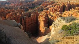
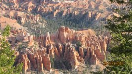
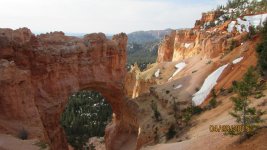
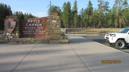
Bryce Canyon NP was first on the list today. It was a little hazy when I first got there but I did manage a few decent pics.
 

Attachments

  • IMG_2853.jpg
    IMG_2853.jpg
    141.7 KB · Views: 476
  • IMG_2860.jpg
    IMG_2860.jpg
    144.1 KB · Views: 452
  • IMG_2867.jpg
    IMG_2867.jpg
    150.8 KB · Views: 456
  • IMG_2875.jpg
    IMG_2875.jpg
    141.7 KB · Views: 452
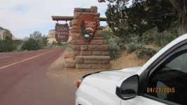
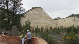
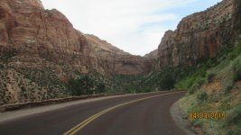
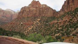
Then it was on to Zion NP about 75 miles NW of Bryce Canyon.
 

Attachments

  • IMG_2890.jpg
    IMG_2890.jpg
    135.9 KB · Views: 464
  • IMG_2892.jpg
    IMG_2892.jpg
    140.8 KB · Views: 461
  • IMG_2909.jpg
    IMG_2909.jpg
    138.2 KB · Views: 453
  • IMG_2913.jpg
    IMG_2913.jpg
    144.8 KB · Views: 478
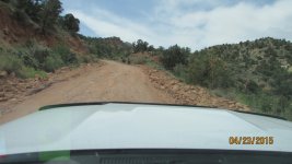
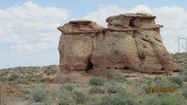
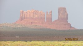
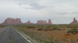
I exited Zion on the south side and punched Monument Valley into the gps. My first 6 miles were taken along the Smithsonian Butte Scenic Byway. I kid you not I had to put it in 4 lo for the first half mile up a rough rocky grade that probably climbed 300' in that distance, because my tires are still aired up at 38 PSI and it was like riding on superballs. After that it became a well maintained dirt road for about 6 miles, which dropped me onto AZ-98. I then zigzagged across the AZ/UT border about 3 times over the next 3 hours heading generally east before turning north into Utah along a high mesa. Monument Valley is quite pretty and maybe 20 miles long. I got there with about an hour of usable light and continued north to Monticello for the night. The pictures from Monument Valley aren't great because there was a slight overcast and haze.
 

Attachments

  • IMG_2924.jpg
    IMG_2924.jpg
    133.5 KB · Views: 429
  • IMG_2932.jpg
    IMG_2932.jpg
    137.4 KB · Views: 427
  • IMG_2968.jpg
    IMG_2968.jpg
    132.1 KB · Views: 438
  • IMG_2970.jpg
    IMG_2970.jpg
    128.5 KB · Views: 440
What trail(s) are you going to do on Saturday? Fins n Things is the classic Moab trail as you are going up and down slickrock, with some broken choppy areas and sandy areas as well. Hells Revenge is more slickrock and much longer climbs and descents. Both are fun and right in town.

I'm meeting Jhalco there tomorrow night or Saturday morning. He'll be the host and I will be following his lead.
 
GOD this sucks! My Photobucket is full and I can't find a free pic hosting site that I trust. I'm in the middle of nowhere and the broadband here sucks!

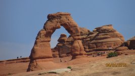
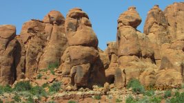
I spent the day in Arches NP, including running 17 miles of the Tower Arch trail, which has a moderate rating. Took me about 2 1/2 hours to run that trail and I used the CRAWL mode twice to get through a couple rough looking sections. No scrapes or bumps, but I was wishing I had installed those Budbuilt skids I'm carrying around. It would have just given me some peace of mind.

Here are a few teasers. At least until I figure out how to get some of these pictures uploaded and linked.
 

Attachments

  • IMG_3047.jpg
    IMG_3047.jpg
    137.6 KB · Views: 365
  • IMG_3015.jpg
    IMG_3015.jpg
    131.1 KB · Views: 360
  • IMG_3017.jpg
    IMG_3017.jpg
    145.4 KB · Views: 358
Quite the tunnel at Zion huh. I entered, couldn't see, switched lights on, couldn't see and realized I had transition glasses on, and realized they wouldn't lighten fast enough, took them off, and them couldn't see because no glasses on.

Friday night in Moab - bet it is busy as hell, and hundreds more arriving during the night.
 
I exited Zion on the south side and punched Monument Valley into the gps. My first 6 miles were taken along the Smithsonian Butte Scenic Byway. I kid you not I had to put it in 4 lo for the first half mile up a rough rocky grade that probably climbed 300' in that distance, because my tires are still aired up at 38 PSI and it was like riding on superballs. After that it became a well maintained dirt road for about 6 miles, which dropped me onto AZ-98. I then zigzagged across the AZ/UT border about 3 times over the next 3 hours heading generally east before turning north into Utah along a high mesa.

I know that road well. :-) I visit Zion several times a year for photography, and there are times when the campgrounds are filled to capacity. I usually camp along that road (near the top), then cruise down to the campground at sunrise to grab a site from someone who is getting an early start. I often times don't have a chance to air down my tires as well (since it's such a short distance), but man it sure is a rough ride!
 
Quite the tunnel at Zion huh. I entered, couldn't see, switched lights on, couldn't see and realized I had transition glasses on, and realized they wouldn't lighten fast enough, took them off, and them couldn't see because no glasses on.

Friday night in Moab - bet it is busy as hell, and hundreds more arriving during the night.

That's why I couldn't see! I was trying to figure it out all the way through that tunnel! And I was leading the convoy so there was no one to follow!

And Moab is happenin' today. It doesn't help that there is a big car show this weekend. I'm meeting Jhalco tomorrow at 9 at the visitor center. We're going to wheel for the day and set up camp somewhere away from the crowd.
 
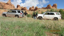
Screw a wet camp. I wheeled with Jhalco until about 1:30. I was very impressed with his Limited. We got in about 25 miles of the milder stuff with a little rock thrown in. Then I left to get a head start on Pikes Peak tomorrow. I'll be meeting Blitzkreig for an early lunch, then a Pikes Peak Hill Climb car museum, then on to the mountain to see how far we can climb it before the road is closed. I ran into falling snow for the first time during the trip coming up through Vail. If there's any stuck on Da Whale in the morning I'll have to get a picture of that. Let me organize some pictures and see how good this motel's wifi is.
 

Attachments

  • IMG_3064.jpg
    IMG_3064.jpg
    145.8 KB · Views: 500
This was the lowest picture count day since I started the trip. I was concentrating too hard on driving and avoiding the big stuff. But I did get a few decent shots. And some good GoPro video to post at the end of the trip.

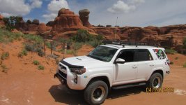
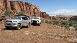
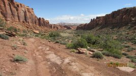
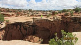
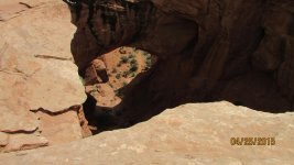
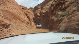
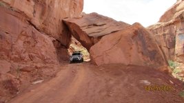
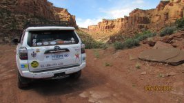
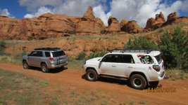
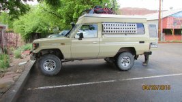
The top shot is a 2000 Land Cruiser that pulled into the lot as we were getting ready to leave. I had to get pictures of this awesome looking thing with a popup top. I think the most difficult trail we ran today was the one into Bull Canyon, but we ran it all the way until it basically dead ended in a walking trail. Then we went over to Gemini Bridge. That trail you can just make out in the hole below the bridge is part of what we ran to get up there. After that we took a wickedly narrow winder down in to another canyon and got a couple pictures of Da Whale parked under a rock. After that trail we boogied back down to pavement and I said my goodbyes to Jhalco so he could go ride his mountain bike and find a place to camp. Of course that took the standard 20 minutes standing around the 4R's and talking before one of us finally had to say goodbye. It's happened with every person I've met on this trip. All of them great people.
 

Attachments

  • IMG_3057.jpg
    IMG_3057.jpg
    141.2 KB · Views: 501
  • IMG_3072.jpg
    IMG_3072.jpg
    143.3 KB · Views: 502
  • IMG_3073.jpg
    IMG_3073.jpg
    141.8 KB · Views: 497
  • IMG_3075.jpg
    IMG_3075.jpg
    142 KB · Views: 504
  • IMG_3078.jpg
    IMG_3078.jpg
    136.2 KB · Views: 498
  • IMG_3090.jpg
    IMG_3090.jpg
    140.2 KB · Views: 498
  • IMG_3094.jpg
    IMG_3094.jpg
    138.8 KB · Views: 492
I've picked up decals for almost every park I've visited. Zion didn't have any but I found one online to order. Badlands ended up being 2 smaller ones in my side windows, but I am trying to find the white oval style for all of the parks. I am also filling a small cooler up with shot glasses from every place that had them. I'm somewhere between 14 - 18 of those right now. Coffee cups were getting to be too bulky after several years of collecting those. These are only for places I have taken the 4Runner in the last 16 months. No cheating by adding places I had previously been. Mount Rushmore didn't have anything I liked, so the one rectangular one I bought there is inside the bottom of the hatch. It is more of a South Dakota decal with Rushmore as part of a collage.
 

Attachments

  • IMG_3074.jpg
    IMG_3074.jpg
    142.8 KB · Views: 478
  • IMG_3063.jpg
    IMG_3063.jpg
    142.4 KB · Views: 494
Last edited:
Looks like you are having a grand 'ol time!

Not sure when you are headed into CO, but thought I'd pass on a useful tool for ya:

Road Conditions, Speeds, Travel Times, Traffic Cameras, Live Streaming Traffic Cameras, Road Closures and Road Work Information provided by Intelligent Transportation Systems (ITS) a branch of Colorado Department of Transportation

Road conditions, web-cams along various roads to see the roads, etc.

I'm in Durango currently, but will be headed to Telluride for a short stop (business), then back home via Ridgway, Montrose, Gunnison, Salida, Canon City, Penrose, Colo Spgs, Franktown, Parker and then home. Storm front moving through has changed the Weather-Guesser's forecast from rainy, to rain/sleet/snow, with up to 18" of snow potentially in the mountains...

Safe Travels and hope I have the chance to meet up with ya if you swing through metro Denver.
 
Thanks for the link. I'm in Frisco and about to leave for Colorado Springs via Breckenridge. I'm meeting Blitzkreig for lunch then we're going to see what we can see with the weather.

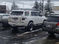
This may not seem like much for you mountain folk, but this was almost enough for this flatlander to go back to bed!
 

Attachments

  • snow.jpg
    snow.jpg
    132.7 KB · Views: 249
Last edited:
Unfortunately, the weather doesn't appear to be cooperating for panoramic views from Pikes Peak. I'm on my way up to the Springs myself and should be arriving about the same time as you. I'll be on the lookout for 'Da Whale'.
 
Unfortunately the weather was completely uncooperative this morning.

It was raining sheets in Manitou Springs and the Pikes Peak Highway was completely closed - wouldn't be able to see anything with the cloud cover anyway. :-(

Pikes Peak -> :closed_2:

Sorry about the weather CJ. Mother Nature can be fickle here in the Rockies.
 

Members online

Forum statistics

Threads
278,309
Messages
3,554,071
Members
248,016
Latest member
Advally Service

Trending content

Back
Top