j0shu@
New member
My buddy is selling his Dad's Fj55. Anyone interested? https://sfbay.craigslist.org/sby/cto/d/1972-toyota-land-cruiser-fj55/6571277927.html
Dam that sold fast, did not even get a chance to check it out.

My buddy is selling his Dad's Fj55. Anyone interested? https://sfbay.craigslist.org/sby/cto/d/1972-toyota-land-cruiser-fj55/6571277927.html

Dam that sold fast, did not even get a chance to check it out.
Soooooo Since we failed the last time around, I vote we go back to High Lakes on last weekend of April? Any takers? I would like to go up Saturday, wheel around for the good part of the day, camp out for the night, wheel around during Sunday and head home NLT noon?
:attention: :director:
Im thinking I will be trying to pull together a trail run on Sat. 5/19/2018.
Details to follow in coming days (weeks?)... just throwing this out there now so y'all can hold the date.
I
Marked in my calendar. The Saturday after my finals. Woot :dance:
A friend just suggested Bald mountain to do as well.... Bald Mountain or High lakes.... I've never wheeled through either of them but willing to do both.
Drool...He just sold it an hour ago. Haha
I'll ask him if still has his photo album up.
Edit:
Here's his post on IH8mud and photos of the fj55
I agree... :nod:Drool...
Anyone know if the trails up in the Arnold / Bear Valley are opened yet? I've been trying to reach out to the rangers station to no avail. Trying to hit up some trails there next weekend.

Anyone know if the trails up in the Arnold / Bear Valley are opened yet? I've been trying to reach out to the rangers station to no avail. Trying to hit up some trails there next weekend.

[MENTION=113049]rochmpr[/MENTION] you're up that way all the time... got any recent updates?


Looks like the snow in Tahoe is getting to more manageable levels and I'm thinking about trying to get some people together for Blackwood Canyon/East Rubicon. Seems like we already got some dates on the calendar for some other stuff but if we can get some date ideas together I'd like to figure out when we can make it happen.

A bunch of family and I are going to eagle lakes for Memorial Day weekend camping and wheeling.
We do it every year and usually get a pretty big spot next to the lake, depending on availability.
Last year we got beat to it but found a good spot just up stream.
Anyone is welcome to join, we will have plenty of food and beers to share.
Eagles off of 80.
Yes sir.
Last year we got in trouble for shooting a shotgun across the river. But we knew no one was over there cause the water was too high and moving to fast to cross.
Ipdated the trip post, and marked Brian's trail run and the HH trip in the calendar.!:rockon:For anyone ones that's interested....
5/19 [MENTION=142877]Folsom4Rnr[/MENTION] is hosting a trail run.
Then...
5/20~5/23 Eastern Sierras (Date's are still tentative)
5/26 Hollister Hills
Ipdated the trip post, and marked Brian's trail run and the HH trip in the calendar.!:rockon:
Hi All:
Hope to see you all out for this... For those that just want the key details... the short story:
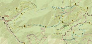
The trail I plan to run is Long Canyon 4WD Trail (and North Shanty 4WD Trail afterwards if there is time).
8:00AM Meet up @ Starbucks at 195 Placerville Rd, Folsom, CA 95630 (its right off HWY50)
8:15AM head up the hill
Approx 9:30AM arrive at staging / air-down spot at intersection of Silver Fork Rd. and Forest Service Rd 11N18 (38°44'51.1"N 120°15'40.8"W) (this is just past China Flat Campground)
10:00AM start the trail run / have fun till day is done
Pack some food and we'll stop someplace along the trail to eat "lunch".
At the end of the day, we'll make our way back to Silver Fork Rd., then to HWY50 to head home.
The longer story .....
I finally got some answers from TNF and EDNF rangers on conditions of a couple of the options I was thinking about. A lot of roads/trails are still closed due to snow, snow drifts and mud conditions.
BUT, I think I've found an option that is doable, so Im going with it... Long Canyon 4WD Trail (and if there is time, North Shanty 4WD Trail which is close by). I spoke to a ranger at the Placerville Ranger District this AM; she checked the 2018 MVUM and some other file and said the trail is open, pending on-the-ground water / mud conditions (which is a typical FS response).
I havent run this trail yet, so I dont have first hand info on it. The source I found it on rates it as "moderate" ... which they define as follows:
"While more challenging than the "Easy" rated trails, drivers of all skill levels can enjoy these trails. At this level a stock high clearance four wheel drive vehicle is required. Trails are typically narrow with possible brush that may scratch your vehicle. Passing usually requires backing up."
However... I believe there info may be a little dated so the actual trail conditions could be anything... so standard disclaimer alert... Use your own judgment and participate at your own risk - I take no responsibility for you/your guests/your vehicle/etc.
[MENTION=157695]theoutbackdream[/MENTION] [MENTION=115347]gamefreakgc[/MENTION] [MENTION=166246]bpchura[/MENTION] [MENTION=173212]dietsoap[/MENTION] [MENTION=116424]insomnia001[/MENTION] [MENTION=156518]Trojan4x4[/MENTION] [MENTION=137954]I35it[/MENTION] [MENTION=175666]-joshua[/MENTION] [MENTION=204767]mlnhtrang[/MENTION] [MENTION=127339]4Reak Show[/MENTION] [MENTION=156224]MORmjso[/MENTION] [MENTION=144752]MarkamisPrime[/MENTION] [MENTION=88231]having fun[/MENTION] [MENTION=113049]rochmpr[/MENTION] [MENTION=120981]Pats98[/MENTION] [MENTION=80668]Loud Runner[/MENTION] [MENTION=45602]ghettoflow21[/MENTION] [MENTION=139950]Brenn[/MENTION] [MENTION=211704]jason2000SR5[/MENTION] [MENTION=102533]SluiceboxSlim[/MENTION] [MENTION=94038]redwolf3[/MENTION] [MENTION=175696]El Burro[/MENTION] [MENTION=146538]Nitro81[/MENTION] [MENTION=125906]Shred_Head[/MENTION] [MENTION=85375]Brookey_813[/MENTION] [MENTION=93018]nghiS4[/MENTION] [MENTION=139229]lukeskywalker[/MENTION] [MENTION=106195]v_man[/MENTION] [MENTION=143718]mrbrenan[/MENTION] [MENTION=132866]ccool91[/MENTION] [MENTION=146753]Bodie the Dog[/MENTION] [MENTION=96750]mfregeau20[/MENTION] [MENTION=169146]sactown[/MENTION] [MENTION=172515]cbassd[/MENTION] [MENTION=146367]Warpkor[/MENTION] [MENTION=218894]nat3ten2018[/MENTION]