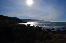
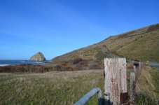
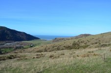
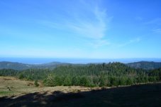
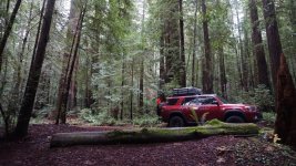
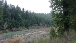
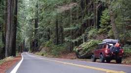
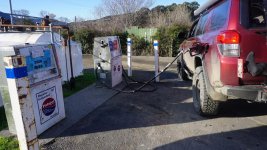
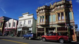
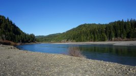
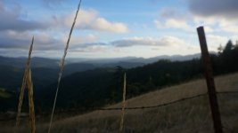
The Humboldt / Lost Coast / surrounding areas thread

Excellent pics!

Yes, once it gets wet those roads get goopy! Even (quasi) maintained county roads like Showers Pass need 4WD in a few spots in the wet.

I used 4hi once, after we turned around on Midslope Rd, going uphill it was a little loose a few times. I basically had it engaged from a bit after we turned around to just after we crossed over the last downed tree. I generally use the transmission in manual mode and keep it in the lower 3 gears except for longer high speed stretches where I am in 4th, sometimes 5th.

The only legit 4WD trail I know around here, that genuinely requires 4Lo, is Devils' Backbone off of Mad River Rock Lookout. We can go do that one anytime you guys want! Josh, you might get to learn a lot about recovery etc on that one, LOL!

I looked up Devil's Backbone and it's listed as a 'difficult' trail. I need more training! Lol and it must be capable of being completed with stock suspension.

I think I'm looking forward to the rains. I'd like to learn good places to explore the river bar also. Maybe I can get into some of that before the rains come and the fish move upstream. Otherwise that'll be something fun to do next summer.

And definitely learning some recovery techniques would be good. I do have a recovery shackle hitch receiver and a recovery strap at least.

It'd be hard for me to know if I needed 4Hi or not, since the V8 is always in 4Hi.

Here are a few videos:

The worst sounds of the drive. The first one is plants on the side, and the second is bottoming out on the last crossing.

Meeting JJ Abrams, also known as "the dude with his huge light bar on in the middle of the day". Doesn't show up that well on the dashcam though.

Timelapse of the Bald Hills Road section. This is at 4x speed which works pretty well in open areas like this. In the more forested areas with trees right by the road, you can't really see anything when you speed up the video too much. At about 0:21 the traction control got mad at me and beeped.

Duuuude! The sounds in the first video make me cringe! We had some pretty loud ones in my 4R too. Like nails on a chalk board.

The other videos are really cool! Especially the time lapse one across Bald Hills Road! Your cam is good quality too and 60 fps yeah? What do you record to? Just an SD?
 
Duuuude! The sounds in the first video make me cringe! We had some pretty loud ones in my 4R too. Like nails on a chalk board.

The other videos are really cool! Especially the time lapse one across Bald Hills Road! Your cam is good quality too and 60 fps yeah? What do you record to? Just an SD?

It's 1080p 30FPS, but when I do timelapses with the footage I render it at 60, since at anything above 2x speed there are enough frames for 60FPS. I also upscale it to 4k first, since that helps stop YouTube from compressing it too much. If I just speed up the footage and throw it on YouTube, the quality pretty much ruins it. And it has a microSD card slot. I think I have a 32GB one in there now.
 
Last edited:
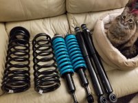
My black friday purchase showed up today. Definitely a weekend project, although not sure which weekend it will actually be. This time of year isn't exactly wide open with free time.
 

Attachments

  • 20181204_175727.jpg
    20181204_175727.jpg
    70 KB · Views: 217
We got a dog. Malamute, one year old. Still working on a name for her. Thinking of something Alaskan adventurey, but not your typical "Denali", "Juneau", etc. Maybe like Dalton... or Dawson (City)...

Edit, ended up naming her "Relli". Back in Ohio about ten years ago we had black lab named "Bosco:, which was short for a character from a show called 'The Third Watch', Boscorelli. Since we used the first bit of his name for our old dog we decided to use the last bit of the name for our new dog.

The 4Runner is a good dog hauler with the rear window although I had to buy a commercial barrier to separate the back seats from the cargo area because every home brewed solution I came up with was immediately defeated by this effing escape artist.

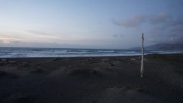
Beach pics from 12-12-18:

DSC_0027-XL.jpg


DSC_0044-XL.jpg


DSC_0025-XL.jpg


DSC_0055-XL.jpg


The GS was another persons, they played a little and chased each other around

DSC_0039-XL.jpg
 
Last edited:
Plan on driving through Avenue of the Giants next weekend from LA. Any recommendations along the way or while I'm there?

Thanks in advance
 
You looking for routes to drive, or stuff to get out and see, or what exactly?

All of the above. I know the route I am taking but I don't mind stopping and taking scenic routes or hitting a trail or two. This is more or less a last minute trip so nothing is set in stone so I can go and do/see whatever on the way to or back from Ave of the Giants
 
All of the above. I know the route I am taking but I don't mind stopping and taking scenic routes or hitting a trail or two. This is more or less a last minute trip so nothing is set in stone so I can go and do/see whatever on the way to or back from Ave of the Giants

Well, AoG is pretty nice but there is a spur that runs off of it near Dyerville that goes WEST (edit) towards the towns of Honeydew and Petrolia - Bull Creek Rd (also shown on maps as Lower Bull Ck Rd and / or Mattole Rd and / or Panther Gap Rd). The first few miles of it off of 101 and AoG are freshly paved and zing through the redwoods way tighter than AoG, with less traffic. It's a really pretty drive. You can just drive the first part and then turn around when the fresh pavement ends, or you can keep going to the coast, but the road gets really rough with major potholes and such. If you choose to go to the coast, which is super awesome in this area, take Bull Creek / Mattole / Panther Gap Rd into Honedew, turn right over the green one lane bridge and follow the signs to Petrolia / Ferndale. There is a stretch of road that runs right along the ocean for 6 miles just past Petrolia that is really pretty. Keep a eye out for zebras near it. I'm serious. There's an old shelf road that runs off of Mattole Rd in this stretch to the abandoned Cape Mendocino lighthouse base which you can drive part of the way to and then walk the rest of the way back (maybe 1/4 mile of walking, not far). Really pretty views.

You're kind of late in the season and a lot of the dirt coast roads are closed. Usal, Ft Bragg-Sherwood are shut already and those are a sweet off road drive. The seasonal bridges at Shivley and Holmes flat are already out, too, which sucks because they are fun to drive over. I do believe the roads in the Coastal Range BLM land are still open though (Lightening Peak Rd, King Peak Rd) and those are pretty good. King Peak has 5 or 6 little water crossings and they should be flowing this time of year. Probably better check with BLM to make sure they are still open if you plan on running them.

If you want to hit some dirt off of AoG, look into Dyerville Loop Rd. It runs from AoG / 101 at the Dyerville / Honeydew exit (opposite direction of Bull Creek Rd). Starts as pavement but turns into sporty gravel and dirt heading south and ends up near Garberville on Alderpoint Rd. From there you can also run Harris Rd and Belle Springs Rd south to 101 near Leggett (Mendo County); Harris and Belle Springs are also gravel / dirt and pretty fun. You can also get onto the river bar with your truck at several places on AoG.

For hiking and such there's some short trails off AoG near Dyerville and off of Bull Creek west of AoG/101 that are well marked and decent. Mostly flat, not technical, just a easy walk in the redwoods.

For decent food on AoG there is the Calico Cafe in Garberville, Deb's Hamburgers in Redway, Avenue Cafe in Miranda, Hot Brews and Caken Bacon in Fortuna.

If you make it to Eureka and you stop for anything try to park in a visible and trafficked place and lock your car and hide your shit, there are a lot of shitbags in town that will smash a window for a jacket or a bag.
 
Last edited:
Well, AoG is pretty nice but there is a spur that runs off of it near Dyerville that goes east towards the towns of Honeydew and Petrolia - Bull Creek Rd (also shown on maps as Lower Bull Ck Rd and / or Mattole Rd and / or Panther Gap Rd). The first few miles of it off of 101 and AoG are freshly paved and zing through the redwoods way tighter than AoG, with less traffic. It's a really pretty drive. You can just drive the first part and then turn around when the fresh pavement ends, or you can keep going to the coast, but the road gets really rough with major potholes and such. If you choose to go to the coast, which is super awesome in this area, take Bull Creek / Mattole / Panther Gap Rd into Honedew, turn right over the green one lane bridge and follow the signs to Petrolia / Ferndale. There is a stretch of road that runs right along the ocean for 6 miles just past Petrolia that is really pretty. Keep a eye out for zebras near it. I'm serious. There's an old shelf road that runs off of Mattole Rd in this stretch to the abandoned Cape Mendocino lighthouse base which you can drive part of the way to and then walk the rest of the way back (maybe 1/4 mile of walking, not far). Really pretty views.

You're kind of late in the season and a lot of the dirt coast roads are closed. Usal, Ft Bragg-Sherwood are shut already and those are a sweet off road drive. The seasonal bridges at Shivley and Holmes flat are already out, too, which sucks because they are fun to drive over. I do believe the roads in the Coastal Range BLM land are still open though (Lightening Peak Rd, King Peak Rd) and those are pretty good. King Peak has 5 or 6 little water crossings and they should be flowing this time of year. Probably better check with BLM to make sure they are still open if you plan on running them.

If you want to hit some dirt off of AoG, look into Dyerville Loop Rd. It runs from AoG / 101 at the Dyerville / Honeydew exit (opposite direction of Bull Creek Rd). Starts as pavement but turns into sporty gravel and dirt heading south and ends up near Garberville on Alderpoint Rd. From there you can also run Harris Rd and Belle Springs Rd south to 101 near Leggett (Mendo County); Harris and Belle Springs are also gravel / dirt and pretty fun. You can also get onto the river bar with your truck at several places on AoG.

For hiking and such there's some short trails off AoG near Dyerville and off of Bull Creek west of AoG/101 that are well marked and decent. Mostly flat, not technical, just a easy walk in the redwoods.

For decent food on AoG there is the Calico Cafe in Garberville, Deb's Hamburgers in Redway, Avenue Cafe in Miranda, Hot Brews and Caken Bacon in Fortuna.

If you make it to Eureka and you stop for anything try to park in a visible and trafficked place and lock your car and hide your shit, there are a lot of shitbags in town that will smash a window for a jacket or a bag.

I appreciate all this. I'll spend some time this week researching these. Happy holidays!
 
I had to edit my post because I got directions confused, Bull Ck is WEST of AoG, not east.

If you are on AoG anyway, and you do nothing else, run that few miles of Bull Ck WEST from AoG, it's epic. In the summer on my bike I hammer it through there like it's my own private one lane racetrack curving through the redwoods.

Bull Ck Rd aka Mattole / Panther Gap / Lower Bull Ck / road to Honeydew:

IMG_1349-XL.jpg
 
I had to edit my post because I got directions confused, Bull Ck is WEST of AoG, not east.

If you are on AoG anyway, and you do nothing else, run that few miles of Bull Ck WEST from AoG, it's epic. In the summer on my bike I hammer it through there like it's my own private one lane racetrack curving through the redwoods.

Bull Ck Rd aka Mattole / Panther Gap / Lower Bull Ck / road to Honeydew:

IMG_1349-XL.jpg

Seriously appreciate your recommendations
 

Attachments

  • DSC_0001.jpg
    DSC_0001.jpg
    78.6 KB · Views: 190
  • DSC_0008.jpg
    DSC_0008.jpg
    136.5 KB · Views: 203
  • DSC_0018.jpg
    DSC_0018.jpg
    137.7 KB · Views: 201
  • DSC_0020.jpg
    DSC_0020.jpg
    130 KB · Views: 199
  • DSC_0031.jpg
    DSC_0031.jpg
    137.8 KB · Views: 202
  • DSC00380.jpg
    DSC00380.jpg
    145.6 KB · Views: 194
  • DSC00404.jpg
    DSC00404.jpg
    147.7 KB · Views: 207
  • DSC00410.jpg
    DSC00410.jpg
    143.3 KB · Views: 201
Just a few of the several hundred photos i took. I was also playing around with 2 different cameras. I haven't had the time to upload any of the drone photos/videos but I hope these will do for now.
 

Attachments

  • DSC00424.jpg
    DSC00424.jpg
    147.1 KB · Views: 189
  • DSC00435.jpg
    DSC00435.jpg
    140.6 KB · Views: 174
  • DSC00440_LI.jpg
    DSC00440_LI.jpg
    146.6 KB · Views: 183
  • DSC00464.jpg
    DSC00464.jpg
    78.3 KB · Views: 175
  • DSC00473.jpg
    DSC00473.jpg
    139.9 KB · Views: 185
  • DSC00504.jpg
    DSC00504.jpg
    144.2 KB · Views: 177
  • DSC00512.jpg
    DSC00512.jpg
    139 KB · Views: 185
  • DSC00448.jpg
    DSC00448.jpg
    61.3 KB · Views: 177
Banged around with Meredith and Relli (the dog) today... found some new stuff just over the Trinity County Line - Klondike Mine Rd - dead end but pretty cool with a few spots requiring 4WD and some water crossings. Trees down blocking the road on Horse Ridge Lookout (couldn't make it to the lookout or Pickens Trail) and Swift Creek Rd. South Fork Mtn Rd was snowed shut around 4800' and I assume NF 1 is also snowed shut since they run into each other about 5000'.

Klondike Mine Rd

DSC_0107-XL.jpg


DSC_0105-XL.jpg


DSC_0102-XL.jpg


2019013018043044-IMG_8343-XL.jpg


Horse Ridge Lookout Rd (aka NF 23)

DSC_0063-XL.jpg


Swift Ck Rd and turning around on the hillside

DSC_0066-XL.jpg


2019013018043044-IMG_8319-XL.jpg


Relli in the snow on South Fk Mtn Rd

DSC_0082-XL.jpg


Along the Van Duzen at Swimmer's Delight

DSC_0002-XL.jpg


No one was going in except the dog

DSC_0033-XL.jpg
 
Last edited:

Members online

Forum statistics

Threads
278,316
Messages
3,554,120
Members
248,016
Latest member
Advally Service

Trending content

Back
Top