
The Return to Death Valley (A Trip Report)

Xtremluck

New member
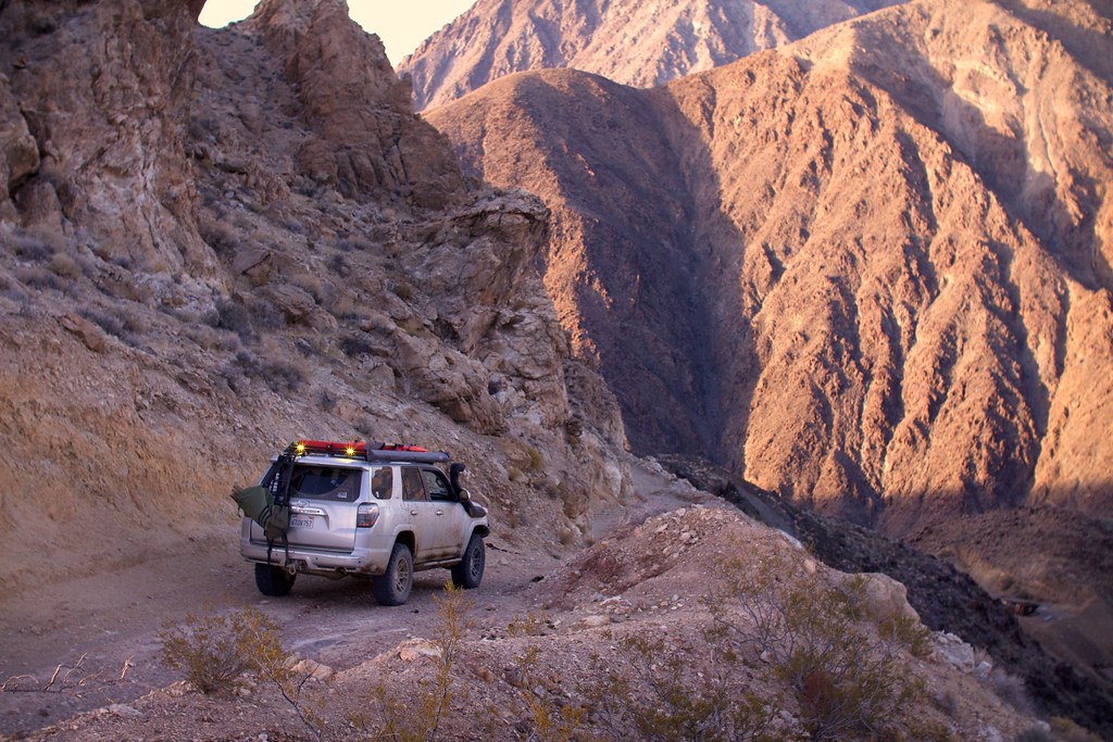
39884372371_eb9718d291_b.jpg


So a little over a year ago I had my first visit to Death Valley and was totally blown away by what I experienced and saw. Never in my wildest dreams would I ever think that a place with such a morbid name would be so beautiful and scenic. The first trip comprised of visits to Racetrack Playa, Lipincott Pass, Titus Canyon and Cerro Gordo. Fast forward a year later and I was itching for some more!

This time around I would be embarking on the trip completely solo. I had a few friends back out at the last minute but I was determined to get my desert fix in before the season was out.

Day 1: Getting to Death Valley (Ballarat Ghost Town)
Decided to depart from San Francisco late afternoon and drive the 8 hours down to camp somewhere along Pleasant Canyon. Broke up the drive a bit by stopping in Bakersfield, CA to buy provisions and fuel up for four days. Since I would be covering a lot of ground on remote off-road trails I elected to bring a considerable amount of spare fuel in my roof mounted Rotopax containers (10 Gallons).

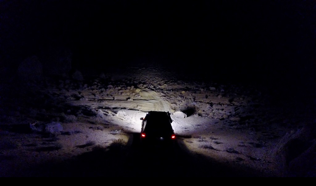
After fueling up it was a few more hours of pavement pounding to get to the ghost town of Ballarat. I finally reached Ballarat around 12:30 AM in the pitch dark and was glad to have all the additional lighting I installed after my last desert trip (Thanks Baja Designs!)
25012674947_79a9b46ddd_b.jpg


Nothing like rolling into a ghost town in the dead of night to really take in the sights. I quickly air downed and hit the trail. After about 30 minutes of driving I realized that I was getting really tired and it was probably a good idea to call it a night and find camp. Another shout out to my BD S2 Pros mounted on the sides of my rack. It made finding a campsite super easy. Parked the truck and had a quick beer. Decided to sleep in the cab for the first night to make things nice and simple.

Day 2: Pleasant Canyon, Briggs Camp, Goler Wash
28103924499_93739daff4_z.jpg


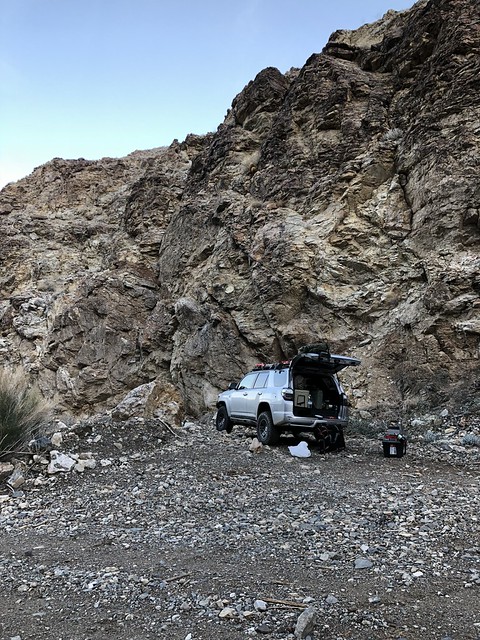
Woke up to a great desert sunrise and had my first chance to see where I was in daylight. Now I know it is never best practice to camp in a canyon but I knew there was no rain in the forecast and the danger of me falling asleep at the wheel was real. So I took my chances :)

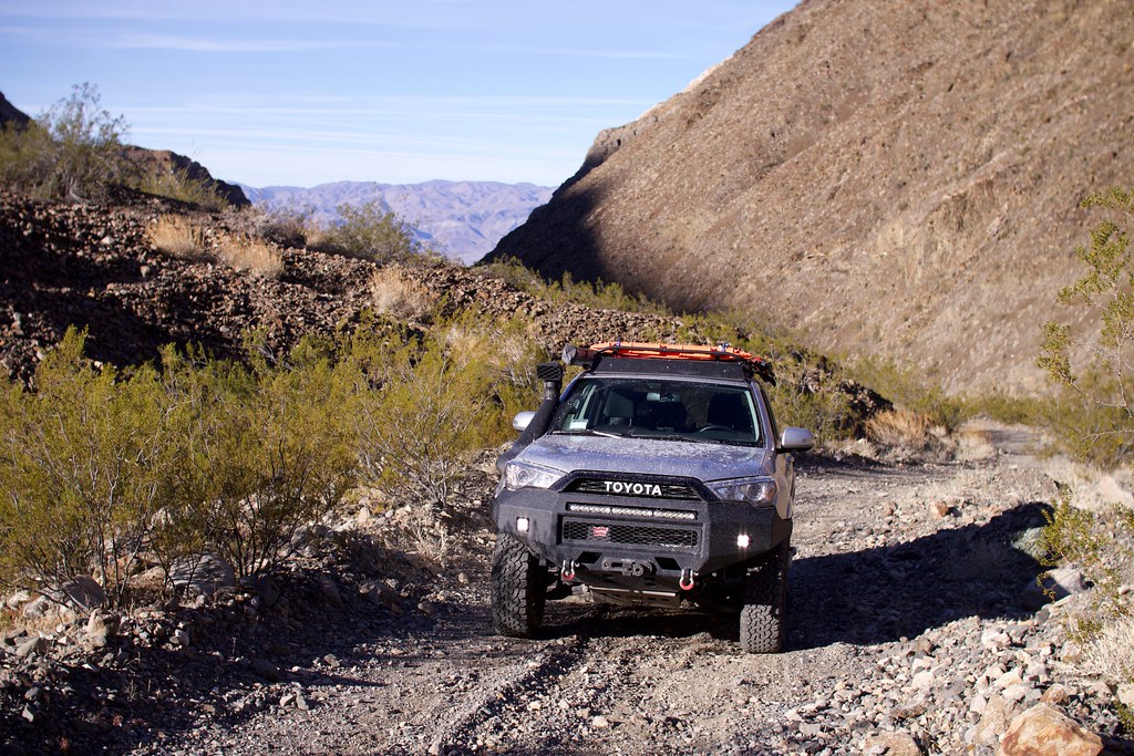
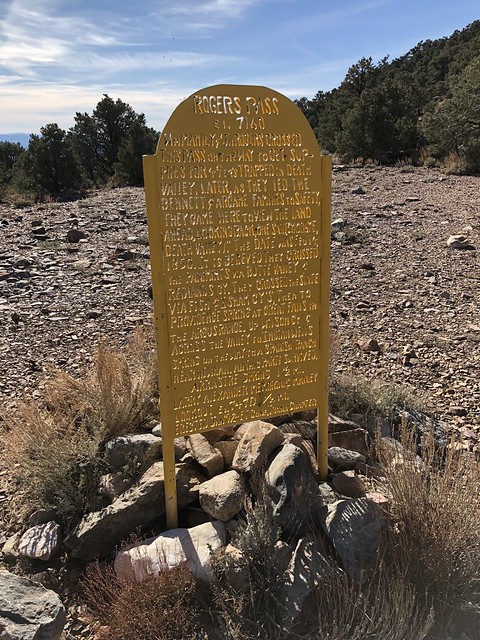
After a quick breakfast I pushed forward and continued climbing up Pleasant Canyon. There were a couple of old cabins and mining sites along the way that made for some fun exploration. Near the top of Roger’s pass there was also some nice off camber sections that were super rutted out from recent rains.
26010964158_1ccd9b9b86_b.jpg


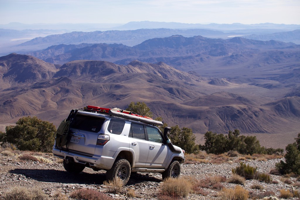
After peaking at Rogers Pass it was a nice steep decent over the other side that offered some amazing views of the valleys and mountains of Death Valley.
38985226645_12501d16cf_z.jpg


26010812038_0fbac96478_b.jpg


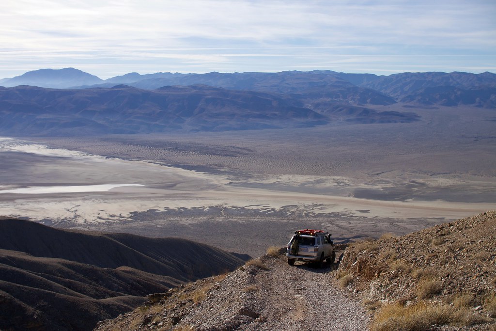
As I made my way down only one thing was really on my mind (Chicken Rock). It’s a infamous portion of the trail that is a narrow rocky turn that pitches your truck towards the cliffs edge with an unforgiving drop of about 100 ft to the canyon floor. People have rolled off it with pretty severe consequences in the past.

Not having a spotter with me made me pretty anxious. So I quickly came up with an idea. I flew my drone out and had it hover and pointed its camera back at my truck. I now had a live feed of what was going on with my cab mounted iPad. Success!

Here is the actual clip of me sliding down the corner ever so carefully. Obviously the video and perspective don’t do this turn justice. It was some very white knuckle driving to say the least!


After tackling Chicken Rock it was down to Briggs Camp which has a REALLY well maintained cabin. It has its own water supply, wood stove and even solar powered electricity and lights! I was a bit taken aback at all the amenities that the cabin had to offer. It’s pretty obvious that the cabin gets some real love from the locals.

After descending some narrow switchbacks it was back to the valley floor.
39173512734_93f21d2b96_b.jpg


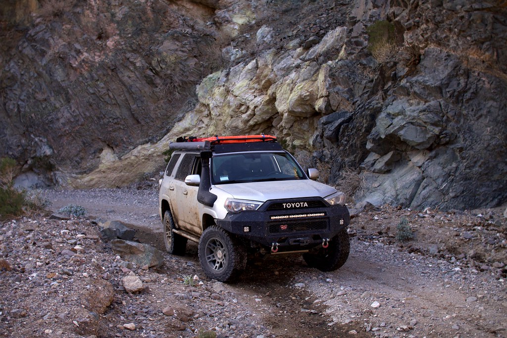
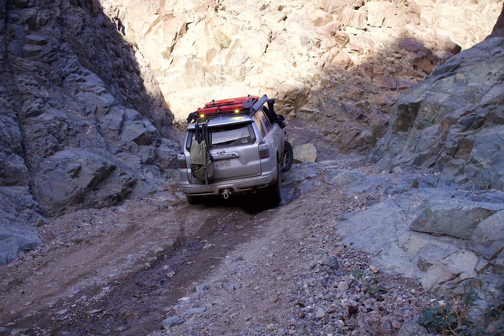
With the recent rains in Death Valley the main route was extremely muddy. Which resulted in a not so clean truck when I made my ascent up Goler Wash. Fun Fact: This was the same route the infamous murderer Charles Manson took to his final hideout at Barker Ranch!
25012411017_578fa64f8a_b.jpg


39173512624_60ccb1bf57_b.jpg


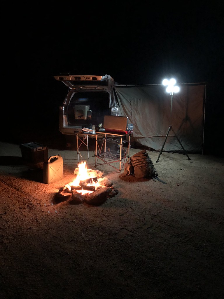
With the light fading I made my way up an abandoned mine site and found the perfect campsite to settle down for the night. Nothing like a nice campfire, good food and a cold beer to cap off a great day.
39851965972_95f57d7dc8_b.jpg

**Note: That is water in the jerry can next to the fire NOT gas

Day 3: Mengel Pass and Butte Valley
At first light I broke down camp and made my way through Mengel Pass after driving by Barker Ranch. I unfortunately didn’t take a lot of pictures as this portion of the route was relatively technical. The rocky descent after Mengel Pass was definitely a treat :)

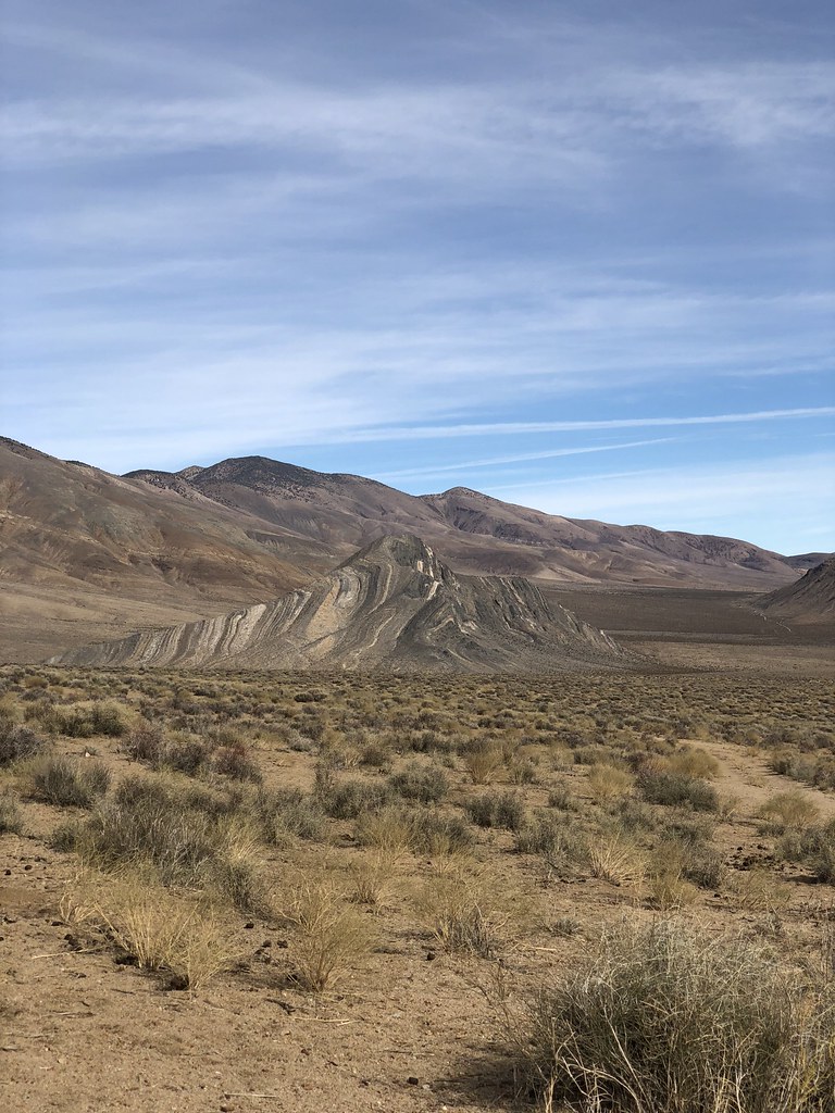
To end the trip I finished it off with a loop through Butte Valley to see the famous Striped Butte pictured here:
38985136945_a9ac18b104_b.jpg


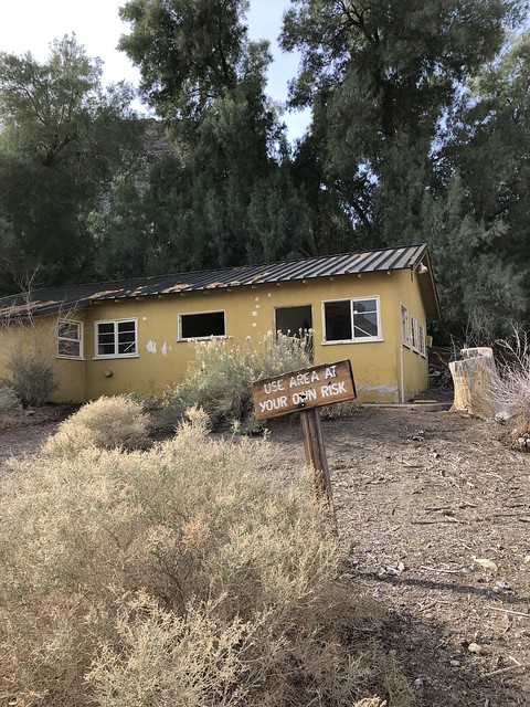
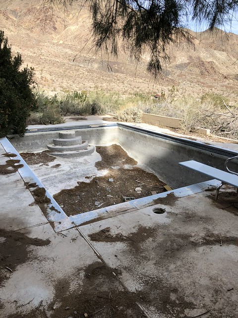
I also had a chance to visit the SUPER creepy abandoned resort in middle of nowhere. Pretty funny to think that someone thought it was a good idea to build a resort in middle of a desert.
28103924149_4b66bff7fe_z.jpg


28103925349_e01ec6b9d9_z.jpg


Conclusion
In the end my adventure back to Death Valley covered 121 miles of uninterrupted dirt, 25,000 ft of elevation change and two nights of camping. I drove through Pleasant Canyon, Briggs Camp, Goler Wash, Mengel Pass and Butte Valley. If interested you can see my entire route here: https://www.gaiagps.com/datasummary/track/348ee4cc14309cbd1cdb22017982b60f/

Retrospective
Lighting - My newly installed side mounted Baja Designs S2 Pros worked fantastically at night to help with lighting while looking for camping spots. They also worked great as camp setup lamps and I will be working on implementing a dual battery system so that I can run them continuously with no worry of battery drain.

Onboard Air - WOW, totally blown away by the performance of my ARB dual air compressor. Airing up used to take me around 15 minutes and I now have it down to less than 5! Might think of adding an air tank in the future but it’s more than enough for now.

Nav - Really love my 12.9” iPad Pro as a navigation tool and drone video display but I’m not so hot about my current mount setup. The weight of the larger iPad is overcoming the RAM mounts and I think I will need to add another uniball for stability. Will work on that for the next trip!

Alright that’s it folks, if you haven’t been to Death Valley I highly recommend it. It’s a place like no other and with its many 4x4 roads it affords you a perspective that not many people get to experience. Definitely should be on any dirt lovers bucket list! Next Up: Moab!
 
Last edited:
Register to hide this ad
Having covered a number of those same areas, I now am itching for a Death Valley trip after seeing your photos. There are so many amazing places to see in that area when you take your time and enjoy the surroundings! :thumb3:
 
Welp, I'm inspired! Nice write up. Thanks for putting this together for a mid week escape.
 
Last edited:
Great write up and photos! Was out there last week and just did Titus Canyon and Marble Canyon and used Stovepipe Wells as a base camp.
 
Jealous.. Great write up and photos.. I've pulled the Drone trick more than once without a spotter!!! Works wonders!
 
Nice report.

But where are you coming up with 25,000' elevation change? Even if you went from lowest point to highest point you'd be at around 11,600' (Badwater Basin to Telescope Peak).
 
We ran Goeler/Mengle east to west and stopped at that yellow structure too. There was a definitive Charlie looking dude perma-camping giving us the evil eye the whole time. We spent the night off some offshoot of Goeler and probably won't do it again. Mengle pass was great, but I'lll be camping elsewhere next time!
 
Love it, thanks for your report and media content.... No one understands the difficulty of Chicken Rock, this video helps gives some context. We did this with at midnight going uphill, it was literally the scariest shit i have ever done.
 
Having covered a number of those same areas, I now am itching for a Death Valley trip after seeing your photos. There are so many amazing places to see in that area when you take your time and enjoy the surroundings! :thumb3:

I think I've made a commitment to do at least one extended weekend trip to SoCal's deserts every year! I just can't get enough.
 
Nice report.

But where are you coming up with 25,000' elevation change? Even if you went from lowest point to highest point you'd be at around 11,600' (Badwater Basin to Telescope Peak).

If you look at my GAIA trip stats you'll see
Ascent: 12523 ft
Descent: 13748 ft

So more like 26,000+ ft of elevation change for the entire loop.
 
We ran Goeler/Mengle east to west and stopped at that yellow structure too. There was a definitive Charlie looking dude perma-camping giving us the evil eye the whole time. We spent the night off some offshoot of Goeler and probably won't do it again. Mengle pass was great, but I'lll be camping elsewhere next time!

I intentionally camped outside of Death Valley National Park designated land because of the fire restrictions. It's kind of funny how you can step 1ft in one direction and you're allowed to have campfires but then you take a step onto National Park territory and its banned.
 
If you look at my GAIA trip stats you'll see
Ascent: 12523 ft
Descent: 13748 ft

So more like 26,000+ ft of elevation change for the entire loop.

I'm not trying to be argumentative, or to be a dick. I clicked on your report because I wanted to see some DV stuff... I love DV. I enjoyed your report. But claiming 25k elevation change based on that measuring system is inaccurate. Elevation change would be measured from lowest point on the trip to highest point, even if you didn't drive directly between those two spots.

I'm not sure why this bothers me except that I am some sort of elevation nerd. I only run a GPS most of the time to tell me elevation.
 
That chicken rock vid is balls out out the most hardcore thing I’ve ever seen. The day i was going to drive it there was a Jeep roll over. Trail blocked with Jeeps, CHP SAR helicopter flying around. Never made it.
 
I intentionally camped outside of Death Valley National Park designated land because of the fire restrictions. It's kind of funny how you can step 1ft in one direction and you're allowed to have campfires but then you take a step onto National Park territory and its banned.

Got it.. ya it can be a little silly sometimes. We bring one of these portable pits when the temps are cold to get around those restrictions, just as an FYI to anyone it works pretty good.

https://www.campchef.com/fire-pits.html
 
I'm not trying to be argumentative, or to be a dick. I clicked on your report because I wanted to see some DV stuff... I love DV. I enjoyed your report. But claiming 25k elevation change based on that measuring system is inaccurate. Elevation change would be measured from lowest point on the trip to highest point, even if you didn't drive directly between those two spots.

I'm not sure why this bothers me except that I am some sort of elevation nerd. I only run a GPS most of the time to tell me elevation.

Love hearing different perspectives and opinions so please keep it coming. I get and respect what you are saying but I still don't think my number is wrong. The main reason I floated that number out there was to illustrate that Death Valley is quite mountainous. I think there is a a misnomer that it's mostly flat desert and I think these stats clearly show that its not.
 
Great pics and report. Love the desert, but usually go to Anza Borrego since its only a couple hours away.

BTW, those ascent/decent readings are cumulative, so correct in that regard, but not to be confused with elevation change.
 
Death Valley report

This is another great trip report, [MENTION=1681]Xtreme[/MENTION]luck. Following your recent Mojave National Preserve report, this inspires me to get out there and explore.

I think it's risky going out that far alone. In case you break down, maybe you shouldn't drive farther from a busy highway than you can walk in a day or less. And you have to be able to walk out carrying all the water and food you'll need plus overnight bivouac gear. You said you drove 121 miles of dirt road. I'd guess you got out farther than you can walk.

I'm glad everything went well. The camping locations look great. I really got a chuckle from the photo of the campfire, with the gas can just a couple of feet from the fire! :biggrin1:

Next time you travel to the So Cal or eastern Sierra deserts give me a few days notice and maybe I can join you. My next big adventure is Mojave NP.
Dave in So Cal :fishing:
 
This is another great trip report, [MENTION=1681]Xtreme[/MENTION]luck. Following your recent Mojave National Preserve report, this inspires me to get out there and explore.

I think it's risky going out that far alone. In case you break down, maybe you shouldn't drive farther from a busy highway than you can walk in a day or less. And you have to be able to walk out carrying all the water and food you'll need plus overnight bivouac gear. You said you drove 121 miles of dirt road. I'd guess you got out farther than you can walk.

I'm glad everything went well. The camping locations look great. I really got a chuckle from the photo of the campfire, with the gas can just a couple of feet from the fire! :biggrin1:

Next time you travel to the So Cal or eastern Sierra deserts give me a few days notice and maybe I can join you. My next big adventure is Mojave NP.
Dave in So Cal :fishing:

Risky is sitting and reading forums your entire life and waiting for the optimal time to go, you may never go. Get a locator beacon and/or sat phone and go solo with confidence. Dave-not directing this comment directly at you, it's just a comment I wanted to make.
 
Last edited:

Forum statistics

Threads
278,314
Messages
3,554,097
Members
248,016
Latest member
Advally Service

Trending content

Back
Top