JohnTheLuck's Adventures Thread

Day 23:

Start point: Hanksville UT
End point: Hanksville UT

Distance driven: 139 km
Distance hiked: 3.4 km


Wanting to rest our legs a bit. and having a little less energy due to a mild cold, we headed back to the San Rafael Swell to revisit the area near Salt Wash that we had explored in October 2016. Along Factory Bench Road, Factory Butte was glowing in the morning sun.

52731393883_be33a1e24f_o.jpg


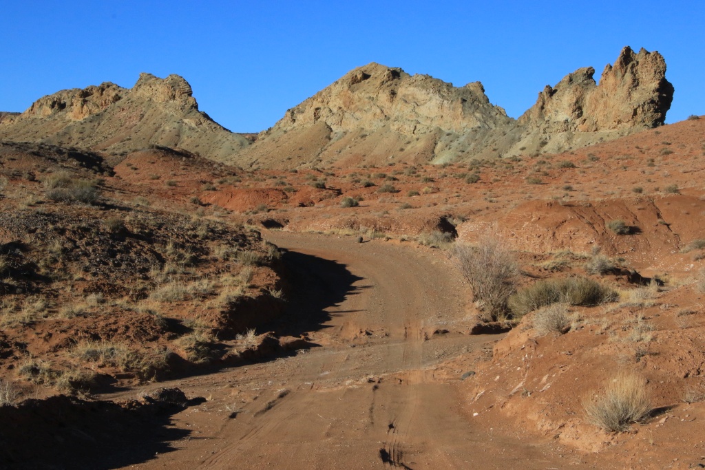
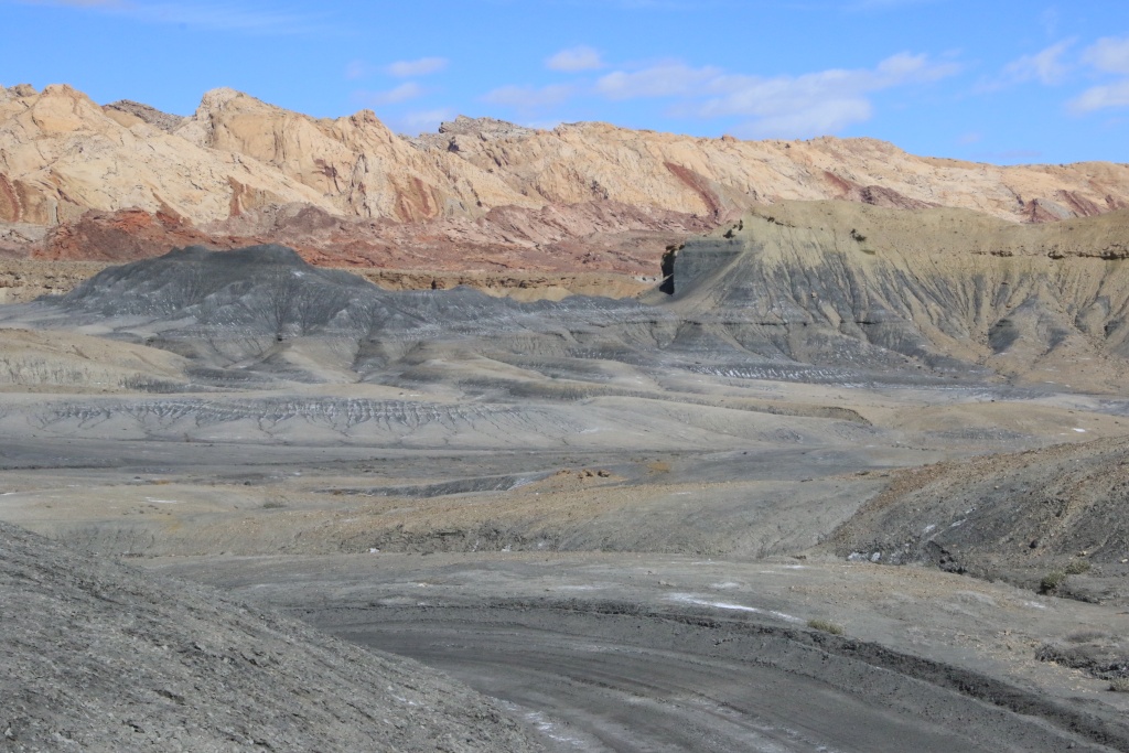
Salt Wash Road winds between the gray bentonite hills of Factory Bench and the San Rafael Swell fold.

52730386057_8590be7e98_o.jpg


Nancy had identified using Google Earth three very short hikes leading to promontories offering a bird's eye view of the colorful bentonite hills. At the start of the first, we noticed that the ground was covered with shards of shells. These would date back more than 80 million years.

52731319325_a227fccd6f_o.jpg


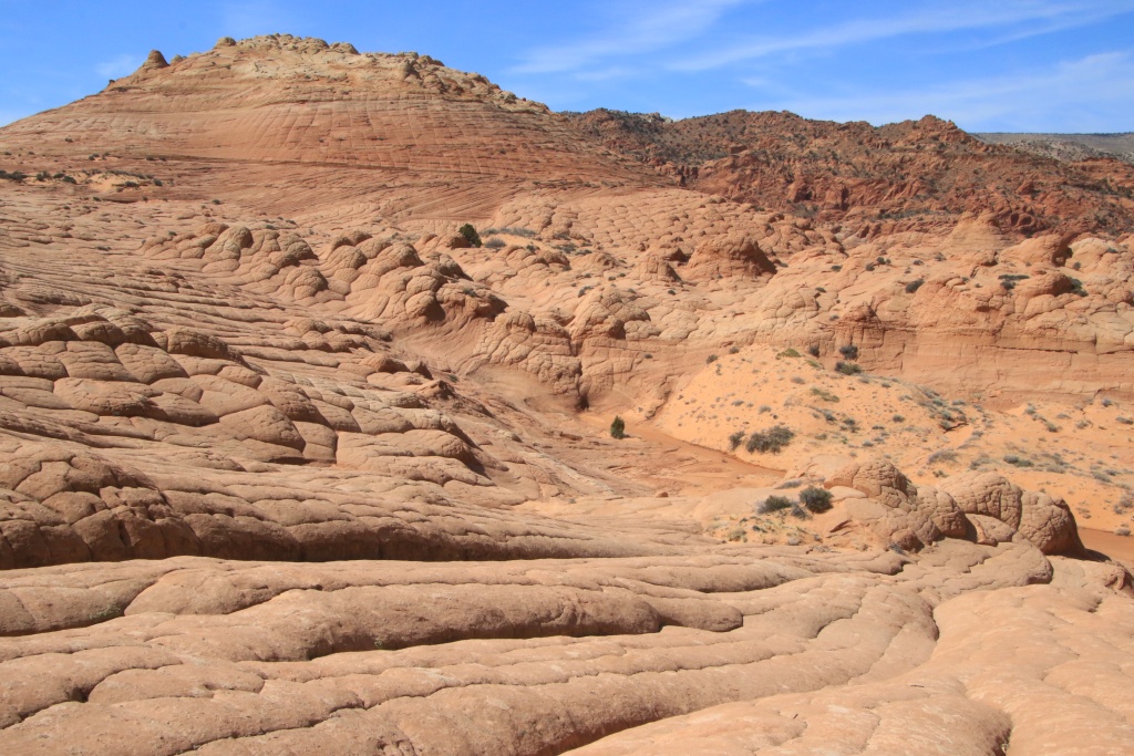
Our hike also passed through areas of bentonite. As mentioned yesterday, the texture is like popcorn, with the sun-dried top layer becoming cracked. The surface becomes smooth again during heavy rainfall, and the popcorn re-forms as it dries, erasing footprints.

52731161604_4c55bdfd1e_o.jpg


The view at the top was truly stunning.

52730910006_773179b07c_o.jpg


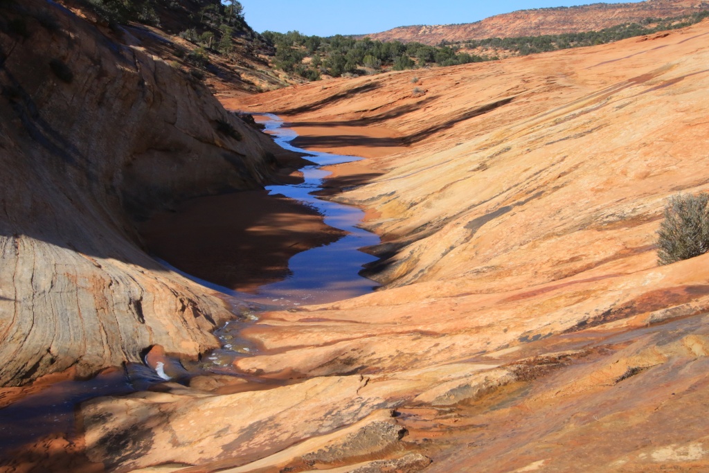
Further on, as the elevation of the road slowly approaches that of Salt Wash, the presence of salt is noticeable and the road becomes a little wetter.

52731393813_8bf69561be_o.jpg


Having reached Salt Wash, we did not dare to cross it because the area immediately after the crossing was very muddy, since located near a cliff keeping it in the shade for part of the day. Anyway, this road ends in a dead-end. We wisely turned around. The crossing could wait for a next trip.

This road has some slopes which must be very dangerous if the ground is not dry enough. Luckily for us, that was not the case today.

52730385992_6f6de20535_o.jpg


52730909961_29f2718df1_o.jpg


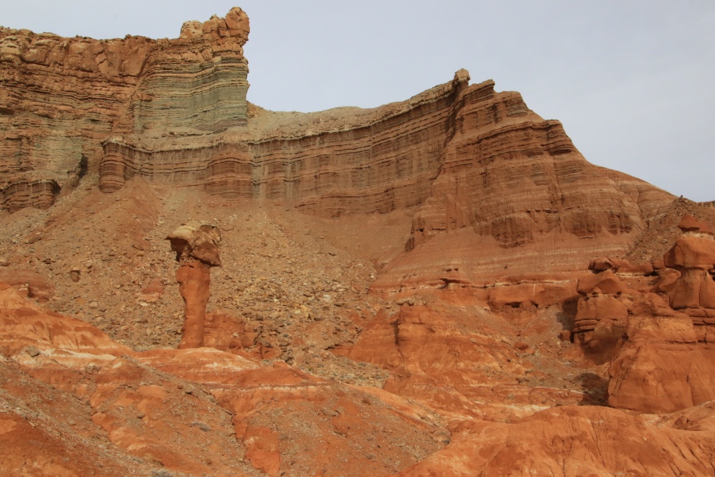
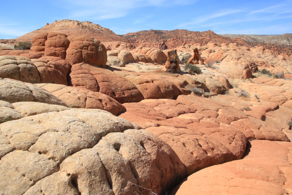
Then we came back a short distance on Factory Bench Road to explore on foot the dry Coal Mine Wash, an area that had been mined for coal in the 1930s. The water and the winds have sculpted strangely shaped monoliths there.

52730385947_038a3c919e_o.jpg


52731319375_8bab9a596c_o.jpg


52730385917_dc35009dc5_o.jpg


Then, we came back to the intersection with Salt Wash Road to continue north towards Muddy Creek, which we braved for a second consecutive day!

52730385897_e64b69c957_o.jpg


After completing Wild Horse Road, we went for a short section on Temple Mountain Road. Several sections located to the north were muddy with the presence of snow, having gained altitude.
52731319335_b33ea7e2d9_o.jpg


A cloud layer at high altitudes has started to cast some shadow on the landscapes, making the colors look duller. As our supply of clean clothes is rapidly decreasing, we took the opportunity to do some laundry, in order to last a few more days.
 
Day 24:

Start point: Hanksville UT
End point: Hanksville UT

Distance driven: 211 km
Distance hiked: 7.3 km


After a very long night's sleep, although still a little weak from a cold, we decided to go for a hike in the Dirty Devil Wilderness Study Area, and complete the day with a loop in the Cathedral Valley area.

The hiking trail begins at Angel Point Overlook and meanders downhill over a multitude of ledges before reaching the Dirty Devil River.

52733600750_fe1cba54c0_o.jpg


With the sun still very low on the horizon and countless rocks having tumbled from the cliff higher up, we had difficulty discerning the trail cairns when we reached the long slickrock portion. The elevation being quite steep, the route I had loaded on my GPS was not very useful, other than to give the general direction.

After a series of trials and errors, obviously frustrated by the lack of direction, we were finally able to reach the level of a tributary stream of Dirty Devil River. We saw no obvious path. In addition, we came up against dry ditches of several meters with vertical walls, impossible to cross.

52733671353_1901e04ea8_o.jpg


We think we should have crossed the tributary to continue to Dirty Devil River. Not wanting to have wet shoes for the rest of the day, having reached our frustration threshold, we turned around.

52733600650_f168634194_o.jpg


Contrary to our apprehensions, the return was very easy, apart from the more than 200 meters to climb and the lack of energy due to the cold. Helped by our memories of the descent, and especially that the cairns were much easier to spot on the ascent, we reached our vehicle probably a little faster than on the way out.

52733600795_eebf1eb0b0_o.jpg


52733671313_aec510cd51_o.jpg


After a short break for dinner, to recharge my energy battery a bit, we headed down The Hartnet Road towards Cathedral Valley. We had traveled this easy route in March 2013 with a rental vehicle.

The route begins with a crossing of the Fremont River, followed by a short area of bentonite clay hills, rocky hills, and then a large practical area devoid of vegetation. Thereafter, another succession of very colorful bentonite hills.

52733600725_3f5839cba3_o.jpg


52733439369_0931b1511c_o.jpg


Given the elevation increasing as we progressed north, we suspected that it would be impossible for us to make the usual loop down the switchbacks to join Cathedral Valley Road. We then decided to take a secondary road crossing a very hilly region to try to reach it. Done deal!

Continuing on Cathedral Valley Road to the north, we passed another vehicle, and the driver confirmed that the switchbacks were impassable.

We continued north to see again an area with dykes, magma intrusions having split the lower layers of the earth's crust, before solidifying. We had visited this area in October 2016.

52733671243_6c9976df0f_o.jpg


It is very likely that we will explore this area located in Lower Last Chance Wilderness on a future trip, as it has several remains of volcanic origin.

52733671228_2df02f8da3_o.jpg


52732663982_2a5b391483_o.jpg


We turned back after appreciating the beauty of this area. On the way back on Cathedral Valley Road, the rectilinear silhouette of North Caineville Mesa told us that the end of the road was coming.

52733600625_2fc74ce383_o.jpg


Tomorrow will be our last full day in the Hanksville area. We will advise tomorrow morning according to the state of my cold, and that of Nancy which begins, of course.
 
Day 25:

Start point: Hanksville UT
End point: Hanksville UT

Distance driven: 243 km
Distance hiked: 4.1 km


Since it is my wife's turn to be weak with a cold, we decided to go on very short hikes today and some mild offroading. We visited Little Egypt Geological Site, then drove the Poison Spring Wash off-road trail and a short section of Flint Trail. The clouds were present for a good part of the day before dissipating late in the afternoon.

The Little Egypt Geological Site contains a multitude of very eroded rocks in various shapes, having the appearance of small goblins, similar to those of Goblin Valley State Park a little north of Hanksville.

52735699230_70fa64d01a_o.jpg


52735538244_f699ab55d3_o.jpg


52735770293_7dd152f56f_o.jpg


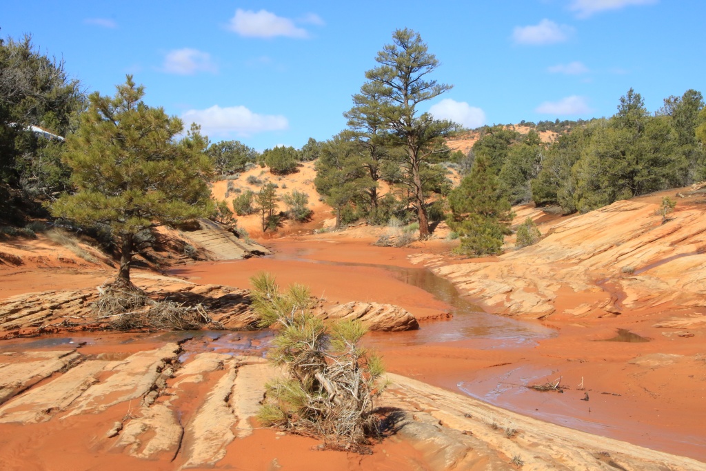
Then we headed to the Poison Spring Wash off-road trail. This gradually descends into Poison Spring Canyon. In several places, the track crossed the small stream and even large ponds (the truck lost a few tens of kilos of dried mud!). This water allows large trees to grow, and to be uprooted during very heavy downpours.

52735762293_1ff6e78869_o.jpg


52735762228_9f8a1065ac_o.jpg


The presence of water allowed ancestral Amerindians to take up residence there, proven by the number of different sites with petroglyphs. One imagines that several conflicts took place considering the limited resources of the place.

52735699285_d3fd2ff42d_o.jpg


These ancient inhabitants do not seem to have built dwellings and probably occupied the many caves present.

52735762323_e0414ba6f0_o.jpg


Further down the track, a spring was once fenced by a wall and access controlled by a small iron gate.

52735762193_8f05df68d8_o.jpg


Notorious outlaw Butch Cassidy is said to have frequented the area. We managed to spot an inscription bearing his name, which is difficult to see in the following photo. In the lower left corner, below the engraved face, we can read "1869 S. J.". As Cassidy was only three years old at this time, his name, visible in the upper right corner, would probably have been engraved later. According to experts, the wear of these inscriptions would lead to think that they are original.

52735538214_8dee19c261_o.jpg


Continuing on the track, we reached a sector where it descends rapidly to join Dirty Devil River. The landscapes here resemble those around Moab with high, steep cliffs. In the bottom, we recognize the yellowish rock of Robbers Roost.

52734762522_4e5e9a4e3f_o.jpg


The water level was quite high and the very muddy approaches were also damaged by the passage of side-by-sides. Thanks guys... We decided not to take our chances and turned around.

52734762527_7542a3c47b_o.jpg


After rejoining UT95, and still having a few hours left, we headed south on Flint Trail into Glen Canyon National Recreation Area. This track leads to the Poison Spring Wash continuation on the other side of Dirty Devil River, but also to The Maze sector of Canyonlands National Park, one of the most remote places in Utah. We only covered a very short portion of it, fortunately with the sun having made its appearance.

52735762208_a3d5170b62_o.jpg


52734762477_2aa6c40bea_o.jpg


Tomorrow we will leave Hanksville for Escalante UT, a little over two hours drive southwest. We had planned to take a series of trails, namely Burr Trail and Wolverine Loop Trail among others, but as the altitude of these is higher than the Hanksville area, it is very likely that this whole sector is still impassable due to the presence of snow and mud (we do have a confirmation the Burr switchbacks are closed). We will therefore spend the morning in the region before taking the usual paved road Utah Scenic Byway 12, usual but so spectacular.
 
That's funny about your Factory Butte excursion. I did the same with my then 5 year old and my H6 Outback. I chose not to cross the creek! I am still to get back there but finishing that is a high priority.

The whole itinerary is another gorgeous Utah experience. Cannot wait to get back there. I like the desert here, but I always prefer Utah's :)

As for Poison Spring, well, you missed a lot because the other side is the even better side! But once at the end, it is a LOOOONG way back (though the exit via Hite does not take me long) so maybe this worked just fine for you.

Since our own trip to Canada shifted a bit, I am starting to have high hopes for the Doll House in late May. If not, high priority for October... Time will tell!

Cheers
 
Last edited:
Yep, not crossing a creek, but having driven from both side gives an unfinished business feeling. I am glad I check the Muddy Creek crossing box on my todo list.

Now, I have a few more more on that list:

- Dirty Devil Crossing below Poison Spring Canyon
- Poison Spring Canyon and Flint Trail Loop
- Flint Trail, Hans Flat Ranger Station, to UT24

We should talk in private about Doll House and The Maze. You got my interest!
 
Day 26:

Start point: Hanksville UT
End point: Cedar City UT

Distance driven: 622 km


This morning, we left Hanksville after a stay during which we did less than half of the activities we had planned. The weather ruined almost two whole days, and greatly affected the possibilities of others. We were still able to enjoy it with new discoveries. It is with this feeling that we hit the road again.

We made a short stop at the BLM Henry Mountains Field Ranger Station to check the condition of the roads we had hoped to travel, but as expected, no change, they were all still impassable. So we took the UT 12 Scenic Byway.

The route, starting near Torrey UT just west of Capitol Reef National Park, begins with a climb up a snow-capped mountain, before descending into the region dubbed Canyon Country, a hiker's paradise.

After descending the mountain, the road joins Boulder UT, a small town that we would have reached by the Burr Trail if it had been entirely open. We decided to drive a short section of it to see the conditions. Although the paved road is clear, the photos speak for themselves with the amount of snow on the ground. We turned around after a viewpoint on Long Canyon.

52737862380_c3e1b9b940_o.jpg


52737845110_37e63ee255_o.jpg


Farther out in Grand Staircase-Esacalante National Monument, the view from Calf Creek Overlook showed that the snow wasn't going to go away until our intended destination, Escalante UT. We had a few hikes planned in this area, but we didn't bring our snowshoes... The level of confidence was going down even further.

52737916243_f0711b1fd9_o.jpg


52737452896_907ee2f3d6_o.jpg


Further on UT 12 SB, a misleading stop at Boynton Overlook showing a landscape with the terrain facing south, without snow. Misleading...

52736911827_41f203ce3e_o.jpg


And the nail in the coffin was when we saw the snow around Hole in the Rock Road, a gravel road that was also lined with snow. As this route crosses several washes, it is very likely that it is also not recommendable. After a brief reflection over lunch, we decided to cancel our planned five-day stay in Escalante. No need to fight against the weather.

We then decided to reach St. George UT, in the extreme southwest of the state, at the foot of the Colorado plateau, at a much lower altitude and offering several activity options. From our hotel in Escalante, we attempted to book another hotel in St. George, but internet service was down.

We therefore continued on the UT 12 SB, gaining a little more altitude. The road is very scenic, like here a little before Henrieville UT.

52737435206_7ab260a3d0_o.jpg


Further on, the road climbs to reach the plateau of Bryce Canyon National Park. We drove the short 3 km stretch of Scenic Drive that was open. Unsurprisingly, the snow was present in abundance.

52737845055_1f62eccd6f_o.jpg


A few daredevils braved the danger (and probably closed trail registrations) by traversing portions of snowy and icy trails. Not for me.

52737845035_c51ff30197_o.jpg


52737916153_f9b2e14c82_o.jpg


Further on, the Red Canyon sector in Dixie National Forest, another destination on the route, was obviously covered in snow and everything was closed.

Continuing, we completed the UT 12 SB. After arriving in Cedar City UT, we tried to take advantage of the free network of a McDonalds to try again to book the hotel in St. George, but here are the safety warnings of these free networks. Impossible to do anything. We then decided to continue and go directly to our favorite hotel in the area.

After finally reaching St. George, all the hotels were full, several sporting activities taking place in the city. It was already later than 5 p.m. We found an available hotel in Cedar City, where we had just come from. So we go back up to the Colorado plateau!!! We will spend two nights in Cedar City before heading to St. George for three more nights.

We wanted to stay in St. George because the truck will be due for an oil change during the trip, and we had excellent service at the Toyota dealership in St. George on a previous trip.
 
Day 27:

Start point: Cedar City UT
End point: Cedar City UT

Distance driven: 132 km


We didn't have a day that will go down in history; clouds, showers, and winds expected all day, getting up late to allow my wife to recover from the last nights spent blowing her nose and coughing, laundry chores, trying to find an optometrist to fix my glasses, and finally short visits around Cedar City to learn a little more about the history of this municipality.

Our first visit was the Frontier Homestead State Park Museum located in Cedar City itself. The place has a good collection of objects, photographs, and old vehicles.

52739742523_5f79630e0b_o.jpg


52739672320_8bbd261ba7_o.jpg


Outside, a few ancestral buildings are on display.

52738739372_72bfb33107_o.jpg


One building in particular caught our attention, the one fitted out by a sheep breeder to shear them industrially.

52739257296_fda13ba0e4_o.jpg


52739742468_bc58d9822c_o.jpg


Another aspect, very lightly touched upon by the museum, relates to the mining past of the region when an iron mine had been in operation. Originally, the mine also carried out refining to generate a product directly suitable for consumption. After a few years, the transformation ceased and only the exploitation and the export of the ores extracted towards Salt Lake City remained.

52738739332_c978775808_o.jpg


As we wanted to learn more about this aspect of iron mining, we headed a little west of Cedar City, in the mountains to reach Old Iron Town Historic Site. It is on this site that the ores were transformed into iron suitable for consumption. Very little remains, a kiln used to produce the coal necessary for the production of iron, some foundations, and a blast furnace used to generate iron.

52739742398_34365c52f3_o.jpg


52739742378_db1f3fed87_o.jpg


Tomorrow we will be moving to St. George UT. Unfortunately, the bad weather persists and we will be entitled to showers and thunderstorms throughout the day.
 
Day 28:

Start point: Cedar City UT
End point: St. George UT

Distance driven: 246 km
Distance hiked: 2.4 km


We left Cedar City under a very gray sky while a few thinnings were to show the tip of the nose. We wanted to take advantage of these to see some attractions around Parowan Gap. As this place is located a little higher in elevation, the mercury dropped a few degrees and showers started.

The first site is that of Parowan Gap Petroglyphs where rather elaborate drawings are visible, having a remarkable quality. Unfortunately, the steady rain came to spoil the visit. As this site is quite close to the I-15 highway, it is very likely that we will revisit it one day, I hope under better conditions.

52741559259_6672a6feed_o.jpg


Just a little further, we also wanted to see Parowan Gap Dinosaur Tracksite but the rain hadn't stopped and we let it go. One more reason to come back one day.

We then took the direction of Silver Reef, an old mining town located near Leeds UT. The city experienced rapid growth, going from 300 inhabitants to more than 2000 in less than two months in 1879 after the discovery of silver ores in sandstone, an extremely rare occurrence. This allowed the extraction much less expensive than when the ores are in harder rock like granite.

Following a fire and the reuse of materials for other constructions in the vicinity, very few vestiges have survived, namely the Wells Fargo Express Office Building and a few other walls and foundations. The Wells Fargo building now houses a museum where extras tell the story of the city and its inhabitants. Outside, an explanatory path runs through the old streets.

52741304286_1b79c3d166_o.jpg


52741718455_1b62a40916_o.jpg


52741304281_7024e46307_o.jpg


In the afternoon, we went to see the Red Hills Desert Garden, located in Pioneer Park, in St. George UT. We had to wait for a storm to pass, pouring rain and hail and wetting everything in its path.

52741304121_7aa5bf2abe_o.jpg


52741718270_453b7fce81_o.jpg


Tomorrow, we should be able to do some hiking in the afternoon since some thunderstorms are forecast for tomorrow morning, again.
 
Day 29:

Start point: St. George UT
End point: St. George UT

Distance driven: 179 km
Distance hiked: 7.6 km


The bad weather left its place to the sun and we took advantage of it in the morning to go for a few hikes. In the afternoon, we then went further south and walked an off-road track leading to a site protecting petroglyphs.

Our first destination of the day was Snow Canyon State Park (no, we don't miss the snow that much...). This park, located in the western suburbs of St. George, has several assets, such as petrified sand dunes, orange sandstone cliffs, ancient lava flows and tubes, as well as several flowing streams due to the precipitation of the last few days. We had already visited this park quickly in April 2015.

The first trail we hiked is Jenny's Canyon Trail. This short path runs along a cliff to the north, creating a small oasis where the greenery is in the spotlight. Further on, the path joins a narrow dead end passage dug by the action of the water.

52743931899_424046e9ed_o.jpg


52743161402_e9cd48a015_o.jpg


The second path we walked, that of Pioneer Names, joins an alcove where certain well-known characters from the region have left their signature.

52744098080_93c806bc1e_o.jpg


The park road allows you to see some works of Mother Nature, like this one with black volcanic rocks and groves of vegetation.

52743931884_4460b09ba3_o.jpg


Then we did a loop combining Lava Tubes Trail, Overlook Trail, and Butterfly Trail.

52744170328_989954c053_o.jpg


52743931829_7dfd45b155_o.jpg


52744170283_0ba5273a9c_o.jpg


After lunch, we wanted to go for a hike in the Red Cliffs National Conservation Area, but that was without counting a large cloud having formed above the mountains to the west and which hung motionless for the rest of the day, dropping continuous rain.

So we went onto an off-road track leading to Little Black Mountain Petroglyphs Site, a little southeast of St. George. Although it is not an exceptional site, the environment is interesting, and above all the weather was nice!

52744170263_b8d88bcc01_o.jpg


52744097920_6631c130bc_o.jpg


We continued on the off-road track to complete a loop. Recent rainfall had turned a probably dry wash into a muddy creak but not very deep stream, with a rocky bottom that we crossed easily.

52743931749_097089cf63_o.jpg


Tomorrow morning, we have an appointment for an obligatory oil change, given the expected length of the trip. Since Toyota dealerships are not very frequent, we will take advantage of them even if we could have waited another two or three weeks.
 
Day 30:

Start point: St. George UT
End point: St. George UT

Distance driven: 140 km
Distance hiked: 3.8 km


Our first half-day was devoted to vehicle maintenance and other things, while the second was shared between an off-road track and a few short hikes, all under a beautiful sun and a very pleasant temperature.

Our first attraction was Sand Mountains OHV Area, a place where off-road vehicle enthusiasts can let loose legally. As the name suggests, it's a very sandy place, and with the rainfall over the past few days, the wet sand provided a very comfortable smooth ride.

52746520250_87e9e390e8_o.jpg


52746355004_200f609229_o.jpg


Several secondary tracks lead to viewpoints overlooking Warner Valley, where we will go next. Note the presence of off-road vehicles on a promontory.

52745588012_fefaf0715f_o.jpg


Having only the afternoon, and especially since we weren't really prepared for this place, we retraced our steps to reach Warner Valley Road. This maintained road bypasses Sand Mountain OHV Area from the south, offering very beautiful landscapes.

52746103981_281916c261_o.jpg


In several places on Warner Valley Road, huge sand dunes were seen at the foot of Sand Mountain cliffs, pushed by the winds.

52746600573_019fae188c_o.jpg


Warner Valley Road leads to Warney Valley Dinosaur Track Site, a site protecting the footprints of several dinosaurs, dating back nearly 190 million years.

52746520235_84485f2be5_o.jpg


A little further, we went to see Fort Pearce Historic Site, one of only three remaining fortifications, and built during the Black Hawk War between 1865 and 1870 between Mormon settlers and Ute and Navajo Indians. These fortifications, erected by the Mormon militia to contain the assaults of the Ute, were judiciously located at the transport corridors and made it possible to control the movements of the Ute and warn the towns of an eminent danger.

52745580027_2601e83478_o.jpg


Fort Pearce was located near a natural constriction, on a promontory overlooking Fort Pearce Wash that provided a reliable water source. This place was also inhabited long before by other inhabitants of the region, as evidenced by several petroglyphs along the wash.

52746600548_539fdc2e22_o.jpg


We came back to St. George early for a nice meal. Then we went back to walk a bit on the sandstone mounds at Pioneer Park, taking advantage of the extra hour offered by the weekend time change.

52746600593_9aac894d7e_o.jpg


52746600533_6cd8e5bdc7_o.jpg


Tomorrow we will leave St. George not to join Kanab UT as listed on our itinerary, but to head towards Nevada. This morning, the weather forecast for the next three days in Kanab prompted us to make this other change. Now, when looking at recent forecasts, it is not certain we made a good choice. Will see...
 
Day 31:

Start point: St. George UT
End point: Mesquite NV

Distance driven: 312 km
Distance hiked: 4.9 km


Good decision or bad decision? No one can tell us, but our last itinerary change caused by less than favorable weather turned out to be profitable at only 25%. We were still able to enjoy the morning without the rain bothering us by exploring a little Valley of Fire State Park in Nevada, very close to Las Vegas. The rain became constant in the afternoon and it's the same scenario for tomorrow all day. Definitely, we have already seen better conditions.

This morning, as we left St. George UT, the timid sun managed to break through the veil of clouds at high altitude. However, the sky quickly became overcast as we drove on I-15 towards Nevada. The road is really spectacular when crossing the Virgin River Gorge, but no stopping point is provided, a question of safety given the pronounced curves.

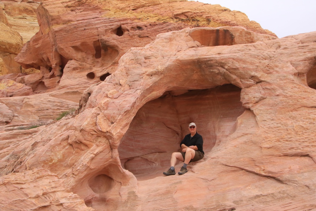
Returned to Valley of Fire SP, we went to the White Domes area, one of the most photogenic in the park, in my opinion. The road crosses portions of sandstone with multiple colors and textures.

52748623863_f29e5817d0_o.jpg


We decided to hike the short White Domes Loop Trail. We had hiked this trail on a previous trip in April 2010, but too quickly when the sun was already too low. With today's cloudy sky, the lighting conditions were perfect and the pastel colors shone softly. After a slight sandy slope, the trail begins a long descent surrounded by multi-colored sandstone rocks.

52748131036_550982b1cb_o.jpg


52748543210_ff4ba15ffc_o.jpg


52748131111_89c957d7e7_o.jpg


At the bottom of the slope, the trail reaches a wash. The loop crosses a narrow passage dug by water.

52748131096_f7112fd4e2_o.jpg


52748131066_2f50f29fc9_o.jpg


Then, the trail begins to climb very gradually.

52748623803_7217504438_o.jpg


52748375444_e8c2f48f42_o.jpg


Having completed the loop, we headed to the P2 parking lot. This gives access to an area of the park where it is possible to explore off-trail. The sandstone rocks in this area have a wide variety of colors and textures. We had hiked a similar loop on a previous visit in March 2019.

52747604817_be3f7f47b2_o.jpg


52748131001_7b4591c569_o.jpg


52747604767_830cf118d1_o.jpg


52748375314_f15ab7c4c3_o.jpg


By doing our trip a little later than usual, we hoped to see more wildflowers. This was without counting on the exceptionally cold and cloudy winter that the region suffered. The flowers are only beginning to show their nose, while we are currently much further south than our itinerary implied.

52748623683_a7ee6be182_o.jpg


Afterwards, as the rain was constant, we made a short visit to Echo Bay in Lake Mead National Recreation Area. The rain and the greyness got the better of our inspiration as photographers.

As the weather forecast for tomorrow is not very good, we will have to be very creative. Obviously, with all this water to fall, needless to say that we will try to stay on the paved roads, again...
 
Day 32:

Start point: Mesquite NV
End point: Mesquite NV

Distance driven: 513 km


When even paved roads lead to adventure! As expected, the gloomy weather continued all day. Very early on, we put a cross on hiking. With the help of Google Earth, we had identified an interesting region northwest of Mesquite. Very few roads lead there, and even fewer paved roads. We tried a few off-road tracks anyway, with very limited success. Then the paved roads brought us the biggest thrills of the day.

The region of interest was the one south of the small town of Caliente NV, mainly the Rainbow Canyon road. There are two options to reach it; either a long loop on paved roads I-15, NV172, then US93, or maintained unpaved roads winding through the mountains.

We tried our luck by taking the unpaved Carp Elgin Road, passing several areas designated as Wilderness. At the beginning, the road crosses a forest of Joshua Trees whose flowers were beginning to open.

52750242746_d006338b3d_o.jpg


At this time, only a few drops were falling, nothing to hinder our progress. However, the rain was gradually increasing and as we gained altitude, we joined that of the clouds, enveloping us in a mist thick enough to no longer distinguish the landscapes. Water was starting to accumulate on the road and in the washes. Our progress became much more difficult and when the road started to look more like a river, this was the final blow and we turned around.

52750487504_2198c092e3_o.jpg


Back on the paved roads, we then opted for the long loop. After a misleading clearing, the clouds came back in force. But we are strong, we Canadians and we have seen others. We continue!

52749713172_54f685ef57_o.jpg


My navigator mentioned to me that the target route remained in the bottom of the valleys at low altitude. It was not to mention that the main road climbs to more than 1900 meters in the mountains before descending towards our objective. Well, a feeling of déjà vu when we suddenly reached sections of road covered with hailstones with a temperature of only 2C, while we were still only at 1500 meters altitude. Not too promising, and the courage failed us; another half-turn. Decidedly, it is the theme of the trip now.

52750655990_bce802a7f1_o.jpg


On the way back, after traveling enough distance to lose elevation, we noticed a white mass moving in a wash along the road; a first for us, a flash flood!!! Even if its flow was really low and the height of the water did not exceed 8 cm, it is still a flash flood... It progressed at a rate of 2 or 3 km/hour only. Not very dangerous!

52750487689_334dfe6a06_o.jpg


As the rainfall subsided, we took a few detours into Pahranagat National Wildlife Refuge. This place protects marshes and small lakes for fauna and flora. We drove two short sections. Curiously, it is permitted to hunt there on Tuesdays, Thursdays and Saturdays during the hunting season. Hunting in a nature reserve... Seriously!!!

52750242661_941a47346f_o.jpg


52750656100_499150fc16_o.jpg


Continuing on the way back, we thought that the bad weather was finally behind us, greeted by this superb double rainbow.

52750656060_8992f7ccc3_o.jpg


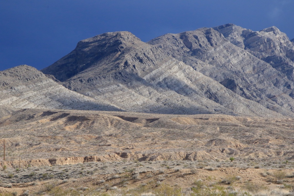
Farther on, near the intersection with the NV168 road, the sun shone under a mass of towering dark clouds in the distance, illuminating the mountains of Arrow Canyon Wilderness.

52750242511_9ce7f72a84_o.jpg


52750487544_afecf2770e_o.jpg


How wrong we were when we thought the bad weather was over! Strong wind, rain, hail, lightning, snow, floods, this is the cocktail we suffered. The ditches and surroundings were transformed into rivers and lakes. The fully inflated washes overflowed and crossed the road in several places. The worst place was the next, when the water covered a stretch of road for more than 200 meters. Fortunately, the water level did not exceed about 25 cm. Debris was floating or rolling across the road, giving us an indication of the level. Masses of hailstones floated on the surface. Still stressful.

52750242496_a0a532b37e_o.jpg


Having finally joined the I-15 freeway, we thought we were done... Well, not really. Intense rain mixed with hail, with strong winds and lightning. What better way to end a day in a memorable way. We were only driving about 50 km/h. The trucks parked in the stops provided for them. Fortunately, the water hardly accumulated on the roadway. We only had about 40 km to go before reaching Mesquite. Finally arrived!

Enough palpitations for this day which will remain etched in our memory for a long time!
 
Day 33:

Start point: Mesquite NV
End point: Kanab UT

Distance driven: 338 km
Distance hiked: 3.2 km


The major weather system that we experienced yesterday having moved eastward and passed during the night at Kanab UT, our next place of stay. Consequently, all off-road tracks were impassable and several hiking trails as well. We were therefore forced to stay on the paved roads.

When we left Mesquite NV, some portions of pavement were still wet, despite the sun shining in a nearly cloudless sky.

We crossed again the splendid Virgin River Gorge. We made a brief stop at Virgin River Canyon Recreation Area to witness the strong flow of the river swollen to capacity from yesterday's rainfall.

52751650312_a28ff957fd_o.jpg


52752427819_8849703238_o.jpg


We started hiking the Sullivan Canyon Trail to get a closer look at the river, but to our surprise the river had submerged part of it.

52752427719_f81d0ecb61_o.jpg


Having got back on the road, we decided to bypass St. George UT by going south through Hurricane UT and Colorado City AZ. This allowed us to see that it would probably be impossible for us to hike a trail we had planned in Canaan Mountain Wilderness, due to the heavy presence of snow. Same for some off-road tracks around Apple Valley UT.

We reached Kanab UT, where also some amount of snow will probably also impact our planned activities.

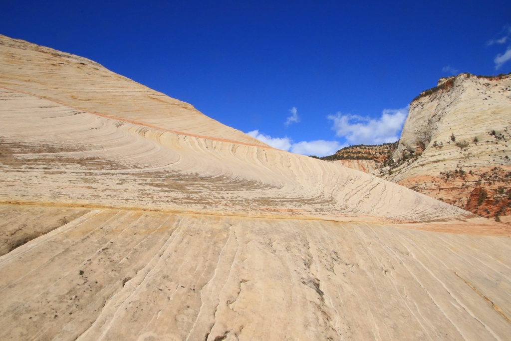
We then decided to return another time to Zion National Park. This park is stunningly beautiful and offers several opportunities to explore on foot over the sandstone along the Zion Park Scenic Byway, a road winding through the bottom of a deep gorge. A few waterfalls were plunging down further carving out the canyon.

52752598360_b6f9ee46e1_o.jpg


52751650257_e673c7b7f2_o.jpg


52752188196_292c2d64f6_o.jpg


We made several stops to wander a bit along the road.

52752598275_bf365cb885_o.jpg


One of those stops was at our favorite spot on the road, an area of eroded petrified wave-like dunes. We climbed up to get a better view, the incline still quite moderate.

52751650272_590efc0d74_o.jpg


52752682428_0f109a7141_o.jpg


52752682368_ec64f3200e_o.jpg


52752427739_1e06b4e7be_o.jpg


52752682353_086c987668_o.jpg


We then returned to Kanab and had a good meal at Houston's Trail's End, a restaurant we had enjoyed on our very first trip to the American Southwest back in April 2010.
 
Day 33:


Start point: Mesquite NV

End point: Kanab UT


Distance driven: 338 km

Distance hiked: 3.2 km


The major weather system that we experienced yesterday having moved eastward and passed during the night at Kanab UT, our next place of stay. Consequently, all off-road tracks were impassable and several hiking trails as well. We were therefore forced to stay on the paved roads.


When we left Mesquite NV, some portions of pavement were still wet, despite the sun shining in a nearly cloudless sky.


We crossed again the splendid Virgin River Gorge. We made a brief stop at Virgin River Canyon Recreation Area to witness the strong flow of the river swollen to capacity from yesterday's rainfall.


52751650312_a28ff957fd_o.jpg


52752427819_8849703238_o.jpg


We started hiking the Sullivan Canyon Trail to get a closer look at the river, but to our surprise the river had submerged part of it.


52752427719_f81d0ecb61_o.jpg


Having got back on the road, we decided to bypass St. George UT by going south through Hurricane UT and Colorado City AZ. This allowed us to see that it would probably be impossible for us to hike a trail we had planned in Canaan Mountain Wilderness, due to the heavy presence of snow. Same for some off-road tracks around Apple Valley UT.


We reached Kanab UT, where also some amount of snow will probably also impact our planned activities.


We then decided to return another time to Zion National Park. This park is stunningly beautiful and offers several opportunities to explore on foot over the sandstone along the Zion Park Scenic Byway, a road winding through the bottom of a deep gorge. A few waterfalls were plunging down further carving out the canyon.


52752598360_b6f9ee46e1_o.jpg


52751650257_e673c7b7f2_o.jpg


52752188196_292c2d64f6_o.jpg


We made several stops to wander a bit along the road.


52752598275_bf365cb885_o.jpg


One of those stops was at our favorite spot on the road, an area of eroded petrified wave-like dunes. We climbed up to get a better view, the incline still quite moderate.


52751650272_590efc0d74_o.jpg


52752682428_0f109a7141_o.jpg


52752682368_ec64f3200e_o.jpg


52752427739_1e06b4e7be_o.jpg


52752682353_086c987668_o.jpg


We then returned to Kanab and had a good meal at Houston's Trail's End, a restaurant we had enjoyed on our very first trip to the American Southwest back in April 2010.
Looks like an awesome adventure. Great pictures and write up.

Sent from my SM-G996U using Tapatalk
 
Thanks for following us!

Yes it is a great adventure so far, with the exception of the rain and snow which forces us to change our plans continuously. I hope the best is still to come. Looks promising on paper, but will see in reality if Mother Nature cooperate a bit more.
 
Day 34:

Start point: Kanab UT
End point: Kanab UT

Distance driven: 175 km
Distance hiked: 3.9 km


We had a very nice day, going through some off-road tracks around Kanab to reach some points of interest not accessible otherwise. We had some apprehensions about the state of these in the region, because a thin layer of snow had fallen during the night. However, as the ground is mostly sand, driving there was relatively easy as it was humid.

Our first destination of the day was Moccasin Mountain Dinosaur Tracksite, reached by a sandy track of just under 4 km. Although the state of the track at the very beginning left some doubt, we reached the start of the hike without incident.

This hike, apart from an information panel, is not marked at all. The number of dinosaur tracks being relatively low there, we are not sure to have seen any. On the other hand, the area was really beautiful.

52754685518_ec41454e55_o.jpg


52754197621_f03a13bd36_o.jpg


After our unsuccessful search for dinosaur tracks, we still enjoyed the beauty of the place by walking along the stream. A thin trickle of water flowed there but the bed of the creek was composed of sand compacted enough to be able to walk without getting dirty.

52754197726_3959035666_o.jpg


On the way back down the trail we noticed a nice area of colored sandstone. We took a short walk there.

52754603010_35da62c102_o.jpg


Confident by the condition of this first track, we then headed to Nephi Pasture Road, a long track in Grand Staircase-Escalante National Monument. A secondary track allowed us to reach Inchworm Arch.

52754685463_4902d06a55_o.jpg


52753657047_5e7be3f77c_o.jpg


52754197671_937e0ed77a_o.jpg


As we still had a lot of time left, we explored other secondary tracks, somewhat at random.

52754602915_724e0e54f8_o.jpg


On one of them, we reached a fairly low sector and encountered an intimidating obstacle, especially since it seemed to have caused a victim. I approached on foot to see if there was anyone on board to assist him. The vehicle was empty and appeared to have gotten stuck a long time ago as the mud and sand were dry under the fenders. Since he was carrying a bale of hay, we believe he is a rancher.

52754439789_9a0f2078ed_o.jpg


We then turned around, not daring to risk getting stuck in our turn. Another secondary track caught our attention as it approached a highly colored cliff, Pink Cove.

52754197571_9c72d75d96_o.jpg


52753657087_dfa20216da_o.jpg


We walked to reach the base of the cliff, on a promontory offering a beautiful view. Unfortunately, a large cloud mass appeared above the cliff and blocked the sun. We waited long enough, but no clearing came. The photos would have been much better, but anyway, here's what we got.

52754439719_af23489658_o.jpg


52754685423_7143d640cf_o.jpg


Tomorrow again we should have another mostly sunny day. We will advise tomorrow morning for our activities of the day, but the impassable state of several roads limit our choice of activities.
 
Day 35:

Start point: Kanab UT
End point: Kanab UT

Distance driven: 165 km
Distance hiked: 11.1 km


We had a great day as we like them; sunny and slightly cool. We took a long hike through Paria Canyon-Vermilion Cliffs Wilderness to an area called Edmaier's Secret. We had explored the southern part of this place on a previous trip in November 2016. Due to lack of time, we then skipped a few more northern attractions. Today's objective was to explore them. Get ready for a photo festival!

To reach the starting point of the hike, we had to take the House Rock Road, a superb road but how tricky due to the precipitation. The road crosses Buckskin Gulch and the place is often impassable. Precisely, a pickup truck was stuck there and someone was busy getting out two somewhat reckless tourists. A second passage made crossing easier.

Our hike started with the trail along Buckskin Gulch. The heavy rains of a few days ago swelled this creek significantly. At the beginning, a thin trickle of water was still flowing there and the bottom was a little muddy but nothing more.

52756238361_fedeccc6b7_o.jpg


52755698592_18c49eaa00_o.jpg


After about 3.5 km, we left the Buckskin Gulch trail, branching off to a large secondary wash on a dry sand bottom. We reached the bottom of the hills leading to Edmaier's Secret. Soon we started to see some interesting formations created by the wind erosion of layers of sandstone with different compositions.

52756483899_7f80776bd4_o.jpg


Our first point of interest was a colorful area made up of brain cell rocks. This type of formation is very common in this region and you will be able to see it in the distance on the photos to come.

52755698567_d0849d3130_o.jpg


52756644520_bc01683b1e_o.jpg


52755698542_0a1f749d9c_o.jpg


52756722078_6ca95f511e_o.jpg


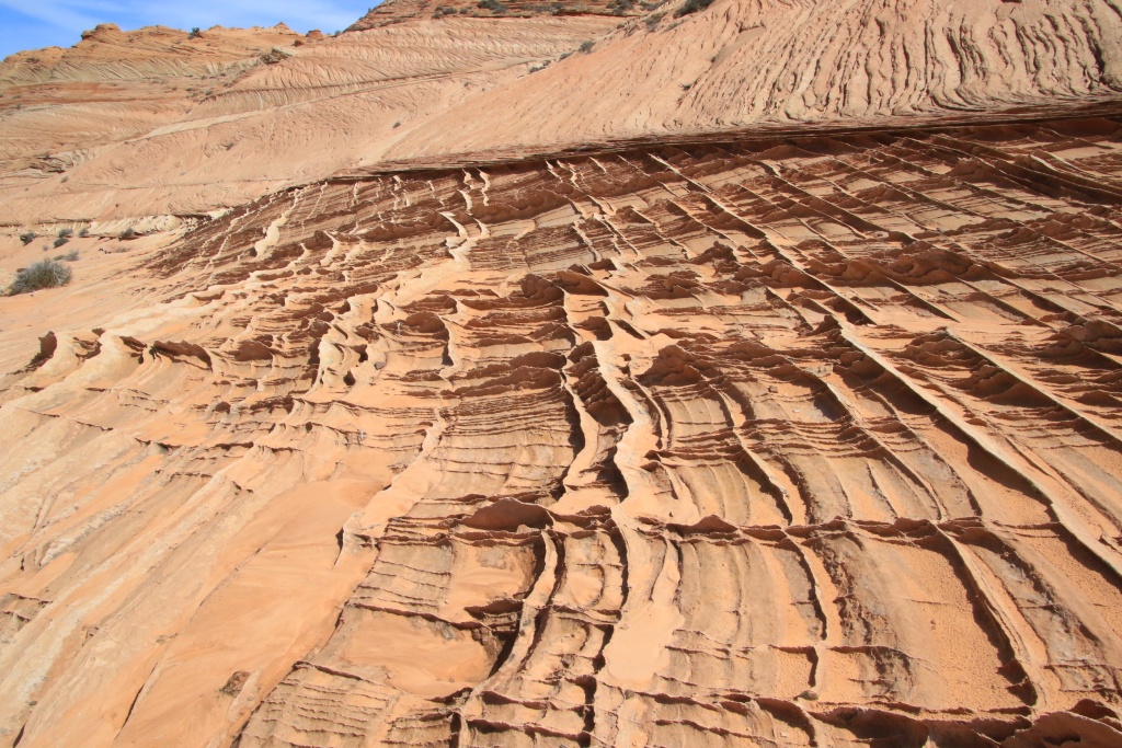
All the rocks in this area were originally sand dunes now petrified. Erosion has created all sorts of forms, each more surprising than the next.

One type of formation that we saw in huge numbers on our hike was thin slivers between the hardened layers of sand. These slats are extremely fragile and we have taken great care to minimize the impact of our steps. Curiously, on several occasions we have seen slats intersecting at right angles.

52756238316_b2342dcb98_o.jpg


52756722068_0357870eb8_o.jpg


52755698427_855e7bbc89_o.jpg


52756483804_26fc801c07_o.jpg


52756483794_c3cc9a0c89_o.jpg


Continuing our exploration, we reached a high ridge offering a superb view of the region covered by our hike.

52756644460_9070f7ce9c_o.jpg


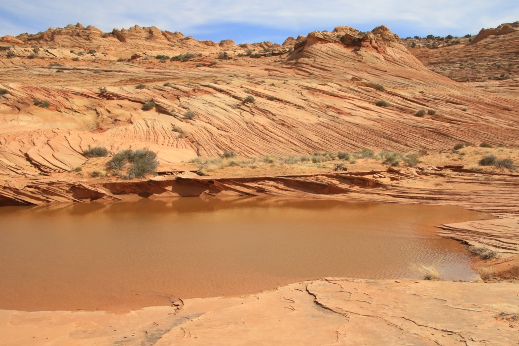
We could even see that several small lakes had formed during the last rainfall. Also, the green plains in the distance near Buckskin Gulch seemed to show us the way back.

52755698442_c463e4c08d_o.jpg


52756644450_6619dccc67_o.jpg


Back in our vehicle, we drove again House Rock Road, always so spectacular.

52756644425_5363bd204e_o.jpg


Tomorrow promises to be much cloudier than today. Let's hope that the rain expected at the end of the day does not degrade the roads in the region too much, which are just beginning to recover.
 
Thanks for the latest series of great pics!
Sure that guy could not make it, he bought a Ford truck :)
Cheers!
 
Day 36:

Start point: Kanab UT
End point: Kanab UT

Distance driven: 183 km
Distance hiked: 2.9 km


As the weather forecast mentioned precipitation from the middle of the afternoon, we took the opportunity to travel an off-road track northwest of Kanab and leading to some attractions that we had spotted. Fortunately, the sun was present at the beginning, despite a slight veil.

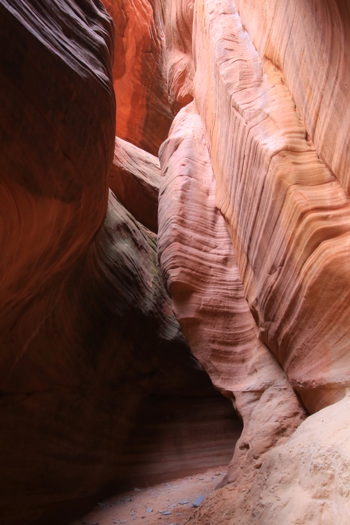
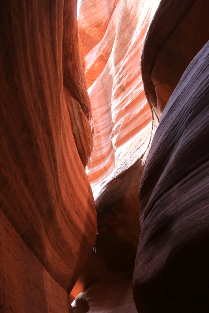
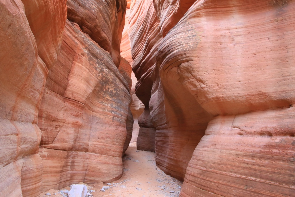
The first attraction was Peekaboo Slot Canyon (also called Red Canyon Slot). It is possible to reach this one by walking from the US89, but having the appropriate vehicle, we traveled the very sandy track to reach directly from the beginning of the canyon.

52759021153_0ca39d68e0_o.jpg


Peekaboo Slot Canyon is very pretty and luckily for me, wide enough to explore easily. In addition, the ground, composed of sand and rock, was completely dry. We were able to explore it for a little less than 1 km before encountering an impassable obstacle.

52758538621_a76e684b58_o.jpg


52758538601_57d35eb6b8_o.jpg


52759021093_7cd97c4d9d_o.jpg


52758944010_a97e22b05d_o.jpg


Back in the vehicle, we continued further north and took a secondary track climbing towards the colored cliffs that openings between the trees and bushes gave a glimpse of.

52759021073_ef1d6f9358_o.jpg


At the end of the track, we reached our second attraction, White Wave, a formation in waves, formed in the whitish rock, as opposed to the famous The Waves which is located in the reddish rock. We covered a loop of about 1 km climbing on a ridge offering a view down to the wave.

52757995232_bf6cfa8e95_o.jpg


52757995262_b60a2a9f98_o.jpg


Continuing on the main track, we approached our third attraction, White Tower. We had planned to hike around it, but as the terrain was much too rugged we decided to give up.

By this time the clouds had arrived and the sky was beginning to darken to become ominous. We continued to reach an intersection with a track to leave the area quickly. To do so, it was necessary to cross Kanab Creek whose waters laden with sediments did not make it possible to assess the depth. We crossed it with caution and without incident, apart from a short section which was a little deeper.

52757995222_c392703975_o.jpg


It was already past noon, so since we would have run out of time anyway to see the other attractions we had planned, we decided to take the shortcut back to the paved roads.

After a quick dinner, and as the precipitation did not seem to be imminent, we decided to explore an area still unknown to us. We had identified a few off-road tracks that we had to cover tomorrow when we left Kanab, but with the forecast rainfall, we couldn't have covered them.

The main trail we traveled is located in Arizona and runs along Kaibab National Forest to reach Gunsight Point. This long trail is well maintained at the start, but as we progressed the conditions got a little tougher. We encountered several pools of muddy water practically blocking the road. In addition, it is heading mainly towards the southwest, bringing us closer to the showers at the same time. A few more threatening clouds were beginning to be visible in the distance. We were still able to reach Gunsight Point, not without having decorated the 4Runner a little!

52757995212_87a03ae3c0_o.jpg


We quickly admired the landscape, at the confluence of Kanab Creek and Snake Gulch, surprised by the beauty of this unknown area. Under the sunlight, the place must be even more admirable. We will definitely return to this area to see other viewpoints.

52759021043_8fa4221a8d_o.jpg


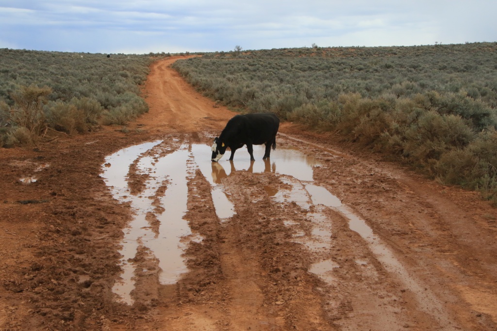
On the way back, the shower clouds had closed in and we felt a little rushed to get back on the paved roads. This was without counting a stubborn cow drinking quietly in one of the many ponds that we had to cross. Sweet words, engine roar, cries, horn, nothing helped. After ten minutes, probably sated to capacity, she decided to leave very slowly. Finally!

52758943990_ae4ae7229a_o.jpg


After rejoining the safety of the paved roads and reaching Kanab, a continuous rain started, a little too late to clean the truck. We will have this rain mixed with snow during the night and the day tomorrow. This may affect our planned activities around Page AZ, where we are staying for the next week.
 

Members online

No members online now.

Forum statistics

Threads
278,312
Messages
3,554,083
Members
248,016
Latest member
Advally Service

Trending content

Back
Top