JohnTheLuck's Adventures Thread

Day 25:

Starting Point: Darby MT
End point: Salmon ID

Distance driven: 252 km

The rain that fell this morning encouraged us to continue our sleep longer than usual. These last few days have been quite long and the additional rest has been very beneficial.

As we left Darby MT, the rain stopped. We had two forest roads on our route leading to viewpoints toward Trapper Peak, the highest peak in the Bitterroot Mountain Range at more than 3100 meters. The low clouds obscured even the tops of the nearby hills, so no hope of catching a glimpse of the summit. That will be for another time.

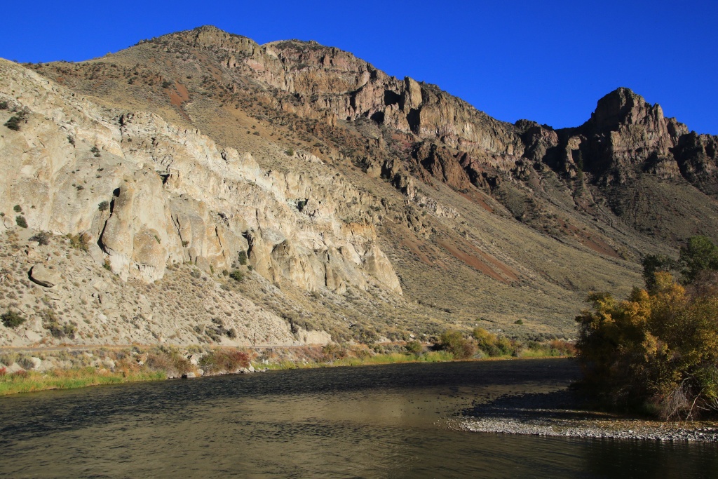
Continuing, we reached the Salmon River which we saw earlier in the trip.

53224178792_864b2c2a8c_o.jpg


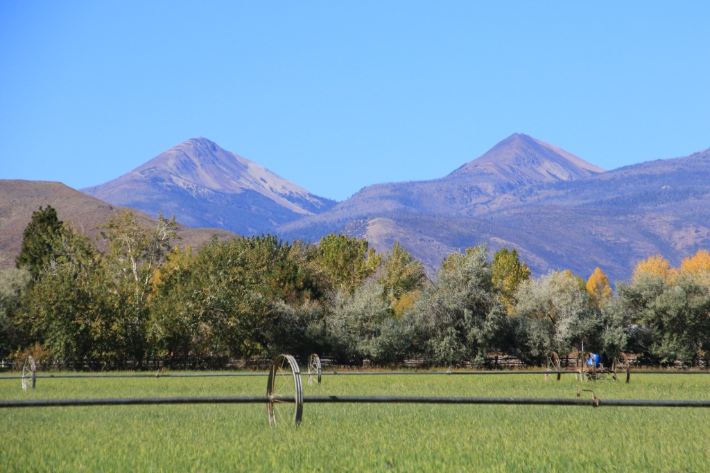
Continuing, we reached Idaho again then Salmon ID while the cloud layer had become much thinner and suggested some clearing. The Beaverhead Mountain Range of Montana loomed in the distance.

53224178787_d43b413b11_o.jpg


After dinner, we traveled the Lewis and Clark Backcountry Byway, a maintained gravel road running through the mountains to where the famous expedition entered present-day Idaho. Several information panels mentioned the highlights of the challenges they encountered. The route also offered beautiful views towards the Lemhi Mountains in the distance, sometimes reduced by light showers.

53224178757_45ae261745_o.jpg


53225437844_15a2069a9e_o.jpg


The view towards Montana was much clearer.

53225360398_1968b56258_o.jpg


Arriving at Lemhi Pass, the place where the Lewis and Clark expedition set foot in August 1805, the loop continues by taking a much steeper and winding route.

53225048421_135690ff94_o.jpg


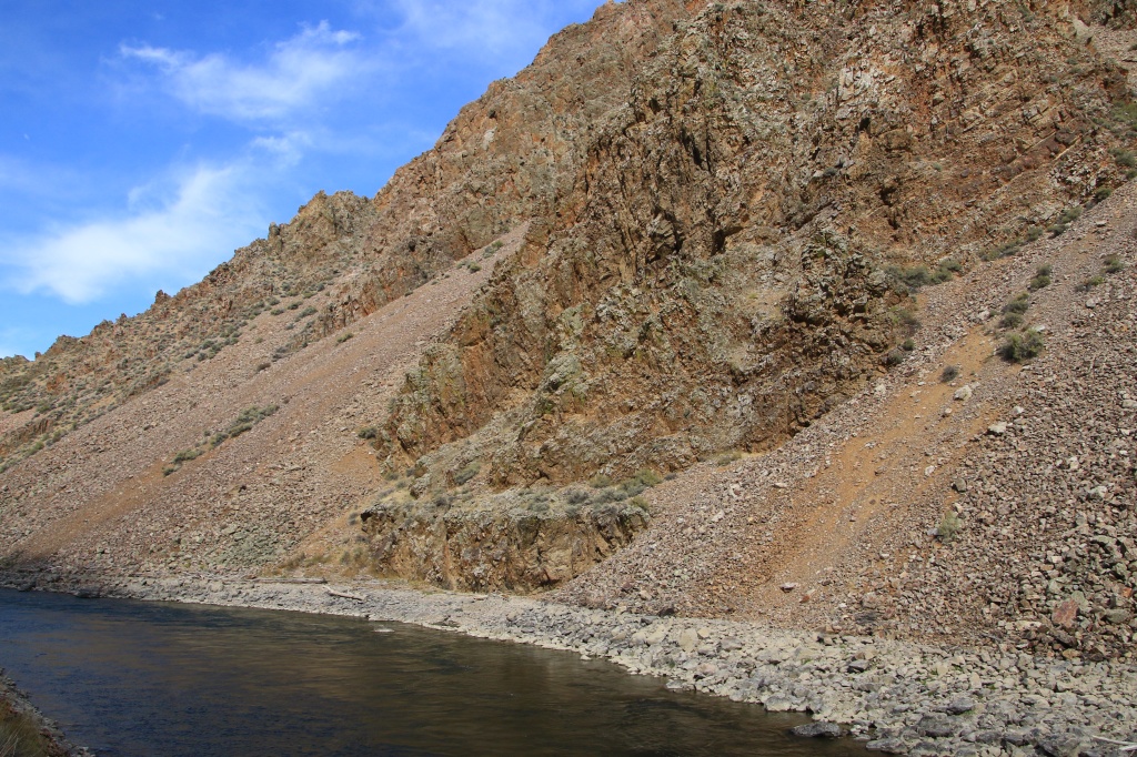
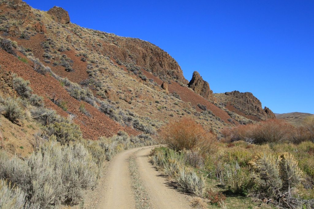
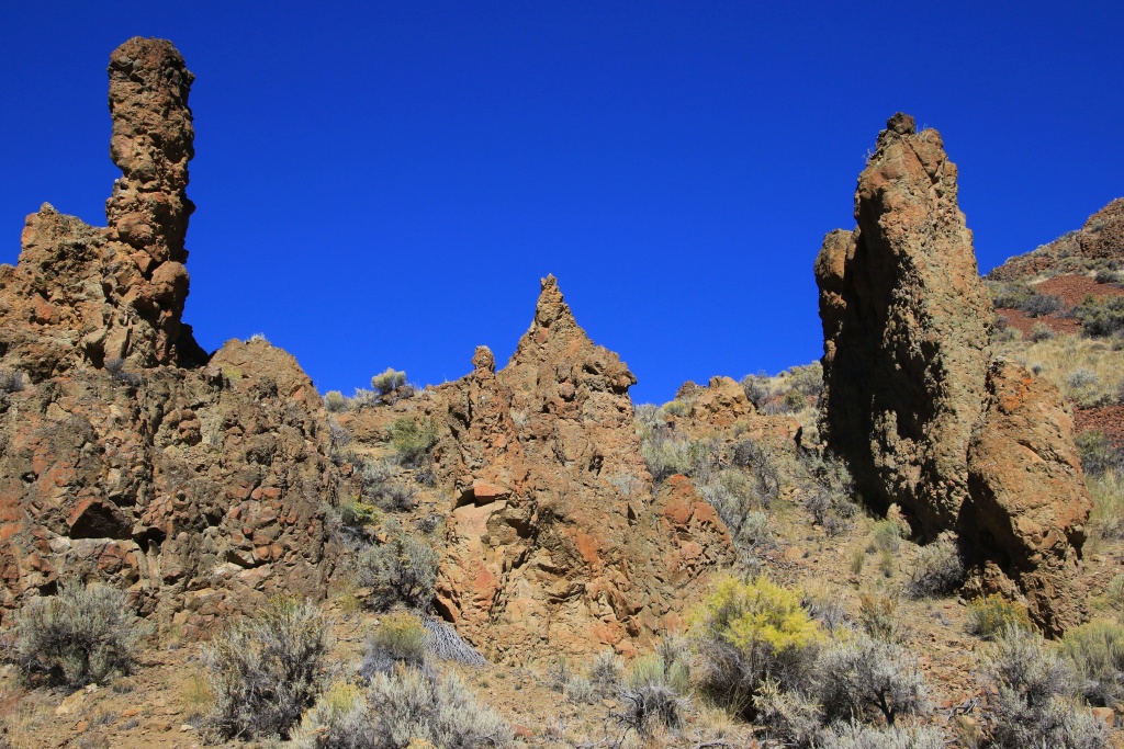
Continuing the steep descent, we noticed peculiar rock formations on the mountainsides. We quickly recognized dikes, intrusions of magma in cracks occurring in the depths of the earth's crust.

53225048401_240b8be9d5_o.jpg


53225048406_b613ff32e0_o.jpg


53225437814_f2b2e1f670_o.jpg


Towards the end of the road, when we had reached the valley, we came across a group of young Gambel quails (those we nicknamed glou-glou!) proudly posing on a fence, while its brothers and sisters had fled. in the bushes!

53225555555_a23af6a1bd_o.jpg


The weather is uncertain for the next few days and we will have to improvise as many of our planned activities were in the mountains. However, we noticed that the summits are starting to show some snow accumulations.
 
Last edited:
Day 26:

Starting Point: Salmon ID
End point: Salmon ID

Distance driven: 448 km

The expected gloomy weather actually came true, with a thick cloud cover hiding the high peaks, and frequent showers. We still had some clearings.

We had planned to travel a mountain road to do a hike that promised to be spectacular. Given the low clouds and rain, we chose to stay on the paved roads instead. So we continued on Salmon River Scenic Byway, the road that took us to Salmon yesterday. This road follows the Salmon River to its source in the mountains.

We took a short detour crossing the Salmon River to reach the lodge that Richard "Dougout Dick" Zimmerman had built for himself in the 1960s. Dougout Dick lived as a hermit all his life, distant from all services, until his death in 2010 at the age of 94. Other hermits were also living in this area, including some women.

53228031240_23bec8ec9c_o.jpg


53227908064_7b804fe483_o.jpg


Continuing on Salmon River SB, some morning clearings gave us hope for better weather, but it was very short-lived. This road is very spectacular with postcard landscapes at every turn.

53227839908_64f3df277e_o.jpg


53226656072_fd71f932a3_o.jpg


53228031220_9a68528f8d_o.jpg


Even at the beginning of October, the presence of flowers amazes us, as tthis tiny one, about 20 centimeters high.

53227908014_baaf53797d_o.jpg


53227908044_c24817cbc9_o.jpg


As we progressed towards the headwaters of the Salmon River, we gained altitude and the clouds and showers became more and more present. We then decided to turn around.

53227529761_f994a26630_o.jpg


53227529746_aea691b476_o.jpg


We headed back on Salmon River SB to Challis ID and then headed south when we saw some clearings in that direction. We took the Peaks to Craters Scenic Byway, another spectacular route starting near the high peaks to reach the craters of Craters of the Moon National Monument, a place we have already visited twice.

In our rearview mirror, the cloud mass we were trying to leave appeared as an imposing mass.

53227839798_2abb0b0b50_o.jpg


Continuing on Peaks to Craters SB, we reached Grand View Point Pass, as the road travels through a narrow, winding canyon.

53227529731_1bab6d42a4_o.jpg


Further still, after another pass, the Lost River Range appeared to us in all its splendor. The leftmost peak in the next photo is Borah Peak, the highest point in Idaho, while Sacajawea Peak is further to the right. On the far right, another immense system that was coming our way.

53227529706_94a4e7f3ba_o.jpg


Nancy decided to do the partial ascent of Borah Peak. The trail begins climbing into the dark valley on the right in the next photo at around 2300 meters above sea level and climbs to 3860 meters. Her objective is to reach a long dark gray ridge on the left, under the snow line. Frankly, given the altitude, I don't think we have the physical fitness to accomplish this daring hike. We'll see in about a week...

53227529721_cbc841e5f4_o.jpg


We reached the Borah Peak trailhead, heavy rain accompanied by strong winds joined us. We turned around. We again crossed the short clearing then once again joined the weather system which accompanied us all day and which was threatening.

53228031140_6b7e911cec_o.jpg


We are back in Salmon ID, still under the clouds. Tomorrow we hope for better weather so we can do the activities we have planned.
 
Day 27:

Starting Point: Salmon ID
End point: Salmon ID

Distance driven: 314 km
Distance hiked: 4.3 km

When we got up, as the weather seemed to be favorable, we decided to go for two off-trail hikes on the peaks of the Lost River Range in Targhee National Forest southeast of Salmon ID. To reach the area, we took the Sacajawea Scenic Byway traveling through a long valley between the Lost River Range and Beaverhead Mountains in Montana. This road gains altitude very gradually and we reached the very low cloud layer, forcing us to slow down as the visibility was so reduced.

When we reached the road leading to the summits, it was difficult to be confident for the future. On the other hand, the road climbs more than 1000 meters before reaching our points of interest, which allowed us to get rid of the clouds, at least temporarily.

53230877085_6557b945d2_o.jpg


53229503367_cf11914c27_o.jpg


The trail climbs relentlessly up the mountainside toward the pass between Sheep Mountain and Big Windy Peak. Our progress was quite slow because the track surface was very rocky.

53230877060_54b679b123_o.jpg


53230373896_3ea9891557_o.jpg


As we reached the starting point of our hike towards Sheep Mountain, the rising temperatures in the valley were causing the clouds to rise towards the peaks. Although we waited a little, the situation did not seem to be clearing up any time soon. This is the most beautiful moment of clarity we have had. We turned back before reaching the point we had planned.

53230876995_efb0fc6351_o.jpg


Back at the vehicle, the road continuing towards Big Windy Peak was visible in the distance, with some snow on the ground.

53229503267_6cf4c6c5c6_o.jpg


Upon reaching the promontory visible in the previous photo, Sheep Mountain finally deigned to show itself. A little too late for us though...

53230373716_293a5120d2_o.jpg


We then reached the starting point of our second hike, towards Big Windy Peak, as the clouds joined us once again.

53230876910_ddfd3fb6af_o.jpg


The area was exploited by a mining operation and some vestiges still remain, including this pretty house with breathtaking views, but with rather too generous ventilation!

53230876860_acde3e9e3c_o.jpg


53229503042_87fb063477_o.jpg


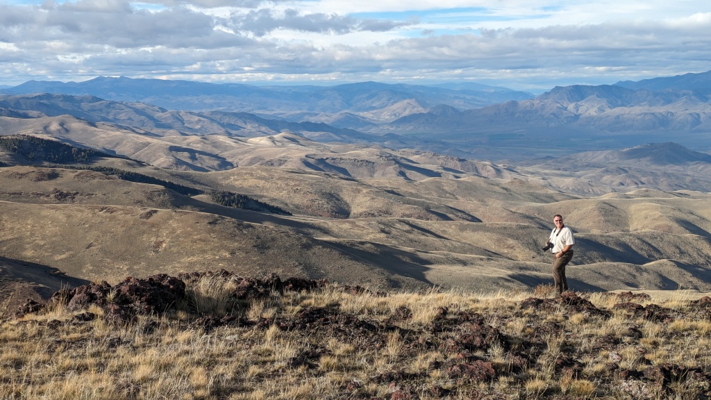
Our goal was not to climb Big Windy Peak, but rather to follow a long ridge to a promontory in front of it. Unfortunately, the snow on the ground mixed with the rocks made the progression quite difficult, even dangerous. We still reached an interesting viewpoint with a view towards Sheep Mountain in the distance still playing hide and seek in the clouds.

53229503102_b987d833bc_o.jpg


We came back down from the promontory to reach another construction, also in a pitiful state.

53230682293_c1c7528c3a_o.jpg


From this point, we took an ATV track making the descent a lot easier. The horizon was obscured by clouds and as a result, sometimes made us lose our bearings.

53230373581_9a63335a72_o.jpg


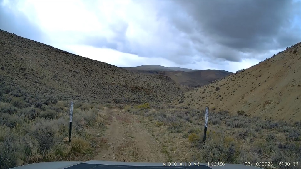
Returning to the vehicle, we descended into the valley using another track that we had spotted from the top of the mountain. This one was less intimidating but also very rocky. Nancy then found us a “shortcut” winding through the foothills of the mountain in a large area covered with small shrubs. Despite the mud holes, we still reached our next destination, Birch Creek Charcoal Kilns Interpretive Site, preserving kilns formerly used to produce charcoal by slow combustion of wood.

53229502977_7f11f3bbd8_o.jpg


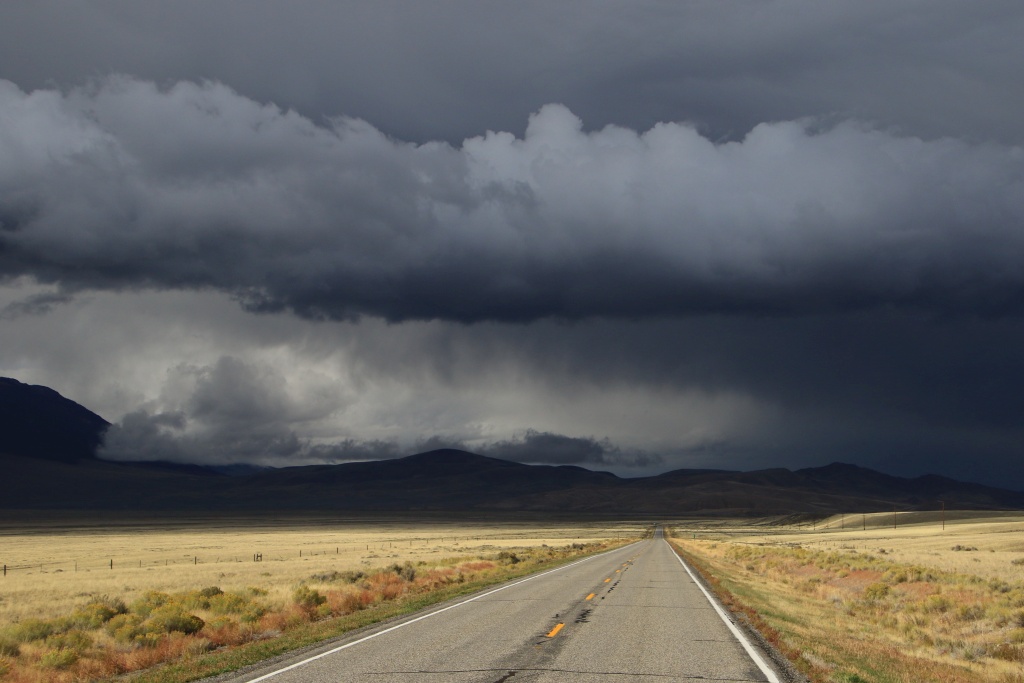
On the way back to Salmon ID, an all too familiar landscape awaited us once again.

53229502877_892f6c8cee_o.jpg


After passing the clouds, the clear skies inspired us to go drive ID 29 leading to Bannock Pass on the Idaho-Montana border. We included this route in our itinerary that we had prepared for our 2018 trip, which unfortunately never took place. This road follows a passage that has been very frequented in history, including by the Nimíipuu (Nez Perce) when they were heading towards their bison hunting territory in present-day Montana.

53230776238_c081c3e2d5_o.jpg


53230373481_5f76963c7d_o.jpg


53230682078_d2cdab4dc5_o.jpg


We finally reached Salmon ID for our last night. Tomorrow we will head to Challis ID, with once again inclement weather.
 
Day 28:

Starting Point: Salmon ID
End point: Challis ID

Distance driven: 162 km

As the weather forecast called for rain this morning and clearing late in the afternoon, we took the opportunity to do our second laundry chore.

We then left Salmon ID to reach Challis ID, taking the Salmon River Scenic Byway again. We had only a few sunny spells but several showers, much like two days ago when we drove it.

53231907437_e2a6cb1dd5_o.jpg


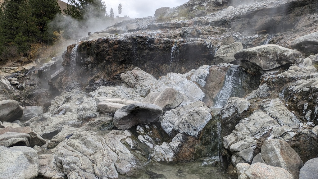
Arriving in Challis, we went to see the Challis Hot Springs. The water supplying the pools emerges from deep within the earth at around 48C in a large pond visible below. We may be tempted later during our stay in Challis.

53232776276_209d338538_o.jpg


Wanting to take advantage of the few remaining hours, we drove the Pennal Gulch Trail. It winds between very colorful hills and rocky massifs. For fans of steep slopes, long shelf road segments with blind corners, narrow switchbacks, fast sections, some very rocky sections, and spectacular landscapes, this one is for you.

53232776286_db1d2700ac_o.jpg


53233154924_25fb351bb3_o.jpg


53231907377_48ec8c220b_o.jpg


53233154869_7eef4233a4_o.jpg


53233154844_e4d667d35c_o.jpg


The only downside, and which could be considered an advantage, is that you will have to return by the same route, the last few hundred meters being on private land and the owner not allowing passage. A bit of a shame, but ultimately, we must respect the choices of others.

53233359640_cb861bd6cf_o.jpg


The few sunny spells we had on the way out were a thing of the past as the cloud layer persisted, making the colors a little more faded.

53233076823_8544861c2b_o.jpg


53231907297_540d7860fc_o.jpg


At the bottom of one of the narrow valleys, we came across an old house made of logs.

53233076688_36478da510_o.jpg


When we turned around, we noticed an odor similar to alcohol or a cleaning product, the source of which we could not determine. We felt it again when we crossed an area where the bushes encroached a little on the road and some of them brushed against the body of the 4Runner (this is not the first scratches...). We then realized that the smell was coming from the flower stems of this shrub, the sagebrush.

53231907142_d145ac4180_o.jpg


53233154714_b636192bff_o.jpg


After joining the main road, a large clearing allowed the sun to illuminate the region we had just traveled.

53232776071_de963a69a4_o.jpg


For the next few days, the weather should be very mild with lots of sunshine. On the other hand, it is still raining a little in the evening because the clouds seem to be clinging to the mountains.
 
Day 29:

Starting Point: Challis ID
Arrival point: Challis ID

Distance by vehicle: 163 km
Hiking distance: 5.2 km

The rain and grayness of the last few days have finally left us, at least for a while. The sun was shining despite some cloudy periods. The temperature was very comfortable with a maximum around 19C, and the air was definitely much drier. We had a great day exploring the area around Challis.

Our first destination of the day was a hike along Malm Gulch to see the trunks of petrified giant sequoias. These date back 50 million years and were part of a large forest that was buried by ash from a nearby volcano. Very little of this forest remains today, and fences have been installed to preserve what remains.

53235719195_79a2bdb772_o.jpg


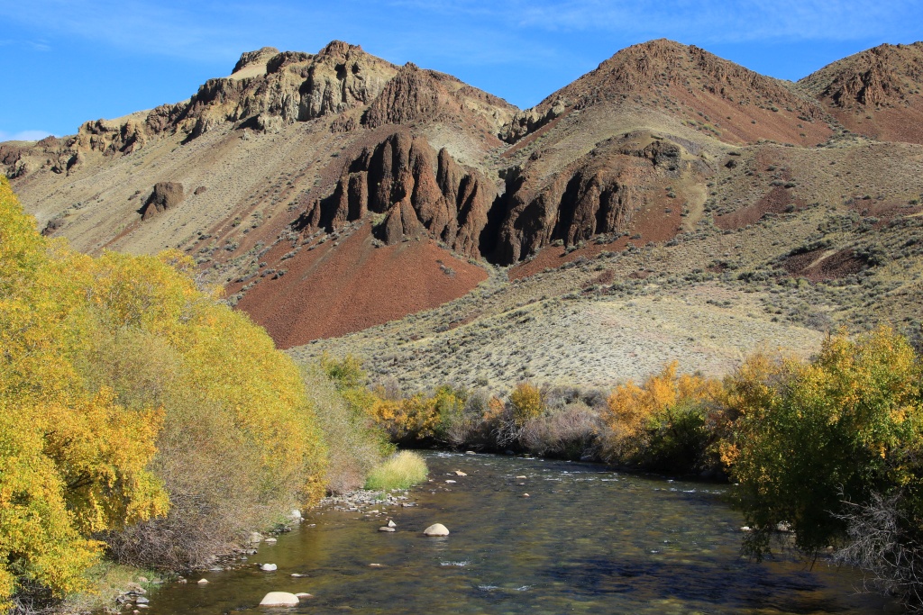
We then continued to our second attraction of the day via the East Fork Road. The East Fork Salmon River was lined with shrubs whose bright yellow foliage reminded us that fall had indeed arrived.

53234355837_ae435ce5e3_o.jpg


Nearby, we reached the start of Spar Canyon Road, our second attraction of the day. This gravel road begins with a canyon lined with very colorful volcanic rocks.

53235590939_a200215d54_o.jpg


53235719175_ab71baf790_o.jpg


53235219246_a9a1d9c509_o.jpg


At the exit of the canyon, this maintained road gives access to a network of secondary trails offering views of this beautiful mountainous region. Our first secondary track running through the bottom of a canyon was a failure because a deep wash would have forced us to take out our shovel to soften the slopes. We decided instead to head towards the second secondary trail. This one climbs more into the hills, offering a very beautiful view towards the Lost River Range in the distance.

53235521578_4c873e7236_o.jpg


One of the viewpoints allowed us to see the hills surrounding Malm Gulch, the location of our morning hike.

53234355637_8463f6b795_o.jpg


We then rejoined US 93 and reached the start of our third attraction of the day, a long loop formed by Lime Creek Road, Spud Basin Road, and Leaton Gulch Road. This loop climbs to reach the foothills of the Lost River Range and its snow-capped peaks.

53235219121_9091212549_o.jpg


53235718925_4d1f70d481_o.jpg


53235219041_64ac1a3e77_o.jpg


We took a short detour to see Grouse Creek Lake on a promontory.

53235590654_b590aa28f5_o.jpg


Continuing on Spud Basin Road, the ride becomes much more exciting. The track then runs on a long ridge with very steep climbs and descents. We then reached the summit of the route on Table Mountain at 2710 meters, about 1000 meters higher than our starting point. The view was exceptional in almost every direction.

53235590659_58816de2fe_o.jpg


53235718775_eff7687ec1_o.jpg


Obviously, after the climb, you have to come back down! The track at this point is made up of volcanic stones offering quite a bit of grip when they are still firmly fixed. I have never gone down such a long and steep slope. Even with the transmission in 4-low and first gear, the compression of the engine running at nearly 4000 rpm was not enough to slow the descent without using the brakes!!!

53234355372_597648087c_o.jpg


Further on, we reached a promontory allowing a last look at the Lemhi Range before the final descent. It is very likely that we will travel through the large valley in the following photo during the day tomorrow.

53235521268_038d50f2d2_o.jpg


We then joined the Leaton Gulch road to reach Challis, visible in the distance.

53235218801_b0607b0005_o.jpg


Tomorrow we hope to do a hike that Nancy has been dreaming of hiking since 2018. As far as she is concerned, this hike is the highlight of the trip. I have no doubt it will be very beautiful, but what we have seen so far on the trip has been spectacular as well.
 
Day 30:

Starting Point: Challis ID
End point: Challis ID

Distance by vehicle: 204 km
Hiking distance: 7.7 km

Today was the day Nancy had been waiting for, the day we were going to hike to Merriam Lake in Challis National Forest. The sky was a beautiful cloudless blue, the winds almost non-existent, and the temperature slightly below 20C, perfect conditions for a hike.

To reach the start of the hike, we took a succession of gravel roads; Doublespring Pass, Horse Heaven Pass, then Upper Pashimeroi Road. As we progressed, the condition of the roads deteriorated greatly due to the presence of areas with large outcropping rocks. As it was still quite early, only the mountains to the west were lit by the still very low sun.

53237498276_6ff5f36270_o.jpg


53237797948_b03cccb8a0_o.jpg


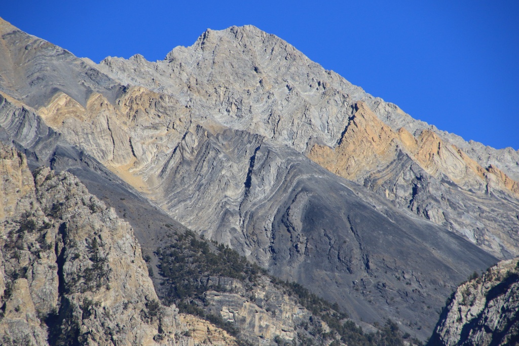
As we approached the trailhead, we began to see the distinctive mountain patterns of the Lost River Range, layers of angled sedimentary rocks of various colors.

53237990705_edc148d105_o.jpg


After reaching the starting point located at 2500 meters, we began the ascent. At first, the trail travels through a coniferous forest with a steady but reasonable elevation gain. Further on, we reached a steep rocky ledge.

53237498131_80bbe9ed8d_o.jpg


Given the altitude, we made many stops to catch our breath. Finally, we reached the stream serving as an overflow from the lake, located at a little over 2900 meters. Good news!

53237797853_9ac079d71c_o.jpg


Finally, Merriam Lake revealed itself to us, with its beautiful emerald green waters and tall cliffs surrounding it on three sides.

53237990665_0c1e5c6f88_o.jpg


53237990680_a3cfa50520_o.jpg


53237498226_9c3e823872_o.jpg


53237498186_a6f61a7968_o.jpg


After a well-deserved break, we admired the landscape, enjoyed the tranquility, and watched the fish swim gently, we began our descent.

53237797833_55dbffb04c_o.jpg


53236635077_04f49aa14b_o.jpg


Back at the 4Runner, we took the reverse route, tackling the rocky sections once again. As it was already afternoon, the mountains that were in shadow this morning were now lit by the sun.

53237867534_fc0c0583ca_o.jpg


53237797748_73d9d49f0f_o.jpg


53237797773_bd544c9680_o.jpg


53237797698_3157a1c729_o.jpg


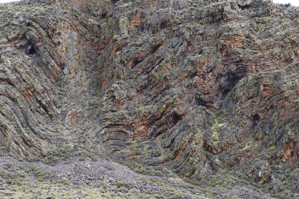
After retracing our route to Doublespring Pass Road, we continued on this one toward the north, just to do something different. We passed some rocky cliffs showing the region's turbulent past. Several natural caves had formed in folds between two rock strata.

53237990380_f4dfe56da2_o.jpg


Continuing further north, we reached the immense Pashimeroi River valley. Water appears to be in abundance there as the valley is dotted with ranches and cultivated areas.

53237497961_10b1dff046_o.jpg


53237797683_a006eba6e5_o.jpg


As we drove through the valley, we recognized Table Mountain, the highest point of the last track we hiked yesterday at the end of the day.
 
Day 31:

Starting Point: Challis ID
End point: Challis ID

Distance by vehicle: 123 km
Hiking distance: 4.7 km

We had another superb day, without a single cloud and a very pleasant temperature of 20C. Our main attraction for the day was a mountainous region of Challis National Forest located a little north of Challis. Access is by passing through a rancher's property. We had previously managed to contact him and he had agreed to allow us to travel through his land. We thank him again for letting us pass, allowing us to experience this very beautiful day.

We started our ascent at just under 1400 meters. We reached a viewpoint allowing us to see the large canyon carved out by the Salmon River. The great variety of colors of the rocks of volcanic origin is truly astonishing on this scale.

53239685891_838ca055df_o.jpg


53238813927_c72216c8b7_o.jpg


53239983663_b2951ea1ae_o.jpg


Then we continued our climb. After hills covered with shrubs, we reached a coniferous forest bordered between two long ridges. The ground became very rocky and our progress was slowed by tree trunks encroaching on the track. With a little work, we always managed to clear the way, except for this one which could fortunately be avoided by a short detour. Obviously, if we had had a chainsaw, the problem would not have persisted for very long.

53240168310_249cdf880c_o.jpg


The forest was very dense, making the track too narrow for a 4Runner. It certainly has new memories on its paint. But, it was not for pampering that we bought it, but precisely to reach places that are difficult to access. It's just sheet metal some would say...

Despite everything, we reached the start of the long switchbacks in just under two hours. The forest having given way to large rocks.

53239983648_9b840eaf57_o.jpg


We continued with the 4Runner until the end of the first segment of the switchbacks, at an altitude of just under 2900 meters. Subsequently, the width of the track was reduced by erosion, and we continued on foot. Our goal was to reach the pass near the summit of Lem Peak. The ascent was gradual and very reasonable, and the shade of some trees gave us a reason to catch our breath.

53238813647_d361d85be9_o.jpg


53240168170_cf5f81cc73_o.jpg


Once the pass was reached at more than 3050 meters, the view of the forest surrounded on three sides by the very high cliffs was truly superb. Can you find the 4Runner in the following photo?

53239983538_08c39d49d1_o.jpg


As if the altitude at the pass was not already high enough, we continued along a long ridge made up of several hills. Progress was then quite slow because the surface was made up of jumbled boulders.

53238813807_88597bea01_o.jpg


53238813787_77d081bde9_o.jpg


53239685586_a9a195ab37_o.jpg


We reached a final promontory located at over 3150 meters, our highest altitude while hiking during the trip.

53240049309_514b44f1f9_o.jpg


As it was getting late, we began our slow return on foot, then by vehicle. We reached our starting point after a descent that was a little faster than we thought. Here is one of the landscapes that our kind rancher has from his house, a very spectacular place.

53240168005_946862127e_o.jpg


On the way back we made frequent stops on the Salmon River Scenic Byway. The rays of the sun setting on the horizon made the mountains shine and especially the poplars having put on their autumn dress.


53238813487_237de39a09_o.jpg


53240167890_f6a156160e_o.jpg


53239685501_90c52af1a2_o.jpg


53240167865_762bd940e7_o.jpg


Tomorrow we will drive some more off-road trails and probably visit some historic sites.
 
Day 32:

Starting Point: Challis ID
End point: Challis ID

Distance by vehicle: 278 km
Hiking distance: 3.2 km

How blessed we are by the weather with another day with a beautiful blue sky without any clouds and a temperature of 22C.

Our first destination was the Bayhorse ghost town, part of the Land of the Yankee Fork State Park. This park includes parcels of this historic mining region. When we arrived the gates were all closed and we thought we were too early.

So we continued on the road and found a secondary track climbing towards mining installations that we had seen high up in the mountains. This track was a little stressful because it offered practically no opportunity to pull over during possible vehicle crossings. Fortunately, we were alone!

53241143817_d2cf7bdcf5_o.jpg


The track eventually reached the start of a path leading to the building we had seen from the main road. We quickly understood that it served as the starting point of an old tramway to transport minerals down to the bottom of the valley. The building was somewhat damaged by time and allowed a glimpse of the interior.

53241143757_f44232188c_o.jpg


53241143802_536a1240c4_o.jpg


Back on the main road, we spotted the building we had seen up close on the top of the cliff, as well as other constructions and towers to support the cables of the tramway.

53241143762_1a2642acc7_o.jpg


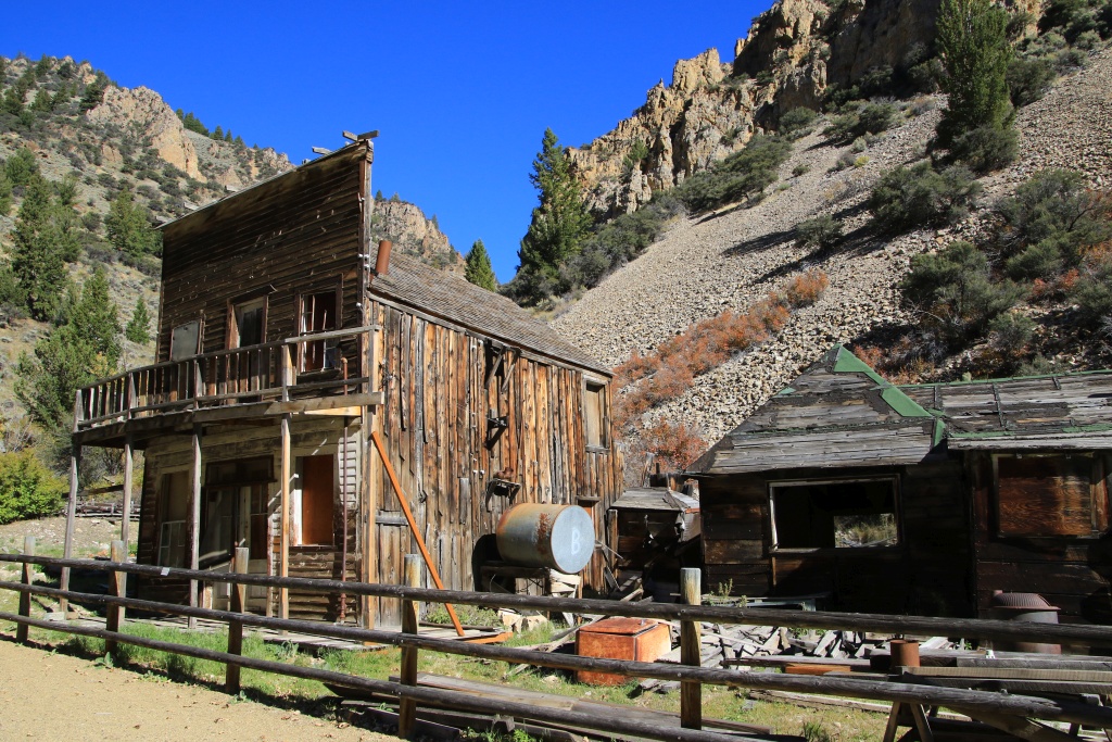
Back in Bayhorse Ghost Town, the fences were still closed. However, we noticed a hiking trail providing access to the site. As all the signs appeared to have been removed, we deduced that the site was closed for the winter. We were still able to see the different buildings and relics.

53242019971_8b0edf306e_o.jpg


53242385864_c60be0b589_o.jpg


53242508265_6bd3f56a94_o.jpg


After the visit, we returned to Challis for our second attraction of the day. On the Salmon River Scenic Byway, we couldn't resist this magnificent view, one of many.

53242385759_aceda5f87e_o.jpg


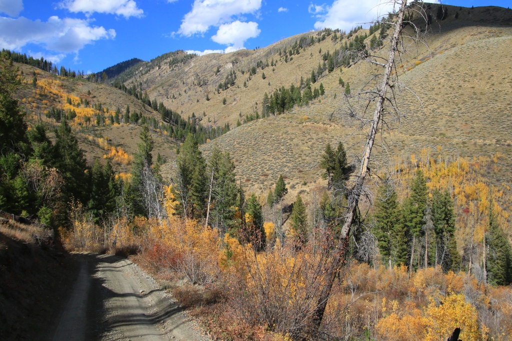
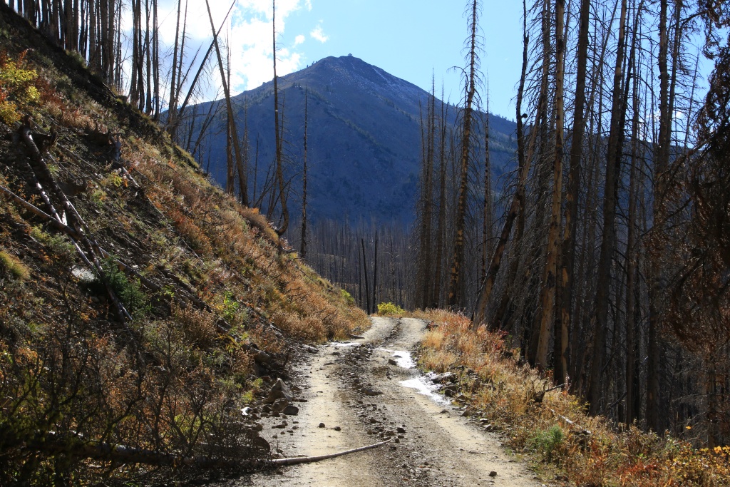
Our second attraction of the day was a road through Challis National Forest leading to the Twin Peaks Fire Lookout. The road passes through an area of forest devastated by a fire several years ago, before reaching the rocky escarpment leading to the south summit of Twin Peaks. From Challis, the fire lookout tower was visible on the left summit of Twin Peaks, as well as the long climb of the road in the rocky section.

53241220987_735cee2280_o.jpg


A nearby peak showed signs of the approaching winter.

53242385739_07a8eaea49_o.jpg


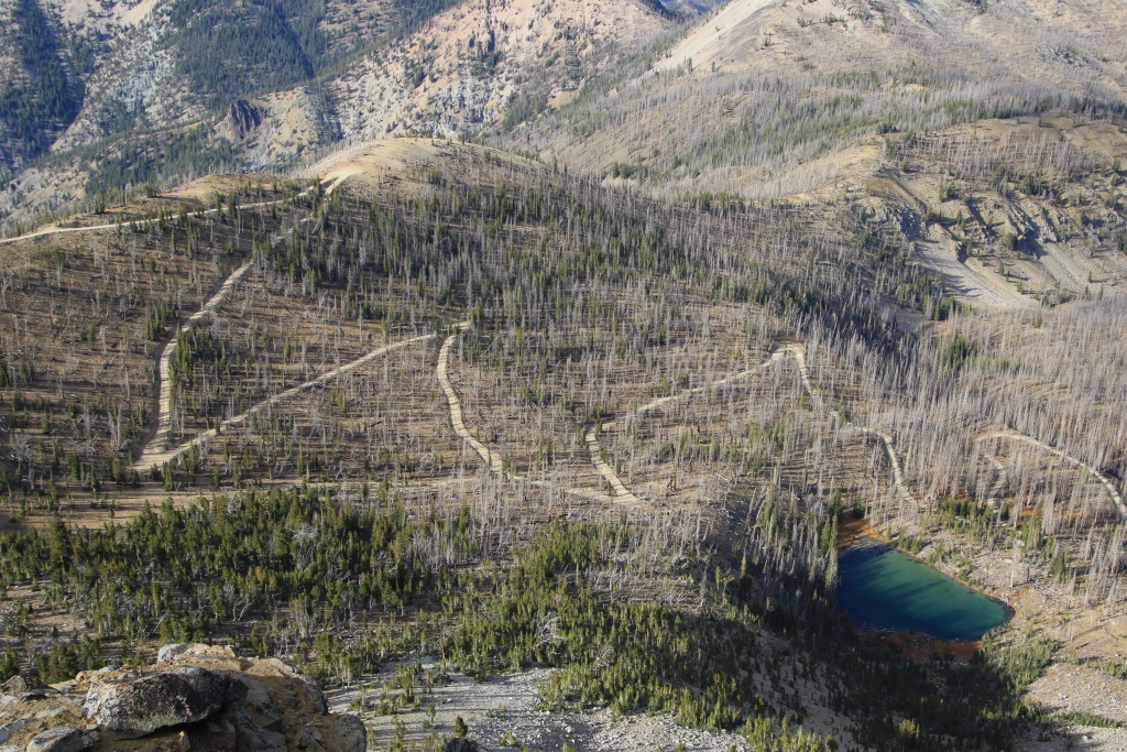
The last segment of the road before reaching the summit is made up of nearly ten very tight switchbacks.

53242314153_6b86eb142d_o.jpg


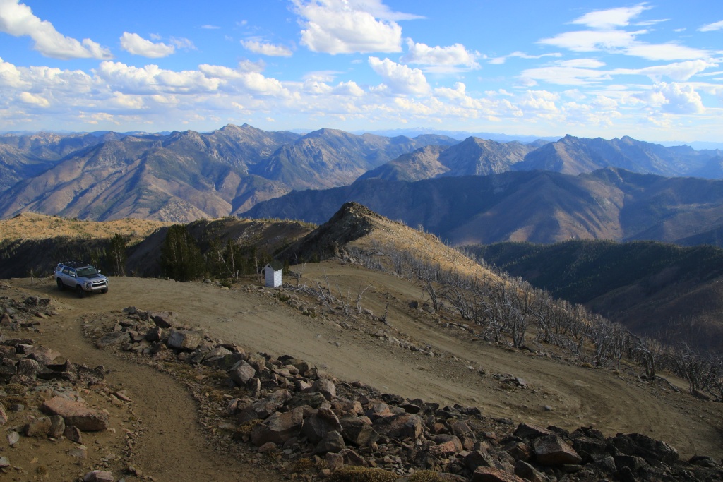
Our objective located at an altitude of 3168 meters finally appeared to us!

53242019661_8a64eeba7d_o.jpg


This high peak offers spectacular 360-degree views. In the distance to the southeast, the valley in which Challis is located is visible, with the Lost River Range, then Lemhi Range even further behind.

53242508145_9851270a64_o.jpg


The view to the northeast allowed us to see the long glacial valley that we crossed before reaching the rocky part.

53242392513_a3a96cf890_o.jpg


The view to the northwest allows you to see the high peaks of Frank Church-River of No Return Wilderness and a nearly 40 km road running in a corridor towards the Sleeping Deer Fire Lookout.

53242508205_e6647f33ef_o.jpg


53242314243_049f0983c9_o.jpg


After returning to Challis, we drove once again the Salmon River Scenic Byway to see or revisit some points of interest and enjoy the scenery at sunset.

53241143482_8007a6e12e_o.jpg


Our final attraction was the old Sunbeam Dam, having been erected in 1910 to provide electricity to the Sunbeam Mine. After seeing the devastating effect on salmon populations by eliminating part of their spawning grounds and decimating them in the turbines, the dam was finally partially destroyed in 1934.

53241143442_518e8803ff_o.jpg


Surprisingly, the salmon leave the salt waters of the Pacific in April, successively going up the waters of the Columbia River, then those of the Snake River then Salmon River. They arrive in the spawning areas in August after having covered a total distance of more than 1,400 kilometers in five months!

Tomorrow, as the good weather continues, we will travel two more mountain routes and a hike which should be colorful.
 
Last edited:
Day 33:

Starting Point: Challis ID
Arrival point: Challis Id

Distance by vehicle: 245 km
Hiking distance: 1.1 km

We had another great day exploring the beautiful Challis ID area. We were treated to a still very clear sky, with only a few clouds at the very end of the day, and a temperature of 23C.

For our first activity of the day, we planned a 7 km off-trail hike in a canyon to a place called Paint Pots given the colors of the rocks. However, upon arriving at our intended starting point, we had a hesitation as the land appears to be private. We didn't feel comfortable crossing the fences without permission first, so we gave it up.

Our second attraction of the day was a drive in Sawtooth National Recreation Area. Railroad Ridge Road intersects the old mining village of Livingston Mill. Some accounts on the Internet and posters on site seem to indicate that the place is private. Several buildings are still in good condition.

53244783078_5948de1d0b_o.jpg


Railroad Ridge climbs a mountain with a large plateau at the top. We reached the altitude of 3181 meters, our highest elevation of the trip!

53244783458_54db6dcd46_o.jpg


The plateau offers a striking 360-degree view. Railroad Ridge Road can be seen climbing up from the valley to the right in the next photo.

53244983390_5baa30cf2c_o.jpg


53244783453_25c2534a8b_o.jpg


In the distance, we saw the Clayton Mine still exploiting silver and zinc deposits today.

53244783053_69662bdeef_o.jpg


Going back down a bit on the way back, we noticed the buildings of Livingston Mine. A barrier on the road providing access was padlocked. We also noticed in some places old steel cables which must have been used by a cable car to transport the ore to Levingston Mill further down the valley. However, we have not found any remains of the towers that would support these cables.

53244853244_fd49aa2181_o.jpg


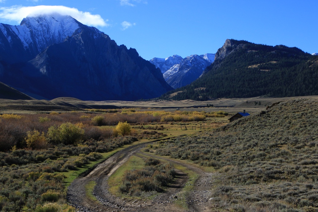
Back on the main road, we reached the start of another road through the hills, parallel to the one to Spar Canyon that we drove a few days ago, but a little further south. We were a little intrigued by the name, Road Creek Road. We quickly understood why it was named that; in a few places, the stream and the road become one! As there was not much water, only the lower section of the road was submerged.

53243610462_0b9eeaf170_o.jpg


Further on, the road runs along very photogenic cliffs of volcanic origin.

53244853174_e7b65e34bb_o.jpg


53244853144_e83defb765_o.jpg


Further on, we turned onto the Walker Way road. This road seems to follow an old railway grade because it loses altitude very constantly, following the contours of the canyons. We then noticed that the rocks were no longer volcanic in nature but were now made of white granite.

53244783258_b7798bafdb_o.jpg


At a bend in the road, the reason for this change in the nature of the ground became apparent to us as the Lost River Range now loomed before us.

53244983265_60cd04980b_o.jpg


The snow that fell about a week ago had already largely melted, to the great delight of migratory birds.

53244983195_0766b57391_o.jpg


53244490276_efdd40163d_o.jpg


After joining the Peaks to Craters Scenic Byway, we then headed to the trailhead of the hike to the summit of Borah Peak, the highest peak in Idaho at 3860 meters above sea level.

53244853009_76ac274cea_o.jpg


53243610107_293550b982_o.jpg


53244982880_b433b58686_o.jpg


In order to reach our last point of interest located on Doublespring Pass Road, rather than returning to the paved road, Nancy found another of her famous shortcuts running closely along the mountains. I have to say this one was very beautiful.

53244490106_c177d7b246_o.jpg


Our final attraction was the Earthquake Interpretive Site on Doublespring Pass Road. This site is located on the long scar of an earthquake that occurred in October 1983. This one of magnitude 7.3 caused the elevation of the Lost River Range by 30 cm as well as the subsidence of the valley by more than 2 meters . The subsidence, visible from the place where the following photo was taken, continues along the mountains for 34 kilometers. (You can also see it in the previous photo and the 4th photo above).

53244783003_f757818f52_o.jpg


Tomorrow we will leave Challis via a road through the mountains to some historic mining sites in Land of the Yankee Fork State Park. We will then join Stanley ID by completing the Salmon River Scenic Byway.
 
Day 34:

Starting Point: Challis ID
End point: Stanley ID

Distance by vehicle: 220 km
Hiking distance: 1.8 km

We left Challis this morning after a memorable stay. Rather than take the Salmon River Scenic Byway again, we opted instead for a historic gravel road running through the mountains. The Custer Motorway Adventure Road was, when it opened in 1879, the only road supplying the region's mining villages from Challis. A cost of 5 dollars was required as a right of passage.

Several establishments were located at regular intervals to meet the needs of travelers, but as these buildings were made of wood, very few remain today. This road was later improved for automobile traffic in 1933.

The road eventually joins Yankee Fork Salmon River.

53247649919_9b53d7c2df_o.jpg


This region has been very actively exploited for its gold deposits. The road intersects the ghost town of Custer. Several period buildings and old mining equipment are on display.

53247292816_c39cb576ed_o.jpg


53246415792_35e109b7b5_o.jpg


Several years later, the Yankee Fork Salmon River was mined by a massive dredge, destroying the natural salmon spawning habitat and leaving behind arcuate rock piles. This was in operation from 1940 until 1952.

53247649629_0a278c6b14_o.jpg


53246415787_9cf9109b79_o.jpg


53247292611_2e4833c4b4_o.jpg


53246415482_348cd0115e_o.jpg


Efforts to reconstitute the natural spawning habitat have been carried out and the salmon are returning. The natives have the right to practice an ancestral fishing technique with rod nets, capturing only the largest salmon and letting the smallest pass through.

53247787345_51ff78a8b3_o.jpg


We took a short detour to see Bonanza Cemetery, another ghost town located near Custer.

53247588618_0c8af9201f_o.jpg


Wanting to make the most of the still clear sky, as clouds and rain are expected in the coming days, we decided to continue on the Loon Creek and Beaver Creek forest roads reaching the Pinyon Peak Fire Lookout tower. .

Along Loon Creek, several mines have been operated, some of which are now undergoing land reclamation.

53247292796_be3a3a6d63_o.jpg


Further on, the road runs in a narrow corridor in the protected territory of Frank Church-River of No Return Wilderness.

53247787625_ea59496627_o.jpg


Further on, we were able to see our next destination high above, the Pinyon Peak Fire Lookout, as we drove through an area that had been ravaged by a forest fire.

53247787580_c78c6a9b04_o.jpg


After completing the ascent, we had a spectacular 360 degree view of the surrounding area, although the clouds appeared and spoiled the party.

53247649699_5d8179df57_o.jpg


53247292416_13ddc672bf_o.jpg


53246415417_019671d892_o.jpg


Visible below, the road we had just traveled, then the one we were about to discover, traveling along a long ridge.

53247649454_caf2482835_o.jpg


53247588138_5e937bae01_o.jpg


Then we continued, a little rushed for time with the sun getting lower and lower. We reached Stanley ID, our place of residence for the next four nights. As the weather is somewhat uncertain for the next few days, we will have to revise our plans.
 
Day 35:

Starting Point: Stanley ID
Arrival Point: Stanley ID

Distance by vehicle: 428 km
Hiking distance: 2.5 km

The weather forecast came true with the arrival of full cloud cover and rain in the afternoon. So we decided to drive three scenic routes forming a loop.

The first, the Ponderosa Pine Scenic Byway, begins in Stanley ID and ends in Boise ID, the state capital. The Grandjean Overlook gave us the best view of the day with the Sawtooth Mountain range still lightly lit by the rising sun.

53250072904_9b75142628_o.jpg


Further on, we stopped at Kirkham Hot Springs, a place where hot springs emerge from the rocks along the Payette River. Pools made from stacked rocks hold water in which visitors can rest, some of which can be seen on the left in the following photo.

53248837957_d785ac0218_o.jpg


53250212655_0e9b979495_o.jpg


53248837947_b18184a273_o.jpg


Continuing, we reached the historic town of Idaho City, having been founded after the discovery of gold veins. The city grew very quickly and was at one time the most populous city in Idaho.

53248837847_7b11bfed21_o.jpg


53250212600_c943b89994_o.jpg


53248837917_cff8689bf2_o.jpg


Still in Idaho City, we went to see the Pioneer Cemetery containing around 2000 graves. Notoriously, of the 200 oldest tombs, only 20 of the deceased died of natural causes, the others following acts of violence that were very common at the time. For example, the grave in the following photo is that of a man who was shot following an altercation over a mine.

53250212645_f0e5dfdaa3_o.jpg


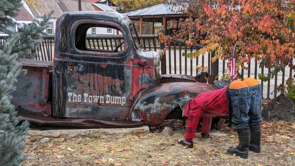
Leaving the cemetery, we encountered some rather gloomy scenes on the same theme!

53250072794_745c72b38d_o.jpg


53250212535_1a6c393116_o.jpg


Continuing the scenic route, we reached the outskirts of Lucky Peak Reservoir where the water level was practically at its lowest. Further on, a viewpoint allowed you to see the Lucky Peak Dam.

53249761951_ddb9f6f94c_o.jpg


53250006343_9c3feeb192_o.jpg


A little further, the Boise River Dam, an older dam that was part of the first developments on the Boise River to regulate the water supply for agricultural purposes in the region.

53249710741_87142e26c2_o.jpg


After completing Ponderosa Pine SB upon reaching Boise ID, and having a hearty meal, we traveled the second scenic road, the Payette River Scenic Byway. Unfortunately, the steady rain accompanied us throughout this route and we did not take any photos.

Further on, we reached the west end of the third scenic road, the Wildlife Canyon Scenic Byway. This magnificent road runs through the canyon carved out by the Payette River and offers multiple waterfalls and waterfalls. A large number of stops are set up to admire the canyon and the river. The rain continued to fall, but more moderately.

53248837832_d0694d6079_o.jpg


53250212520_50a9b2cd82_o.jpg


53250006333_c69253f288_o.jpg


Tomorrow, the bad weather is expected to continue, at least in the morning. We will decide tomorrow morning what we do.
 
Last edited:
Day 36:
Starting Point: Stanley ID
End point: Stanley ID

Distance by vehicle: 153 km

When we got up late, there were some clearings in the sky giving us hope for the rest of the day. We took the opportunity to reach a few viewpoints including a very popular one along the Salmon River Scenic Byway overlooking the village of Lower Stanley as well as Stanley in the background, in front of the Sawtooth Range playing hide and seek behind the clouds.

53252160029_23f197bed4_o.jpg


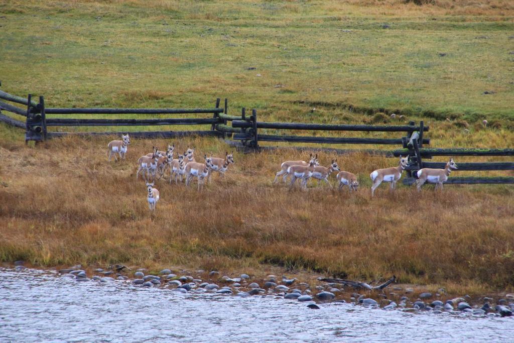
Nearby, a herd of Pronghorn antelopes lined one of the many fences along the Salmon River.

53252160049_b4216c808d_o.jpg


Inspired by the sight of these antelopes, we went to several viewpoints along the Ponderosa Pine Scenic Byway, northwest of Stanley, hoping to see elk or deer. Nothing like that, except cattle and horses in pens in the distance, at least at Valley Creek Overlook.

53250917272_39a36c419c_o.jpg


Afterwards, we went to Stanley Lake to try to see the Sawtooth up close, but as the clouds were getting more and more present, our view was quite obstructed.

53252297300_ab9ef4f57a_o.jpg


Nearby, we took a forest road leading to a viewpoint in the mountains overlooking the lake. We reached the altitude of the freshly fallen snow. Obviously the view wasn't any better.

53251802106_965352f1c5_o.jpg


In the afternoon, conditions did not improve, going from brief clearing to showers of rain or even snow.

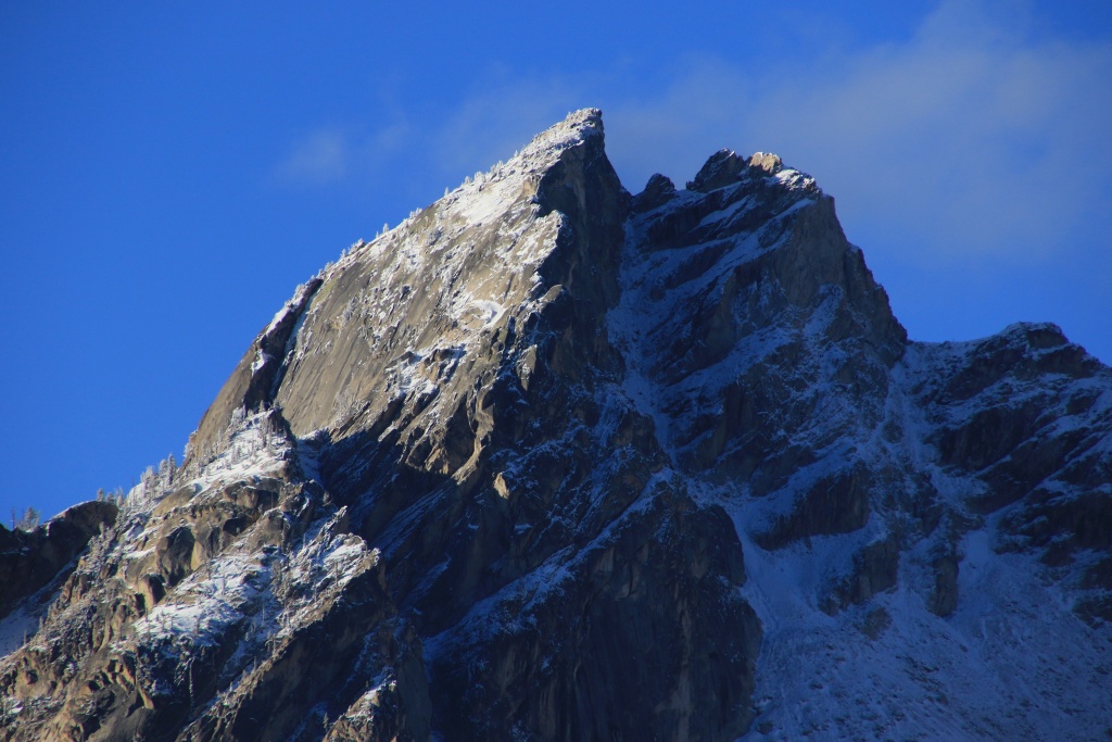
Tomorrow the forecast is much more encouraging and we should be able to see the Sawtooth Mountains in all their glory, covered in their new winter blanket.
 
Day 37:

Starting Point: Stanley ID
End point: Stanley ID

Distance by vehicle: 257 km
Hiking distance: 3.8 km

Oh how good it is to see a beautiful blue sky, even if the morning temperature was below freezing. Our day was a series of changes and improvisation given the presence of snow in elevation, somewhat limiting our planned activities.

We started our day by driving the easy gravel Nip and Tuck Road, winding through the hills a little north of Stanley. The view of the Sawtooth Range was really pretty.

53253176352_353817d94a_o.jpg


53254552325_da25c48fd8_o.jpg


Next, we returned to Stanley Lake in Sawtooth National Recreation Area to hike a portion of the Lakeshore Trail. The surface of the lake was practically mirror-smooth.

53253176342_48d19fb205_o.jpg


In the distance, on the water at the edge of the morning mist, a group of aquatic birds were moving slowly.

53254552245_c0608d190f_o.jpg


In the heights, the few trees managing to survive on the summits probably saw their environment plunged permanently into the next season.

53254552305_22bb0c03ab_o.jpg


We then returned to Stanley for the official photo, in better conditions than yesterday.

53254410799_aa2e14f055_o.jpg


We then reached Redfish Lake. We considered doing a hike, but since that would have been mostly in the forest, we decided to do something else.

53254552310_6208a04a0f_o.jpg


We then headed to Bear Valley Mountain Road in Boise National Forest, but the access road was closed for construction. Change of plans. So we traveled forest roads somewhat randomly, skirting marsh or meadow areas as much as possible.

53254410774_611e7f250a_o.jpg


Wanting to stretch our legs a bit, we then reached the Park Creek Overlook stop on the Ponderosa Pine Scenic Byway. Our GaiaGPS application indicated a network of trails circulating in an open area. However, after walking on the ridge, the path descended towards the plain of tall grass and we lost the trace. We continued a little, trying to find some semblance of a trail, but in vain. We reached the top of the ridge then turned around.

53253176312_4f1e3306d3_o.jpg


Next, we headed south from Stanley via the Sawtooth Scenic Byway. We visited the Sawtooth Fish Hatchery, one of many locations used to breed and reintroduce salmon in decline into the rivers due to numerous dams on the waterways. Huge ponds fed by the waters of the Salmon River are used to grow salmon before their release. These pools contain nearly 2 million small salmon.

53254552215_3520ed4d10_o.jpg


53254552210_2f652fccea_o.jpg


We continued a little further south and made a few diversions towards some small lakes located at the base of the Sawtooth Mountains.

53254059526_3c40c8a84e_o.jpg


53254059536_7924273c9e_o.jpg


Tomorrow we will leave Stanley ID taking the Sawtooth Scenic Byway towards Ketchum ID, our next stop. We will therefore go from a village with 116 permanent occupants to a small town of 3555 inhabitants!!!
 
Day 38:

Starting Point: Stanley ID
End point: Ketchum ID

Distance by vehicle: 430 km

We left Stanley ID after a stay that was somewhat disrupted by the precipitation. It is a very small but very charming town. Being autumn, we certainly escaped the summer rush.

To head south, we took the Sawtooth Scenic Byway along the mountains. The sky was quite cloudy and gave us little hope for the rest of the day.

Our first attraction was the Smiley Creek Road, a forest road along the creek of the same name. We had spotted this route several years ago, attracted by old mines visible on Google Earth.

53255285852_3169075cb8_o.jpg


53256169536_f637a14d05_o.jpg


Aerial photos from the time showed a well-stocked forest, a contrast to the charred ruins we passed through on several occasions.

53256657430_dd991e27d0_o.jpg


After passing a few groups of hunters (deer hunting has just started) and happily scaring away some of the targets (as a photographer, I prefer live deer to dead ones...!!!), we joined a barrier preventing the continuation of the road. The mines we saw on Google may still be in operation.

Back on the Sawtooth Scenic Byway, we reached Galena Summit Overlook, an elevated viewpoint over the valley in which the Salmon River takes it's source. In the distance, the Sawtooths towards Stanley were much sunnier than where we were.

53256657315_4ba333e424_o.jpg


53256657320_d274e7b2e6_o.jpg


Further on, we reached the area of two roads that we had planned to cover during our stay in Ketchum. Unfortunately, as these are in the mountains at a fairly high altitude and we found that snow would cover them, it is a safe bet that we would not attempt to drive them.

Arriving in Ketchum ID, what a shock in comparison to the endearing simplicity of Stanley. Here, big condos, Porches, and high heels... Hmm, a little too high class for our tastes.

In 1936, Ketchum pioneered ski lifts for its ski resorts. One of these still exists today, that of Proctor Mountain National Historic Site.

53256657340_6cc94b9d9d_o.jpg


53256457713_2a87477c92_o.jpg


At this point, the rain started to fall lightly, discouraging us a little. Previously, when descending from Galena Summit, we noticed large clearings toward the south out of the mountain area. We therefore decided to continue Sawtooth SB toward Twin Falls ID, a place where the road spans the deep canyon carved by the Snake River on an impressive bridge.

53256560444_68b41419a5_o.jpg


53256520299_e9561885d7_o.jpg


On the way back to Ketchum, we were intrigued by a large number of trucks carrying what we initially thought were potatoes (yes, although "Scenic Idaho" is written on the vehicle's license plates, it is always also indicated "Famous potatoes".

We made a few diversions into agricultural areas and quickly spotted mechanized harvesting operations. Although we still didn't know what product it was, we were now certain that it wasn't potatoes given the size of these.

53256169241_65145bf9ed_o.jpg


53255285667_f8a1249bcb_o.jpg


Following one of these trucks, we reached a storage center. We then realized it was sugar beets.

53256169156_263936ff94_o.jpg


53256520104_d950c368ec_o.jpg


53256169221_685913f9b0_o.jpg


Several other crops were present in the region, such as corn or something resembling it, much smaller than the varieties growing in Quebec.

53256657100_f888beb629_o.jpg


Having completed the agricultural portion of the trip (!!!), we should have an interesting day tomorrow. On the agenda: an annular solar eclipse, a load of laundry, and hopefully not too snowy roads.
 
Day 39:

Starting Point: Ketchum ID
End point: Ketchum ID

Distance driven: 628 km

As the weather forecast was not very favorable this morning around Ketchum, we decided to move towards the southwest, allowing us to advance the clearing a little but also to slightly increase the percentage of masking of the sun by the moon during the partial solar eclipse.

So we took the US 20 which follows the same corridor as the Goodale Cutoff, a diversion from the Main Oregon Trail migratory route formerly used during the great westward migration in the late 1800s. This diversion made it possible to avoid a area on the main route where skirmishes with Native Americans often occurred.

53259125704_01339a3934_o.jpg


Along the way, we followed the progression of the eclipse with our solar filters, occasionally benefiting from beautiful clearings.

53257898727_0e76de6642_o.jpg


53259071533_176420d5b6_o.jpg


Next we drove four gravel roads forming a long loop a little northeast of Boise ID in Boise National Forest. The first, called Prairie Road, begins with hills and eventually joins the canyon carved by the South Fork Boise River in the thick layer of volcanic rocks.

53258776321_5c71a1b1c2_o.jpg


53259125679_6b4cbb2eaf_o.jpg


The second road, the West Blacks Creek Road, also runs along the route of the South Fork Boise River.

53259071523_491d7c74a1_o.jpg


53259071498_a4e0781cf0_o.jpg


53259125594_1a264e0593_o.jpg


53259125574_38706004fe_o.jpg


While my eyes were mostly glued to the road to avoid taking a plunge towards the bottom of the canyon, Nancy's eyes had spotted a bald eagle perched in a tree near the road.

53259264970_7e2b73e002_o.jpg


53257898582_0680ecea64_o.jpg


53259125524_c79cc5fa59_o.jpg


Further on, we finally reached the start of our third road, Middle Fork Road. This initially runs along the Arrowrock Reservoir and then the Middle Fork Boise River. The water level in the reservoir was very low, revealing the lines of erosion.

53259264935_d3ee4d1008_o.jpg


53259125384_7f70d9423c_o.jpg


53259071228_f6165a1a4a_o.jpg


At the end of the road is the small village of Atlanta, one of the most isolated villages in the region. It has several old buildings including the old school. Its origin stems from mines that were exploited in the past.

53258775981_952882cc66_o.jpg


For the way back, rather than going the other way, we opted instead for the North James Creek road which crosses the mountains to eventually reach the towns of Featherville and Pine.

53259071183_6e936423b9_o.jpg


We finally reached the paved road a little after sunset. We then joined US 20 to return to Ketchum, paying close attention to the deer, which are very numerous in this region. We arrived at our hotel around 10:00 p.m., quite too late for our liking. Finally, we cannot say that we do not maximize our visits while traveling!!!
 
I had just got done asking how long you stayed in the Lost River area in my PM, then I got the bright idea to see if you had posted any pics. I see you have--a lot! Lots of familiar territory you posted in Idaho and otherwise. Looks like I've got a good bit of catching up to do in your thread. A lot of good images here. Well done!
 
So glad you were able to visit this part of the country! Truly a gem My inlaws live, both retired Forest Service, just outside of the small town of Clayton (west of Challis) up one of the spurs of the Salmon. We live the area, massive and magnificent. Great pictures and wonderful story, as always. Thanks again for sharing
 
I had just got done asking how long you stayed in the Lost River area in my PM, then I got the bright idea to see if you had posted any pics. I see you have--a lot! Lots of familiar territory you posted in Idaho and otherwise. Looks like I've got a good bit of catching up to do in your thread. A lot of good images here. Well done!

Thanks to you for inspiring me by your own pictures back then!
 

Members online

Forum statistics

Threads
278,312
Messages
3,554,089
Members
248,016
Latest member
Advally Service

Trending content

Back
Top