GPS help

fitzt4r

New member
I am in the market for a handheld GPS unit. I am interested more in using this thing for hiking/biking and would maybe use it in the 4Runner for road trips. I would like something inexpensive also.

I have a palm pilot, so if a good program existed that I could download areas and maps, I wouldn't be against that.

Thanks for your help in advance. It is kinda overwhelming at first glance.
 
Register to hide this ad
I have had trouble finding a GPS device that was good for both on-road and off-road (biking, hiking) usage. I ended up buying a bluetooth antenna for my Dell Axim PDA about 6 months ago. That allowed me to run street navigation software (INav's IGuidance) as well as off-road navigation (various GPS coordinate tracking programs). It also worked very well for geocaching. The problem is that the Dell Axim x51v was so buggy that the thing ended up crashing too often. So -- I just ended up buying a Nuvi 350 (selling my Axim, antenna, and car cradle on ebay soon).

Anyhow --- you may just want to get an antenna for your Palm Pilot. There is a ton of navigation software. I will try to find my list of navigation programs and post them here for you.
 
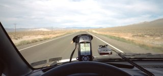
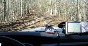
I use my Garmin GPS on my motorcycles, and in all my vehicles with a windshield suction cup mount. Garmin's offers waterproof units of various sizes which are perfect for the various uses we need.

http://www.garmin.com

The eMap is not made anymore, but still available.
 

Attachments

  • emap.jpg
    emap.jpg
    50.5 KB · Views: 289
The 176C is what I use now. However, the newer 376C is the ultimate. It has XM radio Weather which allows you to see the same weather info as you see on local news.
 

Attachments

  • 176c.jpg
    176c.jpg
    69.5 KB · Views: 288
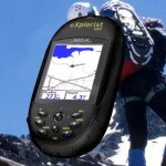
I have been using explorist 600 more than a year now.

I use it for hiking, mountain biking, skiing, white water rafting, wine tasting and road trip! This is a really useful gps compare to the size with other buggy one. I use it with a MapSend software that will show you turn by turn direction and 2GB memory.

I have compare this with my friends RoadMate 800 which is more expensive model. I found out the only different is 800 provide different route you can choose such as skip hwy. and it comes with voice direction. Of course, it has bigger screen! Other function are pretty much the same.

I really like my explorist 600 I can carry around for biking and I love it when I go to NY city for direction of sight seeing. You can even search restaurants by category and it will show you the closer restaurant, address and phone #! For hiking & mtr. biking...you can buy a MapSend software which cover all the park trails. I only use the track function so I can track back in case I get lost. The battery life good too, it last for 6-10 hrs depend how often you use the black light.

You may want to check out the explorist XL which has a bigger screen(just come out this year).

http://www.magellangps.com/products/product.asp?segID=355

hope this help!
 

Attachments

  • explorist600.jpg
    explorist600.jpg
    16.7 KB · Views: 287

Members online

Forum statistics

Threads
278,304
Messages
3,554,040
Members
248,016
Latest member
Advally Service

Trending content

Back
Top